Maps on Sale
to
4,191
18
4,214
1
3
2
2
1
1
1
1
2,329
1,653
232
1
130
12
1
67
1
3
4
2
4,205
10
8
7
7
162
51
41
35
30
4,215
4,215
4,215
104
55
18
13
11
Sale Items
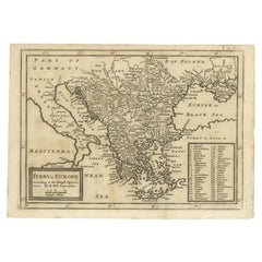
Detailed Original Antique Map of Turkey in Europe, circa 1740
Located in Langweer, NL
Antique map Turkish Empire tilted 'Turky in Europe'. Beautiful, small antique map depicting modern-day Greece and surroundings. Source unknown, to be determined.
Artists and Engra...
Category
Antique 18th Century Maps
Materials
Paper
$324 Sale Price
20% Off
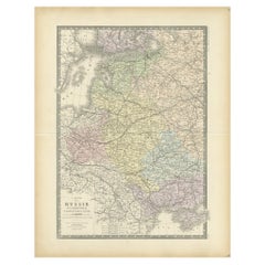
Antique Map of Western Russia by Levasseur, '1875'
Located in Langweer, NL
Antique map titled 'Carte de la Russie Occidentale (..)'. Large map of Western Russia. This map originates from 'Atlas de Géographie Moderne Physique et Politique' by A. Levasseur. P...
Category
Antique Late 19th Century Maps
Materials
Paper
$334 Sale Price
20% Off
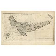
Antique Map of Juan Fernandez, Chile, c.1740
Located in Langweer, NL
Antique map titled 'l'Ile de Juan Fernandes dans la Mer du Sud (..)'.
This map depicts Juan Fernandez Island in the Southern Sea. Source unknown, to be determined.
Artists and En...
Category
Antique 18th Century Maps
Materials
Paper
$181 Sale Price
20% Off
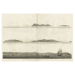
Antique Print of the City of Ten-Tchoo-Foo, China, 1796
Located in Langweer, NL
Antique print titled 'View of the City of Ten-Tchoo-Foo from the Anchorage of the Hindostan in the Strait of Mi-a-Tau Bearing South-West'. Together on a sheet with 'Cape Maccartney and Cape Gower'.
The top two views depict coastal profile views of local islands named after important people in the Embassy, including Macartney, Staunton, and Gower. Below, a view of the city of Ten-Tchoo-Foo taken from aboard the Hindostan, one of the ships on the mission. These land approach views appeared in the account of George Macartney's travels to China, published by George Nicol. Macartney was Britain's first envoy to China, and was tasked with convincing Emperor Qianlong to ease restrictions on trade between Great Britain and China by allowing the British to have a permanent embassy in the country. Sir George Staunton prepared the official report, 'An Authentic Account of an Embassy from the King of Great Britain to the Emperor of China', which included charts and views based on manuscript sketches and drawings by Sir John Barrow...
Category
Antique 1790s Maps
Materials
Paper
$659 Sale Price
20% Off
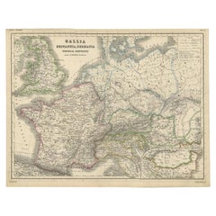
Original Antique Map of West Europe, circa 1870
Located in Langweer, NL
Antique map titled 'Gallia, Britannia, Germania'. Old map of West Europe including France, Germany and the United Kingdom. This map originates from 'Atlas Antiquus, twaalf kaarten be...
Category
Antique 19th Century Maps
Materials
Paper
$181 Sale Price
20% Off
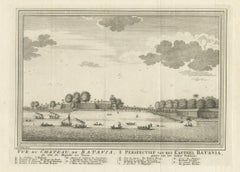
Antique Print of Capital Batavia in the Dutch East Indies 'Indonesia', C.1752
Located in Langweer, NL
Antique print Indonesia titled 'Vue Du Chateau De Batavia - Perspectief van het kasteel Batavia'. View of the Castle of Batavia, seen from the sugar warehouse. Originates from Antoin...
Category
Antique 18th Century Prints
Materials
Paper
$343 Sale Price
20% Off
Antique Print of Zihuatanejo and the harbour of Acapulco in South America, 1749
Located in Langweer, NL
Antique print titled 'Vue de l'entree de Chequetan ou Seguataneo, restant au N.E. a la distance de 5 milles.' 'Vue de l'entree du port d'Acapulco.' View of Zihuatanejo and the harbou...
Category
Antique 18th Century Prints
Materials
Paper
$210 Sale Price
20% Off
Old Map of Prussia, Embellished with a Large Cartouche and Compass Rose, ca.1680
Located in Langweer, NL
Antique map titled 'Prussiae nova Tabula'.
Later edition of Blaeu's map of Prussia, embellished with a large cartouche and compass rose. Prussia was a historically prominent Germ...
Category
Antique 1680s Maps
Materials
Paper
$534 Sale Price
20% Off
Map of Languedoc-Roussillon and Provence in France and Piedmont in Italy, c1680
Located in Langweer, NL
Title: Antique map titled 'La basse Partie du Gouvernement de Languedoc, environne des Frontiers des Gouverns de Provence, de Dauphine de Lyonnais et de Guienne et Gascogne ; Les Fro...
Category
Antique 1680s Maps
Materials
Paper
$2,626 Sale Price
20% Off
Rare Antique Map of the Rio De La Plata, Buenos Ayres, Brazil, ca.1760
Located in Langweer, NL
Description: Antique map titled 'De Ingang van Rio de la Plata, Waar aan de Stad Buenos Ayres ligt, in Zuid-Amerika'. A map showing the Rio de la Plata es...
Category
Antique 1760s Maps
Materials
Paper
$453 Sale Price
20% Off
Antique Map of Guadeloupe, Island in the Caribbean, c.1757
Located in Langweer, NL
Antique map titled 'Carte de L'Isle de la Guadeloupe'.
A very decorative map of Guadeloupe in the Caribbean, adorned with rhumb lines, fleur-de-lys, and two decorative rococo-style...
Category
Antique 18th Century Maps
Materials
Paper
$630 Sale Price
20% Off
Antique Map of France in Provinces, with Inset of Paris
Located in Langweer, NL
Antique map titled 'France par Provinces'. Original antique map of France in Provinces. It covers from the Flanders in the north to Roussillon in the south and from Brittany in the w...
Category
Antique Mid-19th Century Maps
Materials
Paper
$105 Sale Price
20% Off
Engraving of Alejandro Selkirk Island, Juan Fernández-archipel, Chile, 1749
Located in Langweer, NL
Antique print titled 'Vue de la cote du N. E. de Masa-Fuero' - 'Vue de la cote occidentale de Masa-Fuero a la distance de quatre milles.' Views of Alejandro Selkirk Island...
Category
Antique 18th Century Prints
Materials
Paper
$210 Sale Price
20% Off
Antique Map of the Maluku Islands 'Ambon' by Stemler, 1874
Located in Langweer, NL
Antique map titled 'Peta deri Poeloe Poeloe Ambon ...' (The Island of Ambon.) This very scarce map shows the Maluku Islands of Ambon, Buru, Banda. South Moluccas. Originates from 'Ti...
Category
Antique 19th Century Maps
Materials
Paper
$95 Sale Price
20% Off
Antique Map of the City of Zwolle by Guicciardini, 1613
Located in Langweer, NL
Antique map titled 'Swolla'. Map of the city of Zwolle, the Netherlands. This map originates from the 1613 edition of 'Discrittione di tutti i Paesi Bassi', by L. Guicciardini, publi...
Category
Antique 17th Century Maps
Materials
Paper
$205 Sale Price
20% Off
Map of Northern India and Pakistan 'Mogol', Showing Kabul, Delhi Etc., 1758
Located in Langweer, NL
Antique map titled 'Mogol'.
Map of Northern India and Pakistan ('Mogol'), showing Kabul, Delhi and surroundings. This map originates from 'Kort begrip der Oude en Nieuwe Staatkun...
Category
Antique 1750s Maps
Materials
Paper
$353 Sale Price
20% Off
Steel Engraved Antique Map of England
Located in Langweer, NL
Antique map titled 'Angleterre'. Original antique map of England. Engraved by Th. Duvotenay. Originates from 'Complement de L'Encyclopedie Mode...
Category
Antique Late 19th Century Maps
Materials
Paper
$133 Sale Price
20% Off
Antique Map of Mozambique and Cape of Good Hope with Kingdom Monomotapa, 1780
Located in Langweer, NL
Antique map titled 'Carte Du Canal De Mozambique.' The main map, on the right, covers from the Cape of Good Hope north as far as Zanzibar and modern day Kenya, focusing on the gold r...
Category
Antique 18th Century Maps
Materials
Paper
$501 Sale Price
20% Off
Antique Decorative French Map of Java, Indonesia, 1718
Located in Langweer, NL
Antique map of Java titled 'Carte de l'Ile de Java: Partie Occidentale, Partie Orientale, Dressee tout Nouvellement (..)'.
Decorative large format map...
Category
Antique 18th Century Maps
Materials
Paper
$2,531 Sale Price
20% Off
Antique Map of the Islands Within the Queen Charlotte's Islands
Located in Langweer, NL
Antique map titled 'Cote Septentrional de la plus grande des Isles de la Reine Charlotte (..)'. Map and coastal view of the islands within the Queen Charlotte's Islands (Santa Cruz I...
Category
Antique Late 18th Century Maps
Materials
Paper
$315 Sale Price
20% Off
Antique Map of India and the Gulf of Bengal by Mallet, c.1686
Located in Langweer, NL
Antique map titled ?Partie Orientale de la Terre Ferme de l'Inde Moderne. Small map of India and the Gulf of Bengal. This map originates from a German edition of 'Description de l' Univers'.
Artists and Engravers: Alain Manesson Mallet (1630-1706) was a French cartographer and engineer. He started his career as a soldier in the army of Louis XIV, became a Sergeant-Major in the artillery and an Inspector of Fortifications. He also served under the King of Portugal, before returning to France, and his appointment to the court of Louis XIV. His military engineering and mathematical background led to his position teaching mathematics at court. His 'Description de L'Universe' contains a wide variety of information, including star maps...
Category
Antique 17th Century Maps
Materials
Paper
$334 Sale Price
20% Off
Antique Map of the Region of Zeitz in Germany, 1749
By Schreiber
Located in Langweer, NL
Antique map titled 'Das Stifft Zeitz (..)'. Map of the region of Zeitz, Germany. Zeitz is a town in the Burgenlandkreis district, in Saxony-Anhalt, Germany. It is situated on the riv...
Category
Antique 18th Century Maps
Materials
Paper
$315 Sale Price
20% Off
Old Engraving of Batavia 'Jakarta, Indonesia' with Map and Harbour View, 1750
Located in Langweer, NL
Antique map titled 'Carte des environs de Batavia '. French map of the Batavia area (Jakarta) in Indonesia. With cartouche, scale and compass rose. Published circa 1750.
The map i...
Category
Antique 1750s Maps
Materials
Paper
$525 Sale Price
20% Off
Beautiful View of Pulau 'Island' Onrust, Batavia 'Jakarta, Indonesia', ca.1805
Located in Langweer, NL
Antique print titled 'Het Eiland Onrust'. Beautiful view of the sea near Onrust Island, also known as Pulau Onrust or Pulau Kapal (ship island), Indonesia. Published by E. Maaskamp, ...
Category
Antique Early 1800s Maps
Materials
Paper
$697 Sale Price
20% Off
Antique Map of Cheshire, North West England
By Joan (Johannes) Blaeu
Located in Langweer, NL
Antique map titled 'Cestria comitatus Palatinus'. Original old map of Cheshire, Northwest England. Published circa 1665 by J. Blaeu. Willem Jansz. Blaeu and his son Joan Blaeu are th...
Category
Antique Mid-17th Century Maps
Materials
Paper
$1,146 Sale Price
20% Off
Antique Map of Asia Minor with Cyprus, Syria and Turkey and the Black Sea, 1747
Located in Langweer, NL
Antique map Middle East titled 'A New and accurate map of Anatolia or Asia Minor, with Syria and such other provinces of the Turkish Empire (.....
Category
Antique 18th Century Maps
Materials
Paper
$429 Sale Price
20% Off
Antique Print with Charts of York's Bay and Surroundings
Located in Langweer, NL
Antique map titled 'Côte depuis la Baye d'York (..)'. Charts of York's Bay, Haven of the Three Islands, St. David's Bay, and Elizabeth's Bay.
Published in an edition of John Hawk...
Category
Antique Late 18th Century Maps
Materials
Paper
$420 Sale Price
20% Off
Antique Map of England, Also Showing Calais
Located in Langweer, NL
Antique map titled 'Carte de l'Angleterre pour le Voyage dans les trois Royaumes'. Original old map of England, also showing Calais. This map originates from 'Voyage dans les trois r...
Category
Antique Late 18th Century Maps
Materials
Paper
$133 Sale Price
20% Off
Hand Colored Antique Map of the Department of Ariège, France
By Victor Levasseur
Located in Langweer, NL
Antique map titled 'Dépt. de l'Ariège'. Map of the French department of Ariege, France. This area of France is known for its production of semi-soft and mild cheeses, such as Bethmal...
Category
Antique Mid-19th Century Maps
Materials
Paper
$324 Sale Price
20% Off
Antique Map of Groningen with Contemporary Hand Coloring
Located in Langweer, NL
Antique map titled 'Tabulae dominii Groeningae quae et complecititur maximam partem Dreniae Emendata a F. de Wit'. Original antique map of the province of Groningen, the Netherlands....
Category
Antique Late 17th Century Maps
Materials
Paper
$630 Sale Price
20% Off
Original Hand-Colored Antique Print of Various Apples, 1758
Located in Langweer, NL
Antique print depicting apple variaties including the Syden Hemmetje, Somer-Erveling, Suiker-Appel, Princes-Appel, Witte Bloem-Soete, Swaan-Appel, Roode Gulderling, Rode Herfst-Cabri...
Category
Antique 18th Century Maps
Materials
Paper
$165 Sale Price
20% Off
Large Antique Map of France with Original Hand Coloring
Located in Langweer, NL
Antique map titled 'France in Provinces'. Beautiful antique map of France. Drawn and engraved for John Thomson's 'New General Atlas' published circa 1814.
Category
Antique Early 19th Century Maps
Materials
Paper
$420 Sale Price
20% Off
Antique Map of the Rhineland and Alsace Region with Original Hand Coloring
Located in Langweer, NL
Antique map titled 'Palitinat du Rhein, Alsace, et partie de Souabe de Franconie (..)'. Double-page engraved map of the Rhineland and Alsace with original/contemporary hand coloring....
Category
Antique Mid-17th Century Maps
Materials
Paper
$296 Sale Price
20% Off
Antique Map of Harlingen, Harbour City in the Netherlands, 1691
Located in Langweer, NL
Plate 'Harlingen.' (Plan of the city of Harlingen, The Netherlands.) This attractive original old antique print / plate originates from: 'Ausführliche und grundrichtige Beschreibung ...
Category
Antique 17th Century Maps
Materials
Paper
$133 Sale Price
20% Off
Large Antique County Map of Cambridgeshire, England
Located in Langweer, NL
Antique map titled 'A Map of Cambridgeshire from the best Authorities'. Original old county map of Cambridgeshire, England. Engraved by John Cary. Originates from 'New British Atlas'...
Category
Antique Early 19th Century Maps
Materials
Paper
$219 Sale Price
20% Off
Antique Map of the Bay of Brusc, France
Located in Langweer, NL
Antique map titled 'Carte de la rade du Brusc'. Original map of the bay of Brusc, France. This map originates from 'Le Petit Atlas Maritime (..)' by J.N. Bellin. Published 1764.
...
Category
Antique Mid-18th Century Maps
Materials
Paper
$324 Sale Price
20% Off
Antique Map of England and Wales, Also Showing the English Channel
Located in Langweer, NL
Antique map titled 'England and Wales'. Original antique map of England and Wales. Drawn and engraved by J. Dower. Originates from 'A General Descriptive Atlas Of The Earth, Containi...
Category
Antique Mid-19th Century Maps
Materials
Paper
$143 Sale Price
20% Off
Original Antique Map of the Duchy of Holstein
By Willem Blaeu
Located in Langweer, NL
Antique map titled 'Ducatus Holsatiae Nova Tabula'. Original old map of the Duchy of Holstein, the northernmost territory of the Holy Roman Empire, from the mid-17th Century. To the ...
Category
Antique Mid-17th Century Maps
Materials
Paper
$1,050 Sale Price
20% Off
Original Antique Map of Peru in South America, 1875
Located in Langweer, NL
Antique map titled 'Carte générale du Pérou'. Large map of Peru. This map originates from 'Atlas de Géographie Moderne Physique et Politique' by A. Levasse...
Category
Antique Late 19th Century Maps
Materials
Paper
$334 Sale Price
20% Off
Antique Map of Russia in Europe, with Frame Style Border
Located in Langweer, NL
Antique map titled 'Russie d'Europe'. Attractive map of Russia in Europe, covers the European portions of Russia from the Arctic Sea south to the Black Sea and Caspian Sea. This map ...
Category
Antique Mid-19th Century Maps
Materials
Paper
$124 Sale Price
20% Off
Original Antique County Map of Derbyshire, England
Located in Langweer, NL
Antique map titled 'Darbyshire'. Original antique map of the country of Derbyshire, England. Engraved by Robert Morden. Sold by Abel Swale, Awnsham and John Churchill...
Category
Antique Late 17th Century Maps
Materials
Paper
$525 Sale Price
20% Off
Antique Map of the City of Workum by Blaeu, 1649
Located in Langweer, NL
Antique map titled 'Worckum'. Old map of the city of Workum, Friesland. Originates from J. Blaeu's 'Town Book'.
Artists and Engravers: Joan Blaeu (23 September 1596 - 28 May 1673...
Category
Antique 17th Century Maps
Materials
Paper
$124 Sale Price
20% Off
Original Antique Map of England, Showing the Most Memorable Battles
Located in Langweer, NL
Antique map titled 'Carte d'Angleterre ou l'on fait observer les Batailes les plus Memorables de ce Royaume'. Original antique map of England, showing the most memorable battles. Thi...
Category
Antique Early 18th Century Maps
Materials
Paper
$210 Sale Price
20% Off
Antique Copper Engraving with a Panoramic View of Mexico City, ca.1760
Located in Langweer, NL
Description: Antique print titled 'Nouveau Mexico'.
Copper engraving with a panoramic view of Mexico city. Source unknown, to be determined.
Artists and Engravers: Engraved after ...
Category
Antique 1760s Maps
Materials
Paper
$276 Sale Price
20% Off
Old Map of Southern Russia, Incl the Extent of the Kingdom of Poland, 1882
Located in Langweer, NL
Antique map titled 'South-West Russia'.
Old map of southern Russia, also showing the extent of the Kingdom of Poland. This map originates from 'The Royal Atlas of Modern Geography...
Category
Antique 1880s Maps
Materials
Paper
$324 Sale Price
20% Off
Rhine Splendor: Antique Map of the Lower Rhine Region, circa 1680
Located in Langweer, NL
The antique map titled 'Novissima et Accuratissima Archiepiscopatus et Electoratus Coloniensis Ducatuum Iuliancensis et Montensis et Meursiae Comitatus' is a handsome and detailed ma...
Category
Antique 1680s Maps
Materials
Paper
$916 Sale Price
20% Off
Old Map of Region Champagne-Ardenne with Reims, Troyes & Épernay in France, 1759
Located in Langweer, NL
Antique map titled 'Tabula Geographica Campaniae (..).'
Detailed map of the Champagne region in France by J. B. Homann, covering the region Champagne-Ardenne with Reims, Troyes a...
Category
Antique 1750s Maps
Materials
Paper
$702 Sale Price
30% Off
Large Antique County Map of Leicestershire, England, 1805
Located in Langweer, NL
Explore Leicestershire's Past: Antique Map by John Cary
Step into the history of Leicestershire, England, with this original old county map engraved by the renowned cartographer Joh...
Category
Antique Early 19th Century Maps
Materials
Paper
$219 Sale Price
20% Off
Antique Map of France with Inset showing the Northern Departments
Located in Langweer, NL
Antique map titled 'The Republic of France divided according to its 103 Departments'. Decorative map of France. Includes a large cartouche and an in...
Category
Antique Late 18th Century Maps
Materials
Paper
$630 Sale Price
20% Off
Antique Print of a Section of the Kew Gardens, London, England, c.1785
Located in Langweer, NL
Antique print titled 'Coupe sur la longueur d'une partie de la Galerie des Antiques dans les jardins de Kew'.
Copper engraving showing a section of the Royal Botanic...
Category
Antique 18th Century Prints
Materials
Paper
$343 Sale Price
20% Off
Large Antique County Map of the West Riding of Yorkshire 'South Part', England
Located in Langweer, NL
Antique map titled 'A Map of the South Part of the West Riding of Yorkshire from the best Authorities'. Original old county map of the south part of the West Riding of Yorkshire, Eng...
Category
Antique Early 19th Century Maps
Materials
Paper
$267 Sale Price
20% Off
Large Antique Map of the British Isles, with inset of the Orkneys and Shetlands
Located in Langweer, NL
Antique map titled 'A Map of Great Britain and Ireland (..)'. Large antique map of the British Isles, with part of the French and Dutch coasts, and an inset of the Orkneys and Shetla...
Category
Antique Late 18th Century Maps
Materials
Paper
$611 Sale Price
20% Off
Large Antique County Map of Worcestershire, England
Located in Langweer, NL
Antique map titled 'A Map of Worcestershire from the best Authorities'. Original old county map of Worcestershire, England. Engraved by John Cary. Originates from 'New British Atlas'...
Category
Antique Early 19th Century Maps
Materials
Paper
$219 Sale Price
20% Off
Old Hand-Colored Print of the Guards of the King of France, 1890
Located in Langweer, NL
Antique print titled 'Gardes-du-Crops du Roi'.
Old print of the Guards of the King of France. This print originates from 'Histoire de la maison militaire du roi de 1814 à 1830 : ...
Category
Antique 1890s Maps
Materials
Paper
$181 Sale Price
20% Off
Antique Map of France at the End of the Reign of Jean II by Zannoni, 1765
By G. A. Rizzi-zannoni
Located in Langweer, NL
Antique map France titled 'La France sous la fin du Regne de Jean II (..)'. Beautiful old map of France. This map originates from 'Atlas Historique de la France Ancienne et Moderne' ...
Category
Antique 18th Century Maps
Materials
Paper
$151 Sale Price
20% Off
Antique Map of the Island of Borneo by W. G. Blackie, 1859
Located in Langweer, NL
Antique map titled 'The Island of Borneo'. Original antique map of the Island of Borneo. This map originates from ‘The Imperial Atlas of Modern Geography’. Published by W. G. Blackie...
Category
Antique Mid-19th Century Maps
Materials
Paper
$191 Sale Price
20% Off
Antique Map of Surinam by Stedman '1813'
Located in Langweer, NL
Antique map titled 'A Map of Surinam'. Original antique map of Surinam, showing Dutch settlements, military posts, rebel Maroon camps and native villages. This map originates from 'N...
Category
Antique Early 19th Century Maps
Materials
Paper
$477 Sale Price
20% Off
Engraving of Idols of Secotam Village in Virginia 'or now North Carolina', 1721
Located in Langweer, NL
Two religious images on one plate. Upper image 'Kiwasa idole des Virginiens'.
Kiwasa, this Idol is placed in the temple of the town of Secotam, as the keeper of the king's dead c...
Category
Antique 1720s Maps
Materials
Paper
$420 Sale Price
20% Off
Original Copper-Engraving of Westergo, Part of Friesland, the Netherlands, 1744
Located in Langweer, NL
Antique map titled 'Westergo'.
Original antique map of Westergo, part of the province of Friesland, the Netherlands. Published 1744.
Artists and engravers: Isaak Tirion (1705 ...
Category
Antique 1740s Maps
Materials
Paper
$611 Sale Price
20% Off
Antique Map of the French Colonies in Senegal and Madagascar by V. Levasseur
By Victor Levasseur
Located in Langweer, NL
The antique map titled 'Colonies Françaises (en Afrique)' presents a decorative depiction of the French colonies located in Senegal and Madagascar within Africa. Surrounding the map ...
Category
Antique Mid-19th Century Maps
Materials
Paper
$191 Sale Price
20% Off
Recently Viewed
View AllMore Ways To Browse
Statutes And Sculptures
Swedish Gustavian Glass Cabinet
Swiss Chalet Chairs
Tea Cup Art Nouveau
Tea Cup Holder
Teak Buddha
Teak Gentlemans
Thomasville Hollywood Regency
Thomire Clock
Three Legged Vessel
Three Tier Serving Trays
Tibet Earring
Tibetan Antique Cabinet
Tiffany And Co China
Tiffany Blue Rims
Tiffany Sterling Ice Tea Spoons
Torchiere Sculpture
Tortoise Christian Dior
