
Antique Navigation

to
132
614
231
365
282
207
207
166
163
105
93
75
67
55
47
45
44
39
35
33
29
24
22
21
17
15
14
13
13
10
10
10
9
8
8
7
5
5
5
5
4
4
4
4
3
3
3
3
3
2
2
2
1
21
12
11
9
9
Sort By
Waltham 14Kt White Gold "Flared Lugs" Art Deco Watch circa 1925

Waltham 14Kt White Gold "Flared Lugs" Art Deco Watch circa 1925

By Waltham Watch Company

Located in Long Beach, CA

and the Korean war they designed timers, navigational devices, automobiles, aviation and nautical

Category

1920s American Art Deco Antique Navigation

Materials

White Gold

A brass ship’s bell from Peninsular & Orient liner S.S. Ballarat

A brass ship’s bell from Peninsular & Orient liner S.S. Ballarat

Located in Lymington, Hampshire

Navigation Co (still operating cruise ships today as P&O). They were named after a gold rush town in Central

Category

Late 19th Century English Antique Navigation

Materials

Brass

French Art Deco Pendant Chandelier by Verrerie des Hanots, 1920

French Art Deco Pendant Chandelier by Verrerie des Hanots, 1920

By Verrerie des Hanots

Located in Saint-Amans-des-Cots, FR

lighthouse optics and navigation beacons road signage and automotive headlights and artistic lighting

Category

1920s French Art Deco Antique Navigation

Materials

Brass

Thusciae
Thusciae

Thusciae

$420Sale Price|30% Off

Thusciae

Located in Porto, PT

qualities, typical of historical European maps designed for study, navigation, and display. While the date

Category

19th Century Antique Navigation

Materials

Paper

Antique Diamond and Silver Upon Gold Star Brooch and Hair Pin, Circa 1905

Antique Diamond and Silver Upon Gold Star Brooch and Hair Pin, Circa 1905

Located in London, GB

in the night sky as navigation aids. Stars have been popular motifs since the 17th century, with

Category

Early 1900s English Edwardian Antique Navigation

Materials

Diamond, Gold, Silver

Map Of Florence By F.B.Werner

Map Of Florence By F.B.Werner

$350Sale Price|30% Off

Map Of Florence By F.B.Werner

Located in Porto, PT

regional aspects of Florence. Printed maps of this type were valued for both practical navigation and

Category

18th Century Antique Navigation

Materials

Paper

Pelew-Eilanders – Antique Hand-Colored Engraving of Palau (c.1800)

Pelew-Eilanders – Antique Hand-Colored Engraving of Palau (c.1800)

Located in Langweer, NL

life and Palauan navigation culture. The engraving reflects the European documentation of Micronesian

Category

Early 19th Century Dutch Antique Navigation

Materials

Paper

Nautical Chart of Cape Verde Islands by J.W. Norie, 1824 Coastal Map

Nautical Chart of Cape Verde Islands by J.W. Norie, 1824 Coastal Map

Located in Langweer, NL

archipelago off the west coast of Africa in exquisite detail, compiled from the latest navigational data

Category

Early 19th Century English Antique Navigation

Materials

Paper

Antique Geological Survey Map of Surinam 1888 Hand Colored, Rare

Antique Geological Survey Map of Surinam 1888 Hand Colored, Rare

Located in Langweer, NL

academic interest in South American natural resources, mining potential, river navigation, and tropical

Category

1880s German Antique Navigation

Materials

Paper

1870 "Johnson's Europe" Map Published by A. J. Johnson

1870 "Johnson's Europe" Map Published by A. J. Johnson

Located in Colorado Springs, CO

, making the atlas a valuable resource not just for navigation and geography, but also for understanding

Category

1870s American Victorian Antique Navigation

Materials

Paper

Map of the Island of Bohol – Observatorio de Manila, 1899

Map of the Island of Bohol – Observatorio de Manila, 1899

Located in Langweer, NL

, making the map both a geographic and navigational tool. Stamped with the brown circular seal of the

Category

1890s Philippine Antique Navigation

Materials

Paper

Map of the Island of Mindoro – Observatorio de Manila, 1899

Map of the Island of Mindoro – Observatorio de Manila, 1899

Located in Langweer, NL

important anchorages, with soundings and navigational contours rendered in delicate blue tones. The legend

Category

1890s Philippine Antique Navigation

Materials

Paper

Antique Map of the Coast of Southern France, 1793

Antique Map of the Coast of Southern France, 1793

Located in Langweer, NL

designed for maritime navigation along the French coastlines. Key Features of the Map: 1. **Geographic

Category

Late 18th Century Antique Navigation

Materials

Paper

English New Wharf Pottery Conway Pattern Flow Blue Plates, circa 1890, S/4

English New Wharf Pottery Conway Pattern Flow Blue Plates, circa 1890, S/4

By Staffordshire

Located in Philadelphia, PA

1880s – early 1890s. The New Wharf Pottery Company was located at Navigation Road, Burslem, Stoke-on

Category

1880s English High Victorian Antique Navigation

Materials

Porcelain

Map of Masbate and Ticao Islands – Observatorio de Manila, 1899

Map of Masbate and Ticao Islands – Observatorio de Manila, 1899

Located in Langweer, NL

, complete with soundings, coastal contours, and navigational details. The legend (“Signos”) at lower left

Category

1890s Philippine Antique Navigation

Materials

Paper

Map of the San Juanico Strait between Leyte and Samar – 1899

Map of the San Juanico Strait between Leyte and Samar – 1899

Located in Langweer, NL

that line the strait, reflecting its importance for 19th-century navigation and hydrographic study

Category

1890s Philippine Antique Navigation

Materials

Paper

Map of Manila Bay and Environs – Observatorio de Manila, 1899

Map of Manila Bay and Environs – Observatorio de Manila, 1899

Located in Langweer, NL

navigation. Roads, telegraph lines, rivers, and urban areas are finely delineated, while the legend (“Signos

Category

1890s Philippine Antique Navigation

Materials

Paper

The Return of Dutch Explorers to Amsterdam Harbor, Pontanus, 1611

The Return of Dutch Explorers to Amsterdam Harbor, Pontanus, 1611

Located in Langweer, NL

commerce and navigation. Condition: Fair to good for its age, with minor toning, faint foxing, and small

Category

Early 17th Century Dutch Antique Navigation

Materials

Paper

Revest, Original Vintage Poster, Canary Islands, Paquet Liner, Flamenco, 1950

Revest, Original Vintage Poster, Canary Islands, Paquet Liner, Flamenco, 1950

Located in SAINT-OUEN-SUR-SEINE, FR

: Revest N. Title: Allez aux Iles Canaries par les paquebots de la compagnie de navigation Paquet Date

Category

19th Century French Mid-Century Modern Antique Navigation

Materials

Paper

19th C. Biedermeier Inlaid Fruitwood, Satinwood & Yew Side Table, Circa 1850s

19th C. Biedermeier Inlaid Fruitwood, Satinwood & Yew Side Table, Circa 1850s

Located in West Palm Beach, FL

Enlightenment-era values of guidance, reason, and navigation—an aesthetic gesture toward both literal and

Category

Mid-19th Century Austrian Biedermeier Antique Navigation

Materials

Brass

  • 1
  • ...
Get Updated with New Arrivals
Save "Antique Navigation", and we’ll notify you when there are new listings in this category.

Antique Navigation For Sale on 1stDibs

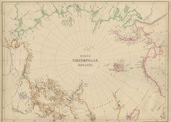
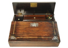
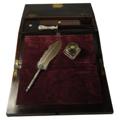
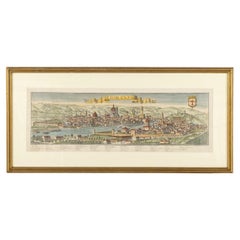
Choose from an assortment of styles, material and more with respect to the antique navigation you’re looking for at 1stDibs. Each antique navigation for sale was constructed with extraordinary care, often using metal, brass and glass. Your living room may not be complete without an antique navigation — find older editions for sale from the 18th Century and newer versions made as recently as the 20th Century. An antique navigation is a generally popular piece of furniture, but those created in Industrial, Mid-Century Modern and Victorian styles are sought with frequency. Honoré Daumier each produced at least one beautiful antique navigation that is worth considering.

How Much is a Antique Navigation?

The average selling price for an antique navigation at 1stDibs is $1,157, while they’re typically $156 on the low end and $108,004 for the highest priced.