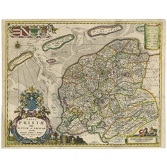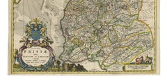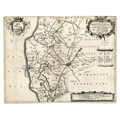

Antique Map of the Region of Wonseradeel, Friesland in the Netherlands, 1664
By B. Schotanus
Located in Langweer, NL
Antique map titled 'De Grietenije van Wonsera-deel (..).' Map of the Grietenij of Wonseradeel, Friesland, The Netherlands. Multiple cartouches, key and coat of arms. "Beschrijvinge e...
Category
17th Century Antique B. Schotanus Prints
Materials
Paper