Jodocus Hondius Prints
to
1
1
1
Height
to
Width
to
1
1
1
1
1
1
1
1
110
104
93
80
Creator: Jodocus Hondius
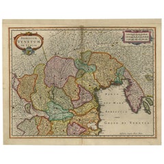
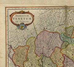
Antique Map of the Area Around Venice in Italy by H. Hondius, circa 1606
By Gerard Mercator, Jodocus Hondius
Located in Langweer, NL
Attractive and early map of the area around Venice, Italy. With South-Tirol in the North, areas of Krain (Slovenia), Croatia, Ferrara, Modena and Piacenza. In the east with areas aro...
Category
Early 17th Century Dutch Antique Jodocus Hondius Prints
Materials
Paper
$665 Sale Price
20% Off
Related Items
Original Antique Map of Ancient Greece, Achaia, Corinth, 1786
Located in St Annes, Lancashire
Great map of Ancient Greece. Showing the region of Thessaly, including Mount Olympus
Drawn by J.D. Barbie Du Bocage
Copper plate engraving by P.F Tardieu
Original hand color...
Category
1780s French Other Antique Jodocus Hondius Prints
Materials
Paper
Original Antique Map or City Plan of Venice, Italy. Circa 1835
Located in St Annes, Lancashire
Nice map of Venice
Drawn and engraved by J.Dower
Published by Orr & Smith. C.1835
Unframed.
Free shipping
Category
1830s English Antique Jodocus Hondius Prints
Materials
Paper
Hand-Colored 18th Century Homann Map of the Danube, Italy, Greece, Croatia
By Johann Baptist Homann
Located in Alamo, CA
"Fluviorum in Europa principis Danubii" is a hand colored map of the region about the Danube river created by Johann Baptist Homann (1663-1724) in his 'Atlas Novus Terrarum', publish...
Category
Early 18th Century German Antique Jodocus Hondius Prints
Materials
Paper
$875
H 20 in W 23.88 in D 0.07 in
Original Antique Map of Spain and Portugal, circa 1790
Located in St Annes, Lancashire
Super map of Spain and Portugal
Copper plate engraving by A. Bell
Published, circa 1790.
Unframed.
Category
1790s English Other Antique Jodocus Hondius Prints
Materials
Paper
Antique Map of Principality of Monaco
By Antonio Vallardi Editore
Located in Alessandria, Piemonte
ST/619 - "Old Geographical Atlas of Italy - Topographic map of ex-Principality of Monaco" -
ediz Vallardi - Milano -
A somewhat special edition ---
Category
Late 19th Century Italian Other Antique Jodocus Hondius Prints
Materials
Paper
Original Antique Map of Ancient Greece- Boeotia, Thebes, 1787
Located in St Annes, Lancashire
Great map of Ancient Greece. Showing the region of Boeotia, including Thebes
Drawn by J.D. Barbie Du Bocage
Copper plate engraving by P.F T...
Category
1780s French Other Antique Jodocus Hondius Prints
Materials
Paper
Original Antique Map of South East Asia by Thomas Clerk, 1817
Located in St Annes, Lancashire
Great map of South East Asia
Copper-plate engraving
Drawn and engraved by Thomas Clerk, Edinburgh.
Published by Mackenzie And Dent, 1817
Unframed.
Category
1810s English Antique Jodocus Hondius Prints
Materials
Paper
Map of the Republic of Genoa
Located in New York, NY
Framed antique hand-coloured map of the Republic of Genoa including the duchies of Mantua, Modena, and Parma.
Europe, late 18th century.
Dimension: 25...
Category
Late 18th Century European Antique Jodocus Hondius Prints
Vintage "View of the Center of Paris Taken from the Air" Lithograph Map
Located in San Diego, CA
A very stylish "View of the Center of Paris Taken from the Air" lithograph map published by the Paris Ministry of Tourism, circa early 1950s. The piece measures 27" x 43" and shows...
Category
20th Century French Mid-Century Modern Jodocus Hondius Prints
Materials
Paper
$680 Sale Price
20% Off
H 43 in W 27 in D 0.25 in
The Kingdom of Naples and Southern Italy: A Hand-Colored 18th Century Homann Map
By Johann Baptist Homann
Located in Alamo, CA
"Novissima & exactissimus Totius Regni Neapolis Tabula Presentis Belli Satui Accommo Data" is a hand colored map of southern Italy and the ancient Kingdom of Naples created by Johann...
Category
Early 18th Century German Antique Jodocus Hondius Prints
Materials
Paper
$1,175
H 20 in W 23.88 in D 0.07 in
Original Antique Map of South America. C.1780
Located in St Annes, Lancashire
Great map of South America
Copper-plate engraving
Published C.1780
Two small worm holes to left side of map
Unframed.
Category
Early 1800s English Georgian Antique Jodocus Hondius Prints
Materials
Paper
Original Antique Map of The World by Thomas Clerk, 1817
Located in St Annes, Lancashire
Great map of The Eastern and Western Hemispheres
On 2 sheets
Copper-plate engraving
Drawn and engraved by Thomas Clerk, Edinburgh.
Published by Mackenzie And Dent, 1817
...
Category
1810s English Antique Jodocus Hondius Prints
Materials
Paper
Previously Available Items
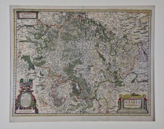
17th Century Hand-Colored Map of the Hesse-Kassel Region of Germany by Hondius
By Jodocus Hondius
Located in Alamo, CA
This highly detailed 17th century original hand-colored map is entitled "Hassia Landgraviatus". It was published in Amsterdam in 1650 by Johannes Janssonius after an earlier map by G...
Category
Mid-17th Century Dutch Antique Jodocus Hondius Prints
Materials
Paper
H 27.5 in W 30 in D 0.13 in
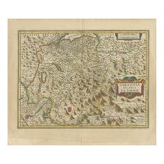
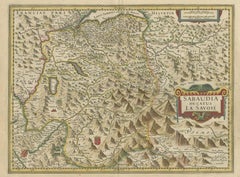
Antique Map of the Savoy Region by Hondius, circa 1630
By Jodocus Hondius
Located in Langweer, NL
Antique map titled 'Sabaudia ducatus la Savoie'. Detailed map of the Savoy region bounded by Geneva, Grenoble, the Piemont and southern Switzerland, including Mont Blanc, St. Anton, ...
Category
Mid-17th Century Antique Jodocus Hondius Prints
Materials
Paper
Jodocus Hondius prints for sale on 1stDibs.
Jodocus Hondius prints are available for sale on 1stDibs. These distinctive items are frequently made of paper and are designed with extraordinary care. There are many options to choose from in our collection of Jodocus Hondius prints, although brown editions of this piece are particularly popular. If you’re looking for additional options, many customers also consider prints by Abraham Ortelius, Johannes Janssonius, and Gerard Mercator. Prices for Jodocus Hondius prints can differ depending upon size, time period and other attributes — on 1stDibs, these items begin at $612 and can go as high as $612, while a piece like these, on average, fetch $612.
Creators Similar to Jodocus Hondius
Guillaume Cornelis van Beverloo (Corneille)