Antique Ortelius Map of Asia Featuring Japan, China, Taiwan & East Indies, 1587
$3,731Sale Price|35% Off
Antique Ortelius Map of Asia Featuring Japan, China, Taiwan & East Indies, 1587
By Abraham Ortelius
Located in Langweer, NL
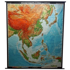
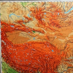
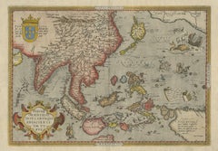
Ortelius Asia Japan China Taiwan Philippines East Indies Antique Map 1570 This highly important early map of Asia titled “Indiae Orientalis Insularumque Adiacientium Typus” is one of the most influential 16th-century European depictions of East and Southeast Asia. Published by Abraham Ortelius for his groundbreaking atlas Theatrum Orbis Terrarum, this map presents a sweeping geographical vision of the Far East before the full penetration of the Dutch into the region. It covers India, Indochina, China, Korea, Japan, the Philippines, the East Indies or Spice Islands, New Guinea, and parts of the western Pacific. Ortelius was the first European cartographer to name Formosa (modern Taiwan), marking a milestone in Western geographic knowledge of Asia. Japan appears in its famous early “kite-shaped” form, shown as a large oval island...
16th Century Belgian Antique Abraham Ortelius Prints
Paper