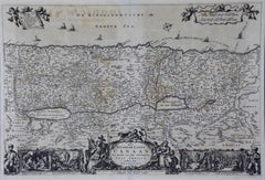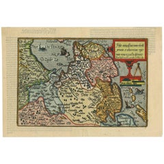
Antique Map of Friesland 'The Netherlands' by J. Bussemacher, 1596
By Johann Bussemacher
Located in Langweer, NL
Beautiful hand-colored engraving of the province Friesland (The Netherlands). This map originates from the Atlas 'Europae totius orbis terrarium partis praestantissimae, universalis ...
Category
16th Century European Antique Johann Bussemacher
Materials
Paper