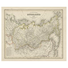
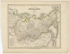
Antique Map of Russia in Asia from An Old German Atlas, 1845
By Meyer
Located in Langweer, NL
Antique map titled 'Asiatisches Russland'. This map depicts Russia in Asia and originates from 'Meyers Handatlas'. Artists and Engravers: Engraved and published by 'Bibliographis...
Category
19th Century Antique Meyer Wall Decorations
Materials
Paper