Maps
to
815
1,042
42
1,085
10
1
2,927
2,257
475
3
290
34
10
126
10
37
9
2
5
4
3
3
1,084
10
9
2
2
159
74
62
56
14
1,085
1,085
1,085
59
12
10
6
5
Maps For Sale
Period: Early 1900s
Period: 17th Century
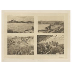
Four Rare Heliograph Views of Mining Near Sungei Bessi River in Malaysia, 1907
Located in Langweer, NL
Four views of early Mining operations in Malaysia at the beginning of the 20th century. Published in 1907.
1) A Sand-Lake of Residue (Sungai of Sungei Bessi)
2) Chinese Smelting...
Category
Early 1900s Antique Maps
Materials
Paper
$425 Sale Price
20% Off
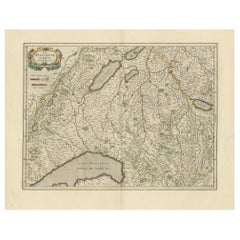
Circa 1659 Willem Blaeu Map: Southwestern Switzerland with Geneva & Lakes
Located in Langweer, NL
Circa 1659 Willem Blaeu Map: Southwestern Switzerland with Geneva & Lakes
This detailed map from circa 1659 by Willem Blaeu, titled "Das Wiflispurgergow," highlights the southwestern region of Switzerland.
It features significant landmarks such as Geneva, Lake Geneva (Lacus Lemannus), Lake Neuchatel, Lake Biel, Bern, Freiburg, and Lake Thuner.
Based on the work of Gerard Mercator, this map is published with Spanish text on the verso, dating from the period between 1659 and 1672.
Measuring 19.9 inches wide by 15.1 inches high, the map is rendered in full contemporary color on a bright sheet that bears a large watermark of the god Atlas.
The condition is excellent, with a sharp impression, short centerfold separations at the top and bottom margins, and an archivally repaired tear in the right margin.
Keywords:
- Willem Blaeu map
- Gerard Mercator
- 17th-century Switzerland map...
Category
1650s Antique Maps
Materials
Paper
$1,171 Sale Price
20% Off
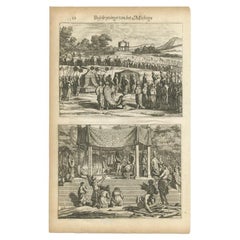
Antique Print of a Funeral on Ceylon 'Sri Lanka' is Asia, 1672
Located in Langweer, NL
Untitled print of the death of the prince heir, and his burial. Two prints, one with a long burial train including numerous horses, carrying the coffin, covered with cloth. The other...
Category
17th Century Antique Maps
Materials
Paper
$170 Sale Price
20% Off
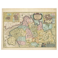
The 17th Century Map of Northern Dithmarschen and Its Towns in Germany
Located in Langweer, NL
This is a detailed colored copperplate engraving depicting northern Dithmarschen, accompanied by town plans of Weßlingburen (now Wesselburen), Lunden, and Heyde (now Heide) at the to...
Category
1640s Antique Maps
Materials
Paper
$1,077 Sale Price
20% Off
Original Antique Engraving of the Eastern Hemisphere, c.1700
Located in Langweer, NL
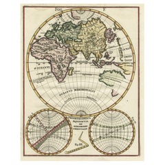
Antique map titled 'Proiectio Optica Aequinoctia lis Hemishaerii Orientalis' - Map of the Eastern Hemisphere with Africa, Europe, Asia and Nova Hollandia...
Category
17th Century Antique Maps
Materials
Paper
$869 Sale Price
20% Off
Antique Map of Southeast Asia 'India, Indonesia' by N. Visscher, circa 1670
Located in Langweer, NL
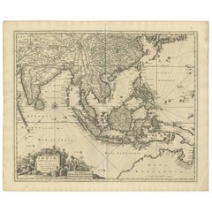
Antique map titled 'Indiae Orientalis, nec non Insularum Adiacentium Nova Descriptio.' The map centers on the Strait of Malacca and Malay Peninsula. It extends from India and the Mal...
Category
Mid-17th Century Antique Maps
Materials
Paper
$1,842 Sale Price
20% Off
Antique Map of the Spice Islands 'Moluccas', Indonesia by W. Blaeu, circa 1640
By Willem Blaeu
Located in Langweer, NL
Antique map titled 'Moluccae Insulae Celeberrimae'. Highly decorative antique map of the Spice Islands (Moluccas) published by W. Blaeu (circa 1640). This map features a large inset ...
Category
Mid-17th Century Antique Maps
Materials
Paper
Large Rhine River Map, Moselle and Meuse, by Willem Blaeu, Hand-coloured - 1640
Located in Langweer, NL
Rhine River & Tributaries Antique Map by Willem Blaeu, c.1640
This spectacular mid-seventeenth-century copper-engraved map, titled in Latin “Rhenus Fluvio...
Category
Mid-17th Century Dutch Antique Maps
Materials
Paper
$1,417 Sale Price
20% Off
Beautiful Original Copper Engraved Map of Lake Geneva in Switzerland, 1613
Located in Langweer, NL
Description: Antique map titled 'Lacus Lemanus'.
Old map of Lake Geneva with good detail of surrounding towns and villages. Decorated with a large compass rose with two sailing boats and a sea monster in the lake. Originates from 'Atlas Minor'.
Artists and Engravers: Henricus Hondius...
Category
1610s Antique Maps
Materials
Paper
$614 Sale Price
20% Off
Original Antique Map of the English counties Cornwall, Devon, Dorset, etc, 1633
Located in Langweer, NL
Antique map titled 'Cornubia, Devonia, Somersetus, Dorcestria, Wiltonia, Glocestria, Monumetha, Glamorgan, Caermarden, Penbrok, Cardigan, Radnor, Breknoke et Herfordia'.
Old map of the English counties of Cornwall, Devon, Somerset, Dorset, Wiltshire, Gloucestershire, Herefordshire, Worcestershire etc. Originates from the 1633 German edition of the Mercator-Hondius Atlas Major, published by Henricus Hondius and Jan Jansson under the title: 'Atlas: das ist Abbildung der gantzen Welt, mit allen darin begriffenen Laendern und Provintzen: sonderlich von Teutschland, Franckreich, Niderland, Ost und West Indien: mit Beschreibung der selben.'
Artists and Engravers: Gerard Mercator (1512 - 1594) originally a student of philosophy was one of the most renowned cosmographers and geographers of the 16th century, as well as an accomplished scientific instrument maker. He is most famous for introducing Mercators Projection, a system which allowed navigators to plot the same constant compass bearing on a flat...
Category
1630s Antique Maps
Materials
Paper
$1,086 Sale Price
20% Off
Cartographic Survey of Pontevedra, 1902: Crossroads of Galicia"
Located in Langweer, NL
This original old map of over 100 years old depicts the province of Pontevedra as it was in 1902. Pontevedra is located in the northwest of Spain, in the autonomous community of Galicia. This coastal province is bordered by the Atlantic Ocean to the west and Portugal to the south. It is a region known for its rugged coastline, which includes the famous Rías Baixas, a series of four estuarine inlets that are known for their scenic beauty, beaches, and seafood. The interior of the province is characterized by a hilly landscape that gradually rises from the coast to the interior.
Pontevedra's capital, which shares the same name, is renowned for its well-preserved old town, rich medieval history, and the iconic Sanctuary of the Pilgrim Virgin...
Category
Early 1900s Antique Maps
Materials
Paper
$302 Sale Price
20% Off
Antique Map of Modern Day Ukraine and Russia Titled Moscovie 'Moscow', Ca.1683
Located in Langweer, NL
Antique map of modern day Ukraine and Russia titled ‚Moscovie‘. Miniature map of the Moscovia region by A.M. Mallet.
Artists and Engravers: Alain Manneson Mallet (1630-1706) spent...
Category
1680s Antique Maps
Materials
Paper
$434 Sale Price
20% Off
Antique Map of Thracia ‘Greece’ by J. Janssonius, circa 1650
Located in Langweer, NL
This antique map of Thracia is engraved and published by J. Janssonius after the cartographical sources by Abraham Ortelius. Ornated in the upper left corner with a title cartouche a...
Category
Mid-17th Century Antique Maps
Materials
Paper
$803 Sale Price
20% Off
Original Antique Map of the Road from London to Bensington
Located in Langweer, NL
Antique map titled 'The Road from London to St. Davids in com: Pembroke (..)'. A strip map of the road from London to Bensington. The map is ornamented with numerous compass roses, a...
Category
Late 17th Century Antique Maps
Materials
Paper
$510 Sale Price
20% Off
Original Antique Map of Brasil, Published in the 16th Century, 1561
Located in Langweer, NL
This important Ruscelli map of Brazil, from his work La Geografia di Claudio Tolomeo Alessandrino, is one of the earliest obtainable modern maps of the re...
Category
1660s Antique Maps
Materials
Paper
$519 Sale Price
20% Off
Old Map Focusing on the Wine Region of Metz, the Moselle Region of France, 1657
Located in Langweer, NL
Antique map of France titled 'Territorium Metense'.
Old map focusing on the wine region surrounding Metz, in the Moselle region of France. This map originates from 'Atlas Novus, ...
Category
1650s Antique Maps
Materials
Paper
$595 Sale Price
20% Off
Beautiful Antique Map of the Moluccas or Spice Islands, Indonesia, ca.1650
Located in Langweer, NL
Antique map titled 'Insularum Moluccarum Nova Descriptio.'
Beautiful map of the Moluccas. The famous Spice Islands, the cornerstone of the Dutc...
Category
1650s Antique Maps
Materials
Paper
$699 Sale Price
20% Off
Original Antique Map of the City of Stavoren, Friesland, The Netherlands, 1649
Located in Langweer, NL
Antique map titled 'Staveren'. Original antique map of the city of Stavoren, Friesland, The Netherlands. This map originates from 'Toonneel der Steden van de Vereenighde Nederlanden'...
Category
1640s Antique Maps
Materials
Paper
$897 Sale Price
20% Off
Detailed Map of Southern Holland, Incl the Hague, Rotterdam, Delft, Gouda, c1680
Located in Langweer, NL
Antique map titled 'Delflandia, Schielandia et circumjacentes Insulae ut Voorna, Overflackea, Goerea, Yselmonda et aliae.'
Detailed map of Southern Holland, which includes the ci...
Category
1680s Antique Maps
Materials
Paper
$960 Sale Price
34% Off
Antique Map of the City of Rotterdam by Guicciardini, C.1600
Located in Langweer, NL
Antique map titled 'Rotterdam'. Bird's eye view plan of Rotterdam in the province of Zuid-Holland, The Netherlands, Holland. This map originates from one of the editions of 'Discritt...
Category
17th Century Antique Maps
Materials
Paper
$373 Sale Price
20% Off
Bird’s-Eye View Map of Gallipoli: Fortified Ionian Gem by Mattheus Merian, 1688
Located in Langweer, NL
Bird’s-Eye View Map of Gallipoli: Fortified Ionian Gem by Mattheus Merian
Description:
This exquisitely detailed map of Gallipoli, crafted by the renowned engraver Mattheus Merian,...
Category
1680s German Antique Maps
Materials
Paper
Detailed Antique Map of Southeast England, incl Warwickshire and Hampshire, 1690
Located in Langweer, NL
Antique map titled 'Orientalior districtus Regni Angliae (..)'.
Detailed map of southeast England encompassing the country from Lincolnshire and the Wash south and including Warw...
Category
1690s Antique Maps
Materials
Paper
$803 Sale Price
20% Off
Antique Plan of the Siege of Grave by Guicciardini, c.1608
Located in Langweer, NL
Antique map titled 'Hic est situs oppidi Grauiae (..)'. Bird's eye view plan of Grave, The Netherlands, Holland. Showing the siege of Grave in the year 1602. Source unknown, to be de...
Category
17th Century Antique Maps
Materials
Paper
$453 Sale Price
20% Off
Antique Map of Lower Silesia of The Famous Mapmaker Blaeu, c.1650
Located in Langweer, NL
Antique map titled 'Ducatus Silesiae Wolanus'. \
Antique map depicting lower Silesia with the cities of Wolow (Wohlau), Winsko (Winzig), Herrnstadt, Chobie (Koben), Lubin (Lüben), R...
Category
17th Century Antique Maps
Materials
Paper
$803 Sale Price
20% Off
Antique Hand-colored Map of Brandenburg, Germany
Located in Langweer, NL
Antique map titled 'Marchionatus Brandenburgicus'. Original antique map of Brandenburg, with Königsberg and Stettin, Germany. Published by J. Janssonius, circ 1650.
Jan Janssonius ...
Category
Mid-17th Century Antique Maps
Materials
Paper
$396 Sale Price
20% Off
Original Decorative Antique Map of Prussia, 1628
Located in Langweer, NL
Antique map titled 'Prussia'. Original antique map of Prussia, a historically prominent German state that originated in 1525 with a duchy centered on th...
Category
1620s Antique Maps
Materials
Paper
$519 Sale Price
20% Off
Decorative Early Hand-Colored Map of the Northeast of England, ca.1620
Located in Langweer, NL
Antique map titled 'Eboracum, Lincolnia, Derbia, Staffordia, Notinghamia, Lecestria, Rutlandia et Norfolcia'.
Decorative early map of the northeast of England, comprising the cou...
Category
1620s Antique Maps
Materials
Paper
$633 Sale Price
20% Off
Girona 1902: Geographic and Infrastructural Map of Catalonia’s Northern Province
Located in Langweer, NL
The map provided is of the province of Girona (in Catalan, Girona), located in the northeast of Spain, within the autonomous community of Catalonia, as of the year 1902. Here are the...
Category
Early 1900s Antique Maps
Materials
Paper
$368 Sale Price
20% Off
Natives from Pegu, the Moluccan Islands, Penequais Indians and St Thomas, c.1605
Located in Langweer, NL
Antique print titled 'Provincie Pegu incola (..) - Incola ex Insulis Moluco (..) - Penequais familiae (..)'.
Old print showing various figures including a man from Pegu, a man fr...
Category
Early 1600s Antique Maps
Materials
Paper
$340 Sale Price
20% Off
Decorative Antique Map of the Region of Cambrai, France, ca.1630
Located in Langweer, NL
Antique map titled 'l'Archevesche de Cambray'. Decorative map of the region of Cambrai, France. Includes the cities of Cambrai, Valencienes, Douai, and Bouchain.
Artists and Engravers: Henricus...
Category
1630s Antique Maps
Materials
Paper
$699 Sale Price
20% Off
Antique Map of Nova Zembla by Janssonius, c.1650
Located in Langweer, NL
Antique map titled 'Nova Zemla, waygats fretum Nassovi cum et terra Samoiedum singula omnium emendatissime descripta'. This map depicts Nova Zembla and the northern continental coast...
Category
17th Century Antique Maps
Materials
Paper
$375 Sale Price
20% Off
Antique Map of Zeeland, The Netherlands, by Jaillot, 1693
Located in Langweer, NL
Antique map titled 'Le Comte de Zeelande (..).' Detailed map of the province of Zeeland, The Netherlands. Details shown include fortified towns, roads, sandbanks and marshlands. Base...
Category
17th Century Antique Maps
Materials
Paper
$841 Sale Price
20% Off
1752 Vaugoundy Map of Flanders : Belgium, France, and the Netherlands, Ric.a002
Located in Norton, MA
Large Vaugoundy Map of Flanders:
Belgium, France, and the Netherlands
Colored -1752
Ric.a002
Description: This is a 1752 Didier Robert de Vaugondy map of Flanders. The map de...
Category
17th Century Unknown Antique Maps
Materials
Paper
Antique Map of the Northeast of England by Mercator 'circa 1620'
Located in Langweer, NL
Antique map titled 'Eboracum Lincolnia, Derbia, Staffordia, Notinghamia, Lecestria, Rutlandia, et Norfolcia'. Decorative early map of the northeast of England, comprising the countie...
Category
Early 17th Century Antique Maps
Materials
Paper
$519 Sale Price
20% Off
Antique Map of the Duchy of Saxony by De Wit, c.1680
Located in Langweer, NL
Antique map titled 'Circuli Saxoniae Superior Pars Meridionalis in qua sunt Ducatus Saxoniae, Comitatus Mansfeldiae, et Voitlandiae, Landgraviat Thuringiae, Marchionatus Misniae Prin...
Category
17th Century Antique Maps
Materials
Paper
$680 Sale Price
20% Off
Rare Antique Engraving of Mount Fuji During an Earthquake in Tokyo, Japan, 1669
Located in Langweer, NL
Antique print, titled: 'Aertbeevinge tot Jedo.' - ('Earthquake in Edo').
A temple falls to ruins because of an earthquake in Yedo (or Edo, Jeddo; now Tokyo). Men and women lament...
Category
1660s Antique Maps
Materials
Paper
$604 Sale Price
20% Off
Málaga 1901: A Cartographic Detailing of Andalusia's Coastal Jewel
Located in Langweer, NL
The map depicts the province of Málaga, located in the autonomous community of Andalusia in southern Spain, as it was in 1901. Here are the key features illustrated on the map:
- **...
Category
Early 1900s Antique Maps
Materials
Paper
$321 Sale Price
20% Off
León 1903: A Cartographic Detailing of Castilla y León's Mountainous Province
Located in Langweer, NL
The map depicts the province of León, which is located in the northwest of Spain and forms part of the autonomous community of Castilla y León, as of 1903. Notable features of the ma...
Category
Early 1900s Antique Maps
Materials
Paper
$274 Sale Price
20% Off
Antique Map of the Region of Oldenburg, Germany
By Willem Blaeu
Located in Langweer, NL
Antique map titled 'Oldenburg Comitatus'. Detailed old map of Oldenburg, Germany. The map also shows Bremen and the Jade Bight. Published by W. Blaeu, circa 1640. Willem Jansz. Blaeu...
Category
Mid-17th Century Antique Maps
Materials
Paper
$415 Sale Price
20% Off
Topographical and Administrative Cartography of Segovia in Spain, 1902
Located in Langweer, NL
An original old map of the province of Segovia from the year 1902. Segovia is a historic area located in the central part of Spain, northwest of Madrid. Known for its rich history, a...
Category
Early 1900s Antique Maps
Materials
Paper
$274 Sale Price
20% Off
Map of Le Maine by H. Hondius, 1633, Hand-Colored, Decorative and Historic
Located in Langweer, NL
Map of Le Maine by H. Hondius, 1633, Hand-Colored, Decorative and Historic
This rare and beautifully executed antique map titled 'Le Maine' was published in 1633 by Henricus Hondius...
Category
1630s Antique Maps
Materials
Paper
Antique Map of Flanders, Belgium, 1630
Located in Langweer, NL
Antique map titled 'Comitatus Flandria'. Original antique map of Flanders, Belgium. This map originates from 'Vyerige Colom verthonende de 17 Nederlandsche Provintien' published 1630...
Category
17th Century Antique Maps
Materials
Paper
$425 Sale Price
20% Off
An Antique Map of Extremadura: Crossroads of History and Nature, 1903
Located in Langweer, NL
The image is a historical map of Extremadura, an autonomous community of Spain, from an unspecified year. The map features the region's topography, including mountain ranges, river systems, and road networks. Extremadura is bordered by Portugal to the west and is situated to the southwest of Madrid. The map also includes the coat of arms of Lisbon (Lisboa), possibly indicating the historical connections between the two regions, as Lisbon is close to the border of Extremadura.
Extremadura is known for its:
1. **Natural Landscapes**: The region has diverse landscapes, including the mountainous areas in the north and the fertile plains (known as the dehesa) used for grazing pigs, which produce the famous Iberian ham.
2. **Historical Significance**: Extremadura was the birthplace of many famous conquistadors, such as Hernán Cortés...
Category
Early 1900s Antique Maps
Materials
Paper
$434 Sale Price
20% Off
Large Antique Lithography Map, Northamptonshire, Framed Cartography, John Speed
Located in Hele, Devon, GB
This is a large antique lithography map of Northamptonshire. An English, framed atlas engraving of cartographic interest by John Speed, dating to the early 17th century and later.
Superb lithography reproduction of Northamtonshire - place names are written in 17th century English
Displays a desirable aged patina and in very good order
Fascinating Jacobean period cartography, set within a quality, later frame
Reproduced here from its appearance in the 'Theatre of Great Britain' of 1627 published by George Humble
Marked for John Speed as cartographer and George Humbell (sic) as seller
Exceptional detail, as expected from a John Speed map...
Category
Mid-17th Century British Other Antique Maps
Materials
Glass, Wood, Paper
Antique Map of the Duchy of Westphalia, Germany
Located in Langweer, NL
Original antique map titled 'Westphalia Ducatus'. Fine map of the Duchy of Westphalia, Germany. The map is centered on Meschede and includes Arensberg, Beelick, and Brilon. Published...
Category
Mid-17th Century Antique Maps
Materials
Paper
$699 Sale Price
20% Off
Antique Map of Paraguay by A. Montanus, circa 1671
Located in Langweer, NL
Antique map titled 'Paraquaria Vulgo Paraguay Cum adjacentibus'. Antique map extending from Rio de Janiero to the Rio de la Plata basin. The map include...
Category
Mid-17th Century Antique Maps
Materials
Paper
$565 Sale Price
20% Off
Antique Map of the Region of Perce and Blois by Janssonius, 1657
Located in Langweer, NL
Antique map of France titled 'Perchensis Comitatus - Comitatus Blesensis'. Decorative map of Perce region and the region of Blois. This map originates from 'Atlas Novus, Sive Theatru...
Category
17th Century Antique Maps
Materials
Paper
$324 Sale Price
20% Off
Antique Map of the Southern Lorraine Region by Mercator, c.1625
Located in Langweer, NL
Antique map titled 'Lotharingiae Ducatus'. Old map of the southern portion of the Lorraine region, France. Lorraine is a cultural and historical region in north-eastern France, now l...
Category
17th Century Antique Maps
Materials
Paper
$273 Sale Price
20% Off
Antique Map of Kent with Inset Plans of Rochester & Canterbury, England, 1676
Located in Langweer, NL
Antique map titled 'Kent with her Cities and Earles described and observed'.
Map of Kent, England. Includes inset town plans of Rochester and Canterbury....
Category
17th Century Antique Maps
Materials
Paper
$661 Sale Price
20% Off
Original Antique Engraving of Sakai in the Osaka Prefecture, Japan, 1669
Located in Langweer, NL
Antique print, titled: 'De Stadt Saccai. La Ville de Saccai.' - ('The City Saccai').
This plate shows a view of Sakai in the Osaka Prefecture, Japan. Sakai has been one of the la...
Category
1660s Antique Maps
Materials
Paper
$614 Sale Price
20% Off
Cartographic Heritage: The 1901 Map of the Vizcaya Province in Spain
Located in Langweer, NL
This is a historical map of the province of Vizcaya (Biscay) in Spain, dated 1901. The title on the map is "VIZCAYA. 1901." It shows the topographical details of the region with cont...
Category
Early 1900s Antique Maps
Materials
Paper
$302 Sale Price
20% Off
Original Antique Map of the Road from Marlborough to Huntspil
Located in Langweer, NL
Antique map titled 'The Continuation of the Road from London to Bristol (..)'. A strip map of the continuation of the road from London to Bristol, this particular sheet showing the r...
Category
Late 17th Century Antique Maps
Materials
Paper
$510 Sale Price
20% Off
Beira Alta: A Cartographic Journey Through Portugal's Heartland in 1903
Located in Langweer, NL
The uploaded image is a historical map of the Beira Alta region in Portugal. The map is detailed, showing the topography, hydrography, and transportation networks of the region, incl...
Category
Early 1900s Antique Maps
Materials
Paper
$274 Sale Price
20% Off
Antique Map of Part of Flanders 'Belgium' by F. de Wit 'circa 1680'
Located in Langweer, NL
Antique map titled 'Marchionatus Sacri Imperii et Dominii Mechelini Tabula'. Large folio size map of the region around Mechelen, Leuven, Brussels, Dendermonde and Antwerp. Published ...
Category
Late 17th Century Antique Maps
Materials
Paper
$543 Sale Price
20% Off
Original Antique Map the Imperial States of the Habsburg Netherlands, 1609
Located in Langweer, NL
Antique map titled 'Belgii inferioris descriptio (..)'.
Old map of the Seventeen Provinces, the Imperial states of the Habsburg Netherlands in the 16th century. They roughly cove...
Category
Early 1600s Antique Maps
Materials
Paper
$1,181 Sale Price
20% Off
Antique Engraving of a Bird's-Eye Plan of Nagapattinam or Negapatam, India, 1672
Located in Langweer, NL
Antique map titled 'Negapatam.'
Bird's-eye plan of Nagapattinam or Negapatam, India. This map originates from 'Naauwkeurige Beschryvinge van Malabar en Choromandel…en het machtige ...
Category
1670s Antique Maps
Materials
Paper
$321 Sale Price
20% Off
Original Antique Print of a Procession of Monks in Ceylon 'Sri Lanka', 1672
Located in Langweer, NL
Antique print, untitled. This original antique print shows a procession of monks in Ceylon. A group of dancing monks, beating drums, in front of the abbot, seated on an elephant. Dut...
Category
1670s Antique Maps
Materials
Paper
$255 Sale Price
20% Off
Map of Sevilla Province, 1901: A Depiction of The Spanish Cultural Heartland
Located in Langweer, NL
The print for sale here depicts a historical map of the province of Sevilla (Seville) from the year 1901. Sevilla is located in the southern part of Spain and is part of the autonomo...
Category
Early 1900s Antique Maps
Materials
Paper
$264 Sale Price
30% Off
Topographical and Infrastructure Map of the Province of Valencia, 1901
Located in Langweer, NL
A historical map of the province of Valencia, dated 1901. The map includes intricate details such as topographical features, with mountain ranges and river systems prominently marked...
Category
Early 1900s Antique Maps
Materials
Paper
$491 Sale Price
20% Off
Antique Map of the Region of Bouchain and Cambrai by Visscher 'circa 1680'
Located in Langweer, NL
Antique map titled 'Carte Nouvelle des Environs de Bouchain & Cambray'. Uncommon map of the region of Bouchain and Cambrai (Cambray, France) showing the camps of two armies.
Category
Late 17th Century Antique Maps
Materials
Paper
$472 Sale Price
20% Off
Recently Viewed
View AllMore Ways To Browse
Antique Wellington Chests
Antonio Cassi Ramelli
Archimede Seguso Birds
Art Deco Coasters
Art Deco Footballer
Art Deco Music Cabinet
Art Deco Waterfall Bedroom Furniture
Art Deco Waterfall Bedroom
Art Deco Whisky
Art Foulard
Art Nouveau Sunflower
Arts And Crafts Silver Coffee Pot
Asian Pink Bowl
Avesn Vase
Baccarat Carafe
Bakelite Bird
Bakelite Cocktail Picks
Bamboo Ikebana Vase
