18th Century and Earlier Maps
to
2,336
2,867
64
2,934
26
12
1
1
2,934
2,261
475
3
290
34
10
126
10
37
9
2
5
4
3
3
2,920
30
20
3
3
304
110
79
53
50
2,934
2,934
2,934
59
21
13
12
12
Period: 18th Century and Earlier
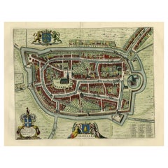
Old Map of the City of Franeker, Friesland by the Famous Mapmaker Blaeu, 1652
Located in Langweer, NL
Antique map titled 'Franekera'. Old map of the city of Franeker, Friesland. Also shows two cartouches, coats of arms and legend. This map originates from a Latin edition of the town ...
Category
Antique 18th Century and Earlier Maps
Materials
Paper
$1,189 Sale Price
20% Off
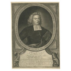
Portrait of Bernhard Sandyck, a Dutch Protestant Minister from Amsterdam, 1720
Located in Langweer, NL
Antique print, titled: 'Bernhardus Sandyck Amstelodamiensis (…)'
This plate shows a portrait of Bernhard Sandyck (1680 - 1727), a Dutch protestant minister from Amsterdam.
Sou...
Category
Antique 18th Century and Earlier Maps
Materials
Paper
$704 Sale Price
20% Off
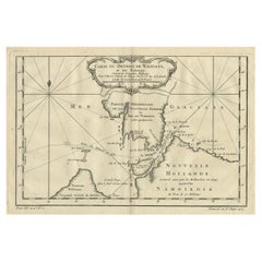
Map of the Russian Islands of Novaya Zemlya and Pechorskaya Guba, 1758
Located in Langweer, NL
Antique map titled 'Carte du detroit de Waeigats ou de Nassau.'
Map of the Russian islands of Novaya Zemlya (Nova Zembla) and Pechorskaya Guba, here Nouvelle Zemble and Grande Ba...
Category
Antique 18th Century and Earlier Maps
Materials
Paper
$247 Sale Price
20% Off
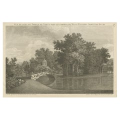
Antique Print of West Wycombe Park in Buckinghamshire, England, c.1785
Located in Langweer, NL
Antique print titled 'Vue du Pont, du Temple de Venus dans les Jardins de West-Wycomb (..)'.
Copper engraving of West Wycombe park, showing the bridge and temple.
West Wycombe Park is a country house built between 1740 and 1800 near the village of West Wycombe in Buckinghamshire, England. It was conceived as a pleasure palace for the 18th-century libertine and dilettante Sir Francis Dashwood, 2nd Baronet. The house is a long rectangle with four façades that are columned and pedimented, three theatrically so. The house encapsulates the entire progression of British 18th-century architecture from early idiosyncratic Palladian to the Neoclassical, although anomalies in its design make it architecturally unique...
Category
Antique 18th Century and Earlier Maps
Materials
Paper
$456 Sale Price
20% Off
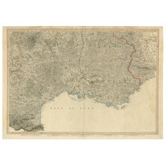
Striking Large Format Antique Map of Southeastern France, 1799
Located in Langweer, NL
Antique map titled 'The South Eastern Part of France which includes Roussillon-Languedoc, with a Great Portion of Rouergue and Auvergne-Provence-Dauphine, and the Whole Frontier of Italy'.
Striking large format map...
Category
Antique 18th Century and Earlier Maps
Materials
Paper
$618 Sale Price
20% Off
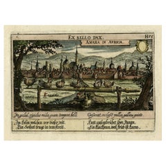
Old Print Titled from War Comes Peace, City Amara in Africa in Background, C1630
Located in Langweer, NL
Antique print, titled: 'Amara in Africa.'
Caption above the image reads: 'Ex bello Pax' (From War comes Peace). A lance is used as a roost for chickens. In the background the cit...
Category
Antique 18th Century and Earlier Maps
Materials
Paper
$418 Sale Price
20% Off
Original Copperplate Engraved Detailed Map of South Africa, ca.1680
Located in Langweer, NL
Antique map titled 'Pays et Coste des Caffres Empires de Monomotapa (..)'.
Detailed map of South Africa. Engraved by Antoine d'Winter for a Dutch edition of Sanson's pocket atlas...
Category
Antique 18th Century and Earlier Maps
Materials
Paper
$342 Sale Price
20% Off
Antique Print of Various Views of Rambouillet Near Paris, France, c.1785
Located in Langweer, NL
Antique print titled 'Chaumiere á Rambouillet - Maison de Campagne (..)'.
Copper engraving showing a cottage, church and bascule in Rambouillet. The Château de Rambouillet, also ...
Category
Antique 18th Century and Earlier Maps
Materials
Paper
$371 Sale Price
20% Off
Antique Print with a View of the Temple of Daibuth, Japan, 1683
Located in Langweer, NL
Antique print titled 'Temple de Daibuth'.
View of the temple of Daibuth, Japan. Originates from 'Description de l'Univers'.
Artists and Engravers: Alain Manesson Mallet, a Fr...
Category
Antique 18th Century and Earlier Maps
Materials
Paper
$171 Sale Price
20% Off
Antique Copper Engraved Print of Garden Kiosks in England, c.1785
Located in Langweer, NL
Antique print titled 'Divers Kiosques à l'Anglaise'. Copper engraving showing various garden kiosks. This print originates from 'Jardins Anglo-Chinois à la Mode' by Georg Louis le Ro...
Category
Antique 18th Century and Earlier Maps
Materials
Paper
$275 Sale Price
20% Off
Old Original Map of the Philippines and Part of Indonesia 'Spice Islands', 1744
Located in Langweer, NL
Antique map titled 'Nieuwe Kaart van de Filippynsche, Ladrones, Moluccos of Specery Eilanden, als mede Celebes etc'.
Old map of the Philippines and part of Indonesia. Originates ...
Category
Antique 18th Century and Earlier Maps
Materials
Paper
$884 Sale Price
20% Off
Original Colored Antique Map of Utrecht & Surroundings, The Netherlands, c1690
Located in Langweer, NL
Antique map titled 'Tabula nova Provinciae Ultrajectinae quam jussu Nob: hujus Dominij Ordinum Emensus est Bernardus du Roy'.
Map of the region of Utrecht, The Netherlands. This ...
Category
Antique 18th Century and Earlier Maps
Materials
Paper
$846 Sale Price
20% Off
Governor of Miaco (Kyoto, Japan), Leaving the City in a Carriage, 1669
Located in Langweer, NL
Antique print, titled: 'Sortie pompeuse du Gouverneur de Miaco. 't Uytreyden des Gouverneurs van Miaco.'
The governor of Miaco (Kyoto), in a carriage as part of a long procession...
Category
Antique 18th Century and Earlier Maps
Materials
Paper
$437 Sale Price
20% Off
Original Antique Engraving of the Murder of Emperor Cubo in Kyoto, Japan, 1669
Located in Langweer, NL
Antique print, titled: ''t Vermoorde vande Keyser Cubus.
Massacre de l'Empereur Cubo.' - ('Murder of the Emperor Cubo'). Two armies clash in Kyoto, where the reigning Emperor was...
Category
Antique 18th Century and Earlier Maps
Materials
Paper
$437 Sale Price
20% Off
Antique Print of the Monument to Pope Paul iii Located in the Vatican, c.1710
Located in Langweer, NL
Antique print titled 'Deposito di Papa Paolo III Eretto nella Basilica Vaticana'.
Old print of the monument to Pope Paul III by Giacomo della Porta, locate...
Category
Antique 18th Century and Earlier Maps
Materials
Paper
$437 Sale Price
20% Off
Original Antique Plan of the Dutch Settlement at Chinsura-Hooghly, India, 1746
Located in Langweer, NL
Antique print, titled: 'Plan de la Loge Hollandoise d'Ougly'.
A plan of the Dutch settlement at Chinsura-Hooghly, India. This print originates from Prevost's 'Histoire Generale d...
Category
Antique 18th Century and Earlier Maps
Materials
Paper
$333 Sale Price
20% Off
Nicely Hand-Colored Antique Map of Part of India, the Ganges & Hindustan, 1755
Located in Langweer, NL
Antique map titled 'Carte de l'Inde en deca du Gange comprenant l' Indoustan (..)'
A map of part of India, the Ganges and Hindustan. From: Antoine Francois Prevost d'Exiles' (or ...
Category
Antique 18th Century and Earlier Maps
Materials
Paper
$608 Sale Price
20% Off
Antique Map of the Banda Islands and the Route of Abel Tasman, Indonesia, 1726
Located in Langweer, NL
Antique print Indonesia with an image on each side. The first image depicts Ontong Java, one of the largest atolls on earth. On verso: antique map of the Banda Islands. With the rout...
Category
Antique 18th Century and Earlier Maps
Materials
Paper
$401 Sale Price
24% Off
Nicely Framed View on the 'Spaarndammerdijk' in Amsterdam, the Netherlands, 1795
Located in Langweer, NL
Antique print titled 'De Stad Amsteldam'.
View on the 'Spaarndammerdijk' in the city of Amsterdam, the Netherlands. This print originates from 'De...
Category
Antique 18th Century and Earlier Maps
Materials
Paper
$361 Sale Price
20% Off
Old Print of a Bridge of Kimpton Hoo in Kimpton, Hertfordshire, England, c.1770
Located in Langweer, NL
Antique print titled 'Plan & Elevation of a Bridge at Thomas Brand's Esqr. of the Hoo in Hertfordshire'.
This is a scheduled Monument in Kimpton, Hertfordshire
PLan and elevat...
Category
Antique 18th Century and Earlier Maps
Materials
Paper
$437 Sale Price
20% Off
Navigational Chart of Mexico's Coast, with Acapulco and Port Marquis, 1748
Located in Langweer, NL
Antique map titled 'The Form of cruising off Acapulca on the Coast of Mexico in the South Seas in the Year 1742. by His Majesty's Ships, Centurion, Gloucester, Tryall Prize, Carmila ...
Category
Antique 18th Century and Earlier Maps
Materials
Paper
$133 Sale Price
20% Off
Decorative Rare Map of the French Regions of Isle De France and Orleans, ca.1780
Located in Langweer, NL
Antique map titled 'Carte du Gouvernment de L'Isle de France et de edlui de L'Orleanois (..).'
A fine example of Rigobert Bonne's c. 1780 decorative map of the French regions of ...
Category
Antique 18th Century and Earlier Maps
Materials
Paper
$656 Sale Price
20% Off
Original Antique Detailed Map of the Rhine and Moselle River Regions, ca.1680
Located in Langweer, NL
Antique map titled 'Tabula Geographica qui Pars Meridionalis sive Superior Rheni, Mosae et Mosellae (..).'
Detailed map of the Rhine and Moselle River regions and contigous parts...
Category
Antique 18th Century and Earlier Maps
Materials
Paper
$523 Sale Price
20% Off
Remarkable Map of the Alsace Region and Nova Zembla, Russia, ca.1700
Located in Langweer, NL
Antique map titled 'Chorographia Alsatiae.'
Map of the Alsace region and Nova Zembla, printed for Scherer's 'Atlas Novus' (1702-1710). Scherer's 'Atlas Novus' forms an important ...
Category
Antique 18th Century and Earlier Maps
Materials
Paper
$379 Sale Price
34% Off
Curious Map of the Laptev Sea 'Arctic Ocean' and the Mediterranean, ca.1700
Located in Langweer, NL
Antique map, untitled.
Map of the Laptev Sea (Arctic Ocean) and the Mediterranean, printed for Scherer's 'Atlas Novus' (1702-1710). Scherer's 'Atlas Novus' forms an important mil...
Category
Antique 18th Century and Earlier Maps
Materials
Paper
$447 Sale Price
20% Off
Charming Decorative Miniature Map of Russia, from an Old Pocket Atlas, 1685
Located in Langweer, NL
Antique map titled 'Russia cum Consinijs'.'
Charming miniature map of Russia, from the pocket atlas 'Introductionis in Universam Geographiam tam Veterem quam novam .. Acessit P. ...
Category
Antique 18th Century and Earlier Maps
Materials
Paper
$338 Sale Price
25% Off
Uncommon and Rare Map of the Caspian Sea by Order of the Czar, 1742
Located in Langweer, NL
Antique map, titled: 'Kaert van de Kaspische Zee volgens bevel van den Czaer (…).'
Uncommon map of Caspian Sea. Source unknown, to be determined.
Ar...
Category
Antique 18th Century and Earlier Maps
Materials
Paper
$694 Sale Price
20% Off
Interesting Old Map of the Nw Coast of America and the Ne Coast of Asia, ca.1772
Located in Langweer, NL
Antique map titled 'Carte Generale des Decouvertes de l'Amiral de Fonte (..)'.
Original antique map of the discoveries of Admiral de Fonte, showing the possibility of a north-west passage. Interesting map of the NW Coast...
Category
Antique 18th Century and Earlier Maps
Materials
Paper
$564 Sale Price
35% Off
Small Early 18th Century Map of Banten Bay on the Island Java, Indonesia, c.1725
Located in Langweer, NL
A small early 18th century map of Banten Bay showing the islands of Pulo Dua and Pulo Batto together with soundings within the Bay and profiles of hills on the islands published by C...
Category
Antique 18th Century and Earlier Maps
Materials
Paper
$209 Sale Price
20% Off
Decorative Hand-Colored Antique Map of Groningen in the Netherlands, ca.1730
Located in Langweer, NL
Antique print, titled: 'Groningae et Omlandiae Dominium vulgo de Provincie van Stadt en Lande (…) ' - This map shows Groningen, the Netherlands. Lower left scale sticks in the decora...
Category
Antique 18th Century and Earlier Maps
Materials
Paper
$1,189 Sale Price
20% Off
Antique Map of Austria, Centered Around the Danube from Passau to Vienna, C.1690
Located in Langweer, NL
Antique map of Austria titled 'Circuli Austriaci pars septentrionalis in quia archiducatus Austriae et Ducatus Stiriae accuratissime divisi ostenduntur per F. de Wit'.
Detailed m...
Category
Antique 18th Century and Earlier Maps
Materials
Paper
$1,284 Sale Price
20% Off
Old Dutch Map of Part of Syria and Phoenicia, 1773
Located in Langweer, NL
Antique print titled 'Gedeelte van Syriën en Phenicië'.
Old map of part of Syria and Phoenicia. Originates from the first Dutch editon of an interesting travel account of Norther...
Category
Antique 18th Century and Earlier Maps
Materials
Paper
$304 Sale Price
20% Off
Old Dutch Map of the City of Oran 'Warran', Algeria, 1773
Located in Langweer, NL
Antique print titled 'Ligging der Stad en Haven van Warran of Oran'.
Old map of the city of Oran (Warran), Algeria. Originates from the first Dutch ed...
Category
Antique 18th Century and Earlier Maps
Materials
Paper
$275 Sale Price
20% Off
Decorative and Detailed Original Antique Map of Switzerland, 1657
Located in Langweer, NL
Antique map of Switzerland titled 'Helvetiae Rhetiae & Valesiae'.
Decorative and detailed map of Switzerland. This map originates from 'Atlas Novus, Sive Theatrum Orbis Orbis Ter...
Category
Antique 18th Century and Earlier Maps
Materials
Paper
$818 Sale Price
20% Off
Beautiful Original Print of The Creation of the World According to Moses, 1725
Located in Langweer, NL
Antique map, titled: 'De Schepping der Wereldt volgens de Beschryving van Mozes.'
Two separate maps on one sheet showing the creation of the world according to Moses. The upper dep...
Category
Antique 18th Century and Earlier Maps
Materials
Paper
$932 Sale Price
20% Off
Beautiful Antique Map of the Province of Noord-Holland, the Netherlands, Ca.1730
Located in Langweer, NL
Antique map titled 'Kennemaria et Westfrisia vulgo et vernaculé Noord-Holland'.
Beautiful original antique map of the province of Noord-Holland, the Netherlands. Two large elaborat...
Category
Antique 18th Century and Earlier Maps
Materials
Paper
$1,379 Sale Price
20% Off
Antique Handcolored Map of the Dutch Province Groningen, Incl. Emden, Ca.1680
Located in Langweer, NL
Antique print, titled: 'Groningae et Omlandiae Dominium vulgo de Pronvicie van Stadt en Lande …'
A map of the Dutch province Groningen. A small part of Germany is also shown (Emd...
Category
Antique 18th Century and Earlier Maps
Materials
Paper
$903 Sale Price
20% Off
Beautiful Map of the Region Naters and Pancrasgors, The Netherlands, ca.1697
Located in Langweer, NL
Antique map titled ‘Caarte der Heerlyckheyt van Naters ende Pancras Gors’.
Beautiful map of the region Naters and Pancrasgors, The Netherlands. This ma...
Category
Antique 18th Century and Earlier Maps
Materials
Paper
$1,284 Sale Price
20% Off
Original Antique Chart of the Santa Cruz Islands, 1774
Located in Langweer, NL
Antique print titled 'Isles de la Reine Charlotte (..)'.
A detailed chart of the Santa Cruz islands, to the north of the New Hebrides, with Carte...
Category
Antique 18th Century and Earlier Maps
Materials
Paper
$437 Sale Price
20% Off
Print of Maps of Islands of the South Pacific, Incl. Pitcairn & Dusky Bay, 1788
Located in Langweer, NL
Antique map titled 'Esquisse de la Bay Dusky, Dans La Nouvelle Zeelande / I. Pitcairn / Isles de Wallis / I Turtle / I des Cocos and Traitres / Palmerston I. / I. Suavage / I. D'Hervey/ Havre Pickersgill / I de Pasques.'
Detailed set of maps of the islands of the South Pacific...
Category
Antique 18th Century and Earlier Maps
Materials
Paper
$418 Sale Price
20% Off
Attractive Original Hand-Colored Map of the Swabia Region of Germany, 1799
Located in Langweer, NL
Antique map titled 'A New Map of the Circle of Swabia, from the Latest Authorities'.
Attractive example of John Cary's 1799 map of the Swabia region of Germany. Covers from the U...
Category
Antique 18th Century and Earlier Maps
Materials
Paper
$456 Sale Price
20% Off
Map of the Circle of Franconia, Germany Bamberg, Wurtzburg and Nuremberg, 1757
Located in Langweer, NL
Antique map titled 'Cercle de Franconie (..)'.
Map of the Circle of Franconia, Germany. Centered on Bamberg, Wurtzburg and Nuremberg. This map originates from 'Atlas Universel (..)'.
Artists and Engravers: Gilles Robert de Vaugondy (1688 - 1766), also known as Le Sieur or Monsieur Robert, and his son, Didier Robert de Vaugondy (c.1723 - 1786), were leading mapmakers in France during the 18th century. In 1757, they published The Atlas Universel, one of the most important atlases of the 18th century. To produce the atlas, the Vaugondys integrated older sources with more modern surveyed maps...
Category
Antique 18th Century and Earlier Maps
Materials
Paper
$523 Sale Price
20% Off
Antique Map of the Coast of Angola Up to Port Elizabeth in South Africa, 1675
Located in Langweer, NL
Antique map titled 'Cimbebas et Caffariae Littora a Catenbela ad Promontorium Bonae Spei'.
This map depicts the coast of Angola, South-West Africa and South Africa up to Port Elizabeth...
Category
Antique 18th Century and Earlier Maps
Materials
Paper
$903 Sale Price / set
20% Off
Handsome Old Detailed Map of the Low Countries by Famous Mapmaker Blaeu, ca.1635
Located in Langweer, NL
Antique map titled 'Novus XVII Inferioris Germaniae Provinciarum Typus'.
Handsome - and much sought after- detailed map of the Low Countries by the world most famous map maker Bla...
Category
Antique 18th Century and Earlier Maps
Materials
Paper
Antique Plan of Fort Dauphin on Madagascar of the East Coast of Africa, 1756
Located in Langweer, NL
Antique map titled 'Plan du Fort Dauphin (..) -
Grondtekening van 't Fort Dauphin'. Plan of Fort Dauphin on the island of Madagascar of the east coast of Africa. This print origi...
Category
Antique 18th Century and Earlier Maps
Materials
Paper
$228 Sale Price
20% Off
Antique Engraving of a Print Showing the Indian City of Suratte 'Surat', 1672
Located in Langweer, NL
Antique print, titled: 'Suratte' -
View of the Indian city of Suratte (Surat) showing a panoramic view of the city with figures, animals and a river ...
Category
Antique 18th Century and Earlier Maps
Materials
Paper
$342 Sale Price
20% Off
Old Town View of the Fula Tribe and Its Cotton Plantations, Gambia, Africa, 1748
Located in Langweer, NL
Antique print titled 'Vue d'une Ville des Foulis et de ses Plantations - Gezigt van eene Stad der Fuli, en derzelver Planteryen'. View of a town of the Fula people and its cotton pla...
Category
Antique 18th Century and Earlier Maps
Materials
Paper
$133 Sale Price
20% Off
Nice Antique Map of the Empire of Japan. Centered on the Bay of Osaka, ca.1752
Located in Langweer, NL
Antique map titled 'Carte de L'Empire de Japon (..).'
Map of the Empire of Japan. Centered on the Bay of Osaka, this map covers from Hirado (here identified as I. Firando) and Naga...
Category
Antique 18th Century and Earlier Maps
Materials
Paper
$903 Sale Price
20% Off
Old Print of the Spanish Conquest of Cusco or Cuzco, Capital of the Incas, c1750
Located in Langweer, NL
Antique print titled 'Grundriss von Cuzco bey der Eroberung von den Spaniern'.
Old plan of the city of Cusco, Peru, often spelled Cuzco. It shows Cusco during the conquest by the...
Category
Antique 18th Century and Earlier Maps
Materials
Paper
$275 Sale Price
20% Off
Original Old Copper Engraved Map of the Region of Albi, Southern France, 1663
Located in Langweer, NL
Antique map titled 'Carte du Diocese d'Alby'.
Original antique map of the region of Albi in Southern France. This map originates from 'Topographia Galliae dat is eene algemeene e...
Category
Antique 18th Century and Earlier Maps
Materials
Paper
$523 Sale Price
20% Off
Antique Map of Friesland and Groningen, Provinces of the Netherlands, 1628
Located in Langweer, NL
Antique map Friesland titled 'Frisia Occidentalis'. Small, decorative map of the province of Friesland, the Netherlands. Second state, out of three, originating from 'Atlas Minor' by...
Category
Antique 18th Century and Earlier Maps
Materials
Paper
$333 Sale Price
20% Off
Antique Decorative Map of the Low Countries, '17 Provinces, Netherlands', c.1680
Located in Langweer, NL
Description: Antique map titled 'Germaniae Inferioris XVII Provinciarum Accuratissima Tabula.'
Map of the low countries (17 provinces, Netherlands). The map is dedicated to Theod...
Category
Antique 18th Century and Earlier Maps
Materials
Paper
$1,379 Sale Price
20% Off
Map of Tapi or Tapti River in Central India and Along the Arabian Sea, 1726
Located in Langweer, NL
Description: Antique map titled 'De Rivier van Suratta'.
This chart shows the Tapti or Tapi River in Central India and the Indian coast along the Arabian Sea, into which the rive...
Category
Antique 18th Century and Earlier Maps
Materials
Paper
$361 Sale Price
20% Off
Antique Map of Friesland by De Wit, c.1690
Located in Langweer, NL
Antique map titled 'Tabula Comitatus Frisiae'.
Old map of the province of Friesland, the Netherlands. With a small inset map of the Wadden area. Third state of the map by Schotan...
Category
Antique 18th Century and Earlier Maps
Materials
Paper
$780 Sale Price
20% Off
Antique Map of Friesland, The Netherlands, 1638
Located in Langweer, NL
Antique map titled 'Frisia Occidentalis'.
Original antique map of Friesland, the Netherlands. First state, originating from 'Atlantis novi pars secunda' published 1638.
Artis...
Category
Antique 18th Century and Earlier Maps
Materials
Paper
$451 Sale Price
20% Off
Antique Map of France by British Mapmaker Wells, c.1710
Located in Langweer, NL
Antique map titled 'A New Map of France (..)'.
Original antique map of France. It covers all of France and parts of Belgium and Switzerland. This map originates from 'A new sett ...
Category
Antique 18th Century and Earlier Maps
Materials
Paper
$342 Sale Price
20% Off
Shetland Islands Sea Chart – Antique Nautical Map by Ottens Brother c.1745
Located in Langweer, NL
Shetland Islands Sea Chart – Antique Nautical Map by Ottens Brothers, c.1740s
This striking antique nautical chart titled Nieuwe Paskaard van ...
Category
Dutch Antique 18th Century and Earlier Maps
Materials
Paper
$1,189 Sale Price
20% Off
Antique Map of France in the 5th Century by Zannoni, 1765
Located in Langweer, NL
Antique map France titled 'Etat de la Gaule (..)'.
Beautiful old map of France. This map originates from 'Atlas Historique de la France Ancienne et Moderne' by M. Rizzi Zannoni. ...
Category
Antique 18th Century and Earlier Maps
Materials
Paper
$151 Sale Price
20% Off
Antique Map of France under the Reign of Philip II by Zannoni, 1765
Located in Langweer, NL
Antique map France titled 'La France sous les Regne de Philippe Auguste (..)'.
Beautiful old map of France. This map originates from 'Atlas Historique de la France Ancienne et Mo...
Category
Antique 18th Century and Earlier Maps
Materials
Paper
$149 Sale Price
20% Off
Antique Map of Friesland, Groningen and German East Friesland by Ortelius, 1603
Located in Langweer, NL
Antique map titled 'Oost end West Vrieslandts beschrijvinghe. Utriusque Frisiorum Regionis Noviss: Descriptio. 1568.' Detailed map of Friesland, the Netherlands. Includes a larger co...
Category
Antique 18th Century and Earlier Maps
Materials
Paper
$304 Sale Price
60% Off
