Items Similar to Antique Map of France under the Reign of Philip II by Zannoni, 1765
Want more images or videos?
Request additional images or videos from the seller
1 of 5
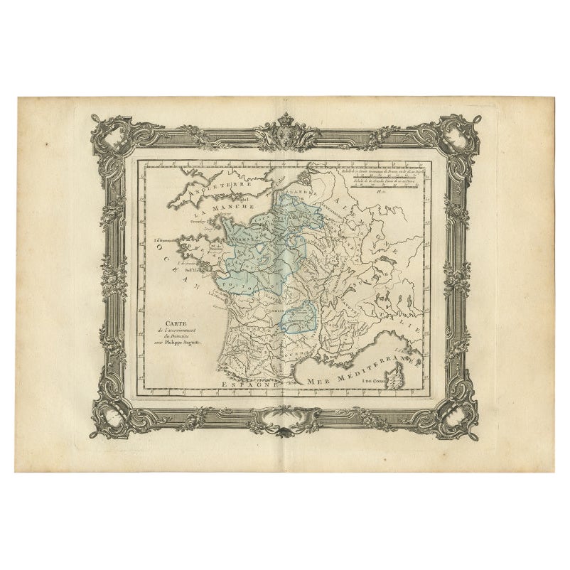
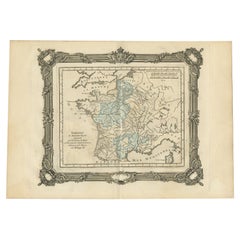
Antique Map of France under the Reign of Philip II by Zannoni, 1765
About the Item
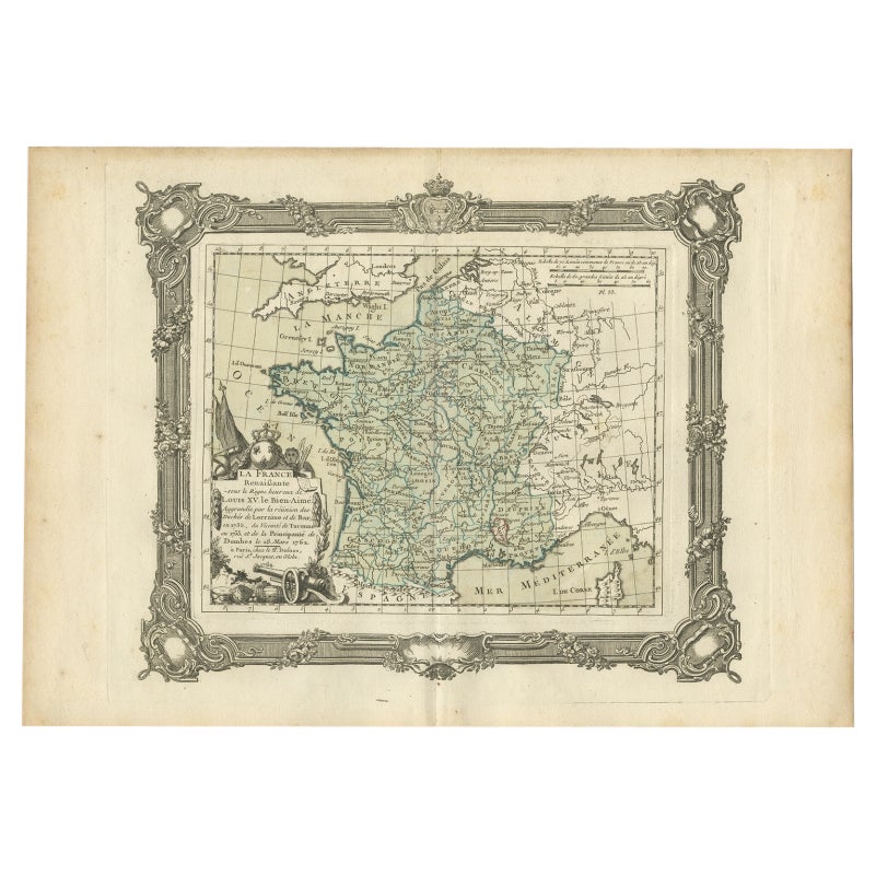
Antique map France titled 'La France sous les Regne de Philippe Auguste (..)'.
Beautiful old map of France. This map originates from 'Atlas Historique de la France Ancienne et Moderne' by M. Rizzi Zannoni.
Artist: Published by S. Desons, Paris. Giovanni Rizzi Zannoni (1736-1814 ) was an Italian cartographer and geographer.
Condition: Very good, please study image carefully.
Date: 1765
We sell original antique maps to collectors, historians, educators and interior decorators all over the world. Our collection includes a wide range of authentic antique maps from the 16th to the 20th centuries. Buying and collecting antique maps is a tradition that goes back hundreds of years. Antique maps have proved a richly rewarding investment over the past decade, thanks to a growing appreciation of their unique historical appeal. Today the decorative qualities of antique maps are widely recognized by interior designers who appreciate their beauty and design flexibility. Depending on the individual map, presentation, and context, a rare or antique map can be modern, traditional, abstract, figurative, serious or whimsical. We offer a wide range of authentic antique maps for any budget.
- Dimensions:Height: 11.03 in (28 cm)Width: 15.75 in (40 cm)Depth: 0 in (0.01 mm)
- Materials and Techniques:
- Period:
- Date of Manufacture:1765
- Condition:
- Seller Location:Langweer, NL
- Reference Number:
About the Seller
5.0
Platinum Seller
These expertly vetted sellers are 1stDibs' most experienced sellers and are rated highest by our customers.
Established in 2009
1stDibs seller since 2017
1,929 sales on 1stDibs
Typical response time: <1 hour
- ShippingRetrieving quote...Ships From: Langweer, Netherlands
- Return PolicyA return for this item may be initiated within 14 days of delivery.
More From This SellerView All
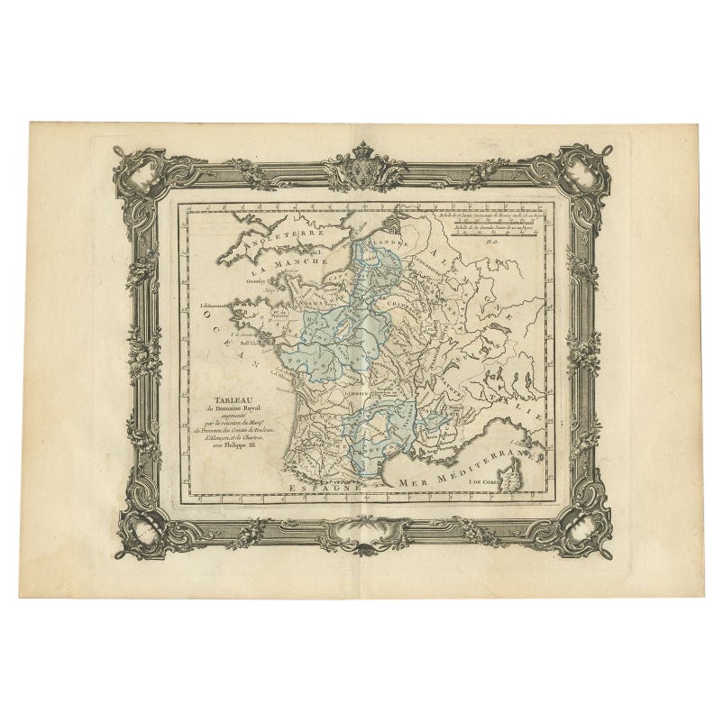
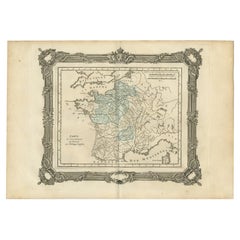
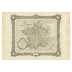
- Antique Map of France under the Reign of Philip II by Zannoni, 1765Located in Langweer, NLAntique map France titled 'Carte de l'accroissement du Domaine sous Philippe Auguste (..)'. Beautiful old map of France. This map originates from 'Atlas Historique de la France Ancie...Category
Antique 18th Century Maps
MaterialsPaper
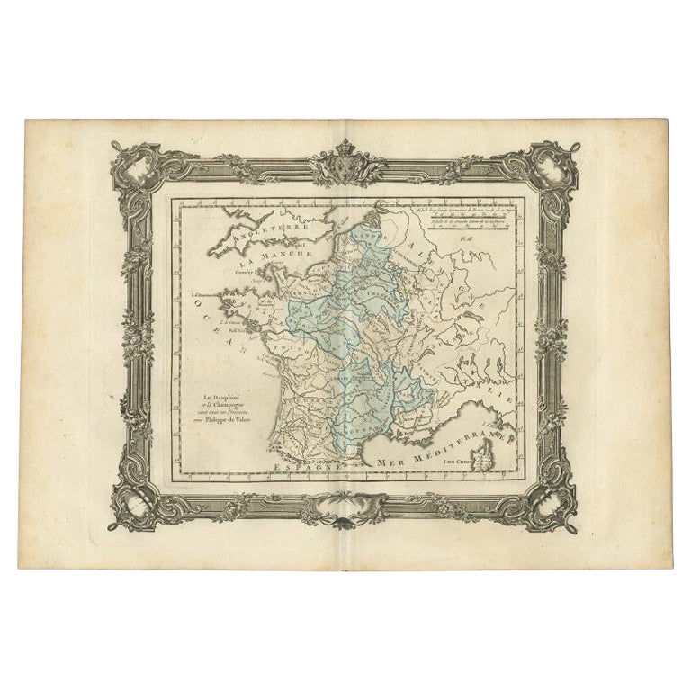
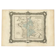
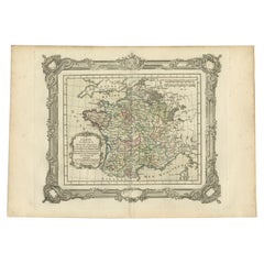
- Antique Map of France under the Reign of Philip VI by Zannoni, 1765Located in Langweer, NLAntique map France titled 'Le Dauphine et la Champagne (..)'. Beautiful old map of France. This map originates from 'Atlas Historique de la France Ancienne...Category
Antique 18th Century Maps
MaterialsPaper
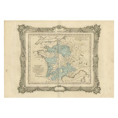
- Antique Map of France under the Reign of Philip III by Zannoni, 1765Located in Langweer, NLAntique map France titled 'Tableau du Domaine Royal (..)'. Beautiful old map of France. This map originates from 'Atlas Historique de la France Ancienne et Moderne' by M. Rizzi Zanno...Category
Antique 18th Century Maps
MaterialsPaper
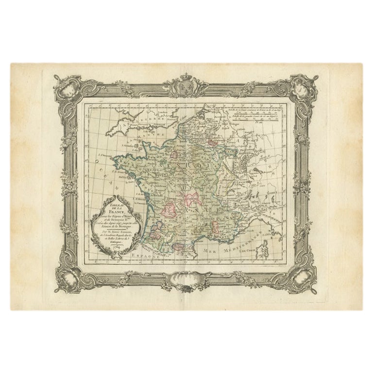
- Antique Map of France under the Reign of Henry and Francois II by Zannoni, 1765Located in Langweer, NLAntique map France titled 'Tableau de la France sous les Règnes d'Henri (..)'. Beautiful old map of France. This map originates from 'Atlas Historique de la France Ancienne et Modern...Category
Antique 18th Century Maps
MaterialsPaper
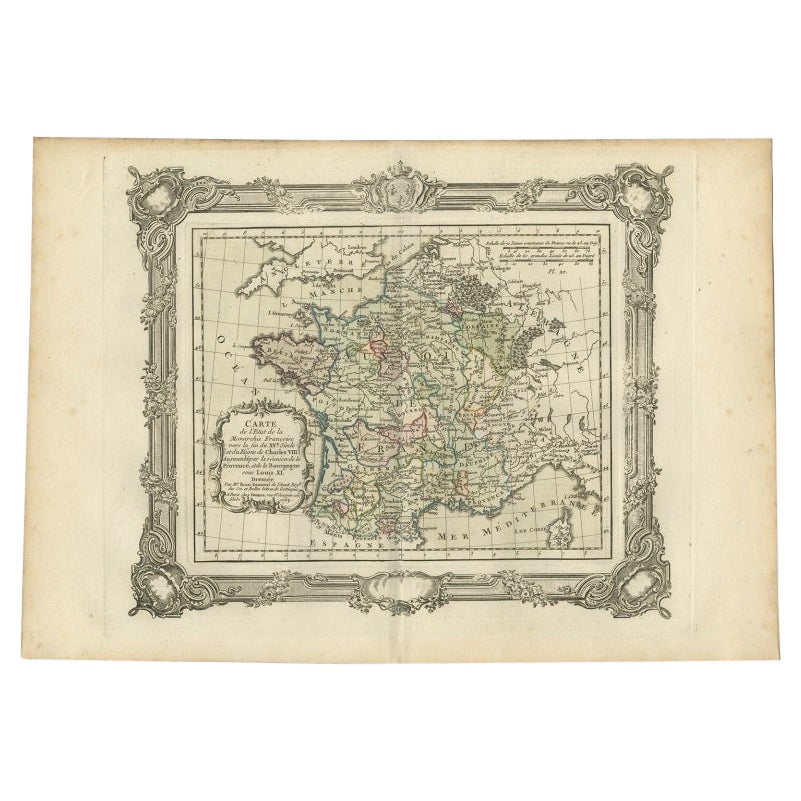
- Antique Map of France under the Reign of Louis XI by Zannoni, 1765Located in Langweer, NLAntique map France titled 'Carte de l'Etat de la Monarchie Francoise (..)'. Beautiful old map of France. This map originates from 'Atlas Historique de la France Ancienne et Moderne' ...Category
Antique 18th Century Maps
MaterialsPaper
- Antique Map of France under the reign of Charles VII by Zannoni, 1765Located in Langweer, NLAntique map France titled 'Après la Bataille de Formigni (..)'. Beautiful old map of France. This map originates from 'Atlas Historique de la France Ancienne et Moderne' by M. Rizzi ...Category
Antique 18th Century Maps
MaterialsPaper
You May Also Like
- HOWARD, Sir Robert. The History Of The Reigns Of Edward and Richard II. (1690)Located in Hillsborough, NJAUTHOR: HOWARD, Sir Robert. TITLE: The History Of The Reigns Of Edward and Richard II. PUBLISHER: London: by F. Collins, for Thomas Fox, 1690. DESCRIPTION: 1 vol., 7-3/16" x 4-9/...Category
Antique 1620s British Books
MaterialsLeather
- 1861 Topographical Map of the District of Columbia, by Boschke, Antique MapLocated in Colorado Springs, COPresented is an original map of Albert Boschke's extremely sought-after "Topographical Map of the District of Columbia Surveyed in the Years 1856 ...Category
Antique 1860s American Historical Memorabilia
MaterialsPaper
- 1812 United States Map, by Pierre Tardieu, Antique French Map Depicting the U.S.By Pierre François TardieuLocated in Colorado Springs, CO1812 "United States of Nth America -- Carte des Etats-Unis De L'Amerique Septentrionale" Two-Sheet Map by Tardieu This attractive map, published in Paris in 1812, is one of the most rare large format maps from the period. It features a view of the East Coast of the U.S. from Maryland to just below South Carolina. Additionally, Ellicott’s plan for the City of Washington D.C. is included at the top right and an illustration of Niagara Falls is shown at the bottom right with a description in both French and English. This extremely detailed map not only depicts the mountainous regions of the southeastern U.S., but also includes names of regions, rivers, and towns. Based on the first state of Arrowsmith’s 4-sheet map of the United States, this map is completely engraved by Tardieu in Paris and showcases high quality engravings. This detailed map of the recently independent United States includes one of the largest and earliest examples of the Ellicott plan of Washington DC. The artist, Pierre François Tardieu (PF Tardieu) was a very well-known map engraver, geographer, and illustrator. Awarded a bronze medal by King Louis-Phillipe for the accuracy and beauty of his map-making, Tardieu produced many fine works including maps of Louisiana...Category
Antique 1810s French Maps
MaterialsPaper
- Plan of Paris, France, by A. Vuillemin, Antique Map, 1845Located in Colorado Springs, COThis large and detailed plan of Paris was published by Alexandre Vuillemin in 1845. The map conveys a wonderful amount of information and is decorated throughout with pictorial vigne...Category
Antique 1840s American Maps
MaterialsPaper
- Original Antique Map of The World by Thomas Clerk, 1817Located in St Annes, LancashireGreat map of The Eastern and Western Hemispheres On 2 sheets Copper-plate engraving Drawn and engraved by Thomas Clerk, Edinburgh. Published by Mackenzie And Dent, 1817 ...Category
Antique 1810s English Maps
MaterialsPaper
- Original Antique Map of France, Arrowsmith, 1820Located in St Annes, LancashireGreat map of France Drawn under the direction of Arrowsmith. Copper-plate engraving. Published by Longman, Hurst, Rees, Orme and Brown, 1820 Unframed.Category
Antique 1820s English Maps
MaterialsPaper


Recently Viewed
View AllMore Ways To Browse
Rare Map France
Antique French 18th Century Map
Ii Unique Designer
Old Map Of Paris
Old Map Paris
Maps By Zannoni
Netherlands 16th Century
Antique Furniture In Texas
Antique Map Of England
Antique Maps Of England
Antique Furniture North East
Natural History Curiosities
Antique Map United States
United States Map Antique
Antique United States Map
Antique United States Maps
Antique Railroad
Antique Western Collectibles