Old Map Paris
1
to
27
303
44
130
111
109
92
89
28
21
20
20
19
16
16
9
9
8
7
6
6
6
5
4
3
3
3
3
3
3
2
2
2
2
2
2
2
2
1
1
1
1
1
1
1
1
42
42
16
10
4
Sort By
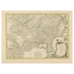
Original Old Map of Present-Day Mongolia, Northeast China and Korea
Located in Langweer, NL
, rue S. Jacques a la Ville de Bordeaux. Avec privilege du Roy. 1771'. Original old map of the region
Category
Antique Late 18th Century Maps
Materials
Paper
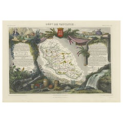
Old Map of Vaucluse, France: A Cartographic Celebration of Viticulture, 1852
Located in Langweer, NL
name, A. Combette from Paris, and the addresses of the various contributors to the map's creation, like
Category
Antique 1850s Maps
Materials
Paper
H 14.18 in W 20.99 in D 0 in
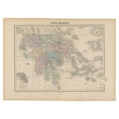
Antique Map of Greece from an Old French School Atlas, 1880
Located in Langweer, NL
Antique map titled 'Grèce Moderne '. Old map of Greece and surroundings. This map originates from
Category
Antique 19th Century Maps
Materials
Paper
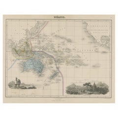
Old Map of the Oceans Around Australia, Indonesia and New Zealand, 1880
Located in Langweer, NL
Antique map titled 'Océanie'.
Old map of the oceans around Australia, Indonesia and New Zealand
Category
Antique 1880s Maps
Materials
Paper
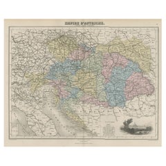
Old Map of the Austrian Empire with Decorative Vignette of Vienna, 1880
Located in Langweer, NL
Antique map titled 'Empire d'Autriche'.
Old map of the Austrian Empire. With decorative
Category
Antique 1880s Maps
Materials
Paper
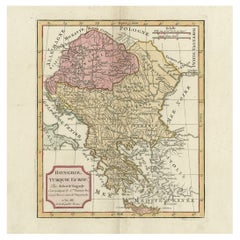
Old Engraved Map of Hungary, European Balkan Countries, Greece and Crete, 1806
Located in Langweer, NL
Francois Delamarche (1740-1817) founded the important and prolific Paris based Maison Delamarche map
Category
Antique 19th Century Maps
Materials
Paper
H 15.08 in W 11.34 in D 0 in
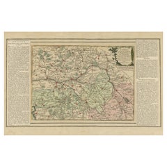
Old Map of Part of France: Poitou, Berry, Bourbonnais, and Nivernais in 1768
Located in Langweer, NL
The map with text neatly mounted on both sides of the map on the plate, is a section of an old map
Category
Antique 1760s Maps
Materials
Paper
H 13.19 in W 20.28 in D 0 in
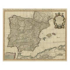
Beautiful Old Map of Spain and Portugal With Decorative Title Cartouche, ca.1740
Located in Langweer, NL
Antique map Spain titled 'L’Espagne dressée sur la Description qui en a eté faite par Rodrigo
Category
Antique 1740s Maps
Materials
Paper
H 20.87 in W 25.6 in D 0 in
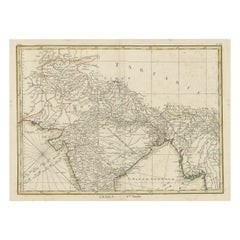
Old Map of North India From Kandahar East to Burma 'Pegu' and South to Goa, 1776
Located in Langweer, NL
Description: Antique map titled 'Indes Iere Feuille'.
Old map of northern India. Covers the
Category
Antique 1770s Maps
Materials
Paper
H 14.77 in W 19.1 in D 0 in
Antique Map of Algeria, 1880
Located in Langweer, NL
Antique map titled 'Algérie. Old map of Algeria. This map originates from 'Géographie Universelle
Category
Antique 19th Century Maps
Materials
Paper
Antique Political Map of France, 1880
By J. Migeon
Located in Langweer, NL
Antique map titled 'France Féodale'. Old map of France with a decorative vignette of Castle de
Category
Antique 19th Century Maps
Materials
Paper
Map of North and East coast of Asia with Japan & inset maps of Kamchatka, c1750
Located in Langweer, NL
east coast of Asia, showing an oddly shaped Japan and inset maps of Kamchatka. This old antique print
Category
Antique 1750s Maps
Materials
Paper
H 14.77 in W 17.45 in D 0 in
Antique Map of France by Zannoni, 1765
Located in Langweer, NL
Antique map titled 'La France divisée en ses LVIII Provinces (..)'. Beautiful old map of France
Category
Antique 18th Century Maps
Materials
Paper
Antique Map of the Europe Continent, 1880
Located in Langweer, NL
Antique map titled 'Europe'. Old map of the European continent. This map originates from
Category
Antique 19th Century Maps
Materials
Paper
Antique Map of France by Migeon, 1880
Located in Langweer, NL
Antique map titled 'France Physique'. Old map of France. This map originates from 'Géographie
Category
Antique 19th Century Maps
Materials
Paper
Antique Map of Siberia by Reclus, 1881
Located in Langweer, NL
Antique map titled 'Itineraires en Siberie.' This map shows the itineraries of famous explorers in
Category
Antique 19th Century Maps
Materials
Paper
Antique Map of Sweden by Delamarche, 1806
Located in Langweer, NL
the important and prolific Paris based Maison Delamarche map publishing firm in the late 18th century
Category
Antique 19th Century Maps
Materials
Paper
Antique Map of Oceania by Didot, 1836
Located in Langweer, NL
Antique map titled 'Oceanie par G.L.Dy. De Rienzi'. Map of the Oceania region, around Australia
Category
Antique 19th Century Maps
Materials
Paper
Antique Map of Sumatra by Tardieu, 1811
Located in Langweer, NL
Antique map Sumatra titled 'Partie de l'Isle Sumatra'. Part of the Island of Sumatra, where the
Category
Antique 19th Century Maps
Materials
Paper
Antique Map of Oceania by Hérisson, 1816
Located in Langweer, NL
Antique map titled "Océanie ou cinquième partie du monde". This is an original antique map of
Category
Antique 19th Century Maps
Materials
Paper
Antique Map of the Archdiocese of Cologne, Germany
Located in Langweer, NL
Antique map titled 'Archevesche et Eslectorat de Cologne avec ses Enclaves'. Original old map of
Category
Antique Late 17th Century Maps
Materials
Paper
Antique Map of ancient France by Zannoni, 1765
Located in Langweer, NL
Antique map France titled 'Galliae Veteris (..)'. Beautiful old map of France. This map originates
Category
Antique 18th Century Maps
Materials
Paper
Antique Map of Northern Italy by Migeon, 1880
Located in Langweer, NL
Antique map titled 'Italie Septentrionale'. Old map of the northern part of Italy. This map
Category
Antique 19th Century Maps
Materials
Paper
Antique Map of Southeast Asia by Dussy, 1778
Located in Langweer, NL
Engravers: E. Dussy, a Paris draughtsman and map engraver, active 1754-1784, best known for his long
Category
Antique 18th Century Maps
Materials
Paper
Antique Map of Southern Italy by Migeon, 1880
Located in Langweer, NL
"Antique map titled 'Italie Méridionale'. Old map of southern Italy including Sicily/Sicilia. This
Category
Antique 19th Century Maps
Materials
Paper
Antique Map of the Netherlands by Zannoni, 1765
Located in Langweer, NL
Pays Bas (..)'. Beautiful old map of the Netherlands. This map originates from 'Atlas Historique de la
Category
Antique 18th Century Maps
Materials
Paper
Antique Map of the Kingdom of Prussia, 1880
Located in Langweer, NL
Antique map titled 'Prusse'. Old map of the Kingdom of Prussia, with a decorative vignette of the
Category
Antique 19th Century Maps
Materials
Paper
Antique Map of Siberia and Russia, c.1885
Located in Langweer, NL
. Migeon (fl. c. 1855 - 1899) was a late 19th century map publisher based in Paris, France. His most
Category
Antique 19th Century Maps
Materials
Paper
Antique Map of North and East Asia, 1751
Located in Langweer, NL
as an peninsular. This map originates from the plate section. This old antique print originates from
Category
Antique 18th Century Maps
Materials
Paper
Antique Map of the Adour River, Near Bayonne, France
Located in Langweer, NL
Antique map titled 'Cours de la riviere de l'Adour depuis la mer jusqua Bayonne'. Original old map
Category
Antique Mid-18th Century Maps
Materials
Paper
Antique Map of Southeast Asia by Larousse, 1897
Located in Langweer, NL
"Front: 'Carte Generale des Indes.' (General map of India / The Indies / Thailand / Malaysia). Rear
Category
Antique 19th Century Maps
Materials
Paper
Antique Map of the Netherlands and Belgium, circa 1880
Located in Langweer, NL
Antique map titled 'Hollande et Belgique'. Old map of the Netherlands and Belgium. With decorative
Category
Antique 19th Century Maps
Materials
Paper
Antique Map of Spain and Portugal by Migeon, 1880
Located in Langweer, NL
Antique map titled 'Espagne et Portugal'. Old map of Spain and Portugal with a decorative vignette
Category
Antique 19th Century Maps
Materials
Paper
Antique Map of France in Ancient Roman Times, 1880
Located in Langweer, NL
Antique map titled 'Gaule indépendante et Romaine'.
Old map of Gaul or France in ancient Roman
Category
Antique 19th Century Maps
Materials
Paper
Antique Map of the German Empire by Migeon, 1880
Located in Langweer, NL
Antique map titled 'Empire d'Allemagne'. Old map of Germany. With decorative vignette of Mainz
Category
Antique 19th Century Maps
Materials
Paper
Antique Map of Russia in Europe by Migeon, 1880
Located in Langweer, NL
Antique map titled 'Russie d'Europe'. Old map of Russia in Europe. This map originates from
Category
Antique 19th Century Maps
Materials
Paper
Antique Map of the Austrian Empire by Migeon, 1880
Located in Langweer, NL
Antique map titled 'Empire d'Autriche'. Old map of the Austrian Empire. With decorative vignette
Category
Antique 19th Century Maps
Materials
Paper
Antique Map of Sweden and Norway by Migeon, 1880
Located in Langweer, NL
Antique map titled 'Suède et Norvége'. Old map of Sweden and Norway. With decorative vignette of
Category
Antique 19th Century Maps
Materials
Paper
French Antique Map of France and Western Europe, 1765
By G. A. Rizzi-zannoni
Located in Langweer, NL
Antique map titled 'Carte de tous les Lieux, célébres dans l'Histoire (..)'. Beautiful old map of
Category
Antique 18th Century Maps
Materials
Paper
Antique Map of the British Isles by Delamarche, 1806
Located in Langweer, NL
) founded the important and prolific Paris based Maison Delamarche map publishing firm in the late 18th
Category
Antique 19th Century Maps
Materials
Paper
Antique Map of the Buton Strait by Philippe, 1787
Located in Langweer, NL
Antique map titled 'Carte du Détroit de Bouton'. Map of the Buton Strait between Paula Buton and
Category
Antique 18th Century Maps
Materials
Paper
Antique Map of Northern Germany by Wyld, c.1840
Located in Langweer, NL
, Hamburg and Lubeck Conformably with the Treaty of Paris'. Scarce regional map of Northern Germany filled
Category
Antique 19th Century Maps
Materials
Paper
Antique Map of France by Covens & Mortier, c.1730
Located in Langweer, NL
Antique map titled 'Nova regni Galliae (..) La France'. Old map of France with large decorative
Category
Antique 18th Century Maps
Materials
Paper
Antique Map of Russia and Siberia by Migeon, 1880
Located in Langweer, NL
Antique map titled 'Sibérie ou Russie d'Asie'. Migeon's map covers the Russian empire in Asia from
Category
Antique 19th Century Maps
Materials
Paper
Original Antique Map of the Cape Verde Islands, 1746
Located in Langweer, NL
Antique map titled 'Carte Des Isles Du Cap Verd.' Original antique map of the Cape Verde Islands
Category
Antique 18th Century Maps
Materials
Paper
Rare Antique Map of 'Barbarie' or Northern Africa, 1655
Located in Langweer, NL
Antique map titled 'Partie de la Coste de Barbarie en Africque ou sont les Royaumes de Tunis et
Category
Antique 17th Century Maps
Materials
Paper
Antique Map of Spain by Covens & Mortier, c.1740
Located in Langweer, NL
Antique map Spain titled 'L?Espagne dressée sur la Description qui en a eté faite par Rodrigo
Category
Antique 18th Century Maps
Materials
Paper
Antique Map of Southern Brazil by Bonne, c.1780
Located in Langweer, NL
"Antique map titled 'Carte de la Partie Méridionale du Bresil (..)'. This antique map of Brazil
Category
Antique 18th Century Maps
Materials
Paper
Antique Map of Hondarribia Near the Bidasoa River, France & Spain
Located in Langweer, NL
Antique map titled 'Plan de Fontarabie et de la redoute d'Andaye'. Original old map of Hondarribia
Category
Antique Mid-18th Century Maps
Materials
Paper
Antique Map of Northern Germany, Including Schleswig-Holstein and Hamburg
Located in Langweer, NL
, Meckelenbourg et Lauvenbourg (..)'. Original old map of northern Germany, including Schleswig-Holstein, Hamburg
Category
Antique Mid-17th Century Maps
Materials
Paper
H 17.6 in W 22.45 in D 0.02 in
Antique Map of the Departments of France by Migeon, 1880
By J. Migeon
Located in Langweer, NL
Antique map titled 'France par Départements'. Old map of France with a decorative vignette of
Category
Antique 19th Century Maps
Materials
Paper
Antique Map of the Region of Brie by Janssonius, 1657
Located in Langweer, NL
Antique map of France titled 'Le Pais de Brie'. Old map of the Brie Region, to the east of Paris
Category
Antique 17th Century Maps
Materials
Paper
French Antique Map of Northern Africa and Libya, c.1840
Located in Langweer, NL
Antique map titled 'Marok, Alger et Tunis - Etat de Tripoli'. Map of Northern Africa and Libya
Category
Antique 19th Century Maps
Materials
Paper
Antique Map of the Bukhari Region by Van Schley, 1758
Located in Langweer, NL
Antique map titled 'Carte de la petite Bukharie et pays voisins.' Original antique map of the
Category
Antique 18th Century Maps
Materials
Paper
Antique Map of European Trade in Asia by Pluche, 1742
Located in Langweer, NL
Map pag. 444: 'Le commerce des Europeens en Asie.' (The commerce / trade of the Europeans in Asia
Category
Antique 18th Century Maps
Materials
Paper
1616 Bertius Map of Sumatra, Singapore and the Straits of Malacca
Located in Langweer, NL
Title: "1616 Bertius Map of Sumatra and the Straits of Malacca"
Description: This is an exquisite
Category
Antique Early 17th Century Maps
Materials
Paper
Antique Map of Tunis and Tripoli in Northern Africa, circa 1880
By J. Migeon
Located in Langweer, NL
Antique map titled 'Tunis et Tripoli & Empire de Maroc'. Old map of Tunis and Tripoli and the
Category
Antique 19th Century Maps
Materials
Paper
Antique Map of the Languedoc Canal, Between Touloouse and Marseillette, France
Located in Langweer, NL
'. Original old map of the Languedoc Canal, between Touloouse and Marseillette, France. This map originates
Category
Antique Mid-18th Century Maps
Materials
Paper
H 12.49 in W 17.45 in D 0.02 in
Antique Map of France in the 7th Century by Zannoni, 1765
Located in Langweer, NL
Antique map France titled 'La France sous le VIIe Siècle (..)'. Beautiful old map of France. This
Category
Antique 18th Century Maps
Materials
Paper
Antique Map of France under the Reign of Francois II, 1765
Located in Langweer, NL
Antique map France titled 'La Bretagne et le Cté de Penthièvre (..)'. Beautiful old map of France
Category
Antique 18th Century Maps
Materials
Paper
- 1
Get Updated with New Arrivals
Save "Old Map Paris", and we’ll notify you when there are new listings in this category.
Old Map Paris For Sale on 1stDibs
At 1stDibs, there are many versions of the ideal old map paris for your home. Each old map paris for sale was constructed with extraordinary care, often using paper, metal and stone. Find 142 options for an antique or vintage old map paris now, or shop our selection of 6 modern versions for a more contemporary example of this long-cherished piece. Your living room may not be complete without an old map paris — find older editions for sale from the 18th Century and newer versions made as recently as the 21st Century. Each old map paris bearing modern, Art Deco or mid-century modern hallmarks is very popular. You’ll likely find more than one old map paris that is appealing in its simplicity, but G. A. Rizzi-zannoni, Patrick Norguet and Denis Diderot produced versions that are worth a look.
How Much is an Old Map Paris?
The average selling price for an old map paris at 1stDibs is $263, while they’re typically $77 on the low end and $50,000 for the highest priced.
Questions About Old Map Paris
- How old is Mellerio Paris?1 Answer1stDibs ExpertApril 5, 2022Mellerio dits Meller is a French jewelry house founded in 1613 by the Mellerio family. The brand claims to be the oldest family-owned company in Europe with over 400 years in business. Browse a collection of Mellerio jewelry pieces on 1stDibs.
More Ways To Browse
Magellan Map
Antique Map Argentina
Sierra Leone Antique Map
Antique Ornamental Map
Uruguay Antique Map
East Coast Australia Charts
Ancient Map Of Jerusalem
Goa France
Bicyclette Vintage
Antique Table Cigarette Lighters
J Beringer
Map Of Ural
Astra Coffee Table
World Map Globe Table Light
Larousse Universel
Patrick Norguet On Sale
Auge En Pierre
Renoir Naked
