18th Century and Earlier Maps
to
2,336
2,863
64
2,930
26
12
1
1
2,930
2,261
475
3
290
34
10
126
10
37
9
2
5
4
3
3
2,916
30
20
3
3
293
110
72
53
43
2,930
2,930
2,930
59
21
13
12
12
Period: 18th Century and Earlier
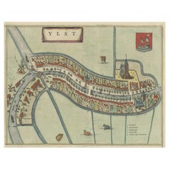
Antique Hand-Colored Map of the Frisian City of IJlst, The Netherlands, 1649
Located in Langweer, NL
Antique hand-colored map titled 'Ylst'. Original antique map of the city of IJlst, Friesland, the Netherlands.
This map originates from 'Novum Ac Magnum Theatrum Urbium Belgicae ...
Category
Antique 18th Century and Earlier Maps
Materials
Paper
$356 Sale Price
20% Off
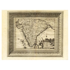
Rare Engraved Antique Map of India with Elephants in the Cartouche, c.1725
Located in Langweer, NL
Antique map titled 'L'Inde de ca le Gange suivant les nouvelles observations (..)'.
Detailed map of India, with part of Sri Lanka. Compass rose and decorative cartouche lower rig...
Category
Antique 18th Century and Earlier Maps
Materials
Paper
$1,284 Sale Price
20% Off
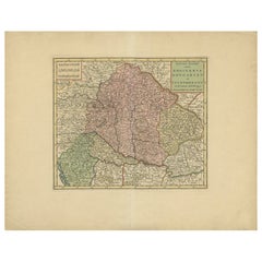
Antique Map of Hungary Incl Surroundings like Croatia, Bosnia, Servia, 1730
Located in Langweer, NL
Antique map titled 'Nieuwe Kaart van t Koninkryk Hongaryen en Zevenbergen na de laatste ontdekkingen'.
This map depicts Hungary including surroundings like Croatia, Bosnia, Servia,...
Category
Antique 18th Century and Earlier Maps
Materials
Paper
$523 Sale Price
20% Off
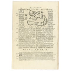
Antique Map of the Banda Islands or Spice Islands, Moluccas, Indonesia, 1697
Located in Langweer, NL
Antique map titled 'Isole di Banda Nelle Molucche'.
Engraved map of Isola di Banda, Nelle, Molucche. On verso: 'Isola di Solor'.
Artists and Engravers: Vincenzo Maria (Padre)...
Category
Antique 18th Century and Earlier Maps
Materials
Paper
$428 Sale Price
20% Off
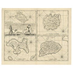
Antique Map of Manipa and Other Maluku Islands, Indonesia, 1726
Located in Langweer, NL
Antique map titled 'Caart van het Eyland Manipa, Noessa-Laoet, Honimoa, Oma. Der Manipesen dracht, een Orangkaya van Manipa.'
Four maps of islands and two figures in native dress...
Category
Antique 18th Century and Earlier Maps
Materials
Paper
$428 Sale Price
20% Off
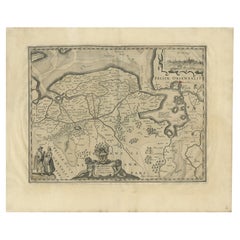
Antique Map of the Province of Groningen in the Netherlands, 1634
Located in Langweer, NL
Antique map titled 'Groninga Dominium'.
Old map of the province of Groningen, the Netherlands. In the upper right hand corner a general view of Groningen (taken from Guicciardini...
Category
Antique 18th Century and Earlier Maps
Materials
Paper
$742 Sale Price
20% Off
Attractive Antique Map of Asia with Borders Hand-Coloured, c.1780
Located in Langweer, NL
Antique map titled 'L'Asie.'
This map shows the Asia continent. Originates from 'Atlas de toutes les parties du Globe Terrestre (..)', published by M. Bonne in Paris, c. 1780.
...
Category
Antique 18th Century and Earlier Maps
Materials
Paper
$428 Sale Price
20% Off
Antique Map of Friesland and Groningen in The Netherlands, 1616
Located in Langweer, NL
Antique map titled 'Frisia'. Small map of the province of Friesland, the Netherlands.
This map originates from 'Omnium Belgii, sive Inferioris Germaniae, regionum descriptio' by ...
Category
Antique 18th Century and Earlier Maps
Materials
Paper
$342 Sale Price
20% Off
Rare Map of St. Louis on the Island of Hispaniola 'Santa Domingo', 1748
Located in Langweer, NL
Description: Antique map titled 'A New & Exact Planof the Harbour of Port Louis (..)'.
Scarce early plan of the Harbor of St. Louis on the Island of Hispaniola (Santa Domingo), showing the the harbor at the time it was taken by Admiral Knowles in March 1748. Charles Knowles (1704 – 1777) was an officer of the Royal Navy, who saw service during the War of Jenkins' Ear, the War of the Austrian Succession, and the Seven Years War. He also briefly served with the Imperial Russian Navy...
Category
Antique 18th Century and Earlier Maps
Materials
Paper
$333 Sale Price
20% Off
Antique Map of France in the 7th Century by Zannoni, 1765
Located in Langweer, NL
Antique map France titled 'La France sous le VIIe Siècle (..)'. Beautiful old map of France. This map originates from 'Atlas Historique de la France Ancienne et Moderne' by M. Rizzi ...
Category
Antique 18th Century and Earlier Maps
Materials
Paper
$151 Sale Price
20% Off
Antique Frontispiece of a Book about Europe by Tirion, 1734
Located in Langweer, NL
Antique frontispiece of the 6th volume of 'Hedendaagsche historie of tegenwoordige staat van allen volkeren (..)' by Thomas Salmon. This volume describes par...
Category
Antique 18th Century and Earlier Maps
Materials
Paper
$114 Sale Price
20% Off
Antique Map of Guinea in West Africa by Blaeu, c.1638
Located in Langweer, NL
Antique map titled 'Guinea'.
Decorative map of West Africa, including numerous animals in the interior, sailing ships and several elegant cartouches. Both the map and the sea are s...
Category
Antique 18th Century and Earlier Maps
Materials
Paper
$523 Sale Price
20% Off
Antique Engraving of a Map or Plan of Jerusalem and Surrounding Mountains, 1773
Located in Langweer, NL
Antique map titled 'Platte grond van Jerusalem, en de omliggende Bergen'. Plan of the city of Jerusalem, with surrounding mountains. Originates from the first Dutch editon of an inte...
Category
Antique 18th Century and Earlier Maps
Materials
Paper
$256 Sale Price
20% Off
Antique Map of Ancient Jerusalem, depicting The Temple of Solomon, c.1725
Located in Langweer, NL
Antique map titled 'Nieuwe Plattegrond van het Oude Jeruzalem Volgens den Schryver.'
Bird's-eye view of the ancient city of Jerusalem shows its divisions with prominent depiction...
Category
Antique 18th Century and Earlier Maps
Materials
Paper
$808 Sale Price
20% Off
Antique Map of Drenthe, a Province in The Netherlands, 1658
Located in Langweer, NL
Antique map titled 'Drentia comitatus (..)'. Copper engraved contemp. hand coloured map of Drenthe, a province in the Netherlands. Large cartouche with coats of arms. This map is mad...
Category
Antique 18th Century and Earlier Maps
Materials
Paper
$618 Sale Price
20% Off
Antique Map of Mozambique Channel with Madagascar and Inset of Cape Region, 1780
Located in Langweer, NL
Antique map titled 'Carte du canal de Mosambique, contenant l'Isle de Madagascar avec les Cotes d'Afrique.' Map of Mozambique Channel, containing the Island of Madagascar with the coasts of Africa from Cape of Good Hope to Melinde. The inset map shows the Cape region in South Africa with False Bay, Robben Island etc. Source unknown, to be determined. Artists and Engravers: Rigobert Bonne (1727-1795 ) was one of the most important cartographers of the late 18th century. In 1773 he succeeded Jacques Bellin as Royal Cartographer to France in the office of the Hydrographer at the Depôt de la Marine. Working in his official capacity Bonne compiled some of the most detailed and accurate maps of the period. Bonne's work represents an important step in the evolution of the cartographic ideology away from the decorative work of the 17th and early 18th century towards a more detail oriented and practical aesthetic. With regard to the rendering of terrain Bonne maps...
Category
Antique 18th Century and Earlier Maps
Materials
Paper
$418 Sale Price
20% Off
Antique Map of Mozambique Bay and a Map Fort de Mozambique, c.1759
Located in Langweer, NL
Two antique maps on one sheet. The upper antique map is titled 'Plan du Fort de Mozambique tiré de Faria' and depicts the island of Mozambique with its fort, settlement, harbor and i...
Category
Antique 18th Century and Earlier Maps
Materials
Paper
$104 Sale Price
20% Off
Rare Antique Map of Noord-Holland, Province in The Netherlands, c.1750
Located in Langweer, NL
Antique map titled 'Kaart van Noord-Holland'. Map of the province of Noord-Holland, the Netherlands. Published circa 1750. Artists and Engravers: Published by 'de Erven van J. Ratelb...
Category
Antique 18th Century and Earlier Maps
Materials
Paper
Antique Map of Guadeloupe with Les Saintes, Grand Bourg and La Désirade, c.1780
Located in Langweer, NL
Antique map titled 'Les Isles de la Guadeloupe (..).'
Map of the Caribbean Island of Guadeloupe with the surrounding islands Les Saintes, Grand Bourg and La Désirade. Source unknow...
Category
Antique 18th Century and Earlier Maps
Materials
Paper
$266 Sale Price
20% Off
Antique Map of Lapland Covering all of Sweden around the Gulf of Bothnia, 1714
Located in Langweer, NL
Antique map titled 'Carte de la Laponie Suedoise (..)'. Includes an inset map of Lapland covering all of Sweden around the Gulf of Bothnia. A series of ...
Category
Antique 18th Century and Earlier Maps
Materials
Paper
$646 Sale Price
20% Off
French Antique Miniature Map of Germany and Surrounding Countries, 1721
Located in Langweer, NL
Antique map Germany titled 'Allemagne Par N. Sanson le Fils Geographe du Roy'. Minitaure map of Germany and surroundings. Originates from 'Introduc...
Category
Antique 18th Century and Earlier Maps
Materials
Paper
$85 Sale Price
20% Off
Rare Antique Map of Germany with English Text, c.1690
Located in Langweer, NL
Antique map Germany titled 'Germani by Robt. Morden'. Rare antique map of Germany. Originates from 'Atlas Terestris'. Artists and Engravers: Robert M...
Category
Antique 18th Century and Earlier Maps
Materials
Paper
$133 Sale Price
20% Off
Original Antique Map of Friesland by Guicciardini, 1612
Located in Langweer, NL
Antique map titled 'Frisiae Occidentalis Typus'. Original antique map of the province of Friesland, the Netherlands. This map originates from 'Beschryvinghe van alle de Neder-Landen'...
Category
Antique 18th Century and Earlier Maps
Materials
Paper
$523 Sale Price
20% Off
Antique Map of France under the Reign of Charles IX by Zannoni, 1765
Located in Langweer, NL
Antique map France titled 'Tableau du Domaine sous Charles IX (..)'. Beautiful old map of France. This map originates from 'Atlas Historique de la France An...
Category
Antique 18th Century and Earlier Maps
Materials
Paper
$118 Sale Price
20% Off
French Edition of an Antique Map of Friesland in the Netherlands, 1709
Located in Langweer, NL
Antique map titled 'La Seigneurie d'Ouest-Frise ou Frise Occidentale (..)'. Original antique map of Friesland, published 1709. Artists and Engravers: Alexis-Hubert Jaillot (1632 ? 2 ...
Category
Antique 18th Century and Earlier Maps
Materials
Paper
$618 Sale Price
20% Off
Antique Map of France under the Reign of Philip VI by Zannoni, 1765
Located in Langweer, NL
Antique map France titled 'Le Dauphine et la Champagne (..)'. Beautiful old map of France. This map originates from 'Atlas Historique de la France Ancienne...
Category
Antique 18th Century and Earlier Maps
Materials
Paper
$142 Sale Price
20% Off
Antique Map of France under the Reign of St. Louis by Zannoni, 1765
Located in Langweer, NL
Antique map France titled 'Le Domaine de la Couronne (..)'. Beautiful old map of France. This map originates from 'Atlas Historique de la France Ancienne et Moderne' by M. Rizzi Zann...
Category
Antique 18th Century and Earlier Maps
Materials
Paper
$142 Sale Price
20% Off
Antique Map of France up-to the Peace of Ryswick by Zannoni, 1765
Located in Langweer, NL
Antique map France titled 'Carte pour servir à l'intelligence de l'Histoire de France (..)'. Beautiful old map of France. This map originates from 'Atlas Historique de la France Anci...
Category
Antique 18th Century and Earlier Maps
Materials
Paper
$142 Sale Price
20% Off
Antique Map of Friesland by Bussemacher in Frame, c.1592
Located in Langweer, NL
Original antique map titled 'Frisiae Antiquissimae (..)'. Original antique map of Friesland. Published by J. Bussemacher, circa 1592. Artists and Engravers: Bussemacher was active as...
Category
Antique 18th Century and Earlier Maps
Materials
Paper
$713 Sale Price
20% Off
Original Antique Map of Friesland in Frame, The Netherlands, 1612
Located in Langweer, NL
Antique map titled 'Frisiae Occidentalis Typus'. Original antique map of the province of Friesland, the Netherlands. Second state, published 1612. Artists and Engravers: Published by...
Category
Antique 18th Century and Earlier Maps
Materials
Paper
$713 Sale Price
20% Off
Antique Map of Friesland after the Floods of the 13th Century, 1718
Located in Langweer, NL
Antique map Friesland titled 'Pars II et III Frisiae Libera(..)'. Old map of Friesland, the Netherlands, after the floods of the 13th century. Originates from 'Uitbeelding van de Hee...
Category
Antique 18th Century and Earlier Maps
Materials
Paper
$333 Sale Price
20% Off
Antique Map of Gaasterland in Friesland, the Netherlands, 1718
Located in Langweer, NL
Antique map titled 'Gaasterland. De zevende Grietenije van de Zevenwolden (..)'. Original antique map of Gaasterland, Friesland, the Netherlands. Originates from 'Uitbeelding van de ...
Category
Antique 18th Century and Earlier Maps
Materials
Paper
$618 Sale Price
20% Off
Antique Map of Friesland by Von Reilly, 1791
Located in Langweer, NL
Antique map titled 'Friesland'. Map of the province of Friesland, the Netherlands. This map orginates from 'Schauplatz der fünf Theile der Welt'. Artists and Engravers: Franz Joseph ...
Category
Antique 18th Century and Earlier Maps
Materials
Paper
$185 Sale Price
20% Off
Antique Map of Friesland in the Time of the Franks, 1718
Located in Langweer, NL
Antique map Friesland titled 'Descriptio Frisiae sub Francorum reditum (..)'. Old map of Friesland, the Netherlands, in the time of the Franks. Originates from 'Uitbeelding van de He...
Category
Antique 18th Century and Earlier Maps
Materials
Paper
$242 Sale Price
20% Off
Beautiful First State Map of Friesland, the Netherlands, c.1665
Located in Langweer, NL
Antique map titled 'Dominii Frisiae Tabula, inter Flevum et Lavicam'. Beautiful first state map of Friesland, the Netherlands. With small inset map of the Frisian Wadden islands Vlie...
Category
Antique 18th Century and Earlier Maps
Materials
Paper
$832 Sale Price
20% Off
Antique Map of Friesland with Four Coats of Arms, 1664
Located in Langweer, NL
Antique map titled 'Typus Frisiae inter Fevum et Lavicam'. Original antique map of the province of Friesland, the Netherlands. Also shows the Wadden islands Vlieland, Terschelling and Ameland and part of Schiermonnikoog. With a decorative cartouche with two putti, livestock and cheese and milk barrels. Four coats...
Category
Antique 18th Century and Earlier Maps
Materials
Paper
$1,379 Sale Price
20% Off
Antique Map of Asia with Misshaped Coastlines and Distorted Islands c.1760
Located in Langweer, NL
Antique map titled 'L’Asie la feuille exc'. Old map of Asia. The map contains several misshaped coastlines and distorted islands with a small cartouche held by an elephant in the top...
Category
Antique 18th Century and Earlier Maps
Materials
Paper
$132 Sale Price
20% Off
Antique Map of Anjouan or Ndzuani, Island of The Comoros, 1748
Located in Langweer, NL
Antique map titled ‘Carte de L’Isle D’Anjouan’. Original antique map of Anjouan, also known as Ndzuwani or Nzwani, or, historically, as Johanna, an autonomous island in the Indian Oc...
Category
Antique 18th Century and Earlier Maps
Materials
Paper
$218 Sale Price
20% Off
Antique Map of Asia Showing all of Indonesia and the Marianas, 1790
Located in Langweer, NL
Antique map titled 'L'Asie dressee pour l'etude de la Geographie (..)'. Attractive map of Asia with an ornate cartouche and ships surrounding the coast. Extends to an incomplete New ...
Category
Antique 18th Century and Earlier Maps
Materials
Paper
$206 Sale Price
20% Off
Antique Map of Ambon with Inset of the Victoria Castle, Moluku, Indonesia, 1726
Located in Langweer, NL
Antique map titled 'Caart van het Eyland Ambonia in het bijsonder. ' This is a print of an antique map of the Islands Ambon and Timor, one of the Moluccan Islands, Indonesia, with an...
Category
Antique 18th Century and Earlier Maps
Materials
Paper
$250 Sale Price
20% Off
Antique Map of a Bay Nearby Makassar, Celebes 'Sulawesi)' by Hawkesworth, 1774
Located in Langweer, NL
Antique map titled 'Vue de la Baye de Bonthain (..)'. Map of the island Sulawesi (Celebes), Indonesia that Philip Carteret rested his crew and made repairs to his ship the Swallow fo...
Category
Antique 18th Century and Earlier Maps
Materials
Paper
$109 Sale Price
20% Off
Antique Map of Belgium and Surroundings, 1692
Located in Langweer, NL
Antique map titled 'Provincie Meridionali de Paesi Bassi Intese sotto nome di Fiandra overo Li Paesi Bassi Cattolici con li confini di Francia di Allemagna et di Hollanda'. Uncommon map of Belgium...
Category
Antique 18th Century and Earlier Maps
Materials
Paper
$404 Sale Price
20% Off
Antique Frontispiece of Book about The Turkish Empire in Asia and Africa, 1733
Located in Langweer, NL
Antique frontispiece of the 5th volume of 'Hedendaagsche historie of tegenwoordige staat van allen volkeren (..)' by Thomas Salmon. This volume describes the...
Category
Antique 18th Century and Earlier Maps
Materials
Paper
$128 Sale Price
20% Off
Antique Map of Asia with Northern Portion of Australia “Hollandia Nova", 1727
Located in Langweer, NL
Antique map titled 'Exactissima Asiae Delineatio in praecipuas regiones Caeterasq Partes.' Original antique map of the continent of Asia with a northern portion of Australia “Holland...
Category
Antique 18th Century and Earlier Maps
Materials
Paper
$1,569 Sale Price
20% Off
Antique Map of France After the Peace of Ryswick by Zannoni, 1765
Located in Langweer, NL
Antique map France titled 'Etat du Domaine apès le Traité de Ryswick (..)'. Beautiful old map of France. This map originates from 'Atlas Historique de la France Ancienne et Moderne' ...
Category
Antique 18th Century and Earlier Maps
Materials
Paper
$140 Sale Price
20% Off
Large Antique Map of Denmark by Bowles, c.1780
By Thomas
Located in Langweer, NL
Antique map titled 'Bowles's new pocket map of the Kingdom of Denmark (..)' Large map of Denmark. Source unknown, to be determined.
Artists and Engravers: Made by 'Thomas & Carington Bowles' after 'J. Palairet'. Thomas Bowles, born around 1712, was map publisher and seller in London...
Category
Antique 18th Century and Earlier Maps
Materials
Paper
$283 Sale Price
20% Off
Antique Map of Delfland and Schieland by Hondius, c.1630
Located in Langweer, NL
Antique map titled ‘Novissima Delflandiae, Schielandiae et circumiacentium insularum ut Voornae, Overflackeae, Goereae, Iselmondae (..)’. Engraving of Delfland and Schieland. Designe...
Category
Antique 18th Century and Earlier Maps
Materials
Paper
$784 Sale Price
20% Off
Antique Map of the 1591 Siege and Occupation of Deventer City, Holland, c1610
Located in Langweer, NL
Antique map titled 'Daventria'. Old map of the city of Deventer, the Netherlands. The print illustrates the siege and occupation of Deventer by the State army under command of prince...
Category
Antique 18th Century and Earlier Maps
Materials
Paper
$361 Sale Price
20% Off
Antique Map of Eastern Tartary and the Gobi Desert by Van Schley, 1758
Located in Langweer, NL
Antique map titled 'Carte de la Tartarie occidentale.' Original antique map of Eastern Tartary and the Gobi desert showing the silk road and the Great Wall of China. While these maps...
Category
Antique 18th Century and Earlier Maps
Materials
Paper
$333 Sale Price
20% Off
Antique Map of Eastern Siberia Extending to Kamtchatka, Russia, 1764
Located in Langweer, NL
Antique map titled 'Suite De La Carte De La Siberie Et le Pays de Kamtchatka'. Detailed map the Eastern portion of Siberia, extending to Kamtchatka. Shows the Russian voyage of 1648 in the NE Passage region. Includes a decorative title cartouche. Originates from Prevost d'Exiles influential travel book, 'L'Histoire Generale des Voyages'.
Artists and Engravers: Jacques-Nicolas Bellin (1703-1772) was among the most important mapmakers of the eighteenth century. In 1721, at age 18, he was appointed hydrographer (chief cartographer) to the French Navy. In August 1741, he became the first Ingénieur de la Marine of the Depot des cartes...
Category
Antique 18th Century and Earlier Maps
Materials
Paper
$209 Sale Price
20% Off
Antique Map of England and London with Two Large Allegorical Views, c.1720
Located in Langweer, NL
Antique map titled 'Nouvelle Carte du gouvernement civil d'Angleterre (..)'. Old plan of London, with map of England and two large allegorical views. This map originates from Chatela...
Category
Antique 18th Century and Earlier Maps
Materials
Paper
$589 Sale Price
20% Off
Antique Map Showing Estates of 1669 in Amsterdam, Published in c.1767
Located in Langweer, NL
Antique map titled 'Kaart der landeryen, gelegen aan of onder de honderd gaarden, zo in de Buitenvelder- als Stads-polder; van welken de gestreepten, voor 't geregt van Nieuwer-Amste...
Category
Antique 18th Century and Earlier Maps
Materials
Paper
$428 Sale Price
20% Off
Antique Map of Gallia and Germania on one Sheet, c.1703
Located in Langweer, NL
Antique map depicting France (Gallia) and Germany (Germania). Printed for Scherer's 'Atlas Novus' (1702-1710).
Artists and Engravers: Heinrich Scherer (1628-1704) was a Professor o...
Category
German Antique 18th Century and Earlier Maps
Materials
Paper
$228 Sale Price
20% Off
Antique Map of France by Homann, 1738
Located in Langweer, NL
Antique map titled 'Gallia Benedictina seu Abbatiar & Prioratus tam Monachorum quam Monialium Ord. S. Benedict (..)'. Beautiful antique map of France...
Category
Antique 18th Century and Earlier Maps
Materials
Paper
$713 Sale Price
20% Off
Antique Map of France by Covens & Son, c.1790
Located in Langweer, NL
A detailed description of the 'Carte de France divisée en 83 Departements (..)', an antique map circa 1790, along with information about its publishers, Covens & Mortier:
**Title**:...
Category
Antique 18th Century and Earlier Maps
Materials
Paper
$428 Sale Price
20% Off
Antique Map of France with Decorative Border, 1766
Located in Langweer, NL
Antique map titled 'La France, divisée en ses quarante Gouvernemens Généraux.' Attractive map of France by Brion de la Tour, published by Desnos. The decorative border was printed fr...
Category
Antique 18th Century and Earlier Maps
Materials
Paper
$409 Sale Price
20% Off
Detailed Antique Miniature Map of France by Mallet, c.1683
Located in Langweer, NL
Antique map titled 'France en General'. BG-11796-55. Originates from Mallet's 'Description de l'Univers'.
Artists and Engravers: Alain Manneson Mallet (1630-1706) spent the first ...
Category
Antique 18th Century and Earlier Maps
Materials
Paper
$152 Sale Price
20% Off
Antique Map of Cities in the Hubei and Hunan Provinces of China, 1755
Located in Langweer, NL
Antique print titled 'Plans de Quelques villes de la province de Hou-Quang.' Three bird's-eye view plans of walled cities in what are now China's Hubei (Hou-Quang) and Hunan Province...
Category
Antique 18th Century and Earlier Maps
Materials
Paper
$275 Sale Price
20% Off
Antique Map of Cities of the Province of Che-Kyang in China, 1738
Located in Langweer, NL
Antique print China titled 'Cities of the Province of Che-Kyang'. Old map depicting four walled cities of the Chinese Qing dynasty province of Che-Kiang (modern day CHEKIANG): Hang C...
Category
Antique 18th Century and Earlier Maps
Materials
Paper
$333 Sale Price
20% Off
Antique Map of Asia with Additional Country Information, c. 1749
Located in Langweer, NL
Antique map titled 'L'Asie divisée en ses principaux Empires et Royaumes'. Detailed map of Asia, with a large table on the right side, providing information about the various major c...
Category
Antique 18th Century and Earlier Maps
Materials
Paper
$1,712 Sale Price
20% Off
