18th Century Maps
to
1,514
1,844
36
1,882
26
1
1
2,974
2,230
473
3
288
34
9
126
8
36
9
2
5
4
3
2
1,869
19
11
3
1
169
45
44
41
27
1,882
1,882
1,882
24
16
13
12
12
Period: 18th Century
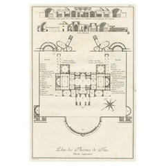
Antique Plan of the Overground Area of Baths of Emperor Titus, Rome, Italy, 1786
Located in Langweer, NL
Antique print titled 'Plan des Thermes de Titus Partie Superieure'.
Plan of the overground area of the Baths of Titus. The Baths of Titus or Thermae Titi were public baths (Thermae) built in 81 AD at Rome, by Roman emperor Titus...
Category
Antique 18th Century Maps
Materials
Paper
$264 Sale Price
20% Off
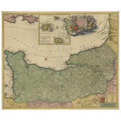
Original Normandy Map by Frederick de Wit, 1705, with Inset of Channel Islands
Located in Langweer, NL
Normandy Map by Frederick de Wit, 1705, with Inset of Channel Islands
Description:
This beautifully engraved and hand-colored map, titled Duché et Gouvernement General de Normandie,...
Category
Antique 18th Century Maps
Materials
Paper
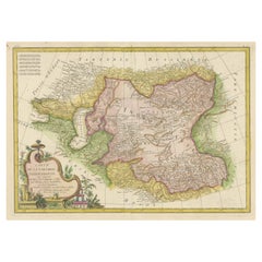
Decorative Antique Map of Central Asia
Located in Langweer, NL
Antique map titled 'Carte de la Tartarie Indépendante (..)'. Decorative map of Central Asia (Tartary). Covers from the Black Sea south to China, north to Russia, and south to Persia ...
Category
Antique 18th Century Maps
Materials
Paper
$368 Sale Price
20% Off
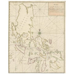
Large German Chart of the Islands of the Philippines with Hand-Colored Borders
Located in Langweer, NL
Original antique map titled 'Karte von dem Canal in den Philippinischen Inseln (..)'. Large detailed chart of the islands of the Philippines. One of the most detailed charts of the Philippines of the era. Shows Islands, bays, reefs, soundings tracks of the Manila Galleon route, etc. Includes a large compass rose and rhumb lines. Originates from a German edition of "Voyage around the World...
Category
Antique 18th Century Maps
Materials
Paper
$935 Sale Price
20% Off
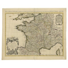
Antique Map of France by Covens & Mortier, c.1730
Located in Langweer, NL
Antique map titled 'Nova regni Galliae (..) La France'. Old map of France with large decorative title cartouche. With great detail.
Artists and Engravers: Pieter und David Mortie...
Category
Antique 18th Century Maps
Materials
Paper
$614 Sale Price
20% Off
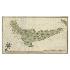
Rare Handcolored Map of Isle de Juan Fernandes 'Robinson Crusoe Island', Chili
Located in Langweer, NL
Antique map titled 'Die Insel Iuan Fernandes in der Sudsee (..)'. This map depicts Robinson Crusoe, one of the Juan Fernández Islands.
Robinson Crusoe Island, formerly known as Más a Tierra, is the second largest of the Juan Fernández Islands. From 1704 to 1709, the island was home to the marooned sailor Alexander Selkirk, who at least partially inspired novelist Daniel Defoe's fictional Robinson Crusoe in his 1719 novel, although the novel is explicitly set in the Caribbean.
This was just one of several survival stories from the period of which Defoe would have been aware. To reflect the literary lore associated with the island and attract tourists, the Chilean government renamed the place Robinson Crusoe Island in 1966. This map originates from a German edition of 'Voyage around the World...
Category
Antique 18th Century Maps
Materials
Paper
$396 Sale Price
20% Off
Antique Map of Ancient Persia, Assyria and surroundings, c.1760
Located in Langweer, NL
Antique map titled 'De XII de Landkaart vertoonende de Landen der Assyrische, Babylonische, Persische, Grieksche en daarna Romeinsche Heerschappy.' Map of ancient Persia...
Category
Antique 18th Century Maps
Materials
Paper
$321 Sale Price
20% Off
Two Engravings of an Florida King of the Indians in America, 1722
Located in Langweer, NL
Antique print titled 'Ceremonie, observée par un des Rois de la Floride (..)'.
Two images on one sheet.
1. A ceremony that takes place before they set...
Category
Antique 18th Century Maps
Materials
Paper
$321 Sale Price
20% Off
Antique Map of Spain and Portugal by Tardieu, circa 1795
Located in Langweer, NL
The image is an antique map titled "Hispanie Betique et Lusitanie", which depicts the Iberian Peninsula during the Roman times, highlighting the provinces of Hispania Baetica (Betiqu...
Category
Antique 18th Century Maps
Materials
Paper
$236 Sale Price
20% Off
Antique Map of Java 'Indonesia' by Chatelain, 1719
Located in Langweer, NL
Antique map titled 'Carte de l'Ile de Java: Partie Occidentale, Partie Orientale, Dressee tout Nouvellement Sur Les Memoires Les Plus Exacts (..)'. This beautiful map of Java exists ...
Category
Antique 18th Century Maps
Materials
Paper
Antique Map of the Auvergne-Rhône-Alpes region of France by Valk, circa 1730
Located in Langweer, NL
Antique map titled 'Praefectura Lugdunensis Generalis'. Detailed map of the Auvergne-Rhône-Alpes region in the southeast of France. To the east the Rhône from Chalon-sur-Saône, Mâcon...
Category
Antique 18th Century Maps
Materials
Paper
$472 Sale Price
20% Off
Three Views of Fort James, Van der Schley, c.1760
Located in Langweer, NL
Three views of Fort James. The Dutch subtitles read: a) Grondtekening van ?t eiland St. James, op de Gambra Ao 1732. B) Noord-Oostlyk gezigt van ?t Fort St. James. C) Noord-Noord-Wes...
Category
Antique 18th Century Maps
Materials
Paper
$75 Sale Price
20% Off
Antique Map of the Gaspar Strait by Huddart, '1788'
Located in Langweer, NL
Antique map titled 'Sketch of the Straits of Gaspar'. Detailed sea chart of the Gaspar Strait, showing part of the Island of Banca on the east coast of Sumatra just to the south of S...
Category
Antique 18th Century Maps
Materials
Paper
$785 Sale Price
30% Off
Antique Map of the Philippines and Guam by Scherer, circa 1702
Located in Langweer, NL
Antique map titled 'Nova et Vera Exhibitio Geographica Insularum Marianarum (..)'. Rare and very attractive map of the Mariana Islands, Philippines, Ko...
Category
Antique 18th Century Maps
Materials
Paper
$2,126 Sale Price
20% Off
Antique Map of Buckinghamshire in England, 1743
Located in Langweer, NL
Antique map titled 'Buckingham both shyre and shire towne describ'. Map of Buckinghamshire, England. With town plans of Buckingham and Redding. This map originates from Overton's atl...
Category
Antique 18th Century Maps
Materials
Paper
$453 Sale Price
20% Off
Antique Map of the World with Polar Projections by Keizer & de Lat, 1788
Located in Langweer, NL
Antique map titled 'Schuine Ronde Aard-Klooten (..)'. Interesting double hemisphere world map with polar projections. In North America, there is a...
Category
Antique 18th Century Maps
Materials
Paper
$443 Sale Price
25% Off
Antique Map of the Northern Hemisphere, 1782
Located in Langweer, NL
Antique map titled 'Hémisphère Septentrional pour voir plus distinctement les Terres Arctiques (..)'.
Map of the Northern Hemisphere, originall...
Category
Antique 18th Century Maps
Materials
Paper
$1,417 Sale Price
20% Off
Antique Map of Borneo (Largely Kalimantan), the Largest Island of Asia, 1726
Located in Langweer, NL
Antique map Indonesia titled 'Kaart van het Eyland Borneo'. Early map of the Island of Borneo. This map originates from 'Oud en Nieuw Oost-Indië...
Category
Antique 18th Century Maps
Materials
Paper
$4,016 Sale Price
20% Off
Antique Print of Designs for Ebberston Lodge, Yorkshire, United Kingdom, 1725
Located in Langweer, NL
Antique print titled 'The Elevation of Ebberston Lodge (..)'. Designs for Ebberston Lodge, near Scarborough, Yorkshire, England.
This print originates from 'Vitruvius Britannicus' ...
Category
Antique 18th Century Maps
Materials
Paper
Print of Garden Pavilions of the Earl of Tilney and Knight Stevenson, c.1785
Located in Langweer, NL
Antique print titled 'Pavillon pour les jardins (..)'. Copper engraving showing the pavilions of the Earl of Tilney and Knight Stevenson.
Earl Tylney, of Castlemaine in the Count...
Category
Antique 18th Century Maps
Materials
Paper
$274 Sale Price
20% Off
Copperplate Engraving Showing Forts on the West African Gold Coast, Ghana, 1744
Located in Langweer, NL
Antique print, titled: 'The Fort Fredricksburg formerly to ye Danes and now Fort Royal (…).' - A three panel copperplate engraving showing three forts on the West African Gold Coast, Ghana; a) The Fort Fredricksburgh formerly to ye Danes and now Fort Royal. English at Manfroe, b) The Fort Amsterdam at Cormentyn belonging to ye Hollanders, c) The Fort James, English at Accra. From: "A Collection of Voyages and Travels" published by John and Awnsham Churchill in London in 1744.
Artists and Engravers: Made by 'Johannes Kip' after 'A. Churchill'. Johannes Kip (b Amsterdam, 1653; d London, 1722). Dutch draughtsman, engraver and dealer, active in England. He was a pupil of Bastiaen Stopendaal (1636–1707) from 1668 to 1670. His earliest dated engravings are of 1672 (e.g. the Siege of Groningen , Hollstein, no. 4), and he supplied numerous plates for books published from that date onwards. His work brought him into contact with the court of William of Orange and in 1686 he produced six plates depicting William of Orange, his Wife and Attendants near The Hague (Hollstein, no. 5). Shortly after the Glorious Revolution of 1688 Kip followed the court to England. After settling in Westminster, he worked extensively for London publishers, engraving works after Francis Barlow, Caius Gabriel Cibber (e.g. Interior of the Danish Church in London , 1697; Hollstein, no. 6) and other London-based artists. His engravings were principally destined for book illustrations. The work for which Kip is best remembered is his large corpus...
Category
Antique 18th Century Maps
Materials
Paper
$340 Sale Price
20% Off
Pl. 6 Antique Print of Château De Neuilly by Le Rouge, c.1785
Located in Langweer, NL
Antique print titled 'Grande Facade de Neuilly'. Copper engraving showing part of Château de Neuilly. This print originates from 'Jardins Anglo-Chinois à la Mode' by Georg Louis le R...
Category
Antique 18th Century Maps
Materials
Paper
Original Engraved Map of Saint Lucia in the West Indies by Bellin, 1758
Located in Langweer, NL
The "Carte de L’Isle de Sainte Lucie" by Jacques Nicolas Bellin, a prominent figure as the Royal Hydrographer and engineer of the French Navy, is a remarkable antique map showcasing ...
Category
Antique 18th Century Maps
Materials
Paper
$321 Sale Price
20% Off
Antique Map of the Holy Land by Schut, 1710
Located in Langweer, NL
Antique map of the Holy Land titled 'Het Beloofde Landt Canaan.' Very detailed and decorative map of the Holy Land embellished with sailing ships and com...
Category
Antique 18th Century Maps
Materials
Paper
$396 Sale Price
20% Off
Uncommon Old Map of Lapland to Russia and Denmark to Kazan in the South, 1785
Located in Langweer, NL
Description: Antique map titled 'Kaart van het Noorderdeel van Europa, Bevattende Deenmarken, Noorwegen, Zweden, Lapland en het Grootste Gedeelte van Europeesch Rusland.'
This un...
Category
Antique 18th Century Maps
Materials
Paper
$519 Sale Price
20% Off
Antique Town Plan Map, Poole, English, Framed Cartography, Georgian, Circa 1780
Located in Hele, Devon, GB
This is an antique town plan map of Poole in Dorset. An English, framed atlas engraving, dating to the 18th century and later.
Fascinating cartography with annotated streets and pl...
Category
British George III Antique 18th Century Maps
Materials
Glass, Wood, Paper
Antique Print of various Churches on Ceylon or Nowadays Sri Lanka, 1704
Located in Langweer, NL
Antique print titled 'Paneteripou, Manipay, Changane, Vanarpone'. Antique print with four views of the churches of Paneteripoum, Manipay, Changane and Vanarpone (Ceylon/Sri Lanka). This print originates from 'A Collection of Voyages and Travels, some now first printed from original manuscripts'.
Artists and Engravers: Published by Awnsham and John Churchill...
Category
Antique 18th Century Maps
Materials
Paper
$207 Sale Price
20% Off
Antique Map of Tibet, The Gobi Desert and China by Bellin, circa 1764
Located in Langweer, NL
Antique map titled 'Carte de l'Empire de Hya et Partie de Tangut'. Old map of Tibet, Gobi desert and China depicting the Great Wall of China and caravan routes. Originates from Prevo...
Category
Antique 18th Century Maps
Materials
Paper
$226 Sale Price
20% Off
Antique Map of France by Mortier 'c.1710'
Located in Langweer, NL
Antique map titled 'Gallia vetus ex C. Iulii Caesaris (..)'. Original antique map of France. Published by P. Mortier, c.1710.
Category
Antique 18th Century Maps
Materials
Paper
$945 Sale Price
20% Off
Detailed Map of Friesland, Groningen and Drenthe, The Netherlands, 1706
Located in Langweer, NL
Antique map tited 'Frisiae Dominium vernacule Friesland verdeeld met de hoofd-deelen van Oostergoo, Westergoo en Sevenwolden (..)'. Detailed map of Friesland, Groningen and Drenthe, ...
Category
Antique 18th Century Maps
Materials
Paper
$897 Sale Price
20% Off
Print of Makassar 'Ujung Pandang' in the Dutch East Indies 'Indonesia', c.1725
Located in Langweer, NL
Antique print titled 'Macasar, Capitale du Roiaume de même nom'. This rare print shows Makassar, the present capital of South Sulawesi, Indonesia. In the foreground several VOC ships...
Category
Antique 18th Century Maps
Materials
Paper
$415 Sale Price
20% Off
Antique Map with Plans of Cremona, Pavia, Montferrato & Others by Homann, '1734'
Located in Langweer, NL
Antique map titled 'Plan von Cremona und denen übrigen Maylaendischen (..)'. Original antique map showing plans of Cremona, Pavia, Casale Montferrato, Fort de Fuentes, Novara, Serava...
Category
Antique 18th Century Maps
Materials
Paper
$1,151 Sale Price
35% Off
Antique Print of Batavia or nowadays Jakarta, Indonesia, c.1755
Located in Langweer, NL
Antique print titled 'Vue de l'Isle et de la ville de Batavia appartenant aux Hollandois'. Beautiful view of the island and the city of Batavia belonging to the Dutch, for the India ...
Category
Antique 18th Century Maps
Materials
Paper
$689 Sale Price
20% Off
Original Antique Map of North and South America in Attractive Old Coloring
By Isaak Tirion
Located in Langweer, NL
Antique map titled 'Nieuwe Kaart van America'. Beautiful map of America. The fabled Quivira is used to name a large mountain range placed just north of M...
Category
Antique 18th Century Maps
Materials
Paper
$935 Sale Price
20% Off
Antique Map of Cities Nanking and Suzhou in the Jiangsu Region, China, c.1758
Located in Langweer, NL
Antique map titled 'Plan de l' Enceinte de la Ville de Nan-King ou Kyang-Ning-Fou et plan de la ville de Su-Tcheou-Fou.' A map of the city of Nanking or Nanjing. A second map shows S...
Category
Antique 18th Century Maps
Materials
Paper
$226 Sale Price
20% Off
Colourful Antique Map Centered on Nuremberg and Bamberg in Germany, ca.1703
Located in Langweer, NL
Antique map titled 'Circuli Franconiae pars Occidentalis, exhibes simul integrum fere Electoratum Moguntinum (..)'.
Antique map centered on Nuremberg and Bamberg. Extends from th...
Category
Antique 18th Century Maps
Materials
Paper
$699 Sale Price
20% Off
Antique Map of Guyenne, Gascony and Béarn, France
Located in Langweer, NL
Antique map titled 'Guyenne et Gascogne et Bearn'. Original old map of Guyenne (or Guienne), Gascony and Béarn, France. This map originates from 'Le Petit Atlas Maritime Recueil De C...
Category
Antique 18th Century Maps
Materials
Paper
$245 Sale Price
20% Off
Charting Eastern Tartary: An 18th-Century Jesuit and English Collaboration, 1757
Located in Langweer, NL
The antique map titled 'Carte de la Tartarie Orientale pour Servir a l'Histoire Generale des Voyages Tiree des Cartes Levees par les P.P. Jesuites' is an original old map that covers...
Category
Antique 18th Century Maps
Materials
Paper
$359 Sale Price
20% Off
Antique Map of the Caspian Sea, Uzbekistan, Northern Persia Etc, C.1735
Located in Langweer, NL
Antique map titled 'Nova Maris Caspii et Regions Usbeck (..).' Detailed map of Central Asia centered on the Caspian Sea, showing Uzbekistan to the east of ...
Category
Antique 18th Century Maps
Materials
Paper
$1,559 Sale Price
20% Off
Antique Map of Germany by T. Kitchin, circa 1770
Located in Langweer, NL
Antique map titled 'An Accurate Map of Germany (..) '. Drawn from the best Authorities by T.Kitchin Geogr." Rare edition, drawn and etched by Thomas Kitchin, published, circa 1770.
Category
Antique 18th Century Maps
Materials
Paper
$226 Sale Price
20% Off
Rare Detailed Antique Map of Prague and Its North West Environs, ca.1760
Located in Langweer, NL
Description: original antique map of the environs of North West Prague. This map originates from the 'Gentlemans Magazine'. Published circa 1760.
Artists and Engravers: Engraved ...
Category
Antique 18th Century Maps
Materials
Paper
$425 Sale Price
20% Off
Antique Engraved Map of the Friendly Islands or Tonga, ca.1785
Located in Langweer, NL
Antique map titled 'Carte des Isles des Amis'.
Map of the Friendly Islands / Tonga. The Tongan people first encountered Europeans in 1616 when the Dutch vessel Eendracht, captain...
Category
Antique 18th Century Maps
Materials
Paper
$302 Sale Price
20% Off
Antique Map of the Holy Land, c.1717
Located in Langweer, NL
Antique map Israel titled 'Tabula Geographica Terrae Sanctae'. Rare edition made after a map of the Holy Land by J. Bonfrerius. The map is oriented ...
Category
Antique 18th Century Maps
Materials
Paper
$368 Sale Price
20% Off
Small Detailed Antique Map of France, with Decorative Title Cartouche, 1754
Located in Langweer, NL
Antique map France titled 'An Accurate Map of France drawn from the best authorities'.
Small, detailed map of France. With decorative title cartouche.
...
Category
Antique 18th Century Maps
Materials
Paper
$226 Sale Price
20% Off
Antique Map of Denmark with the Danish Royal Crest, c.1730
By Homann Heirs
Located in Langweer, NL
Antique map titled 'Regni Daniae in quo sunt Ducatus Holsatia and Slesuicum Insulae Danicae Jutia, Scania Blekingia (..).' Map of Denmark and islands, part of Sweden and Germany, dra...
Category
Antique 18th Century Maps
Materials
Paper
$425 Sale Price
20% Off
Antique Plan of the City of Damietta Egypt by C. Niebuhr, 1774
Located in Langweer, NL
Antique print titled 'Grundris der Stadt Damiât'. This print originates from 'Reisebeschreibung nach Arabien und andern umliegenden Ländern' by C. Niebuhr, 1774.
Category
Antique 18th Century Maps
Materials
Paper
$170 Sale Price
20% Off
Hand-colored Nautical Chart: St. George's Channel and the Irish Sea, 1744
Located in Langweer, NL
The map was engraved by Richard William Seale, a notable British engraver. This map is a fine example of 18th-century cartography, particularly focused on maritime navigation.
The m...
Category
Antique 18th Century Maps
Materials
Paper
$623 Sale Price
20% Off
Antique Map of Cities of the Jiangsu Region in China, c.1760
Located in Langweer, NL
Antique map titled 'Plan de l' Enceinte de la Ville de Nan-King ou Kyang-Ning-Fou et plan de la ville de Su-Tcheou-Fou.' A map of the city of Nanking or Nanjing and a second map show...
Category
Antique 18th Century Maps
Materials
Paper
$189 Sale Price
20% Off
Antique Map of Asia by Dussy, 1778
Located in Langweer, NL
Antique map of Asia titled 'Indostan presqu'isles de l'Inde, Chine, Tartarie Independante'. Depicting South-East Asia including Hindustan, India an...
Category
French Antique 18th Century Maps
Materials
Paper
$207 Sale Price
20% Off
Extremely Rare Map of The land of Eso or Hokkaido in Japan, 1725
Located in Langweer, NL
Plate 46: 'Le Pais d' Eso.' (The land of Eso / Hokkaido in Japan.) Extremely rare in this edition.
This plate originates from the very scarse: 'La Galerie Agreable du Monde (..). T...
Category
Antique 18th Century Maps
Materials
Paper
$685 Sale Price
20% Off
Antique Map of Manipa, Nusa-Laut, Saparua & Haruku 'Indonesia' by F. Valentijn
Located in Langweer, NL
Four maps of islands and two figures in native dress. The islands are: Manipa, Nusa-Laut (Noessa-Laoet), Saparua (Honimoa) and Haruku (Oma). These islands...
Category
Antique 18th Century Maps
Materials
Paper
$803 Sale Price
20% Off
Antique Optical View of The Coronation Ceremony of The Emperor of China, ca.1770
Located in Langweer, NL
Antique print China titled 'Vue perspective de la grande Ceremonie du couronnement de l'Empereur de la Chine'.
Optical view of the coronation c...
Category
Antique 18th Century Maps
Materials
Paper
$637 Sale Price
20% Off
Antique Portrait of Frederik Hendrik, Prince of Orange, Etc Etc, 1749
Located in Langweer, NL
Antique portrait titled 'Frederik Hendrik, Prins van Oranje enz. enz. enz'.
Portrait of Frederick Henry, or Frederik Hendrik in Dutch (29 January 1584 – 14 March 1647). The sover...
Category
Dutch Antique 18th Century Maps
Materials
Paper
Print of a Dutch VOC Fort on the Peninsula Trincomalee, Ceylon (Sri Lanka), 1726
Located in Langweer, NL
Dutch print with the title: Platte Grond van t'Fort Tricoen male met de daar aangelegen Pagoods-Berg (Trincomalee, Sri Lanka)
The map is taken from: 'Oud en Nieuw Oost-Indiën' van...
Category
Antique 18th Century Maps
Materials
Paper
$255 Sale Price
20% Off
Antique Print of the Residence of Sir Gregory Page by Miller, c.1770
Located in Langweer, NL
Antique print titled 'Elevation of the Flank of Sir Gregory Page'. Architectural elevation of the residence of Sir Gregory Page.
Sir Gre...
Category
Antique 18th Century Maps
Materials
Paper
$708 Sale Price
20% Off
Antique Map of the Rhine centered on Cologne, Germany
Located in Langweer, NL
Antique map titled 'Archiepsiscopatus et Electoratus Coloniensis (..)'. Original antique map of the Rhine river, centered on Cologne, Germany. The Rhine River cuts across this map fr...
Category
Antique 18th Century Maps
Materials
Paper
$519 Sale Price
20% Off
Untitled Print Lincoln Cathedral ii, Basire, 1791
Located in Langweer, NL
Antique print depicting the Lincoln Cathedral, or the Cathedral Church of the Blessed Virgin Mary of Lincoln. Artists and Engravers: Made by J. Basir...
Category
Antique 18th Century Maps
Materials
Paper
$141 Sale Price
20% Off
Antique Map of Peloponnesus, Greece by Pierre Antoine Tardieu, 1797
Located in Langweer, NL
This antique map, titled "Carte Ancienne d'Allemagne," represents ancient Germany and surrounding regions. It was published by the well-known Parisian mapmakers and publishers Jean-Baptiste-Louis Clouet and Alexandre Aimé Vuillemin in the late 18th century, specifically in 1787.
The map covers the extensive geographical area of ancient Germany, highlighting various tribes and regions known at the time. Key features include:
1. **Geographical Boundaries**: The map outlines the territorial extents of ancient Germany, bordered by Gallia (France) to the west, Sarmatia (parts of Eastern Europe) to the east, and the Italian regions to the south. The northern boundary reaches the Oceanus Germanicus (North Sea) and the Sarmatian Sea (Baltic Sea).
2. **Tribal Regions**: It details numerous ancient Germanic...
Category
Antique 18th Century Maps
Materials
Paper
$321 Sale Price
20% Off
Historical Map of Ancient Germany (1787): Tribes and Territories by Mentele
Located in Langweer, NL
This antique map, titled "Carte Ancienne d'Allemagne," represents ancient Germany and surrounding regions. It was published by the well-known Parisian mapmakers and publishers Jean-Baptiste-Louis Clouet and Alexandre Aimé Vuillemin in the late 18th century, specifically in 1787.
The map covers the extensive geographical area of ancient Germany, highlighting various tribes and regions known at the time. Key features include:
1. **Geographical Boundaries**: The map outlines the territorial extents of ancient Germany, bordered by Gallia (France) to the west, Sarmatia (parts of Eastern Europe) to the east, and the Italian regions to the south. The northern boundary reaches the Oceanus Germanicus (North Sea) and the Sarmatian Sea (Baltic Sea).
2. **Tribal Regions**: It details numerous ancient Germanic...
Category
Antique 18th Century Maps
Materials
Paper
$340 Sale Price
20% Off
Antique Map of the West Coast of America with Island Views, ca.1784
Located in Langweer, NL
Antique print titled 'Views on the West Coast of America (..)'.
Coastal views of various islands of the American coast. Originates from an edition of Cook's Voyages.
Artists ...
Category
Antique 18th Century Maps
Materials
Paper
$425 Sale Price
20% Off
