18th Century Maps
to
1,512
1,844
17
1,863
26
1
1
2,930
2,261
475
3
290
34
10
126
10
37
9
2
5
4
3
3
1,850
19
11
3
1
158
46
43
38
26
1,863
1,863
1,863
21
13
12
11
11
Period: 18th Century
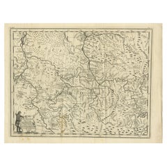
Antique Map of Part of Russia, c.1740
Located in Langweer, NL
Antique map titled 'Ienisensis Provinicia cum adjacentibus Toboliensis & Irkutensis'. Old map of part of Russia including the city of Tobolsk and others. Source unknown, to be determ...
Category
Antique 18th Century Maps
Materials
Paper
$130 Sale Price
20% Off
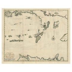
Old Antique Map of the Banda Islands (Southeast), Indonesia & Northern Australia
By F. Valentijn
Located in Langweer, NL
Original antique map titled 'Kaart van de Zuyd-Ooster Eylanden van Banda'. Important map of the seas and islands surrounding the Banda Islands, Indonesia, extending south to northern Australia, east to Papua New Guinea and north to Ceram. Published 1724-1726 by Joannes van Braam...
Category
Antique 18th Century Maps
Materials
Paper
$732 Sale Price
20% Off
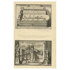
Circus Flaminius (..), Anonymous, 1704
Located in Langweer, NL
Antique print, titled: 'Circus Flaminius (?)' - This original old antique print shows a reconstruction of Circus Flaminius, a large, circular area in ancient Rome, located in the sou...
Category
Antique 18th Century Maps
Materials
Paper
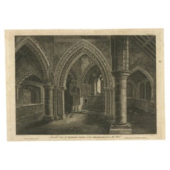
Inside View of Magdalen Chapel in the Cowgate in Edinburgh. Scotland, 1790
Located in Langweer, NL
Antique print titled 'Inside View of Magdalen Chapel, near Winchester, from the West'. Inside view of the Magdalen Chapel taken from the Chancel from the West. Artists and Engravers:...
Category
Antique 18th Century Maps
Materials
Paper
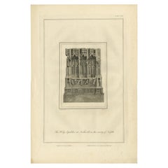
The Holy Sepulchre '..', Basire, 1795
Located in Langweer, NL
Antique print titled 'The Holy Sepulchre at Northwold in the County of Norfolk'. Antique print depicting the Holy Sepulchre, Northwold. Artists and Engr...
Category
Antique 18th Century Maps
Materials
Paper
$142 Sale Price
20% Off
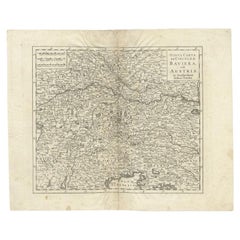
Antique Map of the Region of Bavaria and Austria by Tirion, c.1740
Located in Langweer, NL
Antique map titled 'Carte des environs de Batavia - Kaart van de Buitenstreken van Batavia'. Map of the Batavia area (Jakarta) in Indonesia. With cartouche, scale and compass rose. P...
Category
Antique 18th Century Maps
Materials
Paper
$212 Sale Price
20% Off
Antique Map of Picardy, Aroits and French Flanders by Bonne, c.1780
Located in Langweer, NL
Antique map titled 'Carte des Gouvernements de Flandre Francoise, d'Artois, de Picardie et du Boulenois.' An attractive example of Rigobert Bonne's 1771 decorative map of the French regions of Picardy, Artois, and French Flanders. Covers the region in full from the English Chanel to Normandy. A large decorative title cartouche appears in the upper right. Source unknown, to be determined. Artists and Engravers: Rigobert Bonne (1727-1795 ) was one of the most important cartographers of the late 18th century. In 1773 he succeeded Jacques Bellin as Royal Cartographer to France in the office of the Hydrographer at the Depôt de la Marine. Working in his official capacity Bonne compiled some of the most detailed and accurate maps of the period. Bonne's work represents an important step in the evolution of the cartographic ideology away from the decorative work of the 17th and early 18th century towards a more detail oriented and practical aesthetic. With regard to the rendering of terrain Bonne maps...
Category
Antique 18th Century Maps
Materials
Paper
$166 Sale Price
20% Off
Old Map of Indian Ocean & Sumatra, Java, Borneo, India, Arabia, Africa, c.1783
Located in Langweer, NL
Antique map titled 'Carte des Declinaisons et Inclinaisons de L'Aiguille Aimantée redigée d'après la table des observations Magnetiques faites par les Voyageurs depuis l'Année 1775'....
Category
Antique 18th Century Maps
Materials
Paper
$1,332 Sale Price
20% Off
Antique Print Showing Remnants of Constantine I the Great's Baths, Rome, 1704
Located in Langweer, NL
Antique print, titled: 'De Overblyfzels der Badstoven van Konstantyn den Grooten' - This original old antique print shows the remnants of Constantine I the Great's baths in Rome, Ita...
Category
Antique 18th Century Maps
Materials
Paper
Antique Map of the City of Leeuwarden by Christyn, 1785
Located in Langweer, NL
Antique map titled 'La Ville de Lewarde'. Old map of the city of Leeuwarden, Friesland. Originates from 'Les Délices des Pays-Bas' by J.B. Christyn.
Artists and Engravers: Author:...
Category
Antique 18th Century Maps
Materials
Paper
$108 Sale Price
20% Off
Pl. 1 Antique Print of Pavillon La Bouëxière by Le Rouge, c.1785
Located in Langweer, NL
Antique print titled 'Pavillon de Labossiere (..)'. Copper engraving of pavillon La Bouëxière. This print originates from 'Jardins Anglo-Chinois à la Mode' by Georg Louis le Rouge. A...
Category
Antique 18th Century Maps
Materials
Paper
Antique Map of the Arabian Desert by Cellarius, 1731
Located in Langweer, NL
Antique map titled 'Arabia Petraea et Deserta.' Arabian desert with present day Israel, Jordania, Iraq. With decorative cartouche showing dromedaries. T...
Category
Antique 18th Century Maps
Materials
Paper
$166 Sale Price
20% Off
Antique Map of the Banda Islands in Indonesia by Valentijn, 1726
Located in Langweer, NL
Antique map Indonesia titled 'Kaart der Zuyd-Wester Eylanden van Banda'. Map of the islands in the southwestern part of the Banda Sea including ...
Category
Dutch Antique 18th Century Maps
Materials
Paper
$475 Sale Price
20% Off
Antique Map of the Danube River by Homann, c.1720
By Homann Heirs
Located in Langweer, NL
Antique map titled 'Danubii Fluminis (..)'. Regional map of the Donau river, Shows the Danube river from Belgrade in Serbia, along the border between Roma...
Category
Antique 18th Century Maps
Materials
Paper
$880 Sale Price
20% Off
Antique Print of the Stowe House in Stowe, Buckinghamshire, England, c.1785
Located in Langweer, NL
Antique print titled 'Plan actuel du Chateau de Stowe'.
Copper engraving showing a plan and elements of the Stowe House.
Stowe House is a grade I l...
Category
Antique 18th Century Maps
Materials
Paper
$542 Sale Price
20% Off
Antique Map of the Moluques Islands, Part of Indonesia, circa 1750
Located in Langweer, NL
Map of the Moluques (also known as the Moluccas, Moluccan Islands or simply Maluku). Depicts the islands of Herij, Ternate, Tidor, Pottebackers, Timor, Machian and Bachian.
Category
Antique 18th Century Maps
Materials
Paper
$199 Sale Price
20% Off
Antique Map of Japan by J.N. Bellin, 1752
Located in Langweer, NL
Bellin's wonderfully detailed map of Japan from the atlas of Prevost d'Exiles' influential collection of travel narratives, Histoire Generale des Voyages. Considered the best general...
Category
Antique 18th Century Maps
Materials
Paper
$437 Sale Price
20% Off
Antique Map of South America by Scherer, c.1700
Located in Langweer, NL
Antique map of part of South America. Two maps on a single sheet, each depicting nearly the same area. On close examination there are slight differences in the rivers, lakes and moun...
Category
Antique 18th Century Maps
Materials
Paper
$142 Sale Price
20% Off
Antique Map of the Seven United Provinces of Holland by Seutter, 1727
Located in Langweer, NL
Antique map titled ‘Belgium Foederatum Auctius Et Emendatius‘. Important antique map of the Seven United Provinces of Holland with inset views of the East Indies, the province of Lim...
Category
Antique 18th Century Maps
Materials
Paper
$690 Sale Price
20% Off
Herculaneum Monuments, 1762: Bayardi's Engraving Plate 61
Located in Langweer, NL
Antique print originating from 'Le Antichita di Ercolano Esposte'. A vast survey of the bronzes, statues, wall-paintings, and monuments of Herculaneum. This monumental work was the f...
Category
Antique 18th Century Maps
Materials
Paper
Antique Print of the Mansion House in London, England, by Woolfe, c.1770
Located in Langweer, NL
Antique print titled 'Section of the Mansion House'.
Old engraving of the Mansion House, London. This print originates from 'Vitruvius Britannicus...
Category
Antique 18th Century Maps
Materials
Paper
Antique Map of Kyoto located in The Kansai Region on the Island of Honshu, c1740
Located in Langweer, NL
Antique map titled 'Plan de la Ville de Meaco'.
Detailed plan of Kyoto, located in the Kansai region on the island of Honshu, Japan. This map most likely originates from an edition of 'Histoire et description generale du Japon' by P.F.X. de Charlevoix.
Artists and Engravers: Jacques-Nicolas Bellin (1703-1772) was among the most important mapmakers of the eighteenth century. In 1721, at age 18, he was appointed hydrographer (chief cartographer) to the French Navy. In August 1741, he became the first Ingénieur de la Marine of the Depot des cartes...
Category
Antique 18th Century Maps
Materials
Paper
$428 Sale Price
20% Off
Antique Map of the Alsace region and Nova Zembla by Scherer, c.1700
Located in Langweer, NL
Antique map titled 'Chorographia Alsatiae.' Map of the Alsace region and Nova Zembla, printed for Scherer's 'Atlas Novus' (1702-1710). Scherer's 'Atlas Novus' forms an important mile...
Category
Antique 18th Century Maps
Materials
Paper
$142 Sale Price
20% Off
Antique Map of the Buton Strait by Philippe, 1787
Located in Langweer, NL
Antique map titled 'Carte du Détroit de Bouton'. Map of the Buton Strait between Paula Buton and Celebes, Indonesia. This map originates from 'World atlas for the study of geography ...
Category
Antique 18th Century Maps
Materials
Paper
$114 Sale Price
20% Off
Antique Map of The Bay of D'Estaing located on the Russian island Sakhalin, 1798
Located in Langweer, NL
Antique map titled 'Plan of La Baie d'Estaing'.
This map shows the bay of D'Estaing located on the Russian island of Sakhalin. La Perouse was selected b...
Category
Antique 18th Century Maps
Materials
Paper
$342 Sale Price
20% Off
Antique Map of the Seventeen Provinces of Netherlands, Belgium, Luxembourg, 1748
By Homann Heirs
Located in Langweer, NL
Antique map titled 'Belgii Universi seu Inferioris Germaniae quam XVII Provinciae (..)'.
Map of the Seventeen Provinces after Tobias Meier, published by Homann's Heirs in 1748. The...
Category
Antique 18th Century Maps
Materials
Paper
$437 Sale Price
20% Off
Antique Map of the World with California as an Island, 1788
Located in Langweer, NL
Description: Antique map titled 'De wareld in een ronde gedaante van de Noord Pool te zien - De Wareld verbeeld in de gedaante van een hard'. This interesting composition contains three world maps on the sheet. At left is a northern projection showing all the landmasses. At right is a cordiform projection (heart-shaped). At top is a map of the world as known to the ancients. Both the polar and cordiform projections show California as an island...
Category
Antique 18th Century Maps
Materials
Paper
$618 Sale Price
20% Off
Antique Map of South America by Tirion, c.1765
Located in Langweer, NL
Antique map titled 'Kaart van het Onderkoningschap van Peru zig uitstrekkende: over Chile, Paraguay en andere Spaansche Landen als ook van Brazil en verdere Bezittingen van Portugal ...
Category
Antique 18th Century Maps
Materials
Paper
$331 Sale Price
20% Off
Detailed Antique Map of Slavonia, the Region in Eastern Croatia, ca.1745
Located in Langweer, NL
Antique map titled 'Tabula Geographica exhibens Regnum Sclavoniae.'
Detailed map of Slavonia, the region in eastern Croatia. Map is dated shortly after the Peace of Belgrade sign...
Category
Antique 18th Century Maps
Materials
Paper
$618 Sale Price
20% Off
Antique Map of Juan Fernandez Island by Anson, c.1740
Located in Langweer, NL
Antique map titled 'Plan de la Côte du N.E. de l 'Ile de Juan Fernandes'.
Map of the northeast coast of the island of Juan Fernandez with Cumberland Bay, South America. In 1740 Ans...
Category
Antique 18th Century Maps
Materials
Paper
$228 Sale Price
20% Off
Rare Map of North Africa Depicting Numidia, Libia and Morocco, Published C.1740
Located in Langweer, NL
Antique map Africa titled 'Mauretania, Numidia, Gaetulia & c.'.
Rare map of North Africa depicting Numidia, Libia and Morocco.
Artists and E...
Category
Antique 18th Century Maps
Materials
Paper
$418 Sale Price
20% Off
Original Antique Print of the 'Korenbeurs' in Amsterdam, the Netherlands, 1787
Located in Langweer, NL
Antique print titled 'De Nieuwe Koornbeurs, in 1786'.
Original antique print of the 'Korenbeurs' in Amsterdam, the Netherlands. The Korenbeurs ("grain bourse") was a 17th-century commodity market in Amsterdam where grain was traded. The building stood on the banks of the Amstel, on the western side (Nieuwezijde) of the Damrak. It was directly south of the Oude Brug bridge, on a spot now occupied by the former stock and commodity exchange Beurs van Berlage...
Category
Antique 18th Century Maps
Materials
Paper
$342 Sale Price / set
20% Off
Antique Map of the Roadstead of Bantam by Van der Aa, 1725
Located in Langweer, NL
Antique map titled 'La rade de Bantam'. (The roadstead of Bantam.) This map shows the Indonesian city of Banten / Bantam on Java, Indonesia and its roadstead. With compass rose and s...
Category
Antique 18th Century Maps
Materials
Paper
$250 Sale Price
20% Off
Rare Antique Map of Part of Europe and Africa by Scherer, C.1703
Located in Langweer, NL
Antique map with two figures. The upper figures showing part of Europe and Africa. Below a chart. Printed for Scherer's 'Atlas Novus' (1702-1710). Artists and Engravers: Heinrich Sch...
Category
Antique 18th Century Maps
Materials
Paper
Detailed Antique Map of Portugal, Published for the 'Gentleman's Magazine', 1758
Located in Langweer, NL
Antique map Portugal titled 'A Map of the Kingdom of Portugal'.
Detailed map of Portugal, published for the 'Gentleman's Magazine'.
Artist...
Category
Antique 18th Century Maps
Materials
Paper
$456 Sale Price
20% Off
Original Antique Map of the Bay and Rocks of Petatlan, Mexico, 1749
Located in Langweer, NL
Antique map titled 'Baye et Rochers de Petaplan (..) - De Baay en de Rotsen van Petaplan (..)'.
Original antique map of the bay and rocks of Petatlan, Mexico. This map originates...
Category
Antique 18th Century Maps
Materials
Paper
$342 Sale Price
20% Off
Original and Colourful Map of Northern India with Surrounding Regions, 1783
Located in Langweer, NL
Antique map titled 'Indes'. A map of Northern India with surrounding regions. From Lattre's 'Atlas moderne ou collection de cartes sur toutes les parties du globe terrestre...
Category
Antique 18th Century Maps
Materials
Paper
$542 Sale Price
20% Off
Old Map of the Rhine & German Cities Incl Düsseldorf, Bonn, Köln, Etc., c.1730
Located in Langweer, NL
Antique map Germany titled 'Mappa Geographica continens Archiepiscopatum et Electoratum Coloniensem (..)'.
This antique map depicts the Rhine r...
Category
Antique 18th Century Maps
Materials
Paper
$932 Sale Price
20% Off
Old Sea Charts of Tourane Bay & the Con Dao Islands 'Pulo Condor', Vietnam, 1780
Located in Langweer, NL
Description: Two maps on one sheet titled 'Carte d'une partie de la Cote de Cochinchine [and] Plan de l'Isle Condor'.
Sea charts of the coast of Vietnam around the Tourane Bay an...
Category
Antique 18th Century Maps
Materials
Paper
$618 Sale Price
20% Off
Antique Map of the Region of Orleans by Homann Heirs, c.1760
By Homann Heirs
Located in Langweer, NL
Antique map titled 'Novissima Totius Aureliani Generalitatis (..) - Nouvelle Carte du Gouvernement General et Militaire d'Orleans (..).' Detailed map by Rizzi Zononi covering the vic...
Category
Antique 18th Century Maps
Materials
Paper
$214 Sale Price
20% Off
Antique Chart of Dundee, Aberdeen and Montrose in Scotland, C.1774
Located in Langweer, NL
Antique map titled 'To the Honble the Magistrates of the Citty of Aberdeene'. Sea chart of Tay Estuary depictinging Dundee, with two further inset charts of Aberdeen and Montrose, wi...
Category
Antique 18th Century Maps
Materials
Paper
$256 Sale Price
20% Off
Danube River Incl Serbia, Moldavia, Transylvania, Romania, Bulgaria Etc, ca.1720
Located in Langweer, NL
Antique map titled 'Danubii Fluminis (..)'.
Regional map of the Donau river, Shows the Danube river from Belgrade in Serbia, along the border between ...
Category
Antique 18th Century Maps
Materials
Paper
$880 Sale Price
20% Off
Old Dutch Map of the City of Carthage and the Bay of Carthage, 1773
Located in Langweer, NL
Antique print titled 'Kaart van de Legging van het Oude Karthago'. Old map of the city of Carthage and the Bay of Carthage. It was the center or capital city of the ancient Carthagin...
Category
Antique 18th Century Maps
Materials
Paper
$304 Sale Price
20% Off
Old Print with a View of the Dutch Church in Batavia 'Jakarta, Indonesia', 1738
Located in Langweer, NL
Antique print titled 'Ein Perspectivischer Aufzug der neu erbauten Holländischen Kirch zu Batavia, welche von Ao. 1733. bis 1736. mit grossen Kosten der Ed;en Ost-Indischen Compagnie...
Category
Antique 18th Century Maps
Materials
Paper
$742 Sale Price
20% Off
Early Bird's-Eye View of Rio Di Janeiro and Guanabara Bay, Brazil, 1702
Located in Langweer, NL
Antique print titled 'Rio Janeiro'.
Bird's-eye view of Rio di Janeiro and Guanabara Bay, Brazil. From the French edition (translation by Renneville) of Commelin's 'Recueil des Vo...
Category
Antique 18th Century Maps
Materials
Paper
$247 Sale Price
20% Off
Antique Map of Seram Island by Keizer & De Lat, c.1747
Located in Langweer, NL
Antique map titled 'Kaart van het eiland Ceram'. Rare and uncommon map of Seram Island, Indonesia. One of the earliest separately printed maps of the island. Artists and Engravers: P...
Category
Antique 18th Century Maps
Materials
Paper
$217 Sale Price
20% Off
Antique Map of the Province of Noord-Holland by Keizer & De Lat, 1788
Located in Langweer, NL
Antique map titled 'La Nord Hollande (..)'. Uncommon antique map of the province of Noord-Holland, the Netherlands. This map originates from 'Nieuwe Natuur- Ge...
Category
Antique 18th Century Maps
Materials
Paper
Antique Map of the Russian Empire in Europe, ca.1780
Located in Langweer, NL
Description: Antique map titled 'Bowles's New Pocket Map of the Russian Empire in Europe, Comprehending the West Part of the Empire in Asia' Large and detai...
Category
Antique 18th Century Maps
Materials
Paper
$809 Sale Price
20% Off
Antique Map of Friesland, A Dutch Province, c.1780
Located in Langweer, NL
Antique map titled 'Dominii Frisiae (..)'. Original antique map of Friesland. 3rd state, most likely published after 1775 (De Rijke, 46.3). Artists and Engravers: Published by P. Sch...
Category
Antique 18th Century Maps
Materials
Paper
$904 Sale Price
20% Off
Antique Map of the Region of Pasuruan, Java, Indonesia, 1726
Located in Langweer, NL
"Map of the region around Pasuruan. It shows the location of rice fields, the village Bangil, as well as three places named Pagger (also Pagar), a cluster of buildings surrounded by a bamboo fence. The location of a earthen wall with pallisade and small cannons...
Category
Antique 18th Century Maps
Materials
Paper
Pl. 3 Antique Print of a Winter Garden by Le Rouge, c.1785
Located in Langweer, NL
Antique print titled 'Coupe du nouveau Berceau ou Jardin d'Hiver (..)'. Copper engraving showing a winter garden. This print originates from 'Jardins Anglo-Chinois à la Mode' by Geor...
Category
Antique 18th Century Maps
Materials
Paper
Antique Map of Friesland in the Netherlands, 1770
Located in Langweer, NL
Antique map titled 'De Synode van Friesland, in VI Klassen verdeeld door W.A. Bachiene?. Map of the province of Friesland, the Netherlands. This map originates from 'Nieuwe kerkelyke...
Category
Antique 18th Century Maps
Materials
Paper
$142 Sale Price
20% Off
Antique Map of Flanders, Belgium by Homann Heirs, c.1735
Located in Langweer, NL
Antique map titled 'Comitatus Flandriae in omnes ejusdem subjecentes Ditioes (..).' Original antique map of Flanders, Belgium. This map details the coastline from Grevelingen to Zeel...
Category
Antique 18th Century Maps
Materials
Paper
$523 Sale Price
20% Off
Antique Map of Province Friesland, The Netherlands, 1787
Located in Langweer, NL
Antique map titled 'Nieuwe Kaart van Friesland behoorende tot het Vaderlandsch Woordenboek van Jacobus Kok'. Original antique map of the province of Friesland, the Netherlands. This ...
Category
Antique 18th Century Maps
Materials
Paper
$407 Sale Price
20% Off
Antique Map of the Harbour of Tongatabu by Cook, C.1783
Located in Langweer, NL
Antique map titled 'Sketch of Tongataboo Harbour (..)'. Antique map of the harbour of Tongatabu, one of the Tonga Islands. Originates from an edition of Cook's Voyages.
Artists an...
Category
Antique 18th Century Maps
Materials
Paper
$323 Sale Price
20% Off
Antique Map of the Wallis and Futuna Islands, French Overseas Territory, 1778
Located in Langweer, NL
Antique map titled 'Walliss Inseln, Isles de Wallis'. Old map of the Wallis and Futuna Islands, officially Territory of the Wallis and Futuna Islands, French overseas territory. The ...
Category
Antique 18th Century Maps
Materials
Paper
$276 Sale Price
20% Off
Antique Map of the Region of Dölitzsch by Schreiber, 1749
By Schreiber
Located in Langweer, NL
Antique map titled 'Die Aemter Doelitsch, Bitterfeld und Zörbig'. Map of the region of Dölitzsch, Germany. This map originates from 'Atlas Selectus von allen Konigreichen und Landern...
Category
Antique 18th Century Maps
Materials
Paper
$88 Sale Price
20% Off
Antique Plan of the Harbour of Taloo by Cook, c.1781
Located in Langweer, NL
Antique map titled 'Sketch of the Harbours on the North Side of Eimeo (..)'. Plan of the harbour of Taloo in the Island of Moorea, one of the Society Islands, French Polynesia. Origi...
Category
Antique 18th Century Maps
Materials
Paper
$218 Sale Price
20% Off
Old Print with a Genealogical Tree of the Chinese Imperial Dynasties, 1732
Located in Langweer, NL
Antique print titled 'Succession des Empereurs de la Chine divisée en XXII Familles'.
Old print with a genealogical tree of the Chinese imperial dynasties. This print originates ...
Category
Antique 18th Century Maps
Materials
Paper
$523 Sale Price
20% Off
Map of the African Coast, Gulf of Guinea, from Sierra Leone to Gabon, 1788
Located in Langweer, NL
Antique map titled 'Drawn from d'Anvilles Map of the Coast of Guinea, Between Sierra Leone and the crossing of the Line.'
Map of the African coast, Gulf of Guinea, from Sierra Le...
Category
English Antique 18th Century Maps
Materials
Paper
$437 Sale Price
20% Off
