19th Century Maps
to
1,669
2,205
75
2,283
72
9
9
4
2
2
1
1
2,936
2,283
475
3
290
34
10
126
10
37
9
2
5
4
3
3
2,245
71
33
13
11
352
175
107
106
102
2,283
2,283
2,283
104
23
9
8
7
Period: 19th Century
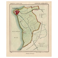
Antique Map of Hindelopen, Picturesque Harbour City in Friesland, Holland, 1868
Located in Langweer, NL
Antique map titled 'Provincie Friesland - Gemeente Hindeloopen'.
Map of the township of Hindeloopen, Friesland. This map originates from 'Gemeente-Atlas van Nederland' by J. Kuyp...
Category
Antique 19th Century Maps
Materials
Paper
$133 Sale Price
20% Off
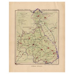
Antique Map of Hennaarderadeel, Township in Friesland, The Netherlands, 1868
Located in Langweer, NL
Antique map titled 'Provincie Friesland - Gemeente Hennaarderadeel'.
Map of the township of Hennarderadeel including Oosterend, Wommels and many other villages. This map originat...
Category
Antique 19th Century Maps
Materials
Paper
$123 Sale Price
20% Off
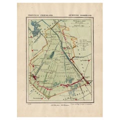
Antique Map of Haskerland, Township in Friesland, The Netherlands, 1868
Located in Langweer, NL
Antique map titled 'Provincie Friesland - Gemeente Haskerland'.
Map of the township of Haskerland including Haskerhorne, Joure, Oudehaske and many other villages. This map origin...
Category
Antique 19th Century Maps
Materials
Paper
$123 Sale Price
20% Off
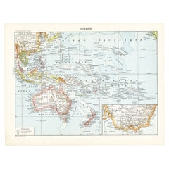
Old French Lithograph of Oceania with an Inset of Victoria, Australia 1897
Located in Langweer, NL
Sheet: Front: 'Oceanie.' (Map of Oceania). Rear: 'Oceanie.' (Oceania; native people, costume, plants, animals; crocodile, cassowary, tiger, kangeroo, platypus, lyre bird...
Category
Antique 19th Century Maps
Materials
Paper
$114 Sale Price
20% Off
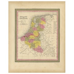
Antique Nicely Colored Map of Holland and Belgium, 1846
Located in Langweer, NL
Antique map titled 'Holland and Belgium'. Old map of the Netherlands and Belgium. This map originates from 'A New Universal Atlas Containing Maps of the various Empires, Kingdoms, St...
Category
Antique 19th Century Maps
Materials
Paper
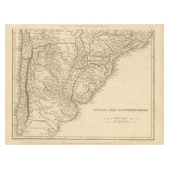
Antique Map of La Plata, Chili and Southern Brazil, 1849
Located in Langweer, NL
Antique map titled 'La Plata - Chili and Southern Brazil'.
Old map of La Plata, Chili and Southern Brazil. This map originates from 'Sharpe's Correspondin...
Category
Antique 19th Century Maps
Materials
Paper
$332 Sale Price
20% Off
Antique Chart of the Straits of Makassar, Indonesia with Borneo and Celebes-1820
Located in Langweer, NL
Description: Antique map titled 'A New Chart of the Straits of Macassar with various additions & improvements by J.W. Norie'.
Rare and beautifully engraved chart of the Straits of Makassar showing Eastern Borneo and Celebes coast lines. With various smaller inset maps including a plan of the shoals off ragged and shoal points in Borneo, the Bay of Bonthain and the Straits of Salayr.
Artists and Engravers: John William Norie (1772-1843), acquired the chart publishing business of William Heather after he died in 1812. He went into partnership with George Wilson...
Category
Antique 19th Century Maps
Materials
Paper
$2,613 Sale Price
20% Off
Antique Map of Italy with Vignette of Saint Angu Castle in Rome, 1880
Located in Langweer, NL
Antique map titled 'Italie Septentrionale'.
Old map of Italy with a decorative vignette of Saint Angu castle in Rome. This map originates from 'G...
Category
Antique 19th Century Maps
Materials
Paper
$152 Sale Price
20% Off
Interesting Antique Map of the Development of the Mapping of the America's, 1841
Located in Langweer, NL
Title: "De ontdekking van Amerika. Voorgesteld in eene reeks geschiedkundige kaarten".
Collection of hand-colored engraved maps by D. VEELWAARD on 1 sheet, "Dertiende aflevering,...
Category
Antique 19th Century Maps
Materials
Paper
$1,187 Sale Price
20% Off
Antique Dutch Map of The Opsterland Township in Friesland, 1861
Located in Langweer, NL
Antique map titled 'Gemeente Opsterland'. Old map depicting the Opsterland township including cities and villages like Boornbergum, Beets, Olterterp, Terwispel, Lippenhuizen, Gorredi...
Category
Antique 19th Century Maps
Materials
Paper
$114 Sale Price
20% Off
Old Map Showing the Tracks of Cook Between North America and Asia's Coast, 1803
Located in Langweer, NL
Description: Antique map titled 'Kaart van de Noord-West kust van Amerika en de Noord-Oost kust van Asia'.
Antique chart depicting America's northwest coast and Asia's northeast ...
Category
Antique 19th Century Maps
Materials
Paper
$902 Sale Price
20% Off
Antique Map of Groningen by Veelwaard, c.1865
Located in Langweer, NL
Antique map titled 'Groningen 1861'. Map of Groningen, the Netherlands. Published by 'Gewest. Vereeniging Noord Holland van het Ned. Onderwijzers-Genootschap'. Artists and Engravers:...
Category
Antique 19th Century Maps
Materials
Paper
$90 Sale Price
20% Off
Engraving of a Chinese Garden in Canton and the Festival of Death in Macao, 1808
Located in Langweer, NL
Antique print titled 'Plan d'un Jardin Chinois à Quanton, Fête des Morts à Macao'.
Two images on one sheet depicting a Chinese garden and Festival of the Death in Macao. Originat...
Category
Antique 19th Century Maps
Materials
Paper
$399 Sale Price
20% Off
Antique Map of Leeuwarderadeel, Township in Friesland, The Netherlands, 1868
Located in Langweer, NL
Antique map titled 'Provincie Friesland - Gemeente Leeuwarderadeel'. Map of the township of Leeuwarderadeel including Leeuwarden, Wirdum, Stiens and many other villages. This map ori...
Category
Antique 19th Century Maps
Materials
Paper
$131 Sale Price
20% Off
Antique Map of the Dutch Most Northern Provinces Friesland and Groningen, 1883
Located in Langweer, NL
Antique map titled 'Friesland en Groningen'. Map of Friesland and Groningen, provinces of the Netherlands. This map originates from 'Atlas van Nederland volgens de nieuwe spelregels'...
Category
Antique 19th Century Maps
Materials
Paper
$266 Sale Price
20% Off
Antique Map of Macao and Surroundings by Captain Cook, 1803
Located in Langweer, NL
Antique map Macao titled 'Schets van Typa of van Macao'. Map of Macao and surrounding islands. Originates from 'Reizen Rondom de Waereld door James Cook (..)'. Artists and Engravers:...
Category
Antique 19th Century Maps
Materials
Paper
$522 Sale Price
20% Off
Antique Map of Greece from an Old French School Atlas, 1880
Located in Langweer, NL
Antique map titled 'Grèce Moderne '. Old map of Greece and surroundings. This map originates from 'Géographie Universelle Atlas-Migeon' by J. Migeon. Artists and Engravers: Published...
Category
Antique 19th Century Maps
Materials
Paper
$104 Sale Price
20% Off
Antique Map of Germany from an Old English Atlas, c.1802
Located in Langweer, NL
Antique map titled 'Germany'. Antique map of Germany engraved for 'Atlas to Walker's Geography'. Artists and Engravers: Engraved by W. Darton.
Artist: Engraved by W. Darton.
Co...
Category
Antique 19th Century Maps
Materials
Paper
$123 Sale Price
20% Off
Hong Kong Chinese Temple Print – Antique Architectural View from 1856
Located in Langweer, NL
Description: Antique print titled ‘Chinese Temple Hong-Kong‘. View of the Chinese temple in Hong Kong. This print originates from 'Narrative of the expedition of an American squadron...
Category
Antique 19th Century Maps
Materials
Paper
$275 Sale Price
20% Off
Antique Map of Germany and Switzerland from an Old Dutch School Atlas, 1852
Located in Langweer, NL
Antique map titled 'Duitschland en Zwitersland'. Map of Germany and Switzerland. This map originates from 'School-Atlas van alle deelen der Aarde' by Otto Petri. Artists and Engraver...
Category
Antique 19th Century Maps
Materials
Paper
$114 Sale Price
20% Off
Antique Map of France according to the Treaty of Paris '1815', Published in 1854
Located in Langweer, NL
Antique map titled 'The Kingdom of France, describing the new limits according to the treaty of Paris. (1815)'. Large map of France. From James Wyld's 'A New General Atlas of Modern ...
Category
Antique 19th Century Maps
Materials
Paper
$640 Sale Price
30% Off
Antique Map of the Asian Continent by Johnston, 1885
Located in Langweer, NL
Antique map titled 'Asia'. Beautiful map of the Asian continent by Keith Johnston F.R.S.E.
Artists and Engravers: Engraved, printed and published by A.K. Johnston.
Condition: ...
Category
Antique 19th Century Maps
Materials
Paper
$332 Sale Price
20% Off
Antique Map of Belgium and the Netherlands by Johnston, 1882
Located in Langweer, NL
Antique map titled 'Belgium and the Netherlands'. Old map of Belgium and the Netherlands. This map originates from 'The Royal Atlas of Modern Geography, Exhibiting, in a Series of En...
Category
Antique 19th Century Maps
Materials
Paper
$99 Sale Price
20% Off
Antique Steel Engraved Map of Asia, c.1860
Located in Langweer, NL
Antique map titled 'Asia'. Steel engraved map of Asia by F. P. Becker & Co.
Artists and Engravers: Engraved by F.P. Becker & Co. Published in London.
Condition: Very good, gen...
Category
Antique 19th Century Maps
Materials
Paper
$75 Sale Price
20% Off
Antique Map of Asia Showing the European Language Areas, c.1873
Located in Langweer, NL
Antique map titled 'Asia'. Old map depicting the Asian continent. This map originates from 'School-Atlas van alle Deelen der Aarde'.
Artists and Engravers: Published by O. Petri,...
Category
Antique 19th Century Maps
Materials
Paper
$111 Sale Price
20% Off
Antique Map of Drenthe, Province of the Netherlands, C.1870
Located in Langweer, NL
Antique map titled 'De Provincie Drenthe'. Map of the province of Drenthe, the Netherlands. This map originates from 'F. C. Brugsma's Atlas van het Koninkrijk der Nederlanden (..)'. ...
Category
Antique 19th Century Maps
Materials
Paper
Antique Map of the European Continent, 1882
Located in Langweer, NL
Antique map titled 'Europe'. Old map of the European continent. This map originates from 'The Royal Atlas of Modern Geography, Exhibiting, in a Series of ...
Category
Antique 19th Century Maps
Materials
Paper
$128 Sale Price
20% Off
Antique Map of the Asian Continent from a German School Atlas, 1862
Located in Langweer, NL
Antique map titled 'Asien Politische Ubersicht'. Old map of the Asian continent. Originates from Stieler's 'Schul-Atlas'.
Artists and Engravers: Published by Johan Georg Justus Per...
Category
Antique 19th Century Maps
Materials
Paper
$88 Sale Price
20% Off
Antique Map of Asia by Malte-Brun, 1880
Located in Langweer, NL
Map Pl. 63 - 64: 'Carte de l'Asie.' This map shows Asia. This original antique map originates from 'Atlas de la Geographie Universelle ou Description de toutes les parties du monde s...
Category
Antique 19th Century Maps
Materials
Paper
$171 Sale Price
20% Off
Antique Map of Drenthe, Province in the Netherlands, 1883
Located in Langweer, NL
Antique map titled 'Drenthe'. Map of Drenthe, a province of the Netherlands. This map originates from 'Atlas van Nederland volgens de nieuwe spelregels' by J. Kuyper.
Artists and ...
Category
Antique 19th Century Maps
Materials
Paper
$116 Sale Price
20% Off
Antique Map of Asia with an Illustration of the Porcelain Tower at Nanjing, 1880
Located in Langweer, NL
Antique map titled 'Asie'. Map of the Asian continent, with an illustration of the porcelain tower at Nanjing, China. This map originates from 'Géograp...
Category
Antique 19th Century Maps
Materials
Paper
$132 Sale Price
20% Off
Antique Map of Asia Minor by Lapie, 1842
Located in Langweer, NL
Antique map titled 'Carte de l'Asie Mineure Ancienne (..)'. Map of Asia Minor, also called Anatolia or Turkish Anadolu. This map originates from 'Atlas univ...
Category
Antique 19th Century Maps
Materials
Paper
$370 Sale Price
20% Off
Antique Map of China with insets the Island of Chusan and Canton River, c.1860
Located in Langweer, NL
Antique map titled 'China'. Large map of China, with insets the Island of Chusan, and the Estuary of the Canton River from Hong Kong to Canton. Korean peninsula shown.
Artists an...
Category
Antique 19th Century Maps
Materials
Paper
$114 Sale Price
20% Off
Antique Map of Dantumadeel, Friesland, The Netherlands, 1868
Located in Langweer, NL
Antique map titled 'Provincie Friesland - Gemeente Dantumadeel'. Map of the township of Dantumadeel including Birdaard, Rinsumageest, Veenwouden and many other villages. This map ori...
Category
Antique 19th Century Maps
Materials
Paper
$102 Sale Price
20% Off
Antique Map of Africa with European Language Borders, 1852
Located in Langweer, NL
Antique map titled 'Afrika'. Map of Africa. This map originates from 'School-Atlas van alle deelen der Aarde' by Otto Petri.
Artists and Engravers: Published by A. Baedeker (Otto...
Category
Antique 19th Century Maps
Materials
Paper
$152 Sale Price
20% Off
Antique Map of East Flanders, Belgium, c.1840
Located in Langweer, NL
Antique map titled 'Kaart van Oost Vlaanderen'. Original antique map of East Flanders, Belgium. Source unkown, to be determined. Published circa 1840.
Artists and Engravers: Engr...
Category
Antique 19th Century Maps
Materials
Paper
$118 Sale Price
20% Off
Antique Map of Ferwerderadeel, a County in Friesland, The Netherlands, 1868
Located in Langweer, NL
Antique map titled 'Provincie Friesland - Gemeente Ferwerderadeel'. Map of the township of Ferwerderadeel including Ferwerd, Blija and many other villages. This map originates from '...
Category
Antique 19th Century Maps
Materials
Paper
$171 Sale Price
20% Off
Two Antique Maps of Europe on One Sheet in Different Time Periods, 1842
Located in Langweer, NL
Antique map titled 'Carte de l'Europe'. Two maps of Europe. The upper map depicts Europe in the year 350, the lower map depicts Europe in the 5th century. This map originates from 'A...
Category
Antique 19th Century Maps
Materials
Paper
$617 Sale Price
20% Off
Antique Map of the Famous French Wine Area of Correze, 1854
Located in Langweer, NL
Antique map titled 'Dépt. da la Corrèze'. Map of the French department of Correze, France. This area of France is known for its production of straw wine, a sweet red or white wine. T...
Category
Antique 19th Century Maps
Materials
Paper
$114 Sale Price
20% Off
Antique Map of Eastern Borneo, Indonesia with Views of Mountain Ranges, c.1875
Located in Langweer, NL
Antique map titled 'Kaart van het Oostelijk gedeelte van Borneo.' (Map of the eastern part of Borneo.) This map shows the eastern part of Borneo, Indonesia. With views of mountain ra...
Category
Antique 19th Century Maps
Materials
Paper
$171 Sale Price
20% Off
Antique Map of England and Wales by Johnston, 1882
Located in Langweer, NL
Antique map titled 'England and Wales'. Old map of England and Wales, with an inset map of Scilly Islands. This map originates from 'The Royal Atlas of Modern Geography, Exhibiting, ...
Category
Antique 19th Century Maps
Materials
Paper
$135 Sale Price
20% Off
Antique Map of France with Surrounding Countries, 1842
Located in Langweer, NL
Antique map titled 'Carte comparée de la France en 1789 et 1813'. Map of France. This map originates from 'Atlas universel de géographie ancienne et moderne (..)' by Pierre M. Lapie ...
Category
Antique 19th Century Maps
Materials
Paper
$285 Sale Price
20% Off
Antique Map of France with Inset Map of the Island of Corsica, 1820
Located in Langweer, NL
Antique map titled 'France in Departments'. Old map of France, with small inset map of the island of Corsica. Includes a table with reference to the departments.
Artists and Engr...
Category
Antique 19th Century Maps
Materials
Paper
$247 Sale Price
20% Off
Antique Map of The Asian Continent, 1855
Located in Langweer, NL
Antique map titled 'Carte Générale de l 'Asie'. Beautiful map of the Asian continent. This map originates from 'Voyage en Asie et en Afrique, d'aprés les récits des derniers voyageur...
Category
Antique 19th Century Maps
Materials
Paper
$237 Sale Price
20% Off
Denmark & German Empire – Antique Map by A.K. Johnston, 1882 Atlas Edition
Located in Langweer, NL
Denmark & German Empire – Antique Map by A.K. Johnston, 1882 Atlas Edition
This detailed antique map titled Denmark with North-West portion of the German Empire comprising Schleswig...
Category
English Antique 19th Century Maps
Materials
Paper
$228 Sale Price
20% Off
Antique Exploration Map of Australia from Sharks Bay to Alice Springs, 1876
Located in Langweer, NL
Antique map titled 'Die neuesten Entdeckungsreisen Innern von Australien von Warburton, Giles, Forrest (..)'. Old map of Australia from Sharks Bay to 90 Mile Beach over to Alice Springs...
Category
Antique 19th Century Maps
Materials
Paper
$237 Sale Price
20% Off
Antique Map of Frisian Township of Baarderadeel in the Netherlands, 1868
Located in Langweer, NL
Antique map titled 'Provincie Friesland - Gemeente Baarderadeel'. Map of the township Baarderadeel including Weidum, Oosterlittens and many other villages. This map originates from '...
Category
Antique 19th Century Maps
Materials
Paper
$171 Sale Price
20% Off
Large Antique Map of the Asian Continent, 1814
Located in Langweer, NL
Antique map titled 'Asia'. Large antique map of the Asian continent. Drawn under the direction of Mr. Pinkerton by L. Hebert.
Artists and Engraver...
Category
Antique 19th Century Maps
Materials
Paper
$427 Sale Price
20% Off
Nicely Decorated Antique Map of Asia, incl Population Figures, 1854
Located in Langweer, NL
Antique map titled 'Asie'. Map of the main Asian continent. The decorated border shows various images, as well as two blocks of statistical text on the continent, including populatio...
Category
Antique 19th Century Maps
Materials
Paper
$427 Sale Price
20% Off
Antique Map of Asia by Young, c.1860
Located in Langweer, NL
Antique map titled 'Asia'. Steel engraved map of Asia by Francis Young.
Artists and Engravers: Engraved by Lewis Becker. Published by S.O. Beeton.
We sell original antique maps to...
Category
Antique 19th Century Maps
Materials
Paper
$128 Sale Price
20% Off
Antique Map of Frisian Municipality of Achtkarspelen in the Netherlands, 1868
Located in Langweer, NL
Antique map titled 'Provincie Friesland - Gemeente Achtkarspelen'. Map of the township of Achtkarspelen including Buitenpost, Surhuisterveen and many other villages. This map origina...
Category
Antique 19th Century Maps
Materials
Paper
$133 Sale Price
20% Off
Antique Map of Frisian Municipality of Aengwirden in the Netherlands, 1868
Located in Langweer, NL
Antique map titled 'Provincie Friesland - Gemeente Aengwirden'. Map of the township Aengwirden including Heerenveen, Terband, Tjalleberd, Gersloot and many other villages. This map o...
Category
Antique 19th Century Maps
Materials
Paper
$123 Sale Price
20% Off
Antique Frontispiece of Meyer's Universum Depicting a Scene of Syria, 1854
Located in Langweer, NL
Antique frontispiece of volume 16 of 'Meyer's Universum' including a scene of Syria, published 1854.
Artists and Engravers: Joseph Meyer (May 9, 1796 - June 27, 1856) was a German...
Category
Antique 19th Century Maps
Materials
Paper
Dutch Municipality of the Gemeente Oldehove in Grongingen, Kuyper, 1865
Located in Langweer, NL
Groningen: Gemeente Kommerzijl, Oldehove, Niehove, Saaksum. These scarse detailed maps of Dutch Towns originate from the 'Gemeente-atlas' of Jacob Kuyper. This atlas of all towns in ...
Category
Antique 19th Century Maps
Materials
Paper
$114 Sale Price
20% Off
Dutch Municipality of Uithuizermeeden in Groningen, Kuyper, 1865
Located in Langweer, NL
Groningen: Gemeente Oldenzijl, Oosternieland, de Roode School, Uithuizermeeden. These scarse detailed maps of Dutch Towns originate from the 'Gemeente-atlas' of Jacob Kuyper. This at...
Category
Antique 19th Century Maps
Materials
Paper
$104 Sale Price
20% Off
Dutch Municipality of Scheemda in Groningen, Kuyper, 1865
Located in Langweer, NL
Groningen: Gemeente Heiligerlee, Scheemda, Nieuw Scheemda, Westerlee. These scarse detailed maps of Dutch Towns originate from the 'Gemeente-atlas' of Jacob Kuyper. This atlas of all...
Category
Antique 19th Century Maps
Materials
Paper
$104 Sale Price
20% Off
Dutch Municipality of Wildervank in Grongingen, Kuyper, 1865
Located in Langweer, NL
Groningen: Gemeente Nieuw Stadskanaal, Wildervank. These scarse detailed maps of Dutch Towns originate from the 'Gemeente-atlas' of Jacob Kuyper. This atlas of all towns in the Nethe...
Category
Antique 19th Century Maps
Materials
Paper
$114 Sale Price
20% Off
Antique Map of the Dutch Utingeradeel Township by Behrns, 1861
Located in Langweer, NL
Antique map titled 'Gemeente Utingeradeel'. Old map depicting the Utingeradeel township including cities and villages like Akkrum, Nes, Terhorne and Akmarijp. This map orginates from...
Category
Antique 19th Century Maps
Materials
Paper
$114 Sale Price
20% Off
Antique Dutch Map of The Region of Leeuwarden by Behrns, 1861
Located in Langweer, NL
Antique map titled 'Arrondissement Leeuwarden'. Old map depicting the region of Leeuwarden including cities and villages like Franeker, Harlingen, Dokkum and more. This map orginates...
Category
Antique 19th Century Maps
Materials
Paper
$142 Sale Price
20% Off
Antique Map of The Region of Heerenveen by Behrns, 1861
Located in Langweer, NL
Antique map titled 'Arrondissement Heerenveen'. Old map depicting the region of Heerenveen including cities and villages like Akkrum, Oudehaske, Wolvega, Donkerbroek and more. This m...
Category
Antique 19th Century Maps
Materials
Paper
$123 Sale Price
20% Off
