Engraved Maps
to
329
789
62
851
3
589
260
2
1
849
7
3
1
1
407
143
112
81
41
851
851
851
2
2
2
2
1
Technique: Engraved
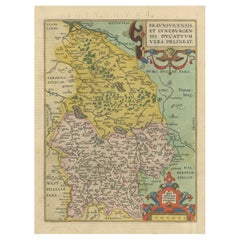
Duchy of Brunswick-Lüneburg, 1595: A Renaissance Cartographic Masterpiece
Located in Langweer, NL
Title: "Braunschweig and Lüneburg Duchies: Authentic Depiction by Abraham Ortelius"
This is an exquisite example of Abraham Ortelius’s cartographic craftsmanship: an original antiqu...
Category
16th Century Antique Engraved Maps
Materials
Paper
$334 Sale Price
20% Off
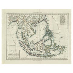
1797 Tardieu Map of Southeast Asia: The Malay Archipelago and Beyond
Located in Langweer, NL
An original historical map titled 'Presqu' Île Au Dela Du Gange et Archipel De L'Inde', created by Pierre Francois Tardieu and published in the "Atlas Universel" by Pierre Grégoire C...
Category
1790s Antique Engraved Maps
Materials
Paper
$1,099 Sale Price
20% Off
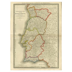
Engraved Large Map of The Kingdom of Portugal Original Handcolored, 1854
Located in Langweer, NL
Antique map titled 'Mappa Corografica do Reino de Portugal - Chorographical map of the Kingdom of Portugal divided into its Grand Provinces.'
Large map of...
Category
1850s Antique Engraved Maps
Materials
Paper
$1,052 Sale Price
20% Off
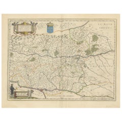
Lyonnais, Beaujolais, Forez, Mâconnais: A 1644 Depiction of France's Provinces
Located in Langweer, NL
An original antique map from 1644, depicting the French provinces of Lyonnais, Beaujolais, Forez, and Mâconnais. In this map, north is oriented to the right, which is a cartographic ...
Category
1640s Antique Engraved Maps
Materials
Paper
$459 Sale Price
20% Off
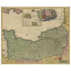
Original Normandy Map by Frederick de Wit, 1705, with Inset of Channel Islands
Located in Langweer, NL
Normandy Map by Frederick de Wit, 1705, with Inset of Channel Islands
Description:
This beautifully engraved and hand-colored map, titled Duché et Gouvernement General de Normandie,...
Category
Early 1700s Antique Engraved Maps
Materials
Paper
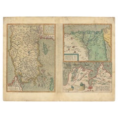
Three Antique Maps on One Folio: Turkey, Northern Egypt, and Ancient Carthage
Located in Langweer, NL
The map consists of three distinct sections on a single folio sheet:
1. **Map of Turkey**:
- Orientation: The map is oriented with the east at the top, which is a common practic...
Category
16th Century Antique Engraved Maps
Materials
Paper
Ancient Persia, Assyria and Babylon – Willem Albert Bachiene, c.1760
Located in Langweer, NL
Ancient Persia, Assyria and Babylon – Willem Albert Bachiene, circa 1760
Antique map depicting the territories of the Assyrian, Babylonian, Persian, Gr...
Category
18th Century Dutch Antique Engraved Maps
Materials
Paper
Antique Map of the Russian Empire by R. Bonne, 1780
Located in Langweer, NL
Antique map titled 'Carte de l'Empire de Russie.' Drawn by R. Bonne for G. Raynal’s Atlas de Toutes les Parties Connues du Globe Terrestre, Dressé pour l'Histoire Philosophique et Po...
Category
Late 18th Century French Antique Engraved Maps
Materials
Paper
1851 Map of "Independent Tartary", Ric. R018
Located in Norton, MA
1851 Map of
Independent Tartary
"Russia"
Ric.r018
A highly decorative 1851 map of Independent Tartary by John Tallis and John Rapkin. Covers the regions between the Caspian Sea and Lake Bakquash and between Russia and Afghanistan. These include the ancient Silk Route kingdoms of Khiva, Tartaria, Kokand, and Bokhara. Today this region roughly includes Kazakhstan, Uzbekistan, Turkmenistan, Kyrgyzstan, and Tajikistan. This wonderful map offers a wealth of detail for anyone with an interest in the Central Asian portion of the ancient Silk Road. Identifies various caravan routes, deserts, wells, and stopping points, including the cities of Bokhara and Samarkand. Three vignettes by W. Bragg decorate the map, these including an image of Tartars on a Journey, a horseback Bride Chase, and a tartar camp site. Surrounded by a vine motif border. Engraved by J. Rapkin for John Tallis's 1851 Illustrated Atlas .
Tartary Antique Map...
Category
19th Century Unknown Antique Engraved Maps
Materials
Paper
Antique Map of South East Asia, Australia and the Indian Ocean, 1726
By F. Valentijn
Located in Langweer, NL
Antique map titled 'Tabula Indiae Orientalis'.
Beautiful detailed map of Australia, Southeast Asia and the Indian Ocean. The map features a fine depiction of the outlines of the western two-thirds of Australia, based on the discoveries of explorers working for the Dutch East India Company (the VOC). These include Willem Jansz's discoveries in the Gulf of Carpentaria in 1606; the encounters of Dirk...
Category
Mid-18th Century Dutch Antique Engraved Maps
Materials
Paper
$6,886 Sale Price
20% Off
Copenhagen (Kiöbenhaven) Map with City View – Antique German Atlas Print, 1844
Located in Langweer, NL
Copenhagen (Kiöbenhaven) Map with City View – Antique German Atlas Print, 1844
This finely detailed antique map titled 'Copenhagen (Kiöbenhaven)' presents a historical view of Denma...
Category
Mid-19th Century German Antique Engraved Maps
Materials
Paper
Antique Portrait of Frederik Hendrik, Prince of Orange, Etc Etc, 1749
Located in Langweer, NL
Antique portrait titled 'Frederik Hendrik, Prins van Oranje enz. enz. enz'.
Portrait of Frederick Henry, or Frederik Hendrik in Dutch (29 January 1584 – 14 March 1647). The sover...
Category
1740s Dutch Antique Engraved Maps
Materials
Paper
Friesland, Groningen and Overijssel – Rare Woodcut Map by Münster, c. 1550
Located in Langweer, NL
Frisia, Groningen and Overijssel – Rare Woodcut Map by Münster, c. 1550, Germany
This highly decorative 16th-century woodcut map titled “Von dem Teutschen Land: Seelentfrie” was pub...
Category
16th Century Antique Engraved Maps
Materials
Paper
Antique Map of the Brazilian Coast by A. Van Krevelt
Located in Langweer, NL
Uncommon edition of this accurate map of part of Brazil, from San Salvador till Rio de Janeiro and S.Paulo. In lower right engraved "29b." Originates from 'Atlas Portatif pour servir...
Category
Late 18th Century Brazilian Antique Engraved Maps
Materials
Paper
$230 Sale Price
22% Off
Genuine Antique Engraved Map of Helvetia or Switzerland, 1729
Located in Langweer, NL
Decorative early 18th century engraved map of Switzerland.
Title: Helvetia Conterminarumq terra rum antiqua.
Translated from Latin: Switzerland is an ancient land
Description: Switzerland, antique copperplate engraved map with hand coloring and a decorative title cartouche. Two figures greatly enhances visual appeal.
Author: Phillip Cluver, or Philip Cluverius, Philipp Clüver, Latinized as Philippus Cluverius studied law in Leiden and settled over there in 1615.
We only sell Guaranteed Absolutely Original authentic Maps and Prints.
A Certificate of Authenticity ( COA ) will be supplied on request.
We ship our antique maps and prints...
Category
1720s Antique Engraved Maps
Materials
Paper
$373 Sale Price
20% Off
Antique Map op Siberia and Chinese Tartary with original hand coloring, 1732
Located in Langweer, NL
Antique map titled 'Nieuwe Kaart van Tartarie na de alderlaatste ontdekking int ligt gebragt'. Map op Siberia and Chinese tartary. In the north Novaya Zemlya curls back to attach its...
Category
Mid-18th Century Antique Engraved Maps
Materials
Paper
$765 Sale Price
20% Off
Fabulous Original Antique two-sheet Map of the Caspian Sea, ca.1723
Located in Langweer, NL
Carte Marine de la Mer Caspiene... [and] Coste de Perse sur la Mer Caspiene et Partie de Celles de Tartarie", Delisle, Guillaume (2 maps)
Subject: Caspian Sea
...
Category
1720s Antique Engraved Maps
Materials
Paper
$2,104 Sale Price
20% Off
Intriguing Antique Map of Europe, Asia and Africa by Scherer, c.1703
Located in Langweer, NL
Two maps on a single sheet showing Europe, Asia and Africa, each depicting nearly the same area. On close examination there are slight differences. Major cities are located. Printed ...
Category
18th Century German Antique Engraved Maps
Materials
Paper
Antique Map of Christmas Island by Cook, 1784
Located in Langweer, NL
Antique map Kiribati titled 'Christmas Island (..)'. Antique map of Christmas Island, also known as Kiritimati. Originates from an edition of Cook's Voyages.
Artists and Engravers...
Category
18th Century Antique Engraved Maps
Materials
Paper
$105 Sale Price
20% Off
Antique Map of Japan by A.M. Mallet, 1683
Located in Langweer, NL
A charming late 17th century French map with a very decorative title cartouche showing trumpet-blowing cherubs, by Allain Manneson Mallet (1630-1706), a well traveled military engine...
Category
Late 17th Century French Antique Engraved Maps
Materials
Paper
Architectural Antique Print of Various Garden Temples by Le Rouge, c.1785
Located in Langweer, NL
Untitled antique print showing various garden temples. This print originates from 'Jardins Anglo-Chinois à la Mode' by Georg Louis le Rouge. Artists and ...
Category
18th Century Antique Engraved Maps
Materials
Paper
Antique Print of Cairo and Joseph's Well in Egypt, 1698
Located in Langweer, NL
Untitled antique print with a view of the city of Cairo in Egypt and Joseph's Well in Cairo. This print originates from 'Reizen van Cornelis de Bruyn, door de vermaardste deelen van ...
Category
17th Century Dutch Antique Engraved Maps
Materials
Paper
$162 Sale Price
20% Off
Antique Map by Janssonius of the Dutch Province of Overijsel, ca.1650
Located in Langweer, NL
Very good, given the age. Center fold as issued with wide margins. Sharp print with beautiful old-fashioned colouring, carbon copy on verso. Paper in the margins somewhat browned.
Category
1650s Antique Engraved Maps
Materials
Paper
$420 Sale Price
20% Off
Old Hand-Colored Map of Western Tartary with Focus on Present-Day Mongolia, 1749
Located in Langweer, NL
Antique map titled 'Carte de la Tartarie Occidentale pour Servir a l'Histoire Générale des Voyages. Tirée des Auteurs Anglois.'
This map covers western Tartary and focuses on the r...
Category
1740s French Antique Engraved Maps
Materials
Paper
$394 Sale Price
25% Off
Antique Map of the Coast of Guinea from, Cape Apollonia to the Volta River
Located in Langweer, NL
Antique map titled 'Suite de la Coste de Guinée (..) - Vervolg van de Kust van Guinée (..)'. Decorative map of the coast of Guinea from, Cape Apollonia to the Volta River. Engraved b...
Category
Mid-18th Century Antique Engraved Maps
Materials
Paper
$344 Sale Price
20% Off
Vintage Print of the Lady of Stavoren by Voskuil, 1946
Located in Langweer, NL
Vintage lithograph titled 'Vrouwtje van Stavoren'. Lithograph of the Lady of Stavoren, a folk tale from the Netherlands which originated in the 16th century. Published 1946.
Artist...
Category
20th Century Dutch Engraved Maps
Materials
Paper
Leicestershire – Antique Map of Leicester by Richard Blome, Britannia 1673
Located in Langweer, NL
Leicestershire – Antique Map of Leicester by Richard Blome, Britannia 1673
This original antique map titled A Mapp of the Country of Leicester presents a detailed and decorative dep...
Category
Late 17th Century English Antique Engraved Maps
Materials
Paper
$420 Sale Price
20% Off
Antique Map of Moldova to Thessaly and from the Adriatic to the Black Sea, 1880
Located in Langweer, NL
Antique map titled 'Turquie d'Europe'.
Map of the european parts of Turkey. The map covers from Moldova to Thessaly and from the Adriatic to the Black Sea. Greece and the island ...
Category
1880s French Antique Engraved Maps
Materials
Paper
Map of the West African coast from the North of Mauretania to Guinee, 1788
Located in Langweer, NL
Antique map titled 'Particular Map of the Western Coast of Africa, from Cape Blanco to Cape de Verga, and of the Course of the Rivers Senega and Gambia.'
Map of the African coast...
Category
1780s English Antique Engraved Maps
Materials
Paper
$363 Sale Price
20% Off
Old Engraving of Batavia 'Jakarta, Indonesia' with Map and Harbour View, 1750
Located in Langweer, NL
Antique map titled 'Carte des environs de Batavia '. French map of the Batavia area (Jakarta) in Indonesia. With cartouche, scale and compass rose. Published circa 1750.
The map i...
Category
1750s Antique Engraved Maps
Materials
Paper
$526 Sale Price
20% Off
Antique Map of the Cape Verde Islands and Part of Senegal, West Africa, 1690
Located in Langweer, NL
Antique map titled 'Bocche del Fivme Negro et Isole di Capo Verde'. Beautiful double-page map of the Cape Verde Islands and part of the coast of Senegal, with large decorative cartou...
Category
17th Century Italian Antique Engraved Maps
Materials
Paper
Antique Print of Forts and Views of the East Indies by Chatelain (1719)
Located in Langweer, NL
Antique print titled 'Vue et Description de Quelques-Uns des Principaux Forts des Hollandois dans les Indes'. Interesting sheet with seven detailed views illustrating the most import...
Category
18th Century French Antique Engraved Maps
Materials
Paper
$410 Sale Price
30% Off
Inside View of Magdalen Chapel – Engraving of Medieval Gothic Interior, 1790
Located in Langweer, NL
Inside View of Magdalen Chapel – Engraving of Medieval Gothic Interior, 1790
This atmospheric antique engraving captures the interior of the Magdalen Chapel near Winchester, as view...
Category
18th Century English Antique Engraved Maps
Materials
Paper
Antique Map of Gabon, Angola and the Congo Region in Africa c.1680
Located in Langweer, NL
Antique map titled 'Royaume de Congo'.
Map of Gabon, the Congo and Angola from Cape Lopez and Sao Tomé to approximately the border with present-day Namibia. The map is fully engrav...
Category
17th Century Antique Engraved Maps
Materials
Paper
1849 Map of "Europaische Russland", 'Meyer Map of European Russia', Ric. R017
Located in Norton, MA
1849 Map of
"Europaische Russland"
( Meyer Map of European Russia)
Ric.r017
A lovely map of European Russia dating to 1849 by Joseph Meyer. It covers the European portions of...
Category
19th Century Unknown Antique Engraved Maps
Materials
Paper
Antique Engraving of Kirby Hall Near Gretton, Northamptonshire, England c.1770
Located in Langweer, NL
Antique print titled 'Principal Front of Kirby Hall'.
Kirby Hall is an Elizabethan country house, located near Gretton, Northamptonshire, England. The nearest main town is Corby. One of the great Elizabethan houses of England, Kirby Hall was built for Sir Humphrey Stafford of Blatherwick, beginning in 1570. In 1575 the property was purchased by Sir Christopher Hatton of Holdenby,[1] Lord Chancellor to Queen Elizabeth I. It is a leading and early example of the Elizabethan prodigy house. Construction on the building began in 1570, based on the designs in French architectural pattern books and expanded in the Classical style over the course of the following decades. The house is now in a semi-ruined state with many parts roof-less although the Great Hall and state rooms remain intact. The gardens, with their elaborate "cutwork" design, complete with statues and urns, have been recently restored.
Anne of Denmark stayed at Kirby on 9 August 1605 while King James stayed at Rockingham Castle. King James stayed for three days in August 1616. During a royal progress Esmé Stewart, 3rd Duke of Lennox died at Kirby of the "spotted ague" on 30 July 1624.
The building and gardens are owned by the Earl of Winchilsea and are managed by English Heritage.
Kirby Hall has been used as a filming location in many productions. These include the following; an episode (6. Protest and Communication) of Kenneth Clark...
Category
18th Century Antique Engraved Maps
Materials
Paper
$526 Sale Price
20% Off
Early 18th Century Map of Denmark in Old Coloring, Published in 1706
Located in Langweer, NL
Denmark. Schenk (Petrus), Dania Regnum Ducatus Holsatia. et Slesvicum Insulae Danicae et Provinciae Jutia Scania etc. Amsterdam, 1706, engraved reticulated map on thick paper with co...
Category
Early 1700s Antique Engraved Maps
Materials
Paper
$680 Sale Price
20% Off
Old Color Engraving of Blaeu's first Map of Brazil, North Oriented to the Right
By Willem Blaeu
Located in Langweer, NL
Antique map titled 'Novus Brasiliae Typus'. Fine old color example of Blaeu's first map of Brazil, with north oriented to the right. Includes inset map of Baya de todos Santos, elaborate cartouche, 2 compass roses and richly embellished vignettes of native Brazilian life and animals.
The interior of the map includes vignettes of indigenous animals and native scenes, including cannibalism. Inset within a decorative border is a small map of "Baya de todos Sanctos". In the sea are monsters, a galleon and two compass roses. The large title cartouche features a male and female Brazilian, both of whom are shown naked.
Willem Janszoon Blaeu (1571-1638) was a prominent Dutch geographer and publisher. Born the son of a herring merchant, Blaeu chose not fish but mathematics and astronomy for his focus. He studied with the famous Danish astronomer Tycho Brahe...
Category
Mid-17th Century Antique Engraved Maps
Materials
Paper
$1,291 Sale Price
40% Off
Antique Map of Africa by Delamarche, 1806
Located in Langweer, NL
Antique map titled 'L'Afrique'.
Decorative map of Africa by Robert de Vaugondy, revised and published by Delamarche. Source unknown, to be determined.
Artists and Engravers: Charl...
Category
19th Century Antique Engraved Maps
Materials
Paper
$258 Sale Price
20% Off
Antique Map of the East Indies by Dower, 1832
Located in Langweer, NL
Antique map titled 'East India Isles'. Old map of the East Indies. This map originates from 'A General Descriptive Atlas Of The Earth (..)' by J. Dower.
Artists and Engravers: Draw...
Category
19th Century Antique Engraved Maps
Materials
Paper
French Geographical, Statistical and Historical Map of Pensylvania, 1825
Located in Langweer, NL
Title: Carte geographique, statistique et historique de la Pensylvanie.
Beautiful Hand-Colored 1825 French Map of Pennsylvania, with a List of Prominent Rivers, Descriptions of Mountains, Climate and Government as well as a list of Colonial and post-American Revolution Governors
Produced by: J. Carez in Paris. (1825)
Hand colored engraved map. Relief shown by hachures. Text and tables at sides and bottom. Prime meridians: Washington and Paris.
A very interesting 1825 French hand-colored map of Pennsylvania from Lucas' 1822 map, which breaks down county populations by Whites and Free Blacks. "Carte Geographique, Statistique et Historique de la Pensylvanie" Originally published in 1822 by Carey and Lea and then revised and republished in 1825 by J. A. C. Buchon (1791-1846 ) in a French edition entitled Atlas Geographique des Deux Ameriques, printed by J. Carez. Fielding Lucas, Jr. (1781-1854), a Baltimore mapmaker and publisher, drew the map. original hand-coloring.
Shown on the map are parts of Maryland, Delaware, New York and New jersey. Printed on the same page as the map is geographical, statistical, and historical information about Pennsylvania, such as descriptions of the state's important rivers, a list of Governors since its founding as well as important French and Indian...
Category
1820s Antique Engraved Maps
Materials
Paper
$459 Sale Price
20% Off
Antique Decorative Map of The County of Nottinghamshire, England, 1804
Located in Langweer, NL
Antique county map of Nottinghamshire first published c.1800. Villages, towns, and cities illustrated include Worksop, Neware, Tuxford, and Maplebe...
Category
Early 1800s Antique Engraved Maps
Materials
Paper
$310 Sale Price
20% Off
Map of the Russian Islands of Novaya Zemlya and Pechorskaya Guba, 1758
Located in Langweer, NL
Antique map titled 'Carte du detroit de Waeigats ou de Nassau.'
Map of the Russian islands of Novaya Zemlya (Nova Zembla) and Pechorskaya Guba, here Nouvelle Zemble and Grande Ba...
Category
1750s European Antique Engraved Maps
Materials
Paper
1839 Map of Karte Des "Russischen Reiches in Europa Und Asien" Ric.R0013
Located in Norton, MA
1839 map of Karte Des
"Russischen Reiches in Europa and Asien"
Ric.r013
Map of the European and Asian parts of Russian Empire. Karte der Russischen Reiches in Europa und Asien...
Category
19th Century Unknown Antique Engraved Maps
Materials
Paper
Antique Hand-Colored Map of France by J.B. Elwe, 1792
Located in Langweer, NL
Antique map titled 'Carte Nouvelle du Royaume de France'. Beautiful antique map of France, including the Southern part of England. Decorated with cartouche and 12 coats of arms.
Category
Late 18th Century Antique Engraved Maps
Materials
Paper
$813 Sale Price
20% Off
Interesting Map of the Thousand Islands in the Bay of Batavia 'Jakarta', ca.1740
Located in Langweer, NL
A single unfolded page border colored engraved map, printed no. 107 in top corner. This same map is found as plate 107 in Atlas Universelle aus dem Jahre 1787 by Philippe de Pretot b...
Category
1740s Antique Engraved Maps
Materials
Paper
$325 Sale Price
20% Off
1752 Vaugoundy Map of Flanders : Belgium, France, and the Netherlands, Ric.a002
Located in Norton, MA
Large Vaugoundy Map of Flanders:
Belgium, France, and the Netherlands
Colored -1752
Ric.a002
Description: This is a 1752 Didier Robert de Vaugondy map of Flanders. The map de...
Category
17th Century Unknown Antique Engraved Maps
Materials
Paper
Antique Map of the Banda Islands in Indonesia by Valentijn, 1726
Located in Langweer, NL
Antique map Indonesia titled 'Kaart der Zuyd-Wester Eylanden van Banda'. Map of the islands in the southwestern part of the Banda Sea including ...
Category
Mid-18th Century Dutch Antique Engraved Maps
Materials
Paper
$478 Sale Price
20% Off
Antique Map of the Region of Luik by Veelwaard, c.1840
Located in Langweer, NL
Antique map titled 'Kaart van Luik'. Original antique map of the region of Luik (Liege), Belgium. Source unkown, to be determined. Published circa 1840.
Artists and Engravers: Eng...
Category
19th Century Dutch Antique Engraved Maps
Materials
Paper
Antique Print of San Nicola Da Tolentino Agli Orti Sallustiani by De Rossi
Located in Langweer, NL
Antique print titled 'Facciata della Chiesa di S. Nicola da Tolentio, a Capo le Case'. Old print of the San Nicola da Tolentino agli Orti Sallustiani church...
Category
18th Century Antique Engraved Maps
Materials
Paper
Original Hand-Coloured Nautical Chart of West-Africa, c.1680
Located in Langweer, NL
NIEUWE PASKAERT VAN DE KUST VAN GENEHOA (Senegal) alsmede een gedeelte van Gambia beginnende an C. Blanco tot C. Verde (...). Amsterdam, Johannus van Keulen, c. 1680.
Large folio...
Category
17th Century Antique Engraved Maps
Materials
Paper
$1,386 Sale Price
20% Off
Antique Map of the Province of Zeeland by Veelwaard, C.1840
Located in Langweer, NL
Antique map titled 'Kaart van Zeeland (..).' Uncommon map showing the province of Zeeland in the Netherlands. Source unkown, to be determined. Published circa 1840.
Artists and Eng...
Category
19th Century Dutch Antique Engraved Maps
Materials
Paper
Queen Eleanor Memorial Cross – Antique Engraving of Waltham Cross, c.1791
Located in Langweer, NL
Queen Eleanor Memorial Cross – Antique Engraving of Waltham Cross, c.1791
This finely executed antique engraving depicts the Eleanor Cross at Waltham, one of the twelve monumental c...
Category
18th Century English Antique Engraved Maps
Materials
Paper
$152 Sale Price
20% Off
Rare Antique Map of the Imperial Court in Peking China, 1665
Located in Langweer, NL
Antique print titled 'Platte Grondt van s Keysers Hof in Pekin. Forme de la Cour Imperiale de Peking'. This print originates from 'Joan Nieuhof, Het Gezands...
Category
Mid-17th Century Dutch Antique Engraved Maps
Materials
Paper
Antique Map of a Bay of Borneo, Indonesia, c.1760
Located in Langweer, NL
Antique map titled 'La Baye de l'isle et Ville de Borneo'. Small map depicting a Bay of Borneo.
Artists and Engravers: Anonymous.
Condition: Good, general age-related toning. Smal...
Category
18th Century Antique Engraved Maps
Materials
Paper
Scandinavia & Baltic Map – Antique by G. & L. Valk, incl. Sweden, Finland, c1700
Located in Langweer, NL
Scandinavia & Baltic Map – Antique by G. & L. Valk, incl. Sweden, Finland, 1700
Antique map titled 'Sueciae Magnae, totius orbis regni antiquissimi (..)' by Gerard and Leonard Valk....
Category
Late 17th Century Dutch Antique Engraved Maps
Materials
Paper
$621 Sale Price
20% Off
1633 Map "La Souverainete De Sedan Et De Raucourt, Et La Prevoste Ric0011
Located in Norton, MA
1653 map entitled
"La Souverainete de Sedan et de Raucourt, et la Prevoste de Doncheri,"
Ric0011
Description:
Lovely map centered on Sedan and Doncheri and the Meuze River fr...
Category
17th Century Dutch Antique Engraved Maps
Materials
Paper
Antique Map of Africa with Ocean Currents and Other Details, C.1780
Located in Langweer, NL
Antique map titled 'Afrique.' Detailed map of Africa, showing towns, rivers, some topographical features, ocean currents, ports and political boundaries. Source unknown, to be determ...
Category
18th Century French Antique Engraved Maps
Materials
Paper
$229 Sale Price
20% Off
Antique Map of West Africa by R. Bonne, 1780
Located in Langweer, NL
Antique map titled 'Partie Occidentale De L'Ancien Continent Depuis Lisbonne Jusqua La Riviere De Sierra Leona Avec L'Isle de Madere, les Isles Canaries et celles Du Cap Verd'. Parts...
Category
Late 18th Century French Antique Engraved Maps
Materials
Paper
$172 Sale Price
20% Off
Antique Map of Celebes 'Sulawesi, Indonesia' by Bellin, ciarca 1755
Located in Langweer, NL
Antique map titled 'Carte de l'Isle Celebes ou Macassar'. Map of Celebes (Sulawesi, Indonesia), showing Makassar, which was the most important trading city of eastern Indonesia in th...
Category
Mid-18th Century European Antique Engraved Maps
Materials
Paper
$143 Sale Price
20% Off
Recently Viewed
View AllMore Ways To Browse
Bavarian Porcelain Vases
Beer Tankard
Bjorn L
Black Cabinet With Flowers And Birds
Black Tansu Chest
Blue Morpho
Blue Opaline Crystal Vases
Bow Front Buffet
Boy And Girl Statues
Brass Donkey
Brass Hound
Bread Oven
Bronze Atlas Sculpture
Bronze Door Stop
Bronze Shakespeare Sculpture
Buddha Bell
Bull Terrier
Butlers Chest
