17th Century Collectibles and Curiosities

to
820
1,099
152
1,259
85
3
1
1
1
4,378
6,589
13,338
2,719
3,509
4,611
3,039
518
306
588
733
464
896
880
904
659
578
1,033
120
110
34
31
298
61
55
48
43
1,259
1,259
1,259
63
12
11
11
6
Period: 17th Century
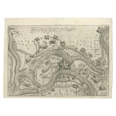
Antique Print of the Sang-Won-Hab Mountains in China, 1665
Located in Langweer, NL
Antique print titled 'Gebergte van Sang-Won-Hab'. Old print depicting the Sang-Won-Hab mountains (China) with many ships on the river between the mountains. This print originates fro...
Category

Antique 17th Century Collectibles and Curiosities

Materials

Paper

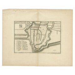
Antique Map of the Berchtesgaden Region by Scherer, 1699
Located in Langweer, NL
Antique map titled 'Principat et praepositura Berchtesgadensis (..).' Detailed uncommon map of the Berchtesgaden region in southern Bavaria, Germany. Source unknown, to be determined...
Category

Antique 17th Century Collectibles and Curiosities

Materials

Paper

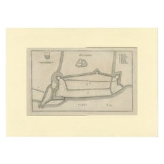
Antique Map of Stavoren by Blaeu, 1649
Located in Langweer, NL
Antique map titled 'Staveren'. Original antique map of the city of Stavoren, Friesland, The Netherlands. This map originates from 'Novum Ac Magnum Theatrum Urbium Belgicae Liberae Ac...
Category

Antique 17th Century Collectibles and Curiosities

Materials

Paper

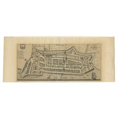
Antique Map of the Region of Saintonge by Janssonius, 1657
Located in Langweer, NL
Antique map 'La Saintonge vers le Midy avecq le Brovageais'. Decorative map of the Saintonge region, a former province of France located on the west central Atlantic coast. This map ...
Category

Antique 17th Century Collectibles and Curiosities

Materials

Paper

Antique Map of Sloten, IJlst, Workum & Hindeloopen by Blaeu, 1652
Located in Langweer, NL
Antique map titled: 'Sloten - Ylst - Worcum - Hinloopen.' - Three plans and a bird's eye view on one sheet. The plans show the Frisian cities Sloten, IJlst, Workum and the view shows...
Category

Antique 17th Century Collectibles and Curiosities

Materials

Paper

Antique Map of the Province of Kilan by Olearius '1662'
Located in Langweer, NL
Antique map titled 'A Map of ye Province of Kilan as it lies on ye Caspian Sea'. Rare map of the province of Kilan, near the Caspian Sea. Originates from 'The voyages and travells of the Ambassadors sent by Frederick Duke of Holstein, to the Great Duke of Muscovy, and the King of Persia...
Category

Antique 17th Century Collectibles and Curiosities

Materials

Paper

Antique Map of the Region of Guyenne by Janssonius, 1657
Located in Langweer, NL
Antique map of France titled 'Description du Guienne'. Decorative map of Guyenne region. Guyenne or Guienne was an old French province which corresponded roughly to the Roman provinc...
Category

Antique 17th Century Collectibles and Curiosities

Materials

Paper

Antique Map of Drenthe, a Province of The Netherlands, 1635
Located in Langweer, NL
Antique map titled 'Drentiae'. Original antique map of the province of Drenthe, the Netherlands. This map originates from 'Vyerige Colom verthonende de 17 Nederlandsche Provintien.',...
Category

Antique 17th Century Collectibles and Curiosities

Materials

Paper

Antique Map of the City of Leeuwarden by Guicciardini, 1613
Located in Langweer, NL
Antique map tited 'Lewardum'. Plan of the city of Leeuwarden, Friesland, the Netherlands. This map originates from the 1613 edition of 'Discrittione di tutti i Paesi Bassi', by L. Gu...
Category

Antique 17th Century Collectibles and Curiosities

Materials

Paper

Antique Map of Nova Zembla by Janssonius, c.1650
Located in Langweer, NL
Antique map titled 'Nova Zemla, waygats fretum Nassovi cum et terra Samoiedum singula omnium emendatissime descripta'. This map depicts Nova Zembla and the northern continental coast...
Category

Antique 17th Century Collectibles and Curiosities

Materials

Paper

Antique 17th Century Map of the Islands Near Ceylon or Sri Lanka, 1672
Located in Langweer, NL
Antique map titled 'Eyland Ceylon.' Map of the islands near Ceylon or Sri Lanka. Dutch text on verso. Source unknown, to be determined. Artists and Engravers: Philip Baldaeus (1632-...
Category

Antique 17th Century Collectibles and Curiosities

Materials

Paper

Antique Print of the University of Franeker by Winsemius, 1622
Located in Langweer, NL
Antique print titled 'De Academia van Vrieslant'. Original antique print of the university of Franeker, Friesland, the Netherlands. This print originates from volume 1 of 'Chroniqve ...
Category

Antique 17th Century Collectibles and Curiosities

Materials

Paper

Antique Map of the Rhine-Palatinate by Janssonius, circa 1630
Located in Langweer, NL
Antique map titled 'Nova Descriptio Palatinatus Rheni'. Detailed map of the Rhine-Palatinate, a state of Germany located in the west of the country. The map tracks the course of the ...
Category

Antique 17th Century Collectibles and Curiosities

Materials

Paper

Original Antique Map of the City of Stavoren, Friesland, The Netherlands, 1649
Located in Langweer, NL
Antique map titled 'Staveren'. Original antique map of the city of Stavoren, Friesland, The Netherlands. This map originates from 'Toonneel der Steden van de Vereenighde Nederlanden'...
Category

Antique 17th Century Collectibles and Curiosities

Materials

Paper

Antique Map of the Namur Region 'France' by F. de Wit, circa 1680
Located in Langweer, NL
Antique map titled 'Comitatus Namurci Tabula in Lucem Edita'. Large map of the Namur region, France. Published by F. de Wit, circa 1680.
Category

Antique 17th Century Collectibles and Curiosities

Materials

Paper

Nice Hand-Colored Plan by Blaeu of Bolsward in Friesland, the Netherlands, 1652
Located in Langweer, NL
Antique print, titled: 'Bolswaert' - (Town plan of Bolsward). Plan of Bolsward in Friesland, the Netherlands. A cartouche and two coats of arms. From the town atlas 'Toneel der S...
Category

Antique 17th Century Collectibles and Curiosities

Materials

Paper

Antique Map of the Region of Limoge by Janssonius, '1657'
Located in Langweer, NL
Antique map 'Totius Lemovici et consinium provinciaru quantum ad dioecesin Lemovicensen spectant'. Decorative map of the province of Limoge based on the important map of Antoin-Jean ...
Category

Antique 17th Century Collectibles and Curiosities

Materials

Paper

Old Print of Vishnu and the Fifth Incarnation, 1672
Located in Langweer, NL
Antique print, untitled. This original antique print shows Vishnu in his fifth incarnation or avatar. Dutch text on verso. From: 'Naauwkeurige Beschryvinge van Malabar en Choromandel...
Category

Antique 17th Century Collectibles and Curiosities

Materials

Paper

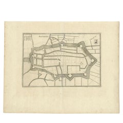
Antique Map of the City of Alkmaar by Priorato, 1673
Located in Langweer, NL
Antique map titled 'Alcmaer'. Original map of the city of Alkmaar, the Netherlands. This map originates from 'Teatro del Belgio', by G. Gualdo Priorato. Artists and Engravers: Author: Galeazzo Gualdo Priorato (1606-1678) entered military service at a very young age and served in Flanders under the Prince of Orange. After his retirement, he authored several historical accounts including the Teatro del Belgio, which described the Catholic/Protestant wars in Belgium and Netherlands during the seventeenth century. His superb plans do not show the internal layout of the cities, except for showing the locations of the major churches. Instead the emphasis is on the fortification, as well as on the surrounding site, rivers and canals...
Category

Antique 17th Century Collectibles and Curiosities

Materials

Paper

Antique Map of the Namur Region in France by Coronelli, c.1695
Located in Langweer, NL
Antique map titled 'Contado di Namur (..)'. Old map of the Namur region in central Belgium. Includes several coats of arms. Artists and Engravers: The remarkable Vincenzo Coronell...
Category

Antique 17th Century Collectibles and Curiosities

Materials

Paper

Antique Map of the City of Gorinchem by Merian, 1659
Located in Langweer, NL
Antique map titled 'Gorckum'. This print depicts the city of Gorinchem (or Gorcum/Gorkum, The Netherlands). This print originates from 'Topographia Germaniae Inferioris (..)' by C. M...
Category

Antique 17th Century Collectibles and Curiosities

Materials

Paper

Antique Map of Île de Ré and Île d'Oléron by Janssonius, 1657
Located in Langweer, NL
Antique map 'Insulae Divimartini et Vliarus vulgo l'isle de Re et Oleron'. Decorative map of Île de Ré and Île d'Oléron. This map originates from 'Atlas Novu...
Category

Antique 17th Century Collectibles and Curiosities

Materials

Paper

Antique Map of the City of Franeker by Blaeu, 1652
Located in Langweer, NL
Antique map titled 'Franekera'. Old map of the city of Franeker, Friesland. Also shows two cartouches, coats of arms and legend. This map originates from a Latin edition of the town ...
Category

Antique 17th Century Collectibles and Curiosities

Materials

Paper

Antique Map of the Region of Zevenwouden in Friesland, The Netherlands, 1635
Located in Langweer, NL
Antique map titled 'De Zeeven Wolden'. Map of the region of Zevenwouden (or Zevenwolden) in Friesland, the Netherlands. This region include the villages of Langweer, Echtenerbrug, Le...
Category

Antique 17th Century Collectibles and Curiosities

Materials

Paper

Antique Map of the Region of Ferwerderadeel in The Netherlands, 1664
Located in Langweer, NL
Antique map titled 'De Grietenye van Ferwerdera-Deel (..)'. Map of the Grietenij of Ferwerderadeel, Friesland, The Netherlands. Originates from "Beschrijvinge ende nieuwe caerten van...
Category

Antique 17th Century Collectibles and Curiosities

Materials

Paper

Antique Map of the Region of Kollumerland by Schotanus, 1664
Located in Langweer, NL
Antique map titled 'De Grietenije van Kollumer landt (..).' Map of the Grietenij of Kollumerland, Friesland, The Netherlands. Multiple cartouches, key and coat of arms. "Beschrijving...
Category

Antique 17th Century Collectibles and Curiosities

Materials

Paper

Antique Map of the Region of Beauce in France by Janssonius, c.1650
Located in Langweer, NL
Antique map of France titled 'La Beauce'. Decorative map of the region of Beauce, a natural region in northern France, located between the Seine and Loire ri...
Category

Antique 17th Century Collectibles and Curiosities

Materials

Paper

Antique Map of Southern Germany and Switzerland by Cluver, 1685
Located in Langweer, NL
"Antique map titled 'Vindeliciae et Norici conterminarunque terrarum antiqua descriptio.' Miniature map of south Germany and Switzerland in Celtic times, From the pocket atlas 'Intro...
Category

Antique 17th Century Collectibles and Curiosities

Materials

Paper

Antique Map of the Alsace Region of France by Janssonius, c.1650
Located in Langweer, NL
Antique map titled 'Utriusquae Alsatiae Superioris Ac Inferioris Nova Tabula'. Map of the Alsace region (France) including the Rhine from Phillipsburg to south of Basle. Two decorati...
Category

Antique 17th Century Collectibles and Curiosities

Materials

Paper

Antique Map of Overijssel by Visscher, c.1652
Located in Langweer, NL
Antique map titled 'Transisalania provincia vulgo Over-yssel'. Original antique map of the province of Overijssel, the Netherlands. Published by N. Visscher after N. ten Have, circa ...
Category

Antique 17th Century Collectibles and Curiosities

Materials

Paper

Antique Map of the Region of Dauphiné by Janssonius, 1657
Located in Langweer, NL
Antique map of France titled 'Nova et Accurata descriptio Delphinatus vulgo Dauphiné'. Decorative map of Dauphiné region in France. Originally a seperate province in southeastern Fra...
Category

Antique 17th Century Collectibles and Curiosities

Materials

Paper

Antique Map of Northern India and the Bengal Gulf by Mallet, 1686
Located in Langweer, NL
This is a fine example of 17th or early 18th-century cartography, showcasing Southeast Asia, including parts of India, China, and the Gulf of Bengal. The French-labeled map highlights early European understanding of the Orient during the Age of Exploration. Mounted in a soft cream matting board, the presentation enhances the map’s historical appeal while protecting its delicate condition. The map features detailed geographical elements such as rivers, coastal lines, and mountain ranges. Regions like Tartarie, the Presqu'Isle de l'Inde, and the Golfe de Bengala are illustrated with early cartographic precision. Subtle hand-coloring highlights borders and coastal areas, adding to its visual charm. In terms of condition, the map is well-preserved with clean paper with some waterdamage in the top, light toning, intact margins, and no visible tears or damage. The hand-coloring remains vibrant, reflecting careful handling over centuries. This map provides insight into the evolving European knowledge of Asia and would make a distinguished addition to any collection of antique maps or historical artifacts. Antique map titled "Partie Orientale de la Terre Ferme de l'Inde Moderne". Original antique map of the northern part of India and the Bengal Gulf. This map originates from Alain Manesson Mallet's 'Description de l 'Univers'. Artists and Engravers: Alain Manesson Mallet (1630?1706) was a French cartographer and engineer. He started his career as a soldier in the army of Louis XIV, became a Sergeant-Major in the artillery and an Inspector of Fortifications. He also served under the King of Portugal, before returning to France, and his appointment to the court of Louis XIV. His military engineering and mathematical background led to his position teaching mathematics at court. His major publications were Description de L'Univers (1683) in 5 volumes, and Les Travaux de Mars ou l'Art de la Guerre (1684) in 3 volumes. His Description de L'Universe contains a wide variety of information, including star maps...
Category

Antique 17th Century Collectibles and Curiosities

Materials

Paper

Rare Antique Map of the Region of Franekeradeel, The Netherlands 1664
Located in Langweer, NL
Antique map titled 'De Grietenije van Franeker deel (..)'. Map of the Grietenij of Franekeradeel, Friesland, The Netherlands. Multiple cartouches, key and coat of arms. Originates fr...
Category

Antique 17th Century Collectibles and Curiosities

Materials

Paper

Antique Map of the Region of Sedan and Doncheri in France by Janssonius, c.1650
Located in Langweer, NL
Antique map of France titled 'La Souveraineté de Sedan et de Raucourt, et la prevosté de Doncheri'. Lovely map centered on Sedan and Doncheri and the Meuze River from Charleville and...
Category

Antique 17th Century Collectibles and Curiosities

Materials

Paper

Antique Map of the Lower Alsace Region of France by Mapmaker Hondius, c.1630
Located in Langweer, NL
Antique map titled 'Alsatia Inferior'. Original antique map of the northern Alsace (Elzas) region of France. The map is centered on the course of the Rhine River, with Strasbourg at ...
Category

Antique 17th Century Collectibles and Curiosities

Materials

Paper

Italian 17th Century "Mannequin De Presentation"
Located in Atlanta, GA
A stunning 17th century "Mannequin De Presentation" from Northern Italy. Wonderfully constructed from polychromed wood with a very handsome face, articulating body and sulfur eyes. T...
Category

Italian Antique 17th Century Collectibles and Curiosities

Materials

Wood

Antique Map of the Region of Cologne and Liege by Scherer, 1699
Located in Langweer, NL
Antique map titled 'Archpiescopatus Coloniensis (..) Episcopatus Leodiensis (..).' Detailed uncommon map of the Archbishopric of Cologne and the Bishopric of Liege/Luik. Source unkno...
Category

Antique 17th Century Collectibles and Curiosities

Materials

Paper

Striking Antique Map of Luxembourg and Northern France 'Lotharingen', c.1680
Located in Langweer, NL
Description: Antique map titled 'Exactissima Lotharingia tam Regis Gallorum quam Ducis.' - Striking map of Luxembourg and Northern France. Includ...
Category

Antique 17th Century Collectibles and Curiosities

Materials

Paper

Antique Map of the Region of 'Île de France' by Janssonius, 1657
Located in Langweer, NL
Antique map of France titled 'Ager Parisiensis vulgo l'Isle de France'. Old map of Paris and adjacent regions. This map originates from 'Atlas Novus, ...
Category

Antique 17th Century Collectibles and Curiosities

Materials

Paper

Antique Map of the Region of Achtkarspelen by Schotanus, 1664
Located in Langweer, NL
Antique map titled 'De Grietenije van Achtkerspelen (..)'. Map of the Grietenij of Achtkarspelen, Friesland, The Netherlands. Multiple cartouches, key and coat of arms. Originates fr...
Category

Antique 17th Century Collectibles and Curiosities

Materials

Paper

Antique Map of the Region of Blois by Janssonius, c.1650
Located in Langweer, NL
Antique map titled 'Description du Blaisois'. Old map of the region of Blois, France. It shows the city of Blois, Amboise, the Loire River and more. Artists and Engravers: Johann...
Category

Antique 17th Century Collectibles and Curiosities

Materials

Paper

Antique Map of the Region of Perce and Blois by Janssonius, 1657
Located in Langweer, NL
Antique map of France titled 'Perchensis Comitatus - Comitatus Blesensis'. Decorative map of Perce region and the region of Blois. This map originates from 'Atlas Novus, Sive Theatru...
Category

Antique 17th Century Collectibles and Curiosities

Materials

Paper

Antique Map of Stavoren by Blaeu, 1649
Located in Langweer, NL
Antique map titled 'Staveren'. Original antique map of the city of Stavoren, Friesland, The Netherlands. This map originates from 'Toonneel der Steden van de Vereenighde Nederlanden'...
Category

Antique 17th Century Collectibles and Curiosities

Materials

Paper

Antique Map of the Moluccas in Indonesia by Janssonius, C.1650
Located in Langweer, NL
Antique map titled 'Insularum Moluccarum Nova Descriptio.' Old map of the Moluccas. The famous Spice Islands, the cornerstone of the Dutch trading ...
Category

Antique 17th Century Collectibles and Curiosities

Materials

Paper

Antique Map of the Region of Franekeradeel, Friesland, The Netherlands, 1664
Located in Langweer, NL
Antique map titled 'De Grietenije van Franeker deel (..)'. Map of the Grietenij of Franekeradeel, Friesland, The Netherlands. Multiple cartouches, key and coat of arms. Originates fr...
Category

Antique 17th Century Collectibles and Curiosities

Materials

Paper

Antique Map of the Province of Groningen by Blaeu, 1635
Located in Langweer, NL
Antique map titled 'Groninga Dominium.' A map of the Dutch province Groningen. This includes the Wadden islands Schiermonnikoog, Rottumeroog (Rottumerplaat) and Borkum. With compass ...
Category

Antique 17th Century Collectibles and Curiosities

Materials

Paper

Antique Map of Normandy by Janssonius, 1657
Located in Langweer, NL
Antique map of France titled 'Normandia Ducatus'. Decorative map of the Normandy region, including decorative cartouche, sailing ships and compass rose. This map originates from 'Atl...
Category

Antique 17th Century Collectibles and Curiosities

Materials

Paper

Antique Map of Surrey by Speed, 1676
Located in Langweer, NL
Antique map titled 'Surrey described and divided into hundreds'. Map of Surrey, England. Includes inset elevations of Richmond and Nonsuch Palaces. This map originates from 'Theatre ...
Category

Antique 17th Century Collectibles and Curiosities

Materials

Paper

Antique Map of the City of Enkhuizen by Merian, 1659
Located in Langweer, NL
Antique map titled 'Enckhuysen'. This print depicts the city of Enkhuizen, the Netherlands. This print originates from 'Topographia Germaniae Inferioris (..)' by C. Merian. Artists a...
Category

Antique 17th Century Collectibles and Curiosities

Materials

Paper

Antique Map of the City of Roermond by Guicciardini, 1613
Located in Langweer, NL
Antique map titled ‚Ruremunda Gelriae Opp‘. Plan of Roermond in the province of Limburg, The Netherlands, Holland. This map originates from the 1613 edition of 'Discrittione di tutti...
Category

Antique 17th Century Collectibles and Curiosities

Materials

Paper

Antique Map of the City of Zutphen by Guicciardini, 1612
Located in Langweer, NL
Antique map Zutphen titled 'Zutphen'. This map depicts the city of Zutphen, Gelderland, The Netherlands. Originates from 'Beschryvinghe van alle de Neder-landen anderssins ghenoemt N...
Category

Antique 17th Century Collectibles and Curiosities

Materials

Paper

Antique Map of the Region of Gaasterland, Friesland, The Netherlands, 1664
Located in Langweer, NL
Antique map titled 'De Grietenie van Gaesterlandt (..)'. Map of the region of Gaasterland in Friesland, the Netherlands. This region includes the villages of Balk, Sloten, Wyckel and...
Category

Antique 17th Century Collectibles and Curiosities

Materials

Paper

Antique Map of the Region of Dantumadeel, Friesland, The Netherlands, 1664
Located in Langweer, NL
Antique map titled 'De Grietenije van Dantuma deel (..)'. Map of the Grietenij of Dantumadeel, Friesland, The Netherlands. Multiple cartouches, key and coat of arms. Originates from ...
Category

Antique 17th Century Collectibles and Curiosities

Materials

Paper

Antique Map of the Region of Cambrai in France, c.1630
Located in Langweer, NL
Antique map titled 'l'Archevesche de Cambray'. Decorative map of the region of Cambrai, France. Includes the cities of Cambrai, Valencienes, Douai, and Bouchain. Artists and Engrav...
Category

Antique 17th Century Collectibles and Curiosities

Materials

Paper

Antique Map of the Region of Zevenwouden, Friesland, The Netherlands, 1660
Located in Langweer, NL
Antique map titled 'De Zeeven Wolden'. Map of the region of Zevenwouden (or Zevenwolden) in Friesland, the Netherlands. This region include the villages of Langweer, Echtenerbrug...
Category

Antique 17th Century Collectibles and Curiosities

Materials

Paper

Handcolored Rare Map of Leeuwarden, Capital of Friesland, The Netherlands, 1622
Located in Langweer, NL
Antique map titled 'Leeuwerden de Hooftstadt van Vrieslandt'. Rare and old map of the city of Leeuwarden, Friesland. Artists and Engravers: Published by Pieter Feddes van Harlingen...
Category

Antique 17th Century Collectibles and Curiosities

Materials

Paper

Extremele Rare, Original Miniature Map of Prussia, ca.1640
Located in Langweer, NL
Antique map titled 'Prussia'. Extremele rare, original miniature map of Prussia, a historically prominent German state that originated in 1525 with a du...
Category

Antique 17th Century Collectibles and Curiosities

Materials

Paper

Antique Map of Kuinderschans, Part of the Frisian Defense Line, Netherlands 1649
Located in Langweer, NL
Antique Dutch map titled 'Kuynder-Schans'. Old map of the 'Kuinderschans', a rampart to block passage over the Zuiderzeedijk and prevent an attack from the waterside. The buildin...
Category

Antique 17th Century Collectibles and Curiosities

Materials

Paper

Read More

Medal-Worthy Memorabilia from Epic Past Olympic Games

Get into the games! These items celebrate the events, athletes, host countries and sporting spirit.

Ahoy! You’ve Never Seen a Collection of Sailor Art and Kitsch Quite Like This

French trendsetter and serial collector Daniel Rozensztroch tells us about his obsession with objects related to seafaring men.

Pamela Shamshiri Shares the Secrets behind Her First-Ever Book and Its Effortlessly Cool Interiors

The sought-after designer worked with the team at Hoffman Creative to produce a monograph that beautifully showcases some of Studio Shamshiri's most inspiring projects.

Moroccan Artworks and Objects Take Center Stage in an Extraordinary Villa in Tangier

Italian writer and collector Umberto Pasti opens the doors to his remarkable cave of wonders in North Africa.

Montecito Has Drawn Royalty and Celebrities, and These Homes Are Proof of Its Allure

Hollywood A-listers, ex-pat aristocrats and art collectors and style setters of all stripes appreciate the allure of the coastal California hamlet — much on our minds after recent winter floods.

Whaam! Blam! Pow! — a New Book on Pop Art Packs a Punch

Publishing house Assouline and writer Julie Belcove have teamed up to trace the history of the genre, from Roy Lichtenstein, Andy Warhol and Yayoi Kusama to Mickalene Thomas and Jeff Koons.

The Sparkling Legacy of Tiffany & Co. Explained, One Jewel at a Time

A gorgeous new book celebrates — and memorializes — the iconic jeweler’s rich heritage.

What Makes a Gem-Encrusted Chess Set Worth $4 Million?

The world’s most opulent chess set, weighing in at 513 carats, is literally fit for a king and queen.

Recently Viewed

View All