18th Century and Earlier More Furniture and Collectibles

to
2,900
4,129
1,110
5,286
299
154
137
81
58
53
50
26
16
5
3
3
2
2
2
2
1
10,615
31,730
15,220
6,678
13,764
6,696
929
566
1,131
1,402
1,051
2,870
2,940
2,587
1,203
818
3,362
951
711
501
284
1,938
415
370
369
264
5,286
5,286
5,286
59
21
14
13
12
Period: 18th Century and Earlier
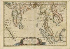
1654 Nicolas Sanson Map of Southern India and Southeast Asia
Located in Langweer, NL
1654 Nicolas Sanson Map of Southern India and Southeast Asia - Partie Meridionale de L'Inde This 1654 map by Nicolas Sanson, titled "Partie Meridionale de L'Inde en deux Presqu'Is...
Category

Antique 18th Century and Earlier More Furniture and Collectibles

Materials

Paper

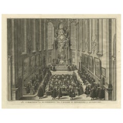
The Communion of the Lutherans in the Minorite Church in Augsburg, Germany, 1730
Located in Langweer, NL
Antique print, titled: 'La communion des Lutheriens dans l'Eglise des Minorites à Augsbourg' - This original antique print shows the Communion of the Lutherans in the Minorite Chu...
Category

Antique 18th Century and Earlier More Furniture and Collectibles

Materials

Paper

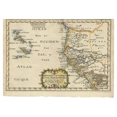
Antique Map of the West African Coast and the Cape Verde Islands, c.1680
Located in Langweer, NL
Antique map Africa titled 'Isles du Cap Verd Coste et Pays des Negres'. Antique map of the coast of Africa and the Cape Verde islands. Artists and...
Category

Antique 18th Century and Earlier More Furniture and Collectibles

Materials

Paper

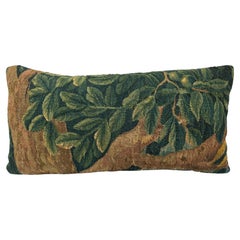
17th Century Woolen Brussels Tapestry Pillow
Located in Los Angeles, US
17th Century Woolen Brussels Tapestry Pillow
Category

Belgian Empire Antique 18th Century and Earlier More Furniture and Collectibles

Materials

Wool, Feathers

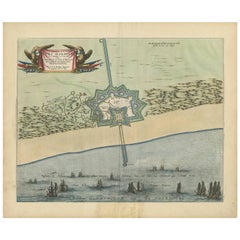
Antique Plan of Fort Mardyck Mardijk, France by S. Beaulieu, 1649
Located in Langweer, NL
Plan of Fort Mardyck (Fort Mardijk) and surroundings by Sébastian de Pontault Beaulieu. Mardyck is a former commune in the Nord department in northern France. It is an associated com...
Category

Antique 18th Century and Earlier More Furniture and Collectibles

Materials

Paper

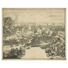
Rare Print of the Siege of Doornik Between the English and French Armies, c.1680
Located in Langweer, NL
Antique print of the Siege of Doornik (Tournai) in 1581, during the Eighty Years' War. This print most likely originates from an edition of 'Histoire de la guerre de Flandre' by F. S...
Category

Antique 18th Century and Earlier More Furniture and Collectibles

Materials

Paper

Cartographic Elegance of the Mughal Dominion in a Hand-Colored Antique Map, 1705
Located in Langweer, NL
This original antique map titled “'T Ryk van den Grooten Mogol” by Nicolas Sanson from 1705 is an interesting historical artifact. It depicts the extent of the Mughal Empire in North...
Category

Antique 18th Century and Earlier More Furniture and Collectibles

Materials

Paper

18th Century Giltwood and Polychrome Painted Putti / Cherub
Located in Hastings, GB
Hand carved winged Italian Baroque Putti, water gilded over applied gesso, the face and head polychrome painted. Small hanging hook to the back of the head. Width 23 cm x Height 1...
Category

Italian Baroque Antique 18th Century and Earlier More Furniture and Collectibles

Materials

Gesso, Wood

Antique Map of the City of Emden by Blaeu, 1649
Located in Langweer, NL
Antique map titled 'Emda'. Old map of the city of Emden, Germany. This map originates from 'Novum Ac Magnum Theatrum Urbium Belgicæ Liberæ ac Foederatæ' by J. Blaeu. Artists and Engr...
Category

Antique 18th Century and Earlier More Furniture and Collectibles

Materials

Paper

Antique Map of the Island of Tinos by Dapper, 1687
Located in Langweer, NL
Antique map titled 'Tino.' This original antique map shows the island of Tinos, Greece. Source unknown, to be determined. Artists and Engravers: Made by 'Olfert Dapper' after an a...
Category

Antique 18th Century and Earlier More Furniture and Collectibles

Materials

Paper

Spectacular Large Map of Upper and Lower Austria between Passau and Wien, c.1700
Located in Langweer, NL
Antique map titled 'Austriae Archiducatus pars superior in omnes ejusdem (..).' Spectacular large map of Upper and Lower Austria between Passau and Wien with figurative cartouche a...
Category

Antique 18th Century and Earlier More Furniture and Collectibles

Materials

Paper

Rare Stoneware Beer Jug From Raeren, Circa 1680–1720
Located in Bilzen, BE
A rare and fully handmade stoneware beer jug attributed to Raeren, a historic pottery center in present-day Belgium. Dating from around 1680 to 1720, this jug is a striking example o...
Category

Belgian Folk Art Antique 18th Century and Earlier More Furniture and Collectibles

Materials

Stoneware

Large Antique Map of New Guinea and New Britain Showing Capt. Cooks Tract, 1773
Located in Langweer, NL
Antique map titled 'A Chart of Captain Carteret's Discoveries at New Britain, with part of Captain Cooke's Passage thro Endeavour Streights, & of Captain Dampier's tract & discoverie...
Category

Antique 18th Century and Earlier More Furniture and Collectibles

Materials

Paper

Antique Map of the Koblentz Region by Moll, 1695
Located in Langweer, NL
Antique map Koblentz titled 'Coblentz'. Rare antique map of the Koblentz region in Germany. On verso, an antique map of the Mont Royal fortress, Germany. Originates from 'Thesaurus Geographicus. A New Body of Geography: or a Compleat Description of the Earth 'by H. Moll. Artists and Engravers: Herman Moll...
Category

Antique 18th Century and Earlier More Furniture and Collectibles

Materials

Paper

Antique Architectural Print of the Melville House in Fife, Scotland, 1725
Located in Langweer, NL
Antique print titled 'The Elevation of Melvin House in the Shire of Fyfe (..)'. Old engraving of Melville House in Fife, Scotland. This print originates from 'Vitruvius Britannic...
Category

Antique 18th Century and Earlier More Furniture and Collectibles

Materials

Paper

A Fine Italian Neoclassical Inlaid Fruitwood Stand
Located in Sheffield, MA
The rectangular top with inlays over a case with a single drawer and a tambour door all resting on four tapering legs.
Category

Italian Antique 18th Century and Earlier More Furniture and Collectibles

Antique Plan of Port-Vendres, Roussillon, France
Located in Langweer, NL
Antique map titled 'Plan de Port Vendre en Roussillon'. Original plan of Port-Vendres, Roussillon, France. This map originates from 'Le Petit Atlas Maritime (..)' by J.N. Bellin. Pub...
Category

Antique 18th Century and Earlier More Furniture and Collectibles

Materials

Paper

Imperial map of Northern Russia with Archangel, Lapland and Permia, c.1730
Located in Langweer, NL
Imperial map of Northern Russia with Archangel, Lapland, and Permia, c.1730 Description: This intricately engraved and hand-colored map presents the northern reaches of the Russian ...
Category

German Antique 18th Century and Earlier More Furniture and Collectibles

Materials

Paper

Early Woodcut Map of the Rhine River Region in Germany and Holland, circa 1628
Located in Langweer, NL
Early Woodcut Map of the Rhine River Region, "Die Dritte Tafel des Rheinstroms," ca. 16th Century This early woodcut map, titled "Die Dritte Tafel des Rheinstroms Innhaltend das Nid...
Category

Antique 18th Century and Earlier More Furniture and Collectibles

Materials

Paper

Antique Map of Italy by R. Bonne, circa 1780
Located in Langweer, NL
Beautiful map of Italy, Corsica, Sardinia and Sicily. Highly detailed, showing towns, rivers, some topographical features and political boundaries. Published by R. Bonne, circa 1780.
Category

French Antique 18th Century and Earlier More Furniture and Collectibles

Materials

Paper

Original Antique Engraving of A Jewish Priest, 1709
Located in Langweer, NL
Antique print titled 'La Representation du Grand Pontise'. Old print depicting a Jewish Priest. This print originates from 'Introduction à l'écriture sainte, où l'on traite tout ...
Category

Antique 18th Century and Earlier More Furniture and Collectibles

Materials

Paper

Rare Antique Map of Southwestern Europe and West Africa by V.M. Coronelli, 1692
Located in Langweer, NL
Antique Globe Gore: Southwestern Europe and West Africa by Vincenzo Coronelli This exquisite, hand-colored globe gore by Vincenzo Coronelli, one of the most renowned 17th-century cartographers, represents Southwestern Europe and West Africa. A segment of Coronelli's monumental 42-inch terrestrial globe, this gore is a remarkable example of the artistry and geographical knowledge of the late 1600s. Covering France, the Iberian Peninsula, and all of Africa west of a line extending from Algeria to the Bight of Benin, it also includes the Canary Islands and Madeira. Coronelli’s globe gores are celebrated for their exceptional engraving and accuracy, and this piece is no exception. The coastline of Africa is depicted with remarkable precision for its time, reflecting the latest geographical knowledge of European explorers. In contrast, the interior of Africa—still a mystery to European mapmakers—features mythical elements such as fantastical mountain ranges and exotic fauna. Giraffes, elephants, lions, and mysterious giant birds populate the landscape, offering a glimpse into the imagination and curiosity of the era. One notable detail is the Gambia...
Category

Antique 18th Century and Earlier More Furniture and Collectibles

Materials

Paper

Old Decorative Map of the West African Coast & St. Thomae Island, c.1600
Located in Langweer, NL
Antique map titled 'Guineae Nova Descriptio.' This very decorative map shows the West African coast from Senegal (the 'Rio Senega' is the Senegal River) to Cape Lopez on the Gulf...
Category

Antique 18th Century and Earlier More Furniture and Collectibles

Materials

Paper

17th Century Oushak Pillow
Located in Los Angeles, US
dd a touch of timeless charm to your space with this one-of-a-kind decorative pillow made from a fragment of an authentic 17th century Oushak rug. Handwoven in Anatolia, this antique...
Category

Turkish Oushak Antique 18th Century and Earlier More Furniture and Collectibles

Materials

Wool, Cotton

Scarce Middle East and Arabia Map Showing The Exodus of the Israelites, 1725
Located in Langweer, NL
Antique map titled 'Kaarte van de reize en togten der Israeliten in de woestyne, sedert der zelver uytgang uyt Egypten, tot den overtogt over de Jordaane.' Scarce map of the Middle East and Arbabia. It shows the exodus...
Category

Antique 18th Century and Earlier More Furniture and Collectibles

Materials

Paper

Antique Engraving of the Story of Jephthah’s Daughter, 1728
Located in Langweer, NL
Antique religion print titled 'Jephthah's daughter meets him at the door of his house'. The story of Jephthah’s Daughter (Judges 11) tells us that Jephthah the Gileadite made a vow to the Lord before going into battle with the Ammonites. This print originates from 'Figures de la Bible'. Artists and Engravers: Published by P. de Hondt. Illustrated by Gerard Hoet...
Category

Antique 18th Century and Earlier More Furniture and Collectibles

Materials

Paper

Detailed 18th-Century Map of Paris and Its Surrounding Regions by Johann Homann
Located in Langweer, NL
This map, titled “Agri Parisiensis Tabula particularis,” was created and published by the German cartographer Johann Baptist Homann (1664–1724), or his workshop, in Nuremberg. Homann...
Category

Antique 18th Century and Earlier More Furniture and Collectibles

Materials

Paper

Juan Fernandez Island Map – Antique Chilean Chart circa 1750
Located in Langweer, NL
Antique map titled 'Plan de la Côte du N.E. de l 'Ile de Juan Fernandes'. Map of the northeast coast of the island of Juan Fernandez with Cumberland Bay, South America. In 1740 Ans...
Category

Antique 18th Century and Earlier More Furniture and Collectibles

Materials

Paper

Antique Map of the Bay of Manila, Capital of the Philippines
Located in Langweer, NL
Antique map titled 'Abzeichnung des Meerbusens bey Manila'. Map of the Bay of Manila, capital of the Philippines. This map originates from a German edition of 'Voyage around the World...
Category

Antique 18th Century and Earlier More Furniture and Collectibles

Materials

Paper

Antique Map of the Coast of Southern Brazil by Bellin, c.1755
Located in Langweer, NL
Antique map titled ‘Suite de Bresil’. Map of the coast of southern Brazil, with Lagoa Mirim, and Uruguay (here named as Paraguay). This print originates from 'Histoire générale des V...
Category

Antique 18th Century and Earlier More Furniture and Collectibles

Materials

Paper

Antique Map of Southern India by Chatelain, c.1720
Located in Langweer, NL
"Antique map titled 'Carte Nouvelle des Terres de Cucan, de Canara, de Malabar, de Madura, et de Coromandel'. Map of the southern portion of India, originating from Chatelain's 'Atla...
Category

Antique 18th Century and Earlier More Furniture and Collectibles

Materials

Paper

Map of Styria by William Blaeu, 1645: A Masterpiece of 17th-Century Cartography
Located in Langweer, NL
This 1645 map, created by Willem Janszoon Blaeu, represents Styria (Steyrmark), a historical region in present-day Austria, located in the Alpine regions. Blaeu, one of the most sign...
Category

Antique 18th Century and Earlier More Furniture and Collectibles

Materials

Paper

Old Detailed Map of the Historical Regions of the Duchy of Saxony, Germany, 1680
Located in Langweer, NL
Antique map titled 'Circuli Saxoniae Superior Pars Meridionalis in qua sunt Ducatus Saxoniae, Comitatus Mansfeldiae, et Voitlandiae, Landgraviat Thuringiae, Marchionatus Misniae Prin...
Category

Antique 18th Century and Earlier More Furniture and Collectibles

Materials

Paper

"Green Frog Service" - Book about an Imperial Russian Dinner Service
Located in North Yorkshire, GB
This is number 111 from the limited edition of 1,000 copies. The first 25 are special leather bound copies, a further 25 were for collaborators on the publication, the next 350 were reserved for subscribers and 650 were for general sale. Therefore we know that this was one of the subscribers copies. With green cloth covers in a green slipcase with an embossed frog motif to the front. 424 pages with over 350 large detailed illustrations, 60 color plates and more than 1000 reference illustrations. This magnificent dinner and dessert service was the crowning achievement of the great English potter Josiah Wedgwood who made it between 1773-1774 as a commission from the Empress Catherine...
Category

Antique 18th Century and Earlier More Furniture and Collectibles

Materials

Paper

Map of Japanese Coast from Osaka to Tokyo & the Kyushu and Shikoku Islands, 1669
Located in Langweer, NL
Antique map titled 'De Land Reyse van Osacca to Iedo. De Water eyse van Nangasacqui tot Osacca.' Two maps on one sheet. The top map shows the Japanese coast from Osaka to Tokyo (Jedo). The lower map shows the strait between mainland Japan and the two large islands...
Category

Antique 18th Century and Earlier More Furniture and Collectibles

Materials

Paper

Antique Map of the Gulf of Cambay, Gujarat, India, 1725
Located in Langweer, NL
Antique map titled 'Le Golfe de Cambaye at la Rade de Suratt.' (The gulf of Cambay and the coast of Surat, India.) The Gulf of Khambhat, formerly known as the Gulf of Cambay, is an i...
Category

Antique 18th Century and Earlier More Furniture and Collectibles

Materials

Paper

Antique Print of a Design for a Bridge across the Thames, London, England, 1725
Located in Langweer, NL
Antique print titled 'This new Design for a Bridge over the River Thames at London (..)'. Print of the design for a new bridge across the Thames at Westminster. This print originates...
Category

Antique 18th Century and Earlier More Furniture and Collectibles

Materials

Paper

Spectacular View of the Siege of Jerusalem by King Nebuchadnezzar, ca.1730
Located in Langweer, NL
Antique print titled 'Belegering van Jerusalem door Nebucadnezar (..)'. This original antique print shows the siege of Jerusalem by King Nebucha...
Category

Antique 18th Century and Earlier More Furniture and Collectibles

Materials

Paper

Decorative Hand-Coloured Antique Map of the Four Irish Provinces, Ireland, c1718
Located in Langweer, NL
Title: Regni Hiberniae Accurata Tabula per Hermanum Moll Decorative map of the four Irish provinces, Ireland, 1718, by Christoph Weigel (with credit to Herman Moll), engraved by Mi...
Category

Antique 18th Century and Earlier More Furniture and Collectibles

Materials

Paper

Antique Map of the Sunda Islands Including Sumatra, Java, and Borneo, 1705
Located in Langweer, NL
Title: “Antique Map of the Sunda Islands Including Sumatra, Java, and Borneo” This print is a beautifully detailed and relatively rare map of Western Indonesia, encompassing the reg...
Category

Antique 18th Century and Earlier More Furniture and Collectibles

Materials

Paper

Map of South America 1792 by Elwe – Hand-Colored Antique Dutch Engraving
Located in Langweer, NL
Map of South America 1792 by Elwe – Hand-Colored Antique Dutch Engraving This striking antique map of South America, titled "L'Amerique Meridionale," was published in 1792 by the Du...
Category

European Antique 18th Century and Earlier More Furniture and Collectibles

Materials

Paper

Antique Miniature Map of Java by Bertius/Hondius '1618'
Located in Langweer, NL
Rare antique miniature map titled 'Iava Maior'. This map shows the northern coastline of Java (Indonesia) with numerous place names, but the southern coa...
Category

Antique 18th Century and Earlier More Furniture and Collectibles

Materials

Paper

Map of Queen Charlotte's, Carteret's, Simson's and Gower's Islands, Canada, 1773
Located in Langweer, NL
Antique map Canada titled 'Queen Charlotte's Islands'. Old map of Queen Charlotte's Islands, Canada. With an inset map of Carteret's, Simson's a...
Category

Antique 18th Century and Earlier More Furniture and Collectibles

Materials

Paper

Old Print of an Indian Nobleman and Noblewoman in a Sedan Chair, 1782
Located in Langweer, NL
Untitled print of an Indian nobleman and noblewoman in a sedan chair. This print originates from: 'Voyage aux Indes Orientales et a la Chine (..)', by Pierre Sonnerat, published in Paris in 1782. Artists and Engravers: Pierre M. Sonnerat (1745-1814) was a French naturalist...
Category

Antique 18th Century and Earlier More Furniture and Collectibles

Materials

Paper

Decorative Antique Map of the Quercy Region in France, 1657
Located in Langweer, NL
Antique map of France titled 'Quercy olim Cadurcium'. Decorative map of the Quercy region. Quercy is a former province of France located in the country's southwest, bounded on th...
Category

Antique 18th Century and Earlier More Furniture and Collectibles

Materials

Paper

Woodcut Map of the Rhine River Region Covering the Palatinate, Austria and Elsa
Located in Langweer, NL
Early Woodcut Map of the Rhine River Region Covering the Palatinate, Austria, and Elsass, ca. 1628 This early woodcut map, titled "Die ander Tafel des Rheinstromes/begriffen die Pfa...
Category

Antique 18th Century and Earlier More Furniture and Collectibles

Materials

Paper

Map of Languedoc by Willem Blaeu, Antique French Copper Engraving 1635
Located in Langweer, NL
Map of Languedoc by Willem Blaeu, Antique French Copper Engraving 1635 This fine antique map titled "Langvedoc" depicts the historical province of Languedoc in southern France and w...
Category

Antique 18th Century and Earlier More Furniture and Collectibles

Materials

Paper

Map of Brittany and Western France by Gerard Valk, circa 1690
Located in Langweer, NL
Map of Brittany and Western France by Gerard Valk, circa 1700 This finely detailed antique map, titled *Praefectura Ducatus Britanniae, Quae Superior et Inferior*, was created aroun...
Category

Dutch Antique 18th Century and Earlier More Furniture and Collectibles

Materials

Paper

Antique Map of Piedmont, Savoy and Liguria by Justus Danckerts, Amsterdam c.1690
Located in Langweer, NL
Map of Piedmont, Savoy and Liguria by Justus Danckerts, Amsterdam c.1690 This richly detailed and decorative map, titled *Tabula Generalis Ducatus Sabaudiae Principatus Pedemontii C...
Category

Antique 18th Century and Earlier More Furniture and Collectibles

Materials

Paper

17th Century Antique Brussels Tapestry Pillow
Located in Los Angeles, US
17th Century Antique Brussels Tapestry Pillow
Category

Unknown Empire Antique 18th Century and Earlier More Furniture and Collectibles

Materials

Wool, Cotton

Antique Print of the Main Facade of Castle Hill, Dorsetshire, England c.1770
Located in Langweer, NL
Antique print titled 'Principal Front of Castle Hill in Dorsetshire (..)'. Lambert's Castle Hill (258 metres, 846 feet high) rises between the villages...
Category

Antique 18th Century and Earlier More Furniture and Collectibles

Materials

Paper

Original Antique Map of Tartary 'Northern China & Far Eastern Russia', 1757
Located in Langweer, NL
Antique map titled 'Carte de la Tartarie Orientale (..)'. Original antique map of what is present day northern China and far eastern Russia. Centere...
Category

Antique 18th Century and Earlier More Furniture and Collectibles

Materials

Paper

Antique Print of Gibraltar Showing the Spanish and English Fleet, 1782
Located in Langweer, NL
Antique print titled 'Perspective View of Gibraltar. With the the Disposition of the Spanish Attack, and Relief of the Garrison by the English Fleet under the command of Admiral Darby, 12 April 1781'. View of the island clearly showing the fortifications, during a bombardment, with the Spanish encampments on the left wing of the bay and a few Spanish ships...
Category

Antique 18th Century and Earlier More Furniture and Collectibles

Materials

Paper

Very Rare Wind Vane Dial in the Manner of Whitehurst
Located in Lincolnshire, GB
A George III period carved mahogany wind vane dial. The silvered engraved dial with all the points of a compass housed in the finely carved mahogany frame, ...
Category

English Antique 18th Century and Earlier More Furniture and Collectibles

Materials

Glass, Mahogany

Antique Map of the Philippines, Taiwan and Surroundings by Bonne '1780'
Located in Langweer, NL
Antique map titled 'Les Isles Philippines, celle de Formose, le Sud de la Chine, les Royaumes de Tunkin, de Cochinchine, de Cambode, de Siam des Laos, avec partie de Pegu et D'Ava'. ...
Category

Antique 18th Century and Earlier More Furniture and Collectibles

Materials

Paper

1606 Hand-Colored Woodcut Map of Sumatra from Ramusio’s Delle Navigationi
Located in Langweer, NL
This is a fascinating woodcut map titled Taprobana, depicting the island of Sumatra, hand-colored, and published in Venice in 1606. The map originates from Giovanni Battista Ramusio’...
Category

Italian Antique 18th Century and Earlier More Furniture and Collectibles

Materials

Paper

Antique Print of a Greece Island, Most Likely Gavdopoula South of Crete, 1688
Located in Langweer, NL
Description: Untitled print of one of the islands of Greece, most likely Gavdopoula (located south of Crete). Gavdopoula is an islet located north-west of its larger neighbour, G...
Category

Antique 18th Century and Earlier More Furniture and Collectibles

Materials

Paper

Antique Map of the Region of Languedoc, Foix, Roussillon and Rouergue by Zatta
By Antonio Zatta
Located in Langweer, NL
Antique map titled 'Li Governi di Linguadoca, di Foix e di Rossiglione con il Rouergue'. Old map of France showing the regions of Languedoc, Foix, Roussillon and Rouergue. This map o...
Category

Antique 18th Century and Earlier More Furniture and Collectibles

Materials

Paper

Antique Map of Africa with Original Hand Coloring
Located in Langweer, NL
Antique map titled 'Kaart van Afrika door den Heer d'Anville'. Detailed original old map of Africa, with very small inset map titled 'Vlaamsche Eilanden', which shows the Azores. Pub...
Category

Antique 18th Century and Earlier More Furniture and Collectibles

Materials

Paper

Religious Antique Engraving of the Various Ways of Crucifixion, 1731
Located in Langweer, NL
Description: Three religious images on one sheet titled 'Verscheide Manieren van Kruysigen'. Various methods of crucifixion. This print depicts religious punishments and originates...
Category

Antique 18th Century and Earlier More Furniture and Collectibles

Materials

Paper

Read More

Medal-Worthy Memorabilia from Epic Past Olympic Games

Get into the games! These items celebrate the events, athletes, host countries and sporting spirit.

Ahoy! You’ve Never Seen a Collection of Sailor Art and Kitsch Quite Like This

French trendsetter and serial collector Daniel Rozensztroch tells us about his obsession with objects related to seafaring men.

39 Incredible Swimming Pools

It's hard to resist the allure of a beautiful pool. So, go ahead and daydream about whiling away your summer in paradise.

Pamela Shamshiri Shares the Secrets behind Her First-Ever Book and Its Effortlessly Cool Interiors

The sought-after designer worked with the team at Hoffman Creative to produce a monograph that beautifully showcases some of Studio Shamshiri's most inspiring projects.

Moroccan Artworks and Objects Take Center Stage in an Extraordinary Villa in Tangier

Italian writer and collector Umberto Pasti opens the doors to his remarkable cave of wonders in North Africa.

Montecito Has Drawn Royalty and Celebrities, and These Homes Are Proof of Its Allure

Hollywood A-listers, ex-pat aristocrats and art collectors and style setters of all stripes appreciate the allure of the coastal California hamlet — much on our minds after recent winter floods.

Whaam! Blam! Pow! — a New Book on Pop Art Packs a Punch

Publishing house Assouline and writer Julie Belcove have teamed up to trace the history of the genre, from Roy Lichtenstein, Andy Warhol and Yayoi Kusama to Mickalene Thomas and Jeff Koons.

What Makes a Gem-Encrusted Chess Set Worth $4 Million?

The world’s most opulent chess set, weighing in at 513 carats, is literally fit for a king and queen.
Recently Viewed

View All