Late 18th Century More Furniture and Collectibles

to
342
509
203
723
67
36
33
18
13
8
4
3
2
2
1
1
1
5,296
10,472
31,565
15,222
6,666
13,666
6,664
931
570
1,132
1,396
1,046
2,848
2,913
2,553
1,213
815
389
234
132
54
46
377
122
107
97
68
723
723
723
3
2
1
1
1
Period: Late 18th Century
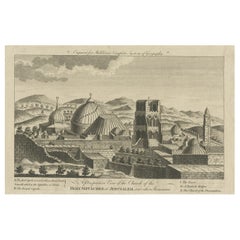
Antique View of the Holy Sepulchre Church in Jerusalem, Ca.1778
Located in Langweer, NL
Description: Antique print titled 'A perspective View of the Church of the Holy Sepulchre at Jerusalem and other Structures'. A view of the Holy Sep...
Category

Antique Late 18th Century More Furniture and Collectibles

Materials

Paper

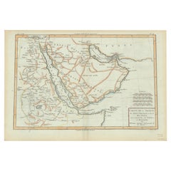
Old Map of the Arabian Peninsula with Parts of Egypt, Sudan, Eritrea & Ethiopia
Located in Langweer, NL
"Carte de l'Arabie, du Golfe Persique, et de la Mer Rouge, avec l'Egypte, la Nubie et l'Abissinie", Bonne, Rigobert Subject: Arabia Period: 1780 (circa) Publication: Atlas de Toutes...
Category

Antique Late 18th Century More Furniture and Collectibles

Materials

Paper

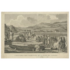
Old Engraving of French Visiting Tomari, a Village in Far East Russia, 1797
Located in Langweer, NL
Plate: 'Costumes des Habitants de la Baie de Langle.' (Costumes of the inhabitants of Langle Bay, Russia). Tomari (Russian: ??????) is a coastal town and the administrative cente...
Category

Antique Late 18th Century More Furniture and Collectibles

Materials

Paper

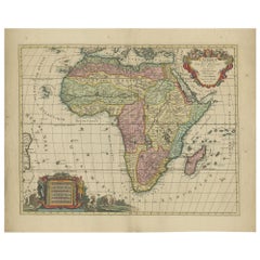
Original Hand-Colored Antique Map of Africa by Elwe '1792'
Located in Langweer, NL
Antique map titled 'l'Afrique Divisée en ses Empires, Royaumes, et Etats'. Decorative large map of Africa. The cartography is typical for the 17th century with the Nile originating i...
Category

Antique Late 18th Century More Furniture and Collectibles

Materials

Paper

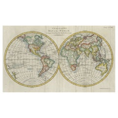
Interesting Original Antique Hemisphere Map Showing the Latest Discoveries
Located in Langweer, NL
Antique world map titled 'A Map of the World from the best Authorities'. Detailed map of the World, showing tracks of Captain James Cook in his 3 voyages in great detail. The map is ...
Category

Antique Late 18th Century More Furniture and Collectibles

Materials

Paper

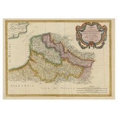
Decorative Map of the French Regions of Picardy, Artois & French Flanders, c1780
Located in Langweer, NL
Antique map titled 'Carte des Gouvernements de Flandre Francoise, d'Artois, de Picardie et du Boulenois.' An attractive example of Rigobert Bonne's 1771 decorative map of the Fre...
Category

Antique Late 18th Century More Furniture and Collectibles

Materials

Paper

Occasus Ortus: An Astronomical Measuring Device for Angular Precision, c.1780
Located in Langweer, NL
This print, titled "Occasus Ortus", showcases a highly detailed engraving of an 18th-century measuring device, likely related to astronomy or navigation. The design features various components of the instrument arranged systematically, with each part labeled by figure numbers. The centerpiece is a large circular protractor...
Category

European Antique Late 18th Century More Furniture and Collectibles

Materials

Paper

Antique Somerset Map, Thomas Kitchin, English, Cartographic Reference, Georgian
Located in Hele, Devon, GB
This is a fine antique Somerset map. An 18th century English cartographic county reference engraving by Thomas Kitchin (1718–1784), dating to the Georgian period, circa 1780. A beaut...
Category

British Georgian Antique Late 18th Century More Furniture and Collectibles

Materials

Glass, Paper

"Green Frog Service" - Book about an Imperial Russian Dinner Service
Located in North Yorkshire, GB
This is number 111 from the limited edition of 1,000 copies. The first 25 are special leather bound copies, a further 25 were for collaborators on the publication, the next 350 were reserved for subscribers and 650 were for general sale. Therefore we know that this was one of the subscribers copies. With green cloth covers in a green slipcase with an embossed frog motif to the front. 424 pages with over 350 large detailed illustrations, 60 color plates and more than 1000 reference illustrations. This magnificent dinner and dessert service was the crowning achievement of the great English potter Josiah Wedgwood who made it between 1773-1774 as a commission from the Empress Catherine...
Category

Antique Late 18th Century More Furniture and Collectibles

Materials

Paper

Antique Map of the Malacca and Bangka Strait by De Mannevillette '1775'
Located in Langweer, NL
Antique map titled 'Carte de la Partie Comprise entre la Sortie du Detroit de Malac Le Detroit de Banca et L’Isle Borneo'. Chart of the Strait of Malacca and Bangka Strait. It shows ...
Category

Antique Late 18th Century More Furniture and Collectibles

Materials

Paper

Antique Map of the Russian Empire by R. Bonne, 1780
Located in Langweer, NL
Antique map titled 'Carte de l'Empire de Russie.' Drawn by R. Bonne for G. Raynal’s Atlas de Toutes les Parties Connues du Globe Terrestre, Dressé pour l'Histoire Philosophique et Po...
Category

French Antique Late 18th Century More Furniture and Collectibles

Materials

Paper

Old Map of the Kingdom of Tonga, Also Known as the Friendly Islands, ca.1780
Located in Langweer, NL
Antique print, titled: 'Carte des Isles des Amis.' Map of the Kingdom of Tonga, also known as the Friendly Islands, and one of the last hereditary monarchies. Cook named this gro...
Category

Antique Late 18th Century More Furniture and Collectibles

Materials

Paper

View of the Exchange and the Warehouses at Petersburg in Russia, ca.1790
Located in Langweer, NL
Description: antique print titled 'A view of the Exchange and the Warehouses at Petersburg in Russia / Vüe de la Bourse & du Magazin de Marchandises a Petersburg Russe'. Beautiful engraving of the Stock and Warehouses of St. Petersburg, Russia. Artists and Engravers: Robert Sayer...
Category

Antique Late 18th Century More Furniture and Collectibles

Materials

Paper

Engraving Print from the Panckoucke Encyclopédie Nautical Subject 1782-1832
Located in Milan, IT
Print by engraving on copper plate from the Panckoucke Encyclopédie méthodique, end of the 18th century, volume Marine Planches (more than 1,500 figures dealing with all subjects on ...
Category

French Antique Late 18th Century More Furniture and Collectibles

Materials

Paper

Admiral Viscount Bridport’s Gold and Hardstone Armorial Swivel Fob Seal
Located in Lymington, Hampshire
The openwork gold pendent mount supports a three sided faceted quartz, each side seal engraved respectively with the crest of Hood within the motto ‘Tria Juncta in Uno for the Order ...
Category

English Antique Late 18th Century More Furniture and Collectibles

Materials

Quartz, Gold

Pair French Miniature Portraits Of Commander Jean-baptiste Raymond De Lacrosse
Located in Bilzen, BE
A Pair of Napoleonic Portrait Miniatures Commander of Jean-Baptiste Raymond de Lacrosse Jean-Baptiste Raymond de Lacrosse (1760-1829) Career Joined the French Navy in the 1780sPartic...
Category

French Empire Antique Late 18th Century More Furniture and Collectibles

Materials

Wood

Europe Divided into Principal States by Jean Denis Janvier, Paris, 1782
Located in Langweer, NL
This is a historical map of Europe titled "L'Europe divisee en ses Principaux Etats," created by Jean Denis Janvier in 1782. This beautiful map depicts the political boundaries and...
Category

Antique Late 18th Century More Furniture and Collectibles

Materials

Paper

18th Century French Carved Giltwood & Polychrome "Mother and Child" with Base
Located in Dallas, TX
Place this beautiful gilt statue with base in a living room or bedroom. Hand carved circa 1780, this elegant two-piece antique sculpture was found in a chapel in Southern France and ...
Category

French Baroque Antique Late 18th Century More Furniture and Collectibles

Materials

Giltwood

Decorative Map of the Empire of China, Korea, Japan, Taiwan, Lucon, Macau, 1780
Located in Langweer, NL
Antique map titled 'Carte de L'Empire de la Chine.' Decorative map of the Empire of China, depicting China, Corea ( Korea ), Japan, Tonquin and the Philippine island Lucon. Source unknown, to be determined. Artists and Engravers: Rigobert Bonne (1727-1795 ) was one of the most important cartographers of the late 18th century. In 1773 he succeeded Jacques Bellin as Royal Cartographer to France in the office of the Hydrographer at the Depôt de la Marine. Working in his official capacity Bonne compiled some of the most detailed and accurate maps of the period. Bonne's work represents an important step in the evolution of the cartographic ideology away from the decorative work of the 17th and early 18th century towards a more detail oriented and practical aesthetic. With regard to the rendering of terrain Bonne maps...
Category

Antique Late 18th Century More Furniture and Collectibles

Materials

Paper

Early Chart Identifying British Spice Trading Colony of Bencoolen, Sumatra, 1797
Located in Langweer, NL
Antique map titled 'A Chart of the West Coast of Sumatra'. Early nautical chart identifying the British spice trading colony of Bencoolen and F...
Category

Antique Late 18th Century More Furniture and Collectibles

Materials

Paper

Scarce Antique Map of the Island of Java, Indonesia
Located in Langweer, NL
Title: "Kaart van 't Eyland Groot Java: Antique Map of Java, Indonesia" Description: This antique map, titled "Kaart van 't Eyland Groot Java," offers a rare and valuable depiction ...
Category

Antique Late 18th Century More Furniture and Collectibles

Materials

Paper

18th Century German Pewter Passover Plate
Located in New York, NY
Pewter passover tray, Germany, 18th century. The outer rim has wriggle- work engraving of the order of the Seder service, along with a pair of birds fl...
Category

German Antique Late 18th Century More Furniture and Collectibles

Materials

Pewter

Map of Europe Highlighting Ancient and Modern Geographical Divisions (1794)
Located in Langweer, NL
Map of Europe Highlighting Ancient and Modern Geographical Divisions (1794). Germany, France, Italy, Spain, and the British Isles – Map by D’Anville (1794). This detailed 18th-cent...
Category

Antique Late 18th Century More Furniture and Collectibles

Materials

Paper

Antique Map of the Santa Cruz Islands with Inset of Carteret and Gower Islands
Located in Langweer, NL
Antique map titled 'Isles de la Reine Charlotte (..)'. A detailed chart of the Santa Cruz islands, to the north of the New Hebrides, with Carteret's track in "Swallow"; including an ...
Category

Antique Late 18th Century More Furniture and Collectibles

Materials

Paper

Impressive Decorative Engraved Map of the Red Sea and Arabian Peninsula, 1787
Located in Langweer, NL
This map, titled "Karte des arabischen Meerbusens oder des Rothen Meeres," is an original engraving from 1787 created by F. A. Schraembl, based on the cartographic work of d'Anville. It is a partially colored copper engraving. Key features and notable details of the map include: 1. The title is prominently displayed within a large, ornate cartouche, enhancing the aesthetic appeal and indicating the map's subject as the Red Sea (Rothen Meeres). 2. The map covers the Red Sea and its surrounding regions, including significant portions of the Arabian Peninsula and northeastern Africa. 3. There are two detailed inset maps: - The first inset map shows the roadstead of the port of Suez (Rheede des Hafen von Sues). - The second inset map depicts Bahr el Kolsum, the northwestern arm of the Red Sea, based on a map by De la Rochette from 1785. 4. Geographical Features: The map meticulously details the coastline, islands, and notable port cities along the Red Sea. The cartography highlights both natural and man-made features, with elevations and mountains represented through hachures. 5. Condition and Preservation: The map has a horizontal centerfold and is partially backed to prevent tears. The edges of the map sheet show minor holes, tears, and faint brown spots, yet it remains in overall good condition considering its age. 6. Historical Importance: This map is a valuable historical document, reflecting the cartographic knowledge of the late 18th century. It serves as a significant piece for collectors interested in antique maps, particularly those focusing on the Arabian Peninsula and maritime navigation in the Red Sea region. The map shows the coastline of the Red Sea and the Arabian Peninsula, detailing regions and places along the western coast of Saudi Arabia and Yemen, as well as the eastern coast of Egypt and Sudan. Here are some of the most important places identified on the map: 1. Jeddah (Gedda): A major city and port on the western coast of Saudi Arabia, significant for its role as a gateway for pilgrims traveling to Mecca. 2. Mecca (Mekka): A holy city in Islam, located inland from the Red Sea, important for being the site of pilgrimage (Hajj) for Muslims. 3. Medina (Medina): Another important Islamic city, known for the Prophet's Mosque and being a key pilgrimage site. 4. Suez (Suess): Located at the northern end of the Red Sea, near the Suez Canal, it's a crucial link between the Mediterranean Sea and the Red Sea. 5. Aden: A port city in Yemen, located at the southern tip of the Arabian Peninsula, historically significant as a trading hub. 6. Mocha (Mokka): A port city in Yemen, historically known for being a major marketplace for coffee. 7. Sana'a: The capital city of Yemen, noted for its historical and cultural significance. 8. Bab el Mandeb: The strait connecting the Red Sea to the Gulf of Aden, crucial for maritime navigation. These locations are critical due to their historical, religious, and economic significance, especially in terms of trade routes and pilgrimage sites. The map also illustrates the mountainous terrain and coastal features of the region. The condition and preservation status, which, despite minor imperfections, is considered well-preserved for its age. Overall, this map is a rare and valuable artifact, offering both historical insights and aesthetic appeal for collectors and enthusiasts of antique cartography.
Category

Antique Late 18th Century More Furniture and Collectibles

Materials

Paper

18th Century French Religious Fer a Hosties Eucharist Host Iron Waffle Press
Located in Forney, TX
A scarce antique, circa 1765, French fer a hosties (cast iron host press / host mold). Exquisitely hand forged in France in the 18th century, showcasing the blacksmith's high qual...
Category

French Medieval Antique Late 18th Century More Furniture and Collectibles

Materials

Iron

Georgian 18th Century Childs High Chair
Located in Bedfordshire, GB
A Charming Late 18th Century Georgian, Mahogany, Hepplewhite Period Childs High Chairs, Having Camel Back With Elegant Pierced Splat, Scrolling Arms, Removable Safety Bar And Adjustable Foot Rest Over Detachable Mahogany Table Stand Raised On Square Legs. This remarkable little 18th century childs high chair, which also doubles as a childs chair and table...
Category

English Hepplewhite Antique Late 18th Century More Furniture and Collectibles

Materials

Mahogany

Original Antique Engraved Map of the Russian Empire, 1778
Located in Langweer, NL
Description: Antique map titled 'A New and Correct Map of the Russian Empire'. Original antique map of the Russian Empire. This map originates from Moore's 'New and Complete Coll...
Category

Antique Late 18th Century More Furniture and Collectibles

Materials

Paper

Rare Map of the Philippines; Joseph Freewills Island & Mindanao South End, 1773
Located in Langweer, NL
Three charts on one sheet titled '1) A Dangerous Shoal 2) Joseph Freewills Island 3) The South End of Mindanao'. It shows Captain Carteret's voyage: Saint George's Channel to Min...
Category

Antique Late 18th Century More Furniture and Collectibles

Materials

Paper

18th Century Georgian Mahogany Bottle Holder on Stand
Located in Long Island City, NY
The bottle holder with a carrying handle. The stand on turned and fluted legs.
Category

Irish George III Antique Late 18th Century More Furniture and Collectibles

Materials

Mahogany

Antique Map of Lower Saxony by Clouet, 1787
Located in Langweer, NL
Antique map titled 'Basse Saxe'. Antique map of Lower Saxony, Germany. Originates from 'Geographie moderne avec une introduction' by J.B.L. Clouet.
Category

Antique Late 18th Century More Furniture and Collectibles

Materials

Paper

Antique Map of Africa with Mountain Ranges and other details
Located in Langweer, NL
Antique map titled 'Carte générale et Politique de l'Afrique'. Original antique map of Africa. Highlights numerous mountain ranges, lakes and rivers, regions, countries and places. P...
Category

Antique Late 18th Century More Furniture and Collectibles

Materials

Paper

Very Rare Wind Vane Dial in the Manner of Whitehurst
Located in Lincolnshire, GB
A George III period carved mahogany wind vane dial. The silvered engraved dial with all the points of a compass housed in the finely carved mahogany frame, ...
Category

English Antique Late 18th Century More Furniture and Collectibles

Materials

Glass, Mahogany

Old Map of the East Indonesian Islands Borneo, Celebes, New Guinea, Bali, 1792
Located in Langweer, NL
Antique map titled 'Partie de la Nouvelle Grande Carte des Indes Orientales, contenant les Isles de Borneo, Iava, Celebes, Mindanao (..)'. Detailed map of the Indonesian islands ...
Category

Antique Late 18th Century More Furniture and Collectibles

Materials

Paper

Original Antique Map of England and Wales, with Decorative Cartouche
Located in Langweer, NL
Antique map titled 'England and Wales from the best Authorities'. Original antique map of England and Wales, with decorative cartouche. Engraved by T. Conder. Published circa 1790.
Category

Antique Late 18th Century More Furniture and Collectibles

Materials

Paper

Decorative Map of Hanover, Lower Saxony by Lodge, ca. 1785
Located in Langweer, NL
Title: Decorative Map of Hanover, Lower Saxony by Lodge, ca. 1785 This decorative map, titled "A New & Correct Plan of Hanover, a City in the circle of Lower Saxony," was engraved b...
Category

Antique Late 18th Century More Furniture and Collectibles

Materials

Paper

Antique Map of Spain and Portugal by Tardieu, circa 1795
Located in Langweer, NL
The image is an antique map titled "Hispanie Betique et Lusitanie", which depicts the Iberian Peninsula during the Roman times, highlighting the provinces of Hispania Baetica (Betiqu...
Category

Antique Late 18th Century More Furniture and Collectibles

Materials

Paper

Map of Constantinople, Bosphorus, the Coasts of Greece and the Archipelago, 1785
Located in Langweer, NL
This is a large 1785 map titled "Carte de la Ville de Constantinople et du Bosphore de Thrace", which includes detailed maps of Constantinople (modern-day Is...
Category

Antique Late 18th Century More Furniture and Collectibles

Materials

Paper

Tibetan Leather Painted Trunk
Located in Austin, TX
A charming Tibetan painted leather storage trunk, 18th century, Tibet. Of smaller size, the softwood construction of the trunk covered by a richly tanned yak leather. The central p...
Category

Tibetan Tibetan Antique Late 18th Century More Furniture and Collectibles

Materials

Wrought Iron

18th Century Map of Upper Guinea: Kingdoms and Coastal Regions of West Africa
Located in Langweer, NL
This is an antique map depicting the coastal regions of West Africa, specifically the Gulf of Guinea and surrounding areas, including parts of what is now Senegal, Guinea, Sierra Leo...
Category

Antique Late 18th Century More Furniture and Collectibles

Materials

Paper

Circa 1800, Antique French Hand Carved Nutwood Putti Sculpture
Located in Lisse, NL
Lovely putti sculpture in typical Baroque Style. This beautiful and chubby putto sculpture was probably part of a larger Church ornament / sculpture o...
Category

French Baroque Antique Late 18th Century More Furniture and Collectibles

Materials

Nutwood

Antique Map of the Gaspar Strait by Huddart, '1788'
Located in Langweer, NL
Antique map titled 'Sketch of the Straits of Gaspar'. Detailed sea chart of the Gaspar Strait, showing part of the Island of Banca on the east coast of Sumatra just to the south of S...
Category

Antique Late 18th Century More Furniture and Collectibles

Materials

Paper

Two Engravings of an Florida King of the Indians in America, 1722
Located in Langweer, NL
Antique print titled 'Ceremonie, observée par un des Rois de la Floride (..)'. Two images on one sheet. 1. A ceremony that takes place before they set...
Category

Antique Late 18th Century More Furniture and Collectibles

Materials

Paper

Original Antique Plan of the Fortress of Charedsch in Persia or Iran, ca.1780
Located in Langweer, NL
Antique map, titled: 'Plan de la Citadelle de la Ville de Charedsch.' Plan of the fortress of Charedsch, Iran / Persia. This original antique print originates from 'Reize naar Ar...
Category

Antique Late 18th Century More Furniture and Collectibles

Materials

Paper

Antique Map of the World with Polar Projections by Keizer & de Lat, 1788
Located in Langweer, NL
Antique map titled 'Schuine Ronde Aard-Klooten (..)'. Interesting double hemisphere world map with polar projections. In North America, there is a...
Category

Antique Late 18th Century More Furniture and Collectibles

Materials

Paper

Late 18th Century Brass or Copper Bed Warmers with Wood Handles
Located in Savannah, GA
Late 18th century brass or copper bed warmers with great patina wood handles. They are great for hanging on the wall or next to a fireplace. Measure...
Category

English Antique Late 18th Century More Furniture and Collectibles

Materials

Brass, Copper

Antique Town Plan Map, Poole, English, Framed Cartography, Georgian, Circa 1780
Located in Hele, Devon, GB
This is an antique town plan map of Poole in Dorset. An English, framed atlas engraving, dating to the 18th century and later. Fascinating cartography with annotated streets and pl...
Category

British George III Antique Late 18th Century More Furniture and Collectibles

Materials

Glass, Wood, Paper

Uncommon Old Map of Lapland to Russia and Denmark to Kazan in the South, 1785
Located in Langweer, NL
Description: Antique map titled 'Kaart van het Noorderdeel van Europa, Bevattende Deenmarken, Noorwegen, Zweden, Lapland en het Grootste Gedeelte van Europeesch Rusland.' This un...
Category

Antique Late 18th Century More Furniture and Collectibles

Materials

Paper

Decorative Antique Map of Central Asia
Located in Langweer, NL
Antique map titled 'Carte de la Tartarie Indépendante (..)'. Decorative map of Central Asia (Tartary). Covers from the Black Sea south to China, north to Russia, and south to Persia ...
Category

Antique Late 18th Century More Furniture and Collectibles

Materials

Paper

Antique Map of of Bengal and the mouth of the Ganges River
Located in Langweer, NL
Antique map titled 'Carte du Bengale, avec la partie Septentrionale (..)'. Original antique map of Bengal and the mouth of the Ganges river. This map ori...
Category

Antique Late 18th Century More Furniture and Collectibles

Materials

Paper

Antique Plan of the City of Damietta Egypt by C. Niebuhr, 1774
Located in Langweer, NL
Antique print titled 'Grundris der Stadt Damiât'. This print originates from 'Reisebeschreibung nach Arabien und andern umliegenden Ländern' by C. Niebuhr, 1774.
Category

Antique Late 18th Century More Furniture and Collectibles

Materials

Paper

Finely Rendered English Victorian Brass Ornamental Cannon on Cast Iron Carriage
Located in San Francisco, CA
A finely rendered English Victorian brass ornamental signal cannon on cast iron carriage; with solid brass tilting barrel resting on a heavy weight carriage with working wheels; fine...
Category

English Victorian Antique Late 18th Century More Furniture and Collectibles

Rare Antique Map of the Dutch East Indies 'Indonesia', 1774
Located in Langweer, NL
Rare decorative engraved map of the Dutch East Indies, or nowadays Indonesia. Title (in old Dutch): NIEUWE EN NAUKEURIGE KAART DER OOST-INDISCHE ...
Category

Antique Late 18th Century More Furniture and Collectibles

Materials

Paper

Antique Engraved Map of the Friendly Islands or Tonga, ca.1785
Located in Langweer, NL
Antique map titled 'Carte des Isles des Amis'. Map of the Friendly Islands / Tonga. The Tongan people first encountered Europeans in 1616 when the Dutch vessel Eendracht, captain...
Category

Antique Late 18th Century More Furniture and Collectibles

Materials

Paper

Alnmått (Cubit measure) in Birch with a Noble Crown. Gustavian, dated 1783
Located in Knivsta, SE
Rare Alnmått (Cubit measure) made in Birch with a Noble Crown. From the Gustavian period of the late 1700s, roughly corresponding to the Louis XVI period in France, made in Sweden an...
Category

Swedish Gustavian Antique Late 18th Century More Furniture and Collectibles

Materials

Brass

Antique Map of Asia by Dussy, 1778
Located in Langweer, NL
Antique map of Asia titled 'Indostan presqu'isles de l'Inde, Chine, Tartarie Independante'. Depicting South-East Asia including Hindustan, India an...
Category

French Antique Late 18th Century More Furniture and Collectibles

Materials

Paper

Gerusalemme Liberata by Torquato Tasso – Elegant French 18th C "pocket" edition
Located in Middletown, NY
Paris: Prault, 1768 2 vols, 12mo, 5 3/8 x 3 1/8 inches (136 x 80 mm). Vol. 1: front. title, 2nd frontispiece, iii, 326; Vol. 2: title, 333 pp. Text in Italian. Frontispiece by Godefr...
Category

French Antique Late 18th Century More Furniture and Collectibles

Materials

Gold Leaf

Antique Map of the Northern Hemisphere, 1782
Located in Langweer, NL
Antique map titled 'Hémisphère Septentrional pour voir plus distinctement les Terres Arctiques (..)'. Map of the Northern Hemisphere, originall...
Category

Antique Late 18th Century More Furniture and Collectibles

Materials

Paper

Antique Map of the West Coast of America with Island Views, ca.1784
Located in Langweer, NL
Antique print titled 'Views on the West Coast of America (..)'. Coastal views of various islands of the American coast. Originates from an edition of Cook's Voyages. Artists ...
Category

Antique Late 18th Century More Furniture and Collectibles

Materials

Paper

Antique Map of the course of the Don & Voga rivers
Located in Langweer, NL
Antique map titled 'Chart of the Course of The Don & the Volga through the Region of The Kosaks'. SW Russia & Ukraine: interesting map showing the course of th...
Category

Antique Late 18th Century More Furniture and Collectibles

Materials

Paper

Read More

Medal-Worthy Memorabilia from Epic Past Olympic Games

Get into the games! These items celebrate the events, athletes, host countries and sporting spirit.

Ahoy! You’ve Never Seen a Collection of Sailor Art and Kitsch Quite Like This

French trendsetter and serial collector Daniel Rozensztroch tells us about his obsession with objects related to seafaring men.

39 Incredible Swimming Pools

It's hard to resist the allure of a beautiful pool. So, go ahead and daydream about whiling away your summer in paradise.

Pamela Shamshiri Shares the Secrets behind Her First-Ever Book and Its Effortlessly Cool Interiors

The sought-after designer worked with the team at Hoffman Creative to produce a monograph that beautifully showcases some of Studio Shamshiri's most inspiring projects.

Moroccan Artworks and Objects Take Center Stage in an Extraordinary Villa in Tangier

Italian writer and collector Umberto Pasti opens the doors to his remarkable cave of wonders in North Africa.

Montecito Has Drawn Royalty and Celebrities, and These Homes Are Proof of Its Allure

Hollywood A-listers, ex-pat aristocrats and art collectors and style setters of all stripes appreciate the allure of the coastal California hamlet — much on our minds after recent winter floods.

Whaam! Blam! Pow! — a New Book on Pop Art Packs a Punch

Publishing house Assouline and writer Julie Belcove have teamed up to trace the history of the genre, from Roy Lichtenstein, Andy Warhol and Yayoi Kusama to Mickalene Thomas and Jeff Koons.

The Sparkling Legacy of Tiffany & Co. Explained, One Jewel at a Time

A gorgeous new book celebrates — and memorializes — the iconic jeweler’s rich heritage.
Recently Viewed

View All