Late 18th Century More Furniture and Collectibles

to
342
509
203
723
67
36
33
18
13
8
4
3
2
2
1
1
1
5,296
10,472
31,565
15,222
6,666
13,666
6,664
931
570
1,132
1,396
1,046
2,848
2,913
2,553
1,213
815
389
234
132
54
46
377
122
107
97
68
723
723
723
3
2
1
1
1
Period: Late 18th Century
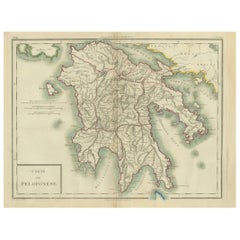
Antique Map of Peloponnesus, Greece by Pierre Antoine Tardieu, 1797
Located in Langweer, NL
This antique map, titled "Carte Ancienne d'Allemagne," represents ancient Germany and surrounding regions. It was published by the well-known Parisian mapmakers and publishers Jean-Baptiste-Louis Clouet and Alexandre Aimé Vuillemin in the late 18th century, specifically in 1787. The map covers the extensive geographical area of ancient Germany, highlighting various tribes and regions known at the time. Key features include: 1. **Geographical Boundaries**: The map outlines the territorial extents of ancient Germany, bordered by Gallia (France) to the west, Sarmatia (parts of Eastern Europe) to the east, and the Italian regions to the south. The northern boundary reaches the Oceanus Germanicus (North Sea) and the Sarmatian Sea (Baltic Sea). 2. **Tribal Regions**: It details numerous ancient Germanic...
Category

Antique Late 18th Century More Furniture and Collectibles

Materials

Paper

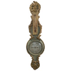
18th Century French Louis XVI Giltwood Barometer
Located in Sheffield, MA
A stunningly beautiful 18th century French gold gilt barometer is a weather instrument with mercury-filled glass thermometer still in working order...
Category

French Louis XVI Antique Late 18th Century More Furniture and Collectibles

Materials

Wood

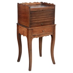
18th Century Louis XV Style Side Table, or Nightstand
Located in Winter Park, FL
A late 18th Century Louis XV style Country French table de chevet, or bedside table, made of solid walnut and oak with a tambour door and a small dovetailed drawer. Scalloped apron a...
Category

French Louis XV Antique Late 18th Century More Furniture and Collectibles

Materials

Walnut, Oak

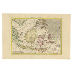
Antique Map of the East Indies by Bonne '1776'
Located in Langweer, NL
Antique map titled 'Indes IVe Feuille'. Very decorative original antique map of the East Indies. Covbers from the Gulf of Siam (Gulf of Thailand) and Malacca (Malaysia) eastward to i...
Category

Antique Late 18th Century More Furniture and Collectibles

Materials

Paper

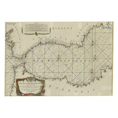
Large Decorative Antique Map of the Mediterranean, ca.1770
Located in Langweer, NL
Antique map titled 'Carte de la Mer Mediterranee en Douze Feuilles'. First map out of twelve fine engraved double-page and folding maps that join to create a large wall map...
Category

Antique Late 18th Century More Furniture and Collectibles

Materials

Paper

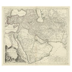
Detailed Original Antique Map of the Turkish Empire with Arabia, 1778
Located in Langweer, NL
Title: Etats Due Grand-Seigneur En Asie, Empire De Perse, Pays Des Usbecs, Arabie et Egypte . . . 1753 Detailed map of the Turkish Empire, extending to the Black Sea, Georgia, the...
Category

Antique Late 18th Century More Furniture and Collectibles

Materials

Paper

Large Antique Map of the Kingdom of France
Located in Langweer, NL
Antique map titled 'The Kingdom of France (..)'. Large antique map of the Kingdom of France. Engraved by T. Kitchin. Published J. Blair, circa 1779.
Category

Antique Late 18th Century More Furniture and Collectibles

Materials

Paper

Rosewood and Oak French Convertible Music Stand by N. Grevenich, circa 1780
Located in Milano, IT
Nicolas Grevenich Convertible music stand France, last quarter 18th century. Bois de rose and oak Measures: H 26.77 in; when open H max 44.09 in Top: 16.14 in x 12.79 in; when open...
Category

French Neoclassical Antique Late 18th Century More Furniture and Collectibles

Materials

Oak, Rosewood

Antique Optical View of The Coronation Ceremony of The Emperor of China, ca.1770
Located in Langweer, NL
Antique print China titled 'Vue perspective de la grande Ceremonie du couronnement de l'Empereur de la Chine'. Optical view of the coronation c...
Category

Antique Late 18th Century More Furniture and Collectibles

Materials

Paper

Original Antique Map of England and Wales
Located in Langweer, NL
Antique map titled 'A New and Correct Map of England and Wales from the Latest and Best Improvements'. Original antique map of England and Wales. Printed by Alex Hogg, London for George Henry Millar's 'New, Complete and Universal System...
Category

Antique Late 18th Century More Furniture and Collectibles

Materials

Paper

The Valley of Inspruck: An 18th-Century Engraved Perspective, 1792
Located in Langweer, NL
Title: "The Valley of Inspruck: An 18th-Century Engraved Perspective" This elegant original antique engraving, titled "The Valley of Inspruck," showcases a serene view of the Innsbruck Valley. The artwork is delicately rendered, capturing the grandeur of the mountains and the pastoral tranquility of the valley. The print depicts a detailed landscape scene, replete with towering craggy peaks that loom over a peaceful settlement nestled in the valley. A striking feature is the contrast between the ruggedness of the natural environment and the cultivated lands and architecture, indicating a harmonious coexistence of humanity with nature. It was published as directed on January 1, 1792, by T & G Egerton of Whitehall for the author. Albanis Beaumont is credited with the original design ('Del.' for delineavit, indicating he drew the initial illustration), and Cornelis Apostool is noted for the engraving work ('Sculp.' for sculpsit, indicating he engraved the image). The publication of this print during the late 18th century aligns with a time when there was a heightened interest in natural beauty and the picturesque, reflected in the art and literature of the Romantic period. This print would have appealed to those with an appreciation for both the aesthetic and the sublime qualities of the European landscape. The publication by T & G Egerton, a reputable firm known for their work in the arts, and the involvement of a skilled artist and engraver like Beaumont and Apostool, respectively, underline the quality and desirability of the print. It is a piece that would attract collectors of fine engravings and admirers of European landscapes, offering a window into the aesthetic values and artistic endeavors of the late 18th century. As a historical piece, this print offers a view into the past, inviting contemplation of the rich cultural and natural heritage of the Innsbruck area. It is a valuable collectible for enthusiasts of antique maps and prints...
Category

Antique Late 18th Century More Furniture and Collectibles

Materials

Paper

Large Antique Map of the German Empire
Located in Langweer, NL
Antique map titled 'A Map of Germany (..)'. Large antique map of the German Empire, highly detailed. Engraved by T. Kitchin. Published J. Blair, cir...
Category

Antique Late 18th Century More Furniture and Collectibles

Materials

Paper

Large Original Antique Folding Map of Manchester, England, Dated 1793
Located in St Annes, Lancashire
Superb map of Manchester and Salford Folding map. Printed on paper laid on to the original canvas Unframed. Published by C. Laurent, 1793. Free shippi...
Category

English Georgian Antique Late 18th Century More Furniture and Collectibles

Materials

Canvas, Paper

Antique Folding London Map, English, Cartography, Historic, Georgian, Dated 1783
Located in Hele, Devon, GB
This is an antique folding London map. An English, paper on linen cartographical study of the London metropolis and the surrounding area, published in the mid Georgian period, dated ...
Category

British Georgian Antique Late 18th Century More Furniture and Collectibles

Materials

Linen, Paper

Pair of Yellow Velvet Appliqued Pillows by Melissa Levinson
Located in Los Angeles, CA
A pair of yellow velvet pillows with 18th century metallic gold and silk urn applique and tricolor silk tassel fringe detail. Linen backs, down in...
Category

French Other Antique Late 18th Century More Furniture and Collectibles

Materials

Linen, Velvet

Historical Map of Ancient Germany (1787): Tribes and Territories by Mentele
Located in Langweer, NL
This antique map, titled "Carte Ancienne d'Allemagne," represents ancient Germany and surrounding regions. It was published by the well-known Parisian mapmakers and publishers Jean-Baptiste-Louis Clouet and Alexandre Aimé Vuillemin in the late 18th century, specifically in 1787. The map covers the extensive geographical area of ancient Germany, highlighting various tribes and regions known at the time. Key features include: 1. **Geographical Boundaries**: The map outlines the territorial extents of ancient Germany, bordered by Gallia (France) to the west, Sarmatia (parts of Eastern Europe) to the east, and the Italian regions to the south. The northern boundary reaches the Oceanus Germanicus (North Sea) and the Sarmatian Sea (Baltic Sea). 2. **Tribal Regions**: It details numerous ancient Germanic...
Category

Antique Late 18th Century More Furniture and Collectibles

Materials

Paper

The Pennsylvania Journal and The Weekly Advertiser, Issued June 16, 1787
Located in Colorado Springs, CO
Presented is an June 16, 1787 issue of Philadelphia's "The Pennsylvania Journal, and The Weekly Advertiser," containing coverage of the Constitutional Convention. The magazine period...
Category

American Federal Antique Late 18th Century More Furniture and Collectibles

Materials

Leather, Fabric, Paper

Map & Views of the Cape Verde Islands, in the Atlantic Ocean, West-Africa, 1775
Located in Langweer, NL
Various maps and views on one plate titled 'Praya Bay (..)', 'The Cape Verd Islands (..)' and 'A view of Praya Bay (..)'. Map and views of the Cape Verde islands, in the Atlantic Ocean west of Africa. Printed from two copper plates, published for Robert Sayer...
Category

Antique Late 18th Century More Furniture and Collectibles

Materials

Paper

Italian Bleached Walnut Nightstand / Chest of Drawers, 18th Century
Located in Carmine, TX
Small, yet insanely heavy, nightstand hand-made in Italy in the late 1700s using walnut. The little chest has beautiful proportions making it perfect for either a nightstand, a side ...
Category

Italian Baroque Antique Late 18th Century More Furniture and Collectibles

Materials

Walnut

Engraving Print from the Panckoucke Encyclopédie Nautical Subject, 1782-1832
Located in Milan, IT
Print by engraving on copper plate from the Panckoucke Encyclopédie méthodique, end of the 18th century, volume Marine Planches (more than 1,500 figures dealing with all subjects on the marina: planes, construction, carpentry, tree trunks, armaments of maneuvers, ropes, sails, artillery, ship maneuvers and combat tactics). This is the plate no. n. 26, pag. 70 fig. 350-353; with frame cm 38.3 x 31.5. Ship ropes are depicted. The Print has the "Benard direxit...
Category

French Antique Late 18th Century More Furniture and Collectibles

Materials

Paper

Jonathan Dickenson, God's Protecting Providence, Cannibals of Florida, 1790
Located in Hillsborough, NJ
"inhuman Cannibals of Florida" AUTHOR: DICKENSON, Jonathan. TITLE: God's Protecting Providence, Man's Surest Help and Defence, in Times of Greatest Difficulty, and most eminent Danger, evidenced in the remarkable Deliverance of Robert Barrow,.. & the cruel devouring Jaws of the inhuman Cannibals of Florida. PUBLISHER: London: by James Phillips, 1790. DESCRIPTION: SEVENTH EDITION. 1 vol., 136pp., 12mo., 6-3/8" x 4-3/16", bound in 1/2 brown morocco, gilt decorated spine, blind stamp to front blank endleaf of "D Hicks & Co. Book Binders...
Category

British Antique Late 18th Century More Furniture and Collectibles

Materials

Leather

Original Antique Map of Africa with large decorative cartouche
Located in Langweer, NL
Original antique map titled 'L'Afrique divisée en ses principaux États'. Attractive and precise map of Africa, with large decorative cartouche. Engraved by Janvier. Published by Dela...
Category

Antique Late 18th Century More Furniture and Collectibles

Materials

Paper

Charting the Course of Empire: Bonne's 1770 Masterpiece Maps of the Indian Ocean
Located in Langweer, NL
A voyage through history with an exquisite collection of Rigobert Bonne's 1770 maps, as featured in the coveted Atlas Moderne circa 1770. Each map, a cartographic treasure, captures ...
Category

Antique Late 18th Century More Furniture and Collectibles

Materials

Paper

Detailed Antique Map of Santa Domingo, Puerto Rico, Eastern Bahamas, ca. 1780
Located in Langweer, NL
Description: Antique map titled 'L'Isle De St. Domingue, et celle De Porto-Rico.' Detailed map of Santa Domingo, Puerto Rico, etc. Includes substanti...
Category

Antique Late 18th Century More Furniture and Collectibles

Materials

Paper

Antique Grand Tour Italy Miniature Landscape Monuments Campagna Embroidery
Located in Munich, DE
This is a rare embroidered Grand Tour souvenir of an italian landscape with archutectural motifs. This beautiful miniature embroidery is in good...
Category

English George III Antique Late 18th Century More Furniture and Collectibles

Materials

Cotton, Oak

Antique Map of Italy, Corsica, Sardinia and Sicily, ca.1780
Located in Langweer, NL
Description: Antique map titled 'L'Italie.' Map of Italy, Corsica, Sardinia and Sicily. Highly detailed, showing towns, rivers, some topographical features and political boundari...
Category

Antique Late 18th Century More Furniture and Collectibles

Materials

Paper

Original Antique Map of the Virgin Islands with Insets of Caribbean Isles, 1787
Located in Langweer, NL
Antique map titled 'Supplément pour les Isles Antilles (..)'. Original old map of the Virgin Islands, with insets of Barbuda, St. Kits, Antigua, Dominica, St. Lucia, Barbados, St. Vi...
Category

Antique Late 18th Century More Furniture and Collectibles

Materials

Paper

Martinique Island in the Caribbean by Bellin Original Original Antique Map, 1780
Located in Langweer, NL
This mid-18th century map, "Carte de l'Isle de la Martinique pour servir a l'historie generale des voyages," was issued in 1780 by M. Bellin in Paris. It presents a detailed and visually captivating depiction of the Island of Martinique within the context of the Caribbean and the Lesser Antilles. **Title:** Carte de l'Isle de la Martinique pour servir a l'historie generale des voyages **Issuer:** M. Bellin **Date:** 1780 **Location Coverage:** North America, Caribbean, Martinique, Lesser Antilles This engraved map is notable for its pleasing aesthetics, featuring lovely hand coloring that enhances its visual appeal. The inclusion of a scroll cartouche, an ornamental frame, and measurement lines adds a distinctive and visually appealing quality to the map. Martinique, situated within the Lesser Antilles in the Caribbean, is presented with meticulous detail, showcasing geographical features, coastlines, settlements, and other notable landmarks. Bellin, known for his accuracy in cartography, crafted this map to serve as a geographical reference within the broader context of historical voyages and exploration. The combination of detailed cartographic information and artistic embellishments, such as hand coloring and decorative elements, makes this map not only a valuable geographical document but also a visually pleasing piece of cartographic art...
Category

Antique Late 18th Century More Furniture and Collectibles

Materials

Paper

Original Antique Map of Asia
Located in Langweer, NL
Antique map titled 'l'Asie'. Original antique map of Asia. Engraved by André after Bonne. Published circa 1780.
Category

Antique Late 18th Century More Furniture and Collectibles

Materials

Paper

Original Antique Map of Asia
$277 Sale Price
20% Off
Antique Hand-Colored Map of France by J.B. Elwe, 1792
Located in Langweer, NL
Antique map titled 'Carte Nouvelle du Royaume de France'. Beautiful antique map of France, including the Southern part of England. Decorated with cartouche and 12 coats of arms.  
Category

Antique Late 18th Century More Furniture and Collectibles

Materials

Paper

Antique County Map, Rutlandshire, Framed Atlas Cartography, John Cary, Georgian
Located in Hele, Devon, GB
This is an antique county map of Rutlandshire. An English, framed atlas engraving of cartographic interest, dating to the Georgian period and later, circa 1790. Superb cartography ...
Category

British Georgian Antique Late 18th Century More Furniture and Collectibles

Materials

Glass, Wood, Paper

Copper Engraving Showing the Neptune Fountain of Versailles, Paris, France, 1785
Located in Langweer, NL
Antique print titled 'Plan de la décoration du Bassin de Neptune à Versailles'. Copper engraving showing parts of the Neptune fountain of Versaill...
Category

Antique Late 18th Century More Furniture and Collectibles

Materials

Paper

Antique Map of the Coast of Guinea and the Cape Verde Islands
Located in Langweer, NL
Antique map titled 'Carte de la Guinée (..)'. This map was originally part of a 2 sheet larger map of Eastern Africa, showing the Cape Verde Islands and Senegal. This map originates ...
Category

Antique Late 18th Century More Furniture and Collectibles

Materials

Paper

Antique Map of India and Ceylon, along with the Maldives
Located in Langweer, NL
Antique map titled 'Stato del Mogol con l'Isole di Ceilan e Maldive'. Beautiful map of India and Ceylon, along with the Maldives. Includes a large decorative title cartouche. The map...
Category

Antique Late 18th Century More Furniture and Collectibles

Materials

Paper

Antique Map of Bonthain Bay, Sulawesi, Celebes
Located in Langweer, NL
Antique map titled 'Vue de la Baye de Bonthain (..)'. Map of the island Sulawesi (Celebes), Indonesia that Philip Carteret rested his crew and made repairs to his ship the Swallow fo...
Category

Antique Late 18th Century More Furniture and Collectibles

Materials

Paper

1797 Tardieu Map of Southeast Asia: The Malay Archipelago and Beyond
Located in Langweer, NL
An original historical map titled 'Presqu' Île Au Dela Du Gange et Archipel De L'Inde', created by Pierre Francois Tardieu and published in the "Atlas Universel" by Pierre Grégoire C...
Category

Antique Late 18th Century More Furniture and Collectibles

Materials

Paper

Antique Map of the Arabian Peninsula by Bonne 'c.1780'
Located in Langweer, NL
Antique map titled 'Carte de l'Arabie, du Golfe Persique, et de la Mer Rouge (..)'. Original antique map of the Arabian Peninsula, including the horn...
Category

Antique Late 18th Century More Furniture and Collectibles

Materials

Paper

Large Scale Map of Greece, Extending to Cythera with Inset of Macedonia, ca.1786
Located in Langweer, NL
Antique map titled 'Graeciae Antiquae'. Large scale map of Greece, extends south to the island of Cythera. Inset map shows details of Macedonia. Pu...
Category

Antique Late 18th Century More Furniture and Collectibles

Materials

Paper

Marseille Ancienne et Moderne - FIRST ED WITH THE GILT ARMS OF NAPOLEON - 1786
Located in Hillsborough, NJ
AUTHOR: M. Guys [Pierre-Augustin]. TITLE: Marseille Ancienne et Moderne. PUBLISHER: Paris: Veuve Duchesne, 1786. DESCRIPTION: FIRST EDITION WITH THE GILT ARMS OF NAPOLEON. 1 vol....
Category

French Antique Late 18th Century More Furniture and Collectibles

Materials

Leather

Old Dutch Map of the Region Around the Mediterranean Sea, 1773
Located in Langweer, NL
Antique map titled 'Kaart van een Deel der Middelandsche Zee (..)'. Old map of the region around the Mediterranean Sea. Originates from the first Dutch editon of an interesting t...
Category

Antique Late 18th Century More Furniture and Collectibles

Materials

Paper

Antique Map of France Divided into Departments, with Original Hand Coloring
Located in Langweer, NL
Antique map titled 'A New Map of France (..)'. Original old map of France, divided into departments. With original/contemporary hand coloring. Published by John Cary, 1799. John Cary was an important and prolific London map seller...
Category

Antique Late 18th Century More Furniture and Collectibles

Materials

Paper

18th Century Louis XV Style Side Table, or Nightstand
Located in Winter Park, FL
A late 18th Century Louis XV Country French table de chevet, or bedside table, made of solid walnut. Open niche with scalloped apron and gallery. Sturdy cabriole legs ending in deer ...
Category

French Louis XV Antique Late 18th Century More Furniture and Collectibles

Materials

Walnut

18th Century Italian Wood and Gesso Altar Vase with Flame and Faux Marble
Located in Hastings, GB
A stunning hand-crafted wood and applied gesso altar vase, late 18th century with faux marbling to the base and flame top. Small areas of loss to the gesso and wear to the paint com...
Category

Italian Baroque Antique Late 18th Century More Furniture and Collectibles

Materials

Gesso, Wood

Antique Map of South American, The West Indies & Most of Africa, Ca.1775
Located in Langweer, NL
Antique map titled 'Carte pour Servir a l' Histoire Philosophique et Politique des Etablissemens et du Commerce des Europeens dans les deux Indes'. This map is roughly centered o...
Category

Antique Late 18th Century More Furniture and Collectibles

Materials

Paper

Map of the West African coast from the North of Mauretania to Guinee, 1788
Located in Langweer, NL
Antique map titled 'Particular Map of the Western Coast of Africa, from Cape Blanco to Cape de Verga, and of the Course of the Rivers Senega and Gambia.' Map of the African coast...
Category

English Antique Late 18th Century More Furniture and Collectibles

Materials

Paper

Engraving on Copper Print from the Volume Navigazione Nautical Subject 1790
Located in Milan, IT
Print by engraving on copper plate Tav III TIX fig. 17-22 from the volume Navigazione; with frame 28 x 33. Some calculations are depicted. Very good condition. Shipping is insured by...
Category

Italian Antique Late 18th Century More Furniture and Collectibles

Materials

Paper

Antique Map of the Eastern Mediterranean and the Balkans
Located in Langweer, NL
Antique map titled 'La Turquie d'Europe et celle d'Asie'. Attractive double page map of the Eastern Mediterranean and the Balkans by R. Bonne. Originates from 'Atlas de Toutes les Pa...
Category

Antique Late 18th Century More Furniture and Collectibles

Materials

Paper

Antique Map of Sumatra, Indonesia 'c.1780'
Located in Langweer, NL
Antique map titled 'Neue Karte von der Insel Sumatra'. Extremely rare map of Sumatra, Indonesia. Published circa 1780.
Category

Antique Late 18th Century More Furniture and Collectibles

Materials

Paper

Antique Map of Europe by Keizer & de Lat, 1788
Located in Langweer, NL
Antique map titled 'Kaartje van Europa (..)'. Uncommon original antique map of Europe. This map originates from 'Nieuwe Natuur- Geschied- en Handelkundige Zak- en Reisatlas' by Gerri...
Category

Antique Late 18th Century More Furniture and Collectibles

Materials

Paper

Antique Print of the City of Ten-Tchoo-Foo, China, 1796
Located in Langweer, NL
Antique print titled 'View of the City of Ten-Tchoo-Foo from the Anchorage of the Hindostan in the Strait of Mi-a-Tau Bearing South-West'. Together on a sheet with 'Cape Maccartney and Cape Gower'. The top two views depict coastal profile views of local islands named after important people in the Embassy, including Macartney, Staunton, and Gower. Below, a view of the city of Ten-Tchoo-Foo taken from aboard the Hindostan, one of the ships on the mission. These land approach views appeared in the account of George Macartney's travels to China, published by George Nicol. Macartney was Britain's first envoy to China, and was tasked with convincing Emperor Qianlong to ease restrictions on trade between Great Britain and China by allowing the British to have a permanent embassy in the country. Sir George Staunton prepared the official report, 'An Authentic Account of an Embassy from the King of Great Britain to the Emperor of China', which included charts and views based on manuscript sketches and drawings by Sir John Barrow...
Category

Antique Late 18th Century More Furniture and Collectibles

Materials

Paper

Antique Map of Cordes Bay, Port Famine, Woods Bay and Surroundings
Located in Langweer, NL
Antique map titled 'Baye et Havre de Cordes (..)'. Four maps on the one sheet of; Cordes Bay, Port Famine, Woods Bay, Port Gallant, Fortescue Bay, Chile based on the voyage of John B...
Category

Antique Late 18th Century More Furniture and Collectibles

Materials

Paper

Antique Map of the Islands Within the Queen Charlotte's Islands
Located in Langweer, NL
Antique map titled 'Cote Septentrional de la plus grande des Isles de la Reine Charlotte (..)'. Map and coastal view of the islands within the Queen Charlotte's Islands (Santa Cruz I...
Category

Antique Late 18th Century More Furniture and Collectibles

Materials

Paper

Antique Map of the Admiralty Islands, Bismarck Archipelago
Located in Langweer, NL
Antique map titled 'Trois Vues des Isles de l'Amirauté'. Several coastal views of the Admiralty Islands, Bismarck Archipelago, to the north of New Guinea in the South Pacific Ocean. ...
Category

Antique Late 18th Century More Furniture and Collectibles

Materials

Paper

Antique Print with Views of Sir Charles Saunders Island and Other Islands, 1774
Located in Langweer, NL
Explore the captivating world of the 18th century with this exquisite antique print titled 'Isles de Sir Charles Saunder Latitude (...)'. I A journey through time as you delve into t...
Category

Antique Late 18th Century More Furniture and Collectibles

Materials

Paper

Antique Map of the Islands of Iwo Jima and Sulfur
Located in Langweer, NL
Untitled Antique Map of the islands of Iwo Jima and Sulfur, with a view of Sulphur with the hill. This map originates from 'A new, authentic, and complete collection of voyages round...
Category

Antique Late 18th Century More Furniture and Collectibles

Materials

Paper

Cemetery on Amsterdam Island, French Territory in the Indian Ocean, ca.1785
Located in Langweer, NL
Antique print titled 'Begraafplaats op het eiland Amsterdam'. Engraved view of a local cemetery on Amsterdam Island, a small French territory in the southern Indian Ocean. Origin...
Category

Antique Late 18th Century More Furniture and Collectibles

Materials

Paper

Antique Map of New Ireland with 7 Coastal Profiles
Located in Langweer, NL
Antique print titled 'l'Isle St. Jean (..) - Cap St. George (..)'. Antique map of New Ireland, an island in the Bismarck Archipelago, New Guinea. Lying just north of New Britain, fro...
Category

Antique Late 18th Century More Furniture and Collectibles

Materials

Paper

18th Century Ship Decorated Liverpool Pearlware Plates
Located in Downingtown, PA
Liverpool Pearlware Plates decorated with Ships, Pair, Circa 1800. The Liverpool pottery pearlware plates with black rim are each printed with the i...
Category

English Georgian Antique Late 18th Century More Furniture and Collectibles

Materials

Creamware, Pottery

Old Print of VOC Ships in the Sea Near Batavia (Jakarta, Indonesia), 1779
Located in Langweer, NL
Antique print Batavia titled 'De Reede van Batavia'. Beautiful view of the sea near Batavia (Jakarta, Indonesia), with several ships lying at anchor. Artists and Engravers: Ma...
Category

Antique Late 18th Century More Furniture and Collectibles

Materials

Paper

Large Antique Sea Chart of the South-Eastern Coast of Sumatra, Indonesia
Located in Langweer, NL
Antique map titled 'Carte pour aller du Détroit de la Sonde ou de Batavia, au Détroit de Banca'. This uncommon sea chart shows northern Java and eastern Sumatra along with an inset of the small islands in the Detroit Sound. The handsome chart provides detailed navigational information, including the route of Julien Crozet in April 1772, who led a French expedition to the South Pacific after the voyage's commander, Marion De Fresne, and 26 crew members were killed (and allegedly eaten) by a Maori tribe in the Bay of Islands off the coast of New Zealand. With title upper left corner and small inset map of the small isles nearby the south-eastern coast of Sumatra. J. B. d'Apres de Mannevillette, from his atlas "Neptune orientale". French sailor...
Category

Antique Late 18th Century More Furniture and Collectibles

Materials

Paper

Read More

Medal-Worthy Memorabilia from Epic Past Olympic Games

Get into the games! These items celebrate the events, athletes, host countries and sporting spirit.

Ahoy! You’ve Never Seen a Collection of Sailor Art and Kitsch Quite Like This

French trendsetter and serial collector Daniel Rozensztroch tells us about his obsession with objects related to seafaring men.

39 Incredible Swimming Pools

It's hard to resist the allure of a beautiful pool. So, go ahead and daydream about whiling away your summer in paradise.

Pamela Shamshiri Shares the Secrets behind Her First-Ever Book and Its Effortlessly Cool Interiors

The sought-after designer worked with the team at Hoffman Creative to produce a monograph that beautifully showcases some of Studio Shamshiri's most inspiring projects.

Moroccan Artworks and Objects Take Center Stage in an Extraordinary Villa in Tangier

Italian writer and collector Umberto Pasti opens the doors to his remarkable cave of wonders in North Africa.

Montecito Has Drawn Royalty and Celebrities, and These Homes Are Proof of Its Allure

Hollywood A-listers, ex-pat aristocrats and art collectors and style setters of all stripes appreciate the allure of the coastal California hamlet — much on our minds after recent winter floods.

Whaam! Blam! Pow! — a New Book on Pop Art Packs a Punch

Publishing house Assouline and writer Julie Belcove have teamed up to trace the history of the genre, from Roy Lichtenstein, Andy Warhol and Yayoi Kusama to Mickalene Thomas and Jeff Koons.

The Sparkling Legacy of Tiffany & Co. Explained, One Jewel at a Time

A gorgeous new book celebrates — and memorializes — the iconic jeweler’s rich heritage.
Recently Viewed

View All