Late 18th Century More Furniture and Collectibles

to
343
506
204
721
67
38
35
20
13
7
5
3
3
2
1
1
5,194
10,386
31,425
15,138
6,681
13,576
6,604
933
584
1,131
1,382
1,029
2,837
2,886
2,586
1,210
784
382
239
133
53
48
362
119
95
93
67
721
721
721
3
2
1
1
1
Period: Late 18th Century
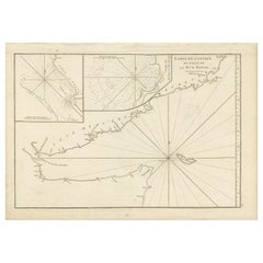
Map of the African Coast, Gulf of Guinea, from Sierra Leone to Gabon, 1788
Located in Langweer, NL
Antique map titled 'Drawn from d'Anvilles Map of the Coast of Guinea, Between Sierra Leone and the crossing of the Line.' Map of the African coast, Gulf of Guinea, from Sierra Le...
Category

Antique Late 18th Century More Furniture and Collectibles

Materials

Paper

Antique Map of Northern Europe and European Russia, ca.1780
Located in Langweer, NL
Antique map titled 'Le Nord de L'Europe, Contenant Le Danemark, La Norwege; La Suede et La Laponie avec la Majeure Partie de al Russie Europeenne.' Map of Northern Europe and Eur...
Category

Antique Late 18th Century More Furniture and Collectibles

Materials

Paper

Antique Map of Cap Providence, St. David's Cove and Surroundings
Located in Langweer, NL
Antique map titled 'Baye du Cap Upright (..)'. Eight charts on one sheet of Cap Providence, St. David's Cove, the Bay of the Island, Swallow's Haven, Puzzlin...
Category

Antique Late 18th Century More Furniture and Collectibles

Materials

Paper

Antique Map of Southern India, the Maldives and Sri Lanka with Currents
Located in Langweer, NL
Antique map titled 'Carte de la Partie Inferieure De L'Inde En Deca Du Gange (..)'. Interesting map of Southern India, the Maldives and Sri Lanka. Includes a month by month charting ...
Category

Antique Late 18th Century More Furniture and Collectibles

Materials

Paper

Antique Map of France with Inset showing the Northern Departments
Located in Langweer, NL
Antique map titled 'The Republic of France divided according to its 103 Departments'. Decorative map of France. Includes a large cartouche and an in...
Category

Antique Late 18th Century More Furniture and Collectibles

Materials

Paper

Original Antique Map of the British Isles Surrounded by Text
Located in Langweer, NL
Antique map titled 'Des Isles Britanniques'. Original antique map of the British isles. This map is divided in to three major regions of the 18th century United Kingdom: England, Ire...
Category

Antique Late 18th Century More Furniture and Collectibles

Materials

Paper

Antique Map of Cordes Bay and Surroundings
Located in Langweer, NL
Antique map titled 'Baye et Havre de Cordes (..)'. Four maps on the one sheet of; Cordes Bay, Port Famine, Woods Pay, Port Gallant, Fortescue Bay, Chile based on the voyage of John B...
Category

Antique Late 18th Century More Furniture and Collectibles

Materials

Paper

Views of Saunders, Osnaburg, Boscawens, Admiral Keppel's & Wallis Island, c.1774
Located in Langweer, NL
Antique print titled 'Isles de Sir Charles Saunder Latitude (..)'. Coastal views of Sir Charles Saunders Island ; Osnaburg Island [Mehetia, in French Polynesia] ; Boscawens Islan...
Category

Antique Late 18th Century More Furniture and Collectibles

Materials

Paper

Antique Map of England and Wales Depicting the Period of the Saxon Heptarchy
Located in Langweer, NL
Antique map titled 'Britain as divided under the Saxon Heptarchy'. An antique copper engraving map of England and Wales by Joseph Ellis depicting the period of the Saxon Heptarchy. E...
Category

Antique Late 18th Century More Furniture and Collectibles

Materials

Paper

Large Sea Chart of the Zuyder Zee & The Northsea with the Wadden Islands, 1773
Located in Langweer, NL
The copper engraving by Herman van Loon, published by Pieter Mortier in 'Le Neptune François' in Amsterdam, is a remarkable piece within the realm of seventeenth-century cartography....
Category

Antique Late 18th Century More Furniture and Collectibles

Materials

Paper

Antique Map of the British Isles with Walls, Settlements and Other Features
Located in Langweer, NL
Antique map titled 'Insulae Britannicae'. Interesting map of Britain, Scotland, and Ireland. It shows a rudimentary outline of the islands according to the geography of the Roman Emp...
Category

Antique Late 18th Century More Furniture and Collectibles

Materials

Paper

Large Antique Map England and Wales, with Part of the Coastlines
Located in Langweer, NL
Antique map titled 'A Map of England and Wales (..)'. Large antique map of England and Wales, with part of the continental and Irish coasts. Published J. Blair, circa 1779.
Category

Antique Late 18th Century More Furniture and Collectibles

Materials

Paper

Antique Map of France in Ancient Roman Times by d'Anville 'c.1795'
Located in Langweer, NL
Antique map titled 'Gallia Antiqua ex Aevi Romani Monumentis (..)'. Original, large, map of France in ancient Roman times. Bottom left, a large inset shows Gallia's southern most Rom...
Category

Antique Late 18th Century More Furniture and Collectibles

Materials

Paper

Antique Chart of the Mid-Pacific Ocean by Anson, 'c.1784'
Located in Langweer, NL
Antique map titled 'Carte de la Mer du Sud ou Mer Pacifique'. Original chart of the mid-Pacific Ocean, includes voyage tracks of Anson’s Centurion and the ship he stalked, the Spanish treasure...
Category

Antique Late 18th Century More Furniture and Collectibles

Materials

Paper

Old Map of the Kingdom of Tonga, Also Known as the Friendly Islands, ca.1780
Located in Langweer, NL
Antique print, titled: 'Carte des Isles des Amis.' Map of the Kingdom of Tonga, also known as the Friendly Islands, and one of the last hereditary monarchies. Cook named this gro...
Category

Antique Late 18th Century More Furniture and Collectibles

Materials

Paper

Old Map of the East Coast of Honshu with an Inset, Japan, c.1785
Located in Langweer, NL
Antique map titled ‘Part of Japan or Nippon'. View of the Coast of Japan when we first saw it: The Hill a bearing West 3 miles distant. London Published by Allexer Hogg at the Kings Arms...
Category

Antique Late 18th Century More Furniture and Collectibles

Materials

Paper

Antique Map of Spain and Portugal by Keizer & de Lat, 1788
Located in Langweer, NL
Antique map titled 'Nouvelle Carte du Royaume d'Espagne (..)'. Uncommon original antique map of Spain and Portugal. This map originates from 'Nieuwe Natuur- Geschied- en Handelkundig...
Category

Antique Late 18th Century More Furniture and Collectibles

Materials

Paper

Old Dutch Map of Part of Syria and Phoenicia, 1773
Located in Langweer, NL
Antique print titled 'Gedeelte van Syriën en Phenicië'. Old map of part of Syria and Phoenicia. Originates from the first Dutch editon of an interesting travel account of Norther...
Category

Antique Late 18th Century More Furniture and Collectibles

Materials

Paper

Framed View of St. Martin's Cathedral or Domkerk, Utrecht, The Netherlands, 1770
Located in Langweer, NL
Antique print titled 'L'Eglise Metropolitaine de Saint Martin a' Utrecht'. View of St. Martin's Cathedral in Utrecht, also known as 'Domkerk'. Artists and Engravers: Publishe...
Category

Antique Late 18th Century More Furniture and Collectibles

Materials

Paper

Old Chart of the North-Eastern Coast of Australia Discovered by Cook, 1774
Located in Langweer, NL
Antique print titled Carte d'une Partie de la Cote de la N.le Galles Merid etc. An interesting chart of the north-eastern coast of Australia discovered by Cook in 1770, showing th...
Category

Antique Late 18th Century More Furniture and Collectibles

Materials

Paper

Nice Sheet of the Sangihe Archipelago in Indonesia & California Island, 1788
Located in Langweer, NL
Antique map titled 'De Noord Pool waar in aangetoont werd alle de Nieuwe Landen (..) De Eilanden van Sangir Sjauw en Pangasare (..)'. Interesting map that includes a map of the N...
Category

Antique Late 18th Century More Furniture and Collectibles

Materials

Paper

Attractive Original Hand-Colored Map of the Swabia Region of Germany, 1799
Located in Langweer, NL
Antique map titled 'A New Map of the Circle of Swabia, from the Latest Authorities'. Attractive example of John Cary's 1799 map of the Swabia region of Germany. Covers from the U...
Category

Antique Late 18th Century More Furniture and Collectibles

Materials

Paper

Engraving Print from the Panckoucke Encyclopédie Nautical Subject, 1782-1832
Located in Milan, IT
Print by engraving on copper plate from the Panckoucke Encyclopédie méthodique, end of the 18th century, volume Marine Planches (more than 1,500 figures dealing with all subjects on the marina: planes, construction, carpentry, tree trunks, armaments of maneuvers, ropes, sails, artillery, ship maneuvers and combat tactics). This is the plate no. n. 26, pag. 70 fig. 350-353; with frame cm 38.3 x 31.5. Ship ropes are depicted. The Print has the "Benard direxit...
Category

French Antique Late 18th Century More Furniture and Collectibles

Materials

Paper

Print of Maps of Islands of the South Pacific, Incl. Pitcairn & Dusky Bay, 1788
Located in Langweer, NL
Antique map titled 'Esquisse de la Bay Dusky, Dans La Nouvelle Zeelande / I. Pitcairn / Isles de Wallis / I Turtle / I des Cocos and Traitres / Palmerston I. / I. Suavage / I. D'Hervey/ Havre Pickersgill / I de Pasques.' Detailed set of maps of the islands of the South Pacific...
Category

Antique Late 18th Century More Furniture and Collectibles

Materials

Paper

Original Antique Chart of the Santa Cruz Islands, 1774
Located in Langweer, NL
Antique print titled 'Isles de la Reine Charlotte (..)'. A detailed chart of the Santa Cruz islands, to the north of the New Hebrides, with Carte...
Category

Antique Late 18th Century More Furniture and Collectibles

Materials

Paper

Large Decorative Antique Map of the Mediterranean, ca.1770
Located in Langweer, NL
Antique map titled 'Carte de la Mer Mediterranee en Douze Feuilles'. First map out of twelve fine engraved double-page and folding maps that join to create a large wall map...
Category

Antique Late 18th Century More Furniture and Collectibles

Materials

Paper

Old Dutch Map of the Region Around the Mediterranean Sea, 1773
Located in Langweer, NL
Antique map titled 'Kaart van een Deel der Middelandsche Zee (..)'. Old map of the region around the Mediterranean Sea. Originates from the first Dutch editon of an interesting t...
Category

Antique Late 18th Century More Furniture and Collectibles

Materials

Paper

Decorative Map of the Empire of China, Korea, Japan, Taiwan, Lucon, Macau, 1780
Located in Langweer, NL
Antique map titled 'Carte de L'Empire de la Chine.' Decorative map of the Empire of China, depicting China, Corea ( Korea ), Japan, Tonquin and the Philippine island Lucon. Source unknown, to be determined. Artists and Engravers: Rigobert Bonne (1727-1795 ) was one of the most important cartographers of the late 18th century. In 1773 he succeeded Jacques Bellin as Royal Cartographer to France in the office of the Hydrographer at the Depôt de la Marine. Working in his official capacity Bonne compiled some of the most detailed and accurate maps of the period. Bonne's work represents an important step in the evolution of the cartographic ideology away from the decorative work of the 17th and early 18th century towards a more detail oriented and practical aesthetic. With regard to the rendering of terrain Bonne maps...
Category

Antique Late 18th Century More Furniture and Collectibles

Materials

Paper

Old Map of the Sinai Peninsula Showing the Mediterranean and the Red Sea, 1773
Located in Langweer, NL
Antique map of the Sinai Peninsula showing the Mediterranean Sea to the north and the Red Sea to the south. The map is decorated with images of a Persian wheel and a view of a vi...
Category

Antique Late 18th Century More Furniture and Collectibles

Materials

Paper

Gironde, Where Rivers Dordogne & Garonne Meet Near Bordeaux, France, ca.1770
Located in Langweer, NL
Antique map titled 'Carte des Entrées et Cours de la Gironde'. Large map of the region of the Gironde estuary. It is formed from the meeting of the rivers Dordogne and Garonne ju...
Category

Antique Late 18th Century More Furniture and Collectibles

Materials

Paper

Striking Large Format Antique Map of Southeastern France, 1799
Located in Langweer, NL
Antique map titled 'The South Eastern Part of France which includes Roussillon-Languedoc, with a Great Portion of Rouergue and Auvergne-Provence-Dauphine, and the Whole Frontier of Italy'. Striking large format map...
Category

Antique Late 18th Century More Furniture and Collectibles

Materials

Paper

Interesting Old Map of the Nw Coast of America and the Ne Coast of Asia, ca.1772
Located in Langweer, NL
Antique map titled 'Carte Generale des Decouvertes de l'Amiral de Fonte (..)'. Original antique map of the discoveries of Admiral de Fonte, showing the possibility of a north-west passage. Interesting map of the NW Coast...
Category

Antique Late 18th Century More Furniture and Collectibles

Materials

Paper

Nicely Framed View on the 'Spaarndammerdijk' in Amsterdam, the Netherlands, 1795
Located in Langweer, NL
Antique print titled 'De Stad Amsteldam'. View on the 'Spaarndammerdijk' in the city of Amsterdam, the Netherlands. This print originates from 'De...
Category

Antique Late 18th Century More Furniture and Collectibles

Materials

Paper

Antique Engraved Map of the Friendly Islands or Tonga, ca.1785
Located in Langweer, NL
Antique map titled 'Carte des Isles des Amis'. Map of the Friendly Islands / Tonga. The Tongan people first encountered Europeans in 1616 when the Dutch vessel Eendracht, captain...
Category

Antique Late 18th Century More Furniture and Collectibles

Materials

Paper

Antique Map of the Persian Gulf and Caspian Sea Region by R. Bonne, 1780
Located in Langweer, NL
Antique print titled 'Carte de la Perse, de la Georgie, et de la Tartarie Independante'. Shows the region from the Persian Gulf and Caspian Sea in the wes...
Category

Antique Late 18th Century More Furniture and Collectibles

Materials

Paper

Antique Map of France by Faden '1792'
Located in Langweer, NL
Antique map titled 'France divided into Metropolitan Circles (..)'. Large, original antique map of France, with a small inset of the island of Co...
Category

Antique Late 18th Century More Furniture and Collectibles

Materials

Paper

Antique Map of South America by J. Cook (1775)
Located in Langweer, NL
Antique map titled 'Kaart van het Zuidlyk Eind van Amerika'. Map of the sourthern part of South America, focusing on Cook's tracks around the Cape Horn and Tierra del Fuego in 1775. ...
Category

Antique Late 18th Century More Furniture and Collectibles

Materials

Paper

Antique Map of the Kingdom of Hungary by Keizer & de Lat, 1788
Located in Langweer, NL
Antique map titled 't Koninkryk Hongarien (..)'. Uncommon original antique map of the Kingdom of Hungary. This map originates from 'Nieuwe Natuur- Geschied- en Handelkundige Zak- en ...
Category

Antique Late 18th Century More Furniture and Collectibles

Materials

Paper

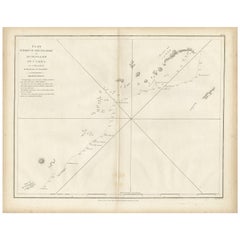
Antique Map of Part of the Korean Archipelago, 1798
Located in Langweer, NL
Antique map titled 'Plan of Part of the Islands or Archipellago of Corea'. This map depicts part of the Korean Archipelago and originates from Charts and Plates to La Pérouse...
Category

Antique Late 18th Century More Furniture and Collectibles

Materials

Paper

18th Century Italian Wood and Gesso Altar Vase with Flame and Faux Marble
Located in Hastings, GB
A stunning hand-crafted wood and applied gesso altar vase, late 18th century with faux marbling to the base and flame top. Small areas of loss to the gesso and wear to the paint com...
Category

Italian Baroque Antique Late 18th Century More Furniture and Collectibles

Materials

Gesso, Wood

Louis XVI Giltwood Barometer
Located in Kittery Point, ME
Of typical form‚ the giltwood body centered by a circular barometer dial flanked by pillars ending in flame‚ above a thermometer flanked by foliate branches‚ surmounted by swags.
Category

French Antique Late 18th Century More Furniture and Collectibles

Materials

Wood

Antique Map of the Middle East by Brion de la Tour '1772'
Located in Langweer, NL
Antique map titled 'Carte des Pays et Principaux Lieux (..)'. Original antique map of Middle East, extending to the Red Sea, Egypt, the Eastern Medi...
Category

Antique Late 18th Century More Furniture and Collectibles

Materials

Paper

Antique Hand-Colored Engraving of Raid on the Medway, England, 'c.1790'
Located in Langweer, NL
Antique print titled 'Aftekening der Schilderye op 't Stadhuis te Dordrecht (..)'. Scene of the battle of Chattam during one of the many Anglo-Dutch wars. In this battle, the Dutch sailed up the river Thames and destroyed part of the English fleet at anchor in the harbor of Chattam. Pictured in the foreground is the Dutch commander, Cornelius de Wit, being presented with the spoils of war...
Category

Antique Late 18th Century More Furniture and Collectibles

Materials

Paper

Antique Map of France by T. Bowen, 1785
Located in Langweer, NL
Decorative antique map of France titled 'A new and accurate map of France, Drawn from the latest Authorities by T. Bowen'. Engraved for Moore’s new and complete collection of Voyages...
Category

Antique Late 18th Century More Furniture and Collectibles

Materials

Paper

Engraving Print from the Panckoucke Encyclopédie Nautical Subject 1782-1832
Located in Milan, IT
Print by engraving on copper plate from the Panckoucke Encyclopédie méthodique, end of the 18th century, volume Marine Planches (more than 1,500 figures dealing with all subjects on ...
Category

French Antique Late 18th Century More Furniture and Collectibles

Materials

Paper

Copper Engraving Showing the Neptune Fountain of Versailles, Paris, France, 1785
Located in Langweer, NL
Antique print titled 'Plan de la décoration du Bassin de Neptune à Versailles'. Copper engraving showing parts of the Neptune fountain of Versaill...
Category

Antique Late 18th Century More Furniture and Collectibles

Materials

Paper

Antique Map of Germany, Bohemia, Hungary and Part of Poland by R. Bonne ‘1780’
Located in Langweer, NL
Antique map titled "L'Allemagne, La Bohême, et la Hongrie avec une partie de la Pologne" by Rigobert Bonne (1729-1795) for "Atlas de toutes les parties connues du globe terrestre" by...
Category

Antique Late 18th Century More Furniture and Collectibles

Materials

Paper

Beautiful Antique Map of Southeastern France with Decorative Cartouche, ca.1790
Located in Langweer, NL
Antique map titled 'Languedoc, Dauphiné, Province'. Beautiful antique map of Southeastern France with decorative cartouche. Map includes topographical detail as well as a referen...
Category

Antique Late 18th Century More Furniture and Collectibles

Materials

Paper

Antique Map of the Black Sea and Surroundings by Keizer & de Lat, 1788
Located in Langweer, NL
Antique map titled 'Klein Tartaryën met de Turksche Provintiën (..)'. Uncommon original antique map of the Black Sea and surroundings. This map originates from 'Nieuwe Natuur- Geschi...
Category

Antique Late 18th Century More Furniture and Collectibles

Materials

Paper

Antique Detailed Map of Papua New Guinea and the Regions to the West, ca.1780
Located in Langweer, NL
Antique map titled 'Carte des Decouvertes du Capite. Carteret dans La Nlle. Bretagne avec une parte du passage du Capite. Cook Par Le Detroit De L'Endeavor ...
Category

Antique Late 18th Century More Furniture and Collectibles

Materials

Paper

Antique Map of Turkey in Europe by Russell, circa 1795
Located in Langweer, NL
Antique map titled 'Turkey in Europe and Hungary'. Original map of Turkey in Europe. Covers present day Northern Turkey, Greece, Albania, Romania, Hungary, Croatia, Bosnia Herzogovin...
Category

Antique Late 18th Century More Furniture and Collectibles

Materials

Paper

Antique Map of Switzerland by Keizer & de Lat, 1788
Located in Langweer, NL
Antique map titled 'La Suisse (..)'. Uncommon original antique map of Switzerland. This map originates from 'Nieuwe Natuur- Geschied- en Handelkundige Zak- en Reisatlas' by Gerrit Br...
Category

Antique Late 18th Century More Furniture and Collectibles

Materials

Paper

Antique Map of the West Coast of America with Island Views, ca.1784
Located in Langweer, NL
Antique print titled 'Views on the West Coast of America (..)'. Coastal views of various islands of the American coast. Originates from an edition of Cook's Voyages. Artists ...
Category

Antique Late 18th Century More Furniture and Collectibles

Materials

Paper

Old Sea Chart of the Tenasserim area, Myanmar 'Burma' in South East Asia, c.1790
Located in Langweer, NL
Antique map titled 'Coast of Tenasserim.' Sea chart of the Tenasserim area, Myanmar in South East Asia. Source unknown, to be determined. Artists and Engravers: Anonymous.
Category

Antique Late 18th Century More Furniture and Collectibles

Materials

Paper

Old Print of an Indian Nobleman and Noblewoman in a Sedan Chair, 1782
Located in Langweer, NL
Untitled print of an Indian nobleman and noblewoman in a sedan chair. This print originates from: 'Voyage aux Indes Orientales et a la Chine (..)', by Pierre Sonnerat, published in Paris in 1782. Artists and Engravers: Pierre M. Sonnerat (1745-1814) was a French naturalist...
Category

Antique Late 18th Century More Furniture and Collectibles

Materials

Paper

Old Vatican Frescoes; Separation of Land from Sea & The Creation of Eve, ca.1780
Located in Langweer, NL
Antique print religion titled 'Producant Aquae Reptile Animae Viventis (..)'. This print depicts the seperation of Land from Sea and the Creation of Eve. Originates from 'Frescoes in the Sistine Chapel'. The Sistine Chapel is a chapel in the Apostolic Palace, in Vatican City and the official residence of the pope. Originally known as the Cappella Magna ('Great Chapel'), the chapel takes its name from Pope Sixtus IV, who had it built between 1473 and 1481. Since that time, the chapel has served as a place of both religious and functionary papal activity. Today, it is the site of the papal conclave, the process by which a new pope is selected. The fame of the Sistine Chapel lies mainly in the frescoes that decorate the interior, most particularly the Sistine Chapel ceiling and The Last Judgment...
Category

Antique Late 18th Century More Furniture and Collectibles

Materials

Paper

Uncommon Rare Map Showing The Louisiade Archipelago, Papua New Guinea, ca.1798
Located in Langweer, NL
Antique map titled 'Carte de la Partie Septentrionale de l'Archipel de la Louisiade'. Uncommon map showing the area around the Louisiade Archipelago, named for Louis XV by Louis ...
Category

Antique Late 18th Century More Furniture and Collectibles

Materials

Paper

Old Print of an Oriental Man in a Small Carriage Pulled by Oxen, 1782
Located in Langweer, NL
Untitled print of an oriental man, possible an Indian, in a small carriage pulled by oxen. This print originates from: 'Voyage aux Indes Orientales et a...
Category

Antique Late 18th Century More Furniture and Collectibles

Materials

Paper

Read More

Medal-Worthy Memorabilia from Epic Past Olympic Games

Get into the games! These items celebrate the events, athletes, host countries and sporting spirit.

Ahoy! You’ve Never Seen a Collection of Sailor Art and Kitsch Quite Like This

French trendsetter and serial collector Daniel Rozensztroch tells us about his obsession with objects related to seafaring men.

39 Incredible Swimming Pools

It's hard to resist the allure of a beautiful pool. So, go ahead and daydream about whiling away your summer in paradise.

Pamela Shamshiri Shares the Secrets behind Her First-Ever Book and Its Effortlessly Cool Interiors

The sought-after designer worked with the team at Hoffman Creative to produce a monograph that beautifully showcases some of Studio Shamshiri's most inspiring projects.

Moroccan Artworks and Objects Take Center Stage in an Extraordinary Villa in Tangier

Italian writer and collector Umberto Pasti opens the doors to his remarkable cave of wonders in North Africa.

Montecito Has Drawn Royalty and Celebrities, and These Homes Are Proof of Its Allure

Hollywood A-listers, ex-pat aristocrats and art collectors and style setters of all stripes appreciate the allure of the coastal California hamlet — much on our minds after recent winter floods.

Whaam! Blam! Pow! — a New Book on Pop Art Packs a Punch

Publishing house Assouline and writer Julie Belcove have teamed up to trace the history of the genre, from Roy Lichtenstein, Andy Warhol and Yayoi Kusama to Mickalene Thomas and Jeff Koons.

The Sparkling Legacy of Tiffany & Co. Explained, One Jewel at a Time

A gorgeous new book celebrates — and memorializes — the iconic jeweler’s rich heritage.
Recently Viewed

View All