Located in Nottingham, GB
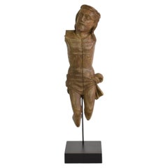
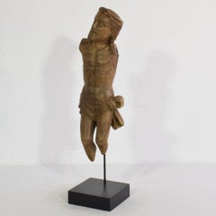
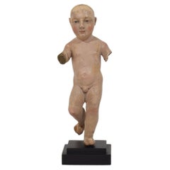
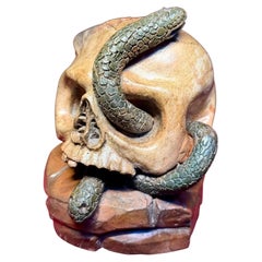
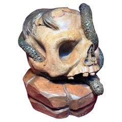
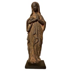
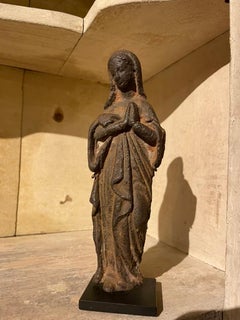
A rare and highly evocative European memento mori terracotta sculpture depicting a human skull resting upon a rocky outcrop, entwined with serpents and surmounted by a distinctive lock of hair. Dating from the late 17th to early 18th century, the piece is likely of German origin.
Beautifully modelled and painted in naturalistic tones, the skull is rendered in warm earthy hues, contrasting with the dark green serpents that coil through and around the cranium. The rocky base is finished in rich brown tones, enhancing the sculpture's dramatic presence and symbolic depth.
Memento mori, Latin for “remember that you must die,” was a powerful artistic and philosophical motif throughout Europe, serving as a reminder of the transience of earthly life and the certainty of mortality. Here, the skull embodies death, decay, and the fleeting nature of human existence, while the entwined serpents symbolise transformation, renewal, healing, and the eternal cycle of life. Together they create a compelling allegory of mortality and rebirth, where death itself becomes a gateway to regeneration.
A striking and unusual example of early European memento mori art...
Category
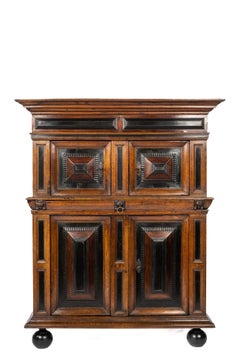
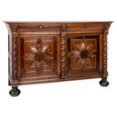
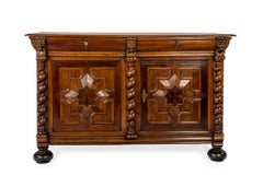
Antique 17th Century Furniture