Collectibles and Curiosities on Sale

to
5,466
1,382
6,859
43
41
356
168
91
80
68
50
41
40
35
26
24
17
15
10
8
7
5
4
2,707
2,345
1,807
84
540
705
284
112
30
79
124
70
150
129
89
64
29
4,942
1,195
604
283
237
1,287
501
453
279
261
6,943
6,939
6,939
104
55
21
18
13
Sale Items
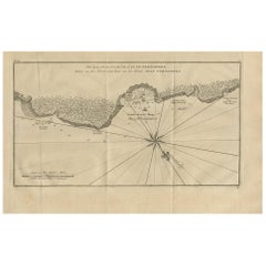
Antique Map of Juan Fernandez Island and Cumberland Bay, Chile - c. '1749'
Located in Langweer, NL
Antique map titled 'Plan de la Côte du N.E. de l 'Ile de Juan Fernandes - Schets van den Noord-Oost kant van het eiland Juan Fernandes '. This map depicts the northeast coast of the ...
Category

Antique Mid-18th Century Maps

Materials

Paper

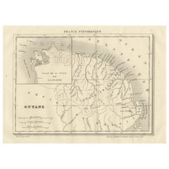
French Guiana and Cayenne: Mid-19th Century Map from France Pittoresque Series
Located in Langweer, NL
This map titled "Guyane" is part of the France Pittoresque series and provides a detailed view of French Guiana along with a plan of the city of Cayenne. Features: - The map showcases the broader region of French Guiana, indicating key rivers, settlements, and the coastline along the Atlantic Ocean. - To the left, there's an inset labeled "Plan de la Ville de Cayenne", which shows the street layout, squares, and main buildings of the capital city, Cayenne. This inset provides a more detailed view of the urban area, highlighting its geometric grid layout near the coast. - The larger map outlines geographical features such as rivers (e.g., Oyapock and Maroni), forests, and territories in the surrounding area, including the neighboring Brazilian Empire...
Category

Antique 1850s Maps

Materials

Paper

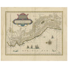
Antique Map of Peru in South America by Blaeu, circa 1645
Located in Langweer, NL
Antique map titled 'Peru'. Original antique map of Peru. With cartouche, compass rose, ships and two sea-monsters. Published by W. Blaeu, circa 1645.
Category

Antique Mid-17th Century Dutch Maps

Materials

Paper

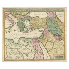
Highly Decorative Map of The Eastern Mediterranean and The Middle East, ca.1700
Located in Langweer, NL
Antique map titled 'Byzondere Kaart van de Landen Daar de Apostelen Het Evangelium Gepredikt Hebben (..).' Highly decorative map of the eastern Mediterranean...
Category

Antique Early 1700s Maps

Materials

Paper

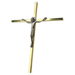
Mid Century Solid Brass Crucifix by Willy Buck, Switzerland
Located in Bern, CH
Mid Century solid brass crucifix made by Swiss artist and goldsmith, Willi Buck (1911 - 1997). W. Buck Gold & Silversmith, Wil, Switzerland. Makers mark on rear side: W.Buck Wil Con...
Category

Mid-20th Century Swiss Mid-Century Modern Religious Items

Materials

Brass, Metal

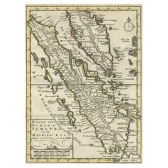
Authentic Old Map of Sumatra, Malaysia and Singapore, 1745
Located in Langweer, NL
Title: "Kaartje van't Eiland Sumatra en de Maleidse Kust gelegen na de stelling van de G. de L'Isle" Published by Jacob Keizer and by Jan de Lat Creator: Keizer, Jacob, active 1706...
Category

Antique 1740s Maps

Materials

Paper

Antique Map of Bavaria with many details, Germany
Located in Langweer, NL
Antique map titled 'Bavariae Circulus atq Electoratus tam cum Adiacentibus quam insertis Regionibus (..)'. Dutch map of Bavaria, showing the many cities, towns, and other features of...
Category

Antique Late 17th Century Maps

Materials

Paper

Map of the Ottoman Empire in Europe, incl. the Balkans, Greece & Turkey, c.1760
Located in Langweer, NL
Antique map Turkey titled 'An Accurate Map of Turky in Europe drawn from the best Authorities'. Map of the Ottoman Empire in Europe, the Balkans, Greece, and Turkey in Europe. Engr...
Category

Antique 1760s Maps

Materials

Paper

Islands of Fire and Whispers: The Canary Islands in 1902
Located in Langweer, NL
This is a authentic historical map of the Canary Islands, specifically the "1A HOJA" or first sheet, from the year 1902. The title on the map is "ISLAS CANARIAS 1902." This map featu...
Category

Antique Early 1900s Maps

Materials

Paper

Newfoundland and St. Pierre & Miquelon: Early 19th Century French Map
Located in Langweer, NL
The map is titled "Île et Banc de Terre-Neuve avec les Îles St. Pierre et Miquelon", depicting Newfoundland and the French islands of St. Pierre and Miquelon. It is from the Petit Atlas National series. Features: - The map is divided into two sections: 1. The left side shows Newfoundland (Terre-Neuve) and its surrounding waters, including important locations such as the Île du Cap Breton and Grand Bank fishing areas. 2. The right side focuses on St. Pierre and Miquelon, a French overseas territory near Newfoundland. - Hand-colored outlines mark the territories, with color distinctions for the different islands. - Administrative divisions and key geographic features, such as capes, bays, and towns, are labeled on the map. Here the text translated: Here is the translation of the text from French to English: **NOTICE.** The islands of St. Pierre and Miquelon, the only remaining French possession in this part of America since the loss of Canada, are located a few miles from the southern coast of Newfoundland, which belongs to the English. Their relatively fertile soil is broken up by hills that give rise to small streams. **Grande Miquelon**, the northernmost of the two islands, has a circumference of about 9 to 10 leagues. It offers a convenient port for fishing boats. **Petite Miquelon**, to the south of Grande Miquelon, has a circumference of about 6 leagues. It is well-watered and well-wooded. **Saint Pierre**, to the south-southwest of the two other islands, presents a somewhat similar appearance but is devoid of trees. Although it is the smallest of the three islands, it is the most important due to the size of its harbor, which can accommodate 30 to 40 ships of various sizes, and because of its favorable coastline for the preparation, preservation, and export of cod. On its eastern coast, at the bottom of a beautiful bay, lies the town of Saint Pierre, the only notable settlement on the three islands. It is the residence of a naval officer who, under the title of Commander, governs the colony. The permanent population is about 2,000 souls, of which 800 reside in Saint Pierre. However, sailors come to the islands from the coasts of Brittany and Normandy during the cod fishing season on the Grand Banks of Newfoundland and the Gulf of St. Lawrence. In 1833, it was estimated that about 14,000 sailors were employed in this fishery, and the purchase of supplies required by the colony was valued at over one million francs. --- This translation reflects the original notice describing the French islands of St. Pierre and Miquelon, with details about their geography, population, and economic activities related to the fishing industry. Historical Context: - This map is part of a collection meant to showcase France's overseas colonies and territories, including the small but significant St. Pierre and Miquelon, which has been under French control for centuries and was a critical fishing and trading hub. - The Petit Atlas National series was typically published in the early 19th century, and this map likely dates from the same period, around 1815–1820. People searching for maps or information about Newfoundland and the French islands of St. Pierre and Miquelon use the following keywords: 1. Newfoundland map...
Category

Antique 1820s Maps

Materials

Paper

Wood and Metal Throwing Discus circa 1930-1940-ONE LEFT
Located in San Francisco, CA
ABOUT Wood and metal discus available. The other two have sold. Antique wood and brass and solid rubber discus. Two are marked "Gill". CREATOR Gill Sporting Goods Company. DATE...
Category

Early 20th Century Industrial Sports Equipment and Memorabilia

Materials

Brass, Metal

Vintage Handmade Boat Model Diorama
Located in Palm Beach, FL
Vintage handmade boat model diorama of the "Sovereign of the Seas" a three masted schooner, displayed in its original case. Originally built in Massac...
Category

Antique 19th Century American American Colonial Nautical Objects

Materials

Hardwood

Vintage Handmade Boat Model Diorama
$3,950 Sale Price
20% Off
Antique Miniature Map of Ceylon 'Sri Lanka' and the Maldives by Bertius, 1618
Located in Langweer, NL
Antique map titled 'Descriptio Zeilan, et Maldivarum Inss'. Rare, original antique miniature map of Ceylon/Sri Lanka and the Maldives. This map originate...
Category

Antique Early 17th Century Maps

Materials

Paper

Antique Print of Johannes Brahms, a German Composer, Pianist & Conductor, 1880
Located in Langweer, NL
Antique print titled 'Johannes Brahms'. Portrait of Johannes Brahms. Johannes Brahms was a German composer, pianist, and conductor of the Romantic period. Artists and Engraver...
Category

Antique 1880s Prints

Materials

Paper

Antique Map of the Mediterranean Sea and Surroundings by Keizer & de Lat, 1788
Located in Langweer, NL
Antique map titled 't Wester Deel van de Middelandse Zee (..)'. Uncommon original antique map of the Mediterranean Sea and surroundings. This map originates from 'Nieuwe Natuur- Gesc...
Category

Antique Late 18th Century Maps

Materials

Paper

French Ceramic Jewelry Box Signed Lucien Brisdoux
By Lucien Brisdoux
Located in Miami, FL
A very nice quality mid-century French ceramic jewelry box or decorative lidded box. This hand-crafted, hand-painted mid-century French box would look great on a small side table o...
Category

Mid-20th Century French Tobacco Accessories

Materials

Ceramic

Antique Religion Print of David Dancing Before the Ark, 1913
Located in Langweer, NL
Large antique print of David Dancing Before the Ark. Published by Mosella-Verlag, 1913. This print originates from a series titled 'Kathol. Schulbibelwerk von Dr. Ecker'.
Category

Early 20th Century Prints

Materials

Paper

Very Attractive Handcolored Antique Plan of Cochin in India, 1744
By Philip Baldaeus
Located in Langweer, NL
Antique map titled 'The City of Cochin (..).' Plan of Cochin, Malabar Coast, India, during the attack by Admiral van Goens in 1663. This map was published in 'The True and Exact Desc...
Category

Antique 18th Century Maps

Materials

Paper

Niels Erik From Modernist Silver Pendant Necklace with Agate
By Niels Erik From
Located in Esbjerg, DK
A late 1960s or early 1970s pendant necklace by Danish silversmith N. E. From. The ovale pendant has a polished insert of red/rose agate. Its comes with its original 50 cm box neckla...
Category

Vintage 1970s Danish Mid-Century Modern Collectible Jewelry

Materials

Agate, Sterling Silver

Twelve Prints of Aceh 'Atjeh' Published by E.J. Brill, '1895'
Located in Langweer, NL
Cardboard cover titled 'Platen behoorende bij De Atjèhers van Dr. C. Snouck Hurgronje' including 12 plates of Aceh (or Atjeh, Indonesia) with a total of 27 images. The plates include...
Category

Antique Late 19th Century Books

Materials

Paper

Original Antique Map of the Maluku Islands or Moluccas, Indonesia
Located in Langweer, NL
Antique map titled 'Carte Particuliere des Isles Moluques'. This map depicts the islands of Herij, Ternate, Tidor, Pottebackers, Timor, Machian and Bachian. The Moluccan islands were...
Category

Antique Mid-18th Century Maps

Materials

Paper

Pl. XLVII Maison de Campagne, Chabat, c.1900
Located in Langweer, NL
Antique print titled 'Maison de Campagne, Mr. Bonnier Architecte'. This print depicts the design of a building in France. Originates from 'La Brique et La Terre Cuite' by P. Chabat. ...
Category

20th Century Prints

Materials

Paper

Large Print of the Procession for the Papal Inauguration in Rome, Italy, c.1730
Located in Langweer, NL
Antique print, titled: 'Le Pape va en ceremonie prendre possession du pontificat (…)' - This very large original antique print shows the procession for the Papal inauguration in the ...
Category

Antique 1730s Prints

Materials

Paper

1698 Mercator Ptolemaic Map of Asia East of the Ganges
Located in Langweer, NL
**Catalogue Description:** **Title:** Tab. XI. Asiae, comprehendens Indiam extra Gangem. **Description:** This is an exquisite Ptolemaic map depicting Asia east of the Ganges, ti...
Category

Antique 1680s Maps

Materials

Paper

Antique Victorian Hardwood Piano Stool with Decorative Base Height Adjustable
Located in West Sussex, Pulborough
We are delighted to offer for sale this stunning hand carved Victorian circa 1880 Piano stool with height adjustable top A very good looking and well-made piano stool, its quite w...
Category

Antique 1880s English Victorian Stools

Materials

Upholstery, Hardwood

Georg Jensen 'Heritage' Flower Clip Earrings 2002 in Sterling Silver
By Georg Jensen
Located in Esbjerg, DK
A set of 'Year' clip earrings by Georg Jensen. Based upon a design from circa 1900 these were relaunched in 2002. Floral design with silver-beads. Original box. Fully hallmarked. Mea...
Category

Early 20th Century Danish Art Nouveau Collectible Jewelry

Materials

Sterling Silver

1930s World War II Sterling Silver DC-3 Airplane Pin
Located in Van Nuys, CA
This large silver DC-3 airplane pin dates to the 1930s through World War II, a period when the DC-3 revolutionized air travel and played a vital role in military transport. Shaped to...
Category

Vintage 1940s American Aviation Objects

Materials

Sterling Silver

Orignal Hand-Colored Antique Map of Chili by W. Blaeu, 1658
By Willem Blaeu
Located in Langweer, NL
Very decorative antique map of Chili published by W. Blaeu, 1658. This map depicts Chile from Copiapo southward to the island of Chiloé with ships and sea monsters adorning the sea. ...
Category

Antique Mid-17th Century Maps

Materials

Paper

Organic Design Sterling Silver Mosaic Bracelet w/ Quartz, Ametrine, & Onyx
Located in Van Nuys, CA
Stunning Sterling Silver Quartz Bracelet. Elevate your collection with this bold, one-of-a-kind sterling silver jewelry bracelet handcrafted with approximately 300 carats of natural ...
Category

Vintage 1960s American Collectible Jewelry

Materials

Onyx, Quartz, Silver

Antique Map of Peru by van der Aa, 'circa 1720'
Located in Langweer, NL
Antique map titled 'Le Perou, Grand Pays de l Amerique Meridionale (..)'. Decorative map of Peru including portions of Ecuador and northern Chile and Boliv...
Category

Antique Early 18th Century Maps

Materials

Paper

Antique Map of Indiana by Johnson, 1872
Located in Langweer, NL
Antique map titled 'Johnson's Indiana'. Original map of Indiana. This map originates from 'Johnson's New Illustrated Family Atlas of the World' by A.J. ...
Category

Antique Late 19th Century Maps

Materials

Paper

Antique Print of a Jacobite Pincushion and a Silk Purse by Gibb, 1890
Located in Langweer, NL
Antique print titled 'Jacobite Pincushion - Silk Purse'. Chromolithographic plate originating from 'The Royal House of Stuart. Illustrated By a Series of Forty Plates in Colours Draw...
Category

Antique 19th Century Prints

Materials

Paper

Old Antique Print of a Peasant of Upper Carniola, Slovenia, Eastern Europe, 1804
Located in Langweer, NL
Old print of a peasant of upper Carniola, Slovenia. This print originates from 'The Costume of the Hereditary States of the House of Austria' by William Miller. Artists and engravers: Engraved by William Ellis.
Category

Antique Early 1800s Prints

Materials

Paper

Rare Antique English SeaChart of Bali, Lombok, Floris, Borneo, Celebes etc, 1711
Located in Langweer, NL
Antique map titled 'A Large Draught from Benjar on the Island of Borneo To Macasser on the Island of Celebes Shewing the Streight of Bally with the Islands to the Eastward thereof.' ...
Category

Antique 1710s Maps

Materials

Paper

Map of Philadelphia with a Historical Tribute to its Volunteer Fire Companies
Located in Langweer, NL
This elaborate map of Philadelphia in Pennsylvania served as a historical tribute to the city's first volunteer fire departments. It was drawn by J...
Category

Vintage 1930s Maps

Materials

Paper

Rare Antique Print of A Cupid being Eaten by A Crocodile, ca. 1608
Located in Langweer, NL
Antique print of Cupid and a crocodile. This print originates from 'Amorum Emblemata', this work includes engravings of Cupids encountering the various trials of Love. The emblematic illustrations include verses in Latin, Dutch and French. The verse of this print would translate to 'Love is the opposite of a crocodile. They say the crocodile has such a nature, that he cries when he is killing and devouring men. But Amor has an opposite nature, for he laughs when he makes lovers perish'. Artists and Engravers: Otto van Veen...
Category

Antique Early 1600s Prints

Materials

Paper

Mid Century Red Retro Westfield Mfg Columbia Fire Arrow Bicycle Bike MCM
Located in Dayton, OH
Mid century Westfield Mfg Co Columbia Fire-Arrow bike. Measure: 69".  
Category

Mid-20th Century Mid-Century Modern Sports Equipment and Memorabilia

Materials

Metal

An Art And Crafts Mezuzah Case, Israel 1948. Judaica
Located in New York, NY
An Art and crafts Mezuzah Case made in Israel in 1948. Early Israeli Mezuzah case on a shaped piece of wood covered in green velvet with a scroll encased...
Category

Vintage 1940s Israeli Mid-Century Modern Religious Items

Materials

Brass

1902 Murcia: A Cartographic Snapshot of Spain's Southeastern Province
Located in Langweer, NL
The map represents the province of Murcia, Spain, as it was in 1902. Here's an overview of its characteristics: - **Geography**: It displays the varied terrain of Murcia, from the c...
Category

Antique Early 1900s Maps

Materials

Paper

Antique Map of South America by Wyld, circa 1850
By J. Wyld
Located in Langweer, NL
Beautiful folding map of South America titled 'Colombia Prima or South America Drawn from the Large Map in Eight Sheets by Louis Stanislas D ' Arcy Delarochette'. Three insets in the...
Category

Antique Mid-19th Century British Maps

Materials

Paper

Lleida 1902: A Cartographic Perspective of Catalonia's Gateway to the Pyrenees
Located in Langweer, NL
The map for sale shows the province of Lleida, located in the western part of Catalonia, Spain, as of 1902. Here are the key features depicted on the map: - **Topography**: The map ...
Category

Antique Early 1900s Maps

Materials

Paper

Antique Map of the Island Java, Indonesia, c.1650
Located in Langweer, NL
Antique map titled 'Insulae Iavae cum parte insularum Boreno Sumatrae (..)'. Beautiful map of the island of Java and part of Borneo, Bali, Madura and Sumatra. With decorative carto...
Category

Antique 17th Century Maps

Materials

Paper

Castellón de la Plana 1901: A Cartographic Perspective of the Valencian Coast
Located in Langweer, NL
The authentic map depicts the province of Castellón de la Plana, often referred to simply as Castellón, situated in the eastern part of Spain in the Valencian Community, and the map ...
Category

Antique Early 1900s Maps

Materials

Paper

Erich Dieckmann:- Praktiker Der Avantgarde Mobelbau, 1921-1933 (Book)
Located in North Yorkshire, GB
A soft covered catalogue produced by the Vitra Design Museum having 182 pages with 99 black & white illustrations and 29 full colour plates and text in german. Showcasing the work of...
Category

20th Century Books

Materials

Paper

Danube River Incl Serbia, Moldavia, Transylvania, Romania, Bulgaria Etc, ca.1720
Located in Langweer, NL
Antique map titled 'Danubii Fluminis (..)'. Regional map of the Donau river, Shows the Danube river from Belgrade in Serbia, along the border between ...
Category

Antique 1720s Maps

Materials

Paper

Early 19th Century Polish Brass Hanukkah Lamp Menorah
Located in New York, NY
Brass Hanukkah lamp Menorah, Poland, circa 1810. Cast in Bench form, on four feet. The backplate is cast and pierced featuring scrollwork. This lamp was made by the technique known as "sand casting". This process begins with a wooden mold that was carved out to create negative space, which in turn is used to make the inverse form or shape to be used for the casting of metal. The mold is pressed into fine sand mixed with clay, then removed, and molten brass poured into the impression. When a mold wears out, a casting from that mold is often used as the mold for the next generation. Those later lamps...
Category

Antique Early 19th Century Polish Religious Items

Materials

Brass

Beautiful Large Scale Map of Spain and Portugal Published by Herman Moll in 1711
Located in Langweer, NL
Title: A New and Exact Map of Spain & Portugal Author: Herman Moll Date: 1711 Medium: Hand-colored copperplate engraving Herman Moll (c. 1654-1732) was one of the most important London mapmakers in the first half of the eighteenth century. Moll was probably born in Bremen, Germany, around 1654. He moved to London to escape the Scanian Wars. His earliest work was as an engraver for Moses Pitt on the production of the English Atlas, a failed work which landed Pitt in debtor's prison. Moll also engraved for Sir Jonas Moore, Grenville Collins, John Adair, and the Seller & Price firm. He published his first original maps in the early 1680s and had set up his own shop by the 1690s. Moll's work quickly helped him become a member of a group which congregated at Jonathan's Coffee House at Number 20 Exchange Alley, Cornhill, where speculators met to trade stock. Moll's circle included the scientist Robert Hooke...
Category

Antique 1710s Maps

Materials

Paper

16th Century Prie-Dieu 'Praying Kneeler' Made of Walnut and Burl
Located in North Miami, FL
16th Century Italian Prie-dieu (Praying Kneeler) made of Italian walnut and burl wood.
Category

Antique 16th Century Italian Renaissance Cabinets

Materials

Wood, Walnut, Burl

Map of Kingdoms of Castile, León, Galicia, Asturias, Biscay and Navarre in Spain
Located in Langweer, NL
Antique map titled 'Partie Septentrionale de la Couronne de Castille (..)'. Decorative and highly detailed map of Northwestern Spain, including Gallicia...
Category

Antique Mid-18th Century Maps

Materials

Paper

Detailed Old Map showing Spain and Portugal Incl. Majorca, Minorca & Ibiza, 1740
Located in Langweer, NL
Antique map titled 'Nieuwe Kaart van Spanje en Portugal.' Attractive detailed map showing Spain and Portugal. Including Majorca, Minorca and Ibiza. Title in block-style cartouche...
Category

Antique 1740s Maps

Materials

Paper

Antique Print of Hakodate from Telegraph Hill in Oshima, Hokkaido, Japan
Located in Langweer, NL
Antique print titled ‘Hakodadi from Telegraph Hill’. View of Hakodate, a city and port located in Oshima Subprefecture, Hokkaido, Japan. This print originates from 'Narrative of the ...
Category

Antique 19th Century Prints

Materials

Paper

Antique Map of Friesland by Van Krevelt, 1787
Located in Langweer, NL
Antique map titled 'Nieuwe Kaart van Friesland behoorende tot het Vaderlandsch Woordenboek van Jacobus Kok'. Original antique map of the province of Friesland, the Netherlands. This ...
Category

Antique 18th Century Maps

Materials

Paper

Charming Miniature Map of Thrace or Thrake in Southeast Europe, 1685
Located in Langweer, NL
Antique map titled 'Thraciae Descriptio.' Charming miniature map of Thrace, from the pocket atlas 'Introductionis in Universam Geographiam tam Veterem quam novam .. Acessit P. Be...
Category

Antique 1680s Maps

Materials

Paper

Vintage 1950s Prop-Spinner
Located in San Francisco, CA
A Vintage Prop-Spinner from an early 1950s navy Neptune patrol plane.
Category

Vintage 1950s American Craftsman Aviation Objects

Materials

Steel

Vintage 1950s Prop-Spinner
$2,240 Sale Price
20% Off
Map of the Mozambique and Tanzania Coast & Inset Map of Anjouan Island, ca.1700
Located in Langweer, NL
Antique map titled 'Carte particuliere des Costes de l'Afrique'. Depicts the coasts of Mozambique and Tanzania. With an inset map of Anjouan Island. Artists and engravers: Pub...
Category

Antique Early 1700s Maps

Materials

Paper

1640 Map of North Africa Nova Barbariae Descriptio or The Barbarian Coast
Located in Langweer, NL
1640 Antique Map of North Africa 'Nova Barbariae Descriptio' by Johannes Janssonius This antique map titled Nova Barbariae Descriptio*, published by Johannes Janssonius around 1640,...
Category

Antique 1640s Maps

Materials

Paper

Old Decorative Map of the West African Coast & St. Thomae Island, c.1600
Located in Langweer, NL
Antique map titled 'Guineae Nova Descriptio.' This very decorative map shows the West African coast from Senegal (the 'Rio Senega' is the Senegal River) to Cape Lopez on the Gulf...
Category

Antique Early 1600s Maps

Materials

Paper

Topographical and Administrative Cartography of Segovia in Spain, 1902
Located in Langweer, NL
An original old map of the province of Segovia from the year 1902. Segovia is a historic area located in the central part of Spain, northwest of Madrid. Known for its rich history, a...
Category

Antique Early 1900s Maps

Materials

Paper

Antique Map of Gelderland, Largest Province of The Netherlands, c.1870
Located in Langweer, NL
Antique map titled 'De Provincie Gelderland'. Map of the province of Gelderland, the Netherlands. This map originates from 'F. C. Brugsma's Atlas van het Koninkrijk der Nederland...
Category

Antique 19th Century Maps

Materials

Paper

A Dutch Jewish Hospital Charity Container, Netherlands, Circa 1920
Located in New York, NY
A Dutch Jewish Hospital Charity Container from the Netherlands, circa 1920, is a unique Judaic historical artifact. This charity container was used to collect donations for a Jewish...
Category

Early 20th Century Dutch Religious Items

Materials

Tin

Read More

Medal-Worthy Memorabilia from Epic Past Olympic Games

Get into the games! These items celebrate the events, athletes, host countries and sporting spirit.

Ahoy! You’ve Never Seen a Collection of Sailor Art and Kitsch Quite Like This

French trendsetter and serial collector Daniel Rozensztroch tells us about his obsession with objects related to seafaring men.

Pamela Shamshiri Shares the Secrets behind Her First-Ever Book and Its Effortlessly Cool Interiors

The sought-after designer worked with the team at Hoffman Creative to produce a monograph that beautifully showcases some of Studio Shamshiri's most inspiring projects.

Moroccan Artworks and Objects Take Center Stage in an Extraordinary Villa in Tangier

Italian writer and collector Umberto Pasti opens the doors to his remarkable cave of wonders in North Africa.

Montecito Has Drawn Royalty and Celebrities, and These Homes Are Proof of Its Allure

Hollywood A-listers, ex-pat aristocrats and art collectors and style setters of all stripes appreciate the allure of the coastal California hamlet — much on our minds after recent winter floods.

Whaam! Blam! Pow! — a New Book on Pop Art Packs a Punch

Publishing house Assouline and writer Julie Belcove have teamed up to trace the history of the genre, from Roy Lichtenstein, Andy Warhol and Yayoi Kusama to Mickalene Thomas and Jeff Koons.

What Makes a Gem-Encrusted Chess Set Worth $4 Million?

The world’s most opulent chess set, weighing in at 513 carats, is literally fit for a king and queen.

Tauba Auerbach’s Geometric Pop-Up Book Is Mighty Rare, Thanks to a Hurricane

This sculptural art book has an epic backstory of its own.
Recently Viewed

View All