Maps on Sale
to
4,175
18
4,198
1
3
3
2
2
1
1
1
2,322
1,643
233
1
130
13
1
66
1
3
4
2
4,187
10
9
7
7
171
51
42
38
33
4,199
4,199
4,199
104
55
18
12
11
Sale Items
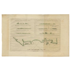
Antique Map of New Ireland Island in the Bismarck Archipelago, New Guinea, 1772
Located in Langweer, NL
Antique map titled 'Nova Hibernia'. Antique map of New Ireland, an island in the Bismarck Archipelago, New Guinea. Lying just north of New Britain, from which it is separated by St. ...
Category
Antique 18th Century Maps
Materials
Paper
$210 Sale Price
20% Off
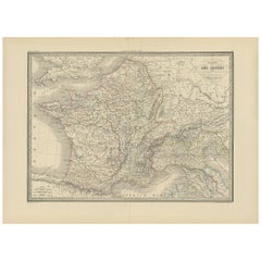
Antique Map of France by Lapie, 1842
Located in Langweer, NL
Antique map titled 'Carte des Gaules'. Map of France. This map originates from 'Atlas universel de géographie ancienne et moderne (..)' by Pierre M. Lapie and Alexandre E. Lapie. Pie...
Category
Antique Mid-19th Century Maps
Materials
Paper
$478 Sale Price
20% Off
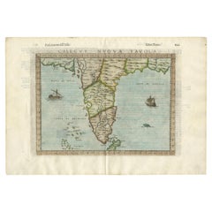
Rare Attractive Antique Map of Asia, India, Sri Lanka, Maldives, 1599
Located in Langweer, NL
Original Antique map of Asia, India, Ceylon (Sri Lanka), Maldives by Rosaccio / Ruscelli in attractive coloring.
Title: Calecut Nuova Tavola
Year: 1599
Relief shown pictorially.
...
Category
Antique 16th Century European Maps
Materials
Paper
$717 Sale Price
20% Off
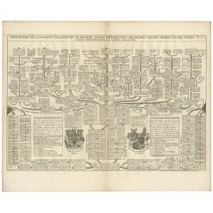
Antique Genealogy Chart of Palatinate & Bavarian Houses with Coats of Arms, 1732
Located in Langweer, NL
Antique print titled 'Genealogie de la Maison Palatine (..)'. Chart of the genealogy of the Palatinate (Die Pfalz) and Bavarian (Baiern) Houses. Shows the coats of arms of both Elect...
Category
Antique 18th Century Prints
Materials
Paper
$229 Sale Price
20% Off
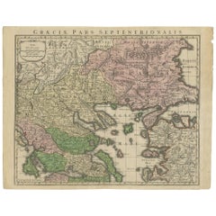
Antique Map of Greece by Seutter or Lotter, 'c.1740'
Located in Langweer, NL
Antique map titled 'Graecia pars Septentrionalis'. Original antique map of Greece, uncommon. Signed cum Gratia et Privil. S.R.I. Vicariatus (..)'. Published by Seutter or Lotter, cir...
Category
Antique Mid-18th Century Maps
Materials
Paper
$660 Sale Price
35% Off
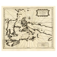
Extremely Rare Map of the East-Indies towards the South-East 'Indonesia', 1725
Located in Langweer, NL
Antique map titled 'La partie des Indes Orientales vers le Zud-Est, depuis Timor jusqu'a Midanao (...).' (The part of the East-Indies towards the South-East, from Timor to Mindanao.)...
Category
Antique 1720s Maps
Materials
Paper
$1,100 Sale Price
20% Off
Antique Map of the Region of Hauts-de-France by Hondius, circa 1630
Located in Langweer, NL
Antique map titled 'Description du Gouvernement de la Cappelle'. Old map of the region of Hauts-de-France including the cities of Vervins, Marle, Cappelle and others. This map origin...
Category
Antique Mid-17th Century Maps
Materials
Paper
$478 Sale Price
20% Off
Miniature Antique Map of England and Wales
Located in Langweer, NL
Miniature map titled 'England & Wales'. Original antique map of England & Wales. This map originates from 'Darton's New Miniature Atlas' publis...
Category
Antique Early 19th Century Maps
Materials
Paper
$248 Sale Price
20% Off
Old Copper Engraving of the Port City Dabhol in India, 1757
Located in Langweer, NL
Antique print titled 'Dabul'.
Old print of the port city Dabhol in India. In the 15th and 16th centuries, Dabul was an opulent Muslim trade center. Around 1660 it was annexed to th...
Category
Antique 1750s Maps
Materials
Paper
$306 Sale Price
20% Off
Antique Map of the Kingdoms of Spain and Portugal by Wyld '1845'
Located in Langweer, NL
Antique map titled 'Kingdoms of Spain and Portugal'. Original antique map of the Kingdoms of Spain and Portugal. This map originates from 'An Atlas of the World, Comprehending Separa...
Category
Antique Mid-19th Century Maps
Materials
Paper
$191 Sale Price
20% Off
Antique Map of Southeast Borneo by P.M.G. Vandermaelen, 1827
Located in Langweer, NL
Striking and highly detailed unusual large-format fine example of Vandermaelen's map covering part of the south-eastern part of Borneo and western tip of Sulawesi. The map provides g...
Category
Antique Early 19th Century Maps
Materials
Paper
$540 Sale Price
20% Off
Original Antique Engraving of Otoo, King of Tahiti, by Cook, 1803
By James Cook
Located in Langweer, NL
Antique print titled 'Otoo Koning van Otahiti'. Antique print depiciting Otoo, King of Tahiti. Originates from 'Reizen Rondom de Waereld door James Cook (..)'.
Artists and Engrave...
Category
Antique 19th Century Prints
Materials
Paper
$229 Sale Price
20% Off
Antique Map of the Region of Oldenburg, Germany
By Willem Blaeu
Located in Langweer, NL
Antique map titled 'Oldenburg Comitatus'. Detailed old map of Oldenburg, Germany. The map also shows Bremen and the Jade Bight. Published by W. Blaeu, circa 1640. Willem Jansz. Blaeu...
Category
Antique Mid-17th Century Maps
Materials
Paper
$420 Sale Price
20% Off
Old Original Hand-Colored Print of a Peasant of Little Russia, 1804
Located in Langweer, NL
Old print of a peasant of Little Russia.
This print originates from 'The Costume of the Hereditary States of the House of Austria' by William Miller....
Category
Antique Early 1800s Prints
Materials
Paper
$267 Sale Price
20% Off
Antique Hand-Colored Print of the Common Hazel, 1758
Located in Langweer, NL
Antique print of the common hazel. Originates from 'Pomologia' by J. H. Knoop.
Artists and Engravers: Published by Johann Hermann Knoop (c.1700-1769).
Condition: Good, general ...
Category
Antique 18th Century Maps
Materials
Paper
$315 Sale Price
20% Off
Original Antique Map of Syria Phoenice by Van Dùren '1749'
Located in Langweer, NL
Interesting Antique map published in Germany titled 'Neue Vorstellung von Phoenice und Syrien (..)' This map is engraved with a lot of details. It is an original antique map of Syria...
Category
Antique Mid-18th Century Maps
Materials
Paper
$287 Sale Price
20% Off
Old Antque Pirint of the New Dutch Church of Batavia 'Jakarta, Indonesia', 1744
Located in Langweer, NL
Antique print titled 'Ein Aufzug und Durchschnitt der Neuerbauten Holländischen Kirche in Batavia nach den Maastaab aufegzogen'.
Old print with a cross-section of the new Dutch church of Batavia (Jakarta). This print originates from from 'Allerneuester Geographische- und Topographischer Schau-platz, von Africa und Ost-Indien'.
Artists and engravers: Johann Wolfgang Heydt, a German artist who worked for the Dutch East India...
Category
Antique 1740s Prints
Materials
Paper
$267 Sale Price
30% Off
Antique Map of Saxon England according to the Anglo-Saxon Chronicle
Located in Langweer, NL
Antique map titled 'Saxon England According to the Saxon Chronicle'. Map of Saxon England based upon descriptions in the Anglo-Saxon Chronicle, a collection of annals in Old English ...
Category
Antique Early 19th Century Maps
Materials
Paper
$430 Sale Price
20% Off
Antique Map of Haute-Saone, France by V. Levasseur, 1854
By Victor Levasseur
Located in Langweer, NL
Antique map titled 'Dépt. de la Hte. Saône'. Map of the French department of Haute-Saone, France. Part of France's important Burgundy or Bourgogne Wine Region. This area is home to t...
Category
Antique Mid-19th Century Maps
Materials
Paper
$172 Sale Price
20% Off
Antique Map of Tibet, The Gobi Desert and China by Bellin, circa 1764
Located in Langweer, NL
Antique map titled 'Carte de l'Empire de Hya et Partie de Tangut'. Old map of Tibet, Gobi desert and China depicting the Great Wall of China and caravan routes. Originates from Prevo...
Category
Antique 18th Century Maps
Materials
Paper
$229 Sale Price
20% Off
Antique Plan of the Town and Harbour of Boulogne-sur-Mer by Barrow 'c.1760'
Located in Langweer, NL
Antique map titled 'Plan of the Town and Harbour of Boulogne'. Original antique plan of the town and harbour of Boulogne-sur-Mer, France. This map originates from John Barrow...
Category
Antique Mid-18th Century Maps
Materials
Paper
$143 Sale Price
20% Off
Antique Costume Print of a Cabbage Cutter From Montafon in Austria, C.1880
Located in Langweer, NL
Antique costume print titled 'Krautschneider aus Montafun, Vorarlberg'. Old print of a cabbage cutter from Montafon. This print originates from 'Blätter...
Category
Antique 19th Century Prints
Materials
Paper
$105 Sale Price
20% Off
Antique Map of the French Colony of Algeria by V. Levasseur, 1854
By Victor Levasseur
Located in Langweer, NL
Antique map titled 'Algérie, Colonie Francaise'. Shows the region divided into the administrative provinces of Oban, Alger, and Constantine. The map proper is surrounded by elaborate...
Category
Antique Mid-19th Century Maps
Materials
Paper
$191 Sale Price
20% Off
Antique Map of the River Systems of Europe and Asia by Johnston, c.1850
Located in Langweer, NL
Antique map titled 'The River Systems of Europe & Asia'. Old map depicting the river systems of Europe and Asia showing the boundaries & comparative extent of the river basins, and t...
Category
Antique 19th Century Maps
Materials
Paper
$104 Sale Price
20% Off
Antique Map of South Australia by Johnston, 1882
By Thomas Kitchin
Located in Langweer, NL
Antique map titled 'South Australia, New South Wales, Victoria & Queensland'. Old map of Southern Australia, with an inset map of Cape York Peninsula. This map originates from 'The R...
Category
Antique 19th Century Maps
Materials
Paper
$114 Sale Price
20% Off
Antique Engraving of the Islands Wanooa, Wateeoo, Mangeea, Toobouai, Cook, 1803
Located in Langweer, NL
Antique map South Pacific Islands, Polynesia. Originates from 'Reizen Rondom de Waereld door James Cook (..)'.
Artists and Engravers: Translated by J.D. Pasteur. Published by Hon...
Category
Antique 19th Century Maps
Materials
Paper
$267 Sale Price
20% Off
Benedictus Goes’ Route – Antique Map of Tartary to China by Van der Aa, 1714
Located in Langweer, NL
Benedictus Goes’ Route – Antique Map of Tartary to China by Van der Aa, 1714
This fascinating antique map titled De Land-Reyse door Benedictus Goes, van Lahor gedaan, door Tartaryen...
Category
Antique Early 18th Century Dutch Maps
Materials
Paper
$516 Sale Price
20% Off
Antique Map of South America by Walker, 1816
By Thomas Kitchin
Located in Langweer, NL
Antique map titled 'South America'. Old map of South America. This map originates from 'Walker's Universal Atlas'. Artists and Engravers: Printed by Barnard and Farley.
Artist: Pr...
Category
Antique 19th Century Maps
Materials
Paper
$105 Sale Price
20% Off
Antique Map of the Malacca and Bangka Strait by De Mannevillette '1775'
Located in Langweer, NL
Antique map titled 'Carte de la Partie Comprise entre la Sortie du Detroit de Malac Le Detroit de Banca et L’Isle Borneo'. Chart of the Strait of Malacca and Bangka Strait. It shows ...
Category
Antique Late 18th Century Maps
Materials
Paper
$1,148 Sale Price
20% Off
Antique Print of a Design for Belton House, Lincolnshire, England, 1725
Located in Langweer, NL
Antique print titled 'Belton in Lincolnshire, the Seat of Sr. John Brownlow Bar'.
Belton House is a Grade I listed country house in the parish of Belton near Grantham in Lincolns...
Category
Antique 18th Century Architectural Models
Materials
Paper
$526 Sale Price
20% Off
Old Views of Cabo Santa Maria & Tierra del Fuego, Chile, 1749
Located in Langweer, NL
Antique print titled 'Kaap Sint Maria aan 't begin van de Straat Magellaan (..)'. Coastal views of Cabo Santa Maria and Tierra del Fuego on the Argent...
Category
Antique 18th Century Prints
Materials
Paper
$181 Sale Price
30% Off
Early Chart Identifying British Spice Trading Colony of Bencoolen, Sumatra, 1797
Located in Langweer, NL
Antique map titled 'A Chart of the West Coast of Sumatra'.
Early nautical chart identifying the British spice trading colony of Bencoolen and F...
Category
Antique 1790s Maps
Materials
Paper
$1,195 Sale Price
20% Off
Antique Map of Australasia, New Zealand, Polynesia & the Pacific Ocean, 1840
Located in Langweer, NL
Antique map titled 'The Pacific Ocean'.
This map depicts Australasia, New Zealand, Polynesia and islands in the Pacific Ocean including the Sandwich Islands.
Artists and Engravers: Published by the Society for the Diffusion of Useful Knowledge, 1840. Engraved by J. & C. Walker.
Condition:
Good, general age-related toning. Few tiny tears...
Category
Antique 1840s Maps
Materials
Abalone, Paper
$210 Sale Price
20% Off
Martinique Island in the Caribbean by Bellin Original Original Antique Map, 1780
Located in Langweer, NL
This mid-18th century map, "Carte de l'Isle de la Martinique pour servir a l'historie generale des voyages," was issued in 1780 by M. Bellin in Paris. It presents a detailed and visually captivating depiction of the Island of Martinique within the context of the Caribbean and the Lesser Antilles.
**Title:** Carte de l'Isle de la Martinique pour servir a l'historie generale des voyages
**Issuer:** M. Bellin
**Date:** 1780
**Location Coverage:** North America, Caribbean, Martinique, Lesser Antilles
This engraved map is notable for its pleasing aesthetics, featuring lovely hand coloring that enhances its visual appeal. The inclusion of a scroll cartouche, an ornamental frame, and measurement lines adds a distinctive and visually appealing quality to the map.
Martinique, situated within the Lesser Antilles in the Caribbean, is presented with meticulous detail, showcasing geographical features, coastlines, settlements, and other notable landmarks. Bellin, known for his accuracy in cartography, crafted this map to serve as a geographical reference within the broader context of historical voyages and exploration.
The combination of detailed cartographic information and artistic embellishments, such as hand coloring and decorative elements, makes this map not only a valuable geographical document but also a visually pleasing piece of cartographic art...
Category
Antique Late 18th Century Maps
Materials
Paper
$267 Sale Price
20% Off
Set of 4 Antique Maps of part of the United States of America
Located in Langweer, NL
Set of four individual antique maps of part of the United States. Published as part of a set of six individual maps.
These maps originate from Stielers Handatlas, published circa 1...
Category
Antique Mid-19th Century Maps
Materials
Paper
$715 Sale Price / set
35% Off
Antique Ptolemaic Map of Ceylon or nowadays Sri Lanka
Located in Langweer, NL
Antique map titled 'Tab XII. Asiae Taprobanam'. Ptolemaic map of Sri Lanka. Ptolemy drew on the accounts of travelers and sailors and though the information was secondhand and often ...
Category
Antique Mid-18th Century Maps
Materials
Paper
$660 Sale Price
20% Off
Antique Map of Modern Day Ukraine and Russia Titled Moscovie 'Moscow', Ca.1683
Located in Langweer, NL
Antique map of modern day Ukraine and Russia titled ‚Moscovie‘. Miniature map of the Moscovia region by A.M. Mallet.
Artists and Engravers: Alain Manneson Mallet (1630-1706) spent...
Category
Antique 1680s Maps
Materials
Paper
$440 Sale Price
20% Off
Original Antique Map of the Road from Marlborough to Huntspil
Located in Langweer, NL
Antique map titled 'The Continuation of the Road from London to Bristol (..)'. A strip map of the continuation of the road from London to Bristol, this particular sheet showing the r...
Category
Antique Late 17th Century Maps
Materials
Paper
$516 Sale Price
20% Off
Old Engraving of the Bairam Celebration, the Easter of the Muslims, 1737
Located in Langweer, NL
Antique print titled 'Le Bairam ou la Paque des Mahometans'.
Old print of the Bairam celebration, the Easter of the Muslims. Originates from 'Ceremonies et coutumes Religieuses.....
Category
Antique 1730s Prints
Materials
Paper
$344 Sale Price
20% Off
Mediterranean Tapestry: A 19th Century Map of the Mediterranean Shores, 1882
Located in Langweer, NL
This map, titled "The Shores of the Mediterranean," is part of the 1882 atlas by Blackie & Son, and it portrays the coastal regions that surround the Mediterranean Sea. It is a detailed representation of the diverse and historically rich countries that share the Mediterranean coastline, spanning from the Strait of Gibraltar in the west to the Levantine Sea in the east, and from the southern shores of Europe down to the northern coastlines of Africa.
The map is a vivid document of the time, with each country along the Mediterranean basin meticulously outlined. The northern coast includes the southern parts of Europe, featuring Spain...
Category
Antique 1880s Maps
Materials
Paper
$267 Sale Price
20% Off
Antique Map of the City of Rotterdam by Guicciardini, C.1600
Located in Langweer, NL
Antique map titled 'Rotterdam'. Bird's eye view plan of Rotterdam in the province of Zuid-Holland, The Netherlands, Holland. This map originates from one of the editions of 'Discritt...
Category
Antique 17th Century Maps
Materials
Paper
$377 Sale Price
20% Off
Authentic Old Map of Persia with Original Border Coloring, 1745
Located in Langweer, NL
Title: "Kaartje van Persien na de stelling van den Heer Guillaume de L'Isle"
Translates to "Map of Persia based on the work of Mr. Guillaume de L'Isle." Guillaume de L'Isle was a p...
Category
Antique 1740s Maps
Materials
Paper
Rare Hand-Colored Antique Map of Asia, 1788
Located in Langweer, NL
Antique map titled 'Kaartje van Asia'.
Original antique map of Asia. This map originates from 'Nieuwe Natuur- Geschied- en Handelkundige Zak- en Reisatlas' by N.T. Gravius, 1788....
Category
Antique 1780s Maps
Materials
Paper
$593 Sale Price
20% Off
Antique Map of the Gulf of Bengal by J.N. Bellin, circa 1760
Located in Langweer, NL
Beautiful chart of the Gulf of Bengal. The map extends from Malabar to Sumatra and today Phuket area in Thailand. Including Pegu, Ceylon, and the Andaman and Nicobar Islands. Numerou...
Category
Antique Mid-18th Century Maps
Materials
Paper
$330 Sale Price
20% Off
Antique Map of Central Europe Showing The Railways and The Political Bounderies
Located in Langweer, NL
Explore the Heart of Europe with the 'Central Europe' Map, Featuring Principal Railways and Political Boundaries! This map offers a captivating view of the dynamic landscapes and pol...
Category
Antique 1880s Maps
Materials
Paper
$162 Sale Price
20% Off
Antique Map of Guyenne, Gascony and Béarn, France
Located in Langweer, NL
Antique map titled 'Guyenne et Gascogne et Bearn'. Original old map of Guyenne (or Guienne), Gascony and Béarn, France. This map originates from 'Le Petit Atlas Maritime Recueil De C...
Category
Antique Mid-18th Century Maps
Materials
Paper
$248 Sale Price
20% Off
Antique Map of New Zealand, 1895
Located in Langweer, NL
Antique map titled 'Neu-Seeland.' Map of New Zealand. With inset maps of the large cities. This attractive original old antique print / plate / map ...
Category
Antique 19th Century Maps
Materials
Paper
$114 Sale Price
20% Off
Pl. XXVIII Ecuries, Chabat, c.1900
Located in Langweer, NL
Antique print titled 'Ecuries (Boulevard Beauséjour) Mr. Pierre Chabat Architecte'. This print depicts the design of buildings in France. Originates from 'La Brique et La Terre Cuite...
Category
20th Century Prints
Materials
Paper
$114 Sale Price
20% Off
Antique Map of Southern Greece, 1892
Located in Langweer, NL
Antique map of Greece titled 'Griechenland. Südlicher Theil'. Old map of Southern Greece with inset maps of the Acropolis of Athens, the region of Athens, Thermopylae and Olympia. So...
Category
Antique 19th Century Maps
Materials
Paper
$81 Sale Price
20% Off
1852 Geometrical Constructions Chart by C. W. Knudsen
Located in Garnerville, NY
Twenty two (22) meticulously rendered hand written and drawn geometrical constructions by C. W. Knudsen, circa 1952. The piece is inscribed in red lower left, C. W. Knudsen, August 1...
Category
Antique 1850s American Schoolhouse Maps
Materials
Glass, Wood, Paper, Parchment Paper
$708 Sale Price
20% Off
Rare Antique Map of Leeuwarden, Friesland, The Netherlands, by P. Bast, 1603
By P. Bast
Located in Langweer, NL
Very rare plan of Leeuwarden, Friesland, The Netherlands. With several cartouches and coat of arms. With a legend and compass rose at bottom right. Made by 'Pieter Bast' after the su...
Category
Antique Early 17th Century Maps
Materials
Paper
$3,498 Sale Price
35% Off
Antique Engraved Map of South East Australia from a German Atlas, 1848
Located in Langweer, NL
Antique map Australia titled 'Süd-Ost Australien'.
Detailed map of South East Australia. Orginates from 'Stieler's Hand Atlas', published in Ge...
Category
Antique 19th Century Maps
Materials
Paper
$76 Sale Price
20% Off
Antique Map of Afghanistan and Surroundings, '1845'
Located in Langweer, NL
Antique map titled 'Map of Persia and Caubul'. Original antique map of Afghanistan and surroundings.
This map originates from 'An Atlas of the World, Comprehending Separate Maps of...
Category
Antique Mid-19th Century Maps
Materials
Paper
$191 Sale Price
20% Off
Mid-19th Century Map of Australasia by Carl Flemming - 1855
Located in Langweer, NL
Title: "Mid-19th Century Map of Australasia by Carl Flemming - 1855"
Description: This original 1855 antique map from the Sohr-Berghaus Atlas, created by Carl Flemming, is a detaile...
Category
Antique 1850s Maps
Materials
Paper
$401 Sale Price
20% Off
Original Antique Map Southeast of the Banda or Spice Islands, Indonesia, 1726
Located in Langweer, NL
Antique map titled 'Kaart van de Zuyd-Ooster Eylanden van Banda'.
Map of the southeastern part of the Banda islands. This map originates from 'Oud en Nieuw Oost-Indiën' by F. Valen...
Category
Antique 1720s Maps
Materials
Paper
$736 Sale Price
20% Off
Antique Copper Engraving of Folding Plan of London, Published in 1804
Located in Langweer, NL
This rare map comes originally from the publication: Modern London: Being the History and Present State of the British Metropolis.
It was published in London and Printed for Richard...
Category
Antique Early 1800s Maps
Materials
Paper
$717 Sale Price
20% Off
Original Antique Map of the City of Stavoren, Friesland, The Netherlands, 1649
Located in Langweer, NL
Antique map titled 'Staveren'. Original antique map of the city of Stavoren, Friesland, The Netherlands. This map originates from 'Toonneel der Steden van de Vereenighde Nederlanden'...
Category
Antique 1640s Maps
Materials
Paper
$908 Sale Price
20% Off
Very Attractive Map of North and South America and Western Part of Africa, 1744
Located in Langweer, NL
Antique map titled 'Nieuwe Kaart van America.' Very attractive map of North and South America, the western part of Africa and south west Europe. With full contemporary hand colouring...
Category
Antique 18th Century Maps
Materials
Paper
$908 Sale Price
20% Off
Beautiful Antique Map of the Moluccas or Spice Islands, Indonesia, ca.1650
Located in Langweer, NL
Antique map titled 'Insularum Moluccarum Nova Descriptio.'
Beautiful map of the Moluccas. The famous Spice Islands, the cornerstone of the Dutc...
Category
Antique 1650s Maps
Materials
Paper
$707 Sale Price
20% Off
Antique Chart of the Storm Centres of the United States, 1874
Located in Langweer, NL
Antique chart titled 'U.S. Signal Service chart showing the frequency of storm centres. Number of storm centres passing over each point deduced from the average of the two years Marc...
Category
Antique Late 19th Century American Maps
Materials
Paper
$382 Sale Price
20% Off
Recently Viewed
View AllMore Ways To Browse
Statutes And Sculptures
Swedish Gustavian Glass Cabinet
Swiss Chalet Chairs
Tea Cup Art Nouveau
Tea Cup Holder
Teak Buddha
Teak Gentlemans
Thomasville Hollywood Regency
Thomire Clock
Three Legged Vessel
Three Tier Serving Trays
Tibet Earring
Tibetan Antique Cabinet
Tiffany And Co China
Tiffany Blue Rims
Tiffany Sterling Ice Tea Spoons
Torchiere Sculpture
Tortoise Christian Dior
