
Sicily Map

Coloured Antique Map of Sicily, Sardinia, Corfu, Elba, Malta and Zerbi (Jerba)

Coloured Antique Map of Sicily, Sardinia, Corfu, Elba, Malta and Zerbi (Jerba)

$2,081Sale Price|20% Off

H 17.52 in W 22.45 in D 0.02 in

Coloured Antique Map of Sicily, Sardinia, Corfu, Elba, Malta and Zerbi (Jerba)

By Abraham Ortelius

Located in Langweer, NL

Ortelius' map combining, on one page, maps of the islands of Sicily, Sardinia, Corfu, Elba, Malta and Zerbi

Category

Antique 16th Century Belgian Maps

Materials

Paper

Italy (South Part), Sicily and Malta, Antique Hand-Colored Map, 1860

Italy (South Part), Sicily and Malta, Antique Hand-Colored Map, 1860

Located in Langweer, NL

Italy (South Part), Sicily and Malta, Antique Hand-Colored Map, 1860 Description: This original

Category

Antique Mid-19th Century British Maps

Materials

Paper

Palermo – 1620 Braun & Hogenberg Bird’s-Eye Map of Palermo, Sicily

Palermo – 1620 Braun & Hogenberg Bird’s-Eye Map of Palermo, Sicily

Located in Langweer, NL

Palermo – 1620 Braun & Hogenberg Bird’s-Eye Map of Palermo, Sicily This beautifully detailed

Category

Antique 1620s Maps

Materials

Paper

Antique Map of Ancient Italy – Roman Peninsula & Sicily, Engraving c.1818

Antique Map of Ancient Italy – Roman Peninsula & Sicily, Engraving c.1818

Located in Langweer, NL

Antique Map of Ancient Italy – Roman Peninsula & Sicily, Engraving c.1818 Elegant antique map

Category

Antique Early 19th Century British Maps

Materials

Paper

Antique Map of Italy, Corsica, Sardinia and Sicily, ca.1780

Antique Map of Italy, Corsica, Sardinia and Sicily, ca.1780

$227Sale Price|40% Off

H 15.16 in W 10.24 in D 0 in

Antique Map of Italy, Corsica, Sardinia and Sicily, ca.1780

Located in Langweer, NL

Description: Antique map titled 'L'Italie.' Map of Italy, Corsica, Sardinia and Sicily. Highly

Category

Antique 1780s French Maps

Materials

Paper

Italy, Sicily, Sardinia, Corsica and Dalmatian Coast: A 17th Century Dutch Map

Italy, Sicily, Sardinia, Corsica and Dalmatian Coast: A 17th Century Dutch Map

By Theodorus Danckerts

Located in Alamo, CA

islands of Corsica and Sardinia and part of Sicily are also represented. At the time this map was made

Category

Antique Late 17th Century Dutch Maps

Materials

Paper

Antique Map of The Regions of Italy and Sicily during the Roman Empire, 1880

Antique Map of The Regions of Italy and Sicily during the Roman Empire, 1880

Located in Langweer, NL

to "The Regions of Italy and Sicily." This detailed historical map portrays the regions of ancient

Category

Antique 1880s Maps

Materials

Paper

Antique Map of Southern Italy by Migeon, 1880

Antique Map of Southern Italy by Migeon, 1880

$124

H 18.71 in W 13.59 in D 0 in

Antique Map of Southern Italy by Migeon, 1880

Located in Langweer, NL

"Antique map titled 'Italie Méridionale'. Old map of southern Italy including Sicily/Sicilia. This

Category

Antique 19th Century Maps

Materials

Paper

1700 Guillaume Delisle Map: Western Mediterranean & Moorish North Africa

1700 Guillaume Delisle Map: Western Mediterranean & Moorish North Africa

$699Sale Price|35% Off

H 19.1 in W 25.2 in D 0.02 in

1700 Guillaume Delisle Map: Western Mediterranean & Moorish North Africa

Located in Langweer, NL

Africa map - Moors medieval control - Iberian Peninsula - 18th-century maps - Sicily and Mount Etna

Category

Antique Early 1700s French Maps

Materials

Paper

Detailed Antique Map of Italy and surrounding Islands, 1761

Detailed Antique Map of Italy and surrounding Islands, 1761

Located in Langweer, NL

antique map, based on D'Anville's important map of Italy. The map extends to Sicily, Corsica, Sardinia

Category

Antique Mid-18th Century French Maps

Materials

Paper

Antique Engraved Map of Italy in Roman Times, ca.1730

Antique Engraved Map of Italy in Roman Times, ca.1730

Located in Langweer, NL

Minora and part of Majorca and Sicily. Richely printed classical map of ancient kingdoms and city states

Category

Antique 1730s Maps

Materials

Paper

Original Antique Map of Northern Africa by Van Dùren (1749)

Original Antique Map of Northern Africa by Van Dùren (1749)

$331Sale Price|20% Off

H 8.27 in W 25.6 in D 0.02 in

Original Antique Map of Northern Africa by Van Dùren (1749)

Located in Langweer, NL

Libya, and including the southern tip of Spain and Sicily. This map originates from 'Neue Sammlung der

Category

Antique Mid-18th Century Maps

Materials

Paper

Very Large Double Page Detailed Map of Italy and Surrounding Regions, 1794

Very Large Double Page Detailed Map of Italy and Surrounding Regions, 1794

$1,884Sale Price / set|20% Off

H 25.79 in W 36.23 in D 0 in

Very Large Double Page Detailed Map of Italy and Surrounding Regions, 1794

Located in Langweer, NL

This is a large (two seperate sheets) and detailed map of Italy, including the southern parts of

Category

Antique 1790s Maps

Materials

Paper

Italy, Central and Southern Part. Century Atlas antique map

Italy, Central and Southern Part. Century Atlas antique map

Located in Melbourne, Victoria

Sicily and Naples. Central fold as issued. Map name and number printed on the reverse corners. Sheet

Category

Early 20th Century Victorian More Prints

Materials

Lithograph

Recent Sales

Antique Map of Ancient Italy and the Islands Corsica, Sicily and Sardinia

Antique Map of Ancient Italy and the Islands Corsica, Sicily and Sardinia

Located in Langweer, NL

Antique map titled 'Italia Antiqua of Oud Italje (..)'. Very decorative map of ancient Italy and

Category

Antique Early 18th Century Maps

Materials

Paper

Big 1960s Detailed 3D Map of Sicily, Italy

Big 1960s Detailed 3D Map of Sicily, Italy

Sold

H 30.71 in W 41.34 in D 1.58 in

Big 1960s Detailed 3D Map of Sicily, Italy

By De Agostini

Located in Weesp, NL

Sicily like Filicudi. Map is in great vintage condition. A real eye-catcher. Measurements ; W.105 x

Category

Vintage 1960s Italian Globes

Kingdom of the Two Sicilies Map – Southern Italy and Sicily 1857

Kingdom of the Two Sicilies Map – Southern Italy and Sicily 1857

Located in Langweer, NL

Kingdom of the Two Sicilies Map – Southern Italy and Sicily 1857 This detailed antique print shows

Category

Antique Mid-19th Century German Maps

Materials

Paper

Original Antique Map of Sicily, Italy, 1889

Original Antique Map of Sicily, Italy, 1889

Located in St Annes, Lancashire

Great map of Sicily Drawn and Engraved by W. & A.K. Johnston Published By A & C Black

Category

Antique 1880s Scottish Victorian Maps

Materials

Paper

Original Antique Map of Sicily by Thomas Clerk, 1817

Original Antique Map of Sicily by Thomas Clerk, 1817

Located in St Annes, Lancashire

Great map of Sicily Copper-plate engraving Drawn and engraved by Thomas Clerk, Edinburgh

Category

Antique 1810s English Maps

Materials

Paper

Large Original Antique Map of Sicily, Italy. John Dower, 1861

Large Original Antique Map of Sicily, Italy. John Dower, 1861

Located in St Annes, Lancashire

Great map of Sicily Lithograph engraving by John Dower Original colour Published, 1861 Unframed

Category

Antique 1860s English Victorian Maps

Materials

Paper

Antique Map of Italy, 1903, Featuring Islands of Sardinia and Sicily

Antique Map of Italy, 1903, Featuring Islands of Sardinia and Sicily

Located in Langweer, NL

Title: Antique Map of Italy, 1903, Featuring Islands of Sardinia and Sicily Description: This

Category

Early 20th Century Maps

Materials

Paper

Antique Map of Italy Depicting Sardinia, Sicily and Corse, c.1873

Antique Map of Italy Depicting Sardinia, Sicily and Corse, c.1873

Located in Langweer, NL

Antique map titled 'Italië'. Old map depicting Italy and the islands of Sardinia, Sicily and Corse

Category

Antique 19th Century Maps

Materials

Paper

Large Antique Map of Italy with Corsica, Sardinia, Sicily & Malta, 1854

Large Antique Map of Italy with Corsica, Sardinia, Sicily & Malta, 1854

Located in Langweer, NL

Antique map titled 'The States of Italy, with their islands, Corsica, Sardinia, Sicily & Malta

Category

Antique 19th Century Maps

Materials

Paper

Antique Map of the Kingdom of Naples and Sicily by Keizer & de Lat, 1788

Antique Map of the Kingdom of Naples and Sicily by Keizer & de Lat, 1788

Located in Langweer, NL

Kingdom of Naples and Sicily, Italy. This map originates from 'Nieuwe Natuur- Geschied- en Handelkundige

Category

Antique Late 18th Century Maps

Materials

Paper

Antique Map of the Region Around Italy, Sicily and Greece by H. Heirs, 1766

Antique Map of the Region Around Italy, Sicily and Greece by H. Heirs, 1766

Located in Langweer, NL

Gorgeous full color example of Homann's map of the region bounded by the Danube in the North, Italy

Category

Antique Mid-18th Century Maps

Materials

Paper

Antique Map of North Africa by Ortelius 'circa 1580'

Antique Map of North Africa by Ortelius 'circa 1580'

Sold

H 17.33 in W 21.26 in D 0.02 in

Antique Map of North Africa by Ortelius 'circa 1580'

Located in Langweer, NL

nearby Mediterranean including Sicily and Malta.This map is oriented northward and shows the northern

Category

Antique 16th Century Maps

Materials

Paper

Antique Map of Italy, South Part, by W. G. Blackie, 1859

Antique Map of Italy, South Part, by W. G. Blackie, 1859

Located in Langweer, NL

Malta and Island west of Sicily. This map originates from ‘The Imperial Atlas of Modern Geography

Category

Antique Mid-19th Century Maps

Materials

Paper

Ancient Italy and Sicily. Antique map, 1830

Ancient Italy and Sicily. Antique map, 1830

Located in Melbourne, Victoria

. Antique English map showng Sicily and a small part of Italy. 280mm by 380mm (image) The map is loose and

Category

19th Century Naturalistic Landscape Prints

Materials

Engraving

Dolce & Gabbana Sicily Map Print Dress M 44

Dolce & Gabbana Sicily Map Print Dress M 44

By Dolce & Gabbana

Located in London, GB

Dolce & Gabbana dress made from silk and printed with the Sicily Map. - Crew neck - Knee length

Category

21st Century and Contemporary Blouses

Get Updated with New Arrivals
Save "Sicily Map", and we’ll notify you when there are new listings in this category.

Sicily Map For Sale on 1stDibs

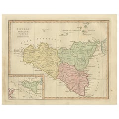
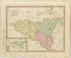
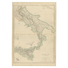
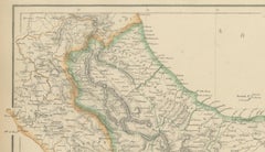
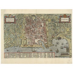
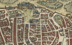
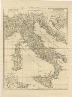
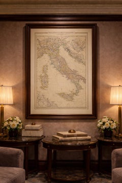
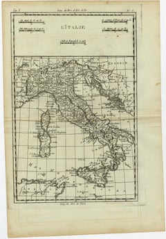
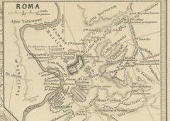
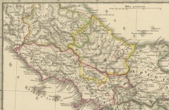
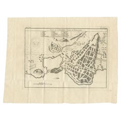
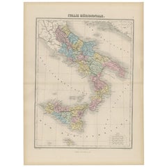
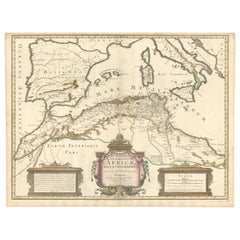
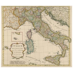
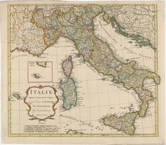
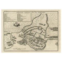
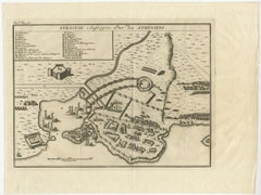
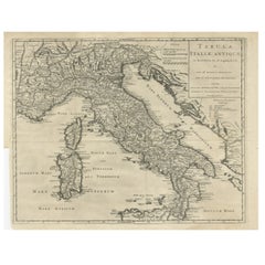
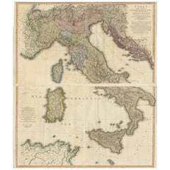
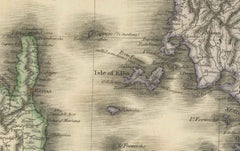
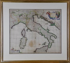
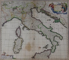
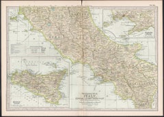
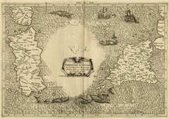
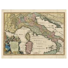
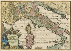
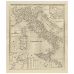
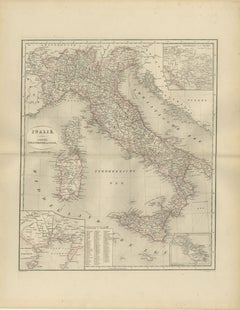
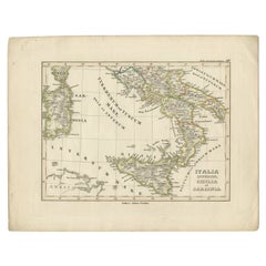
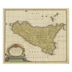
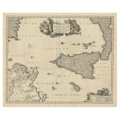
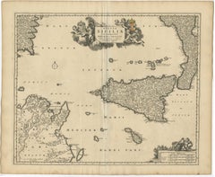
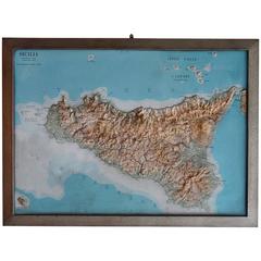
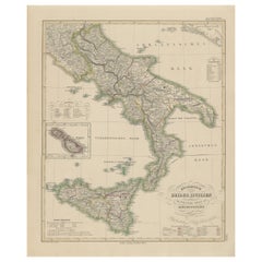
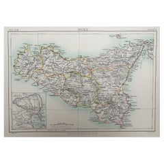
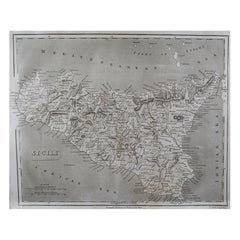
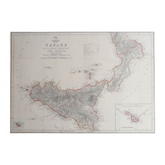
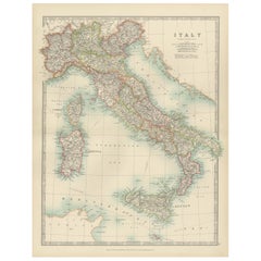
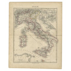
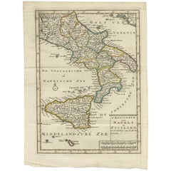
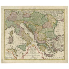
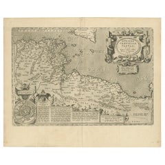
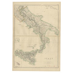
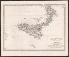
Find many varieties of an authentic sicily map available at 1stDibs. Frequently made of paper, every sicily map was constructed with great care. You’ve searched high and low for the perfect sicily map — we have versions that date back to the 18th Century alongside those produced as recently as the 20th Century are available. A sicily map is a generally popular piece of furniture, but those created in 
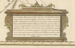
Victorian styles are sought with frequency. A well-made sicily map has long been a part of the offerings for many furniture designers and manufacturers, but those produced by
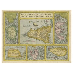
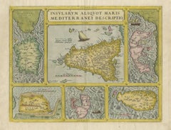
 De Agostini and Theodorus Danckerts are consistently popular.

How Much is a Sicily Map?

A sicily map can differ in price owing to various characteristics — the average selling price 1stDibs is $979, while the lowest priced sells for $36 and the highest can go for as much as $2,536.

Read More

Dickens Fan on Your List? This First Edition of ‘A Christmas Carol’ Is a Treasure

Produced in 1843, the well-preserved volume is evidence of the author's exacting specifications.

Patchwork Quilts Are the Latest Nostalgic Design Trend

New or old, the coverlets add old-time charm to any space.

Medal-Worthy Memorabilia from Epic Past Olympic Games

Get into the games! These items celebrate the events, athletes, host countries and sporting spirit.

Ahoy! You’ve Never Seen a Collection of Sailor Art and Kitsch Quite Like This

French trendsetter and serial collector Daniel Rozensztroch tells us about his obsession with objects related to seafaring men.

39 Incredible Swimming Pools

It's hard to resist the allure of a beautiful pool. So, go ahead and daydream about whiling away your summer in paradise.

Pamela Shamshiri Shares the Secrets behind Her First-Ever Book and Its Effortlessly Cool Interiors

The sought-after designer worked with the team at Hoffman Creative to produce a monograph that beautifully showcases some of Studio Shamshiri's most inspiring projects.

Moroccan Artworks and Objects Take Center Stage in an Extraordinary Villa in Tangier

Italian writer and collector Umberto Pasti opens the doors to his remarkable cave of wonders in North Africa.

Montecito Has Drawn Royalty and Celebrities, and These Homes Are Proof of Its Allure

Hollywood A-listers, ex-pat aristocrats and art collectors and style setters of all stripes appreciate the allure of the coastal California hamlet — much on our minds after recent winter floods.