Antique Maps Of New York City
to
22
160
68
166
86
53
45
45
27
19
19
16
13
13
13
13
11
10
8
6
5
4
3
3
3
2
2
2
1
1
1
1
1
1
1
6
6
5
5
4
Sort By
New York. Southern Part. USA. Century Atlas state antique vintage map
Located in Melbourne, Victoria
'The Century Atlas. New York. Southern Part.'
Original antique map, 1903.
Inset maps of 'New York
Category
Early 20th Century Victorian Antique Maps Of New York City
Materials
Lithograph
New Jersey Antique Map – The Garden State, Railroads & Counties, c.1888
Located in Langweer, NL
during the Gilded Age.
Particularly appealing are the insets, including a detailed map of New York City
Category
Late 19th Century American Antique Maps Of New York City
Materials
Paper
$545
H 20.67 in W 14.18 in D 0.01 in
Antique Map of American Cities, Vignette of New York City, circa 1920
Located in St Annes, Lancashire
Great maps of American Cities
Unframed
Original color
By John Bartholomew and Co
Category
1920s British Antique Maps Of New York City
Materials
Paper
1864 Johnson's Map of New York State with City Insets
Located in Langweer, NL
Title: 1864 Johnson's Map of New York State with City Insets
Description: This 1864 map, titled
Category
1860s Antique Maps Of New York City
Materials
Paper
$265 Sale Price
20% Off
H 17.13 in W 26.78 in D 0 in
1840 "New Map of the City of New York With Part of Brooklyn & Williamsburg"
Located in Colorado Springs, CO
Presented is a hand-colored, engraved folding map titled "New Map of the City of New York With Part
Category
1840s American Antique Maps Of New York City
Materials
Paper
$4,500
H 30 in W 27.5 in D 3 in
1855 "New-York City & County Map" by Charles Magnus
By Charles Magnus
Located in Colorado Springs, CO
This is a beautiful hand-colored map titled “New York City & County Map with Vicinity entire
Category
1850s American Antique Maps Of New York City
Materials
Paper
1858 Colton's Map of New York, Ric.B011
Located in Norton, MA
, Syracuse, Albany, Troy and New York City. The main map in center has typical pastel coloring of counties
Category
19th Century Unknown Antique Maps Of New York City
Materials
Paper
Rare Original Map of New Amsterdam (New York) – “Restitutio”, ca. 1674 –
Located in Dronten, NL
An exceptionally rare and original 17th-century engraving of New Amsterdam, now New York City
Category
17th Century Dutch Antique Maps Of New York City
Materials
Paper
$24,950
H 20.16 in W 23.35 in D 0.4 in
1862 Johnson's Map of New York State by Johnson & Browning
Located in Langweer, NL
Title: 1862 Johnson's Map of New York State by Johnson & Browning
Description:This is an 1862 map
Category
1860s Antique Maps Of New York City
Materials
Paper
$265 Sale Price
20% Off
H 14.18 in W 18.12 in D 0 in
Original Antique City Plan of Buffalo, New York, USA, circa 1900
By Rand McNally & Co.
Located in St Annes, Lancashire
Fabulous colorful map of Buffalo
Original color
By Rand, McNally & Co.
Published, circa 1900
Category
1890s American Antique Maps Of New York City
Materials
Paper
1876 Antique Map of New York State with Niagara and Hudson River Insets
Located in Langweer, NL
Title: Detailed Map of New York State - 1876 by Samuel Augustus Mitchell Jr.
Description: This is
Category
1870s Antique Maps Of New York City
Materials
Paper
$208 Sale Price
20% Off
H 17.13 in W 26.78 in D 0 in
1912 "Panoramic View of New York City and Vicinity" by Jacob Ruppert
Located in Colorado Springs, CO
This is an attractive and very scarce map of New York, published by the Yorkville brewer Jacob
Category
1910s American Antique Maps Of New York City
Materials
Paper
$8,500
H 30 in W 38.5 in D 3.5 in
New York State Antique Map c.1888 – The Empire State, Railroads & Counties
Located in Langweer, NL
Antique Map of New York State – Rand McNally, circa 1888
This antique map of New York State was
Category
Late 19th Century American Antique Maps Of New York City
Materials
Paper
$545
H 14.18 in W 20.67 in D 0.01 in
Long Island New York Antique Map c.1888 – The Empire State, Railroads
Located in Langweer, NL
Antique Map of Long Island, New York – Rand McNally, circa 1888
This antique map of Long Island
Category
Late 19th Century American Antique Maps Of New York City
Materials
Paper
$545
H 14.18 in W 20.67 in D 0.01 in
Western New York Antique Map – The Empire State, Railroads & Counties, c.1888
Located in Langweer, NL
Antique Map of Western New York – Rand McNally, circa 1888
This antique map of western New York
Category
Late 19th Century American Antique Maps Of New York City
Materials
Paper
$545
H 14.18 in W 20.67 in D 0.01 in
1863 "Lloyd's New Map of the United States, the Canadas, and New Brunswick"
Located in Colorado Springs, CO
, two shipping agents and their routes are drawn out of New York City. The map includes details of the
Category
1860s American Antique Maps Of New York City
Materials
Linen, Wood, Paper
$4,000
H 37 in W 49.5 in D 1 in
1917 "New Hudson River Map" by Wallace Bruce, Later Edition, Folding Map
Located in Colorado Springs, CO
Union Publishing Co., in New York City. The map is a later edition, issued in a distinct strip-chart
Category
1910s American Beaux Arts Antique Maps Of New York City
Materials
Paper
$550
H 107 in W 5.41 in D 0.1 in
Johnson’s New Brunswick Nova Scotia Newfoundland Map, USA c.1864
Located in Langweer, NL
Johnson’s New Brunswick Nova Scotia Newfoundland Map, USA c.1864
This is a finely engraved and
Category
Mid-19th Century American Antique Maps Of New York City
Materials
Paper
1868 "Lloyd's Topographical Railway Map of North America..." Hanging Wall Map
Located in Colorado Springs, CO
1900.” This map was published by J. T. Lloyd, in New York, in 1868. A large, hanging map of the United
Category
1860s American Late Victorian Antique Maps Of New York City
Materials
Linen, Paper
$6,500
H 60 in W 67.5 in D 1 in
1854 Map of Massachusetts, Connecticut and Rhode Island, Antique Wall Map
Located in Colorado Springs, CO
some of these companies maintained offices in both Buffalo and New York City.
This map has been
Category
19th Century American Antique Maps Of New York City
Materials
Paper
$5,800
H 38.13 in W 45 in D 3.5 in
Nelson's Guide to the City of New York and its Neighbourhood, 1858
Located in Langweer, NL
"Nelson's Guide to the City of New York and its Neighbourhood," published in 1858 by T. Nelson in
Category
1850s Antique Maps Of New York City
Materials
Paper
$417 Sale Price
20% Off
H 5.91 in W 3.94 in D 0.4 in
1851 Map of "Independent Tartary", Ric. R018
Located in Norton, MA
. (London & New York) between 1838 and 1851. After 1850-51, their maps were published by the London Printing
Category
19th Century Unknown Antique Maps Of New York City
Materials
Paper
Johnson’s Australia Map, USA Published c.1864 – Decorative Hand-Colored Map
Located in Langweer, NL
engraved and hand-colored map titled Johnson’s Australia published by Johnson and Ward in New York, circa
Category
Mid-19th Century American Antique Maps Of New York City
Materials
Paper
$391
H 14.06 in W 18 in D 0.01 in
Vintage 1862 Map of Iowa and Nebraska – Decorative Atlas Print
Located in Langweer, NL
the important boundary between Iowa and Nebraska.
This map comes from Johnson’s New Illustrated
Category
1860s Antique Maps Of New York City
Materials
Paper
French Geographical, Statistical and Historical Map of Pensylvania, 1825
Located in Langweer, NL
Maryland, Delaware, New York and New jersey. Printed on the same page as the map is geographical
Category
1820s Antique Maps Of New York City
Materials
Paper
$455 Sale Price
20% Off
H 20.08 in W 25.99 in D 0 in
Antique Map of the Northeast USA - Vibrant 1903 Cartographic Detail
Located in Langweer, NL
, including states such as New York, Pennsylvania, New Jersey, New England, and parts of the Midwest like Ohio
Category
Early 20th Century Antique Maps Of New York City
Materials
Paper
$403
H 14.49 in W 18.51 in D 0.01 in
Arkansas Map by Colton, USA Published c.1864 – Hand-Colored County Map
Located in Langweer, NL
and hand-colored map titled Arkansas, published by G.W. & C.B. Colton & Co. in New York circa 1864. It
Category
Mid-19th Century American Antique Maps Of New York City
Materials
Paper
$391
H 14.06 in W 18 in D 0.01 in
1859 "Map of the United States of America..." by J. H. Colton
By J.H. Colton
Located in Colorado Springs, CO
,” “Astoria, Oregon,” “Saratoga Lake, New York”, “Valley of the Connecticut,” as well as four monuments, inset
Category
1850s American Antique Maps Of New York City
Materials
Paper
1868 Map of the Upper Part of the Island of Manhattan Above 86th Street
By Wm. Rogers Mfg. Co.
Located in San Francisco, CA
This wonderful piece of New York City history is over 150 years old. It depicts 86th street and
Category
1860s American American Colonial Antique Maps Of New York City
Materials
Paper
$475
H 15.5 in W 24.6 in D 1 in
1847 Ornamental Map of the United States & Mexico by H. Phelps
Located in Colorado Springs, CO
to the rest of the U.S. The map details a potential route for a railroad running from New York City
Category
1840s American Antique Maps Of New York City
Materials
Paper
1876 Map of the United States: Detailing the Railroads and Unsettled Territories
Located in Langweer, NL
according to population, giving insight into urban development at the time. Major cities like New York
Category
1870s Antique Maps Of New York City
Materials
Paper
$1,043
H 18.12 in W 29.93 in D 0.01 in
1899 Poole Brothers Antique Railroad Map of the Illinois Central Railroad
Located in Colorado Springs, CO
, with the short rail distances to New York listed above the stop and short rail distances to New Orleans
Category
1890s American Antique Maps Of New York City
Materials
Paper
$7,950
H 41 in W 47 in D 1.25 in
Antique Map of the Northeastern United States and Canada by Tardieu, 1802
Located in Langweer, NL
.
- Key cities like Boston, New York, and Philadelphia (though not fully visible) were major centers of
Category
Early 1800s Antique Maps Of New York City
Materials
Paper
$531 Sale Price
20% Off
H 16.34 in W 22.25 in D 0.01 in
1856 U.S. Coast Survey Map of Chesapeake Bay and Delaware Bay
Located in Colorado Springs, CO
Presented is U.S. Coast Survey nautical chart or maritime map of Chesapeake Bay and Delaware Bay
Category
1850s American Antique Maps Of New York City
Materials
Paper
1882 Map of the North Atlantic Ocean Showing Cable Tracks and Trade Winds
Located in Langweer, NL
West Africa, with detailed coastlines and prominent cities like London, New York, and Havana marked
Category
1880s Antique Maps Of New York City
Materials
Paper
$296
H 10.63 in W 14.97 in D 0 in
Rare and Early Plaster Relief Map of Adirondack Mountains by F J H Merrill
By P.F. Howells, E. W. Merrill
Located in Buffalo, NY
to check the amazing detail,, Hand delivery avail to New York City or anywhere en route from Buffalo
Category
1910s American Industrial Antique Maps Of New York City
Materials
Plaster, Wood
$3,200
H 63 in W 44 in D 5 in
United States, Canada & Mexico – 1857 North America Map
Located in Langweer, NL
Appalachians, river systems like the Mississippi and Missouri, and major cities including New York, Washington
Category
Mid-19th Century German Antique Maps Of New York City
Materials
Paper
Washington Oregon Idaho Map – Johnson, Hand-Colored, c.1864
Located in Langweer, NL
hand-colored map titled Johnson’s Washington, Oregon, and Idaho, published by Johnson and Ward in New
Category
Mid-19th Century American Antique Maps Of New York City
Materials
Paper
Maine County Map – Johnson, Hand-Colored, USA c.1864
Located in Langweer, NL
hand-colored map titled Johnson’s Maine, published by Johnson and Ward in New York circa 1864. It shows
Category
Mid-19th Century American Antique Maps Of New York City
Materials
Paper
1866 "Johnson's United States" Map, Published by Johnson and Ward
Located in Colorado Springs, CO
by Johnson and Ward in New York.
The map is incredibly detailed, with towns, cities, railroads
Category
1860s American Victorian Antique Maps Of New York City
Materials
Paper
Delaware and Maryland Map – Johnson, Hand-Colored with Insets, 1864
Located in Langweer, NL
engraved and hand-colored map titled Johnson’s Delaware and Maryland, published by Johnson and Ward in New
Category
Mid-19th Century American Antique Maps Of New York City
Materials
Paper
Pennsylvania Antique Map c.1888 – The Keystone State, Northwestern Counties
Located in Langweer, NL
, Cameron, and surrounding areas, extending into parts of New York state. Notable cities and towns such as
Category
Late 19th Century American Antique Maps Of New York City
Materials
Paper
$545
H 14.18 in W 20.67 in D 0.01 in
Minnesota and Dakota Map – Johnson, Hand-Colored, USA c.1864
Located in Langweer, NL
and Ward in New York circa 1864. It shows the state of Minnesota and the Dakota Territory as it was
Category
Mid-19th Century American Antique Maps Of New York City
Materials
Paper
Central America Map – Johnson, Hand-Colored with Insets, c.1864
Located in Langweer, NL
hand-colored map titled Johnson’s Central America, published by Johnson and Ward in New York circa 1864
Category
Mid-19th Century American Antique Maps Of New York City
Materials
Paper
1842 Wall Map of the United States by J. H. Young, Published by S. A. Mitchell
Located in Colorado Springs, CO
city map insets of the vicinities around Boston, New York, Philadelphia, Baltimore and Washington
Category
1840s American Antique Maps Of New York City
Materials
Paper
$5,500
H 45 in W 38 in D 1 in
1882 Blackie Atlas Maps: Atlantic States and Mississippi Valley Compilation
Located in Langweer, NL
dense transportation network and urban centers of the Atlantic coast. Coastal ports, such as New York
Category
1880s Antique Maps Of New York City
Materials
Paper
$426 / set
H 14.97 in W 11.03 in D 0.01 in
Johnson’s Mexico Map with Tehuantepec Inset, USA c.1864 – Hand-Colored
Located in Langweer, NL
and hand-colored map titled Johnson’s Mexico, published by Johnson and Ward in New York circa 1864. It
Category
Mid-19th Century American Antique Maps Of New York City
Materials
Paper
$391
H 14.06 in W 18 in D 0.01 in
1919 "Chicago and Northwestern Railway" Map by P. F. Collier & Son
Located in Colorado Springs, CO
by P. F. Collier & Son, in New York. The map extends from Chicago and Milwalkee in the east, across
Category
1910s American Art Deco Antique Maps Of New York City
Materials
Paper
$550
H 10.13 in W 14.38 in D 0.63 in
Johnson’s China Map with Canton Inset, USA Published c.1864 – Hand-Colored
Located in Langweer, NL
engraved and hand-colored map titled Johnson’s China, published by Johnson and Ward in New York circa 1864
Category
Mid-19th Century American Antique Maps Of New York City
Materials
Paper
$391
H 14.06 in W 18 in D 0.01 in
Johnson’s Illinois Map, USA c.1864 – Hand-Colored with Chicago Courthouse View
Located in Langweer, NL
engraved and hand-colored map titled Johnson’s Illinois, published by Johnson and Ward in New York circa
Category
Mid-19th Century American Antique Maps Of New York City
Materials
Paper
$320
H 18 in W 14.06 in D 0.01 in
"The United States from the Latest Authorities" Antique Wall Map, 1835
Located in Colorado Springs, CO
noted.
The map is bordered with vignettes of Boston, New York, Philadelphia, Hartford, Cincinnati
Category
1830s American Antique Maps Of New York City
Materials
Paper
$4,850
H 25.5 in W 35.5 in D 0.07 in
Turkey in Asia – Antique Ottoman Empire Map by John Tallis, ca. 1851
Located in Langweer, NL
., London & New York, circa 1851
Category
Mid-19th Century English Antique Maps Of New York City
Materials
Paper
$325
H 10.44 in W 14.65 in D 0.02 in
Antique 1844 J Calvin Smith JH Colton Midwest United States Survey Map 27"
By J.H. Colton
Located in Dayton, OH
. Colton in New York. It was tipped into the back of a small travel guide titled “The Western Tourist and
Category
1840s Antique Maps Of New York City
Materials
Paper
$881 Sale Price
25% Off
H 21 in W 26.5 in D 0.5 in
1870 "Johnson's California, also Utah, Nevada, Colorado, New Mexico, and Arizona
Located in Colorado Springs, CO
“Johnson's New Illustrated (Steel Plate) Family Atlas.” The map is engraved, with attractive hand coloring
Category
1870s American Victorian Antique Maps Of New York City
Materials
Paper
$995
H 23.63 in W 30 in D 1 in
1870 "Johnson's North Carolina and South Carolina" Published by A. J. Johnson
Located in Colorado Springs, CO
1865, this map was issued as pages 51 and 52 in the 1870 edition of “Johnson's New Illustrated (Steel
Category
1870s American Victorian Antique Maps Of New York City
Materials
Paper
$995
H 23.5 in W 30 in D 1 in
1870 "Johnson's Georgia and Alabama" Published by A. J. Johnson
Located in Colorado Springs, CO
map was issued as pages 53 and 54 in the 1870 edition of “Johnson's New Illustrated (Steel Plate
Category
1870s American Victorian Antique Maps Of New York City
Materials
Paper
1870 "Johnson's Kentucky and Tennessee" Published by A. J. Johnson
Located in Colorado Springs, CO
map was issued as pages 60 and 61 in the 1870 edition of “Johnson's New Illustrated (Steel Plate
Category
1870s American Victorian Antique Maps Of New York City
Materials
Paper
- 1
Get Updated with New Arrivals
Save "Antique Maps Of New York City", and we’ll notify you when there are new listings in this category.
Antique Maps Of New York City For Sale on 1stDibs
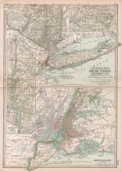
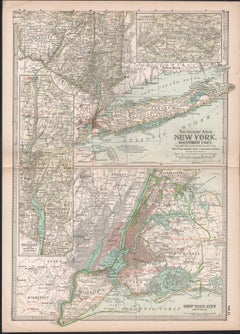
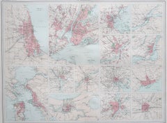
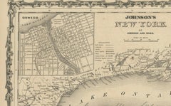
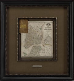
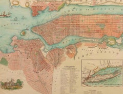
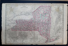
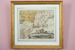
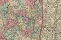
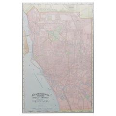
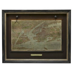
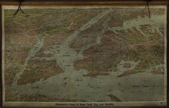
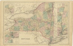
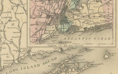
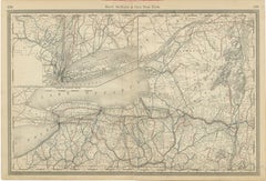
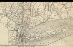
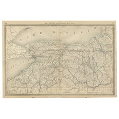
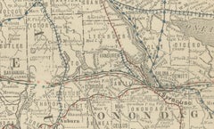
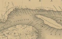
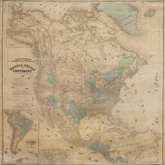
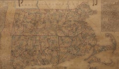
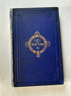
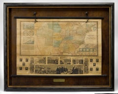
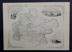
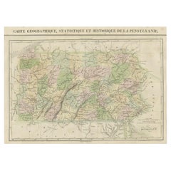
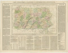
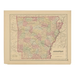
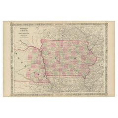
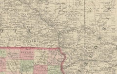
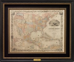
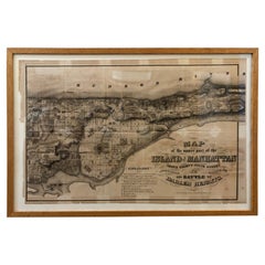
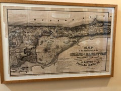
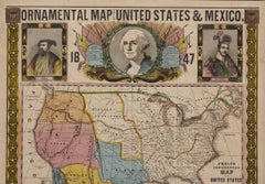
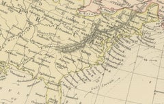
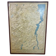
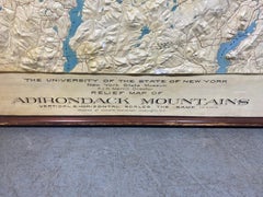
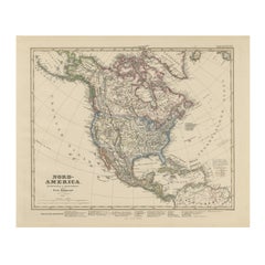
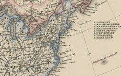
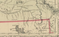
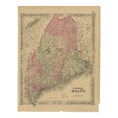
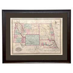
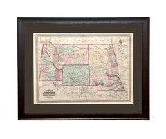
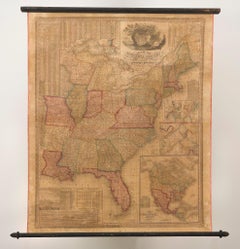
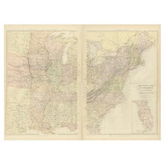
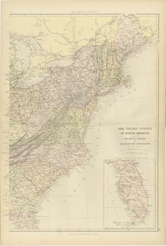
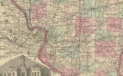
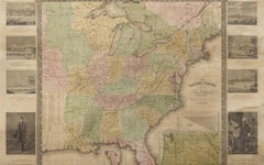
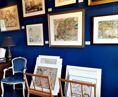
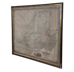
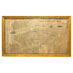
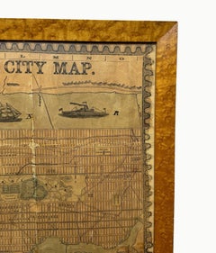
At 1stDibs, there are many versions of the ideal antique maps of new york city for your home. Frequently made of paper, fabric and linen, every antique maps of new york city was constructed with great care. Whether you’re looking for an older or newer antique maps of new york city, there are earlier versions available from the 19th Century and newer variations made as recently as the 20th Century. An antique maps of new york city is a generally popular piece of furniture, but those created in Victorian styles are sought with frequency. A well-made antique maps of new york city has long been a part of the offerings for many furniture designers and manufacturers, but those produced by Charles Magnus, G.W. & C.B. Colton and Rand McNally & Co. are consistently popular.
How Much is a Antique Maps Of New York City?
An antique maps of new york city can differ in price owing to various characteristics — the average selling price 1stDibs is $938, while the lowest priced sells for $55 and the highest can go for as much as $12,000.
More Ways To Browse
Asian Antiques
New York Antique
Antique Japanese Art
Antique Atlases
New York City Mid Century Modern Furniture
Antique Records
Antique Valuables
S S United States
Rare Antique Maps
Sun Antique
Antique Cartography
Mosaic Furniture
Antique Colored Engravings
Amsterdam Used Furniture
Adirondack Antique
Hand Colored Engraving
Antique Hand Colored Engraving
Used Coastal Furniture