Antique Navigator
to
47
143
55
91
84
59
30
29
26
24
24
23
19
13
12
12
10
10
9
8
7
5
5
5
4
4
4
4
4
4
3
3
3
3
3
2
2
2
2
1
1
1
1
1
1
1
1
5
5
3
2
2
Sort By
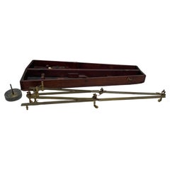
Troughton & Simms Navigators Pantograph
Located in Norwell, MA
Nineteenth century pantograph with box by Troughton and Simms. Engraved Troughton and Simms, London. Missing one wheel. Great nautical instrument. Used in plotting course on a marine...
Category
1920s European Antique Navigator
Materials
Wood
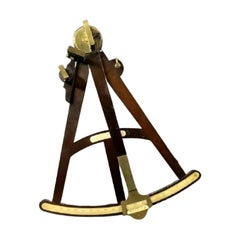
Rosewood Ship's Navigators Octant
Located in Norwell, MA
Ship's octant with rosewood frame, brass filters, mirror and peepsight. Unsigned.
Overall dimensions: 3" x 13" x 16". 2 pounds.
Category
1840s Antique Navigator
Materials
Brass
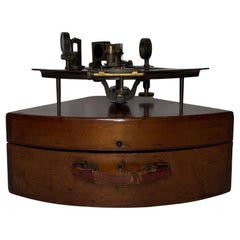
Troughton and Simms Navigators Sextant in Box
Located in Norwell, MA
Solid brass ship's sextant with lattice frame, colored glass filters, many accessory scopes, vernier scale with silver. Mounted into a kidney shaped box with a leather carry handle.
...
Category
Early 1900s North American Antique Navigator
Materials
Brass
16th C. Portuguese Renaissance Painting “Our Lady of Navigators”.
Located in Vero Beach, FL
16th C. Portuguese Renaissance Painting “Our Lady of Navigators” Dutch Ripple frame.
Very early
Category
16th Century Portuguese Renaissance Antique Navigator
Materials
Wood
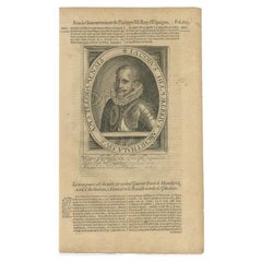
Antique Portrait of Dutch Navigator and Admiral Van Jakob Vanheemskerk, 1618
Located in Langweer, NL
memorables advenues tant és dits pays, qu'és pays voysins, depuis l'an 1315 (..)'.
The navigator and
Category
17th Century Antique Navigator
Materials
Paper
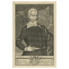
Hendrik Brouwer: Eminent Navigator and Governor-General of the VOC, 1724
Located in Langweer, NL
a navigator and his leadership abilities.
2. **Service with the Dutch East India Company**: Brouwer
Category
1720s Antique Navigator
Materials
Paper
$270 Sale Price
20% Off
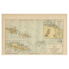
Map of Samoa or Schiffer-Inseln (Navigator Islands) - 19th Century German Map
Located in Langweer, NL
Map of Samoa or Schiffer-Inseln (Navigator Islands) - 19th Century German Map
This detailed 19th
Category
1890s Antique Navigator
Materials
Paper
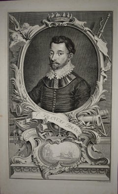
Sir Francis Drake: 18th C. Portrait of 16th C. Navigator, Privateer, Politician
By Jacobus Houbraken
Located in Alamo, CA
-1596) was an English sea captain, privateer, navigator, slaver, and politician of the Elizabethan era
Category
1740s Antique Navigator
Materials
Engraving
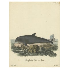
18th Century Hand-Colored Engraving of a Serene Navigator: The Harbor Porpoise
Located in Langweer, NL
This engraving features "Delphinus Phocaena Linn.," referring to what we now call the harbor porpoise (*Phocoena phocoena*). This depiction forms part of a broader collection from th...
Category
1770s German Antique Navigator
Materials
Paper
Dutch Voyages to Madagascar – Early Exploration Scene, Pontanus 1611
Located in Langweer, NL
glorify the courage of Dutch navigators and celebrate the global reach of Amsterdam’s merchants.
The
Category
Early 17th Century Dutch Antique Navigator
Materials
Paper
Early Polar Exploration Engraving – Dutch Arctic Camp, 1611
Located in Langweer, NL
heroic myth of the Dutch Golden Age of exploration, when cartographers, navigators, and publishers
Category
Early 17th Century Dutch Antique Navigator
Materials
Paper
Early Exploration Engraving – Dutch Encounter with Islanders, De Bry 1599
Located in Langweer, NL
ensuing skirmish. The episode likely derives from the voyage accounts of Dutch navigators such as Cornelis
Category
16th Century German Antique Navigator
Materials
Paper
Early Dutch Engraving of Indigenous Peoples, from Pontanus’ Amsterdam, 1611
Located in Langweer, NL
navigators on their way to the East Indies, emphasizing curiosity, commerce, and discovery.
Condition: Good
Category
Early 17th Century Dutch Antique Navigator
Materials
Paper
The Return of Dutch Explorers to Amsterdam Harbor, Pontanus, 1611
Located in Langweer, NL
scene shows richly dressed merchants, navigators, and civic leaders gathered in a courtyard to welcome
Category
Early 17th Century Dutch Antique Navigator
Materials
Paper
Map of Formosa and Pescadores – French Jesuit Engraving by Portier, c.1790
Located in Langweer, NL
scholars, missionaries, and navigators, providing both political and geographic information about regions
Category
Late 18th Century French Antique Navigator
Materials
Paper
Views of St. Denis and St. Paul, Île de Bourbon – Antique French Engraving, 1790
Located in Langweer, NL
for navigators and scholars alike.
Condition report: Very good condition with a strong plate mark and
Category
Late 18th Century French Antique Navigator
Materials
Paper
Map of the Philippines and Palau Islands – Antique French Engraving, c.1790
Located in Langweer, NL
island groups encountered by European navigators. The style suggests it was part of a larger travel or
Category
Late 18th Century French Antique Navigator
Materials
Paper
Memorial to Jacob van Heemskerck, Dutch Naval Hero at Gibraltar, Engraving, 1611
Located in Langweer, NL
navigator, explorer, and naval commander, published in Johannes Isacius Pontanus’ Rerum et urbis
Category
Early 17th Century Dutch Antique Navigator
Materials
Paper
Map of Tierra del Fuego and the Straits of Magellan and Le Maire, c.1760
Located in Langweer, NL
European exploration and trade with the Pacific, though the treacherous conditions led some navigators to
Category
Mid-18th Century French Antique Navigator
Materials
Paper
Martinique Map by Rigobert Bonne – French Antique Map, c.1768
Located in Langweer, NL
reference for scholars, navigators, and colonial administrators during France’s colonial presence in the
Category
1760s French Antique Navigator
Materials
Paper
World Map – Mercator Projection with Global Sea Routes, Published in 1857
Located in Langweer, NL
scales, providing a valuable overview for mid-19th-century navigators and scholars.
Published in 1857 by
Category
Mid-19th Century German Antique Navigator
Materials
Paper
Map of Martinique, Guadeloupe, Marie-Galante, Désirade & Saintes by Bonne, 1788
Located in Langweer, NL
influential *Atlas Encyclopédique*. Such maps were used by scholars, navigators, and colonial administrators
Category
Late 18th Century French Antique Navigator
Materials
Paper
Lithographic View of the Wangari Cape with a Maori Canoe (New Zealand) - 1836
Located in Langweer, NL
navigators of the 19th century, emphasizing the vibrancy and craftsmanship of indigenous seafaring traditions
Category
1830s Swiss Antique Navigator
Materials
Paper
Hand-Colored 1750 Plan of Batavia, Colonial Jakarta, Indonesia by Jacques Bellin
Located in Langweer, NL
to the left, revealing the city in a clear and practical format for navigators and officials. A
Category
Mid-18th Century Antique Navigator
Materials
Paper
19th Century, English Mahogany & Brass Nautical Gimbal Thermometer, Barometer
Located in Atlanta, GA
thermometer and barometer would have been an essential device for ship captains and navigators. Today, it
Category
19th Century British George III Antique Navigator
Materials
Brass
$3,840 Sale Price
20% Off
Mercator's Ptolemaic Map of the Holy Land, Cyprus and Syria, circa 1580
Located in Langweer, NL
Projection, a system which allowed navigators to plot the same constant compass bearing on a flat map.
Category
16th Century Antique Navigator
Materials
Paper
$667 Sale Price
20% Off
Naive School Portrait Of A Man With A Map, Original Antique Oil Painting
Located in Bristol, GB
desk alongside a quill probably denting him as a navigator of some kind.
The painting is probably
Category
18th Century Folk Art Antique Navigator
Materials
Canvas
Confrontation and Culture: Samoan Warrior Engagement, Published in 1820
Located in Langweer, NL
The engraving is captioned as "Mode of Fighting in the Navigator's Islands" and depicts a scene of
Category
1820s Antique Navigator
Materials
Paper
$241 Sale Price
20% Off
Map of Saint Helena Island: Early 18th-Century Copper Engraving by F. Bernard
Located in Langweer, NL
were commonly included in early maps to aid navigators in identifying land from a distance. The
Category
1720s Antique Navigator
Materials
Paper
Small Original Antique Map of the Lower Alsace region, Germany
Located in Langweer, NL
Projection, a system which allowed navigators to plot the same constant compass bearing on a flat map.
Category
Early 17th Century Antique Navigator
Materials
Paper
$328 Sale Price
20% Off
Mercator's Ptolemaic map of Taprobana, (Ceylon) Sri Lanka
Located in Langweer, NL
Mercators Projection, a system which allowed navigators to plot the same constant compass bearing on a flat
Category
16th Century Antique Navigator
Materials
Paper
$561 Sale Price
20% Off
Bay of Saint Helena: French Naval Chart by N.B. Ingénieur de la Marine, ca.1770
Located in Langweer, NL
French and English leagues (*Lieues Marines de France et d'Angleterre*), allowing navigators to gauge the
Category
1770s Antique Navigator
Materials
Paper
Antique Print Illustrating How the Indians Cure Their Sick People
Located in Langweer, NL
William Dampier. Published 1723.
William Dampier was an English explorer, pirate, privateer, navigator
Category
Mid-18th Century Antique Navigator
Materials
Paper
$106 Sale Price
20% Off
Antique Map of the Eastern Hemisphere by Teesdale, '1831'
Located in Langweer, NL
the navigators James Cook and John Gore. Plate 1 from: A new general atlas of the world, containing
Category
Mid-19th Century Antique Navigator
Materials
Paper
$241 Sale Price
20% Off
Small Original Antique Map of Upper Saxony, Germany
Located in Langweer, NL
most famous for introducing Mercators Projection, a system which allowed navigators to plot the same
Category
Early 17th Century Antique Navigator
Materials
Paper
$328 Sale Price
20% Off
Mercator's Ptolemaic Map of Ancient Assyria, Media, and Persia
Located in Langweer, NL
of the Mercator projection was revolutionary, allowing navigators to plot courses using straight
Category
16th Century Antique Navigator
Materials
Paper
$1,102 Sale Price
20% Off
Rare North Atlantic and Caribbean Sea Chart: Newfoundland to Venezuela, 1745
Located in Langweer, NL
lines, intersecting at numerous points across the map, allowed navigators to plot their courses
Category
1740s Antique Navigator
Materials
Paper
$2,321 Sale Price
20% Off
Pair of rare 17th century celestial and terrestrial globes, Vincenzo Coronelli
By Vincenzo Coronelli
Located in Paris, FR
thanks to the information he collected from navigators and missionaries. He perfected the manufacture of
Category
1690s Italian Antique Navigator
Materials
Wood
Star Island, Isles of Shoals
Located in Bryn Mawr, PA
sea. As an expert navigator and yachtsman, Sheppard had a deep reverence for the ocean and understood
Category
1880s Realist Antique Navigator
Materials
Canvas, Oil
View of the New Trinity House on Tower Hill
Located in Middletown, NY
, providing expert navigators for ships trading in Northern European waters.
Category
Late 18th Century English School Antique Navigator
Materials
Handmade Paper, Engraving
Large Antique Plan of St. Philiou Bay or Sant Feliu Catalonia Spain, circa 1746
Located in Langweer, NL
features relevant to Sant Feliu, offering a practical resource for sailors, navigators, or merchants of the
Category
Mid-18th Century Antique Navigator
Materials
Paper
$522 Sale Price
20% Off
1750 Bellin Map of the Red River (Tonkin River) and Hanoi, Vietnam
Located in Langweer, NL
interest for European navigators, merchants, and missionaries seeking access to Indochina.
The map
Category
1750s Antique Navigator
Materials
Paper
1685 Alain Manesson Mallet Map of Hokkaido (Lesso) in Northern Japan
Located in Langweer, NL
mythical lands like Company’s Land, which was believed to have been sighted by European navigators but was
Category
1680s Antique Navigator
Materials
Paper
William IV Terrestrial And Celestial Floor Globes By J. W. Cary
By John & William Cary
Located in New Orleans, LA
COAST OF TARTARY, TOGETHER, With every other Improvement collected from Various Navigators to the
Category
19th Century English Regency Antique Navigator
Materials
Mahogany
W. Hartmann Antique Oak & Copper Ships Binnacle Nautical Maritime Compass
By A. Lietz Co.
Located in Dayton, OH
lantern housing which would help the navigator by illuminating the compass. Measure: 57".
Category
Late 19th Century Late Victorian Antique Navigator
Materials
Brass, Copper
$2,590 Sale Price
36% Off
Hand-Colored Print of Corporal Punishment with a Cangue (or Tcha), China, 1844
Located in Langweer, NL
Engravers: Gabriel Lafond de Lurcy, French navigator, explorer and adventurer.
Category
1840s Antique Navigator
Materials
Paper
$174 Sale Price
20% Off
Scarce Latin Edition of Guillaume Delisle's 1700 Map of North America
Located in Langweer, NL
, and other navigators who were involved in the early exploration of the Americas and Pacific regions
Category
Early 1700s German Antique Navigator
Materials
Paper
Large Map of Russian Discoveries in Siberia, Alaska & the Bering Strait, 1784
Located in Langweer, NL
parts of Alaska and providing further detailed knowledge of the area.
3. Russian Navigators in the
Category
1780s Antique Navigator
Materials
Paper
$2,369 Sale Price
20% Off
Cemetery on Amsterdam Island, French Territory in the Indian Ocean, ca.1785
Located in Langweer, NL
a British explorer, navigator, cartographer, and captain in the Royal Navy. Cook made detailed maps
Category
1780s Antique Navigator
Materials
Paper
$280 Sale Price
20% Off
Fine Pair of Floor Globes by J & G Cary, Dated 1820 and 1833
By George & John Cary
Located in Lymington, Hampshire
Discoveries with the Tracks of the Principal Navigators and every improvement in Geography to the present Time
Category
Early 19th Century English Regency Antique Navigator
Materials
Mahogany
Map of Kerguelen’s Land: The Island of Desolation Explored by Captain Cook
Located in Langweer, NL
southern Indian Ocean. This remote and uninhabited island was discovered by French navigator Yves-Joseph de
Category
1780s Antique Navigator
Materials
Paper
$96 Sale Price
20% Off
Map of Vusihyen, Hu Chew Fu and Hou-Tcheou-Fou, Historical Chinese Cities, 1754
Located in Langweer, NL
des Voyages," were invaluable to navigators, explorers, and scholars. His influence was such that it
Category
1750s Antique Navigator
Materials
Paper
$125 Sale Price
20% Off
Antique Print of Chinese Jugglers and Doctors by De Lurcy, '1844'
Located in Langweer, NL
Lafond de Lurcy.
Artists and Engravers: Gabriel Lafond de Lurcy, French navigator, explorer and
Category
19th Century Antique Navigator
Materials
Paper
$125 Sale Price
20% Off
Antique Print of Chinese Jugglers and Doctors by De Lurcy, circa 1844
Located in Langweer, NL
Lafond de Lurcy.
Artists and Engravers: Gabriel Lafond de Lurcy, French navigator, explorer and
Category
19th Century Antique Navigator
Materials
Paper
$135 Sale Price
20% Off
Portrait of Abraham Ortelius Engraved by Philippe Galle, first published in 1579
Located in Langweer, NL
helped to unify mapmaking practices across Europe.
Ortelius's work not only aided navigators and
Category
16th Century Antique Navigator
Materials
Paper
$570 Sale Price
20% Off
Antique Sea Chart by J. B. d'Apres de Mannevillette, Sumatra, 1780
Located in Langweer, NL
resource for navigators.
Category
Late 18th Century French Antique Navigator
Materials
Paper
$454 Sale Price
20% Off
1717 Johannes Van Keulen Sea Chart of the Eastern Atlantic - Amsterdam to Gambia
Located in Langweer, NL
entire map, allowing navigators to chart their course across the open sea effectively.
2. decorative
Category
1710s Dutch Antique Navigator
Materials
Paper
$2,040 Sale Price
25% Off
- 1
Get Updated with New Arrivals
Save "Antique Navigator", and we’ll notify you when there are new listings in this category.
Antique Navigator For Sale on 1stDibs
Find many varieties of an authentic antique navigator available at 1stDibs. An antique navigator — often made from wood, paper and metal — can elevate any home. You’ve searched high and low for the perfect antique navigator — we have versions that date back to the 18th Century alongside those produced as recently as the 20th Century are available. An antique navigator made by Victorian designers — as well as those associated with folk art — is very popular. You’ll likely find more than one antique navigator that is appealing in its simplicity, but Cary’s, A. Lietz Co. and Ackermann and Fritze produced versions that are worth a look.
How Much is a Antique Navigator?
The average selling price for an antique navigator at 1stDibs is $1,900, while they’re typically $49 on the low end and $434,393 for the highest priced.
More Ways To Browse
Nautical Ship Clock
Ship Chronometer
Troughton And Simms
William Dampier
Box Sextant
Richard Norman Shaw
7 Day Clock
Gimbal Barometer
Antique 7 Day Clock
Ramsden Barometer
Seth Thomas Ship Clock
Darwin Sinke Van Tongeren
Used Furniture In Seattle
Used Storm Doors
Vintage Boat Rope
Vintage Brass Diving Helmet
Vintage Wooden Paddle
Antique Fishing Buoys
