
Historical Documents

to
155
532
101
637
12
2
18
16
7
7
5
5
5
4
3
2
1
1
1
1
233
302
102
14
52
27
15
6
6
6
4
5
7
2
8
4
3
527
71
48
37
25
356
102
96
47
44
651
643
651
22
7
3
3
2
Antique VOC Governance Chart Engraving — Dutch East India Company, ca.1719

Antique VOC Governance Chart Engraving — Dutch East India Company, ca.1719

Located in Langweer, NL

Asian centers — underline the vast geographic scope of VOC activities. As a historical document, this

Category

Antique Early 18th Century French Prints

Materials

Paper

Greece & Ionian Islands Map, Antique Hand-Colored Map, 1860

Greece & Ionian Islands Map, Antique Hand-Colored Map, 1860

Located in Langweer, NL

historical document and a highly decorative wall piece. Condition report: Good antique condition. Light

Category

Antique Mid-19th Century British Maps

Materials

Paper

Elegant Victorian Lady Portrait – Vanity Fair Marchioness of Waterford 1883

Elegant Victorian Lady Portrait – Vanity Fair Marchioness of Waterford 1883

Located in Langweer, NL

printing of the nineteenth century. Today Vanity Fair prints remain highly collectible both as historical

Category

Antique Late 19th Century British Prints

Materials

Paper

Doris Leslie Blau Vintage Samarkand Rug

Doris Leslie Blau Vintage Samarkand Rug

Located in New York, NY

decorative objects and historical documents — visual archives of trade, spirituality, and aesthetic

Category

Early 20th Century Chinese Chinese and East Asian Rugs

Materials

Wool

Antique Orientalist Caravan at Rest City Gate Scene from Maximilian, 1846

Antique Orientalist Caravan at Rest City Gate Scene from Maximilian, 1846

Located in Langweer, NL

an important historical document of Middle Eastern urban life as viewed through 19th-century European

Category

Antique Mid-19th Century German Prints

Materials

Paper

Antique Two-Sheet Map of the Lesser Sunda Islands, Dutch East Indies - 1884

Antique Two-Sheet Map of the Lesser Sunda Islands, Dutch East Indies - 1884

Located in Langweer, NL

. Displayed together, the maps function both as serious historical documents and as refined decorative works

Category

Antique 1880s Dutch Maps

Materials

Paper

Austrian Empire Map, Antique Hand-Colored Political Map, Central Europe 1859

Austrian Empire Map, Antique Hand-Colored Political Map, Central Europe 1859

Located in Langweer, NL

important historical document illustrating the territorial complexity of the Habsburg realm shortly before

Category

Antique Mid-19th Century British Maps

Materials

Paper

Antique Map of Lot, France – Hand-Colored Engraving by Vuillemin, c.1850

Antique Map of Lot, France – Hand-Colored Engraving by Vuillemin, c.1850

Located in Langweer, NL

a visual and historical document, combining geography with iconography and local pride. The style is

Category

Antique Mid-19th Century French Maps

Materials

Paper

Antique Mexico Map Blaeu c.1642 – New Spain, Early Colonial Detail

Antique Mexico Map Blaeu c.1642 – New Spain, Early Colonial Detail

Located in Langweer, NL

cities, trade routes, and coastline with remarkable density and clarity, making it both a historical

Category

Antique Mid-17th Century Dutch Maps

Materials

Paper

19th Century Italian Oil on Panel Landscape Painting Florence View Black Frame

19th Century Italian Oil on Panel Landscape Painting Florence View Black Frame

Located in Firenze, IT

representation of Florence, but a true historical document that captures the essence of the city at a crucial

Category

Antique 19th Century Italian Romantic Paintings

Materials

Wood, Lacquer

1844 Lithograph of a Bukharan Uzbek: Traditional Attire and Craft

1844 Lithograph of a Bukharan Uzbek: Traditional Attire and Craft

$142Sale Price|20% Off

H 10.12 in W 6.7 in D 0 in

1844 Lithograph of a Bukharan Uzbek: Traditional Attire and Craft

Located in Langweer, NL

artwork but also as historical documents that preserve and share the cultural heritage of regions less

Category

Antique 1840s Prints

Materials

Paper

Charlemagne’s Empire Map, Carolingian Europe France Germany Italy 1817

Charlemagne’s Empire Map, Carolingian Europe France Germany Italy 1817

Located in Langweer, NL

historical document and an elegant decorative piece suitable for a wide range of interiors. A compelling

Category

Antique Early 19th Century British Maps

Materials

Paper

Old World Map Featuring Captain Cook's Exploration Routes and Polar Views, 1787

Old World Map Featuring Captain Cook's Exploration Routes and Polar Views, 1787

$1,802Sale Price|20% Off

H 17.13 in W 20.08 in D 0.01 in

Old World Map Featuring Captain Cook's Exploration Routes and Polar Views, 1787

Located in Langweer, NL

, making it an important historical document. Condition Report: - Paper Quality: Overall good, with some

Category

Antique 1860s Maps

Materials

Paper

Crimean War Lithograph Collection: Eight Views of Sevastopol Surroundings, 1855

Crimean War Lithograph Collection: Eight Views of Sevastopol Surroundings, 1855

$1,755Sale Price / set|20% Off

H 14.18 in W 20.08 in D 0 in

Crimean War Lithograph Collection: Eight Views of Sevastopol Surroundings, 1855

Located in Langweer, NL

achievement and an invaluable historical document, offering unique insights into one of the 19th century's

Category

Antique 1850s Prints

Materials

Paper

Plan of Portsmouth – Antique Town Map, George W. Bacon, Ordnance Atlas, 1885

Plan of Portsmouth – Antique Town Map, George W. Bacon, Ordnance Atlas, 1885

Located in Langweer, NL

elegance, making the map appealing both as a historical document and as a decorative artwork suitable for

Category

Antique Late 19th Century British Maps

Materials

Paper

Antique Chinese Porcelain Design Print — Vases & Teapots, Ferrario 1815

Antique Chinese Porcelain Design Print — Vases & Teapots, Ferrario 1815

Located in Langweer, NL

with refined artistic execution, making them both historical documents and decorative works of art

Category

Antique Early 19th Century Italian Prints

Materials

Paper

Map of Rhône: Culture and Commerce in Lyon's Silk and Wine Legacy, 1852

Map of Rhône: Culture and Commerce in Lyon's Silk and Wine Legacy, 1852

$322Sale Price|20% Off

H 20.28 in W 13.94 in D 0 in

Map of Rhône: Culture and Commerce in Lyon's Silk and Wine Legacy, 1852

Located in Langweer, NL

as historical documents, capturing the essence of the department's identity during the mid-19th

Category

Antique 1850s Maps

Materials

Paper

Decorative Antique Map of Neuchâtel & Lake Neuchâtel with Heraldry, 1706

Decorative Antique Map of Neuchâtel & Lake Neuchâtel with Heraldry, 1706

Located in Langweer, NL

city view, this example is both a fascinating historical document and a striking decorative map

Category

Antique Early 18th Century French Maps

Materials

Paper

Roman Empire Map, Europe Mediterranean & Near East, Wilkinson London 1817

Roman Empire Map, Europe Mediterranean & Near East, Wilkinson London 1817

Located in Langweer, NL

, crisp lettering, and harmonious pastel coloring make it both an important historical document and an

Category

Antique Early 19th Century British Maps

Materials

Paper

Old Map of Ancient Spain and Portugal – Hispania Antiqua Featuring Roman Cities

Old Map of Ancient Spain and Portugal – Hispania Antiqua Featuring Roman Cities

Located in Langweer, NL

map not only serves as a geographical reference but also as a valuable historical document, offering

Category

Antique Late 18th Century Maps

Materials

Paper

French Belle Époque Caricature, Mr L. Delâtre Chromolithograph, 1885

French Belle Époque Caricature, Mr L. Delâtre Chromolithograph, 1885

Located in Langweer, NL

desirable both as historical documents and decorative artworks. Decoratively, the composition’s elegant

Category

Antique Late 19th Century French Prints

Materials

Paper

Rare Vanity Fair Cabinet Council Print – British Government Leaders 1883

Rare Vanity Fair Cabinet Council Print – British Government Leaders 1883

Located in Langweer, NL

fascinating historical document and a powerful decorative print. Its larger format and narrative composition

Category

Antique Late 19th Century British Prints

Materials

Paper

Avian Treasures from Buffon's Natural History: Hand-Colored Masterpieces, 1837

Avian Treasures from Buffon's Natural History: Hand-Colored Masterpieces, 1837

$142Sale Price / set|20% Off

H 5.12 in W 6.89 in D 0.01 in

Avian Treasures from Buffon's Natural History: Hand-Colored Masterpieces, 1837

Located in Langweer, NL

. These engravings not only serve as beautiful works of art but also as historical documents that reflect

Category

Antique 1830s Prints

Materials

Paper

Australia or New Holland Map with Inset Regions by Noothoven van Goor, 1876

Australia or New Holland Map with Inset Regions by Noothoven van Goor, 1876

Located in Langweer, NL

decorative shading, making it an appealing decorative piece as well as a historical document. Condition

Category

Antique 1870s Dutch Maps

Materials

Paper

Original Antique Engraving of Hunting, Small Game Hunting and Traps, 1793

Original Antique Engraving of Hunting, Small Game Hunting and Traps, 1793

$218Sale Price|20% Off

H 16.34 in W 10.83 in D 0 in

Original Antique Engraving of Hunting, Small Game Hunting and Traps, 1793

Located in Langweer, NL

an historical document illustrating the technological and industrial knowledge of the time. The

Category

Antique 1790s Prints

Materials

Paper

North America Map with USA, Canada & Mexico – Nieuwe Hand-Atlas, 1876

North America Map with USA, Canada & Mexico – Nieuwe Hand-Atlas, 1876

Located in Langweer, NL

historical document, the map captures North America during a transformative era—before the completion of full

Category

Antique 1870s Dutch Maps

Materials

Paper

Blaeu Holy Land Map, Terra Sancta Palestina, Figural Cartouche, 1642

Blaeu Holy Land Map, Terra Sancta Palestina, Figural Cartouche, 1642

Located in Langweer, NL

it both a significant historical document and a refined statement piece for sophisticated interiors

Category

Antique Mid-17th Century Dutch Maps

Materials

Paper

Large Rhine River Map, Moselle and Meuse, by Willem Blaeu, Hand-coloured - 1640

Large Rhine River Map, Moselle and Meuse, by Willem Blaeu, Hand-coloured - 1640

$1,423Sale Price|20% Off

H 16.93 in W 38.98 in D 0.02 in

Large Rhine River Map, Moselle and Meuse, by Willem Blaeu, Hand-coloured - 1640

Located in Langweer, NL

historical document. Cartographer Willem Janszoon Blaeu, the eminent Amsterdam publisher whose workshop

Category

Antique Mid-17th Century Dutch Maps

Materials

Paper

Decorative Map of Chatham, Rochester and Gillingham, Naval Dockyard Plan, 1885

Decorative Map of Chatham, Rochester and Gillingham, Naval Dockyard Plan, 1885

Located in Langweer, NL

balanced composition and clear labeling make it both a valuable historical document and an attractive

Category

Antique Late 19th Century British Maps

Materials

Paper

Sir Walter Raleigh Frees Five Indian Kings – Drake Voyages Engraving 1770

Sir Walter Raleigh Frees Five Indian Kings – Drake Voyages Engraving 1770

Located in Langweer, NL

London during the period. Today the print is valued both as a historical document relating to Raleigh’s

Category

Antique 18th Century British Prints

Materials

Paper

Columbus Presenting Discovery of America to Ferdinand & Isabella, 1787

Columbus Presenting Discovery of America to Ferdinand & Isabella, 1787

Located in Langweer, NL

London during the period. Today the print is valued both as a historical document relating to Raleigh’s

Category

Antique 18th Century British Prints

Materials

Paper

Defeat at River Gete: The Fall of Orange to Alva in 1568, Published in 1730

Defeat at River Gete: The Fall of Orange to Alva in 1568, Published in 1730

Located in Langweer, NL

. This print would be a significant historical document, as it not only visually represents a pivotal

Category

Antique 1730s Prints

Materials

Paper

19th Century Botanical Engravings of flowers and insects

19th Century Botanical Engravings of flowers and insects

$2,012Sale Price / set|20% Off

H 23.23 in W 16.93 in D 1.58 in

19th Century Botanical Engravings of flowers and insects

Located in Seaford, GB

British natural history. These prints not only serve as decorative pieces but also as historical documents

Category

Antique 19th Century English Victorian Prints

Materials

Paper

Antique Chinese Architecture Design Prints — Temple Elevations & Plans, 1815

Antique Chinese Architecture Design Prints — Temple Elevations & Plans, 1815

Located in Langweer, NL

historical documents and as sophisticated decorative works, combining architectural study with elegant

Category

Antique Early 19th Century Italian Prints

Materials

Paper

Senex Map of Castile, Leon & La Mancha in The Spanish Heartland, 1714

Senex Map of Castile, Leon & La Mancha in The Spanish Heartland, 1714

$464Sale Price|20% Off

H 19.81 in W 26.89 in D 0.02 in

Senex Map of Castile, Leon & La Mancha in The Spanish Heartland, 1714

Located in Langweer, NL

serves not just as a geographical record but also as a historical document, reflecting the territorial

Category

Antique Early 18th Century Maps

Materials

Paper

1932 Art Deco Graz Austria Automobile Motorsport Racing Enamel Bronze Car Badge

1932 Art Deco Graz Austria Automobile Motorsport Racing Enamel Bronze Car Badge

Located in Red Lion, PA

sculptural object and a historical document. This badge is a definitive acquisition for those focused on high

Category

Vintage 1930s German Art Deco Sports Equipment and Memorabilia

Materials

Bronze, Enamel

Antique America Engraving Chile Natives & Guatemala Serpents Drake, 1771

Antique America Engraving Chile Natives & Guatemala Serpents Drake, 1771

Located in Langweer, NL

printmaking, with careful cross-hatching, balanced composition, and crisp engraved lines. As both a historical

Category

Antique 18th Century British Prints

Materials

Paper

Large Map of Castile's Southern Realms - Granada, Andalusia, and Murcia, 1652

Large Map of Castile's Southern Realms - Granada, Andalusia, and Murcia, 1652

$455Sale Price|20% Off

H 17.64 in W 23.75 in D 0.02 in

Large Map of Castile's Southern Realms - Granada, Andalusia, and Murcia, 1652

Located in Langweer, NL

distances on the map. While the map itself is designed for practical use, it also serves as a historical

Category

Antique Mid-17th Century Maps

Materials

Paper

  • 1
  • ...
Get Updated with New Arrivals
Save "Historical Documents", and we’ll notify you when there are new listings in this category.

Historical Documents For Sale on 1stDibs

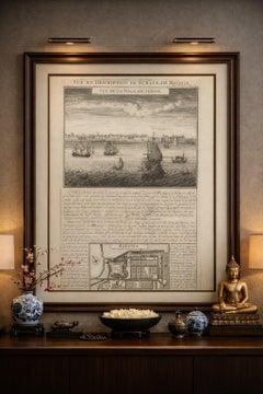
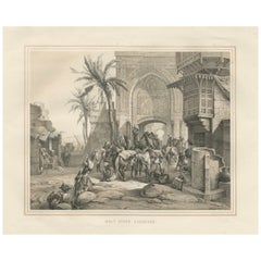
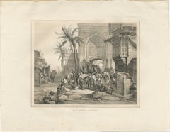
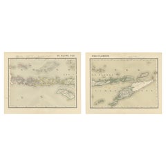
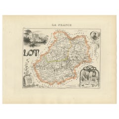
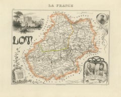
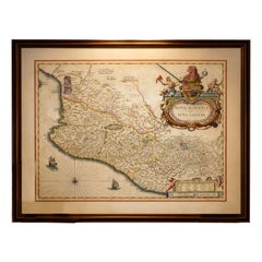
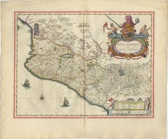
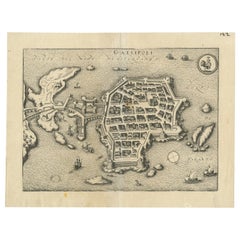
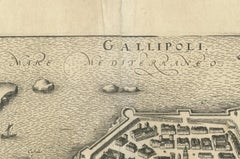
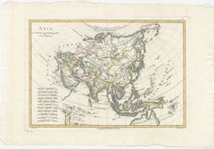
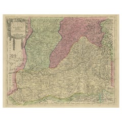
An assortment of historical documents is available at 1stDibs. Each of these unique historical documents was constructed with extraordinary care, often using paper, metal and parchment paper. Historical documents have been made for many years, and versions that date back to the 18th Century alongside those produced as recently as the 20th Century. Historical documents bearing Art Deco or Arts and Crafts hallmarks are very popular at 1stDibs. There have been many well-made historical documents over the years, but those made by Victor Hugo and Eduard Buk Ulreich are often thought to be among the most beautiful.

How Much are Historical Documents?

Historical documents can differ in price owing to various characteristics — the average selling price at 1stDibs is $6,598, while the lowest priced sells for $419 and the highest can go for as much as $92,956.