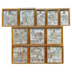
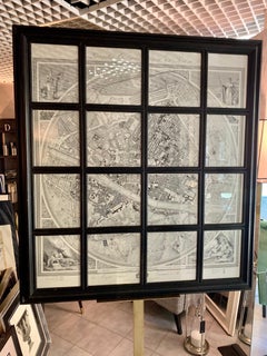
A Variety of Eleven Wonderful Old Maps, Framed
Located in San Francisco, CA
A Variety of Eleven Wonderful Old Maps, Framed
Category
20th Century Decorative Art
Materials
Paper
A Variety of Eleven Wonderful Old Maps, Framed
Located in San Francisco, CA
A Variety of Eleven Wonderful Old Maps, Framed
Paper

$1,400Sale Price|20% Off
H 16.93 in W 38.98 in D 0.02 in
Large Rhine River Map, Moselle and Meuse, by Willem Blaeu, Hand-coloured - 1640
Located in Langweer, NL
Condition report • Strong, clean impression on lightly toned, sturdy laid paper • Original centre-fold as issued; faint reinforcement on verso at two tiny separations • Contemporary ...
Paper
$2,859 / item
H 47.64 in W 43.71 in D 1.58 in
Geometric Map of Florence with Black Lacquered Frame Old Map Reproduction
Located in Scandicci, Florence
GEOMETRIC PLAN OF THE CITY OF FLORENCE WHICH IS TRUE AS 1:4.500, showing expansions and urban planning changes. The entire print, reproduced on paper, is framed with a "window" struc...
Wood, Paper

$1,175
H 26.13 in W 42.13 in D 0.75 in
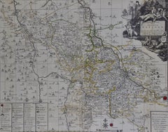
Meissen, Germany : A Large Framed 18th Century Map by Petrus Schenk
Located in Alamo, CA
This is a hand-colored 18th century map of the Meissen region of Germany, entitled "Geographischer Entwurff Derer Aemmter Meissen als Creys-Procuratur-Schul-und Stiffts-Ammt benebst ...
Engraving

$2,375
H 18.75 in W 22.25 in D 0.88 in
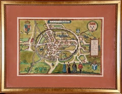
Canterbury: An Original 16th C. Framed Hand-colored Map by Braun & Hogenberg
By Franz Hogenberg
Located in Alamo, CA
This is a framed 16th century map and city view of Canterbury, England entitled "Cantuarbury" by Braun & Hogenburg, from their famous landmark atlas of city views 'Civitates Orbis Te...
Engraving

$1,175
H 23.5 in W 25.75 in D 1 in
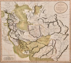
Persia & Afghanistan: A Framed Hand-colored 17th Century Map by John Cary
By John Cary
Located in Alamo, CA
This colorful and detailed early 18th century copperplate map by John Cary entitled "A New Map of Persia from the Latest Authorities" was published in London in 1801. It depicts Pers...
Engraving

$1,375
H 20 in W 24.88 in D 1.13 in
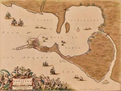
Cadiz Island: A Framed 17th Century Hand-colored Map from Blaeu's Atlas Major
By Joan (Johannes) Blaeu
Located in Alamo, CA
This is a 17th century hand-colored map entitled "Insula Gaditana Isla de Cadiz" from Johannes (Joan) Blaeu's Atlas Maior, published in Amsterdam in 1662. The map provides an excell...
Engraving

$1,003
H 18.51 in W 26.38 in D 1.58 in
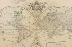
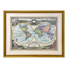
World Map - Etching by Hubert Nicholas-Jaillot - 1719
Located in Roma, IT
World map is an original modern artwork realized by Hubert Nicholas - Jaillot, printed by Louis Cordier in Paris 1719. Etching on copper The artwork depicts two hemispheres, conti...
Etching

$1,975
H 21.5 in W 28 in D 0.75 in
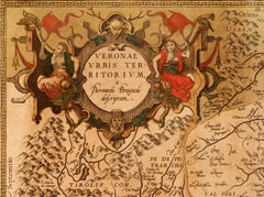
Northern Italy: A 16th Century Hand-colored Map by Abraham Ortelius
By Abraham Ortelius
Located in Alamo, CA
This is a framed 16th century hand-colored copperplate map of northern Italy entitled "Veronae Urbis Territorium a Bernardo Bragnolo Descriptium" by Abraham Ortelius from his atlas "...
Engraving

$1,175
H 28.25 in W 31.25 in D 0.75 in
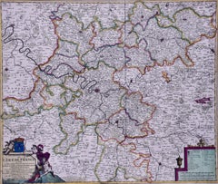
L'Isle de France: A Hand-colored 17th Century Map by De Wit
By Frederick de Wit
Located in Alamo, CA
This colorful and detailed 17th century hand-colored copperplate map by Frederick De Wit was published in Amsterdam between 1666 and 1760. The map depicts the Île-de-France, which is...
Engraving
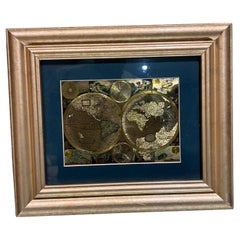
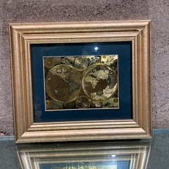
Late 20th Century Gold Foil World Map Double Hemisphere
Located in Chula Vista, CA
Late 20th Century Gold Foil Ancient World Map Double Hemisphere Gold Foil Old World Framed Map information on reverse of the print.
Gold
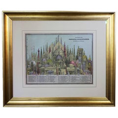
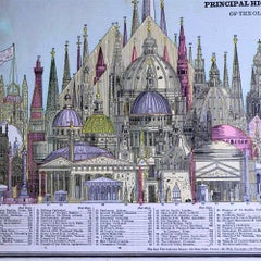
1887 Engraving of Old World Buildings Framed
By George F. Cram
Located in Pataskala, OH
This nicely hand colored pictorial representation shows 78 of the tallest buildings of the late 19th century side by side. The Washington Monument is the tallest one and many are pla...
Paper

Double Hemisphere Old World Map Print, Matted & Framed
Located in Plainview, NY
A double hemisphere old world map print. The map is a reproduction of the original of the 1788 Mapa Mondo made in Rome Italy.
Paper
Sold
H 43.12 in W 64.18 in D 1.58 in
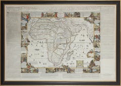
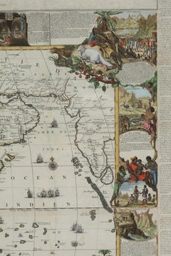
Important giant Map of Africa, for the King of France, 1698
By Nicolas de Fer
Located in Amsterdam, NL
NICOLAS DE FER (PARIS 1647-1720) L’Afrique divisée selon letendu de ses principales parties, et dont les points principaux sont placez sur les observations des Messieurs de l’Acade...
Watercolor, Engraving
Sold
H 43.12 in W 64.18 in
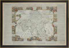
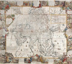
Important giant Map of Asia, for the King of France, 1696
By Nicolas de Fer
Located in Amsterdam, NL
NICOLAS DE FER (PARIS 1647-1720) L’Asie divisée selon letendu de ses principales parties, et dont les points principaux sont placez sur les observations des Messieurs de l’Academie ...
Watercolor, Engraving
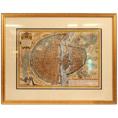
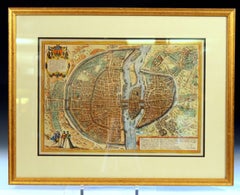
Old Engraving Map of Paris French Munster 16th Century Walled City Framed
Located in Wilton, CT
Old or antique colored engraving of Munster's 1572 map of Paris, circa 19th or 20th century (Frame was not opened to look for a publication date).
Paper


Sold
H 17.88 in W 22 in D 0.75 in
Ireland: A Framed 17th Century Hand-colored Map by Jan Jannson
By Johannes Janssonius
Located in Alamo, CA
This is a 17th century hand-colored map entitled "Hibernia Regnum Vulgo Ireland" by Johannes Janssonius's (Jan Jansson), published in Amsterdam in 1640. This highly detailed map depi...
Engraving

Sold
H 23.5 in W 27 in D 1.325 in
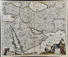
Persia, Armenia & Adjacent Regions: A Hand-colored 17th Century Map by De Wit
By Frederick de Wit
Located in Alamo, CA
This colorful and detailed 17th century copperplate map by Frederick De Wit was published in Amsterdam between 1666 and 1690. It depicts the Caspian Sea and portions of the Black, Re...
Engraving

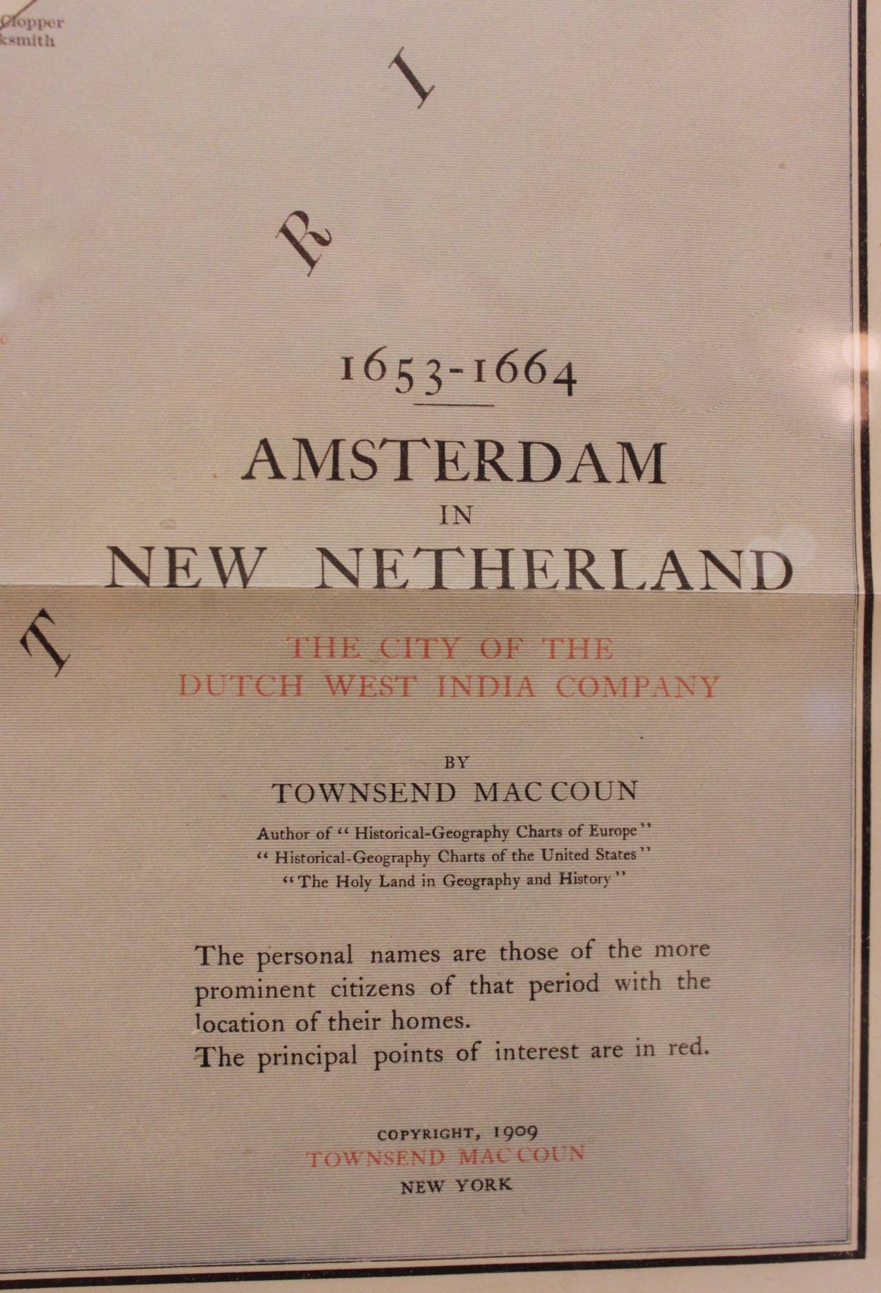
Framed Map of Old New York (Amsterdam in New Netherland)
By Townsend MacCoun
Located in Hudson, NY
Historical Map 'Amsterdam' in New Netherland, 1653-1664, The City of the Dutch West India Company, by Townsend Macon, author of "Historical-Geography Charts of Europe", "Historical-G...
Paper
$4,900 / item
H 34 in W 86 in D 42 in
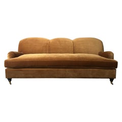
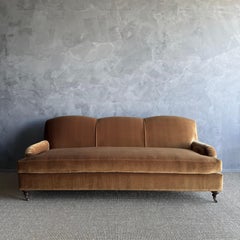
Custom Made Modern English Arm Sofa in Performance Linen Velvet - 86"
By Bloom Home Inc
Located in Old Town Orange, CA
This beautiful english arm sofa has a modern twist, with its single bench cushion, and beautiful curved apron sides. It’s upholstered in a Linen Velvet Performance fabric. Shown in...
Linen, Velvet


$33,847
H 6.3 in W 15.75 in D 5.91 in
Fossilised Skull of Prehistoric Marine Reptile the Mosasaur, 70Million Years Ago
Located in Puglia, Puglia
Upper Cretaceous, about 70-65 million years ago (Maastrichtian) Morocco The skull is reconstructed in good proportions with fossil pieces found in a phosphate mine in Morocco. I att...
Bone
$34,850Sale Price|53% Off
H 38.63 in W 80 in D 59 in
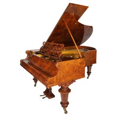
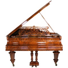
A German 19th Century Louis XVI Style Burr Walnut Bechstein Concert Grand Piano
By Bechstein Piano Company
Located in Los Angeles, CA
A Very Fine German 19th Century Louis XVI Style Burr Walnut Bechstein Concert Grand Piano, Serial No. 5655. The beautifully crafted Grand piano, raised on three tapered barrel shaped...
Bronze