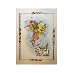
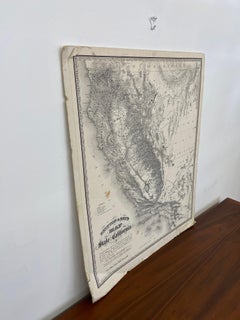
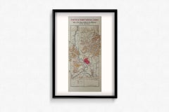
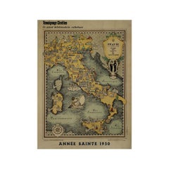
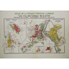
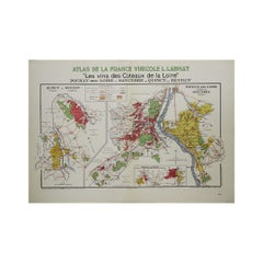
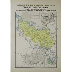
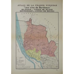
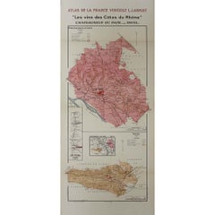
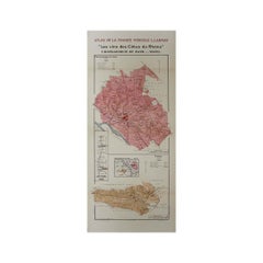
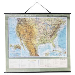
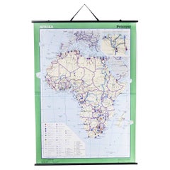
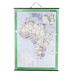
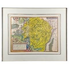
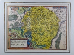
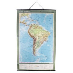
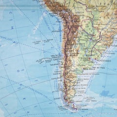
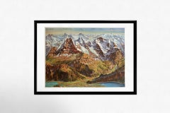
The Vintage Map

to
77
426
253
691
368
191
112
107
86
73
44
32
12
8
7
7
6
Britton & Reys Map of the State of California Print by George H. Goddard.

Britton & Reys Map of the State of California Print by George H. Goddard.

Located in Seattle, WA

Black and white printed map titled "Britton & Reys Map of the State of California", originally compiled by George H.Goddard, C.E.

Category

1970s Mid-Century Modern The Vintage Map

Materials

Paper

A Series of Historical Maps of Italian Cities

A Series of Historical Maps of Italian Cities

Located in New York, NY

A Pair of vintage maps can add so much interest to a space and this group of Italian maps is particularly interesting.

Category

20th Century Italian The Vintage Map

Materials

Paper

Original Vintage Drink Poster Oloroso No.10 R.F. Osborne Sherry Map Bull Design

Original Vintage Drink Poster Oloroso No.10 R.F. Osborne Sherry Map Bull Design

Located in London, GB

Osborne Sherry / Xeres / Jerez Puerto de Santa Maria Espana featuring a great design depicting a bull above a bottle of the sherry wine made from palomino grapes next to a glass on a...

Category

1940s Spanish The Vintage Map

Materials

Paper

Original Vintage Chinese Communist Party Propaganda Poster New China Map Beijing

Original Vintage Chinese Communist Party Propaganda Poster New China Map Beijing

Located in London, GB

Original vintage Chinese Communist Party propaganda poster commemorating the 60th anniversary of the founding of the party: 1921-1981 Without the Communist Party There Would Be No Ne...

Category

1980s Chinese The Vintage Map

Materials

Paper

Journey through Time: Vintage Tourist Map of Vilnius, circa 1964 1j15

Journey through Time: Vintage Tourist Map of Vilnius, circa 1964 1j15

Located in Bordeaux, FR

Embark on a nostalgic exploration of Vilnius with this vintage tourist map, a captivating piece from circa 1964. This map is a window to the past, allowing you to navigate the charmi...

Category

1960s The Vintage Map

Materials

Paper

Late 20th Century Educational Geographic Map - Australasia

Late 20th Century Educational Geographic Map - Australasia

Located in Hook, Hampshire

Late 20th Century Educational Geographic Map – Australasia Late 20th Century Educational Geographic Map – Australasia.

Category

Late 20th Century Czech The Vintage Map

Materials

Cotton

Late 20th Century Educational Geographic Map - African Climate

Late 20th Century Educational Geographic Map - African Climate

Located in Hook, Hampshire

Late 20th Century Educational Geographic Map – African Climate Late 20th Century Educational Geographic Map – African Climate.

Category

Late 20th Century Czech The Vintage Map

Materials

Cotton

Late 20th Century Educational Geographic Map - European Countries

Late 20th Century Educational Geographic Map - European Countries

Located in Hook, Hampshire

Late 20th Century Educational Geographic Map – European Countries Late 20th Century Educational Geographic Map – European Countries.

Category

Late 20th Century Czech The Vintage Map

Materials

Cotton

Late 20th Century Educational Geographic Map - Japan - Korea

Late 20th Century Educational Geographic Map - Japan - Korea

Located in Hook, Hampshire

Late 20th Century Educational Geographic Map – Japan – Korea Late 20th Century Educational Geographic Map – Japan – Korea.

Category

Late 20th Century Czech The Vintage Map

Materials

Cotton

Late 20th Century Educational Geographic Map - Earths Lithosphere

Late 20th Century Educational Geographic Map - Earths Lithosphere

Located in Hook, Hampshire

Late 20th Century Educational Geographic Map – Earths Lithosphere Late 20th Century Educational Geographic Map – Earths Lithosphere.

Category

Late 20th Century Czech The Vintage Map

Materials

Cotton

Late 20th Century Educational Geographic Map - Atlantic Currents

Late 20th Century Educational Geographic Map - Atlantic Currents

Located in Hook, Hampshire

Late 20th Century Educational Geographic Map – Atlantic Currents Late 20th Century Educational Geographic Map – Atlantic Currents.

Category

Late 20th Century Czech The Vintage Map

Materials

Cotton

Mid-Century Map of New York, Framed in Black Lacquered Wood

Mid-Century Map of New York, Framed in Black Lacquered Wood

Located in Barcelona, ES

Mid-Century Map of New York, Framed in Black Lacquered Wood Beautiful mid-century printed map of New York, showcasing the city’s iconic grid and urban layout with vintage charm and ...

Category

1950s American Mid-Century Modern The Vintage Map

Materials

Paper

Mid-Century Map of New York, Framed in Black Lacquered Wood

Mid-Century Map of New York, Framed in Black Lacquered Wood

Located in Barcelona, ES

Mid-Century Map of New York, Framed in Black Lacquered Wood Beautiful mid-century printed map of New York, showcasing the city’s iconic grid and urban layout with vintage charm and ...

Category

1950s American Mid-Century Modern The Vintage Map

Materials

Paper

Late 20th Century Educational Geographic Map - South Asia Topography

Late 20th Century Educational Geographic Map - South Asia Topography

Located in Hook, Hampshire

Late 20th Century Educational Geographic Map – South Asia Topography Late 20th Century Educational Geographic Map – South Asia Topography.

Category

Late 20th Century Czech The Vintage Map

Materials

Cotton

Late 20th Century Educational Geographic Map - African Industry (1728.2)

Late 20th Century Educational Geographic Map - African Industry (1728.2)

Located in Hook, Hampshire

Late 20th Century Educational Geographic Map – African Industry (1728.2) Late 20th Century Educational Geographic Map – African Industry.

Category

Late 20th Century Czech The Vintage Map

Materials

Cotton

Late 20th Century Educational Geographic Map - African Industry (1728.1)

Late 20th Century Educational Geographic Map - African Industry (1728.1)

Located in Hook, Hampshire

Late 20th Century Educational Geographic Map – African Industry (1728.1) Late 20th Century Educational Geographic Map – African Industry.

Category

Late 20th Century Czech The Vintage Map

Materials

Cotton

The Duchy Of Luxembourg - Jacques Surhon De Mons - 1551 - édouard Kutter Edition

The Duchy Of Luxembourg - Jacques Surhon De Mons - 1551 - édouard Kutter Edition

Located in BARSAC, FR

Engraving representing the map of the Duchy of Luxembourg in 1551, after Jacques Surhon de Mons 20th century edition from Edouard Kutter editions in Luxembourg In its luxurious o...

Category

Mid-20th Century Luxembourgish Medieval The Vintage Map

Materials

Paper

Late 20th Century Educational Geographic Map - Australia Topography And Economy

Late 20th Century Educational Geographic Map - Australia Topography And Economy

Located in Hook, Hampshire

Late 20th Century Educational Geographic Map – Australia Topography And Economy Late 20th Century Educational Geographic Map – Australia Topography And Economy.

Category

Late 20th Century Czech The Vintage Map

Materials

Cotton

Late 20th Century Educational Geographic Map - Continent Of Americas Industry

Late 20th Century Educational Geographic Map - Continent Of Americas Industry

Located in Hook, Hampshire

Late 20th Century Educational Geographic Map – Continent Of Americas Industry Late 20th Century Educational Geographic Map – Continent Of Americas Industry.

Category

Late 20th Century Czech The Vintage Map

Materials

Cotton

Late 20th Century Educational Geographic Map - South African Topography (1728.5)

Late 20th Century Educational Geographic Map - South African Topography (1728.5)

Located in Hook, Hampshire

Late 20th Century Educational Geographic Map – South African Topography (1728.5) Late 20th Century Educational Geographic Map – South African Topography.

Category

Late 20th Century Czech The Vintage Map

Materials

Cotton

Late 20th Century Educational Geographic Map - South African Topography (1728.4)

Late 20th Century Educational Geographic Map - South African Topography (1728.4)

Located in Hook, Hampshire

Late 20th Century Educational Geographic Map – South African Topography (1728.4) Late 20th Century Educational Geographic Map – South African Topography.

Category

Late 20th Century Czech The Vintage Map

Materials

Cotton

1943 original map "Les vins des Côtes du Rhône" by Larmat

1943 original map "Les vins des Côtes du Rhône" by Larmat

By Louis Larmat

Located in PARIS, FR

Printed by Dorel in Paris, this map focuses on the Côtes du Rhône wine region, one of the oldest and most celebrated viticultural areas in France.

Category

1940s The Vintage Map

Materials

Paper, Lithograph

4 Vols Vintage English Maps, John Speed, Cartography Folio, Reproduction, C.1953

4 Vols Vintage English Maps, John Speed, Cartography Folio, Reproduction, C.1953

Located in Hele, Devon, GB

Fascinating compendium of early 17th century maps, covering the counties of England Displaying a desirable aged patina, lightly time worn with careful use Each volume hard bound and ...

Category

Mid-20th Century British Mid-Century Modern The Vintage Map

Materials

Paper

1970s Black Lacquered Decorative Box with Antique Map of Vienna

1970s Black Lacquered Decorative Box with Antique Map of Vienna

By Piero Fornasetti, Maison Jansen

Located in SOTTEVILLE-LÈS-ROUEN, FR

The warm sepia tones of the map contrast beautifully with the glossy lacquered frame, creating a piece that is both scholarly and highly decorative.

Category

1970s French Mid-Century Modern The Vintage Map

Materials

Bentwood, Lacquer

World Globe Map Pendant Charm Necklace Chrysophrase 14 Karat Gold Antique Retro

World Globe Map Pendant Charm Necklace Chrysophrase 14 Karat Gold Antique Retro

Located in New York, NY

THE FABULOUS GLOBE IS GREEN CHRYSOPRASE AND THE MAP OF THE COUNTRIES OF THE WORLD ARE APPLIED GOLD.

Category

20th Century Unknown Retro The Vintage Map

Materials

Chrysophrase, Gold, 14k Gold, Yellow Gold

Original 100 Years of the Red Cross World Map vintage planisphere poster

Original 100 Years of the Red Cross World Map vintage planisphere poster

By Lucien Boucher

Located in Spokane, WA

Discover the world from a historical perspective with our beautiful Red Cross World Map. This vibrant and intricately designed map provides a unique view of our planet, inspired by c...

Category

1960s American Modern The Vintage Map

Materials

Lithograph

1946 original map "Les vins des côteaux de la Loire - Bourgueil" by Larmat

1946 original map "Les vins des côteaux de la Loire - Bourgueil" by Larmat

By Louis Larmat

Located in PARIS, FR

Louis Larmat was a master of creating detailed and artistically engaging wine maps, and this particular map is no exception. His maps are celebrated for their accuracy, artistry, and...

Category

1940s The Vintage Map

Materials

Paper, Lithograph

Cambridge map original vintage poster by Kerry Lee

Cambridge map original vintage poster by Kerry Lee

By Kerry Lee

Located in London, GB

He founded the London firm Pictorial Maps in 1946 and published a Prospectus of Pictorial Maps of British cities, including Dublin.

Category

1940s Realist The Vintage Map

Materials

Lithograph

  • 1
  • ...
Get Updated with New Arrivals
Save "The Vintage Map", and we’ll notify you when there are new listings in this category.

The Vintage Map For Sale on 1stDibs

With a vast inventory of beautiful furniture at 1stDibs, we’ve got just the the vintage map you’re looking for. Frequently made of paper, wood and fabric, every the vintage map was constructed with great care. You’ve searched high and low for the perfect the vintage map — we have versions that date back to the 20th Century alongside those produced as recently as the 20th Century are available. A the vintage map, designed in the Mid-Century Modern, Art Deco or Industrial style, is generally a popular piece of furniture. Leslie MacDonald Gill, Arthur Armour and Benjamin Blessum each produced at least one beautiful the vintage map that is worth considering.

How Much is a The Vintage Map?

A the vintage map can differ in price owing to various characteristics — the average selling price 1stDibs is $763, while the lowest priced sells for $53 and the highest can go for as much as $42,232.