J.H. Colton Furniture
to
1
2
2
2
1
1
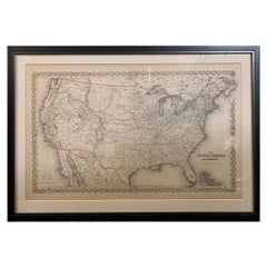
1859 "Map of the United States of America..." by J. H. Colton
By J.H. Colton
Located in Colorado Springs, CO
Presented is an 1859 “Map of the United States of America, the British Provinces, Mexico, the West Indies and Central America with Part of...
Category
1850s American Antique J.H. Colton Furniture
Materials
Paper
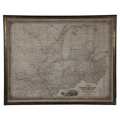
Antique 1844 J Calvin Smith JH Colton Midwest United States Survey Map 27"
By J.H. Colton
Located in Dayton, OH
Antique framed black and white map of seven Midwestern American states. Guide Through Ohio, Michigan, Indiana, Illinois, Missouri, Wisco...
Category
1840s Antique J.H. Colton Furniture
Materials
Paper
$822 Sale Price
30% Off
Related Items
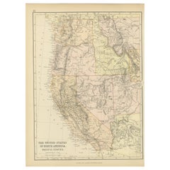
Antique Map of The United States of North America, Pacific States, 1882
Located in Langweer, NL
The map is from the same 1882 Blackie Atlas and focuses on the Pacific States of the United States of America during that period. Here are some details and historical context about t...
Category
1880s Antique J.H. Colton Furniture
Materials
Paper
$296
H 14.97 in W 11.03 in D 0 in
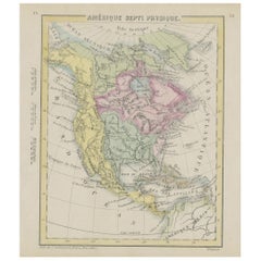
Small Map of the United States, circa 1870
Located in Langweer, NL
Antique map titled 'Amérique septe. Physique'. Small map of the United States. lithographed by C. Callewaert brothers in Brussels circa 1870.
Category
Mid-19th Century Belgian Antique J.H. Colton Furniture
Materials
Paper
Framed 1839 Hand Colored Map of the United States
Located in Stamford, CT
Framed hand colored map of the United States of America from 1839. Newly framed in a giltwood frame.
Category
1830s American American Classical Antique J.H. Colton Furniture
Materials
Giltwood, Paper, Glass
1830 Mexico and United States Framed Map
Located in Stamford, CT
Map of North America published circa 1830. Map shows United States into Canada. Mexico extending into the upper California territory. Texas appears in name but prior to the period of...
Category
1830s American American Classical Antique J.H. Colton Furniture
Materials
Glass, Wood, Paper
Antique Map of The United States Southern Section by A & C. Black, 1870
Located in Langweer, NL
Antique map titled 'United States Southern Section'. Original antique map of Map of The United States Southern Section. This map originates from ‘Black's General Atlas of The World’....
Category
Late 19th Century Antique J.H. Colton Furniture
Materials
Paper
$237 Sale Price
20% Off
H 17.52 in W 23.63 in D 0.02 in
1812 United States Map, by Pierre Tardieu, Antique French Map Depicting the U.S.
By Pierre François Tardieu
Located in Colorado Springs, CO
1812 "United States of Nth America -- Carte des Etats-Unis De L'Amerique Septentrionale" Two-Sheet Map by Tardieu
This attractive map, published in Paris in 1812, is one of the most rare large format maps from the period. It features a view of the East Coast of the U.S. from Maryland to just below South Carolina. Additionally, Ellicott’s plan for the City of Washington D.C. is included at the top right and an illustration of Niagara Falls is shown at the bottom right with a description in both French and English. This extremely detailed map not only depicts the mountainous regions of the southeastern U.S., but also includes names of regions, rivers, and towns.
Based on the first state of Arrowsmith’s 4-sheet map of the United States, this map is completely engraved by Tardieu in Paris and showcases high quality engravings. This detailed map of the recently independent United States includes one of the largest and earliest examples of the Ellicott plan of Washington DC.
The artist, Pierre François Tardieu (PF Tardieu) was a very well-known map engraver, geographer, and illustrator. Awarded a bronze medal by King Louis-Phillipe for the accuracy and beauty of his map-making, Tardieu produced many fine works including maps of Louisiana...
Category
1810s French Antique J.H. Colton Furniture
Materials
Paper
$5,750
H 43.5 in W 48 in D 2.25 in
United States, Canada & Mexico – 1857 North America Map
Located in Langweer, NL
North America Map – United States, Canada, Mexico 1857
This impressive antique print shows “Nord-America” meaning “North America,” published in 1857 by Justus Perthes in Gotha as pa...
Category
Mid-19th Century German Antique J.H. Colton Furniture
Materials
Paper
Antique Map of the United States by Lowry, '1852'
Located in Langweer, NL
Antique map titled 'United States'. Four individual sheets of the United States. This map originates from 'Lowry's Table Atlas constructed and engraved from the most recent Authoriti...
Category
Mid-19th Century Antique J.H. Colton Furniture
Materials
Paper
$284 Sale Price / set
20% Off
H 9.65 in W 12.21 in D 0.02 in
Antique Map of The United States of North America, 1882
Located in Langweer, NL
This is a historical map titled "The United States of North America, Central Part" from the 1882 Blackie Atlas. It depicts the continental United States with a high level of detail, ...
Category
1880s British Antique J.H. Colton Furniture
Materials
Paper
$237 Sale Price
20% Off
H 14.97 in W 22.45 in D 0.01 in
Antique Map of the United States by Balbi '1847'
Located in Langweer, NL
Antique map titled 'Etats-Unis'. Original antique map of the United States. This map originates from 'Abrégé de Géographie (..)' by Ad...
Category
Mid-19th Century Antique J.H. Colton Furniture
Materials
Paper
$189 Sale Price
20% Off
H 9.06 in W 11.23 in D 0.02 in
Antique Map of the United States with Vignette of Washington
Located in Langweer, NL
Antique map titled 'États-Unis'. A very attractive and detailed late 19th century map of the United States, with a fine decorative vignette of Washington. The extensive railway netwo...
Category
Late 19th Century Antique J.H. Colton Furniture
Materials
Paper
$455 Sale Price
20% Off
H 15.44 in W 20.4 in D 0.02 in
Antique Map of the United States by Titus '1871'
Located in Langweer, NL
Antique map titled 'The United States of America'. Original antique map of the United States. This map originates from 'Atlas of Prebl...
Category
Late 19th Century Antique J.H. Colton Furniture
Materials
Paper
$759 Sale Price
20% Off
H 16.54 in W 26.78 in D 0.02 in
Previously Available Items
1855 "The United States of America" by J. H. Colton
By J.H. Colton
Located in Colorado Springs, CO
This is an attractive 19th century map of the United States. Published in 1855 by Joseph H. Colton in New York, this map details the area from the southern border of Canada, labeled ...
Category
1850s American Victorian Antique J.H. Colton Furniture
Materials
Paper
Framed 19th Century Colton Map of Mexico, Texas, California and US Territories
By J.H. Colton
Located in Alamo, CA
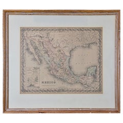
This framed 19th century map of the southern portions of North America by J. H. Colton, published in New York in 1855 in his General Atlas of the World on page No. 54 in volume 1. Th...
Category
Mid-19th Century American Other Antique J.H. Colton Furniture
Materials
Paper
H 20 in W 22.63 in D 0.88 in
J.h. Colton furniture for sale on 1stDibs.
J.H. Colton furniture are available for sale on 1stDibs. These distinctive items are frequently made of paper and are designed with extraordinary care. There are many options to choose from in our collection of J.H. Colton furniture, although brown editions of this piece are particularly popular. If you’re looking for additional options, many customers also consider furniture by Sioux Indian Art, Barry Kieselstein-Cord, and Francesco Scavullo. Prices for J.H. Colton furniture can differ depending upon size, time period and other attributes — on 1stDibs, these items begin at $1,175 and can go as high as $13,500, while a piece like these, on average, fetch $7,338.

