John Speed Prints and Multiples

to
1
4
Overall Width
to
Overall Height
to
1
4
1,439
1,053
915
903
4
4
4
4
4
4
3
3
1
4
3
1
Artist: John Speed
AMERICA
AMERICA

John SpeedAMERICA, 1626-76

$4,250Sale Price|50% Off

AMERICA

By John Speed

Located in Santa Monica, CA

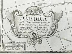
IMPORTANT AMERICAN MAP - ONE OF THE FIRST TO SHOW CALIFORNIA as an ISLAND JOHN SPEED (1552-1629) AMERICA - With Those Known Parts In That Unknown Worlde (sic), 1626-(76) (Burden 217 iv/iv) Engraving, uncolored. Engraved by Abraham Goos and published by Thomas Basset and Richard Chiswell - 4th state of 4 in 1676.15 1/8 x 20 1/2” From “A Prospect of the Most Famous Parts of the World”. Generally good condition. A repaired split in lower centerfold. This is the most common version of this important map...

Category

1620s Old Masters John Speed Prints and Multiples

Materials

Engraving

John Speede Map The Countye of Monmouth

John Speede Map The Countye of Monmouth

By John Speed

Located in London, GB

To see our other views and maps of England - including London, Oxford and Cambridge, scroll down to "More from this Seller" and below it click on "See all from this Seller" - or send...

Category

17th Century Realist John Speed Prints and Multiples

Materials

Engraving

John Speede, Map of the County of Surrey, described and divided into hundreds

John Speede, Map of the County of Surrey, described and divided into hundreds

By John Speed

Located in London, GB

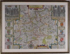
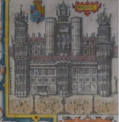
To see our other views and maps of England - including London, Oxford and Cambridge, scroll down to "More from this Seller" and below it click on "See all from this Seller" - or send us a message if you cannot find the view you want. John Speed/Speede (1551/2-1629) The County of Surrey Described and Divided into Hundreds Engraving with later hand colouring and text to the reverse.  Dated to c.1650 36 x 49 cm Probably the most famous early English mapmaker, John Speed's early life is somewhat of an enigma. He is believed to have trained as a rolling-press printer, but he was at heart an historian granted a sinecure in the Customs House by Queen Elizabeth to indulge his passion, later becoming a Fellow of the Society of Antiquaries. His first maps were historical, of the Holy Land 'Canaan as it was Possessed both in Abraham and Israels Dayes' and of England and Ireland recording 'all their Civill Warres since the Conquest'. In 1611 he published his 'Hostory of Great Britaine' which he regarded as his magnum opus, but it was the companion atlas 'Theatre of the Empire of Great Britaine' that - as the first printed atlas of Great Britain - sealed his reputation. William Rogers engraved the first map, 'the County Palatine of Chester' in about 1600, but following his untimely death the task of engraving was passed to Jodocus Hondius of Amsterdam. By 1612 the atlas was complete, the maps famed for their decorative elements. Many have town plans - Britain's first series of such plans - and descriptive text was printed to the reverse until the 1676 edition. Later printings (up until 1770) were issued without this text. By 1627 it has become a part of a world atlas 'Prospect of the Most Famous Parts of the World'. During the 17th century the plates passed through the hands of a series of publishers, the 1676 edition of Thomas Bassett and Richard Chiswell being regarded as its high point with the inclusion for the first time of a series of important maps. For the first half of the eighteenth century they were firmly established in the hands of the Overton family. This particular edition originally featured in The Theatre Of The Empire Of Great Britaine. It features attractive inset views of the long-since destroyed Richmond...

Category

17th Century Realist John Speed Prints and Multiples

Materials

Engraving

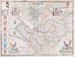
John Speede Map The Countye Palatine of Chester with that most ancient citie

John Speede Map The Countye Palatine of Chester with that most ancient citie

By John Speed

Located in London, GB

To see our other views and maps of England - including London, Oxford and Cambridge, scroll down to "More from this Seller" and below it click on "See all from this Seller" - or send...

Category

17th Century Realist John Speed Prints and Multiples

Materials

Engraving

Related Items
Daniel Marot's The Siege of the Dutch Fortified City of Ypres by Louis XIV

Daniel Marot's The Siege of the Dutch Fortified City of Ypres by Louis XIV

By Daniel Marot

Located in Alamo, CA

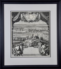
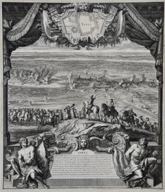
"Ypres, Grand Ville Riche & Marchande" is an engraving and etching by Daniel Marot (le Vieux) (1661–1752). It depicts a view of the siege of the city of Ypres and its citadel on the left in the Spanish Netherlands by Louis XIV's troops. This battle took place between March 18 and March 25, 1678, as part of the Franco-Dutch War. Marot illustrated in great detail (best appreciated with magnification) the French attack on the strong pentagonal citadel on the extreme left, which had been built recently in anticipation of a French attack. The trenches built by the French approaching the town are seen on the right. King Louis XIV can be seen in the foreground surveying the battle mounted on his white horse, surrounded by his officers and troops. The print is presented in an attractive ornate black wood frame with a cream-colored double mat with a black inner trim. It is glazed with plexiglas. The frame measures 25.38" x 22.63" x .88". The engraving, frame, mat and glazing are in excellent condition. Artist: Daniel Marot (1661–1752) was also called "Le Vieux". He was the son of the famous architect, Jean Marot. Marot had diverse interests and talents. In addition to his art, he designed garden projects, architectural ornaments, furniture, and even upholstery. Marot as a Huguenot protestant was forced to leave France in 1685 following the revocation of the Edict of Nantes. He emigrated to Holland, where he worked for William of Orange (an arch enemy of his former employer Louis XIV). Marot was largely responsible for the interiors of Williams palace at the Loo. In 1694 he went Britain as William had married Queen Mary and he had become King William III of England. He later returned to Holland in about 1698 and died in the Hague in 1752. He left a lasting legacy on the decorative arts in the Netherlands, where his grand version of the Louis XIV style remained popular into the 1730s. Historical Background: In October 1677, Mary Stuart, niece and possible successor of Charles II of England, married Louis XIV's arch enemy William III of Orange...

Category

Late 17th Century Old Masters John Speed Prints and Multiples

Materials

Engraving, Etching

"A Dance in Otaheite" (Tahiti), Engraving from Captain Cook's 3rd Voyage

"A Dance in Otaheite" (Tahiti), Engraving from Captain Cook's 3rd Voyage

By John Webber

Located in Alamo, CA

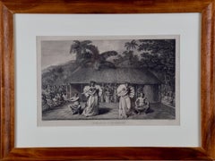
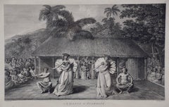
"A Dance in Otaheite" (Tahiti) is an engraving created by William Sharp (1749-1824), from a drawing by John Webber (1752-1793), who was the artist on Captain James Cook's 3rd and final voyage of discovery. It is a plate in the atlas of "A Voyage to the Pacific Ocean Undertaken by the Command of His Majesty, for Making Discoveries in the Northern Hemisphere", the official British Admirality sanctioned journal published upon completion of the voyage in London in 1784 by Strahan & Cadell. Two women and two men wearing ceremonial costumes, performing a dance outdoors standing on a mat. Three men are playing the drums in the background, in front of a thatched roof building. An audience of men are sitting on both sides of the stage. By the time Webber arrived in Tahiti, 'south sea' imagery had become familiar. Webber gave concentrated attention to dance. He had the opportunity to distinguish the Tahitian dance from the more formalized dancing of Tonga. Whereas they seem to have called to mind the more formal dances of antiquity, the Tahitian dancing aroused memories of peasant and folk dancing. This engraving is professionally framed in Koa wood. Koa wood is legendary in Hawaii. Not only is this amazing wood native to Hawaii, but it is known for the deep rich colors and varied grain pattern. Koa has an honored heritage in Hawaii and is highly revered and sacred. The word “koa” means “warrior” in Hawaiian. The warriors of King Kamehameha the Great, created canoes and weapons from a wood plentiful on the Big Island of Hawaii. This wood became synonymous with the warriors themselves, and it became known as koa. The print is in excellent condition. There are three other engravings listed from the official journal of Captain Cook's 3rd voyage available that are presented in identical Koa wood frames and double mats (LU117324682432, LU117324684052, LU117324684062). They would make a wonderful grouping for a display of 2, 3 or 4 prints. A discount is available for a grouping depending on the number of items included. Hawaii was discovered by Captain Cook during this voyage. Hawaii was originally called The Sandwich Islands in honor of The Earl of Sandwich...

Category

1780s Realist John Speed Prints and Multiples

Materials

Engraving

Venice Beach Seascape, Long Wave, Nautical Scene in Blue Tones, Limited Edition

Venice Beach Seascape, Long Wave, Nautical Scene in Blue Tones, Limited Edition

By Kind of Cyan

Located in Barcelona, ES

This is an exclusive handprinted limited edition cyanotype. This beautiful cyanotype is titled "Long Wave in Venice Beach" and it shows an outstanding wave in one of the most iconic ...

Category

2010s Realist John Speed Prints and Multiples

Materials

Paper, Emulsion, Watercolor, Engraving, Etching, Monotype

Pacific Ocean Currents, Handmade Cyanotype Seascape in Blue, Waves Landscape

Pacific Ocean Currents, Handmade Cyanotype Seascape in Blue, Waves Landscape

By Kind of Cyan

Located in Barcelona, ES

This is an exclusive handprinted limited edition cyanotype. "Pacific Ocean Currents" is a handmade cyanotype print of rough water texture resembling Pacific Ocean swell. Details: + ...

Category

2010s Realist John Speed Prints and Multiples

Materials

Paper, Emulsion, Engraving, Etching

Tortoise-shell Butterfly, Hawk Moth: Antique Hand-colored Engraving by M. Harris

Tortoise-shell Butterfly, Hawk Moth: Antique Hand-colored Engraving by M. Harris

By Moses Harris

Located in Alamo, CA

This is a hand-colored antique engraving depicting the natural history of the Tortoise-shell Butterfly and Privet Hawk Moth, which is plate 2 from Moses Harris' publication "The Aure...

Category

Mid-19th Century Realist John Speed Prints and Multiples

Materials

Engraving

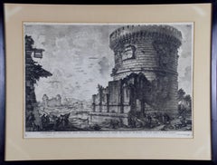
Ancient Roman Architecture: Original Framed 18th C. Etching by G. Piranesi

Ancient Roman Architecture: Original Framed 18th C. Etching by G. Piranesi

By Giovanni Battista Piranesi

Located in Alamo, CA

"Veduta del Sepolcro della Famiglia Plauzia per la Strada Che Conduce da Roma a Tivoli vicino a Ponte Lugano" from "Le Antichità Romane" (Roman Antiquities), one of the most famous works by Piranesi. "Antichita" illustrates the tombs along the Appian Way...

Category

Early 18th Century Old Masters John Speed Prints and Multiples

Materials

Etching, Engraving, Drypoint

Northern Italy: A 16th Century Hand-colored Map by Abraham Ortelius

Northern Italy: A 16th Century Hand-colored Map by Abraham Ortelius

By Abraham Ortelius

Located in Alamo, CA

This is a framed 16th century hand-colored copperplate map of northern Italy entitled "Veronae Urbis Territorium a Bernardo Bragnolo Descriptium" by Abraham Ortelius from his atlas "Theatrum Orbis Terrarum", which was the first modern atlas of the world, with the first volume published in 1570. This map was part of a subsequent volume, published in Antwerp in 1584. It was based on an earlier map by Bernardo Brognoli. This beautiful map of northern Italy is focussed on Verona and its environs, including Mantua. Lake Garda and the South Tyrol mountains are prominently depicted. There is a very large striking cartouche in the upper left and a decorative distance scale in the lower right. This striking hand-colored map of northern Italy is presented in a gold-colored wood frame and an olive green-colored mat. It is glazed with UV conservation glass. All mounting materials used are archival. The frame measures 21.5" high by 28" wide by 0.75" deep. There is a central vertical fold, as issued, with slight separation of the lower portion of the fold. There are faint spots in the upper and right margins, but the map is otherwise in very good condition. Abraham Ortelius (also known as Ortels, Orthellius, and Wortels) (1527-1598) was a Dutch cartographer, geographer, and cosmographer. He began his career as a map colorist. In 1547 he entered the Antwerp guild of St Luke as an "illuminator of maps". He had an affinity for business from an early age and most of his journeys before 1560, were for business. He was a dealer in antiques, coins, maps, and books. 
His business income allowed him to acquire an extensive collection of medals, coins, and antiques, as well as a large library of books...

Category

16th Century Old Masters John Speed Prints and Multiples

Materials

Engraving

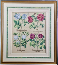
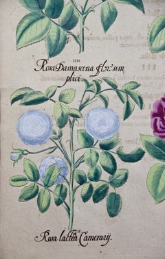
Red Roses: A Framed 17th C. Hand-colored Botanical Engraving by Basilius Besler

Red Roses: A Framed 17th C. Hand-colored Botanical Engraving by Basilius Besler

By Basilius Besler 1

Located in Alamo, CA

"Rosa ex rubro nigricans" (Red Roses); a hand-colored copper engraving from Basilius Besler's landmark work, Hortus Eystettensis (Garden at Eichstatt), first published in 1613 in Eichstatt, Germany near Nuremberg and later in 1640 and 1713. This engraving is presented in a glossy silver and matte gold-colored wood frame with a green edge and an elaborate double cream-colored French mats with light mauve bands; each accented by a broad decorative marbleized green band. It is glazed with plexiglass. There is text offset and a very small crease in the left margin, but the print is otherwise in excellent condition. Provenance: W. Graham Arader Gallery...

Category

17th Century Old Masters John Speed Prints and Multiples

Materials

Engraving

Map of the East Indies: An Original 18th Century Hand-colored Map by E. Bowen

Map of the East Indies: An Original 18th Century Hand-colored Map by E. Bowen

By Emanuel Bowen 1

Located in Alamo, CA

This is an original 18th century hand-colored map entitled "An Accurate Map of the East Indies Exhibiting the Course of the European Trade both on the Continent and Islands" by Emanu...

Category

Mid-18th Century Old Masters John Speed Prints and Multiples

Materials

Engraving

Admirable Butterflies, Magpie Moths: A Hand-colored Engraving by Moses Harris

Admirable Butterflies, Magpie Moths: A Hand-colored Engraving by Moses Harris

By Moses Harris

Located in Alamo, CA

This is a hand-colored antique engraving depicting the natural history of the Admirable Butterfly and the Small Magpie Moth, which is plate 6 from Moses Harris' publication "The Aure...

Category

Mid-19th Century Realist John Speed Prints and Multiples

Materials

Engraving

L’Hiver a Paris ou La Neige a Paris

L’Hiver a Paris ou La Neige a Paris

By Félix Hilaire Buhot

Located in New York, NY

Felix Buhot (1847-1898), L’Hiver a Paris ou La Neige a Paris, 1879, etching, aquatint, drypoint, roulette. [signed and dated in the plate Felix Buhot Par...

Category

1870s Realist John Speed Prints and Multiples

Materials

Drypoint, Etching, Aquatint

Map of the World: An Original 18th Century Hand-colored Map by E. Bowen

Map of the World: An Original 18th Century Hand-colored Map by E. Bowen

By Emanuel Bowen 1

Located in Alamo, CA

This is an original 18th century hand-colored map entitled "A New & Correct Chart of All The Known World Laid down according to Mercator's Projection" by Emanuel Bowen. It was published in 1744 in London in John Harris's "Navigantium atque Itinerantium Bibliotheca" or "A Complete Collection of Voyages and Travels". This highly detailed and colorful map depicts the world. as it was known in the mid 18th century. A majority of the northern and central portions of Canada and America are left blank due to the purity of knowledge at the time this map was published. The map is embellished with four Compass Roses in the lower left, lower center, lower right and center, along with many rhumb lines. There a is a decorative title cartouche in the upper left. This colorful, attractive, historical and interesting 1744 map presents the entire world on Mercator's projection as it was understood in the middle part of the 18th century, before the landmark explorations of Captain’s Cook, Vancouver, Wilkes and others. It is an example of a nautical chart, a type of map that was designed specifically for use by mariners. The map is centered on the equator and includes both the Eastern and Western Hemispheres. The continents of North America, South America, Europe, Africa, and Asia are depicted, as well as various islands in the Atlantic, Pacific, and Indian Oceans. The map is laid out according to the Mercator projection, a type of cylindrical map projection that was developed in the 16th century by Flemish cartographer Gerardus Mercator. This projection has the advantage of preserving angles and shapes, making it useful for navigation. The map presents a paucity of inland detail, particularly for the Americas, but major cities, geographical landmarks, and regions are included. Ocean currents and Tradewinds are identified, as well as the magnetic declination lines or magnetic variance, which refers to the difference between true north and compass north. The continents are color coded, enhancing the beauty of this map. The three compass roses indicate the directions of the cardinal points. The depiction of the western coast of America, the Pacific and Australia are interesting. There was very little exploration of Australia between the navigations of William Damper in 1699 and Tobias Furneaux in 1773. Most of the maps detail relies on the 17th century Dutch expeditions to Australia's western coast, by Abel Tasman and William Janszoon. Van Diemen's Land (Tasmania) and New Guinea appear connected to the Australian continent. New Zealand appears as a single landmass. North of New Zealand there is a landmass labelled 'Ter d' St. Esprit' which probably represents the New Hebrides Islands. This map precedes the accurate exploration of the South Pacific and east coast of Australia by Captain James Cook later in the 18th century. The map includes ‘Drakes' Port,' the site where Sir Francis Drake supposedly landed in 1579 during his 1579 circumnavigation of the globe. Here he claimed territory for England, restocked, and repaired his vessels. Drake named the region New Albion. The exact location of Drake's Port is a cartographic mystery. Drake's Harbor is believed to be in the region of San Francisco Bay, Bodega Bay, San Pablo Bay...

Category

Mid-18th Century Old Masters John Speed Prints and Multiples

Materials

Engraving

John Speed prints and multiples for sale on 1stDibs.

Find a wide variety of authentic John Speed prints and multiples available for sale on 1stDibs. You can also browse by medium to find art by John Speed in engraving and more. Much of the original work by this artist or collective was created during the 18th century and earlier and is mostly associated with the Old Masters style. Not every interior allows for large John Speed prints and multiples, so small editions measuring 21 inches across are available. Customers who are interested in this artist might also find the work of Giovanni Benedetto Castiglione, Stefano Della Bella, and Johann Baptist Homann. John Speed prints and multiples prices can differ depending upon medium, time period and other attributes. On 1stDibs, the price for these items starts at $681 and tops out at $5,000, while the average work can sell for $681.