17th Century Collectibles and Curiosities

to
820
1,099
152
1,259
85
3
1
1
1
4,378
6,589
13,340
2,719
3,508
4,613
3,040
518
305
588
733
464
897
880
904
659
578
1,033
120
110
34
31
298
61
55
48
43
1,259
1,259
1,259
63
12
11
11
6
Period: 17th Century
Antique Map of Friesland with Four Coats of Arms, 1664
Located in Langweer, NL
Antique map titled 'Typus Frisiae inter Fevum et Lavicam'. Original antique map of the province of Friesland, the Netherlands. Also shows the Wadden islands Vlieland, Terschelling and Ameland and part of Schiermonnikoog. With a decorative cartouche with two putti, livestock and cheese and milk barrels. Four coats...
Category

Antique 17th Century Collectibles and Curiosities

Materials

Paper

Antique Map of Belgium and Surroundings, 1692
Located in Langweer, NL
Antique map titled 'Provincie Meridionali de Paesi Bassi Intese sotto nome di Fiandra overo Li Paesi Bassi Cattolici con li confini di Francia di Allemagna et di Hollanda'. Uncommon map of Belgium...
Category

Antique 17th Century Collectibles and Curiosities

Materials

Paper

Early, Rare and Small Hand-Coloured Copper Engraving of Greece, ca. 1602
Located in Langweer, NL
Attractive minature map of Greece or 'Graecia" Maker/Publisher: A. Ortelius/A. en F. Arsenius / M Coignet / J. van Keerbergen - 1601-1620 With a si...
Category

Antique 17th Century Collectibles and Curiosities

Materials

Paper

Antique Map of the Region of Poitou by Janssonius, 1657
Located in Langweer, NL
Antique map 'Pictauiae Ducatus Descriptio vulgo le Pais de Poictov'. Decorative map of the region of Poitou with Rochelle, Nantes, etc., France. This map originates from 'Atlas Novus...
Category

Antique 17th Century Collectibles and Curiosities

Materials

Paper

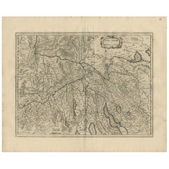
Antique Map of the Region of Aargau by Janssonius, '1657'
Located in Langweer, NL
Antique map 'Argow cum parte merid. Zurichgow'. Detailed map of Switzerland showing Aargau with the southern part of Zürich. This map originates from 'Atlas Novus, Sive Theatrum Orbi...
Category

Antique 17th Century Collectibles and Curiosities

Materials

Paper

Antique Map of the Region of Charolais by Janssonius, 1657
Located in Langweer, NL
Antique map 'Les environs de L'Estang de Longpendu, comprenant une grande partie du Comté de Charolois'. Decorative map of the Charolais region. This map originates from 'Atlas Novus...
Category

Antique 17th Century Collectibles and Curiosities

Materials

Paper

Antique Map of the Region of Pays de Caux by Janssonius, 1657
Located in Langweer, NL
Antique map 'Le Pais de Caux'. Decorative map of the region of Pays de Caux, France. This map originates from 'Atlas Novus, Sive Theatrum Orbis Orbis Terrarum: In quo Galliae, Helvet...
Category

Antique 17th Century Collectibles and Curiosities

Materials

Paper

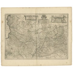
Picardy Map - Hand-Colored 17th-Century Engraving by Frederik De Wit c. 1688
Located in Langweer, NL
Title: Picardy Map - Hand-Colored 17th-Century Engraving by Frederik De Wit c. 1688 Description: This beautifully detailed map, "Nova Picardiae Tabula," captures the Picardy region ...
Category

Antique 17th Century Collectibles and Curiosities

Materials

Paper

Rare Hand-Colored Map of Lyonnais Region in France by Frederik De Wit c. 1688
Located in Langweer, NL
Title: Rare Hand-Colored Map of Lyonnais Region by Frederik De Wit c. 1688 Description: This beautifully detailed map, "Gouvernement General du Lyonnois," showcases the Lyonnais reg...
Category

Antique 17th Century Collectibles and Curiosities

Materials

Paper

Stunning Hand-Colored Map of Languedoc in France by Frederik De Wit c. 1688
Located in Langweer, NL
Title: Stunning Hand-Colored Map of Languedoc by Frederik De Wit c. 1688 Description: This elegant 17th-century map, "Gouvernement General de Languedoc," beautifully illustrates the...
Category

Antique 17th Century Collectibles and Curiosities

Materials

Paper

Antique Map of Greece by J. Jansson, circa 1653
Located in Langweer, NL
This is an authentic antique map of the Greece by Jan Jansson. The map was published in Amsterdam, circa 1653. This striking 17th century map of Greece was based on “Totius Graeciae ...
Category

Antique 17th Century Collectibles and Curiosities

Materials

Paper

Orignal Hand-Colored Antique Map of Chili by W. Blaeu, 1658
Located in Langweer, NL
Very decorative antique map of Chili published by W. Blaeu, 1658. This map depicts Chile from Copiapo southward to the island of Chiloé with ships and sea monsters adorning the sea. ...
Category

Antique 17th Century Collectibles and Curiosities

Materials

Paper

Antique Map of the Hainaut and Namur Region by Janssonius, 'circa 1640'
Located in Langweer, NL
Antique map titled 'Comitatuum Hannoniae et Namurci Descriptio'. Old map of the region of Hainaut and Namur, France. Published by J. Janssonius, circa 1640.
Category

Antique 17th Century Collectibles and Curiosities

Materials

Paper

Original Antique Hand-Colored Map of Friesland by C. Merian, 1659
Located in Langweer, NL
This is a hand-colored engraving of the province of Friesland in the Netherlands, created by the Swiss-born engraver and artist Matthäus Merian (1593–1650) and included in "Topograph...
Category

Antique 17th Century Collectibles and Curiosities

Materials

Paper

Antique Map of Styria by Mercator 'circa 1650'
Located in Langweer, NL
Antique map titled 'Stiria'. Original antique map of Styria, Austria. Published by G. Mercator, circa 1650.
Category

Antique 17th Century Collectibles and Curiosities

Materials

Paper

Antique Map of the Island of Funen by Kaerius, 1628
Located in Langweer, NL
Antique map titled 'Fionia'. Copper engraved map of the Island of Funen (Denmark) by P. Kaerius. Funen is Denmark's second largest island, between the Jutland peninsula, and the capi...
Category

Antique 17th Century Collectibles and Curiosities

Materials

Paper

Antique Map of Vänersborg by Merian 'circa 1680'
Located in Langweer, NL
Antique map titled 'Grundtriss und Situation von der Statt und Vöstung Wennersburg'. Copper engraved plan of Vänersborg, Sweden. This map orginates from 'Theatrum Europaeum' by Meria...
Category

Antique 17th Century Collectibles and Curiosities

Materials

Paper

Italy, Sicily, Sardinia, Corsica and Dalmatian Coast: A 17th Century Dutch Map
By Theodorus Danckerts
Located in Alamo, CA
This hand colored 17th century Dutch map entitled "Novissima et Accuratissima totius Italiae Corsicae et Sardiniae Descriptio" by Theodore Danckerts depicts the Italian Peninsula in ...
Category

Dutch Antique 17th Century Collectibles and Curiosities

Materials

Paper

Antique Map of the Region of Vermandois and Cappelle by Janssonius, circa 1650
Located in Langweer, NL
Antique map of France titled 'Descriptio Veromanduorum - Gouvernement de la Cappelle'. Two detailed maps of France on one sheet. The Vermandois map is centered on the Oyse and Somme ...
Category

Antique 17th Century Collectibles and Curiosities

Materials

Paper

Antique Map of the Region of Étampes and Sens by Hondius, circa 1630
Located in Langweer, NL
Antique map titled 'Gastinois et Senonois'. Old map of the region of Étampes and Sens, France. It shows the cities of Sens, Melun, Étampes, Orleans, Fontainebleau, Montargis and othe...
Category

Antique 17th Century Collectibles and Curiosities

Materials

Paper

Antique Map of the Region of Bouchain and Cambrai by Visscher 'circa 1680'
Located in Langweer, NL
Antique map titled 'Carte Nouvelle des Environs de Bouchain & Cambray'. Uncommon map of the region of Bouchain and Cambrai (Cambray, France) showing the camps of two armies.
Category

Antique 17th Century Collectibles and Curiosities

Materials

Paper

Antique Map of the Region of Lyon by Hondius, circa 1630
Located in Langweer, NL
Antique map titled 'Lionnois, Forest et Beauiolois'. Old map of the former region of Lyon, Vienne, Bresse, Rohan and the Rhône River. This map originates f...
Category

Antique 17th Century Collectibles and Curiosities

Materials

Paper

Antique Map of Denmark by Valk 'circa 1690'
Located in Langweer, NL
The map titled "Regnum Daniae, divisum in Dioeceses Arhusiam, Albergum, Viborgum, et Ripam (..)" is a meticulously detailed representation of the Kingdom of Denmark during a historic...
Category

Antique 17th Century Collectibles and Curiosities

Materials

Paper

Antique Map of Asia by Pierre du Val, '1663'
Located in Langweer, NL
Antique map titled 'L'Asie'. Antique map of the Asian continent by Pierre Duval, dated 1663. Most place names represent geographical entities that currently exist or once existed. The rendition of the lower islands of Japan and the peninsula of Korea are improved over earlier studies. Details of the Great Wall of China...
Category

Antique 17th Century Collectibles and Curiosities

Materials

Paper

Antique Map of the Region of Picardy by Janssonius, 1657
Located in Langweer, NL
Antique map of France titled 'Picardia vera et inferior'. Detailed map of the Picardy region of France. This map originates from 'Atlas Novus, Sive Theatrum Orbis Orbis Terrarum: In ...
Category

Antique 17th Century Collectibles and Curiosities

Materials

Paper

Antique Map of the Region of Sedan and Doncheri by Janssonius, 1657
Located in Langweer, NL
Antique map of France titled 'La Souveraineté de Sedan et de Raucourt, et la prevosté de Doncheri'. Lovely map centered on Sedan and Doncheri and the Meuze River from Charleville and...
Category

Antique 17th Century Collectibles and Curiosities

Materials

Paper

Antique Map of the Region of Lyonnais by Janssonius, '1657'
Located in Langweer, NL
Antique map 'Lionnois, forest, beauviolois et masconnois'. Decorative map of the Lyonnais region, France. The Lyonnais is a historical province of France which owes its name to the c...
Category

Antique 17th Century Collectibles and Curiosities

Materials

Paper

Antique Map Of Brabantia Ducantus By Bleau Circa 1640
Located in Brussels, Brussels
map of theBrabantia Ducantus (Belgium) circa 1640 by Bléau. Bléau was well known for antique atlas that he draw during the 17 century beautiful map, double page folded in the middle,...
Category

French Renaissance Antique 17th Century Collectibles and Curiosities

Materials

Paper

Antique Map of Java by Janssonius, circa 1650
Located in Langweer, NL
Antique map titled 'Insulae Iavae cum parte insularum Borneo Sumatrae, et circumjacentium insularum novissima delineatio'. Beautiful map of Java and parts of Bali, Borneo, Sumatra an...
Category

Antique 17th Century Collectibles and Curiosities

Materials

Paper

Antique Map of Southern Germany by F. de Wit, circa 1680
Located in Langweer, NL
This antique map depicts a portion of southern Germany that included the historic regions of Bavaria, the Palatinate, Prussia-Brandenburg, the Rhineland and Saxony. Regensberg, Freis...
Category

Antique 17th Century Collectibles and Curiosities

Materials

Paper

Antique Map of Austria by F. de Wit, 1690
Located in Langweer, NL
Antique map titled 'Circuli Austriaci pars Septentrionalis in qua Archiducatus'. Decorative and detailed map of Austria by F. de Wit.
Category

Antique 17th Century Collectibles and Curiosities

Materials

Paper

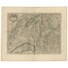
Antique Map of Switzerland by N. Visscher, circa 1690
Located in Langweer, NL
Beautifully detailed map of Switzerland and surrounding regions in present-day France, Germany, and Italy. This map features two decorative cartouches: the larger is flanked by two p...
Category

Antique 17th Century Collectibles and Curiosities

Materials

Paper

17th Century Carved Wood Christ Figure from Navarra, Spain
Located in Madrid, ES
An evocative 17th-century carved wood depiction of Christ from the Navarra region of Spain. This expressive sculpture captures the poignant moment of the crucifixion, with Christ’s ...
Category

Spanish Baroque Antique 17th Century Collectibles and Curiosities

Materials

Wood

Antique Map: Friesland and Terschelling with Inset Isles, by Visscher II, 1670
Located in Langweer, NL
Antique Map: Friesland and Terschelling with Inset Isles, by Nicolaas Visscher II, 1670 This large copper-engraved map provides a detailed and visually stunning depiction of the coastline of Friesland and the island of Terschelling, along with portions of Groningen to the east. Originating from Nicolaas Visscher II’s *Germania Inferiorsive XVII Provinciarum Geographicae Generalis* (Kaert-Boeck van de XVII Nederlandtsche Provincien), this map was published in Amsterdam circa 1670. The map highlights the main cities of Friesland, beautifully accented in red, and includes a decorative inset in the lower-right corner, illustrating the smaller isles belonging to the province. The finely engraved details make this map a remarkable artifact of 17th-century cartography, with its coastline features rendered with precision and artistic flair. Adding to its charm, the map is adorned with elaborate decorative cartouches featuring putti (cherubs) and a coat of arms, hallmark elements of Nicolaas Visscher II’s cartographic artistry. Visscher was one of the most prominent Dutch mapmakers of the Golden Age of Cartography, known for his dedication to both geographical accuracy and artistic embellishment. His maps were highly sought after during his lifetime and remain prized by collectors today. Keywords: antique map Friesland, Terschelling map, Nicolaas Visscher II, 17th-century Dutch cartography, Groningen coastline map, decorative map cartouches, Germania Inferiorsive XVII Provinciarum, Kaert-Boeck Nederlandtsche Provincien, historical Dutch maps, rare collectible maps, Golden Age cartography. This map is a treasure for collectors of antique cartography...
Category

Antique 17th Century Collectibles and Curiosities

Materials

Paper

Antique Map: Carte du Détroit du Sond with Copenhagen Inset, 1693
Located in Langweer, NL
Antique Map: Carte du Détroit du Sond with Copenhagen Inset, Jaillot/Mortier, 1693 This rare and striking antique map, titled *Carte du détroit du Sond contenant les costes de l’Is...
Category

Antique 17th Century Collectibles and Curiosities

Materials

Paper

1635 Willem Blaeu Map of Northern France"Comitatvs Bellovacvm" Ric.a08
Located in Norton, MA
1635 Willem Blaeu map of northern France, entitled. "Comitatvs Bellovacvm Vernacule Beavvais," Colored Ric.a008 “COMITATVS BELLOVACVM…” Amsterdam: W...
Category

Unknown Antique 17th Century Collectibles and Curiosities

Materials

Paper

1636 Jansson Map of Ireland Entitled "Comitatus Lageniae, " Ric.a007
Located in Norton, MA
1646 Jansson map entitled "Procinvia connactiae," Ric.a006 Description: The PROVINCE of CONNAVGT 490 x 380From vol 4 of Jansson's Atlas Novus 1646, published in Amsterdam with...
Category

Unknown Antique 17th Century Collectibles and Curiosities

Materials

Paper

1620 Map of Artois Entitled "Artesia Comitatvs Artois, " by Bleau, Ric.a012
Located in Norton, MA
1640 map of Artois entitled "Artesia Comitatvs Artois," by Bleau Colored A-012. Detailed map of the northern province of Artois, France on the border with Belgium. Feature...
Category

Dutch Antique 17th Century Collectibles and Curiosities

Materials

Paper

Dutch Map and City Plan of La Roche-sur-Foron, France, 17th Century Hand Colored
Located in Alamo, CA
"Rupes Allobrogum vulgo La Roche" by Dutch engraver Coenraet Decker (1650-1685) is from the atlas Theatrum Statuum Regiae Celestudinis Sabaudiae Ducis, published in 1682. This richly...
Category

Dutch Antique 17th Century Collectibles and Curiosities

Materials

Paper

17th Century Norther European Wrought Iron Pestle, 8.5 Inches
Located in Stamford, CT
Unusual wrought iron pestle, most are bronze like most mortars. This one is at least 17th century, quite possibly dating to the Gothic period. I have owned two iron mortars in my ti...
Category

German Baroque Antique 17th Century Collectibles and Curiosities

Materials

Wrought Iron

Silver “Jambiya” or Curved Dagger With Its Sheath
Located in Middleburg, VA
Silver “Jambiya” or Curved Dagger With Its Sheath. These are often Extremely well Crafted with Extraordinary inlaid Silver Designs accentuated with “Neillo”. They Often have Ivory Ha...
Category

Turkish Antique 17th Century Collectibles and Curiosities

Materials

Silver

1627 Hondius Map "La Principaute d'Orange et Comtat de Ve", Ric.0003
Located in Norton, MA
1627 Hondius map entitled "La Principaute d'Orange et Comtat de Venaissin," Original Hand-Colored Description: From Johannes Janssonius's Atlantis Maioris Appendix of 1630. ...
Category

Unknown Antique 17th Century Collectibles and Curiosities

Materials

Paper

Southern & Eastern Europe: A Large 17th C. Hand-colored Map by Sanson & Jaillot
Located in Alamo, CA
This large hand-colored map entitled "Estats de L'Empire des Turqs en Europe, ou sont les Beglerbeglicz our Gouvernements" was originally created by Nicholas Sanson d'Abbeville and t...
Category

French Antique 17th Century Collectibles and Curiosities

Materials

Paper

Shakespeare. The London Prodigal - FOURTH FOLIO - 1685 - page 217-218
Located in Hillsborough, NJ
AUTHOR: SHAKESPEARE, William. TITLE: The Works of William Shakespeare. (The London Prodigal) - page 217-218. PUBLISHER: London: Printed for H. Herringman, E. Brewster and R. Bentley, 1685. DESCRIPTION: THE FOURTH FOLIO. 217-218p., correctly-incorrectly numbered, 1 leaf extracted from the fourth folio, 13-3/4" x 9", good margins. CONDITION: A VERY GOOD leaf...
Category

British Antique 17th Century Collectibles and Curiosities

Materials

Paper

1640 Willem Blaeu Map Entitled "Contado di molise et principato vltra, " Ric.a003
Located in Norton, MA
1640 Willem Blaeu map entitled "Contado di molise et principato vltra," Colored Ric. a003 Measures: 38 x 49.6 cm and wide margins DBLAEU. Cou...
Category

Dutch Antique 17th Century Collectibles and Curiosities

Materials

Paper

Southeastern Ireland: A 17th Century Hand Colored Map by Mercator and Hondius
Located in Alamo, CA
A 17th century copperplate hand-colored map entitled "The Second Table of Ireland, Udrone" by Gerard Mercator and Jodocus Hondius, published in Amsterdam in 1635 in 'Cosmographicall ...
Category

Dutch Antique 17th Century Collectibles and Curiosities

Materials

Paper

17th Century Leather Case for a Chalice
Located in Atlanta, GA
A very rare and beautiful Italian 17th century case, box, to store a chalice. Beautifully crafted with embossed leather. A fantastic accent piece, whether displayed as a single piece...
Category

Italian Antique 17th Century Collectibles and Curiosities

Materials

Leather

1643 Willem&Joan Blaeu Map NW Flanders "Flandriae Teutonicae Pars Prientalior
Located in Norton, MA
1643 Willem and Joan Blaeu map of northwest Flanders, entitled "Flandriae Teutonicae Pars Prientalior," Ric0012 " Authentic" - Map of the northwest Fl...
Category

Dutch Antique 17th Century Collectibles and Curiosities

Materials

Paper

Bronze Mortar with Pestle, Spain, 17th Century
Located in Madrid, ES
Mortar with hand. Bronze. XVII century. Mortar with a circular base, cylindrical body and slightly outwardly flared mouth, decorated with a series of smooth horizontal moldings arranged both in the lower and upper areas and with simple vertical elements (which still maintain slight balustraded shapes) derived from of the ribs that these specimens used to have in the medieval Spanish...
Category

Spanish Baroque Antique 17th Century Collectibles and Curiosities

Materials

Bronze, Other

1640 Joan Bleau Map Entitled"Diocecese de rheims et le pais de rethel, " Eic.a011
Located in Norton, MA
1640 Joan Bleau map entitled "Diocecese de rheims et le pais de rethel," Ric.a011 OAN BLAEU Diocecese de Rheims, et le pais de Rethel. Handcolored engraving, c.1640. ...
Category

Dutch Antique 17th Century Collectibles and Curiosities

Materials

Paper

1656 Jansson Map Metz Region of France Entitled "Territorium Metense" Ric0014
Located in Norton, MA
1656 Jansson map Metz Region of France entitled "Territorium Metense." Ric0014 " Authentic" - Map of the historical region surrounding Metz, in Lorraine, France. Oriented with ...
Category

Dutch Antique 17th Century Collectibles and Curiosities

Materials

Paper

1633 Map "La Souverainete De Sedan Et De Raucourt, Et La Prevoste Ric0011
Located in Norton, MA
1653 map entitled "La Souverainete de Sedan et de Raucourt, et la Prevoste de Doncheri," Ric0011 Description: Lovely map centered on Sedan and Doncheri and the Meuze River fr...
Category

Dutch Antique 17th Century Collectibles and Curiosities

Materials

Paper

Collection of Antique Colf Club Heads
Located in Oxfordshire, GB
Collection Of Antique Colf Club Heads. A rare collection of 16th, 17th century lead Colf club heads from the Netherlands with various ceramic moulds and a reference book by Steven J....
Category

Dutch Antique 17th Century Collectibles and Curiosities

Materials

Lead

1646 Jansson Map Entitled "Procinvia Connactiae, " Ric.a006
Located in Norton, MA
1646 Jansson map entitled "Procinvia connactiae," Ric.a006 Description: The PROVINCE of CONNAVGT 490 x 380From vol 4 of Jansson's Atlas Novus 1646, published in Amsterdam with...
Category

Unknown Antique 17th Century Collectibles and Curiosities

Materials

Paper

1633 Map, Entitled "La Douche De Berry, " Original Hand Colored Ric.0005
Located in Norton, MA
1633 map, entitled. "La douche de Berry," Hand Colored Ric.0005 Description: 1633 map, entitled "La douche de Berry,". Dimension: Paper: 23.3" W x 20.3" H (59 cm W x 51.7...
Category

Unknown Antique 17th Century Collectibles and Curiosities

Materials

Paper

1640 Flandriae Partes Duae Quarum Altera Proprietaria, Ric0016
Located in Norton, MA
1640 Willem and Joan Blaeu map entitled "Flandriae Partes duae quarum altera Proprietaria, altera Imperialis vulgo dictur," Ric0016 (Mounted on Carboard) Willem Janszoon Blaeu...
Category

Dutch Antique 17th Century Collectibles and Curiosities

Materials

Paper

1633 map, entitled "La douche de Berry, " Original Hand Colored Ric.0005
Located in Norton, MA
1633 map, entitled "La douche de Berry," Hand Colored Ric.0005 Description: 1633 map, entitled "La douche de Berry," Dimension: Paper: 23.3" W x 20.3" H (59 cm W x 51.7 cm H) ; ...
Category

Dutch Antique 17th Century Collectibles and Curiosities

Materials

Paper

1633 Map Entitled "Beauvaisis Comitatus Belova Cium, Ric.0002
Located in Norton, MA
1633 map entitled "Beauvaisis Comitatus Belova Cium," Hand Colored Ric.0002 Description: Cartographer : - Hondius, Henricus 1587-1638 Artists and Engravers:Jodocus Hondius, one of the most notable engravers of his time. He is known for his work in association with many of the cartographers and publishers prominent at the end of the sixteenth and the beginning of the seventeenth century. A native of Flanders, he grew up in Ghent, apprenticed as an instrument and globe maker and map engraver. In 1584, to escape the religious troubles sweeping the Low Countries at that time, he fled to London where he spent some years before finally settling in Amsterdam about 1593. In the London period he came into contact with the leading scientists and geographers of the day and engraved maps in The Mariner\\\\\\\\\\\\\\\'s Mirrour, the English edition of Waghenaer\\\\\\\\\\\\\\\'s Sea Atlas, as well as others with Pieter van den Keere, his brother-in-law. No doubt his temporary exile in London stood him in good stead, earning him an international reputation, for it could have been no accident that Speed chose Hondius to engrave the plates for the maps in The Theatre of the Empire of Great Britaine in the years between 1605 and 1610. In 1604 Hondius bought the plates of Mercator\\\\\\\\\\\\\\\'s Atlas which, in spite of its excellence, had not competed successfully with the continuing demand for the Ortelius Theatrum Orbis Terrarum. To meet this competition Hondius added about 40 maps to Mercator\\\\\\\\\\\\\\\'s original number and from 1606 published enlarged editions in many languages, still under Mercator\\\\\\\\\\\\\\\'s name but with his own name as publisher. These atlases have become known as the Mercator/Hondius series. The following year the maps were reengraved in miniature form and issued as a pocket Atlas Minor. After the death of Jodocus Hondius the Elder in 1612, work on the two atlases, folio and miniature, was carried on by his widow and sons, Jodocus II and Henricus, and eventually in conjunction with Jan Jansson in Amsterdam. In all, from 1606 onwards, nearly 50 editions with increasing numbers of maps with texts in the main European languages were printed. Summaries of these issues are given under the entry for Gerard Mercator. Jodocus Hondius the Elder * 1588 Maps in The Mariner\\\\\\\\\\\\\\\'s Mirrour (Waghenaer/Ashley) * 1590 World Map...
Category

Dutch Antique 17th Century Collectibles and Curiosities

Materials

Paper

Read More

Medal-Worthy Memorabilia from Epic Past Olympic Games

Get into the games! These items celebrate the events, athletes, host countries and sporting spirit.

Ahoy! You’ve Never Seen a Collection of Sailor Art and Kitsch Quite Like This

French trendsetter and serial collector Daniel Rozensztroch tells us about his obsession with objects related to seafaring men.

Pamela Shamshiri Shares the Secrets behind Her First-Ever Book and Its Effortlessly Cool Interiors

The sought-after designer worked with the team at Hoffman Creative to produce a monograph that beautifully showcases some of Studio Shamshiri's most inspiring projects.

Moroccan Artworks and Objects Take Center Stage in an Extraordinary Villa in Tangier

Italian writer and collector Umberto Pasti opens the doors to his remarkable cave of wonders in North Africa.

Montecito Has Drawn Royalty and Celebrities, and These Homes Are Proof of Its Allure

Hollywood A-listers, ex-pat aristocrats and art collectors and style setters of all stripes appreciate the allure of the coastal California hamlet — much on our minds after recent winter floods.

Whaam! Blam! Pow! — a New Book on Pop Art Packs a Punch

Publishing house Assouline and writer Julie Belcove have teamed up to trace the history of the genre, from Roy Lichtenstein, Andy Warhol and Yayoi Kusama to Mickalene Thomas and Jeff Koons.

The Sparkling Legacy of Tiffany & Co. Explained, One Jewel at a Time

A gorgeous new book celebrates — and memorializes — the iconic jeweler’s rich heritage.

What Makes a Gem-Encrusted Chess Set Worth $4 Million?

The world’s most opulent chess set, weighing in at 513 carats, is literally fit for a king and queen.

Recently Viewed

View All