18th Century and Earlier Collectibles and Curiosities

to
2,700
3,886
557
4,478
216
93
41
35
29
14
10
7
4
2
2
2
1
1
1
6,828
13,529
2,736
3,516
4,725
3,085
511
298
604
745
487
909
909
906
659
596
3,380
599
526
139
127
1,380
282
267
225
190
4,478
4,478
4,478
58
21
14
13
12
Period: 18th Century and Earlier
Rare Original Miniature Map of Papua New Guinea and the Salomon Islands, 1600
Located in Langweer, NL
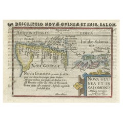
Very handsome original old coloured copper engraving of Papua and the Solomon Island. Title of the map 'Descriptio Novae Guneae et Inss. Salom. On the reverse text in Latin. Ve...
Category

Antique 18th Century and Earlier Collectibles and Curiosities

Materials

Paper

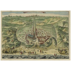
Antique Bird's Eye View of Scheveningen Near The Hague, the Netherlands, 1730
Located in Langweer, NL
Antique print titled 'Afbeeldinge van Schevelinge in den Jaare 1729'. Bird's eye view of Scheveningen near The Hague / Den Haag, the Netherlands. This print originates from 'Beschr...
Category

Antique 18th Century and Earlier Collectibles and Curiosities

Materials

Paper

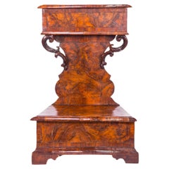
16th Century Prie-Dieu 'Praying Kneeler' Made of Walnut and Burl
Located in North Miami, FL
16th Century Italian Prie-dieu (Praying Kneeler) made of Italian walnut and burl wood.
Category

Italian Renaissance Antique 18th Century and Earlier Collectibles and Curiosities

Materials

Wood, Walnut, Burl

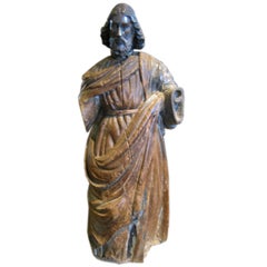
18th Century Spanish Santos
Located in Dallas, TX
Hand carved Santos in original condition. Beautiful old patina.
Category

Spanish Antique 18th Century and Earlier Collectibles and Curiosities

Materials

Wood

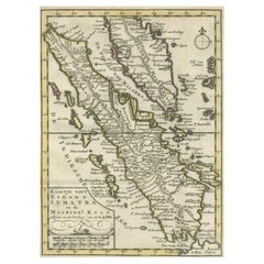
Authentic Old Map of Sumatra, Malaysia and Singapore, 1745
Located in Langweer, NL
Title: "Kaartje van't Eiland Sumatra en de Maleidse Kust gelegen na de stelling van de G. de L'Isle" Published by Jacob Keizer and by Jan de Lat Creator: Keizer, Jacob, active 1706...
Category

Antique 18th Century and Earlier Collectibles and Curiosities

Materials

Paper

Antique Engraved Map of Hungary and Transylvania or Romania, c.1710
Located in Langweer, NL
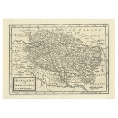
Antique map titled 'Hungary and Transilvania'. Original antique map of Hungary and Transylvania (modern day Romania), centered on Budapest. Artists and ...
Category

Antique 18th Century and Earlier Collectibles and Curiosities

Materials

Paper

Italian Gilt Reliquary Box
Located in Dallas, TX
This 18th century Italian gilded reliquary box is made to contain a personal relic or shine. It has brackets for wall mounting. The front of the door has...
Category

Italian Antique 18th Century and Earlier Collectibles and Curiosities

Materials

Giltwood

Les Fables d'Esope Phrigien avec celles de Philelphe [Aesop's Fables, 1708]
Located in Middletown, NY
A RARE EARLY EDITION OF AESOPIC LITERATURE, BEAUTIFULLY ILLLUSTRATED. Les Fables d'Esope Phrigien avec celles de Philelphe; traduction nouvelle, Enrichie de Discours Moraux et Histor...
Category

Dutch Antique 18th Century and Earlier Collectibles and Curiosities

Materials

Gold Leaf

17th Century Spanish Talavera Pharmacy Jar in Blue Glazed Ceramic
Located in Marbella, ES
17th Century Spanish Talavera pharmacy jar in blue glazed ceramic.
Category

Spanish Antique 18th Century and Earlier Collectibles and Curiosities

Materials

Ceramic

Antique Map of Juan Fernandez Island and Cumberland Bay, Chile - c. '1749'
Located in Langweer, NL
Antique map titled 'Plan de la Côte du N.E. de l 'Ile de Juan Fernandes - Schets van den Noord-Oost kant van het eiland Juan Fernandes '. This map depicts the northeast coast of the ...
Category

Antique 18th Century and Earlier Collectibles and Curiosities

Materials

Paper

Old Engraving of Longvek or Lavek (Eauweck), the 2nd Capital of Cambodia, 1761
Located in Langweer, NL
Antique print titled 'Eauweck, capitale de Camboye'. Decorative panoramic view of the town of Longvek (or Lavek) in Cambodia. It was the second capital city during the Cambodia's Mid...
Category

French Antique 18th Century and Earlier Collectibles and Curiosities

Materials

Paper

Antique Map of Part of the Korean Archipelago, 1798
Located in Langweer, NL
Antique map titled 'Plan of Part of the Islands or Archipellago of Corea'. This map depicts part of the Korean Archipelago and originates from Charts and Plates to La Pérouse...
Category

Antique 18th Century and Earlier Collectibles and Curiosities

Materials

Paper

Highly Decorative Map of The Eastern Mediterranean and The Middle East, ca.1700
Located in Langweer, NL
Antique map titled 'Byzondere Kaart van de Landen Daar de Apostelen Het Evangelium Gepredikt Hebben (..).' Highly decorative map of the eastern Mediterranean...
Category

Antique 18th Century and Earlier Collectibles and Curiosities

Materials

Paper

1698 Mercator Ptolemaic Map of Asia East of the Ganges
Located in Langweer, NL
**Catalogue Description:** **Title:** Tab. XI. Asiae, comprehendens Indiam extra Gangem. **Description:** This is an exquisite Ptolemaic map depicting Asia east of the Ganges, ti...
Category

Antique 18th Century and Earlier Collectibles and Curiosities

Materials

Paper

Map of the Ottoman Empire in Europe, incl. the Balkans, Greece & Turkey, c.1760
Located in Langweer, NL
Antique map Turkey titled 'An Accurate Map of Turky in Europe drawn from the best Authorities'. Map of the Ottoman Empire in Europe, the Balkans, Greece, and Turkey in Europe. Engr...
Category

Antique 18th Century and Earlier Collectibles and Curiosities

Materials

Paper

Antique Map of Bavaria with many details, Germany
Located in Langweer, NL
Antique map titled 'Bavariae Circulus atq Electoratus tam cum Adiacentibus quam insertis Regionibus (..)'. Dutch map of Bavaria, showing the many cities, towns, and other features of...
Category

Antique 18th Century and Earlier Collectibles and Curiosities

Materials

Paper

18th-Century Map of Tyrol and Surrounding Regions by Johann Baptist Homann
Located in Langweer, NL
18th-Century Map of Tyrol and Surrounding Regions by Johann Baptist Homann Description: This striking 18th-century map by Johann Baptist Homann depicts the County of Tyrol (Tirol)...
Category

Antique 18th Century and Earlier Collectibles and Curiosities

Materials

Paper

Original 18th-Century Map of Southern Austria, Carinthia, Carniola, and Styria
Located in Langweer, NL
title: 18th-Century Map of Southern Austria, Carinthia, Carniola, and Styria by Robert de Vaugondy Description: This finely engraved 18th-century map by Gilles Robert de Vaugondy ...
Category

French Antique 18th Century and Earlier Collectibles and Curiosities

Materials

Paper

Original Antique Map of the Maluku Islands or Moluccas, Indonesia
Located in Langweer, NL
Antique map titled 'Carte Particuliere des Isles Moluques'. This map depicts the islands of Herij, Ternate, Tidor, Pottebackers, Timor, Machian and Bachian. The Moluccan islands were...
Category

Antique 18th Century and Earlier Collectibles and Curiosities

Materials

Paper

Antique Miniature Map of Ceylon 'Sri Lanka' and the Maldives by Bertius, 1618
Located in Langweer, NL
Antique map titled 'Descriptio Zeilan, et Maldivarum Inss'. Rare, original antique miniature map of Ceylon/Sri Lanka and the Maldives. This map originate...
Category

Antique 18th Century and Earlier Collectibles and Curiosities

Materials

Paper

Map of Kingdoms of Castile, León, Galicia, Asturias, Biscay and Navarre in Spain
Located in Langweer, NL
Antique map titled 'Partie Septentrionale de la Couronne de Castille (..)'. Decorative and highly detailed map of Northwestern Spain, including Gallicia...
Category

Antique 18th Century and Earlier Collectibles and Curiosities

Materials

Paper

Bird’s-Eye View Map of Gallipoli: Fortified Ionian Gem by Mattheus Merian, 1688
Located in Langweer, NL
Bird’s-Eye View Map of Gallipoli: Fortified Ionian Gem by Mattheus Merian Description: This exquisitely detailed map of Gallipoli, crafted by the renowned engraver Mattheus Merian,...
Category

German Antique 18th Century and Earlier Collectibles and Curiosities

Materials

Paper

Antique Map of the Mediterranean Sea and Surroundings by Keizer & de Lat, 1788
Located in Langweer, NL
Antique map titled 't Wester Deel van de Middelandse Zee (..)'. Uncommon original antique map of the Mediterranean Sea and surroundings. This map originates from 'Nieuwe Natuur- Gesc...
Category

Antique 18th Century and Earlier Collectibles and Curiosities

Materials

Paper

Antique Apothecary Mortar & Pestle, English, Bronze, Chemist Shop Aid, Georgian
Located in Hele, Devon, GB
This is an antique apothecary mortar and pestle. An English, bronze chemist's shop aid, dating to the Georgian period, circa 1800. Quality Georgian apothecary aid with superb finis...
Category

British Georgian Antique 18th Century and Earlier Collectibles and Curiosities

Materials

Bronze

1640 Map of North Africa Nova Barbariae Descriptio or The Barbarian Coast
Located in Langweer, NL
1640 Antique Map of North Africa 'Nova Barbariae Descriptio' by Johannes Janssonius This antique map titled Nova Barbariae Descriptio*, published by Johannes Janssonius around 1640,...
Category

Antique 18th Century and Earlier Collectibles and Curiosities

Materials

Paper

Mid-18th Century French Alabaster Sculpture Depicting a Female Nude with Anchor
Located in Milan, IT
Alabaster sculpture depicting a female nude with cloak and hat, with clasped hands and resting her foot on an anchor, as if to invoke protection for the sailors; French manufacture o...
Category

French Antique 18th Century and Earlier Collectibles and Curiosities

Materials

Alabaster

Antique Portrait of Algernon Percy, 10th Earl of Northumberland, 4th Baron Percy
Located in Langweer, NL
Antique portrait titled 'Algernoon Piercy, Earl of Northumberland'. Old portrait of Algernon Percy. Algernon Percy, 10th Earl of Northumberland, 4th Baron Percy, (1602-1668) was an E...
Category

Antique 18th Century and Earlier Collectibles and Curiosities

Materials

Paper

Rare Antique English SeaChart of Bali, Lombok, Floris, Borneo, Celebes etc, 1711
Located in Langweer, NL
Antique map titled 'A Large Draught from Benjar on the Island of Borneo To Macasser on the Island of Celebes Shewing the Streight of Bally with the Islands to the Eastward thereof.' ...
Category

Antique 18th Century and Earlier Collectibles and Curiosities

Materials

Paper

Beautiful Original Copper Engraved Map of Lake Geneva in Switzerland, 1613
Located in Langweer, NL
Description: Antique map titled 'Lacus Lemanus'. Old map of Lake Geneva with good detail of surrounding towns and villages. Decorated with a large compass rose with two sailing boats and a sea monster in the lake. Originates from 'Atlas Minor'. Artists and Engravers: Henricus Hondius...
Category

Antique 18th Century and Earlier Collectibles and Curiosities

Materials

Paper

Antique Map of Peru by van der Aa, 'circa 1720'
Located in Langweer, NL
Antique map titled 'Le Perou, Grand Pays de l Amerique Meridionale (..)'. Decorative map of Peru including portions of Ecuador and northern Chile and Boliv...
Category

Antique 18th Century and Earlier Collectibles and Curiosities

Materials

Paper

Rare Antique Print of A Cupid being Eaten by A Crocodile, ca. 1608
Located in Langweer, NL
Antique print of Cupid and a crocodile. This print originates from 'Amorum Emblemata', this work includes engravings of Cupids encountering the various trials of Love. The emblematic illustrations include verses in Latin, Dutch and French. The verse of this print would translate to 'Love is the opposite of a crocodile. They say the crocodile has such a nature, that he cries when he is killing and devouring men. But Amor has an opposite nature, for he laughs when he makes lovers perish'. Artists and Engravers: Otto van Veen...
Category

Antique 18th Century and Earlier Collectibles and Curiosities

Materials

Paper

Orignal Hand-Colored Antique Map of Chili by W. Blaeu, 1658
Located in Langweer, NL
Very decorative antique map of Chili published by W. Blaeu, 1658. This map depicts Chile from Copiapo southward to the island of Chiloé with ships and sea monsters adorning the sea. ...
Category

Antique 18th Century and Earlier Collectibles and Curiosities

Materials

Paper

Antique Map of the Island Java, Indonesia, c.1650
Located in Langweer, NL
Antique map titled 'Insulae Iavae cum parte insularum Boreno Sumatrae (..)'. Beautiful map of the island of Java and part of Borneo, Bali, Madura and Sumatra. With decorative carto...
Category

Antique 18th Century and Earlier Collectibles and Curiosities

Materials

Paper

Early Woodcut Map of Swabia and Bavaria in Germany, 1628
Located in Langweer, NL
Title: Early Woodcut Map of Swabia and Bavaria, 16th Century This early woodcut map titled "Schwaben und Bayernlande / Darbey auch begreiffen der Oenwaldt / Nordgaw / etc." provides...
Category

Antique 18th Century and Earlier Collectibles and Curiosities

Materials

Paper

Danube River Incl Serbia, Moldavia, Transylvania, Romania, Bulgaria Etc, ca.1720
Located in Langweer, NL
Antique map titled 'Danubii Fluminis (..)'. Regional map of the Donau river, Shows the Danube river from Belgrade in Serbia, along the border between ...
Category

Antique 18th Century and Earlier Collectibles and Curiosities

Materials

Paper

Beautiful Large Scale Map of Spain and Portugal Published by Herman Moll in 1711
Located in Langweer, NL
Title: A New and Exact Map of Spain & Portugal Author: Herman Moll Date: 1711 Medium: Hand-colored copperplate engraving Herman Moll (c. 1654-1732) was one of the most important London mapmakers in the first half of the eighteenth century. Moll was probably born in Bremen, Germany, around 1654. He moved to London to escape the Scanian Wars. His earliest work was as an engraver for Moses Pitt on the production of the English Atlas, a failed work which landed Pitt in debtor's prison. Moll also engraved for Sir Jonas Moore, Grenville Collins, John Adair, and the Seller & Price firm. He published his first original maps in the early 1680s and had set up his own shop by the 1690s. Moll's work quickly helped him become a member of a group which congregated at Jonathan's Coffee House at Number 20 Exchange Alley, Cornhill, where speculators met to trade stock. Moll's circle included the scientist Robert Hooke...
Category

Antique 18th Century and Earlier Collectibles and Curiosities

Materials

Paper

Antique Roman Battle Print of Scipio's Front by Duncan, c.1753
Located in Langweer, NL
Antique battle map showing Scipio's Front. With detailed legend explaining the various elements of the print. This print most likely originates fro...
Category

Antique 18th Century and Earlier Collectibles and Curiosities

Materials

Paper

Detailed Old Map showing Spain and Portugal Incl. Majorca, Minorca & Ibiza, 1740
Located in Langweer, NL
Antique map titled 'Nieuwe Kaart van Spanje en Portugal.' Attractive detailed map showing Spain and Portugal. Including Majorca, Minorca and Ibiza. Title in block-style cartouche...
Category

Antique 18th Century and Earlier Collectibles and Curiosities

Materials

Paper

17th Century Pair of Carved and Gilded Wooden Mensulae with Birds
Located in Marbella, ES
17th century pair of carved and gilded wooden mensulae with birds.
Category

Spanish Antique 18th Century and Earlier Collectibles and Curiosities

Materials

Wood

Antique Print of Richmond Place by Woolfe, c.1770
Located in Langweer, NL
Antique print titled 'Elevation of Sir Asgill's Villa at Richmond in Surry (..)'. Plan and facade of Richmond Place or Asgill House, Richmond, London. This print originates from 'Vit...
Category

Antique 18th Century and Earlier Collectibles and Curiosities

Materials

Paper

Antique Map of Friesland by Van Krevelt, 1787
Located in Langweer, NL
Antique map titled 'Nieuwe Kaart van Friesland behoorende tot het Vaderlandsch Woordenboek van Jacobus Kok'. Original antique map of the province of Friesland, the Netherlands. This ...
Category

Antique 18th Century and Earlier Collectibles and Curiosities

Materials

Paper

Very Rare Wind Vane Dial in the Manner of Whitehurst
Located in Lincolnshire, GB
A George III period carved mahogany wind vane dial. The silvered engraved dial with all the points of a compass housed in the finely carved mahogany frame, ...
Category

English Antique 18th Century and Earlier Collectibles and Curiosities

Materials

Glass, Mahogany

Antique Map of Nova Zembla by Janssonius, c.1650
Located in Langweer, NL
Antique map titled 'Nova Zemla, waygats fretum Nassovi cum et terra Samoiedum singula omnium emendatissime descripta'. This map depicts Nova Zembla and the northern continental coast...
Category

Antique 18th Century and Earlier Collectibles and Curiosities

Materials

Paper

The Principality of Dombes: A 17th-Century Cartographic Jewel by Jan Jansson
Located in Langweer, NL
The text on the map "La principaute de Dombes; J. van den Eynde sculpit.; La Principavte de Dombes" indicates that it is a map of the principality of Dombes, engraved by J. van den E...
Category

Antique 18th Century and Earlier Collectibles and Curiosities

Materials

Paper

Charming Miniature Map of Thrace or Thrake in Southeast Europe, 1685
Located in Langweer, NL
Antique map titled 'Thraciae Descriptio.' Charming miniature map of Thrace, from the pocket atlas 'Introductionis in Universam Geographiam tam Veterem quam novam .. Acessit P. Be...
Category

Antique 18th Century and Earlier Collectibles and Curiosities

Materials

Paper

Map of the Mozambique and Tanzania Coast & Inset Map of Anjouan Island, ca.1700
Located in Langweer, NL
Antique map titled 'Carte particuliere des Costes de l'Afrique'. Depicts the coasts of Mozambique and Tanzania. With an inset map of Anjouan Island. Artists and engravers: Pub...
Category

Antique 18th Century and Earlier Collectibles and Curiosities

Materials

Paper

Old Decorative Map of the West African Coast & St. Thomae Island, c.1600
Located in Langweer, NL
Antique map titled 'Guineae Nova Descriptio.' This very decorative map shows the West African coast from Senegal (the 'Rio Senega' is the Senegal River) to Cape Lopez on the Gulf...
Category

Antique 18th Century and Earlier Collectibles and Curiosities

Materials

Paper

Antique Map of the City of Goch by Blaeu, 1649
Located in Langweer, NL
Antique map titled 'Gochum vernacule Goch'. Old map of the city of Goch, Germany. This map originates from 'Novum Ac Magnum Theatrum Urbium Belgicæ Liberæ ac Foederatæ' by J. Blaeu. ...
Category

Antique 18th Century and Earlier Collectibles and Curiosities

Materials

Paper

Senex Map of Castile, Leon & La Mancha in The Spanish Heartland, 1714
Located in Langweer, NL
This antique map, titled "A Map of Old & New Castile from the Observations of Rodrigo Mendes Silva and others," depicts the regions of Old Castile and New Castile in Spain, along with the Kingdom of Leon, Estremadura, La Mancha, among others. The map dates back to the early 18th century, a period marked by significant political shifts and territorial changes in Europe, particularly illustrated by the War of the Spanish Succession (1701–1714) that reshaped Spain’s governance and regional boundaries. The map itself was published in 1714 by John Senex, a prominent English mapmaker, surveyor, globemaker, and geographer of the early eighteenth century. He was apprenticed as a young man to bookseller Robert Clavell and collaborated with notable mapmakers such as Jeremiah Seller and Charles Price. In 1728, Senex's contributions to geography and mapping were recognized when he was elected a Fellow of the Royal Society, an exceptional honor for a mapmaker, underlining his significant role as the Society's engraver and a publisher of maps by Edmund Halley and other notable figures. John Senex is renowned for his English Atlas, first published in the same year as this map, 1714, and continued to be printed until the 1760s. Following his death in 1740, his widow Mary Senex managed the business until 1755. Afterward, the stock passed to William Herbert and Robert Sayer for maps, and to James Ferguson for globes. The map serves not just as a geographical record but also as a historical document, reflecting the territorial divisions significant to Spain's political and economic structure at the time. The focus on Old and New Castile underscores their importance during a transformative era in Spanish history. Here are some potentially significant places and features of this map: 1. **Old Castile (Castilla la Vieja)**: Historically significant as part of the former Kingdom of Castile, this region includes major cities such as Burgos and Valladolid. These cities could be popular search...
Category

Antique 18th Century and Earlier Collectibles and Curiosities

Materials

Paper

1718 Holy Land Map - Twelve Tribes, Six Provinces, Hand-Colored, Antique Map
Located in Langweer, NL
Title: Terra Sancta in XII olim Tribus nunc VI Provincias Dispertita Cartographer: Christoph Weigel the Elder (1654–1725) Publisher: Johann Ernst Adelbulner Publication Locatio...
Category

Antique 18th Century and Earlier Collectibles and Curiosities

Materials

Paper

Original Antique Map of Martinique Island In The West Indies by Bonne, circa1780
Located in Langweer, NL
Antique map titled 'Carte de l'Isle de la Martinique Colonie Francoise dans les Isles Antilles'. Detailed map of the French Island of Martinique. Many towns and harbours, anchor pl...
Category

Antique 18th Century and Earlier Collectibles and Curiosities

Materials

Paper

Original Antique Map of the Province of Utrecht, the Netherlands, ca.1720
Located in Langweer, NL
Antique map titled ‘Tabula Nova Provinciae Ultrajectinae (..)’. Original antique map of the province of Utrecht, the Netherlands. It shows the region of Amsterdam, Utrecht, Gouda, ...
Category

Antique 18th Century and Earlier Collectibles and Curiosities

Materials

Paper

Engraved Commemorative Surinam Plantation Glass, History of 18th Century Slavery
Located in Amsterdam, NL
A splendid commemorating glass with a fine engraving of a plantation house and coffee shrubs with a text reading: Het.Welvaaren.Van.De.Plantagie.Saxen (the prosperity of the Plantati...
Category

Surinamer Antique 18th Century and Earlier Collectibles and Curiosities

Materials

Glass

Gerusalemme Liberata by Torquato Tasso – Elegant French 18th C "pocket" edition
Located in Middletown, NY
Paris: Prault, 1768 2 vols, 12mo, 5 3/8 x 3 1/8 inches (136 x 80 mm). Vol. 1: front. title, 2nd frontispiece, iii, 326; Vol. 2: title, 333 pp. Text in Italian. Frontispiece by Godefr...
Category

French Antique 18th Century and Earlier Collectibles and Curiosities

Materials

Gold Leaf

Antique Map of the Holy Land, Showing the Location of the Various Tribes
Located in Langweer, NL
Antique map titled 'Judaea seu Terra Sancta quae Hebraeorum sive Israelitarum (..)'. Map of The Holy Land, showing the location of the various tribes, in two kingdoms, Judah and Isra...
Category

Antique 18th Century and Earlier Collectibles and Curiosities

Materials

Paper

Original Copper Engraving of Koroni 'or Corone', Greece, 1688
Located in Langweer, NL
Antique print titled 'Das Aussehen der Stadt und Vestung Coron von der Seit des Auffgang'. Copper engraving of Koroni (or Corone), Greece. This print originates from 'Ruhm-belorb...
Category

Antique 18th Century and Earlier Collectibles and Curiosities

Materials

Paper

Antique Map of Cordes Bay, Port Famine, Woods Bay and Surroundings
Located in Langweer, NL
Antique map titled 'Baye et Havre de Cordes (..)'. Four maps on the one sheet of; Cordes Bay, Port Famine, Woods Bay, Port Gallant, Fortescue Bay, Chile based on the voyage of John B...
Category

Antique 18th Century and Earlier Collectibles and Curiosities

Materials

Paper

Antique Map of Asia Minor, showing Turkey, Cyprus and the Islands in the Aegean
Located in Langweer, NL
Antique map titled 'Natolia, quae olim Asia Minor'. Decorative map of Asia Minor, showing Turkey, Cyprus and the Islands in the Aegean. This attractive map shows all of Turkey, Cyprus and the Aegean Islands to a relatively high degree of accuracy. At the time the entire region was under the rule of the Ottoman Empire (Cyprus was conquered in 1571 from the Venetians). A maritime battle...
Category

Antique 18th Century and Earlier Collectibles and Curiosities

Materials

Paper

18th Century Baroque Style Baptismal Charger in Brass
Located in Haddonfield, NJ
An 18th century baptismal plate in brass with beveled flower decoration to celebrate the birth of the infant or perhaps as in French is called "Plat a offrandes", which means "Plate ...
Category

European Baroque Antique 18th Century and Earlier Collectibles and Curiosities

Materials

Copper, Gold Plate

Antique Map of Indochina, the Malaysian Peninsula and Northern Sumatra
Located in Langweer, NL
Antique map titled 'Nieuwe Kaart van India over de Ganges of van Malakka, Siam, Cambodia, Chiampa, Kochinchina, Laos, Pegu, Ava, enz'. Original old map of Indochina, the Malaysian Pe...
Category

Antique 18th Century and Earlier Collectibles and Curiosities

Materials

Paper

Read More

Medal-Worthy Memorabilia from Epic Past Olympic Games

Get into the games! These items celebrate the events, athletes, host countries and sporting spirit.

Ahoy! You’ve Never Seen a Collection of Sailor Art and Kitsch Quite Like This

French trendsetter and serial collector Daniel Rozensztroch tells us about his obsession with objects related to seafaring men.

Pamela Shamshiri Shares the Secrets behind Her First-Ever Book and Its Effortlessly Cool Interiors

The sought-after designer worked with the team at Hoffman Creative to produce a monograph that beautifully showcases some of Studio Shamshiri's most inspiring projects.

Moroccan Artworks and Objects Take Center Stage in an Extraordinary Villa in Tangier

Italian writer and collector Umberto Pasti opens the doors to his remarkable cave of wonders in North Africa.

Montecito Has Drawn Royalty and Celebrities, and These Homes Are Proof of Its Allure

Hollywood A-listers, ex-pat aristocrats and art collectors and style setters of all stripes appreciate the allure of the coastal California hamlet — much on our minds after recent winter floods.

Whaam! Blam! Pow! — a New Book on Pop Art Packs a Punch

Publishing house Assouline and writer Julie Belcove have teamed up to trace the history of the genre, from Roy Lichtenstein, Andy Warhol and Yayoi Kusama to Mickalene Thomas and Jeff Koons.

What Makes a Gem-Encrusted Chess Set Worth $4 Million?

The world’s most opulent chess set, weighing in at 513 carats, is literally fit for a king and queen.

Tauba Auerbach’s Geometric Pop-Up Book Is Mighty Rare, Thanks to a Hurricane

This sculptural art book has an epic backstory of its own.
Recently Viewed

View All