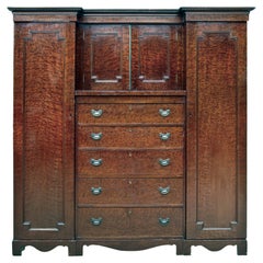
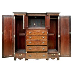
Antique Scottish Armoire
$5,440Sale Price|20% Off
Antique Scottish Armoire
Located in Malibu, CA
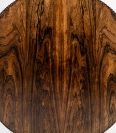
This antique armoire is made from beautiful hardwood and burled walnut veneers. Easy to move and assemble, it is constructed from six separate pieces that stack together. There are two tall wardrobes on each side flanking the center sections. The wardrobe sections have dowels for hanging clothes and small drawers at the bottom. The top center section has locking doors which open to a single compartment. It is large enough to hold a small sound system or tv, and there is a small hole cut in the back for wiring. The lower center section consists of five 5 large graduating drawers. The top drawer has 2 dividers to create 3 sections. All drawers are lined with gilded multi-color Florentine paper...
Late 19th Century Georgian Antique Scottish Furniture
Walnut, Hardwood, Paper