Engraved Furniture

to
1,540
6,059
1,436
7,261
439
32
293
218
199
167
154
148
100
100
81
74
34
27
22
22
21
15
14
7
2,936
2,712
1,613
471
602
413
356
110
36
85
88
35
75
88
138
90
58
5,097
2,097
1,048
649
564
5,359
1,413
1,185
857
834
7,732
7,435
7,569
228
97
91
74
47
Technique: Engraved
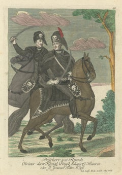
Durouf & Wife’s Channel Balloon Crash – 19th-Century Hand-Coloured Engraving

Durouf & Wife’s Channel Balloon Crash – 19th-Century Hand-Coloured Engraving

Located in Langweer, NL

Durouf & Wife’s Channel Balloon Crash – 19th-Century Hand-Coloured Engraving This gripping 19th-century hand-coloured engraving depicts the perilous rescue scene of French aeronaut ...

Category

Late 19th Century French Antique Engraved Furniture

Materials

Paper

Antique Map of Biblical Palestine – Holy Land & Jerusalem Insets, c.1818

Antique Map of Biblical Palestine – Holy Land & Jerusalem Insets, c.1818

Located in Langweer, NL

Antique Map of Biblical Palestine – Holy Land & Jerusalem Insets, c.1818 Elegant antique map depicting Palestine as understood in classical and biblical antiquity, extending from Phoenicia and Galilee through Judea to Egypt and Arabia Petraea. The map presents the Holy Land with remarkable density, showing ancient cities, regions, rivers, roads, and topography engraved in fine line and enhanced with subtle original outline color. The composition is visually refined and architecturally balanced, centered on the vertical sweep of the Levantine coastline. Insets illustrate the Twelve Tribes of Israel Jerusalem, and additional regional details, lending the sheet strong narrative depth while maintaining a calm, parchment-toned elegance well suited to contemporary interiors. The map is based on the authoritative work of Jean-Baptiste Bourguignon d’Anville, whose historical reconstructions reshaped Enlightenment cartography. D’Anville rejected speculative geography in favor of critical analysis of biblical texts, classical sources, itineraries, and geographic evidence, producing maps valued for clarity, proportion, and scholarly rigor. This example is the English edition published in London by Laurie & Whittle, issued circa 1818 and bound in the atlas A Complete Body of Ancient Geography. Produced during the neoclassical period, the restrained engraving and balanced palette align seamlessly with modern interior design while retaining strong historical presence. The neutral parchment tone, crisp engraving, and meaningful subject matter make this map particularly effective as wall art in libraries, studies, contemplative spaces, and hospitality interiors. It pairs beautifully with companion maps of Asia Minor, the Roman East, and the Ancient World from the same series. A timeless and highly decorative representation of the Holy Land, combining biblical significance with refined aesthetic appeal. Condition report: Good antique condition with light, even toning and gentle age-related wear. Original outline color remains clear and balanced. Central fold as issued. No major tears, losses, or repairs observed. Framing tips: Best presented in a dark walnut, blackened oak, or ebonized frame with a wide ivory or soft parchment mat. Museum or UV glass recommended. Particularly striking when framed as part of a classical or biblical map grouping. Technique: Engraving with original outline color Maker: Jean-Baptiste Bourguignon d’Anville (after), published by Laurie & Whittle, London, circa 1818 Keywords: antique palestine map, holy land antique map, biblical map, map of israel antiquity, jerusalem antique map, twelve tribes map, ancient judea map, roman palestine map, classical levant map, antique engraved map, d’anville map, laurie and whittle, 19th century map, ancient israel map, sacred geography map, biblical wall art, religious wall decor, neoclassical wall art, antique map wall decor, interior designer wall art, library wall decor, study wall art, contemplative decor, museum style decor, parchment toned art, neutral wall art, scholarly antique map, collectible antique map, framed antique map...

Category

Early 19th Century British Antique Engraved Furniture

Materials

Paper

19th Century German Pewter Passover Plate

19th Century German Pewter Passover Plate

Located in New York, NY

German Passover Pewter plate dated 1825. The plate with raised rim engraved in Hebrew with the Order of the Seder of Passover, In center, geometric design, surrounded by Hebrew text...

Category

1820s German Antique Engraved Furniture

Materials

Pewter

Harper’s Ferry by Moonlight, Potomac River Night View – Antique Engraving, 1872

Harper’s Ferry by Moonlight, Potomac River Night View – Antique Engraving, 1872

Located in Langweer, NL

Harper’s Ferry by Moonlight, Potomac River Night View – Antique Engraving This atmospheric 19th-century engraving titled Harper’s Ferry by Moonlight presents a dramatic nocturnal vi...

Category

1870s British Antique Engraved Furniture

Materials

Paper

Jean-Luc Le Mounier, Vers le Large, Freestanding Cabinet, France, 2021

Jean-Luc Le Mounier, Vers le Large, Freestanding Cabinet, France, 2021

By Jean-Luc Le Mounier

Located in New York, NY

Jean-Luc Le Mounier believes that a project is only truly successful when his audience is able to explain to him what “it feels like to see [the] work and not the other way around.” ...

Category

2010s French Engraved Furniture

Materials

Bronze

Traditional Headdresses from Italy and France: Florence, Ostia, Castà – 1823

Traditional Headdresses from Italy and France: Florence, Ostia, Castà – 1823

Located in Langweer, NL

Traditional Headdresses from Italy and France: Florence, Ostia, Castà – 1823 This hand-colored lithograph, marked “No. 5,” is the fifth plate in a captivating 1823 series published in London by Baldwin, Cradock & Joy, illustrating traditional headdresses from across Europe. With a focus on Italian regional fashion, but also including a figure from Languedoc (France), the print showcases the diversity and creativity of 19th-century women's headwear in both ceremonial and everyday contexts. At upper left, a woman from Montefiascone wears a simple yet elegant white veil draped loosely over her hair and shoulders. Her scarlet sleeve ribbons and golden earring add a dash of vibrancy to an otherwise modest ensemble. In contrast, the central figure from Lariana dons one of the most dramatic headpieces on the sheet: a large, bright yellow hat embellished with blue ribbon and multiple ornamental loops. Her necklace with a red cross pendant suggests a religious or festival connection. To the upper right, the figure from Languedoc is rendered in profile wearing a striking purple bonnet with vertical ridges, trimmed with white lace, and set against a yellow collar. This French addition provides an interesting cross-cultural comparison within a primarily Italian series. The bottom row continues with a woman from Florence, shown from behind with her dark hair intricately braided and adorned with a long pink and white ribbon that drapes down her back—an emblem of grace and femininity. The central bottom figure from Ostia wears a wide-brimmed felt hat...

Category

1820s Antique Engraved Furniture

Materials

Paper

Places Recorded in the Five Books of Moses — Biblical Holy Land Map, 1827

Places Recorded in the Five Books of Moses — Biblical Holy Land Map, 1827

Located in Langweer, NL

Places Recorded in the Five Books of Moses — Biblical Holy Land Map, Wilkinson 1827 This finely engraved and beautifully hand-colored biblical map titled “The Places Recorded in the...

Category

Early 19th Century British Antique Engraved Furniture

Materials

Paper

Rare 1770 Bellin Map of Sumatra with Stunning Decorative Cartouches

Rare 1770 Bellin Map of Sumatra with Stunning Decorative Cartouches

Located in Langweer, NL

Title: 1750 Bellin Map of Sumatra with Decorative Cartouches This exquisite 18th-century map of Sumatra, drawn by Jacques-Nicolas Bellin around 1750, is a testament to the artistr...

Category

1770s Antique Engraved Furniture

Materials

Paper

Antique Map of Northern Greece & Balkans – Macedonia, Thrace & Illyria, c.1818

Antique Map of Northern Greece & Balkans – Macedonia, Thrace & Illyria, c.1818

Located in Langweer, NL

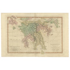
Antique Map of Northern Greece & Balkans – Macedonia, Thrace & Illyria, c.1818 Elegant antique map depicting Northern Greece and the central Balkans, covering Macedonia, Thrace, Illyria, Moesia, and the northern Aegean region, with the Black Sea (Pontus Euxinus) to the east and the Adriatic to the west. The map presents the region as understood in classical antiquity, showing Roman provinces, cities, rivers, mountain ranges, and coastlines engraved in fine detail and enhanced with subtle original outline color. The composition is broad and horizontally balanced, with layered mountain systems and river networks giving the sheet strong visual texture while maintaining a calm, architectural clarity. Latin place names, tribal regions, and Roman administrative divisions provide intellectual depth, making the map equally compelling as a historical document and as refined wall art. The map is based on the work of Jean-Baptiste Bourguignon d’Anville, whose reconstructions of the ancient world transformed Enlightenment cartography. D’Anville emphasized accuracy and proportion through critical study of classical sources, rejecting decorative speculation in favor of scholarly precision. This example is the English edition published in London by Laurie & Whittle, issued circa 1818 and bound in the atlas A Complete Body of Ancient Geography. Produced during the neoclassical period, the restrained engraving and soft parchment tone align seamlessly with contemporary interior design. The neutral palette, crisp line work, and generous margins make this map particularly effective as wall art in libraries, studies, boardrooms, and hospitality interiors. It pairs beautifully with companion sheets of Southern Greece, Asia Minor, and the Roman East from the same series. A timeless and highly decorative representation of the northern Greek and Balkan world, combining classical scholarship with strong interior presence. Condition report: Good antique condition with light, even toning and gentle age-related wear consistent with age. Original outline color remains clear and balanced. Central fold as issued. No major tears, losses, or repairs observed. Framing tips: Best presented in a dark walnut, blackened oak, or ebonized frame with a wide ivory or soft parchment mat. Museum or UV glass recommended. Particularly effective when displayed as part of a multi-sheet classical or Balkan grouping. Technique: Engraving with original outline color Maker: Jean-Baptiste Bourguignon d’Anville (after), published by Laurie & Whittle, London, circa 1818 Keywords: antique greece map, northern greece map, ancient macedonia map, ancient thrace map, illyria antique map, balkans antique map, roman balkans map, græciæ pars septentrionalis, antique engraved map, d’anville map, laurie and whittle, 19th century map, classical antiquity map, roman provinces map, aegean antique map, black sea antique map, pontus euxinus map, neoclassical wall art, antique map wall decor, interior designer wall art, library wall decor, study wall art, museum style decor, parchment toned art, neutral wall art, scholarly antique map, collectible antique map, framed antique map...

Category

Early 19th Century British Antique Engraved Furniture

Materials

Paper

A Silver Kiddush Goblet, Hungary Circa 1930

A Silver Kiddush Goblet, Hungary Circa 1930

Located in New York, NY

A Dedicated Silver Kiddush Goblet, made in Hungary Circa 1930. Seemingly this Kiddush Goblet was donated pre-WWll by a youth group in Galanta which at that time was part of Hungary...

Category

Early 20th Century Hungarian Engraved Furniture

Materials

Silver

A Detailed Mid-18th Century German Map of North-Central Europe

A Detailed Mid-18th Century German Map of North-Central Europe

Located in Langweer, NL

This is an antique, hand-colored engraved map of north-central Europe (centered on the region of Brandenburg, Pomerania, and portions of what is now northern Poland) that was produce...

Category

1730s Antique Engraved Furniture

Materials

Paper

Antique 19th Century Indian Engraved Copper Perfume Bottle

Antique 19th Century Indian Engraved Copper Perfume Bottle

Located in New York, NY

Antique 19th century Indian copper and mixed metal perfume / rose water bottle with original stopper. Copper base and central medallions are finely e...

Category

Late 19th Century Indian Agra Antique Engraved Furniture

Materials

Copper

Louvre Architectural Bas-Relief Engravings Pair, French Neoclassical Plates 1803

Louvre Architectural Bas-Relief Engravings Pair, French Neoclassical Plates 1803

Located in Langweer, NL

Louvre Architectural Bas-Relief Engravings Pair, French Neoclassical Plates, 1803 A refined and visually balanced pair of French architectural engravings depicting sculptural relief...

Category

Early 19th Century French Antique Engraved Furniture

Materials

Paper

Antique Louvre Architectural Engravings Pair, French Neoclassical Reliefs, 1803

Antique Louvre Architectural Engravings Pair, French Neoclassical Reliefs, 1803

Located in Langweer, NL

Antique Louvre Architectural Engravings Pair, French Neoclassical Reliefs, c.1803 This refined pair of early 19th-century French architectural engravings depicts sculptural relief d...

Category

Early 19th Century French Antique Engraved Furniture

Materials

Paper

Antique Map of Ancient Britain – Roman England, Wales & Scotland, c.1818

Antique Map of Ancient Britain – Roman England, Wales & Scotland, c.1818

Located in Langweer, NL

Antique Map of Ancient Britain – Roman England, Wales & Scotland, c.1818 Elegant antique map depicting ancient Britain under Roman rule, covering England, Wales, southern Scotland, and the adjacent coastlines of Ireland and the North Sea. The map presents Roman provinces, tribal regions, cities, roads, rivers, and coastlines in fine engraved detail, highlighted with subtle original outline color. The composition is calm yet visually engaging, with the island form of Britain clearly articulated and balanced across the sheet. Latin place names, tribal territories, and Roman administrative divisions give the map strong historical depth, while the restrained engraving and warm parchment tone create a refined, architectural presence ideally suited to modern interiors. The map is based on the work of Jean-Baptiste Bourguignon d’Anville, whose reconstructions of the ancient world established the foundations of modern historical cartography. D’Anville rejected speculative geography in favor of critical analysis of Roman itineraries, classical texts, and geographic evidence, producing maps valued for accuracy, clarity, and enduring scholarly authority. This example is the English edition published in London by Laurie & Whittle, issued circa 1818 and bound in the atlas A Complete Body of Ancient Geography. Produced during the neoclassical period, the map reflects early nineteenth-century taste for balance, order, and historical precision. The neutral palette, crisp engraving, and generous margins make this map particularly effective as wall art in libraries, studies, boardrooms, and hospitality interiors. It pairs beautifully with companion maps of Roman Gaul, Italy, and the Roman World from the same series. A timeless and highly decorative representation of Roman Britain, combining classical scholarship with strong interior presence. Condition report: Good antique condition with light, even toning and gentle age-related wear consistent with age. Original outline color remains clear and balanced. Central fold as issued. No major tears, losses, or repairs observed. Framing tips: Best presented in a dark walnut, blackened oak, or ebonized frame with a wide ivory or soft parchment mat. Museum or UV glass recommended. Particularly effective when displayed as part of a Roman Europe or classical map grouping. Technique: Engraving with original outline color Maker: Jean-Baptiste Bourguignon d’Anville (after), published by Laurie & Whittle, London, circa 1818 Keywords: antique britain map, ancient britain map, roman britain map, britanniae antiquae, antique england map, roman england map, ancient scotland map, roman scotland map, ancient wales map, roman wales map, antique engraved map, d’anville map, laurie and whittle, 19th century map, roman provinces map, classical antiquity map, british roman history decor, neoclassical wall art, antique map wall decor, interior designer wall art, library wall decor, study wall art, museum style decor, parchment toned art, neutral wall art, scholarly antique map, collectible antique map, framed antique map...

Category

Early 19th Century British Antique Engraved Furniture

Materials

Paper

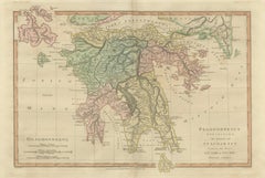
Antique Map of Ancient Greece – Classical Balkans & Aegean, Engraving c.1818

Antique Map of Ancient Greece – Classical Balkans & Aegean, Engraving c.1818

Located in Langweer, NL

Antique Map of Ancient Greece – Classical Balkans & Aegean, Engraving c.1818 Elegant antique map depicting ancient Greece and the classical Balkans, extending from Epirus and Macedo...

Category

Early 19th Century British Antique Engraved Furniture

Materials

Paper

Chinese Agricultural Labor Scenes, Set of Four Hand-Colored Engravings – 1815

Chinese Agricultural Labor Scenes, Set of Four Hand-Colored Engravings – 1815

Located in Langweer, NL

Chinese Agricultural Labor Scenes, Set of Four Hand-Colored Engravings – Ferrario, 1815 This rare and visually engaging set of four hand-colored copperplate engravings originates fr...

Category

Early 19th Century Italian Antique Engraved Furniture
Materials

Paper

Napoleonic Mameluck of the Imperial Guard, hand-colored military print, 1843

Napoleonic Mameluck of the Imperial Guard, hand-colored military print, 1843

Located in Langweer, NL

Napoleonic Mameluck of the Imperial Guard, hand-colored military print, 1843 This finely executed hand-colored military print depicts a Mameluck of the Imperial Guard, one of the mo...

Category

1840s French Antique Engraved Furniture

Materials

Paper

Chinese Boats and River Vessels, Hand-Coloured Ferrario Engraving, 1815

Chinese Boats and River Vessels, Hand-Coloured Ferrario Engraving, 1815

Located in Langweer, NL

Chinese Boats and River Vessels, Hand-Coloured Ferrario Engraving 1815 A finely hand-coloured copperplate engraving depicting a variety of traditional Chinese boats and river vessel...

Category

Early 19th Century Italian Antique Engraved Furniture
Materials

Paper

Farnham House Estate View, Georgian Manor Landscape Engraving, c1850

Farnham House Estate View, Georgian Manor Landscape Engraving, c1850

Located in Langweer, NL

Farnham House Estate View, Georgian Manor Landscape Engraving, c1850 A refined architectural landscape portraying Farnham House, issued in the Victorian publication Picturesque View...

Category

Mid-19th Century British Antique Engraved Furniture

Materials

Paper

Antique Dutch East Indies Forts Engraving — VOC Batavia, Ambon & Banda, c.1719

Antique Dutch East Indies Forts Engraving — VOC Batavia, Ambon & Banda, c.1719

Located in Langweer, NL

Antique Dutch East Indies Forts Engraving — VOC Batavia, Ambon & Banda, Chatelain c.1719 This impressive early 18th-century copperplate engraving titled “Vue et description de quelq...

Category

Early 18th Century French Antique Engraved Furniture

Materials

Paper

Cashew and Rose Apple Trees with Pepper and Crocus Indicus – de Bry, 1600

Cashew and Rose Apple Trees with Pepper and Crocus Indicus – de Bry, 1600

Located in Langweer, NL

Cashew and Rose Apple Trees with Pepper and Crocus Indicus – de Bry, 1600 Exotic early engraving from Johann and Israel de Bry’s illustrated edition of Jan Huygen van Linschoten’s t...

Category

Early 1600s Dutch Antique Engraved Furniture

Materials

Paper

India & Bengal after Bonne – Enlightenment French Cartography, Two-Map Set, 1780

India & Bengal after Bonne – Enlightenment French Cartography, Two-Map Set, 1780

Located in Langweer, NL

India & Bengal after Bonne – Enlightenment French Cartography, Two-Map Set c.1780 This refined two-map set depicts northern and southern India with Bengal, engraved circa 1780 by Rigobert Bonne, one of the most influential cartographers of the French Enlightenment. The pair comprises complementary regional maps, together offering a coherent late-18th-century French view of the Indian subcontinent at a moment of rapidly expanding European geographic knowledge. The maps are offered unframed, enabling custom framing to personal or interior preferences. Bonne was appointed Ingénieur-Hydrographe de la Marine and became chief cartographer at the Dépôt de la Marine, where he succeeded Jacques-Nicolas Bellin and modernized French cartography through a strict emphasis on scientific measurement, hydrographic accuracy, and the synthesis of contemporary travel accounts. His maps are admired for their rational composition, restrained engraving style, and exceptional legibility—hallmarks that distinguish them from the more decorative cartography of earlier periods. These maps illustrate the Indian interior, river systems, coastlines, and political regions with a clarity intended for practical navigation and geographic understanding rather than ornament. The Bengal sheet reflects the strategic importance of the Ganges delta and the Bay of Bengal, while the southern sheet covers the Coromandel Coast, Malabar Coast, Sri Lanka, and surrounding maritime routes. Together, they present a balanced and intellectually grounded portrait of South Asia as understood by European science in the late 18th century. Visually, the set has a calm, architectural presence: fine line engraving, generous margins, and a neutral tonal palette that works exceptionally well in contemporary interiors. Framed as a pair, these maps appeal equally to collectors of Enlightenment cartography and interior designers seeking historically significant yet understated wall pieces. Bonne replaced Bellin at the Dépôt de la Marine, marking the decisive shift from decorative to scientifically grounded French mapmaking. Condition report: Good antique condition. Light age toning and handling wear consistent with 18th-century engraved maps. Original centerfolds visible as issued. Clean impressions with strong legibility; margins ample for framing. Framing tips: Highly effective as a paired display. Recommend dark walnut or ebonized frames with generous ivory or warm off-white mats to emphasize the precision of the engraving. Museum glass suggested for a refined, contemporary finish. Technique: Copperplate engraving Maker: Rigobert Bonne, France, circa 1780 Keywords: India antique map, Bengal antique map, Ganges River map, Bay of Bengal map, Hindustan map, Mughal India map, East Indies map, French Enlightenment cartography, Rigobert Bonne map, 18th century India map, Calcutta map...

Category

Late 18th Century French Antique Engraved Furniture

Materials

Paper

Hand-Colored Engraving of the Dark and Spotted Duck by Seligmann, ca.1770

Hand-Colored Engraving of the Dark and Spotted Duck by Seligmann, ca.1770

Located in Langweer, NL

Title: Die Dunkle und Gefleckte Ente - Hand-Colored Engraving of the Dark and Spotted Duck by Johann Michael Seligmann, 18th Century This exquisite hand-colored engraving, titled 'D...

Category

1770s Antique Engraved Furniture

Materials

Paper

An Antique Italian Emerald Hand Blown Glass and Silver Decanter and Four Glasses

An Antique Italian Emerald Hand Blown Glass and Silver Decanter and Four Glasses

Located in New Orleans, LA

A charming 1920's Italian hand blown glass and silver decanter and four glasses in a lovely shades of emerald green and having designs of silver with silver rims. The ground stopper ...

Category

1920s Italian Grand Tour Vintage Engraved Furniture

Materials

Silver

Antique Engraving of Buenos Aires, City and Harbor View, 1867

Antique Engraving of Buenos Aires, City and Harbor View, 1867

Located in Langweer, NL

Antique Engraving of Buenos Aires, City and Harbor View, 1867 Engraving titled Buenos-Ayres, published in 1867. This finely detailed view depicts the Argentine capital from the sea,...

Category

1860s French Antique Engraved Furniture

Materials

Paper

Antique Chinese Temple & Pagoda Engraving — Chatelain, 1719

Antique Chinese Temple & Pagoda Engraving — Chatelain, 1719

Located in Langweer, NL

Antique Chinese Temple & Pagoda Engraving — Chatelain, 1719 This important early 18th-century copperplate engraving titled “Description d'un des plus fameux temples des Chinois, ave...

Category

Early 18th Century French Antique Engraved Furniture

Materials

Paper

American Arts And Crafts Finely Painted Pyrography Dutch Scene By Harry Ungar

American Arts And Crafts Finely Painted Pyrography Dutch Scene By Harry Ungar

Located in South Burlington, VT

An unusually fine mid century Arts and crafts pyrography portrait of two Dutch children amidst a scene of a windmill , home, boat and water. Attractively hand stained or painted wit...

Category

Mid-20th Century American Mid-Century Modern Engraved Furniture

Materials

Wood

Heraldic Costumes c.1400 – Antique 1845 Prints of Knight and Lady, Hand-Coloured

Heraldic Costumes c.1400 – Antique 1845 Prints of Knight and Lady, Hand-Coloured

Located in Langweer, NL

Chivalry in Devotion Knight and Lady Heraldic Prayer Plates c 1400 These two exquisitely hand-coloured costume plates come from the landmark 1845 edition of Costumes Historiques des...

Category

Mid-19th Century French Antique Engraved Furniture

Materials

Paper

Biblical Chronology Chart from Noah to Abraham — Wilkinson 1823

Biblical Chronology Chart from Noah to Abraham — Wilkinson 1823

Located in Langweer, NL

Post-Diluvian Patriarchs Chrono-Genealogical Chart — Biblical Timeline, Wilkinson 1823 This finely engraved and delicately hand-colored chrono-genealogical chart titled “Chrono-Gene...

Category

Early 19th Century British Antique Engraved Furniture

Materials

Paper

Rare 1699 Map of the Failed Scottish Colony of Caledonia in Panama

Rare 1699 Map of the Failed Scottish Colony of Caledonia in Panama

Located in Langweer, NL

Rare 1699 Map of the Failed Scottish Colony of Caledonia in Panama This scarce and historically fascinating map, titled 'The Scots Settlement in America or New Caledonia A.D. 1699',...

Category

Late 17th Century English Antique Engraved Furniture

Materials

Paper

Original 18th-Century Map of Southern Austria, Carinthia, Carniola, and Styria

Original 18th-Century Map of Southern Austria, Carinthia, Carniola, and Styria

Located in Langweer, NL

title: 18th-Century Map of Southern Austria, Carinthia, Carniola, and Styria by Robert de Vaugondy Description: This finely engraved 18th-century map by Gilles Robert de Vaugondy ...

Category

1750s French Antique Engraved Furniture

Materials

Paper

Antique Map of India, Persia & Afghanistan – Detailed Continental Engraving 1864

Antique Map of India, Persia & Afghanistan – Detailed Continental Engraving 1864

Located in Langweer, NL

Antique Map of India, Persia & Afghanistan – Andriveau-Goujon, Paris 1864 This detailed 19th-century map titled “Asie Méridionale comprenant la Presqu'île de l'Inde, la Perse, l'Afg...

Category

Mid-19th Century French Antique Engraved Furniture

Materials

Paper

Vintage Silver-Plated Flower Frog Centerpiece Bowl Elegant English Floral Arra

Vintage Silver-Plated Flower Frog Centerpiece Bowl Elegant English Floral Arra

Located in Wembley, GB

Vintage Silver-Plated Flower Frog Centerpiece Bowl – Elegant English Floral Arranger Add timeless sophistication to your dining table or interior décor with this beautiful vintage si...

Category

1940s British Art Deco Vintage Engraved Furniture

Materials

Silver, Silver Plate, Sterling Silver, Silver Leaf

1726 Map of Bengal by Van der Aa after Valentijn – Dutch East Indies

1726 Map of Bengal by Van der Aa after Valentijn – Dutch East Indies

Located in Langweer, NL

1726 Map of Bengal by Van der Aa after Valentijn – Dutch East Indies This is an original antique map titled “Nieuwe Kaart van ’t Koninryk van Bengale,” published by Pieter van der Aa in Leiden in 1726. The map depicts the Kingdom of Bengal and surrounding regions, based on earlier work by François Valentijn, a Dutch East India Company (VOC) official and historian whose extensive writings on Asia were among the most important early European sources. The engraving covers the Bengal region (modern-day Bangladesh and West Bengal, India), showing detailed river systems including the Ganges and its distributaries flowing into the Gulf of Bengal. Major towns, cities, and kingdoms are labelled in Dutch, such as Orixa (Orissa), Arracan, Tipera (Tripura), and Cos Assam (Assam). Mountain ranges are represented pictorially with stylised hachured peaks, while fertile plains are indicated with field patterns, adding visual texture to the map. In the upper right is an elegant title cartouche with dedication to VOC officials, referencing Mathijs van den Broecke, a director in Bengal, and Johannes Lennep. A compass rose is positioned at the bottom, enhancing its decorative maritime appeal, with north oriented to the right as typical for Dutch maps of Asian regions in this period. Pieter van der Aa (1659–1733) was a prolific publisher known for compiling maps from earlier explorers and engravers into elegant and collectible volumes. His works remain valued for their historical significance, decorative artistry, and connection to VOC trade networks and colonial history. Condition: Good condition. Strong impression with later hand colouring. Light age toning, faint foxing mainly in margins, and some creasing along original fold lines as issued. Fully suitable for framing. Framing tips: Frame this map in a slim gilt or dark wood frame to highlight its decorative hand colouring. Use an off-white archival mat to accentuate the engraving and protect the edges. UV-protective glazing is recommended to maintain colour vibrancy and paper integrity. Keywords block for your listing: bengal map...

Category

Early 18th Century Dutch Antique Engraved Furniture

Materials

Paper

Blaeu Map of Cambrai, Artois & Hainaut – Heraldic France c.1642

Blaeu Map of Cambrai, Artois & Hainaut – Heraldic France c.1642

Located in Langweer, NL

Title: Blaeu Map of Cambrai, Artois & Hainaut – Heraldic France c.1642 Description: A finely engraved and richly decorated 17th-century map of the historic Archbishopric of Cambrai,...

Category

Mid-17th Century Dutch Antique Engraved Furniture

Materials

Paper

Blaeu Map of Boulogne & Calais Coast – Maritime France, Ships c.1642

Blaeu Map of Boulogne & Calais Coast – Maritime France, Ships c.1642

Located in Langweer, NL

Blaeu Map of Boulogne, Calais & Guînes – Coastal France, Ships c.1642 A striking and highly decorative 17th-century map of the northern French coast, centered on Boulogne-sur-Mer, C...

Category

Mid-17th Century Dutch Antique Engraved Furniture

Materials

Paper

Traditional Headwear from Italy: Turin, Rome, Subiaco and More – 1823 Print

Traditional Headwear from Italy: Turin, Rome, Subiaco and More – 1823 Print

Located in Langweer, NL

Traditional Headwear from Italy: Turin, Rome, Subiaco and More – 1823 Print This hand-colored lithograph, marked “No. 3,” is the third plate from a striking early 19th-century series documenting traditional European costume, particularly regional headwear. Published in London on December 1, 1823, by Baldwin, Cradock & Joy, this print showcases six distinct styles worn by women across Italy, offering a comparative glimpse into local identity, ceremonial dress, and religious symbolism. At the center top is a dramatic blue hooded garment labeled “Penitent.” Worn with the face obscured, this penitential garment features a small red cross emblem, likely representing affiliation with a religious brotherhood or spiritual order. It stands out starkly from the other portraits and introduces a solemn, sacred tone. To its left, a view from behind shows a woman from “Settimo” wearing a stylized crown of hairpins radiating like a sunburst, secured by a horizontal golden bar. Below her elaborately embroidered collar, a red ribbon is neatly tied. To the right, a woman from “Turin” wears an exquisite bonnet of pleated white lace, creating a fan-like halo above her head. Her large gold cross...

Category

1820s Antique Engraved Furniture

Materials

Paper

Antique Biblical Holy Land Map — Jerusalem, Palestine & Levant, De Fer 1703

Antique Biblical Holy Land Map — Jerusalem, Palestine & Levant, De Fer 1703

Located in Langweer, NL

Antique Biblical Holy Land Map — Jerusalem, Palestine & Levant, De Fer 1703 This finely engraved antique map of the Holy Land, titled “La Terre Sainte Tirée des Memoires de M. de la Ruë,” was published in Paris in 1703 by the celebrated French cartographer Nicolas de Fer, Geographe de Sa Majesté Catholique et de Monseigneur le Dauphin. De Fer was one of the most influential map publishers of late seventeenth- and early eighteenth-century France, known for producing highly detailed and historically informed maps that blended geographic knowledge with historical and biblical scholarship. The map is offered unframed, giving flexibility to select a frame that best suits the intended interior. The map presents a detailed representation of Palestine and the surrounding Levant, including regions corresponding to modern Israel, Jordan, Lebanon, and parts of Syria and Egypt. It emphasizes biblical geography, identifying ancient tribal territories, cities, and historically significant sites associated with scriptural narratives. Jerusalem occupies a central position, surrounded by carefully engraved place names that reflect both classical and biblical traditions. The Dead Sea, Jordan River, and Mediterranean coastline are rendered with clarity, reinforcing the cartographic focus on sacred landscapes. A distinctive feature of this example is the inset map at lower left illustrating the “Le Passage du Peuple Saint,” referencing the biblical Exodus narrative and highlighting the broader historical and theological context. The engraved title cartouche in the upper right adds a refined decorative element, while the compass rose and scales at the bottom demonstrate the technical precision characteristic of De Fer’s workshop. Maps of the Holy Land were among the most sought-after cartographic subjects in early modern Europe, serving scholars, clergy, collectors, and travelers interested in biblical history. Today, they remain highly collectible for their historical significance, decorative appeal, and enduring cultural resonance. The horizontal format and balanced composition make this example particularly suitable for framing, either as a standalone focal piece or within a curated wall of antique maps. Condition report: Light age toning and minor foxing consistent with age. Margins show gentle handling wear. Strong impression with clear engraving and legible text. Plate mark visible. Framing tips: A dark walnut or ebonized frame with a generous ivory mat enhances the refined engraving and complements both classic and contemporary interiors. Museum-style framing works especially well to highlight the detailed cartouche and inset map. We sell the map unframed. Technique: Copperplate engraving Maker: Nicolas de Fer, Paris, France, dated 1703 Keywords: Nicolas de Fer map, Terre Sainte map, Holy Land antique map, Palestine antique...

Category

Early 18th Century Antique Engraved Furniture

Materials

Paper

Joe DiMaggio Silver Presentation Tray by Cartier

Joe DiMaggio Silver Presentation Tray by Cartier

By Cartier

Located in New Orleans, LA

Made for one of the most celebrated sports figures of the 20th century, this incredible Cartier presentation tray was gifted to the baseball star Joe DiMaggio...

Category

20th Century French Other Engraved Furniture

Materials

Silver

Rare Antique Engraving – Valparaíso, Chile Harbor and City Scene, 1867

Rare Antique Engraving – Valparaíso, Chile Harbor and City Scene, 1867

Located in Langweer, NL

Antique Engraving of Valparaíso, Harbor and City View, 1867 Detailed 19th-century engraving titled Valparaiso, published in 1867. The panoramic view captures Chile’s principal port ...

Category

1860s French Antique Engraved Furniture

Materials

Paper

Terra Veteribus Nota — Classical World Map of Antiquity, Wilkinson 1814

Terra Veteribus Nota — Classical World Map of Antiquity, Wilkinson 1814

Located in Langweer, NL

Terra Veteribus Nota — Classical World Map of Antiquity, Wilkinson 1827 This elegant antique map titled *Terra Veteribus Nota* (“The World Known to the Ancients”) was published in L...

Category

Early 19th Century British Antique Engraved Furniture

Materials

Paper

Antique Map of Asia Minor & the Levant – Anatolia, Syria & Cyprus, c.1818

Antique Map of Asia Minor & the Levant – Anatolia, Syria & Cyprus, c.1818

Located in Langweer, NL

Antique Map of Asia Minor & the Levant – Anatolia, Syria & Cyprus, c.1818 Elegant antique map depicting Asia Minor and the Eastern Mediterranean, covering Anatolia (modern Turkey), the Aegean coast, Syria, Mesopotamia, Armenia, and Cyprus. The map presents the region as understood in classical antiquity, with Roman and Greek cities, provinces, rivers, and coastlines engraved in fine detail and enhanced with subtle original outline color. The composition has a strong horizontal sweep, with the Black Sea (Pontus Euxinus) to the north and the Mediterranean (Mare Internum) to the south, creating a balanced and architectural visual rhythm. Classical Latin place names and ancient regional divisions lend scholarly depth, while the restrained engraving and calm parchment tone give the sheet a refined, contemporary presence ideal for interior display. The map is based on the work of Jean-Baptiste Bourguignon d’Anville, whose reconstructions of the ancient world defined Enlightenment historical cartography. D’Anville rejected decorative speculation and relied instead on critical comparison of classical texts, itineraries, and geographic evidence, producing maps prized for accuracy, clarity, and proportion. This example is the English edition published in London by Laurie & Whittle, issued circa 1818 and bound in the atlas A Complete Body of Ancient Geography. Produced during the neoclassical period, the map reflects early nineteenth-century taste for order, balance, and historical authority. The neutral palette, crisp engraving, and wide margins make this map particularly effective as wall art in libraries, studies, hallways, and hospitality interiors. It pairs beautifully with companion sheets of Ancient Greece, the Roman East, and the Ancient World from the same series. A timeless and highly decorative representation of the classical Eastern Mediterranean, combining intellectual depth with strong interior presence. Condition report: Good antique condition with light, even toning and gentle age-related wear. Original outline color remains clear and balanced. Central fold as issued. No major tears, losses, or repairs observed. Framing tips: Best presented in a dark walnut, blackened oak, or ebonized frame with a wide ivory or soft parchment mat. Museum or UV glass recommended. Particularly effective when hung horizontally or paired with other classical maps from the series. Technique: Engraving with original outline color Maker: Jean-Baptiste Bourguignon d’Anville (after), published by Laurie & Whittle, London, circa 1818 Keywords: antique asia minor map, anatolia antique map, ancient turkey map, ancient syria map, levant antique map, roman asia map, classical anatolia map, antique engraved map, d’anville map, laurie and whittle, 19th century map, eastern mediterranean map, black sea antique map, pontus euxinus map, cyprus antique map...

Category

Early 19th Century British Antique Engraved Furniture

Materials

Paper

17th Century Blaeu Map – Ottoman Balkans: Walachia, Bulgaria, Romania, ca. 1650

17th Century Blaeu Map – Ottoman Balkans: Walachia, Bulgaria, Romania, ca. 1650

Located in Langweer, NL

Blaeu Map of Walachia, Servia, Bulgaria, Romania, circa 1640 This is an original antique map titled “Walachia, Servia, Bulgaria, Romania,” published by Joan Blaeu in Amsterdam betwe...

Category

17th Century Dutch Antique Engraved Furniture

Materials

Paper

The Land of Promise — Elegant Hand-Colored Biblical Map of Canaan, London 1827

The Land of Promise — Elegant Hand-Colored Biblical Map of Canaan, London 1827

Located in Langweer, NL

The Land of Promise — Elegant Hand-Colored Biblical Map of Canaan, London 1827 This finely engraved and beautifully hand-colored biblical map depicts Canaan, or the Land of Promise ...

Category

Early 19th Century British Antique Engraved Furniture

Materials

Paper

Baroque Splendor: The Östanå Manor in Gränna, 1692 Swidde Engraving

Baroque Splendor: The Östanå Manor in Gränna, 1692 Swidde Engraving

Located in Langweer, NL

An original copper engraving from the renowned "Suecia Antiqua et Hodierna," an atlas of Sweden created under the direction of Erik Dahlberg in the late 17th century. This particular engraving, crafted by Willem Swidde in 1692, depicts the Östanå herrgård (manor house) in Gränna, located in the Jönköping county of Småland. The engraving showcases the manor in a stately fashion, with a classical architectural design featuring symmetrical wings and a central structure adorned with a grand staircase. The scene is animated with figures in the foreground, indicating the manor's role as a hub of activity and societal life. The garden layout...

Category

Late 17th Century Antique Engraved Furniture

Materials

Paper

Long-Nosed Surgeonfish – Antique Hand-Colored Fish Engraving, Nodder c.1794

Long-Nosed Surgeonfish – Antique Hand-Colored Fish Engraving, Nodder c.1794

Located in Langweer, NL

Long-Nosed Surgeonfish – Antique Hand-Colored Fish Engraving, Nodder c.1794 This finely detailed hand-colored engraving depicts a long-nosed surgeonfish, shown in lateral profile an...

Category

Late 18th Century German Antique Engraved Furniture
Materials

Paper

Rare Antique Engraving – Lima, Peru with Cathedral and Plaza Mayor, 1867

Rare Antique Engraving – Lima, Peru with Cathedral and Plaza Mayor, 1867

Located in Langweer, NL

Antique Engraving of Lima, Cathedral and Plaza Mayor, 1867 Detailed 19th-century engraving titled Lima, published in 1867. The view captures the grand Plaza Mayor of the Peruvian ca...

Category

1860s French Antique Engraved Furniture
Materials

Paper

Eagle Rocks Mississippi River, Antique Steel Engraving c.1850

Eagle Rocks Mississippi River, Antique Steel Engraving c.1850

Located in Langweer, NL

Eagle Rocks Mississippi River, Antique Steel Engraving c.1850 Description: A dramatic and finely executed mid-19th-century steel engraving titled “The Eagle Rocks (Mississippi)”, de...

Category

Mid-19th Century German Antique Engraved Furniture
Materials

Paper

Missouri River Stone Walls, Antique Steel Engraving c.1850

Missouri River Stone Walls, Antique Steel Engraving c.1850

Located in Langweer, NL

Missouri River Stone Walls, Antique Steel Engraving c.1850 Description: A striking and highly atmospheric mid-19th-century steel engraving titled “Die Stone Walls (Oberer Missouri)”...

Category

Mid-19th Century German Antique Engraved Furniture
Materials

Paper

Mississippi River Bluffs St. Paul, Antique Steel Engraving c.1850

Mississippi River Bluffs St. Paul, Antique Steel Engraving c.1850

Located in Langweer, NL

Mississippi River Bluffs St. Paul, Antique Steel Engraving c.1850 Description: A refined and atmospheric mid-19th-century steel engraving depicting the dramatic limestone bluffs alo...

Category

Mid-19th Century German Antique Engraved Furniture
Materials

Paper

Chikanobu Triptych – Shogun Returns from the Hunt in Koganehara, c.1897

Chikanobu Triptych – Shogun Returns from the Hunt in Koganehara, c.1897

Located in Langweer, NL

Chikanobu Triptych – Shogun Returns from the Hunt in Koganehara, c.1897 This powerful and dynamic triptych by Toyohara Chikanobu (1838–1912) depicts the Shogun and his retinue returning from a falconry hunt across the vast grasslands of Koganehara. The print is part of the celebrated Meiji-era series Chiyoda no Omote (Outer Palace of Chiyoda), which portrayed ceremonial and military scenes from the life of the Tokugawa shogunate. This series blends historical reverence with a modern Meiji sensibility, celebrating Japan’s warrior heritage at a time of rapid transformation. Rendered in rich color and vivid linework, the triptych shows a noble procession in motion: the mounted Shogun at center turns back toward the viewer, while falconers and warriors in elaborate dress surround him. Attendants carry game and falconry equipment, and a dense forest line marks the horizon behind them. The sweeping composition emphasizes both movement and status, with the central figure visually dominant and placed against a pale, open sky. The triptych is signed by Chikanobu with the toshidama cartouche and published by Fukuda Hatsujirō around 1897. Chikanobu, one of the last great ukiyo-e masters, was celebrated for his ability to capture imperial ceremony, samurai culture, and the feminine elegance of the court — often in triptych format for dramatic impact. While the work shows some age-related signs, it retains strong visual appeal and is a compelling historical document of samurai-era tradition as imagined through Meiji eyes. Condition report: Good overall condition considering age. The three sheets are mounted together on old Japanese paper backing (verso), which is loosening slightly along the joins. Light overall toning and minor wrinkling across the panels. Colors remain well preserved with strong impression and no major losses or tears. Margins present, minor handling wear visible. A stable and attractive display piece. Framing tips: We recommend float mounting the full triptych in a custom horizontal frame, allowing the slight backing and joins to remain visible as part of its historical charm. Use a dark walnut or black lacquer frame with an off-white or light beige acid-free mat. Proper archival mounting can help preserve the integrity of the backing while enhancing its display quality. Technique: Woodblock print (ōban triptych) Maker: Toyohara Chikanobu, Japan, c.1897 Publisher: Fukuda Hatsujirō Keywords: Chikanobu triptych, samurai falconry print, Japanese woodblock print, Meiji print, Chiyoda no Omote, shogun artwork, Koganehara, antique Japanese triptych...

Category

1890s Japanese Antique Engraved Furniture
Materials

Paper

Groningen 1573 — Hand-Colored Woodcut City View from Münster’s Cosmographia

Groningen 1573 — Hand-Colored Woodcut City View from Münster’s Cosmographia

Located in Langweer, NL

Groningen 1573 — Hand-Colored Woodcut City View from Münster’s Cosmographia Description: This rare and evocative 16th-century hand-colored woodcut presents a panoramic view of the c...

Category

16th Century Swiss Antique Engraved Furniture
Materials

Paper

Antique Map of Vienna, Plan von Wien, Hand Colored Artaria City Plan, 1839

Antique Map of Vienna, Plan von Wien, Hand Colored Artaria City Plan, 1839

Located in Langweer, NL

Antique Map Vienna 1839, Plan von Wien, Hand Colored Artaria City Plan A highly detailed and elegant 1839 hand-colored plan of Vienna, published by the renowned Artaria & Compagnie,...

Category

Mid-19th Century Austrian Antique Engraved Furniture
Materials

Paper

Antique Clove Botanical Print, Caryophyllus Aromaticus, Hand Colored, c.1831

Antique Clove Botanical Print, Caryophyllus Aromaticus, Hand Colored, c.1831

Located in Langweer, NL

Antique Clove Botanical Print, Caryophyllus Aromaticus, Hand Colored, c.1831 This strong and visually engaging botanical engraving illustrates Caryophyllus Aromaticus, the clove tre...

Category

1830s German Antique Engraved Furniture
Materials

Paper

Silver Plate Coronation Tray Large Decoratve Vintage Queen Elizabeth 1952-1977

Silver Plate Coronation Tray Large Decoratve Vintage Queen Elizabeth 1952-1977

Located in Wembley, GB

Large Vintage Silver-Plated Coronation Tray, Queen Elizabeth II 1952–1977 An exceptional and highly decorative vintage silver-plated commemorative tray celebrating the Silver Jubile...

Category

Mid-19th Century English Art Deco Antique Engraved Furniture
Materials

Silver, Silver Plate, Sterling Silver

East African Coast – French Map by Bellin, Zanzibar to Arabia, 1740

East African Coast – French Map by Bellin, Zanzibar to Arabia, 1740

Located in Langweer, NL

East African Coast – French Map by Bellin, Zanzibar to Arabia, 1740 This important French map depicts the eastern coast of Africa from Mozambique and Zanzibar northward to the Horn ...

Category

1740s French Antique Engraved Furniture
Materials

Paper