Antique Map Turkey in Asia, Ottoman Empire Anatolia Syria Iraq Black 1884
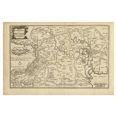
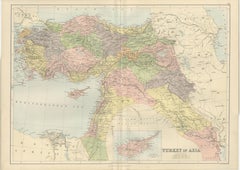
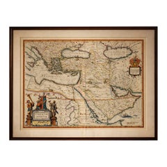
This detailed and beautifully engraved antique map titled Turkey in Asia was published in the New and Revised Edition of Black’s General Atlas of the World, issued in Edinburgh in 1884 by the respected Scottish cartographic publisher Adam and Charles Black. The map illustrates a vast portion of the Middle East during the late nineteenth century, when the region formed the Asian territories of the Ottoman Empire.
The map centers on Anatolia, the great peninsula that today forms modern Turkey, shown here as the heartland of Ottoman Asia. The rugged mountain ranges, river systems, and historic provinces are carefully engraved, reflecting the high standard of Victorian atlas cartography. Numerous cities and towns are clearly marked, including Constantinople (Istanbul), Smyrna (Izmir), Angora (Ankara), Trebizond, and many other regional centers that played important roles in trade and administration.
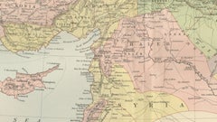
Extending southward, the map covers Syria and the Levant, including Damascus, Aleppo, and the Mediterranean coastal cities that historically linked the Ottoman interior with European commerce. Further south appear Palestine and the Sinai region, together with the eastern Mediterranean coastline. The map also includes the northern portion of Egypt, showing the Nile Delta and the strategic area surrounding the Suez Canal, which had opened only fifteen years earlier in 1869 and had quickly become one of the most important maritime routes in the world.
To the east the map extends into Mesopotamia, depicting the great river valleys of the Tigris and Euphrates, including the historic cities of Mosul, Baghdad, and Basra. These regions formed key administrative provinces of the Ottoman Empire and were vital corridors connecting Anatolia with Persia and the Arabian Peninsula.
The composition also includes parts of Armenia, Kurdistan, and the Caucasus along the northern and northeastern margins, as well as portions of Persia and Arabia to the southeast. An inset map of Cyprus appears at the bottom, highlighting the island’s strategic importance in the eastern Mediterranean. Cyprus had recently come under British administration in 1878, reflecting the shifting geopolitical dynamics of the region during the late nineteenth century.
The map is engraved with remarkable clarity, featuring finely drawn coastlines, mountain relief, and a delicate latitude and longitude grid. Land areas are distinguished with subtle printed color, a typical feature of high-quality Victorian atlas production. The understated color scheme and precise engraving give the map both historical authority and strong decorative appeal.
Maps from Black’s General Atlas were widely respected for their accuracy and clarity and were used throughout the British world in schools, libraries, and government institutions. Today they are highly appreciated by collectors for their elegant engraving and for the insight they provide into the political geography of the late nineteenth century.
This map was published in the New and Revised Edition of Black’s General Atlas of the World, Edinburgh, 1884. This example is an original antique steel engraving with original printed color applied at the time of publication. It is not a modern reproduction. Any presentation images showing the print framed are for visual inspiration only. The map is supplied unframed.
Condition: Good antique condition with light age toning consistent with age and a central fold from the original atlas binding. A small tear near the folding split. The engraving remains crisp and the printed color remains clear and attractive.
Framing tips: This map displays beautifully in a wide horizontal frame. A dark walnut or classic black frame combined with an ivory or museum-white mat will emphasize the delicate engraving and warm tones of the nineteenth-century printed color.
Technique: Steel engraving with original printed color
Maker: Adam & Charles Black, Edinburgh, 1884
Keyword block: Turkey in Asia, Ottoman Empire, Anatolia, Asia Minor, Syria, Palestine, Mesopotamia, Iraq, Baghdad, Mosul, Basra, Damascus, Aleppo, Constantinople, Istanbul, Smyrna, Izmir, Angora, Ankara, Armenia, Kurdistan, Caucasus, Persia, Iran, Arabia, Nile Delta, Egypt, Suez Canal, Cyprus, Eastern Mediterranean, Middle East map, Ottoman provinces, nineteenth century Middle East, Victorian atlas map, Black’s General Atlas, antique Turkey map...
Category
Late 19th Century Scottish Antique Engraved Furniture