Benelux - Collectibles and Curiosities

to
4,814
6,822
15,102
11,599
6,771
37
14
115
31
28
28
27
19
17
14
13
12
6
5
4
4
3
2
2
3,245
2,598
928
51
381
206
69
84
20
10
17
7
33
44
30
15
7
5,803
520
364
108
99
1,331
370
277
154
120
6,822
6,821
6,821
104
58
20
14
14
Item Ships From: Benelux
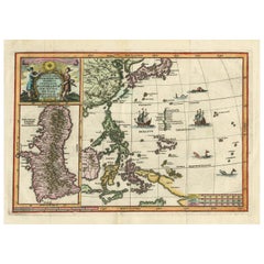
Antique Map of the Philippines and Guam by Scherer, circa 1702
Located in Langweer, NL
Antique map titled 'Nova et Vera Exhibitio Geographica Insularum Marianarum (..)'. Rare and very attractive map of the Mariana Islands, Philippines, Ko...
Category

Early 18th Century Antique Benelux - Collectibles and Curiosities

Materials

Paper

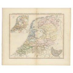
Antique Map of the Netherlands in 1798 by Mees, 1851
Located in Langweer, NL
Antique map titled 'Noord-Nederland in 1798. De Bataafsche Republiek verdeeld in departementen en ringen'. Map of the Netherlands in 1798. This map originates from 'Historische Atlas...
Category

19th Century Antique Benelux - Collectibles and Curiosities

Materials

Paper

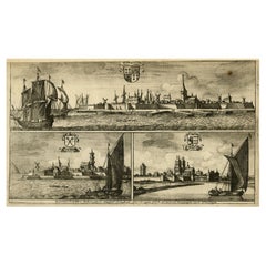
Antique Print of Harlingen, Stavoren and Sneek in Friesland, 1680
Located in Langweer, NL
Antique print titled 'Harlingen, Staveren, Sneck'. Views of the cities of Harlingen, Stavoren and Sneek, Friesland, the Netherlands. This print originates from 'Thooneel der Steden e...
Category

17th Century Antique Benelux - Collectibles and Curiosities

Materials

Paper

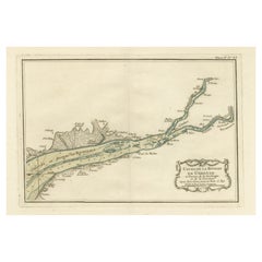
Antique Map of the Gironde, part of the Dordogne and the Garonne, France
Located in Langweer, NL
Antique map titled 'Cours de la riviere de Gironde et parties de la Dordogne et de la Garonne depuis Bourdeaux jusqu'au banc de Bey'. Original old map of the Gironde, part of the Dor...
Category

Mid-18th Century Antique Benelux - Collectibles and Curiosities

Materials

Paper

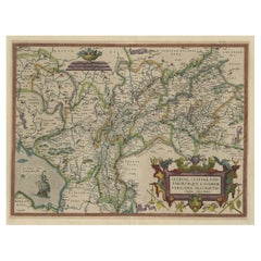
Superb Antique Map of the Province of Gelderland, the Netherlands, ca.1575
Located in Langweer, NL
Antique map titled 'Gelriae, Cliviae, Finitimorumque Locorum Verissima Descriptio Christiano Schrot. Auctore'. This superb map is Ortelius' first plate covering Gelderland. It is b...
Category

16th Century Antique Benelux - Collectibles and Curiosities

Materials

Paper

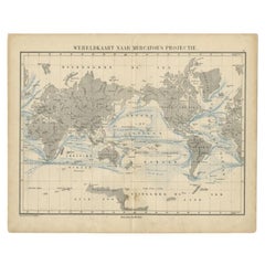
Antique Mercator Projection World Map by Petri, c.1873
Located in Langweer, NL
Antique world map titled 'Wereldkaart naar Mercator's Projectie'. Old map of the world. This map originates from 'School-Atlas van alle Deelen der Aarde'. Artists and engravers: ...
Category

19th Century Antique Benelux - Collectibles and Curiosities

Materials

Paper

Antique Map of Batavia, Semarang and Surabaya by Wolters 'circa 1910'
Located in Langweer, NL
Antique map titled 'Plattegronden van Steden op Java'. Old map with plans of Batavia (Jakarta), Semarang and Surabaya (Soerabaja)'. Published by J.B. Wolters.
Category

20th Century Benelux - Collectibles and Curiosities

Materials

Paper

Antique City View and Map of IJlst, City in Friesland, Holland, Framed, 1664
Located in Langweer, NL
Antique map titled 'Ylst'. Old map and city view of the city of IJlst, Friesland. This map originates from 'Beschrijvinge van de Heerlyckheydt van Frieslandt' by B. Schotanus à Sterr...
Category

17th Century Antique Benelux - Collectibles and Curiosities

Materials

Paper

Antique Map of the Holy Land, showing the travels of Abraham, Isaac and Jacob
Located in Langweer, NL
Antique map titled 'Tabula Itineraria Patriarcharum Abrahami, Isaaci et Iacobi'. Decorative regional map of the Holy Land, showing the travels of Abraham, Isaac and Jacob. Published ...
Category

Mid-17th Century Antique Benelux - Collectibles and Curiosities

Materials

Paper

Antique Map of Manilla Bay Philippines by P. van der Aa, 1719
Located in Langweer, NL
Rare antique map titled 'La Baie de Manille (..)'. Map of Manilla Bay, the map is oriented with southwest at the top and includes a small town plan for Manilla and other places. This...
Category

Early 18th Century Antique Benelux - Collectibles and Curiosities

Materials

Paper

Antique Map and Views of Batavia by Homann Heirs, '1733'
Located in Langweer, NL
Antique map titled 'Der Hollaendisch-Ostindianischen Compagnie weltberuhmte Haupt-Handels und Niederlags-Stadt Batavia, in Asien auf dem grossen Eyland Iava in dem konigreich Iacatra...
Category

Mid-18th Century Antique Benelux - Collectibles and Curiosities

Materials

Paper

Antique Engraving of Chinese Costumes, c.1860
Located in Langweer, NL
Antique print titled 'Costume Chinese'. Print of Chinese costumes. Source unknown, to be determined. Artists and Engravers: Anonymous. Condition:...
Category

19th Century Antique Benelux - Collectibles and Curiosities

Materials

Paper

Antique Map of the World Showing the Distribution of Plants and Minerals, 1872
Located in Langweer, NL
Antique map titled 'Johnson's World showing the distribution of the Characteristic Forest Trees (..)'. Original world map showing the distribution o...
Category

Late 19th Century Antique Benelux - Collectibles and Curiosities

Materials

Paper

Ancient Course of the Ganges: A First Ptolemaic Map of India by Mercator, c.1584
Located in Langweer, NL
This remarkable map, titled "Asiae X Tab:", is a significant historical artifact that represents the convergence of knowledge and craftsmanship from two of the most esteemed figures in the history of geography and cartography. Created by Gerard Mercator and based on the geographical insights of Claudius Ptolemy, this map is part of the rare first issue published in Brussels in 1578. The map itself meticulously delineates the region between the Indus and Ganges rivers, an area of immense historical and geographical importance. It is an excellent representation of Ptolemy's second-century geographical data, which was fundamental in shaping the modern principles of mapmaking. Mercator, renowned for his precision and dedication to adhering closely to Ptolemy's original intentions, showcases this commitment through the detailed depiction of this significant Asian landscape. This edition stands out not only for its historical accuracy but also for its artistic execution. Gerard Mercator, who was also an innovator in the use of the italic hand for map lettering, first introduced this style in his "Literarum latinarum" in 1540. The use of italics in this map enhances its legibility and aesthetic appeal, which became a hallmark of the finest sixteenth and seventeenth-century Dutch maps, largely attributed to Mercator’s influence. The map measures 13 ½ x 18 inches and features fine hand coloring, which has been preserved in almost excellent condition alttough there some browning due to age. As a splendid example of the first issue from Mercator’s definitive edition of Ptolemy’s "Geographia", it not only serves as a testament to the rich history of geographical exploration but also stands as a beacon of the enduring legacy of its makers, shaping the future of cartographic design and precision. The map "Asiae X Tab:", focusing on the region between the Indus and Ganges rivers, highlights several areas and cities of historical and geographical importance that are likely of interest to scholars, historians, and collectors. Here are key locations depicted on the map: 1. **Indus River**: As one of the major rivers of Asia and a cradle of ancient civilizations like the Indus Valley Civilization, the Indus River holds significant historical importance. 2. **Ganges River**: Another crucial river not just for its cultural and religious significance in India, but also as a vital geographic feature in ancient and medieval maps...
Category

16th Century Antique Benelux - Collectibles and Curiosities

Materials

Paper

Antique Print with Views of Sir Charles Saunders Island and Other Islands, 1774
Located in Langweer, NL
Explore the captivating world of the 18th century with this exquisite antique print titled 'Isles de Sir Charles Saunder Latitude (...)'. I A journey through time as you delve into t...
Category

Late 18th Century Antique Benelux - Collectibles and Curiosities

Materials

Paper

Original Antique Map of the East Indies (Indonesia) by Janssonius, c.1644
By Johannes Janssonius
Located in Langweer, NL
Antique map titled 'India quae Orientalis dicitur, et Insulae adiacentes'. Old map of the East Indies and Southeast Asia showing the area between India in the West and parts of Japan...
Category

17th Century Antique Benelux - Collectibles and Curiosities

Materials

Paper

Large Set of Old Dutch Books about the Rise of the Dutch Republic, 1782
Located in Langweer, NL
Title: Vaderlandsche historie, vervattende de geschiedenissen der nu Vereenigde Nederlanden, inzonderheid die van Holland, van de vroegste tyden af [...]. 21 vol., 8vo (1 sm. tear in map in vol. II; normal minor browning or spotting). - Reissue of the 2nd Tirion ed. (1770, 1st 1749-1759) of the account of the rise of the Dutch Republic with historical notes and references by the Dutch historian J. Wagenaar (1709-1773), until the year 1751. Engr. ill. by J. Folkema, P. Tanjé, J.C. Philips, J. Houbraken, S. Fokke, etc.: front. by J. Punt, 5 large folding maps (e.g. "Naaukeurige kaart van het Oude Nederland en eenige aangrenzende gewesten", "Oude kaart der nu Vereenigde Nederlanden", "Nieuwe kaart van het oostelijkste deel der weereld diendende tot aanwijzing van de scheepstogten der Nederlanderen naar Oostindië"), 1 city-plan of Leiden, 105 full-page portraits (e.g. of Erasmus, Philips of Marnix of St Aldegonde, Prince Maurice, Albert & Isabella, Kenau, Hugo De Groot, Piet Hein, Michiel de Ruyter...
Category

Late 18th Century European Antique Benelux - Collectibles and Curiosities

Materials

Paper

Antique Print of Forts and Views of the East Indies by Chatelain (1719)
Located in Langweer, NL
Antique print titled 'Vue et Description de Quelques-Uns des Principaux Forts des Hollandois dans les Indes'. Interesting sheet with seven detailed views illustrating the most import...
Category

18th Century French Antique Benelux - Collectibles and Curiosities

Materials

Paper

Antique Hand-Colored Map of Northern Portugal, 1756
Located in Langweer, NL
Antique map Portugal titled 'Parte Sepentrional del Reyno de Portugal'. Antique map of Northern Portugal. This map originates from 'Atlas Port...
Category

1750s Antique Benelux - Collectibles and Curiosities

Materials

Paper

A 19th-Century Map of West Canada with Niagara Falls and Indigenous Scenes
Located in Langweer, NL
Decorative 19th-Century Map of West Canada with Niagara Falls and Indigenous Scenes This detailed 19th-century map of West Canada, drawn and engraved by J. Rapkin and published by...
Category

1850s Antique Benelux - Collectibles and Curiosities

Materials

Paper

Antique Map of the Basin of the Mediterranean by Johnston '1909'
Located in Langweer, NL
Antique map titled 'Basin of the Mediterranean'. Original antique map of the basin of the Mediterranean. With inset maps of the Strait of Gibraltar, Morocco, Maltese Islands, Valetta...
Category

Early 20th Century Benelux - Collectibles and Curiosities

Materials

Paper

Antique Map of South America by Migeon '1880'
By J. Migeon
Located in Langweer, NL
Antique map titled 'Amérique Méridionale'. Old map of South America. With an inset map of the Galapagos Islands and decorative vignettes. This map...
Category

Late 19th Century French Antique Benelux - Collectibles and Curiosities

Materials

Paper

Original Antique Map of England with Decorative Cartouche
Located in Langweer, NL
Antique map titled 'l'Angleterre (..)'. Original antique map of England, with beautiful hand coloring and decorative cartouche. This map originates from 'Nouvel Atlas Portatif destin...
Category

Late 18th Century Antique Benelux - Collectibles and Curiosities

Materials

Paper

View of the Church of Cortona, a Town and Comune Arezzo, in Tuscany, Italy, 1800
Located in Langweer, NL
Antique print titled 'Veduta della Chiesa ed Episcopio di Cortona'. View of the church of Cortona, a town and comune in the province of Arezzo, in Tuscany, Italy. Source unknown,...
Category

Early 1800s Antique Benelux - Collectibles and Curiosities

Materials

Paper

Print of Leopold I, Holy Roman Emperor, King of Hungary, Croatia & Bohemia, 1695
Located in Langweer, NL
Antique print, titled: 'Leopoldus Romanorum Imperator Semper Augustus.' This original antique plate shows a portrait of Leopold I (9 June 1640 – 5 May 1705), he was Holy Roman Emperor...
Category

1690s Antique Benelux - Collectibles and Curiosities

Materials

Paper

Antique Print of a Maritime Building in Copenhagen in Denmark, 1746
Located in Langweer, NL
Antique print titled 'Opstalt af Søeetatens General-Commissariat - Facade du Commissariat General de la Marine (..)'. Old print of a building in Copenhagen, Denmark. This print origi...
Category

18th Century Antique Benelux - Collectibles and Curiosities

Materials

Paper

Antique Map of Holstein, Germany
Located in Langweer, NL
Antique map titled 'Holsatia Ducatus'. Original old map of Holstein, Germany. By Petrus Kaerius, published circa 1650. Pieter van den Keere (Latin: Petrus Kaerius 1571 – circa 1646) ...
Category

Mid-17th Century Antique Benelux - Collectibles and Curiosities

Materials

Paper

Antique Map of Holstein, Germany
$362 Sale Price
20% Off
Antique Print of a Design for The Great Temple in Eastbury Park, England, 1725
Located in Langweer, NL
Antique print titled 'Plan and Elevation of the great Temple in the garden at Eastbury'. Design for Eastbury Park, England. This print originates from 'Vitruvius Britannicus' by ...
Category

18th Century Antique Benelux - Collectibles and Curiosities

Materials

Paper

Map of The Italian Peninsula with the islands of Sicily, Sardinia, Corsica, 1880
Located in Langweer, NL
This map, titled "ITALIA, Sicilia, Sardinia, Corsica," represents the Italian Peninsula along with the islands of Sicily, Sardinia, and Corsica. Inset maps offer detailed views of "R...
Category

1880s Antique Benelux - Collectibles and Curiosities

Materials

Paper

Portrait of Fernando Alvarez de Toledo y Pimentel, Grand duke of Alba, c.1690
Located in Langweer, NL
Antique print, titled: 'Ferdinand de Tolede. Duc d'Albe.' Portrait of Fernando Alvarez de Toledo y Pimentel, Grand duke of Alba (1507-1582). Source un...
Category

1690s Antique Benelux - Collectibles and Curiosities

Materials

Paper

Authentic Map of the Coast from Cape Formosa to the Dony River, Africa, 1732
Located in Langweer, NL
Antique map titled 'The New Correct Mapp of Calbar River vulgarly call'd Calabar (..)'. An interesting map of the coast from Cape Formosa to the Dony River stated on the map to be ...
Category

1730s Antique Benelux - Collectibles and Curiosities

Materials

Paper

Antique Map of Drôme ‘France’ by V. Levasseur, 1854
Located in Langweer, NL
Antique map titled 'Dépt. de la Drôme'. Map of the French department of Drome, France. This area is known for its production of Picodon, a spicy goats-milk ch...
Category

Mid-19th Century Antique Benelux - Collectibles and Curiosities

Materials

Paper

Antique Map of the Southern Part of the Orange River Colony by Stanford, 1901
Located in Langweer, NL
Antique map titled 'Orange River Colony, southernpart'. Lithograph of the southern part of the Orange River Colony, Africa. The Orange River Colony was the British colony created aft...
Category

Early 20th Century Benelux - Collectibles and Curiosities

Materials

Paper

Huge Oak Wall Sculpture of Virgin Mary & Child Jesus Sitting on a Crescent Moon
Located in Lisse, NL
Unique wall plaque depicting Madonna and Child. If you are looking for unique works of religious art from earlier times then this large church wall plaque...
Category

Early 20th Century European Arts and Crafts Benelux - Collectibles and Curiosities

Materials

Wood, Oak

Badajoz 1901: A Cartographic Record of Extremadura's Largest Province in Spain
Located in Langweer, NL
This original antique map for sale is of the province of Badajoz, part of the autonomous community of Extremadura in Spain, dated 1901. It illustrates several important features: Th...
Category

Early 1900s Antique Benelux - Collectibles and Curiosities

Materials

Paper

Maison Rue de la Faisanderie – French Architectural Print from La Brique, c.1900
Located in Langweer, NL
Maison Rue de la Faisanderie – French Architectural Print from La Brique, c.1900 This antique architectural print showcases an elegant townhouse designed for the Rue de la Faisander...
Category

20th Century French Benelux - Collectibles and Curiosities

Materials

Paper

Antique Map of the African Continent with Inset of the Nile River Delta, c.1870
Located in Langweer, NL
Antique map titled 'Africa'. Old map of the African continent. This map originates from 'H. Kiepert's Kleiner Atlas der Neueren Geographie für Schule...
Category

19th Century Antique Benelux - Collectibles and Curiosities

Materials

Paper

Antique Map of the Netherlands in 1808 by Mees, 1857
Located in Langweer, NL
Antique map titled 'Noord-Nederland in 1808. Het Koningrijk Holland na het tractaat van Fontainebleau van 11 november 1807'. Map of the Netherlands in 1808. This map originates from ...
Category

19th Century Antique Benelux - Collectibles and Curiosities

Materials

Paper

Antique Map Showing Estates of 1669 in Amsterdam, Published in c.1767
Located in Langweer, NL
Antique map titled 'Kaart der landeryen, gelegen aan of onder de honderd gaarden, zo in de Buitenvelder- als Stads-polder; van welken de gestreepten, voor 't geregt van Nieuwer-Amste...
Category

18th Century Antique Benelux - Collectibles and Curiosities

Materials

Paper

Antique Map of Asia Minor, Present-day Turkey and Cyprus, 1803
Located in Langweer, NL
Antique map titled 'Asiae Minoris Tabula Geographica'. Uncommon antique map of Asia minor, comprising most of what is present-day Turkey. Source unknown, to be determined. Artists...
Category

19th Century Antique Benelux - Collectibles and Curiosities

Materials

Paper

Antique Print of the City of Jiangxi, formerly romanized as Kiangsi, China, 1668
By Johannes Nieuhof
Located in Langweer, NL
Antique print China titled 'Kiangsi'. Old print depicting a view on the Chinese city of Kiangsi with its ramparts. Behind the city wall a pagoda can be seen. This print originates fr...
Category

17th Century Antique Benelux - Collectibles and Curiosities

Materials

Paper

Brazil Coastline Map – Broenner Carte du Bresil, 1772 Captaincies
Located in Langweer, NL
Carte du Bresil Map, Broenner Krefeld 1772 – Brazil Coastline Captaincies This is an engraved map titled Carte du Bresil Prem. Partie, published in Krefeld (Germany) by J.J. Broenne...
Category

Late 18th Century French Antique Benelux - Collectibles and Curiosities

Materials

Paper

Central America Map – Johnson, Hand-Colored with Insets, c.1864
Located in Langweer, NL
Johnson’s Central America Map, USA c.1864 – Hand-Colored with Insets This is a finely engraved and hand-colored map titled Johnson’s Central America, published by Johnson and Ward i...
Category

Mid-19th Century American Antique Benelux - Collectibles and Curiosities

Materials

Paper

Washington Oregon Idaho Map – Johnson, Hand-Colored, c.1864
Located in Langweer, NL
Johnson’s Washington Oregon Idaho Map, USA c.1864 – Hand-Colored This is a finely engraved and hand-colored map titled Johnson’s Washington, Oregon, and Idaho, published by Johnson ...
Category

Mid-19th Century American Antique Benelux - Collectibles and Curiosities

Materials

Paper

Extremely Rare Map of The land of Eso or Hokkaido in Japan, 1725
Located in Langweer, NL
Plate 46: 'Le Pais d' Eso.' (The land of Eso / Hokkaido in Japan.) Extremely rare in this edition. This plate originates from the very scarse: 'La Galerie Agreable du Monde (..). T...
Category

18th Century Antique Benelux - Collectibles and Curiosities

Materials

Paper

Antique Map of Asia by Johnston '1909'
Located in Langweer, NL
Antique map titled 'Asia'. Depicting China, Japan, Indonesia, India, Arabia and more. This map originates from the ‘Royal Atlas of Modern Geography’. Published by W. & A.K. Johnston,...
Category

Early 20th Century Benelux - Collectibles and Curiosities

Materials

Paper

17th-Century Original Antique Map of Hunan and Hubei Provinces, China – by Blaeu
Located in Langweer, NL
Title: 17th-Century Antique Map of Hunan and Hubei Provinces, China – "Hvqvang" by Blaeu, Richly Detailed and Illustrated Description: This beautiful 17th-century map of the regions that now comprise Hunan and Hubei Provinces, historically referred to as "Hvqvang," was created by Johannes Blaeu and published in 1655 as part of the *Novus Atlas Sinensis*. This map, drawn with input from Jesuit missionary Martino Martini, provides a meticulous representation of central China’s geography, capturing its rivers, towns, and mountainous terrain. The Yangtze River (Changjiang) is prominently featured, emphasizing the region’s importance as a vital waterway for trade and transportation. Wuhan, now a modern metropolis, and Changsha, the capital of Hunan Province, were historically significant cities that appear on the map. The area is also notable for its fertile lands and contributions to China’s agricultural prosperity, particularly in rice and tea production. The decorative cartouche in the lower-right corner features two figures in traditional Chinese attire standing amid bamboo, symbolizing the cultural and natural richness of the region. Blaeu’s map combines precision and artistry, with vibrant hand-coloring distinguishing boundaries and geographical features. The copperplate engraving ensures fine detail, making this map a remarkable historical artifact. Condition: Near excellent. Clean impression with vivid hand-coloring. Wide margins with minor age-toning appropriate for its age. Framing Tips: Use a neutral double mat and a gilt or dark wood frame to enhance the presentation. UV-protective glass is recommended to preserve the vivid hand-coloring and intricate engraving details. Hunan and Hubei, historically referred to as "Hvqvang," are known for their strategic location along the Yangtze River and their cultural and economic significance in Chinese history. The region’s fertile lands have supported extensive rice cultivation, earning it the title of one of China’s "breadbaskets." Hubei, with Wuhan at its center, has long been a hub of transportation and trade, owing to the convergence of the Yangtze and Han Rivers. Hunan, with Changsha as its capital, is known for its rich cultural heritage and contributions to Chinese literature and art. Important places in the region include Wuhan, an ancient trade center, and Changsha, known for its historical sites and cultural prominence. The Yangtze River, a key feature on the map, highlights the region’s historical importance as a major waterway for commerce and agriculture. Other notable features include Dongting Lake, a vital ecological and cultural landmark, and the surrounding mountainous areas that have shaped the region’s history and development. Keywords: antique map of Hunan, Hubei map, Hvqvang map, Yangtze River map, 17th-century Chinese map...
Category

1650s Antique Benelux - Collectibles and Curiosities

Materials

Paper

Antique Map of Italy and Greece by H. Kiepert, circa 1870
By Heinrich Kiepert
Located in Langweer, NL
Antique map titled 'Italiae pars media'. This map originates from 'Atlas Antiquus. Zwölf Karten zur Alten Geschichte' by H. Kiepert. Published in Berlin, circa 187.
Category

Late 19th Century Antique Benelux - Collectibles and Curiosities

Materials

Paper

Antique Map with Details of Berings' Expedition into Russians' Far East, 1737
Located in Langweer, NL
Antique map titled 'Carte Des Pays traverses par le Capne. Beerings depuis la Ville de Tobolsk jusqua'a Kamtschatka'. This is the first printed map to illustrate Vitus Bering's fir...
Category

1730s Antique Benelux - Collectibles and Curiosities

Materials

Paper

Original Antique Map Covering the Russian Empire in Asia, 1880
Located in Langweer, NL
Antique map titled 'Sibérie ou Russie d'Asie'. Migeon's map covers the Russian empire in Asia from european Russia and the Ural Mountains to the Bering Strait and from the Arctic...
Category

1880s Antique Benelux - Collectibles and Curiosities

Materials

Paper

Old Map of Cook's Discovery and Charting of the East Coast of Australia, 1803
Located in Langweer, NL
Antique map titled 'Kaart van Nieuw Zuid Wales of de Oostlyke Kust van Nieuw Holland ontdekt en onderzogt door den Luitenant J. Cook met het Schip de Endeavour in het Jaar 1770'. ...
Category

Early 1800s Antique Benelux - Collectibles and Curiosities

Materials

Paper

Antique Plan of Turkey in Europe with Inset Map of the Bosporus, ca.1850
Located in Langweer, NL
Antique map titled 'Turkey in Europe'. A map of European Turkey and the surrounding countries. With an inset map of the Bosporus. This includes Macedonia, Bulgaria, Croatia, Bosn...
Category

1850s Antique Benelux - Collectibles and Curiosities

Materials

Paper

Antique Map of the Palembang Area, c.1900
Located in Langweer, NL
Antique map titled 'Palembang.' This map shows the Palembang area on the Indonesian island of Sumatra. With legend. Source unknown, to be determined. Published circa 1900. Artists...
Category

19th Century Antique Benelux - Collectibles and Curiosities

Materials

Paper

Antique Terracotta Religious Wall Plaque / Sculpture of Christ in Deep Relief
Located in Lisse, NL
Impressive and all handcrafted, early 1900s sculpture of Christ suffering. Just like in the days when Christ lived on our planet, the truth (about who we are and how to best live o...
Category

Early 20th Century European Renaissance Revival Benelux - Collectibles and Curiosities

Materials

Terracotta

Antique Map of the Dutch Gold Coast in Africa by Van den Bosch '1818'
Located in Langweer, NL
Antique map titled 'Kaart van de Goud-Kust of Kust van Guina'. A rare and attractive early 19th century Dutch map of the Dutch Gold Coast. The Dutch Gold Co...
Category

Early 19th Century Antique Benelux - Collectibles and Curiosities

Materials

Paper

Antique Map of South America with Many Details, ca.1859
Located in Langweer, NL
Original antique map titled 'Süd-America'. Beautiful old map of South America, with many details and legend. This map originates from Stielers Handatlas, published circa 1859. St...
Category

Mid-19th Century Antique Benelux - Collectibles and Curiosities

Materials

Paper

Hindostan or British India Map – Johnson, Hand-Colored USA c.1864
Located in Langweer, NL
Johnson’s Hindostan or British India Map, USA c.1864 – Hand-Colored This is a finely engraved and hand-colored map titled Johnson’s Hindostan or British India, published by Johnson ...
Category

Mid-19th Century American Antique Benelux - Collectibles and Curiosities

Materials

Paper

Johnson’s China Map with Canton Inset, USA Published c.1864 – Hand-Colored
Located in Langweer, NL
Johnson’s China Map with Canton Inset, USA Published c.1864 – Hand-Colored This is a finely engraved and hand-colored map titled Johnson’s China, publis...
Category

Mid-19th Century American Antique Benelux - Collectibles and Curiosities

Materials

Paper

Antique Map of the East Coast of Sumatra , Indonesia, 1900
Located in Langweer, NL
Antique map of the East Coast of Sumatra. Also depicting the Strait of Malacca. This map originates from 'Atlas van Nederlandsch Oost- en West-Indië' by I. Dornseiffen. Artists and...
Category

20th Century Benelux - Collectibles and Curiosities

Materials

Paper

Antique Print of a Garden House from Garden Architecture by Van Laar, 1802
Located in Langweer, NL
Untitled print of garden architecture. It shows a garden building. This print originates from 'Magazijn van tuin-sieraden'. The book is compiled by Gijsbert van Laar, providing a sur...
Category

19th Century Antique Benelux - Collectibles and Curiosities

Materials

Paper

Read More

Medal-Worthy Memorabilia from Epic Past Olympic Games

Get into the games! These items celebrate the events, athletes, host countries and sporting spirit.

Ahoy! You’ve Never Seen a Collection of Sailor Art and Kitsch Quite Like This

French trendsetter and serial collector Daniel Rozensztroch tells us about his obsession with objects related to seafaring men.

Pamela Shamshiri Shares the Secrets behind Her First-Ever Book and Its Effortlessly Cool Interiors

The sought-after designer worked with the team at Hoffman Creative to produce a monograph that beautifully showcases some of Studio Shamshiri's most inspiring projects.

Moroccan Artworks and Objects Take Center Stage in an Extraordinary Villa in Tangier

Italian writer and collector Umberto Pasti opens the doors to his remarkable cave of wonders in North Africa.

Montecito Has Drawn Royalty and Celebrities, and These Homes Are Proof of Its Allure

Hollywood A-listers, ex-pat aristocrats and art collectors and style setters of all stripes appreciate the allure of the coastal California hamlet — much on our minds after recent winter floods.

Whaam! Blam! Pow! — a New Book on Pop Art Packs a Punch

Publishing house Assouline and writer Julie Belcove have teamed up to trace the history of the genre, from Roy Lichtenstein, Andy Warhol and Yayoi Kusama to Mickalene Thomas and Jeff Koons.

What Makes a Gem-Encrusted Chess Set Worth $4 Million?

The world’s most opulent chess set, weighing in at 513 carats, is literally fit for a king and queen.

Tauba Auerbach’s Geometric Pop-Up Book Is Mighty Rare, Thanks to a Hurricane

This sculptural art book has an epic backstory of its own.
Recently Viewed

View All