Netherlands Maps
to
4,162
5,132
5,526
200
5,131
1
2,833
1,991
307
1
179
6
67
3
3
3
2
5,126
9
7
2
1
485
185
107
88
59
5,132
5,132
5,132
104
58
20
14
13
Item Ships From: Netherlands
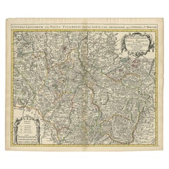
Antique Map of the Diocese of Toul by Covens & Mortier, circa 1720
By Covens & Mortier
Located in Langweer, NL
Antique map titled 'Civitas Leucorum sive Pagus Tullensis'. Detailed map of the Diocese of Toul, France. Centered on the cities of Nancy and Toul and including Metz, Verdun, S. Dizie...
Category
Early 18th Century Antique Netherlands Maps
Materials
Paper
$685 Sale Price
20% Off
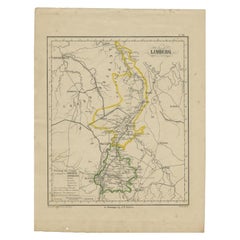
Antique Map of Limburg, The Southern Most Province in The Netherlands, c.1870
Located in Langweer, NL
Antique map titled 'Limburg'. Map of the province of Limburg, the Netherlands. This map originates from 'F. C. Brugsma's Atlas van het Koninkrijk der Nederlanden (..)'. Artists and E...
Category
19th Century Antique Netherlands Maps
Materials
Paper
$122 Sale Price
20% Off
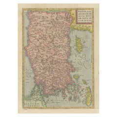
Asia Minor – Antique Map of Natolia by Ortelius, Theatrum Orbis Terrarum c.1600
Located in Langweer, NL
Asia Minor – Antique Map of Natolia by Ortelius, Theatrum Orbis Terrarum c.1600
This beautifully hand-colored antique map titled Natoliae quae olim Asia Minor nova descriptio presen...
Category
Early 17th Century European Antique Netherlands Maps
Materials
Paper
$416 Sale Price
20% Off
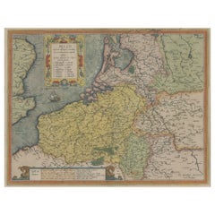
Original Antique Map the Imperial States of the Habsburg Netherlands, 1609
Located in Langweer, NL
Antique map titled 'Belgii inferioris descriptio (..)'.
Old map of the Seventeen Provinces, the Imperial states of the Habsburg Netherlands in the 16th century. They roughly cove...
Category
Early 1600s Antique Netherlands Maps
Materials
Paper
$1,182 Sale Price
20% Off
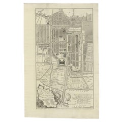
Antique Plan of Batavia, Nowadays Jakarta, Indonesia, 1780
Located in Langweer, NL
Antique map titled 'Plan der Stad en 't Kasteel Batavia'. A very rare late 18th century detailed plan of Batavia with an alpha-numeric key showing the main areas and buildings (only ...
Category
18th Century Antique Netherlands Maps
Materials
Paper
$1,747 Sale Price
20% Off
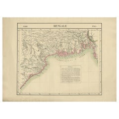
Detailed Orginal Antique Map of Bengal, India, c.1825
Located in Langweer, NL
Antique map titled 'No. 95 Bengale'. Detailed map of Bengal, Bangladesh. With text about the Ganges river. Originates from 'Atlas Universel' by P.M. Vand...
Category
19th Century Antique Netherlands Maps
Materials
Paper
$463 Sale Price
20% Off
Antique Map of South America by Kelly, 1835
Located in Langweer, NL
Antique map titled 'South America'. Old map of South America engraved by A. Findley. With decorative border. Artists and Engravers: Published by Thomas Kelly, London.
Artist: Publ...
Category
19th Century Antique Netherlands Maps
Materials
Paper
$68 Sale Price
20% Off
Antique Map of the City of Groningen by Merian, 1659
Located in Langweer, NL
Antique map titled 'Gröningen'. This print depicts the city of Groningen, the Netherlands. This print originates from 'Topographia Germaniae Inferioris (..)' by C. Merian.
Artist...
Category
17th Century Antique Netherlands Maps
Materials
Paper
$87 Sale Price
20% Off
Original Antique Print of a Procession of Monks in Ceylon 'Sri Lanka', 1672
Located in Langweer, NL
Antique print, untitled. This original antique print shows a procession of monks in Ceylon. A group of dancing monks, beating drums, in front of the abbot, seated on an elephant. Dut...
Category
1670s Antique Netherlands Maps
Materials
Paper
$255 Sale Price
20% Off
Antique Map of South East Asia, Australia and the Indian Ocean, 1726
By F. Valentijn
Located in Langweer, NL
Antique map titled 'Tabula Indiae Orientalis'.
Beautiful detailed map of Australia, Southeast Asia and the Indian Ocean. The map features a fine depiction of the outlines of the western two-thirds of Australia, based on the discoveries of explorers working for the Dutch East India Company (the VOC). These include Willem Jansz's discoveries in the Gulf of Carpentaria in 1606; the encounters of Dirk...
Category
Mid-18th Century Dutch Antique Netherlands Maps
Materials
Paper
$6,809 Sale Price
20% Off
Antique Map of the United States by Lowry, '1852'
Located in Langweer, NL
Antique map titled 'United States'. Four individual sheets of the United States. This map originates from 'Lowry's Table Atlas constructed and engraved from the most recent Authoriti...
Category
Mid-19th Century Antique Netherlands Maps
Materials
Paper
$283 Sale Price / set
20% Off
Antique Map of Buckinghamshire in England, 1743
Located in Langweer, NL
Antique map titled 'Buckingham both shyre and shire towne describ'. Map of Buckinghamshire, England. With town plans of Buckingham and Redding. This map originates from Overton's atl...
Category
18th Century Antique Netherlands Maps
Materials
Paper
$453 Sale Price
20% Off
Original Antique Engraving of Sakai in the Osaka Prefecture, Japan, 1669
Located in Langweer, NL
Antique print, titled: 'De Stadt Saccai. La Ville de Saccai.' - ('The City Saccai').
This plate shows a view of Sakai in the Osaka Prefecture, Japan. Sakai has been one of the la...
Category
1660s Antique Netherlands Maps
Materials
Paper
$614 Sale Price
20% Off
Pl. 465 Antique Print of Roof Structures by Bell, c.1810
Located in Langweer, NL
Antique print titled 'Plate CCCCLXIV Roofs'. Old print depicting various roof structures. This print originates from 'Encyclopedia Britannica'. Artists and Engravers: Engraved by A. ...
Category
19th Century Antique Netherlands Maps
Materials
Paper
$56 Sale Price
20% Off
Antique Plan of Underground Area of Baths of Emperor Titus, Rome, Italy, 1786
Located in Langweer, NL
Antique print titled 'Plan des Thermes de Titus Partie Superieure'.
Plan of the underground areas of the Baths of Titus. The Baths of Titus or Thermae Titi were public baths (Thermae) built in 81 AD at Rome, by Roman emperor Titus...
Category
18th Century Antique Netherlands Maps
Materials
Paper
$226 Sale Price
20% Off
Uncommon Old Map of Lapland to Russia and Denmark to Kazan in the South, 1785
Located in Langweer, NL
Description: Antique map titled 'Kaart van het Noorderdeel van Europa, Bevattende Deenmarken, Noorwegen, Zweden, Lapland en het Grootste Gedeelte van Europeesch Rusland.'
This un...
Category
1780s Antique Netherlands Maps
Materials
Paper
$520 Sale Price
20% Off
Small Original Antique Map of the Lower Alsace region, Germany
Located in Langweer, NL
Antique map titled 'Alsatia Inferior'. Small original antique map of the Lower Alsace region, Germany. This map originates from 'Atlas minor Gerardi Mercatoris a I. Hondio plurimis a...
Category
Early 17th Century Antique Netherlands Maps
Materials
Paper
$321 Sale Price
20% Off
Villa à Fontainebleau – French Architectural Print from La Brique, c.1900
Located in Langweer, NL
Villa à Fontainebleau – French Architectural Print from La Brique, c.1900
Beautiful antique architectural print depicting a villa designed in Fontainebleau by architect Mr. Brunnari...
Category
20th Century French Netherlands Maps
Materials
Paper
Antique Map of Borneo (Largely Kalimantan), the Largest Island of Asia, 1726
Located in Langweer, NL
Antique map Indonesia titled 'Kaart van het Eyland Borneo'. Early map of the Island of Borneo. This map originates from 'Oud en Nieuw Oost-Indië...
Category
18th Century Antique Netherlands Maps
Materials
Paper
$4,019 Sale Price
20% Off
Three Antique Maps on One Folio: Turkey, Northern Egypt, and Ancient Carthage
Located in Langweer, NL
The map consists of three distinct sections on a single folio sheet:
1. **Map of Turkey**:
- Orientation: The map is oriented with the east at the top, which is a common practic...
Category
16th Century Antique Netherlands Maps
Materials
Paper
Copenhagen (Kiöbenhaven) Map with City View – Antique German Atlas Print, 1844
Located in Langweer, NL
Copenhagen (Kiöbenhaven) Map with City View – Antique German Atlas Print, 1844
This finely detailed antique map titled 'Copenhagen (Kiöbenhaven)' presents a historical view of Denma...
Category
Mid-19th Century German Antique Netherlands Maps
Materials
Paper
Old Map of Southern India and Ceylon 'Sri Lanka', 1882
Located in Langweer, NL
Antique map titled 'India (Southern Sheet)'.
Old map of Southern India and Ceylon (Sri Lanka). With an inset map of the South-Eastern Provinces of India. This map originates from...
Category
1880s Antique Netherlands Maps
Materials
Paper
$274 Sale Price
20% Off
Antique Print of Garden Buildings from Garden Architecture by Van Laar, 1802
Located in Langweer, NL
Untitled print of garden architecture. It shows garden buildings. This print originates from 'Magazijn van tuin-sieraden'. The book is compiled by Gijs...
Category
19th Century Antique Netherlands Maps
Materials
Paper
Antique Print of the 'Buitenhof' in The Hague, The Netherlands, c.1770
By Georg Balthasar Probst
Located in Langweer, NL
Antique print titled 'Prospectus de Buyten Hof - Gezicht van het Buyten Hof tot Gravenhaghe'. Beautiful view of the Buitenhof, a square in The Hague, the Netherlands. This is an opti...
Category
18th Century Antique Netherlands Maps
Materials
Paper
$274 Sale Price
20% Off
Antique European War Folding Map, ‘circa 1915’
Located in Langweer, NL
Antique folding map of the European War (1914-1915) titled 'The Eastern Campaign '. From Petrograd to Berlin, geographically colored. Published on linen b...
Category
Early 20th Century Netherlands Maps
Materials
Paper
$709 Sale Price
20% Off
Antique Print of Unterwalden, South of Lake Lucerne in Switzerland, 1654
Located in Langweer, NL
Antique print titled 'Underwaldia - Das Landt Underwalden'. View of the city of Unterwalden, the old name of a forest-canton of the Old Swiss Confederacy in central Switzerland, south of Lake Lucerne...
Category
17th Century Antique Netherlands Maps
Materials
Paper
$482 Sale Price
20% Off
Original Antique Engraving of the Quangguamiau Pagoda in China, 1665
Located in Langweer, NL
Antique print titled 'Pagoda Quangguamiau'. Old print depicting the 'Quangguamiau' pagoda, China. This print originates from 'Het gezantschap der Nee^rlandtsche Oost-Indische Compagn...
Category
17th Century Antique Netherlands Maps
Materials
Paper
Hand Colored Antique Map of the Department of Eure-et-loir, France
By Victor Levasseur
Located in Langweer, NL
Antique map titled 'Dépt. d'Eure et Loir'. Map of the French department of Eure-et-Loir, France. This area is home to the famous Chartres Cathedral....
Category
Mid-19th Century Antique Netherlands Maps
Materials
Paper
$321 Sale Price
20% Off
Antique Map of Vienne 'France' by V. Levasseur, 1854
By Victor Levasseur
Located in Langweer, NL
Antique map titled 'Dépt. de la Vienne'. Decorative antique map of the French Department of Vienne, with its capital of Poitiers and small engraved vignette of the battle of Poitiers...
Category
Mid-19th Century Antique Netherlands Maps
Materials
Paper
$170 Sale Price
20% Off
Old Original Antique German Map of North America, ca.1870
Located in Langweer, NL
Antique map titled 'Nord-America'.
Old map of North America. This map originates from 'H. Kiepert's Kleiner Atlas der Neueren Geographie für Schule und Haus'.
Artists and Engrave...
Category
1870s German Antique Netherlands Maps
Materials
Paper
$376 Sale Price
35% Off
Original Antique Map of Asia
Located in Langweer, NL
Antique map titled 'l'Asie'. Original antique map of Asia. Engraved by André after Bonne. Published circa 1780.
Category
Late 18th Century Antique Netherlands Maps
Materials
Paper
$274 Sale Price
20% Off
Antique Map of Canada by Johnston '1909'
Located in Langweer, NL
Antique map titled 'Dominion of Canada'. Original antique map of Canada. With inset maps of Niagara, Montreal, Quebec. This map originates from t...
Category
Early 20th Century Netherlands Maps
Materials
Paper
$236 Sale Price
20% Off
Antique Map of the region of Trier, Mainz and Cologne, Germany
Located in Langweer, NL
Antique map titled 'Synopsis Circuli Rhenani Inferioris sive Electorum Rheni (..)'. Original antique map of the region of Trier, Mainz and Cologne, Germany. Published by T.C. Lotter,...
Category
Late 18th Century Antique Netherlands Maps
Materials
Paper
$453 Sale Price
20% Off
Antique Map of the County of Bentheim by Hondius, c.1630
Located in Langweer, NL
Antique map titled 'Comitatus Bentheimensis nova descriptio'. Engraved map of the County of Bentheim, showing Linge, Enschede, Bad Bentheim, Coevorden, Ne...
Category
17th Century Antique Netherlands Maps
Materials
Paper
$387 Sale Price
20% Off
Antique Map of the Mouth of the Amu Darya River by Reclus, 1881
Located in Langweer, NL
Antique map titled 'Bouches de L'Amou - Daria'. Original antique map showing the river mouth of the Amu Darya river in Central Asia. This original old antiqu...
Category
19th Century Antique Netherlands Maps
Materials
Paper
$84 Sale Price
20% Off
Antique Map of Turkey in Europe with Bulgaria by Johnston '1909'
Located in Langweer, NL
Antique map titled 'Turkey in Europe with Bulgaria'. Original antique map of Turkey in Europe with Bulgaria. With inset maps of The Bosporus & Constantinople, and Crete (or Candia). ...
Category
Early 20th Century Netherlands Maps
Materials
Paper
$236 Sale Price
20% Off
Friesland, Groningen and Overijssel – Rare Woodcut Map by Münster, c. 1550
Located in Langweer, NL
Frisia, Groningen and Overijssel – Rare Woodcut Map by Münster, c. 1550, Germany
This highly decorative 16th-century woodcut map titled “Von dem Teutschen Land: Seelentfrie” was pub...
Category
16th Century Antique Netherlands Maps
Materials
Paper
Antique German Map of India and Sri Lanka or Ceylon, 1902
By Meyer
Located in Langweer, NL
Antique map titled 'Ostindien.' (Map of India with an inset map of East-Bengal.) This attractive original old antique print / plate / map originates from 1885-1907 editions of a famous German encyclopedia: 'Meyers grosses Konversations-Lexikon.', published in Leipzig and Vienna. Meyers Konversations-Lexikon was a major German encyclopedia that existed in various editions from 1839 until 1984, when it merged with the Brockhaus encyclopedia. Several of the plates were also used in Dutch Encyclopedia's like Winkler Prins...
Category
20th Century Netherlands Maps
Materials
Paper
$65 Sale Price
20% Off
Antique Map of Asia Showing Its Political Divisions, 1874
Located in Langweer, NL
Antique map titled 'Map of Asia showing its Gt. Political Divisions and also the various routes of Travel between London & India, China & Japan & c'. This map covers from the Arabian...
Category
19th Century Antique Netherlands Maps
Materials
Paper
$85 Sale Price
20% Off
Small Map of St. Anna Bay and Willemstad, Curaçao – Dutch Colonial View, c. 1880
Located in Langweer, NL
Map of St. Anna Bay and Willemstad, Curaçao – Dutch Colonial View, c. 1880
This attractive late 19th-century map titled “De St. Anna-baai en de hoofdstad van Curaçao” offers a detai...
Category
1880s Antique Netherlands Maps
Materials
Paper
Antique Map of the Region of Delhi in India, 1833
Located in Langweer, NL
Antique map titled 'India IX'. Old steel engraved map of the region of Delhi, with great detail.
Artists and Engravers: Engraved by J. & C. Walker. Published under the superinten...
Category
19th Century Antique Netherlands Maps
Materials
Paper
$378 Sale Price
20% Off
Untitled Print Lincoln Cathedral ii, Basire, 1791
Located in Langweer, NL
Antique print depicting the Lincoln Cathedral, or the Cathedral Church of the Blessed Virgin Mary of Lincoln. Artists and Engravers: Made by J. Basir...
Category
18th Century Antique Netherlands Maps
Materials
Paper
$141 Sale Price
20% Off
Colorful Detailed Antique Map of The British Islands and `The North Sea, 1882
Located in Langweer, NL
Discover 'The British Islands and The North Sea' Map with Insets of Orkney, Shetland, and Channel Islands! This captivating original antique map offers a detailed view of the British...
Category
1880s Antique Netherlands Maps
Materials
Paper
$179 Sale Price
20% Off
Antique Map of Bonthain Bay, Sulawesi, Celebes
Located in Langweer, NL
Antique map titled 'Vue de la Baye de Bonthain (..)'. Map of the island Sulawesi (Celebes), Indonesia that Philip Carteret rested his crew and made repairs to his ship the Swallow fo...
Category
Late 18th Century Antique Netherlands Maps
Materials
Paper
$208 Sale Price
20% Off
Antique Map of Asia with the Porcelain Tower at Nanjing, China, 1884
Located in Langweer, NL
Antique map titled 'Asie'. Map of the Asian continent, with an illustration of the porcelain tower at Nanjing, China. Migeon's Geographie Universelle, ...
Category
19th Century Antique Netherlands Maps
Materials
Paper
$208 Sale Price
20% Off
Antique Map of the Caspian Sea, Uzbekistan, Northern Persia Etc, C.1735
Located in Langweer, NL
Antique map titled 'Nova Maris Caspii et Regions Usbeck (..).' Detailed map of Central Asia centered on the Caspian Sea, showing Uzbekistan to the east of ...
Category
18th Century Antique Netherlands Maps
Materials
Paper
$1,560 Sale Price
20% Off
Hand Colored Antique Map of the department of Ardennes, France
By Victor Levasseur
Located in Langweer, NL
Antique map titled 'Dépt. des Ardennes'. Map of the French department of Ardennes, France. Part of France's important Champagne producing region. The whole is surrounded by elaborate...
Category
Mid-19th Century Antique Netherlands Maps
Materials
Paper
$321 Sale Price
20% Off
Antique Political Map of France, 1880
By J. Migeon
Located in Langweer, NL
Antique map titled 'France Féodale'. Old map of France with a decorative vignette of Castle de Pierrefonds. This map originates from 'Géographie Universelle Atlas-Migeon' by J. Migeo...
Category
19th Century Antique Netherlands Maps
Materials
Paper
$113 Sale Price
20% Off
Antique Map of The German Empire (West Sheet), 1882
Located in Langweer, NL
Transport yourself to the heart of history with an original Antique Map of The German Empire (west sheet) from 'The Comprehensive Atlas and Geography of the World,' meticulously craf...
Category
1880s German Antique Netherlands Maps
Materials
Paper
Antique Map of the Archdiocese of Cologne, Germany
Located in Langweer, NL
Antique map titled 'Archevesche et Eslectorat de Cologne avec ses Enclaves'. Original old map of the Archdiocese of Cologne with the course of the Rhine from Andernach to Wesel with ...
Category
Late 17th Century Antique Netherlands Maps
Materials
Paper
$406 Sale Price
20% Off
Original Antique Map of Russia in Europe, 1882
Located in Langweer, NL
Embark on an enthralling journey with an original Antique Map of European Russia from the esteemed 'Comprehensive Atlas and Geography of the World,' meticulously crafted in 1882. Thi...
Category
1880s Antique Netherlands Maps
Materials
Paper
$179 Sale Price
20% Off
Original Antique Map of The Austrian Empire, 1882
Located in Langweer, NL
Step into the past with an original Antique Map of The Austrian Empire from the esteemed 'Comprehensive Atlas and Geography of the World,' meticulously crafted in 1882. This intricat...
Category
1880s Antique Netherlands Maps
Materials
Paper
$198 Sale Price
20% Off
Original Antique Map of Spain and Portugal, 1882
Located in Langweer, NL
Embark on a historical voyage with an original Antique Map of Spain and Portugal from the esteemed 'Comprehensive Atlas and Geography of the World,' meticulously crafted in 1882. Thi...
Category
1880s Antique Netherlands Maps
Materials
Paper
$160 Sale Price
20% Off
Antique Print of Various Apples by Knoop, 1758
Located in Langweer, NL
Antique print depicting apple variaties including the Framboos-Appel, Herfst Bloem-Soete, Somer-Parmain, Peer-Soete, Soete Dolphyn, Roode Herfst-Striepeling, Witte Soete Silverling, ...
Category
18th Century Antique Netherlands Maps
Materials
Paper
$302 Sale Price
20% Off
Antique Map of the Region involved in the Conquest of Cyrus the Great
Located in Langweer, NL
Antique map titled 'Tabula Itineris Decies Mille (..)'. This historical map illustrates the region involved in the conquest of Cyrus the Great (558-528 BC), the founder of the Persia...
Category
Mid-17th Century Antique Netherlands Maps
Materials
Paper
$652 Sale Price
20% Off
Antique Map Showing the Division and Distribution of Reptiles by Johnston '1850'
Located in Langweer, NL
Antique map titled 'Geographical division and distribution of reptilia and ophidia. Original antique map showing the geographical division and distribution of reptiles and serpents. ...
Category
Mid-19th Century Antique Netherlands Maps
Materials
Paper
$189 Sale Price
20% Off
Large Antique Map of Ancient Spain and Portugal, Published in circa 1760
Located in Langweer, NL
Antique map titled 'Hispania Antiqua (..)'. Map of ancient Spain and Portugal. Engraved by G. Delahaye. Published circa 1760, by or after Sanson & Vaugondy.
Category
Mid-18th Century Antique Netherlands Maps
Materials
Paper
$416 Sale Price
20% Off
Original Antique Map of the Township of Beilen in the Netherlands, 1865
Located in Langweer, NL
Drenthe - Gemeente Beilen. Hijken, Beilen, Spier, Wijsthoorn. These scarse detailed maps of Dutch Towns originate from the 'Gemeente-atlas' of Jacob Kuyper. This atlas of all towns i...
Category
19th Century Antique Netherlands Maps
Materials
Paper
$179 Sale Price
20% Off
Antique Map of North America by Lapie '1842'
Located in Langweer, NL
Antique map titled 'Carte de l'Amérique septentrionale'. Map of North America, with an inset map of the Aleutian Islands. This map originates from 'Atlas universel de géographie anci...
Category
Mid-19th Century Antique Netherlands Maps
Materials
Paper
$567 Sale Price
20% Off
Antique Map of Part of Flanders 'Belgium' by F. de Wit 'circa 1680'
Located in Langweer, NL
Antique map titled 'Marchionatus Sacri Imperii et Dominii Mechelini Tabula'. Large folio size map of the region around Mechelen, Leuven, Brussels, Dendermonde and Antwerp. Published ...
Category
Late 17th Century Antique Netherlands Maps
Materials
Paper
$543 Sale Price
20% Off
Recently Viewed
View AllMore Ways To Browse
Flemish Cabinets 17th Century
Fox Figurine
Fox Hunt Plate
French Art Deco Rosewood Buffet
French Bulldog Gold
French Louis Xvi Enfilade
French Provincial Antique Dresser
French Provincial Furniture Antique Dresser
French Zinc Bar
Frog Figurine
Georgian Mahogany Longcase Clock
German Folding Trolley
Glass And Brass Fireplace Screen
Glass Nude Woman Sculpture
Glass Parrots
Glass Poodle
Gothic Corbel
Granite Pagoda
