Netherlands Maps
to
4,202
5,081
5,472
195
5,080
1
2,804
1,969
307
1
179
6
68
3
3
3
2
5,075
8
6
2
1
355
113
81
77
45
5,081
5,081
5,081
104
59
20
14
13
Item Ships From: Netherlands
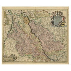
Rhine Splendor: Antique Map of the Lower Rhine Region, circa 1680
Located in Langweer, NL
The antique map titled 'Novissima et Accuratissima Archiepiscopatus et Electoratus Coloniensis Ducatuum Iuliancensis et Montensis et Meursiae Comitatus' is a handsome and detailed ma...
Category
1680s Antique Netherlands Maps
Materials
Paper
$913 Sale Price
20% Off
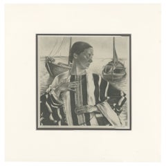
Vintage Print of the Lady of Stavoren by Voskuijl, 1946
Located in Langweer, NL
Vintage lithograph titled 'Vrouwtje van Stavoren'. Lithograph of the Lady of Stavoren, a folk tale from the Netherlands which originated in the 16th century. Published 1946.
Arti...
Category
20th Century Netherlands Maps
Materials
Paper
$275 Sale Price
20% Off
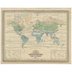
Antique Map of the World Showing the Distribution of Plants and Minerals, 1872
Located in Langweer, NL
Antique map titled 'Johnson's World showing the distribution of the Characteristic Forest Trees (..)'. Original world map showing the distribution o...
Category
Late 19th Century Antique Netherlands Maps
Materials
Paper
$190 Sale Price
20% Off
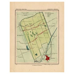
Antique Map of the Township of Nijeveen in The Netherlands, 1865
Located in Langweer, NL
Drenthe: Gemeente Nijeveen, Kolderveen. These scarse detailed maps of Dutch Towns originate from the 'Gemeente-atlas' of Jacob Kuyper. This atlas of all towns in the Netherlands was ...
Category
19th Century Antique Netherlands Maps
Materials
Paper
$180 Sale Price
20% Off
Old Map of Region Champagne-Ardenne with Reims, Troyes & Épernay in France, 1759
Located in Langweer, NL
Antique map titled 'Tabula Geographica Campaniae (..).'
Detailed map of the Champagne region in France by J. B. Homann, covering the region Champagne-Ardenne with Reims, Troyes a...
Category
1750s Antique Netherlands Maps
Materials
Paper
$699 Sale Price
30% Off
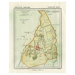
Antique Map of the Township of Peize, Drenthe in the Netherlands, 1865
Located in Langweer, NL
Drenthe: Gemeente Peize, Peizerwolde, de Horst. These scarse detailed maps of Dutch Towns originate from the 'Gemeente-atlas' of Jacob Kuyper. This atlas of all towns in the Netherla...
Category
19th Century Antique Netherlands Maps
Materials
Paper
$180 Sale Price
20% Off
Antique Map of the Township of Odoorn in the Netherlands, 1865
Located in Langweer, NL
Drenthe: Gemeente Odoorn, Exlo, Valthe. These scarse detailed maps of Dutch Towns originate from the 'Gemeente-atlas' of Jacob Kuyper. This atlas of all towns in the Netherlands was ...
Category
19th Century Antique Netherlands Maps
Materials
Paper
$180 Sale Price
20% Off
Antique Map of the Township of Havelte in The Netherlands, 1865
Located in Langweer, NL
Drenthe: Gemeente Havelte, Wapserveen, Uffelte. These scarse detailed maps of Dutch Towns originate from the 'Gemeente-atlas' of Jacob Kuyper. This atlas of all towns in the Netherla...
Category
19th Century Antique Netherlands Maps
Materials
Paper
$180 Sale Price
20% Off
Antique Frontispiece of an Old Dutch Book Depicting Globe Makers, 1717
Located in Langweer, NL
Antique frontispiece titled 'Iets voor Allen'. This print originates from 'Iets voor Allen, zijnde een Verhandeling en Verbeelding Van allerhande Standen, Studien, Konsten, Wetenscha...
Category
18th Century Antique Netherlands Maps
Materials
Paper
Old Hand-Colored Print of the Guards of the King of France, 1890
Located in Langweer, NL
Antique print titled 'Gardes-du-Crops du Roi'.
Old print of the Guards of the King of France. This print originates from 'Histoire de la maison militaire du roi de 1814 à 1830 : ...
Category
1890s Antique Netherlands Maps
Materials
Paper
$180 Sale Price
20% Off
Antique Map of Leeuwarden and Surroundings, in Friesland, the Netherlands, 1865
Located in Langweer, NL
Friesland: Gemeente Leeuwarden. These scarse detailed maps of Dutch Towns originate from the 'Gemeente-atlas' of Jacob Kuyper. This atlas of all towns in the Netherlands was publishe...
Category
19th Century Antique Netherlands Maps
Materials
Paper
$209 Sale Price
20% Off
Cemetery on Amsterdam Island, French Territory in the Indian Ocean, ca.1785
Located in Langweer, NL
Antique print titled 'Begraafplaats op het eiland Amsterdam'.
Engraved view of a local cemetery on Amsterdam Island, a small French territory in the southern Indian Ocean. Origin...
Category
1780s Antique Netherlands Maps
Materials
Paper
$275 Sale Price
20% Off
Antique Map of the Township of Westerbork, Drenthe in the Netherlands, 1865
Located in Langweer, NL
Drenthe: Gemeente Westerbork, Elp, Zwiggelte, Orvelte. These scarse detailed maps of Dutch Towns originate from the 'Gemeente-atlas' of Jacob Kuyper. This atlas of all towns in the N...
Category
19th Century Antique Netherlands Maps
Materials
Paper
$209 Sale Price
20% Off
Antique Map of the Township of Zweelo in the Netherlands, 1865
Located in Langweer, NL
Drenthe: Gemeente Zweelo, Weesup, Meppen, Benneveld. These scarse detailed maps of Dutch Towns originate from the 'Gemeente-atlas' of Jacob Kuyper. This atlas of all towns in the Net...
Category
19th Century Antique Netherlands Maps
Materials
Paper
$180 Sale Price
20% Off
Antique Map of the Lorraine Region 'France' (c.1735)
Located in Langweer, NL
Antique map titled 'Carte du Duche de Lorraine - Kaart van Lotharingen'. A detailed map of the Duchy of Lorraine. The map is surrounded by thirteen vignette bird-eye view of fortifie...
Category
Mid-18th Century Antique Netherlands Maps
Materials
Paper
$261 Sale Price
20% Off
Antique Plan of Batavia and the Castle in the Dutch East Indies, 1763
Located in Langweer, NL
Antique map titled 'Grundriss von der Stadt und dem Schlosse Batavia.' Plan of the city and the castle of Batavia in the Dutch East Indies / Indonesia. From 'Algemeine Welthistorie (...
Category
18th Century Antique Netherlands Maps
Materials
Paper
$371 Sale Price
20% Off
Engraving of Idols of Secotam Village in Virginia 'or now North Carolina', 1721
Located in Langweer, NL
Two religious images on one plate. Upper image 'Kiwasa idole des Virginiens'.
Kiwasa, this Idol is placed in the temple of the town of Secotam, as the keeper of the king's dead c...
Category
1720s Antique Netherlands Maps
Materials
Paper
$418 Sale Price
20% Off
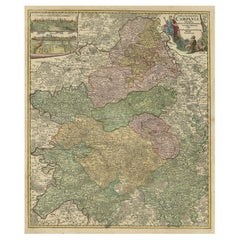
Antique Map of the Circle of Franconia, 1757
Located in Langweer, NL
Antique map titled 'Cercle de Franconie (..)'. Map of the Circle of Franconia, Germany. Centered on Bamberg, Wurtzburg and Nuremberg. This map originates from 'Atlas Universel (..)'....
Category
18th Century Antique Netherlands Maps
Materials
Paper
$646 Sale Price
20% Off
Old Map of the Moluccas and Part of Sulawesi Indonesia by Vandermaelen, c 1825
Located in Langweer, NL
Antique map titled 'Partie des Iles Moluques'. Map of a portion of the Moluccas and part of Sulawesi. Includes the Maluku islands Buru, Sula, Bacan and more. Originates from 'Atlas U...
Category
19th Century Antique Netherlands Maps
Materials
Paper
$599 Sale Price
20% Off
Antique Map of the Cape Verde Islands and Part of Senegal, West Africa, 1690
Located in Langweer, NL
Antique map titled 'Bocche del Fivme Negro et Isole di Capo Verde'. Beautiful double-page map of the Cape Verde Islands and part of the coast of Senegal, with large decorative cartou...
Category
17th Century Italian Antique Netherlands Maps
Materials
Paper
Original Copper-Engraving of Westergo, Part of Friesland, the Netherlands, 1744
Located in Langweer, NL
Antique map titled 'Westergo'.
Original antique map of Westergo, part of the province of Friesland, the Netherlands. Published 1744.
Artists and engravers: Isaak Tirion (1705 ...
Category
1740s Antique Netherlands Maps
Materials
Paper
$608 Sale Price
20% Off
Original Hand-Colored Antique Map of Gelderland and Utrecht in the Netherlands
Located in Langweer, NL
Antique map titled 'Ducatus Geldriae novissima descriptio'. Detailed map of Gelderland, a province in the Netherlands. Two coats of arms, one with scale. Ships on ‘De Zuyderzee’. Pub...
Category
Mid-17th Century Antique Netherlands Maps
Materials
Paper
$713 Sale Price
50% Off
Antique Print of Various Island in French Polynesia, circa 1774
Located in Langweer, NL
Two antique maps on one sheet titled 'Havre d'Ohamaneno a Ulietea' and Havre d'Oopoa a Ulietea'. Also with German subtitles. The upper image depicts Ohamaneno (Vaiaau) Harbour Raiatea (Ulietea) - Leeward Islands...
Category
18th Century Antique Netherlands Maps
Materials
Paper
$228 Sale Price
20% Off
Antique Map of Western Tartary and the Gobi Desert of the Russian Empire, c.1750
Located in Langweer, NL
Antique map titled 'A Map of Western Tartary Drawn from the Survey of the Jesuits and Mr. Kyrillow's Map of the Russian Empire'. Map of the Gobi Desert and the eastern portion of the...
Category
18th Century Antique Netherlands Maps
Materials
Paper
$333 Sale Price
20% Off
Original Antique Map of the Maluku Islands or Moluccas
Located in Langweer, NL
Antique map titled 'Carte Particuliere des Isles Moluques - Byzondere Kaart der Molukze Eylanden'. This map depicts the islands of Herij, Ternate, Tidor, Pottebackers, Timor, Machian...
Category
Mid-18th Century Antique Netherlands Maps
Materials
Paper
$180 Sale Price
20% Off
Antique Map of Part of Borneo 'Kalimantan' Indonesia, by Vandermaelen, C.1825
Located in Langweer, NL
Antique map titled 'Partie de l'Ile de Bornéo'. Map of a portion of Borneo, primarily the Southern part of the Island, the Strait of Macassar and the Staffinaff Islands. Originates f...
Category
19th Century Antique Netherlands Maps
Materials
Paper
$589 Sale Price
20% Off
Antique Map of Ambon and Boero by Valentijn, 1726
By F. Valentijn
Located in Langweer, NL
Untitled map of the western part of the island Amboina with Boero, Indonesia. This print originates from 'Oud en Nieuw Oost-Indiën' by F. Valentijn.
Category
Early 18th Century Dutch Antique Netherlands Maps
Materials
Paper
$475 Sale Price
20% Off
Old Engraving of Batavia 'Jakarta, Indonesia' with Map and Harbour View, 1750
Located in Langweer, NL
Antique map titled 'Carte des environs de Batavia '. French map of the Batavia area (Jakarta) in Indonesia. With cartouche, scale and compass rose. Published circa 1750.
The map i...
Category
1750s Antique Netherlands Maps
Materials
Paper
$523 Sale Price
20% Off
Old Map of the Bourbonnais Region of France, ca.1630
Located in Langweer, NL
Antique map titled 'Bourbonois - Borbonium Ducatus'.
Old map of the Bourbonnais region of France. Bourbonnais was a historic province in the centre of France that corresponds to ...
Category
1630s Antique Netherlands Maps
Materials
Paper
$599 Sale Price
20% Off
Antique Map of France in Provinces, with Inset of Paris
Located in Langweer, NL
Antique map titled 'France par Provinces'. Original antique map of France in Provinces. It covers from the Flanders in the north to Roussillon in the south and from Brittany in the w...
Category
Mid-19th Century Antique Netherlands Maps
Materials
Paper
$104 Sale Price
20% Off
Antique Map of Saldanha Bay 'Near Cape Town, South Africa' by Bellin, 1750
By Jacques-Nicolas Bellin
Located in Langweer, NL
Antique map titled ‘Carte De La Baye De Saldana ou Saldane Dressee sur les Remarques des Navigateurs’. Detailed plan of Saldanha Bay, northwest of Cape Town, South Africa. This map o...
Category
18th Century Antique Netherlands Maps
Materials
Paper
Antique Map of Northern Germany by M. Seutter, circa 1730
By Matthew Seutter
Located in Langweer, NL
Antique map titled 'Saxoniae Inferioris Circulus'. Old map of the northern part of Germany by M. Seutter. Covering the area of Lower Saxony, Mecklenburg-Vorpommern and Schleswig-Hols...
Category
Mid-18th Century Antique Netherlands Maps
Materials
Paper
$561 Sale Price
20% Off
Antique Map of the Wadden Islands, 1792
Located in Langweer, NL
Antique map titled 'Der Vlie Strom'. Map of the Wadden islands with Vlieland in the middle (The Netherlands). This map originates from 'Schauplatz der fünf Theile der Welt' published...
Category
18th Century Antique Netherlands Maps
Materials
Paper
$333 Sale Price
20% Off
Antique Map of the City of Workum by Blaeu, 1649
Located in Langweer, NL
Antique map titled 'Worckum'. Old map of the city of Workum, Friesland. Originates from J. Blaeu's 'Town Book'.
Artists and Engravers: Joan Blaeu (23 September 1596 - 28 May 1673...
Category
17th Century Antique Netherlands Maps
Materials
Paper
$123 Sale Price
20% Off
Detailed Original Antique Map of Turkey in Europe, circa 1740
Located in Langweer, NL
Antique map Turkish Empire tilted 'Turky in Europe'. Beautiful, small antique map depicting modern-day Greece and surroundings. Source unknown, to be determined.
Artists and Engra...
Category
18th Century Antique Netherlands Maps
Materials
Paper
$323 Sale Price
20% Off
Antique Map of Lot et Garonne ‘France’ by V. Levasseur, 1854
Located in Langweer, NL
Antique map titled 'Dépt. de Lot et Garonne'. Map of the French department of Lot et Garonne, France. This area of France is known for its production of Buzet wines and Cabécou d’Ant...
Category
Mid-19th Century Antique Netherlands Maps
Materials
Paper
$171 Sale Price
20% Off
Old Print of VOC Ships in the Sea Near Batavia (Jakarta, Indonesia), 1779
Located in Langweer, NL
Antique print Batavia titled 'De Reede van Batavia'.
Beautiful view of the sea near Batavia (Jakarta, Indonesia), with several ships lying at anchor.
Artists and Engravers: Ma...
Category
1770s Antique Netherlands Maps
Materials
Paper
$742 Sale Price
20% Off
Original Antique Map of West Europe, circa 1870
Located in Langweer, NL
Antique map titled 'Gallia, Britannia, Germania'. Old map of West Europe including France, Germany and the United Kingdom. This map originates from 'Atlas Antiquus, twaalf kaarten be...
Category
19th Century Antique Netherlands Maps
Materials
Paper
$180 Sale Price
20% Off
Rare Print of the Governor-General's Residence in Batavia 'Jakarta', Indonesia
Located in Langweer, NL
Antique print titled 'Ein Prospect Sr. Hoch-Edelheit des Herrn Gen: Gouverneurs Hoff und Wohnhausses in dem Castel Batavia wie dasselbe von innen anzusehen'. Old print with a view of the Governor...
Category
18th Century Antique Netherlands Maps
Materials
Paper
$618 Sale Price
20% Off
Old Map of Turkey in Asia with Mosul Environs and Assyrian Ruins Inset , 1859
Located in Langweer, NL
Turkey in Asia – Antique Map by W\.G. Blackie, 1859, with Inset of Assyrian Ruins
This finely detailed antique map titled *Turkey in Asia* is an original engraving from W\.G. Blacki...
Category
Mid-19th Century English Antique Netherlands Maps
Materials
Paper
Antique Print of Zihuatanejo and the harbour of Acapulco in South America, 1749
Located in Langweer, NL
Antique print titled 'Vue de l'entree de Chequetan ou Seguataneo, restant au N.E. a la distance de 5 milles.' 'Vue de l'entree du port d'Acapulco.' View of Zihuatanejo and the harbou...
Category
18th Century Antique Netherlands Maps
Materials
Paper
$209 Sale Price
20% Off
Antique Print of Capital Batavia in the Dutch East Indies 'Indonesia', C.1752
Located in Langweer, NL
Antique print Indonesia titled 'Vue Du Chateau De Batavia - Perspectief van het kasteel Batavia'. View of the Castle of Batavia, seen from the sugar warehouse. Originates from Antoin...
Category
18th Century Antique Netherlands Maps
Materials
Paper
$342 Sale Price
20% Off
Antique Map of the Mughal Empire by Van der Aa, C.1725
By Pieter Van Der Aa
Located in Langweer, NL
Antique map titled 'Royaume de Grand Mogol (..).' This map shows the extend of the Mughal Empire, which includes northern India, from Golconda to Afghanistan and eastwards to Bengal....
Category
18th Century Antique Netherlands Maps
Materials
Paper
Engraving of Alejandro Selkirk Island, Juan Fernández-archipel, Chile, 1749
Located in Langweer, NL
Antique print titled 'Vue de la cote du N. E. de Masa-Fuero' - 'Vue de la cote occidentale de Masa-Fuero a la distance de quatre milles.' Views of Alejandro Selkirk Island...
Category
18th Century Antique Netherlands Maps
Materials
Paper
$209 Sale Price
20% Off
Antique Map of Africa with French Cartouche and Scale, c.1780
Located in Langweer, NL
Antique map titled 'L'Afrique'. Original antique map of Africa. With beautiful title cartouche and scale. Source unknown, to be determined.
Artists and Engravers: Gilles Robert de...
Category
18th Century Antique Netherlands Maps
Materials
Paper
$333 Sale Price
20% Off
Antique Map of Eastern Tartary as Surveyed by the Jesuits, 1746
By Thomas Kitchin
Located in Langweer, NL
Antique map titled 'A Map of Eastern Tartary as Surveyed by the Jesuits in 1709, 10 & 11'. The map covers much of the course of the Amur River or Heilong Jiang, the world's tenth lon...
Category
18th Century Antique Netherlands Maps
Materials
Paper
$275 Sale Price
20% Off
German Antique Map of Australia and Polynesia, c.1870
Located in Langweer, NL
Antique map titled 'Inseln des Grossen Oceans, Australien und Polynesien'. Old map of Australia and Polynesia. This map originates from 'H. Kiepert's Kleiner Atlas der Neueren Geogra...
Category
19th Century Antique Netherlands Maps
Materials
Paper
$142 Sale Price
20% Off
Antique Map Showing the Ocean Currents and Temperature of Air, '1872'
Located in Langweer, NL
Two maps on one sheet titled 'Johnson's Oceans Currents (..)' and 'Johnson's World showing the Distribution of the Temperature of the Air'. Original world map...
Category
Late 19th Century Antique Netherlands Maps
Materials
Paper
$333 Sale Price
20% Off
Antique Map of Spain and Portugal by Thomson, 1815
Located in Langweer, NL
Antique map titled 'Spain & Portugal.' Map of Spain and Portugal. From Thomson's 'New General Atlas', 1815. Artists and Engravers: Made by 'J. & G. Menzies'. Publisher: John Thomson ...
Category
19th Century Antique Netherlands Maps
Materials
Paper
$166 Sale Price
20% Off
Antique Map of Swabia, 1685
Located in Langweer, NL
Antique map titled 'Sueviae quae cis Codanum fuit finum Antiqua defcriptio.' Miniature map of Swabia, a medieval Duchy in south-west Germany, that also included part of Poland, from ...
Category
17th Century Antique Netherlands Maps
Materials
Paper
Antique Hand-Colored Map of France by J.B. Elwe, 1792
Located in Langweer, NL
Antique map titled 'Carte Nouvelle du Royaume de France'. Beautiful antique map of France, including the Southern part of England. Decorated with cartouche and 12 coats of arms.
Category
Late 18th Century Antique Netherlands Maps
Materials
Paper
$808 Sale Price
20% Off
Antique Map of Germany by Walker, 1820
By R. Walker
Located in Langweer, NL
Antique map Germany titled 'Map of Germany as defined by the Peace of Paris'. Detailed antique map of Germany.
Artists and Engravers: Engrav...
Category
19th Century Antique Netherlands Maps
Materials
Paper
$61 Sale Price
20% Off
Original Antique Print of a Street Scene in Naha, Okinawa in Japan, 1856
Located in Langweer, NL
Antique print titled ‘Street in Napha Lew-Chew'.
Antique print of a street scene in Naha, the capital city of the Okinawa Prefecture, Japan. Okinawa used to be called Great Lew C...
Category
1850s Antique Netherlands Maps
Materials
Paper
$228 Sale Price
20% Off
Antique Map of the Islands Within the Queen Charlotte's Islands
Located in Langweer, NL
Antique map titled 'Cote Septentrional de la plus grande des Isles de la Reine Charlotte (..)'. Map and coastal view of the islands within the Queen Charlotte's Islands (Santa Cruz I...
Category
Late 18th Century Antique Netherlands Maps
Materials
Paper
$313 Sale Price
20% Off
Antique Map of the Island of Djerba by Coronelli '1691'
Located in Langweer, NL
Antique map titled 'Isola e Castello di Gerbi'. Original antique map of the Island of Djerba, Tunisia, in Africa. Includes an inset of the Djerba Castle in upper right. This map orig...
Category
Late 17th Century Antique Netherlands Maps
Materials
Paper
$333 Sale Price
20% Off
Antique Print with Views of Sir Charles Saunders Island and Other Islands, 1774
Located in Langweer, NL
Explore the captivating world of the 18th century with this exquisite antique print titled 'Isles de Sir Charles Saunder Latitude (...)'. I A journey through time as you delve into t...
Category
Late 18th Century Antique Netherlands Maps
Materials
Paper
$304 Sale Price
20% Off
Antique Map of Europe by Keizer & de Lat, 1788
Located in Langweer, NL
Antique map titled 'Kaartje van Europa (..)'. Uncommon original antique map of Europe. This map originates from 'Nieuwe Natuur- Geschied- en Handelkundige Zak- en Reisatlas' by Gerri...
Category
Late 18th Century Antique Netherlands Maps
Materials
Paper
$380 Sale Price
20% Off
Antique Hand-Coloured Map of India, Sri Lanka, Maldives, ca.1599
Located in Langweer, NL
Title: Tabula Asiae XI - 1599
Very old and decorative map of India, Sri Lanka and the Maledives. Put this map in a frame on the wall and amaze your visitors. This original engravi...
Category
16th Century Antique Netherlands Maps
Materials
Paper
$532 Sale Price
20% Off
Old Sea Chart of Northern Norway, also depicting Part of Lapland & Russia, 1702
Located in Langweer, NL
Antique map titled 'The Coast of Norway and Lapland, from North kyn to the River Kola'.
Sea Chart of Northern Norway, also depicting part of Lapland and Russia. The map covers from the Kola river to what the map calls Fishers Island...
Category
Early 1700s Antique Netherlands Maps
Materials
Paper
$466 Sale Price
20% Off
Old Map of Ceylon 'Sri Lanka' with The North Oriented to The Left, 1731
Located in Langweer, NL
Description: Antique map Ceylon titled 'Nieuwe Kaart van t Eland Ceilon'.
Old map of present-day Sri Lanka with north oriented to the left. The ...
Category
1730s Antique Netherlands Maps
Materials
Paper
$618 Sale Price
20% Off
Recently Viewed
View AllMore Ways To Browse
Flemish Cabinets 17th Century
Fox Figurine
Fox Hunt Plate
French Art Deco Rosewood Buffet
French Bulldog Gold
French Louis Xvi Enfilade
French Provincial Antique Dresser
French Provincial Furniture Antique Dresser
French Zinc Bar
Frog Figurine
Georgian Mahogany Longcase Clock
German Folding Trolley
Glass And Brass Fireplace Screen
Glass Nude Woman Sculpture
Glass Parrots
Glass Poodle
Gothic Corbel
Granite Pagoda
