Maps on Sale
to
4,185
18
4,208
1
3
2
2
1
1
1
1
2,325
1,651
232
1
130
12
1
66
1
3
4
2
4,199
10
8
7
7
165
51
41
37
32
4,209
4,209
4,209
104
55
18
12
11
Sale Items
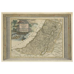
Antique Map of the Holy Land with Picture Frame Border
Located in Langweer, NL
Antique map titled 'Terre Sainte Suivant les Nouvelles Observations (..)'. Original old map of the Holy Land with the picture frame border. The term "Holy Land" usually refers to a t...
Category
Antique Early 18th Century Maps
Materials
Paper
$840 Sale Price
20% Off
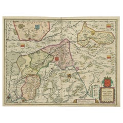
Antique Map of the County of Bentheim by Hondius, c.1630
Located in Langweer, NL
Antique map titled 'Comitatus Bentheimensis nova descriptio'. Engraved map of the County of Bentheim, showing Linge, Enschede, Bad Bentheim, Coevorden, Ne...
Category
Antique 17th Century Maps
Materials
Paper
$391 Sale Price
20% Off
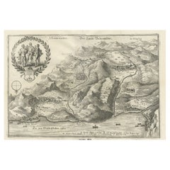
Antique Print of Unterwalden, South of Lake Lucerne in Switzerland, 1654
Located in Langweer, NL
Antique print titled 'Underwaldia - Das Landt Underwalden'. View of the city of Unterwalden, the old name of a forest-canton of the Old Swiss Confederacy in central Switzerland, south of Lake Lucerne...
Category
Antique 17th Century Prints
Materials
Paper
$487 Sale Price
20% Off
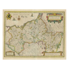
Antique Map of Northern Germany, showing the area of Mecklenburg-Vorpommern
Located in Langweer, NL
Antique map titled 'Meklenburg Ducatus'. Attractive map of northern Germany, showing the area of Mecklenburg-Vorpommern. Published by J. Janssonius, circa 1630.
Jan Janssonius (als...
Category
Antique Mid-17th Century Maps
Materials
Paper
$754 Sale Price
20% Off
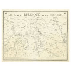
Antique Map of the Region near Cologne, Germany
Located in Langweer, NL
Antique map titled 'Carte de la Belgique d'après Ferraris'. Original antique map of the region near Cologne, Germany. Cologne is the largest city of the German western state of North...
Category
Antique Mid-19th Century Maps
Materials
Paper
$420 Sale Price
20% Off
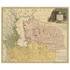
Antique Map of the Caspian Sea, Uzbekistan, Northern Persia Etc, C.1735
Located in Langweer, NL
Antique map titled 'Nova Maris Caspii et Regions Usbeck (..).' Detailed map of Central Asia centered on the Caspian Sea, showing Uzbekistan to the east of ...
Category
Antique 18th Century Maps
Materials
Paper
$1,575 Sale Price
20% Off
Antique Map of the Mouth of the Amu Darya River by Reclus, 1881
Located in Langweer, NL
Antique map titled 'Bouches de L'Amou - Daria'. Original antique map showing the river mouth of the Amu Darya river in Central Asia. This original old antiqu...
Category
Antique 19th Century Maps
Materials
Paper
$85 Sale Price
20% Off
Antique Plan of Batavia, Nowadays Jakarta, Indonesia, 1780
Located in Langweer, NL
Antique map titled 'Plan der Stad en 't Kasteel Batavia'. A very rare late 18th century detailed plan of Batavia with an alpha-numeric key showing the main areas and buildings (only ...
Category
Antique 18th Century Maps
Materials
Paper
$1,764 Sale Price
20% Off
Antique Map of Chinese and Independent Tartary, Korea and Japan, 1806
Located in Langweer, NL
Antique map titled 'A New Map of Chinese & Independent Tartary'. Beautiful map of Chinese Tartary, Korea and Japan.
Artists and Engravers: John Cary (1755-1835) was a British car...
Category
Antique 19th Century Maps
Materials
Paper
$334 Sale Price
20% Off
Antique Map of the Gaspar Strait by Huddart, '1788'
Located in Langweer, NL
Antique map titled 'Sketch of the Straits of Gaspar'. Detailed sea chart of the Gaspar Strait, showing part of the Island of Banca on the east coast of Sumatra just to the south of S...
Category
Antique Late 18th Century Maps
Materials
Paper
$793 Sale Price
30% Off
Antique Map of Africa by Lapie, 1842
Located in Langweer, NL
Antique map titled 'Carte d'Afrique'. Map of Africa. This map originates from 'Atlas universel de géographie ancienne et moderne (..)' by Pierre M. Lapie...
Category
Antique Mid-19th Century Maps
Materials
Paper
$573 Sale Price
20% Off
Cartographic Elegance: The British Raj's India, 1882 Atlas by Blackie and Son
Located in Langweer, NL
These two maps are part of an 1882 atlas published by Blackie and Son, a notable publishing company in the 19th century known for their educational books and detailed atlases. The ma...
Category
Antique 1880s Maps
Materials
Paper
$420 Sale Price / set
20% Off
Untitled Print Lincoln Cathedral ii, Basire, 1791
Located in Langweer, NL
Antique print depicting the Lincoln Cathedral, or the Cathedral Church of the Blessed Virgin Mary of Lincoln. Artists and Engravers: Made by J. Basir...
Category
Antique 18th Century Prints
Materials
Paper
$143 Sale Price
20% Off
Antique Map centered on Nuremberg, Germany
Located in Langweer, NL
Antique map titled 'Territorium Norimbergense'. Beautiful map centered on Nuremberg, Germany. With decorative title cartouche and inset plan of the city. Published by W. Blaeu, circa...
Category
Antique Mid-17th Century Maps
Materials
Paper
$1,146 Sale Price
20% Off
Antique Map of the World with Polar Projections by Keizer & de Lat, 1788
Located in Langweer, NL
Antique map titled 'Schuine Ronde Aard-Klooten (..)'. Interesting double hemisphere world map with polar projections. In North America, there is a...
Category
Antique Late 18th Century Maps
Materials
Paper
$447 Sale Price
25% Off
Antique Map of the World by Johnson, '1872'
Located in Langweer, NL
Antique map titled 'Johnson's World. Original world map. This map originates from 'Johnson's New Illustrated Family Atlas of the World' by A.J. John...
Category
Antique Late 19th Century Maps
Materials
Paper
$447 Sale Price
25% Off
Hand Colored Antique Map of the Department of Eure-et-loir, France
By Victor Levasseur
Located in Langweer, NL
Antique map titled 'Dépt. d'Eure et Loir'. Map of the French department of Eure-et-Loir, France. This area is home to the famous Chartres Cathedral....
Category
Antique Mid-19th Century Maps
Materials
Paper
$324 Sale Price
20% Off
Antique Map of France by Mortier 'c.1710'
Located in Langweer, NL
Antique map titled 'Gallia vetus ex C. Iulii Caesaris (..)'. Original antique map of France. Published by P. Mortier, c.1710.
Category
Antique Early 18th Century Maps
Materials
Paper
$955 Sale Price
20% Off
Antique Map of the Western Part of the German Empire by Levasseur, '1875'
Located in Langweer, NL
Antique map titled 'Empire d'Allemagne (..)'. Large map of the western part of the German Empire. This map originates from 'Atlas de Géographie Moderne Physique et Politique' by A. L...
Category
Antique Late 19th Century Maps
Materials
Paper
$238 Sale Price
50% Off
Antique Map of Denmark with the Danish Royal Crest, c.1730
By Homann Heirs
Located in Langweer, NL
Antique map titled 'Regni Daniae in quo sunt Ducatus Holsatia and Slesuicum Insulae Danicae Jutia, Scania Blekingia (..).' Map of Denmark and islands, part of Sweden and Germany, dra...
Category
Antique 18th Century Maps
Materials
Paper
$429 Sale Price
20% Off
Antique Map of Denmark with An Inset of Iceland, 1852
Located in Langweer, NL
Antique map titled 'Denemarken'. Map of Denmark, with a small inset map of Iceland. This map originates from 'School-Atlas van alle deelen der Aarde' by Otto Petri...
Category
Antique 19th Century Maps
Materials
Paper
$133 Sale Price
20% Off
Rare Hand-Colored Antique Map of Tartary, China and Korea, ca.1741
Located in Langweer, NL
Antique map titled 'A General Map of Eastern and Western Tatary, commonly call'd Tartary; drawn from the Particular Maps of the Jesuit Missionaries'.
Rare antique map of Tartary, C...
Category
Antique 1740s Maps
Materials
Paper
$2,626 Sale Price
20% Off
Small Original Antique Map of the Lower Alsace region, Germany
Located in Langweer, NL
Antique map titled 'Alsatia Inferior'. Small original antique map of the Lower Alsace region, Germany. This map originates from 'Atlas minor Gerardi Mercatoris a I. Hondio plurimis a...
Category
Antique Early 17th Century Maps
Materials
Paper
$324 Sale Price
20% Off
Antique Map of the Holy Land by Schut, 1710
Located in Langweer, NL
Antique map of the Holy Land titled 'Het Beloofde Landt Canaan.' Very detailed and decorative map of the Holy Land embellished with sailing ships and com...
Category
Antique 18th Century Maps
Materials
Paper
$401 Sale Price
20% Off
Print of Various Ceremonies 'Marriage, Funeral, Baptism, Magic' of Finland, 1726
Located in Langweer, NL
Antique print titled 'Mariage des Lapons (..)'.
Old print of various ceremonies (marriage, funeral, baptism, magic) of Finland. This print originates from 'Ceremonies et costumes...
Category
Antique 1720s Prints
Materials
Paper
$324 Sale Price
20% Off
Antique Plan of the Castle & City of Batavia 'Jakarta' on Java, Indonesia, c1669
Located in Langweer, NL
Antique map Batavia titled 'Ware Affbeeldinge wegens het Casteel ende Stadt Batavia'.
Antique print of the castle and city of Batavia on the Island of Java'. Rare edition with En...
Category
Antique 1660s Maps
Materials
Paper
$1,193 Sale Price
20% Off
Antique Map of Cities of the Jiangsu Region in China, c.1760
By Jacques-Nicolas Bellin
Located in Langweer, NL
Antique map titled 'Plan de l' Enceinte de la Ville de Nan-King ou Kyang-Ning-Fou et plan de la ville de Su-Tcheou-Fou.' A map of the city of Nanking or Nanjing and a second map show...
Category
Antique 18th Century Maps
Materials
Paper
$191 Sale Price
20% Off
Hand Colored Antique Map of the department of Ardennes, France
By Victor Levasseur
Located in Langweer, NL
Antique map titled 'Dépt. des Ardennes'. Map of the French department of Ardennes, France. Part of France's important Champagne producing region. The whole is surrounded by elaborate...
Category
Antique Mid-19th Century Maps
Materials
Paper
$324 Sale Price
20% Off
Original Antique Map of Asia
Located in Langweer, NL
Antique map titled 'l'Asie'. Original antique map of Asia. Engraved by André after Bonne. Published circa 1780.
Category
Antique Late 18th Century Maps
Materials
Paper
$276 Sale Price
20% Off
Antique Map of Spain and Portugal by Tardieu, circa 1795
Located in Langweer, NL
The image is an antique map titled "Hispanie Betique et Lusitanie", which depicts the Iberian Peninsula during the Roman times, highlighting the provinces of Hispania Baetica (Betiqu...
Category
Antique Late 18th Century Maps
Materials
Paper
$238 Sale Price
20% Off
Antique Map of Stavoren by Blaeu, 1649
Located in Langweer, NL
Antique map titled 'Staveren'. Original antique map of the city of Stavoren, Friesland, The Netherlands. This map originates from 'Toonneel der Steden van de Vereenighde Nederlanden'...
Category
Antique 17th Century Maps
Materials
Paper
$353 Sale Price
20% Off
Captain Cook's Encampment in Australia where The Endeavour was Beached, 1803
Located in Langweer, NL
Antique print Australia titled 'Gezigt van de Rivier Endeavour op de Kust van Nieuw-Holland'.
View of an encampent on the shore of the Endeavour river on the coast of Australia where the Endeavour boat was beached. Originates from 'Reizen Rondom de Waereld door James Cook (..)'.
HMS Endeavour was a British Royal Navy research vessel that Lieutenant James Cook commanded to Australia and New Zealand on his first voyage of discovery from 1768 to 1771.
She was launched in 1764 as the collier Earl of Pembroke, with the Navy purchasing her in 1768 for a scientific mission to the Pacific Ocean and to explore the seas for the surmised Terra Australis Incognita or "unknown southern land". Commissioned as His Majesty's Bark Endeavour, she departed Plymouth in August 1768, rounded Cape Horn and reached Tahiti in time to observe the 1769 transit of Venus across the Sun. She then set sail into the largely uncharted ocean to the south, stopping at the islands of Huahine, Bora Bora, and Raiatea west of Tahiti to allow Cook to claim them for Great Britain. In September 1769, she anchored off New Zealand, becoming the first European vessel to reach the islands since Abel Tasman's Heemskerck 127 years earlier.
In April 1770, Endeavour became the first European ship to reach the east coast of Australia, with Cook going ashore at what is now known as Botany Bay. Endeavour then sailed north along the Australian coast. She narrowly avoided disaster after running aground on the Great Barrier Reef, and Cook had to throw her guns overboard to lighten her. Endeavour was beached on the Australian mainland for seven weeks to permit rudimentary repairs to her hull. Resuming her voyage, she limped into port in Batavia in October 1770, her crew sworn to secrecy about the lands that they had visited. From Batavia Endeavour continued westward, rounded the Cape of Good Hope on 13 March 1771 and reached the English port of Dover on 12 July, having been at sea for nearly three years.
The ship was largely forgotten after her Pacific voyage, spending the next three years hauling troops and cargo to and from the Falkland Islands. She was renamed in 1775 after being sold into private hands, and used to transport timber from the Baltic. Rehired as a British troop transport during the American War of Independence, she was finally scuttled in a blockade of Narragansett Bay, Rhode Island in 1778. Historical evidence indicates the ship was sunk just north of Goat Island in Newport Harbor, along with four other British transports.
Relics from Endeavour are displayed at maritime museums worldwide, including an anchor and six of her cannon. A replica of Endeavour was launched in 1994 and is berthed alongside the Australian National Maritime Museum in Sydney Harbour. The NASA Space Shuttle...
Category
Antique Early 1800s Prints
Materials
Paper
$522 Sale Price
40% Off
Antique Map of the Auvergne-Rhône-Alpes region of France by Valk, circa 1730
Located in Langweer, NL
Antique map titled 'Praefectura Lugdunensis Generalis'. Detailed map of the Auvergne-Rhône-Alpes region in the southeast of France. To the east the Rhône from Chalon-sur-Saône, Mâcon...
Category
Antique Mid-18th Century Maps
Materials
Paper
$477 Sale Price
20% Off
Antique Map of Southeast Asia by H. Chatelain, circa 1720
By Henri-Abraham Chatelain
Located in Langweer, NL
Antique map titled 'Le Royaume de Siam aves les Royaumes qui luy sont Tributaires et les Isles de Sumatra Andemaon'. Influential map of Southeast Asia, including modern day Thailand, southern Vietnam, Cambodia, Malaysia, Singapore, Borneo, Sumatra and Java. Chatelain incorporated information provided by the French Jesuits and charts the route of the French Embassy to and from Siam in 1685-1686 through the Straits of Banca and the Gulf of Siam.
With good detail of the Andaman Islands, the Gulf of Thailand (Golfe de Siam) and coastal Vietnam. In the Kingdom of Siam, this map shows the fortress of Bangkok, the ancient Siamese capital of Ayutthaya, royal palace, and the Dutch trading colony. In Cambodia, it details the village of Ponompingn (Phnom Penh...
Category
Antique Early 18th Century Maps
Materials
Paper
$1,384 Sale Price
20% Off
Antique Map of the region of Trier, Mainz and Cologne, Germany
Located in Langweer, NL
Antique map titled 'Synopsis Circuli Rhenani Inferioris sive Electorum Rheni (..)'. Original antique map of the region of Trier, Mainz and Cologne, Germany. Published by T.C. Lotter,...
Category
Antique Late 18th Century Maps
Materials
Paper
$458 Sale Price
20% Off
Antique Map of the West Coast of America with Island Views, ca.1784
Located in Langweer, NL
Antique print titled 'Views on the West Coast of America (..)'.
Coastal views of various islands of the American coast. Originates from an edition of Cook's Voyages.
Artists ...
Category
Antique 1780s Maps
Materials
Paper
$429 Sale Price
20% Off
Antique Map of Spain and Portugal by Cruchley, 1854
Located in Langweer, NL
"Antique map of Spain and Portugal. Also depicts the islands Formentera, Ibiza, Mallorca and Minorca. Artists and Engravers: Engraved and publishe...
Category
Antique 19th Century Maps
Materials
Paper
$114 Sale Price
20% Off
Very Old Original Antique Map of The City of Douai in France, ca.1575
Located in Langweer, NL
Antique Map of Douai (France) titled 'Duacum, Catuacorum Urbs, tam situ, quam incolis, et litterarum studijs elegantissime ornata'.
This map depicts the city of Douai (France) an...
Category
Antique 16th Century Maps
Materials
Paper
$783 Sale Price
20% Off
Antique Map of the Region of Delhi in India, 1833
Located in Langweer, NL
Antique map titled 'India IX'. Old steel engraved map of the region of Delhi, with great detail.
Artists and Engravers: Engraved by J. & C. Walker. Published under the superinten...
Category
Antique 19th Century Maps
Materials
Paper
$382 Sale Price
20% Off
Old Print of Ascension Island with Ships, a Whale and Flying Fish, 1601
Located in Langweer, NL
Antique print, titled: 'Vera effigies et delineato Insulae Ascenstio …' - Bird's eye view of Ascension Island. Five large sailing ships in the background and flying fish and waterfowl in the foreground. On the rear an image of four ships sailing towards a whale, accompanied by fowl, flying fish and dolphins. From 'Indiae Orientalis', 1598-1604.
Artists and Engravers: Made by an anonymous engraver after 'Jean Theodore de Bry...
Category
Antique Early 1600s Prints
Materials
Paper
$267 Sale Price
20% Off
Nice Antique Map of Asia Minor, Turkey, circa 1718
Located in Langweer, NL
Antique map titled 'Antiquae Asiae Minoris & C. Tabula' by Philippo Talbor. This rare antique map is published by Edward Wells, circa 1718.
Category
Antique Early 18th Century Maps
Materials
Paper
Antique Map of Bonthain Bay, Sulawesi, Celebes
Located in Langweer, NL
Antique map titled 'Vue de la Baye de Bonthain (..)'. Map of the island Sulawesi (Celebes), Indonesia that Philip Carteret rested his crew and made repairs to his ship the Swallow fo...
Category
Antique Late 18th Century Maps
Materials
Paper
$210 Sale Price
20% Off
A Gold Highlighted Antique Map of Northamptonshire by Blaeu '1659'
Located in Langweer, NL
Antique map titled 'Comitatus Northantonensis vernacule Northamtonshire'. Original antique map of Northamptonshire, England. This map originates from 'Atlas Universal y Cosmographico...
Category
Antique Mid-17th Century Maps
Materials
Paper
$764 Sale Price
20% Off
Large Antique Map of Ancient Spain and Portugal, Published in circa 1760
Located in Langweer, NL
Antique map titled 'Hispania Antiqua (..)'. Map of ancient Spain and Portugal. Engraved by G. Delahaye. Published circa 1760, by or after Sanson & Vaugondy.
Category
Antique Mid-18th Century Maps
Materials
Paper
$420 Sale Price
20% Off
Colorful Detailed Antique Map of The British Islands and `The North Sea, 1882
Located in Langweer, NL
Discover 'The British Islands and The North Sea' Map with Insets of Orkney, Shetland, and Channel Islands! This captivating original antique map offers a detailed view of the British...
Category
Antique 1880s Maps
Materials
Paper
$181 Sale Price
20% Off
Original Antique Map of Africa with large decorative cartouche
Located in Langweer, NL
Original antique map titled 'L'Afrique divisée en ses principaux États'. Attractive and precise map of Africa, with large decorative cartouche. Engraved by Janvier. Published by Dela...
Category
Antique Late 18th Century Maps
Materials
Paper
$945 Sale Price
20% Off
Antique Map of Asia with the Porcelain Tower at Nanjing, China, 1884
Located in Langweer, NL
Antique map titled 'Asie'. Map of the Asian continent, with an illustration of the porcelain tower at Nanjing, China. Migeon's Geographie Universelle, ...
Category
Antique 19th Century Maps
Materials
Paper
$210 Sale Price
20% Off
Old Map of Tartary with Persia, Siberia, the Mogul Territories & China, ca.1717
Located in Langweer, NL
Antique map titled 'A Map of Independent Tartary, containing the territories of Usbeck, Gasgar, Tibet, Lassa & c'.
Old map depicting east of the Caspian Sea with parts of Persia, Siberia, the Mogul territories and on to western China...
Category
Antique 1710s Maps
Materials
Paper
$334 Sale Price
20% Off
Antique Political Map of France, 1880
By J. Migeon
Located in Langweer, NL
Antique map titled 'France Féodale'. Old map of France with a decorative vignette of Castle de Pierrefonds. This map originates from 'Géographie Universelle Atlas-Migeon' by J. Migeo...
Category
Antique 19th Century Maps
Materials
Paper
$114 Sale Price
20% Off
Original Antique Map of the Township of Beilen in the Netherlands, 1865
Located in Langweer, NL
Drenthe - Gemeente Beilen. Hijken, Beilen, Spier, Wijsthoorn. These scarse detailed maps of Dutch Towns originate from the 'Gemeente-atlas' of Jacob Kuyper. This atlas of all towns i...
Category
Antique 19th Century Maps
Materials
Paper
$181 Sale Price
20% Off
Antique Print of the Death of Emperor Cubo at Kyoto, Japan, ca. 1725
By Pieter Van Der Aa
Located in Langweer, NL
Antique print titled 't Vermoorden vande Keyser Cubus. / Massacre de l'Empereur Cubo, dans Meaco.' Engraving of the killing of Emperor Cubo at Kyoto, Japan. The city Kyoto was known ...
Category
Antique 18th Century Prints
Materials
Paper
$878 Sale Price
20% Off
Original Antique German Map of the Russian Empire in Europe, ca.1825
Located in Langweer, NL
Antique map titled 'Des Russischen Reichs - Europäische Theil'.
Original antique map of the Russian Empire in Europe. This map originates from 'Stielers Handatlas'. Published circa...
Category
Antique 1820s Maps
Materials
Paper
$171 Sale Price
20% Off
Antique Map of Central Asia by Johnston '1909'
Located in Langweer, NL
Antique map titled 'Central Asia'. Original antique map of Central Asia. This map originates from the ‘Royal Atlas of Modern Geography’. Published by W. & A.K. Johnston, 1909.
Category
Early 20th Century Maps
Materials
Paper
$238 Sale Price
20% Off
Antique Print of Various Apples by Knoop, 1758
Located in Langweer, NL
Antique print depicting apple variaties including the Framboos-Appel, Herfst Bloem-Soete, Somer-Parmain, Peer-Soete, Soete Dolphyn, Roode Herfst-Striepeling, Witte Soete Silverling, ...
Category
Antique 18th Century Maps
Materials
Paper
$305 Sale Price
20% Off
Antique Map of France with an Inset Map of the Island of Corsica, c.1820
Located in Langweer, NL
Antique map titled 'Frankrijk naar de nieuwste bepalingen meerendeels gevolgd naar Lapie'. Beautiful map of France with an inset map of the island of Corsica. Includes a table with r...
Category
Antique 19th Century Dutch Maps
Materials
Paper
$171 Sale Price
20% Off
Original Antique Map of The Austrian Empire, 1882
Located in Langweer, NL
Step into the past with an original Antique Map of The Austrian Empire from the esteemed 'Comprehensive Atlas and Geography of the World,' meticulously crafted in 1882. This intricat...
Category
Antique 1880s Maps
Materials
Paper
$200 Sale Price
20% Off
Original Antique Map of Russia in Europe, 1882
Located in Langweer, NL
Embark on an enthralling journey with an original Antique Map of European Russia from the esteemed 'Comprehensive Atlas and Geography of the World,' meticulously crafted in 1882. Thi...
Category
Antique 1880s Maps
Materials
Paper
$181 Sale Price
20% Off
Original Antique Map of Spain and Portugal, 1882
Located in Langweer, NL
Embark on a historical voyage with an original Antique Map of Spain and Portugal from the esteemed 'Comprehensive Atlas and Geography of the World,' meticulously crafted in 1882. Thi...
Category
Antique 1880s Maps
Materials
Paper
$162 Sale Price
20% Off
Antique Map of the Archdiocese of Cologne, Germany
Located in Langweer, NL
Antique map titled 'Archevesche et Eslectorat de Cologne avec ses Enclaves'. Original old map of the Archdiocese of Cologne with the course of the Rhine from Andernach to Wesel with ...
Category
Antique Late 17th Century Maps
Materials
Paper
$410 Sale Price
20% Off
Large Decorative Antique Map of the Mediterranean, ca.1770
Located in Langweer, NL
Antique map titled 'Carte de la Mer Mediterranee en Douze Feuilles'.
First map out of twelve fine engraved double-page and folding maps that join to create a large wall map...
Category
Antique 1770s Maps
Materials
Paper
$1,088 Sale Price
20% Off
Recently Viewed
View AllMore Ways To Browse
Statutes And Sculptures
Swedish Gustavian Glass Cabinet
Swiss Chalet Chairs
Tea Cup Art Nouveau
Tea Cup Holder
Teak Buddha
Teak Gentlemans
Thomasville Hollywood Regency
Thomire Clock
Three Legged Vessel
Three Tier Serving Trays
Tibet Earring
Tibetan Antique Cabinet
Tiffany And Co China
Tiffany Blue Rims
Tiffany Sterling Ice Tea Spoons
Torchiere Sculpture
Tortoise Christian Dior
