Maps on Sale
to
4,185
18
4,208
1
3
2
2
1
1
1
1
2,325
1,651
232
1
130
12
1
66
1
3
4
2
4,199
10
8
7
7
165
51
41
37
32
4,209
4,209
4,209
104
55
18
12
11
Sale Items
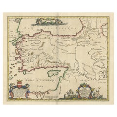
Antique Map of the Region involved in the Conquest of Cyrus the Great
Located in Langweer, NL
Antique map titled 'Tabula Itineris Decies Mille (..)'. This historical map illustrates the region involved in the conquest of Cyrus the Great (558-528 BC), the founder of the Persia...
Category
Antique Mid-17th Century Maps
Materials
Paper
$658 Sale Price
20% Off
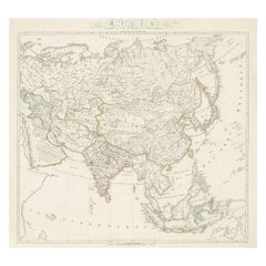
1819 Antique Map of Asia - 'Asien' by Simon Schropp et Comp, Berlin
Located in Langweer, NL
Antique map titled 'Asien'. Original old map of Asia. Published in Berlin by Simon Schropp et Comp, 1819.
"1819 Antique Map of Asia - 'Asien' by Simon Sch...
Category
Antique Early 19th Century Maps
Materials
Paper
$1,814 Sale Price
20% Off
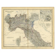
Antique Map of Italy and Corsica, c.1860
Located in Langweer, NL
Antique map titled 'North & Central Italy and the Island of Corsica'.
Old map of North and Central Italy, and the island of Corsica. With an inset map of the region of Rome. Orig...
Category
Antique 19th Century Maps
Materials
Paper
$105 Sale Price
20% Off
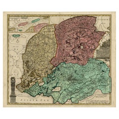
Detailed Antique Map of Friesland, Groningen and Drenthe, The Netherlands, c1735
Located in Langweer, NL
Antique map titled 'Frisia Dominum (?) Friesland, verdeeld in de hoof-delen van Oostergoo, Westergoo en Sevenwolde (?) XXX Grietenijen.' Detailed map of Friesland, Groningen and Dren...
Category
Antique 18th Century Maps
Materials
Paper
$811 Sale Price
20% Off
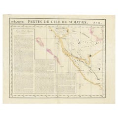
Detailed Antique Map of the Western Sumatra, Indonesia, circa 1825
Located in Langweer, NL
Antique map titled 'Partie de l'Ile de Sumatra'. Chart showing the western part of Sumatra. Originates from 'Atlas Universel' by P.M. Vandermaelen.
Artists and Engravers: Philipp...
Category
Antique 19th Century Maps
Materials
Paper
$401 Sale Price
20% Off
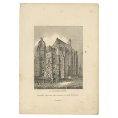
Antique Print of Aachen Cathedral by Knight, 1835
Located in Langweer, NL
Antique print titled 'Aix-La-Chapelle Cathedral'. Old print of Aachen Cathedral, a Roman Catholic church in Aachen, Germany and the see of the Roman Catholic Diocese of Aachen. This ...
Category
Antique 19th Century Prints
Materials
Paper
$75 Sale Price
20% Off
Rare Antique Map of Japan with Place Names Given in Dutch Nomenclature, 1726
Located in Langweer, NL
Antique map titled 'Nieuwe Kaart van het Eyland Japan'.
Rare map of Japan, it shows each of the Japanese provinces, with place names along the route from Nagasaki to Edo. The place...
Category
Antique 18th Century Maps
Materials
Paper
$2,148 Sale Price
20% Off
Large Italian Map of Islands of Oceania, incl Papua, Timor, Banda, Ceram, 1855
Located in Langweer, NL
Description: Antique map titled 'Carta di una parte dell'Oceania'. Beautiful large map of the (Spice) islands of Oceania. Depicting Papua, Timor, Ceram, Gilolo and many more. Source ...
Category
Antique 1850s Maps
Materials
Paper
$2,530 Sale Price
20% Off
Decorative View of the Indonesian Town of Bantam 'Banten', Java, 1726
Located in Langweer, NL
Decorative town-view of the town of Bantam (Banten). In lower margin key a-z to the principal places in town.
The Banten Sultanate was founded in the 16th century and centred in ...
Category
Antique 1720s Maps
Materials
Paper
$534 Sale Price
20% Off
Antique Map of the Eastern Part of the World
Located in Langweer, NL
Antique map titled 'Nieuwe Kaart van het Oostelykste Deel der Weereld, diendende tot aanwyzing van de Scheepstogten der Nederlanderen Naar Oostindie'. This finely engraved map of the...
Category
Antique Mid-18th Century Maps
Materials
Paper
$630 Sale Price
20% Off
Antique Print of Tokyo Bay 'or Edo Bay', Located in Southern Kantō, Japan, 1856
Located in Langweer, NL
Antique print titled 'To-Ri-Ga-Sa-Ki, Yedo Bay'. View of Tokyo Bay (or Edo Bay), a bay located in the southern Kanto region of Japan, and spans the coasts of Tokyo, Kanagawa Prefectu...
Category
Antique 1850s Maps
Materials
Paper
$324 Sale Price
20% Off
Antique Plan of Grave, The Netherlands, Showing the Siege of Grave in 1602
Located in Langweer, NL
Antique map titled 'Die Stat Grave' Bird's eye view plan of Grave, The Netherlands, Holland. Showing the siege of Grave in the year 1602 by Prince Maurits of The Netherlands. Source ...
Category
Antique 16th Century Maps
Materials
Paper
$420 Sale Price
20% Off
Antique Map of France Divided into Departments, with Original Hand Coloring
Located in Langweer, NL
Antique map titled 'A New Map of France (..)'. Original old map of France, divided into departments. With original/contemporary hand coloring. Published by John Cary, 1799. John Cary was an important and prolific London map seller...
Category
Antique Late 18th Century Maps
Materials
Paper
$420 Sale Price
20% Off
Old Map of the Mainland of China and the Islands of Formosa or Taiwan, c.1817
Located in Langweer, NL
Antique map titled 'China'. Old map of the mainland of China and the islands of Formosa or Taiwan. This map originates from 'Universal Geography' by T. Kelly.
Artists and Engrave...
Category
Antique 19th Century Maps
Materials
Paper
$110 Sale Price
20% Off
Antique Map of Nièvre ‘France’ by V. Levasseur, 1854
Located in Langweer, NL
Antique map titled 'Dépt. de la Nièvre'. Map of the French department of Nievre, France. Part of the prestiegous Burgundy or Bourgogne wine region this area is known for its producti...
Category
Antique Mid-19th Century Maps
Materials
Paper
$171 Sale Price
20% Off
Antique Map of Harrison County 'Ohio' by Titus, 1871
Located in Langweer, NL
Antique map titled 'Harrison'. Original antique map of Harrison, Ohio. This map originates from 'Atlas of Preble County Ohio' by C.O. Titus. Published, 1871.
Category
Antique Late 19th Century Maps
Materials
Paper
$238 Sale Price
20% Off
Antique Map of Africa Made after Hondius, circa 1655
Located in Langweer, NL
Antique map titled 'Africa Nova Tabula Auct Jud. Hondio'. Beautiful and rare paneled map of Africa, Based Upon Hondius' map. The first derivative of the map was issued separately by ...
Category
Antique Mid-17th Century Maps
Materials
Paper
$2,865 Sale Price
20% Off
Antique Map of Turkey and Greece, 1852
Located in Langweer, NL
Antique map titled 'Europisch Turkije en Griekenland'. Map of Turkey in Europe and Greece. This map originates from 'School-Atlas van alle deelen der Aar...
Category
Antique 19th Century Maps
Materials
Paper
$114 Sale Price
20% Off
Antique Optical View of The Coronation Ceremony of The Emperor of China, ca.1770
Located in Langweer, NL
Antique print China titled 'Vue perspective de la grande Ceremonie du couronnement de l'Empereur de la Chine'.
Optical view of the coronation c...
Category
Antique 1770s Prints
Materials
Paper
$644 Sale Price
20% Off
Antique Map of Oceania by Levasseur, '1875'
Located in Langweer, NL
Antique map titled 'Carte générale de l'Océanie'. Large map of Oceania. This map originates from 'Atlas de Géographie Moderne Physique et Politique' by A. Levasseur. Published 1875.
Category
Antique Late 19th Century Maps
Materials
Paper
$238 Sale Price
60% Off
Antique Map of the Northern Part of Scotland by Black '1854'
Located in Langweer, NL
Antique map titled 'Scotland'. Original map of the northern part of Scotland. With an inset map of the Orkney Isles. This map originates from 'General Atlas Of The World: Containing ...
Category
Antique Mid-19th Century Maps
Materials
Paper
$191 Sale Price
20% Off
Antique Map of the Ternate Islands by Van den Bosch '1818'
Located in Langweer, NL
Antique map titled 'Kaart der Ternataansche Eilanden'. Rare and attractive map of the Ternate Islands with a large view of Ternate Island. One of 12 maps from 'Atlas van Overzeesche ...
Category
Antique Early 19th Century Maps
Materials
Paper
$1,146 Sale Price
20% Off
Antique Map of Batavia 'Jakarta', Indonesia by Montanus, circa 1669
Located in Langweer, NL
Antique map Batavia titled 'Ware Affbeeldinge wegens het Casteel ende Stadt Batavia'. Antique print of the castle and city of Batavia on the Island of Java'. Rare edition with Englis...
Category
Antique 17th Century Maps
Materials
Paper
$1,193 Sale Price
20% Off
Antique Print of Batavia Castle in Nowadays Jakarta, Indonesia, circa 1770
Located in Langweer, NL
Antique print titled 'Vue a Batavie du côte de la Courtine du Château - Prospect zu Batavia längst der Courtine des Castels'. Scarce view of Batavia Castle, present day Djakarta, Ind...
Category
Antique 18th Century Prints
Materials
Paper
$525 Sale Price
20% Off
Old Map of Russia Originating from the 'Weekly Dispatch Atlas', ca.1865
Located in Langweer, NL
Antique map titled 'Russia in Asia, E Sheet'.
Old map of Russia originating from the 'Weekly Dispatch Atlas'.
Artists and Engravers: Engraved by J.W. Lowry.
Category
Antique 1860s Maps
Materials
Paper
$171 Sale Price
20% Off
Eason's War Map of Europe, circa 1914
Located in Langweer, NL
Antique map titled 'Eason's War Map of Europe'. Printed in Ireland. Source unknown, to be determined.
Artists and Engravers: Anonymous.
Condition: Good, ...
Category
20th Century Maps
Materials
Paper
$525 Sale Price
20% Off
Antique Map of Asia by Dufour, circa 1834
Located in Langweer, NL
Antique map titled 'Asie par A.H. Dufour'. Uncommon map of Asia. Published by or after A.H. Dufour, circa 1834. Source unknown, to be determined.
Category
Antique Mid-19th Century Maps
Materials
Paper
$191 Sale Price
20% Off
Antique Map of the United Kingdom and Ireland, c.1873
Located in Langweer, NL
Antique map titled 'Groot Brittanje en Ierland'. Old map depicting the United Kingdom and Ireland, with inset maps of London and factory districts of the UK. This map originates from...
Category
Antique 19th Century Maps
Materials
Paper
$119 Sale Price
20% Off
Antique Plan of Philippeville in Wallonia, Belgium, 1769
Located in Langweer, NL
Antique map titled 'Philippe-Ville'. Plan of Philippeville in Wallonia, Belgium. This print originates from volume 3 of 'Les Delices des Pays-Bas ou description geographique et histo...
Category
Antique 18th Century Maps
Materials
Paper
$114 Sale Price
20% Off
Rare Antique Engraving of the City of Copenhagen, Denmark, ca.1720
Located in Langweer, NL
Antique print titled 'Copenhagen. Die Königl. Residenz und Haupt Stadt in Dänemark'. Panoramic view of the city of Copenhagen, Denmark. This print, most likely, originates from the s...
Category
Antique 18th Century Prints
Materials
Paper
$439 Sale Price
20% Off
Antique Map of Central America and the West Indies, 1882
Located in Langweer, NL
Antique map titled 'West India Islands and Central America'. Old map of Central America and the West Indies. This map originates from 'The Royal Atlas of Modern Geography, Exhibiting...
Category
Antique 19th Century Maps
Materials
Paper
$171 Sale Price
20% Off
Interesting Map of the Atlantic Showing Nelson's and Trade Routes, 1817
By John Thomson
Located in Langweer, NL
Antique map titled 'Chart of the North Atlantic Ocean with Tracks of the Shipping to West Indies, North America, &cc'. Large map of the Atlantic, showing the tracks of the ships trad...
Category
Antique 19th Century Maps
Materials
Paper
$525 Sale Price
20% Off
Antique Map of Britain in Roman Times
Located in Langweer, NL
Antique map titled 'Britannia Romana collected from Ptolemy (..)'. Map of Britain in Roman times drawn from several sources, including the works of Ptolemy and The Itinerary of the E...
Category
Antique Early 19th Century Maps
Materials
Paper
$467 Sale Price
20% Off
Hand Colored Antique Map of the Department of Eure, France
By Victor Levasseur
Located in Langweer, NL
Antique map titled 'Dépt. de l'Eure'. Map of the French department of Eure, France. This region of France is home to Giverny, where impressionist Claude Monet’s home and garden can...
Category
Antique Mid-19th Century Maps
Materials
Paper
$324 Sale Price
20% Off
Old Detailed Trade Route and Shipping Map from Italy to the Low Countries, c1671
Located in Langweer, NL
Antique map of Italy titled 'Carta Nova accurata del Passagio et strada dalli Peis Bassi per via de Allemgna per Italia et per via di Pesi Suizeri a Geenea, Lione et Roma (..)'. Detailed trade route and shipping map...
Category
Antique 17th Century Maps
Materials
Paper
$1,146 Sale Price
20% Off
Antique Map extending from the Spice Islands to the west of Papua New Guinea
Located in Langweer, NL
Antique map titled 'Kaart van de Papoasche Eilanden'. Beautiful original old map extending from the Spice Islands (Sallawatty, Patenta, Gammen, Land van Waigeeuw, Popo, Misool, and part of Seram) to the western end of Papua New Guinea. Many smaller islands are detailed, and depth soundings are shown near Seram and to the east of Misool. This map originates from 'Nieuwe en Beknopte Hand-Atlas, bestaande in eene Verzameling van eenige der algemeenste en nodigste Landkaarten' by I. Tirion. Published circa 1770.
Tirion was born in Utrecht in 1705. He moved to Amsterdam in 1725 and set up shop on Damrak as a book publisher. Tirion quick rose in prominence by publishing pamphlets, historical works, and, most importantly...
Category
Antique Late 18th Century Maps
Materials
Paper
$467 Sale Price
20% Off
Large Antique County Map of Wiltshire, England, 1805
Located in Langweer, NL
Antique map titled 'A Map of Wiltshire from the best Authorities'. Original old county map of Wiltshire, England. Engraved by John Cary. Originates from 'New British Atlas' by John S...
Category
Antique Early 19th Century Maps
Materials
Paper
$219 Sale Price
20% Off
Antique Map of Allier ‘France’ by V. Levasseur, 1854
By Victor Levasseur
Located in Langweer, NL
Antique map titled 'Dépt. de l'Allier'. Map of the French department of l'Allier, France. This area of France is known for its production of Saint-Pourçain wine. It is also one of th...
Category
Antique Mid-19th Century Maps
Materials
Paper
$171 Sale Price
20% Off
Antique Map of the Arabian Peninsula by Franceschini, '1739'
Located in Langweer, NL
Antique map titled 'Conventus et Residentiae'. Rare map of the Arabian Peninsula. This map originates from 'Provinciarum et Conventum Fratrum Discalc...
Category
Antique Mid-18th Century Maps
Materials
Paper
$537 Sale Price
40% Off
Antique Map of Asia including Arabia, 1806
Located in Langweer, NL
Antique map titled 'Asia'. Original antique map of the Asian continent engraved by E. Jones.
Artists and Engravers: Drawn under the direction of Mr. Arrowsmith. Published in 1806...
Category
Antique 19th Century Maps
Materials
Paper
$286 Sale Price
20% Off
Antique Map of the Region of Fréjus, France
Located in Langweer, NL
Title: "Golf de Fréjus"
Description: This antique map, titled "Golf de Fréjus," is an original depiction of the region of Fréjus, France. It is part of the work "Le Petit Atlas Mari...
Category
Antique Mid-18th Century Maps
Materials
Paper
$284 Sale Price
30% Off
Antique Map of the Admiralty Islands, Bismarck Archipelago
Located in Langweer, NL
Antique map titled 'Trois Vues des Isles de l'Amirauté'. Several coastal views of the Admiralty Islands, Bismarck Archipelago, to the north of New Guinea in the South Pacific Ocean.
...
Category
Antique Late 18th Century Maps
Materials
Paper
$362 Sale Price
20% Off
Antique Map of Mauritania, Massaesylia, Numidia, Tunisia, Cyrenaica & Marmarica
Located in Langweer, NL
Three maps on one sheet showing Mauritania, Massaesylia, Numidia, Tunisia, Cyrenaica and Marmarica (ancient Libya). This map originates from 'Schul-Atlas für die alte Erdbeschreibung...
Category
Antique Early 19th Century Maps
Materials
Paper
$343 Sale Price
20% Off
Antique Map of the Region Around the Nile and the City of Carthage
Located in Langweer, NL
Antique map titled 'Aegypti recentior descriptio - Carthaginis Celeberrimi sinus typus'. Two detailed regional maps by Ortelius. One map shows the region around the Nile, as far as A...
Category
Antique 16th Century Maps
Materials
Paper
$553 Sale Price
20% Off
Large Antique Map of England and Wales
Located in Langweer, NL
Antique map titled 'An Accurate Map of England and Wales'. Original old map of England and Wales. Engraved by John Cary. Originates from 'New British Atlas' by John Stockdale, publis...
Category
Antique Early 19th Century Maps
Materials
Paper
$315 Sale Price
20% Off
Old Map of the British Isles with the Faroes and Shetlands, Showing Cock Fights
Located in Langweer, NL
Antique map titled 'Les Isles Britaniques ou sont les Royaumes d'Angleterre (..)'. Original old map of the British Isles with inset maps of the Faroes and Shetlands. The title cartouche depicts dog...
Category
Antique Early 18th Century Maps
Materials
Paper
$439 Sale Price
20% Off
Daniae Regni & Oldenburg – Antique Maps of Denmark and Saxony by Ortelius, 1598
Located in Langweer, NL
Daniae Regni & Oldenburg – Antique Maps of Denmark and Saxony by Ortelius, 1584
This elegant antique map sheet features two detailed regional maps side by side: Daniae Regni Typus (...
Category
Antique 16th Century European Maps
Materials
Paper
$859 Sale Price
20% Off
Map & Views of the Cape Verde Islands, in the Atlantic Ocean, West-Africa, 1775
Located in Langweer, NL
Various maps and views on one plate titled 'Praya Bay (..)', 'The Cape Verd Islands (..)' and 'A view of Praya Bay (..)'.
Map and views of the Cape Verde islands, in the Atlantic Ocean west of Africa. Printed from two copper plates, published for Robert Sayer...
Category
Antique 1770s Maps
Materials
Paper
$601 Sale Price
20% Off
Antique Map of Berkshire, South East England
By Joan (Johannes) Blaeu
Located in Langweer, NL
Antique map titled 'Bercheria vernacule Barkshire'. Original old map of Berkshire, a historic county in South East England. Published circa 1665 by J. Blaeu. Willem Jansz. Blaeu and ...
Category
Antique Mid-17th Century Maps
Materials
Paper
$1,146 Sale Price
20% Off
Original Detailed Antique Map of the East Coast of Africa, 1747
Located in Langweer, NL
Antique map titled 'Carte de la coste Orientale d'Afrique - Kaart van de Oostkust van Afrika'.
Original antique map of the east coast of Africa. Reaches from Cape of Good Hope an...
Category
Antique 1740s Maps
Materials
Paper
$181 Sale Price
20% Off
Antique Map of Hondarribia Near the Bidasoa River, France & Spain
Located in Langweer, NL
Antique map titled 'Plan de Fontarabie et de la redoute d'Andaye'. Original old map of Hondarribia near the Bidasoa river, a river in the Basque Country of northern Spain and souther...
Category
Antique Mid-18th Century Maps
Materials
Paper
$324 Sale Price
20% Off
Antique Map of the Township of Vledder, Drenthe in the Netherlands, 1865
Located in Langweer, NL
Drenthe: Gemeente Vledder, Doldersum, Nijensleek. These scarse detailed maps of Dutch Towns originate from the 'Gemeente-atlas' of Jacob Kuyper. This atlas of all towns in the Nether...
Category
Antique 19th Century Maps
Materials
Paper
$181 Sale Price
20% Off
Detailed Antique Map of the Southern Part of European Russia and Ukraine, 1752
Located in Langweer, NL
Antique map titled 'Partie meridionale de la Russie Européenne'.
Detailed map of the southern part of European Russia by Robert de Vaugondy. It covers from Moscow south to Georgia and from Poland east to the Volga River, including Crimea and Ukraine.
Artists and engravers: Gilles Robert de Vaugondy (1688-1766) was the head of a leading family of geographers in eighteenth century France. Gilles got his start when he jointly inherited the shop of Pierre-Moullart Sanson, grandson of the famous geographer Nicholas Sanson. The inheritance included the business, its stock of plates, and a roller press...
Category
Antique 1750s Maps
Materials
Paper
$725 Sale Price
20% Off
Genuine Antique Engraved Map of Helvetia or Switzerland, 1729
Located in Langweer, NL
Decorative early 18th century engraved map of Switzerland.
Title: Helvetia Conterminarumq terra rum antiqua.
Translated from Latin: Switzerland is an ancient land
Description: Switzerland, antique copperplate engraved map with hand coloring and a decorative title cartouche. Two figures greatly enhances visual appeal.
Author: Phillip Cluver, or Philip Cluverius, Philipp Clüver, Latinized as Philippus Cluverius studied law in Leiden and settled over there in 1615.
We only sell Guaranteed Absolutely Original authentic Maps and Prints.
A Certificate of Authenticity ( COA ) will be supplied on request.
We ship our antique maps and prints...
Category
Antique 1720s Maps
Materials
Paper
$372 Sale Price
20% Off
Large Antique County Map of Middlesex, England
Located in Langweer, NL
Antique map titled 'A Map of Middlesex from the best Authorities'. Original old county map of Middlesex, England. Engraved by John Cary. Originates from 'New British Atlas' by John S...
Category
Antique Early 19th Century Maps
Materials
Paper
$267 Sale Price
20% Off
Antique Map of the City of Leeuwarden by Leti, 1690
Located in Langweer, NL
Antique map titled 'Leovardia.' A plan of Leeuwarden in Friesland, the Netherlands. With two coats of arms, the title in a scroll and an index of 30 buildings in the lower right. Fro...
Category
Antique 17th Century Maps
Materials
Paper
$637 Sale Price
20% Off
Rare Antique Map of Calcutta 'Kolkata' in India, 1893
Located in Langweer, NL
Antique map titled 'Calcutta (India)'. Old map of Calcutta/Kolkata, India. On verso, a map of Egypt, Arabia, Upper Nubia and Abyssinia. Originates from 'The Columbian World's Fair at...
Category
Antique 19th Century Maps
Materials
Paper
$248 Sale Price
20% Off
Original Antique Map of the Township of Winschoten in The Netherlands, 1862
Located in Langweer, NL
Groningen: Gemeente Winschoten-St. Vitus Holt. These scarse detailed maps of Dutch Towns originate from the 'Gemeente atlas van de Provincie Groningen in 62 kaarten.' by C. Fehse. Th...
Category
Antique 19th Century Maps
Materials
Paper
$152 Sale Price
20% Off
Antique Map of the Passage Between the Atlantic and Pacific Oceans, circa 1753
Located in Langweer, NL
Antique print, titled: 'Carte du Detroit de le Maire (…)' - This chart illustrates the important passage between the Atlantic and Pacific oceans. Jacob Le Maire and Willem Schouten d...
Category
Antique 18th Century Maps
Materials
Paper
$219 Sale Price
20% Off
Antique Map of the City of Kolkata by Balbi '1847'
Located in Langweer, NL
Antique map titled 'Calcutta'. Original antique map of the city of Kolkata, India. This map originates from 'Abrégé de Géographie (..)' by Adrien Balbi. Published 1847.
Category
Antique Mid-19th Century Maps
Materials
Paper
$143 Sale Price
20% Off
Recently Viewed
View AllMore Ways To Browse
Statutes And Sculptures
Swedish Gustavian Glass Cabinet
Swiss Chalet Chairs
Tea Cup Art Nouveau
Tea Cup Holder
Teak Buddha
Teak Gentlemans
Thomasville Hollywood Regency
Thomire Clock
Three Legged Vessel
Three Tier Serving Trays
Tibet Earring
Tibetan Antique Cabinet
Tiffany And Co China
Tiffany Blue Rims
Tiffany Sterling Ice Tea Spoons
Torchiere Sculpture
Tortoise Christian Dior
