Items Similar to Old Map of the Mainland of China and the Islands of Formosa or Taiwan, c.1817


Want more images or videos?
Request additional images or videos from the seller
1 of 6
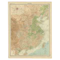
Old Map of the Mainland of China and the Islands of Formosa or Taiwan, c.1817
About the Item
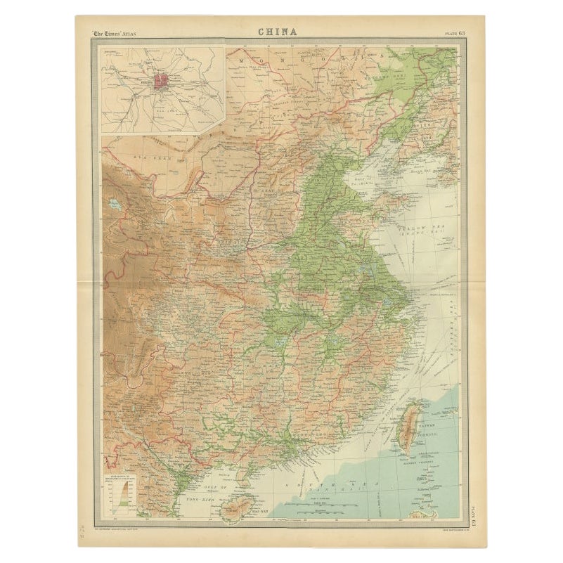
Antique map titled 'China'. Old map of the mainland of China and the islands of Formosa or Taiwan. This map originates from 'Universal Geography' by T. Kelly.
Artists and Engravers: Engraved by A. Findley. Published by Thomas Kelly.
Condition: Very good, general age-related toning. Few defects lower margin. Please study image carefully.
Date: c.1817
Overall size: 26.5 x 21 cm.
Image size: 24 x 18.5 cm.
We sell original antique maps to collectors, historians, educators and interior decorators all over the world. Our collection includes a wide range of authentic antique maps from the 16th to the 20th centuries. Buying and collecting antique maps is a tradition that goes back hundreds of years. Antique maps have proved a richly rewarding investment over the past decade, thanks to a growing appreciation of their unique historical appeal. Today the decorative qualities of antique maps are widely recognized by interior designers who appreciate their beauty and design flexibility. Depending on the individual map, presentation, and context, a rare or antique map can be modern, traditional, abstract, figurative, serious or whimsical. We offer a wide range of authentic antique maps for any budget.
- Dimensions:Height: 8.27 in (21 cm)Width: 10.44 in (26.5 cm)Depth: 0 in (0.01 mm)
- Materials and Techniques:
- Period:
- Date of Manufacture:circa 1817
- Condition:
- Seller Location:Langweer, NL
- Reference Number:
About the Seller
5.0
Platinum Seller
These expertly vetted sellers are 1stDibs' most experienced sellers and are rated highest by our customers.
Established in 2009
1stDibs seller since 2017
1,929 sales on 1stDibs
Typical response time: <1 hour
- ShippingRetrieving quote...Ships From: Langweer, Netherlands
- Return PolicyA return for this item may be initiated within 14 days of delivery.
More From This SellerView All
- Original Old Map of Eastern China, Also Depicting Taiwan 'Formosa', 1922Located in Langweer, NLLarge map of China titled 'China - Peking'. Old map of eastern China depicting Kiangsi, Chekiang, Fukien, Kwangtung, Taiwan (Formosa) and surroundings. With inset map of Peking. This...Category
20th Century Maps
MaterialsPaper
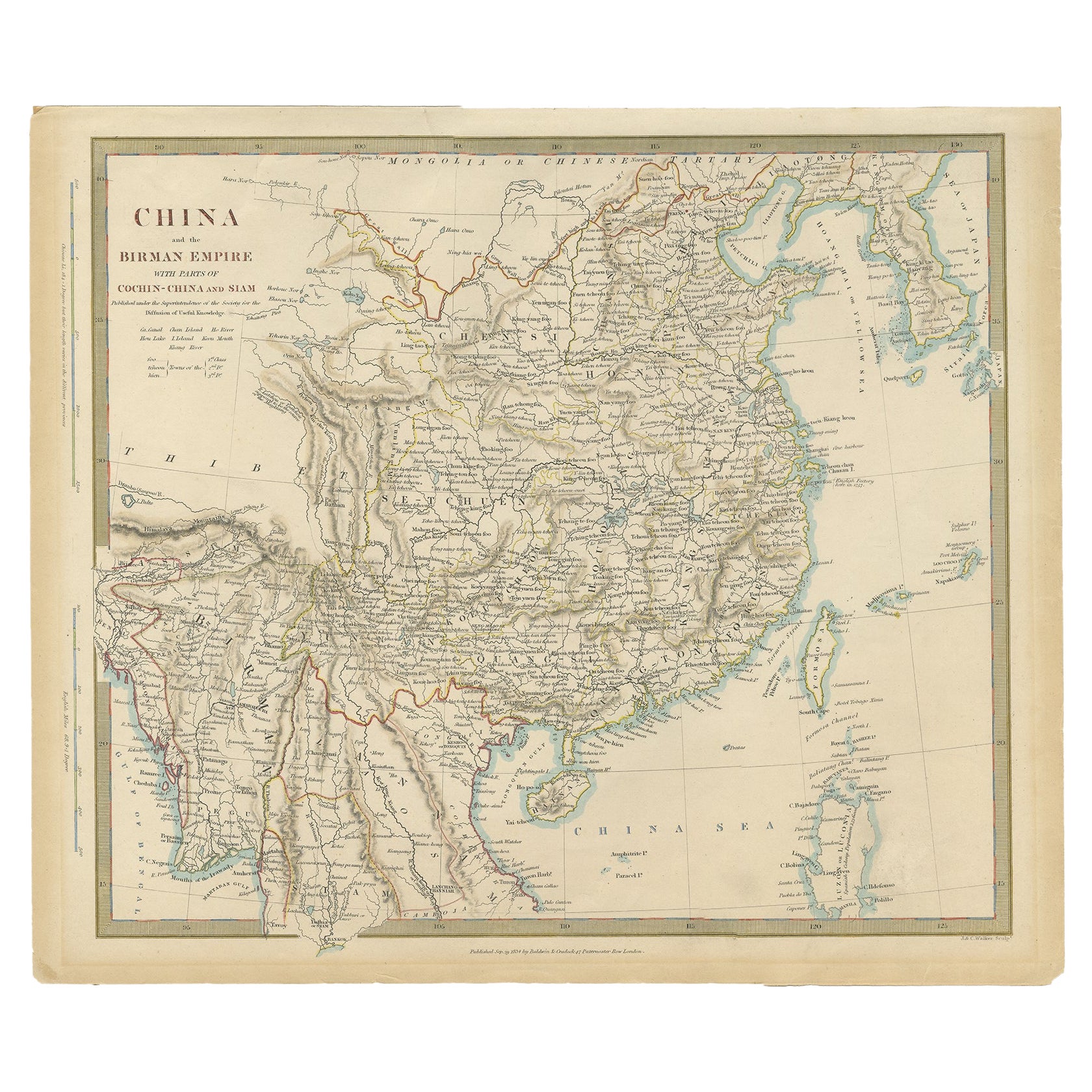
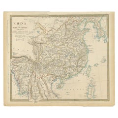
- Antique Map of China, Also Depicting Formosa 'Taiwan' and Part of Korea, c.1840Located in Langweer, NLAntique map titled 'China'. Old map of China, also depicting Formosa (Taiwan) and part of Korea. Source unknown, to be determined. Artists and Engravers: Anonymous. Condition: ...Category
Antique 19th Century Maps
MaterialsPaper
- Antique Map of the Atlantic Islands, 1817Located in Langweer, NLAntique map titled 'Atlantic Islands'. Large map of the Atlantic Islands include the Cape Verde islands, Canary islands, Azore islands and Madeira islands. Also included a view of th...Category
Antique Early 19th Century Maps
MaterialsPaper
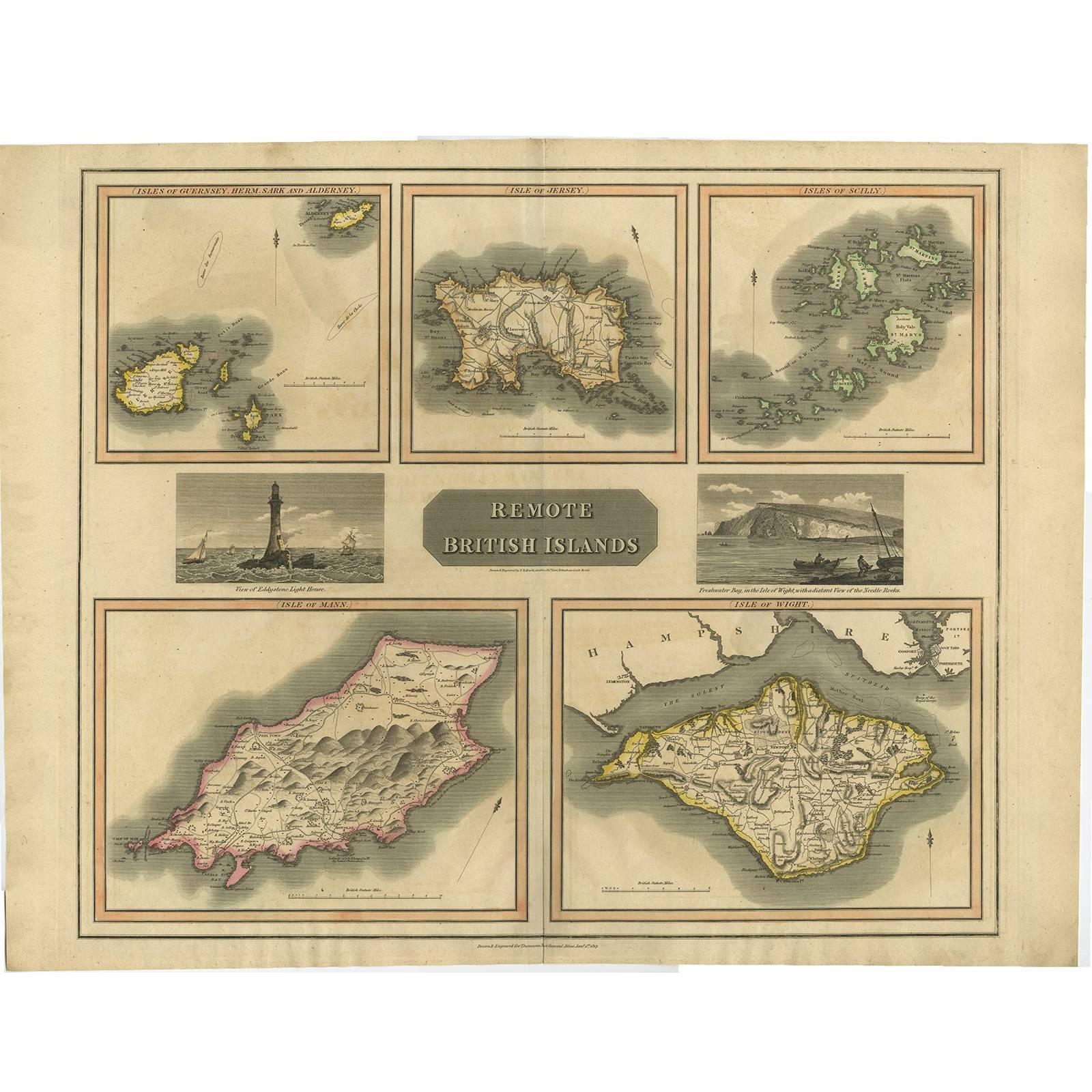
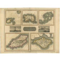
- Antique Map of the British Islands by J. Thomson, 1817Located in Langweer, NLGroup of 5 maps of the Channel Islands, Scilly, Jersey, the Isle of Mann and the Isle of Wight. Engraved views of the Eddystone Lighthouse and Freshwater Bay on the Isle of Wight, wi...Category
Antique Early 19th Century Maps
MaterialsPaper
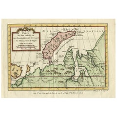
- Decorative Original Old Map of Nova Zembla and the Russian Mainland, ca.1760Located in Langweer, NLAntique map titled 'Carte Des Pais Habites par les Samojedes et Ostiacs.' Map of Novaya Zemlya and the Russian mainland. Source unknown, to be determined. Artists and Engraver...Category
Antique 1760s Maps
MaterialsPaper
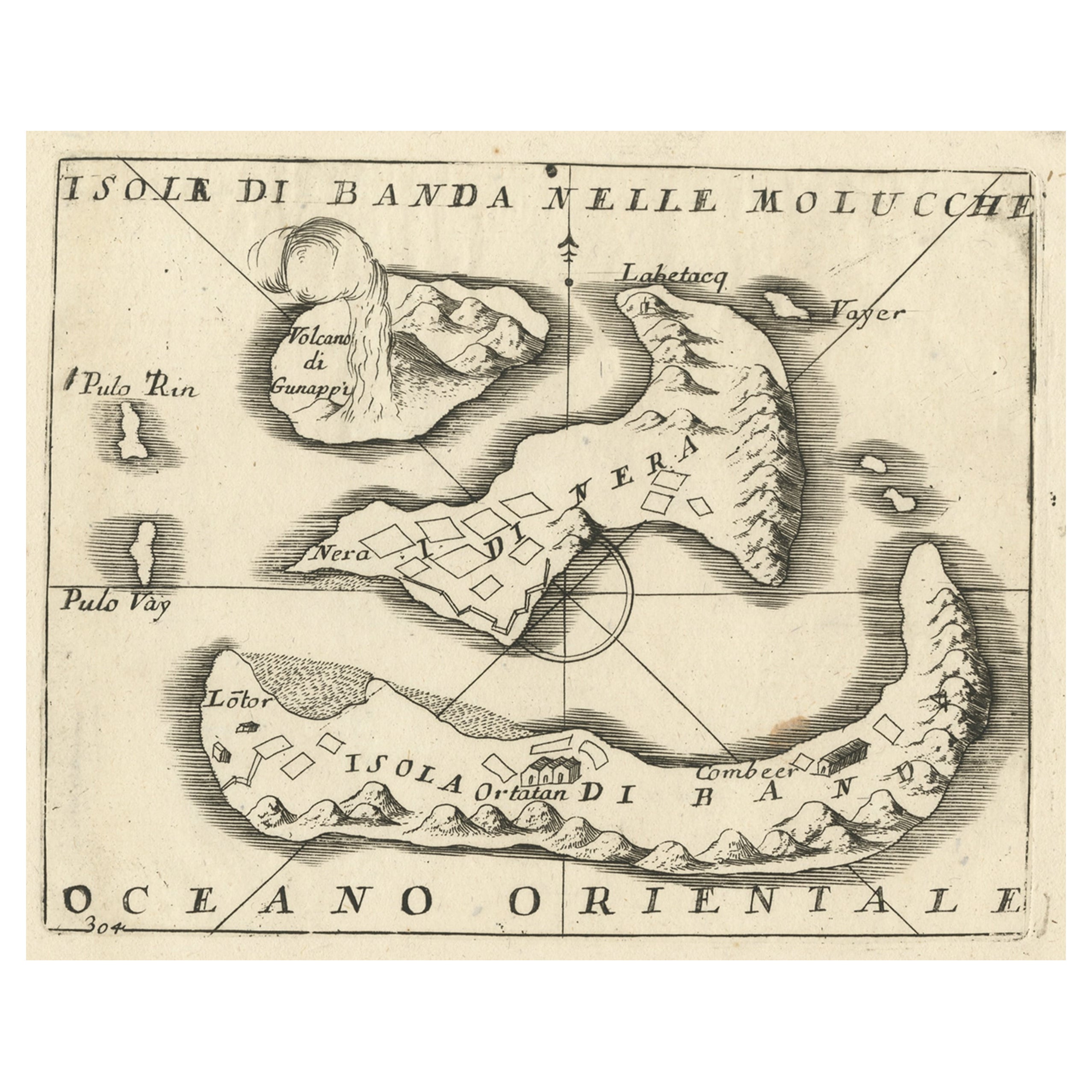
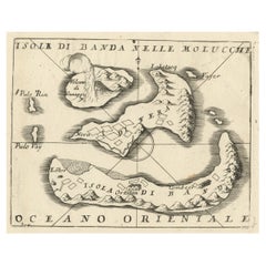
- Small Old Map Depicting the Banda Islands or the Spice Islands, Indonesia, 1706Located in Langweer, NLAntique map titled 'Isole di Banda Nelle Molucche'. Small old map depicting the Banda Islands, Indonesia. Artists and Engravers: Published by V.M. Coronelli in Venice, 1706.Category
Antique Early 1700s Maps
MaterialsPaper

You May Also Like
- Original Antique Map of China by Thomas Clerk, 1817Located in St Annes, LancashireGreat map of China Copper-plate engraving Drawn and engraved by Thomas Clerk, Edinburgh. Published by Mackenzie And Dent, 1817 Unframed.Category
Antique 1810s English Maps
MaterialsPaper
- Original Antique Map of The World by Thomas Clerk, 1817Located in St Annes, LancashireGreat map of The Eastern and Western Hemispheres On 2 sheets Copper-plate engraving Drawn and engraved by Thomas Clerk, Edinburgh. Published by Mackenzie And Dent, 1817 ...Category
Antique 1810s English Maps
MaterialsPaper
- Original Antique Map of Spain and Portugal by Thomas Clerk, 1817Located in St Annes, LancashireGreat map of Spain and Portugal Copper-plate engraving Drawn and engraved by Thomas Clerk, Edinburgh. Published by Mackenzie And Dent, 1817 Unframed.Category
Antique 1810s English Maps
MaterialsPaper
- 1854 Map of Massachusetts, Connecticut and Rhode Island, Antique Wall MapLocated in Colorado Springs, COThis striking wall map was published in 1854 by Ensign, Bridgman & Fanning and has both full original hand-coloring and original hardware. This impression is both informative and highly decorative. The states are divided into counties, outlined in red, green, and black, and subdivided into towns. Roads, canals, and railroad lines are prominently depicted, although they are not all labeled. The mapmakers also marked lighthouses, banks, churches, and prominent buildings, with a key at right. The map is an informative and comprehensive overview of the infrastructural development of New England prior to the Civil War. Physical geographies depicted include elevation, conveyed with hachure marks, rivers and lakes. The impression features an inset map of Boston...Category
Antique 19th Century American Maps
MaterialsPaper
- English Engraved Hand Colored Map of the North Eastern United States, circa 1817Located in Hollywood, SCEnglish copper engraved hand colored map of the North Eastern United States matted under glass in a gilt frame, Early 19th Century. Drawn and Engraved for Thomson's New General Atlas...Category
Antique 1810s English George III Maps
MaterialsGlass, Giltwood, Paint, Paper
- Large Original Vintage Map of The Pacific Islands Including HawaiiLocated in St Annes, LancashireGreat map of The Pacific Islands Unframed Original color By John Bartholomew and Co. Edinburgh Geographical Institute Published, circa 1...Category
Vintage 1920s British Maps
MaterialsPaper


Recently Viewed
View AllMore Ways To Browse
T Kelly
Old World Antique Maps
Antique Old World Map
Old Antique World Map
Old World Antique Map
Antique Old Map Of The World
Antique Thomas China
China Map
Chinese Maps
Chinese Map
Map Of China
Kelly Go
Chinese Hundred Antiques
Antique China Map
Antique Map China
Antique Chinese Maps
Antique Map Of China
Antique Maps Of China