Items Similar to Small Old Map Depicting the Banda Islands or the Spice Islands, Indonesia, 1706


Want more images or videos?
Request additional images or videos from the seller
1 of 5
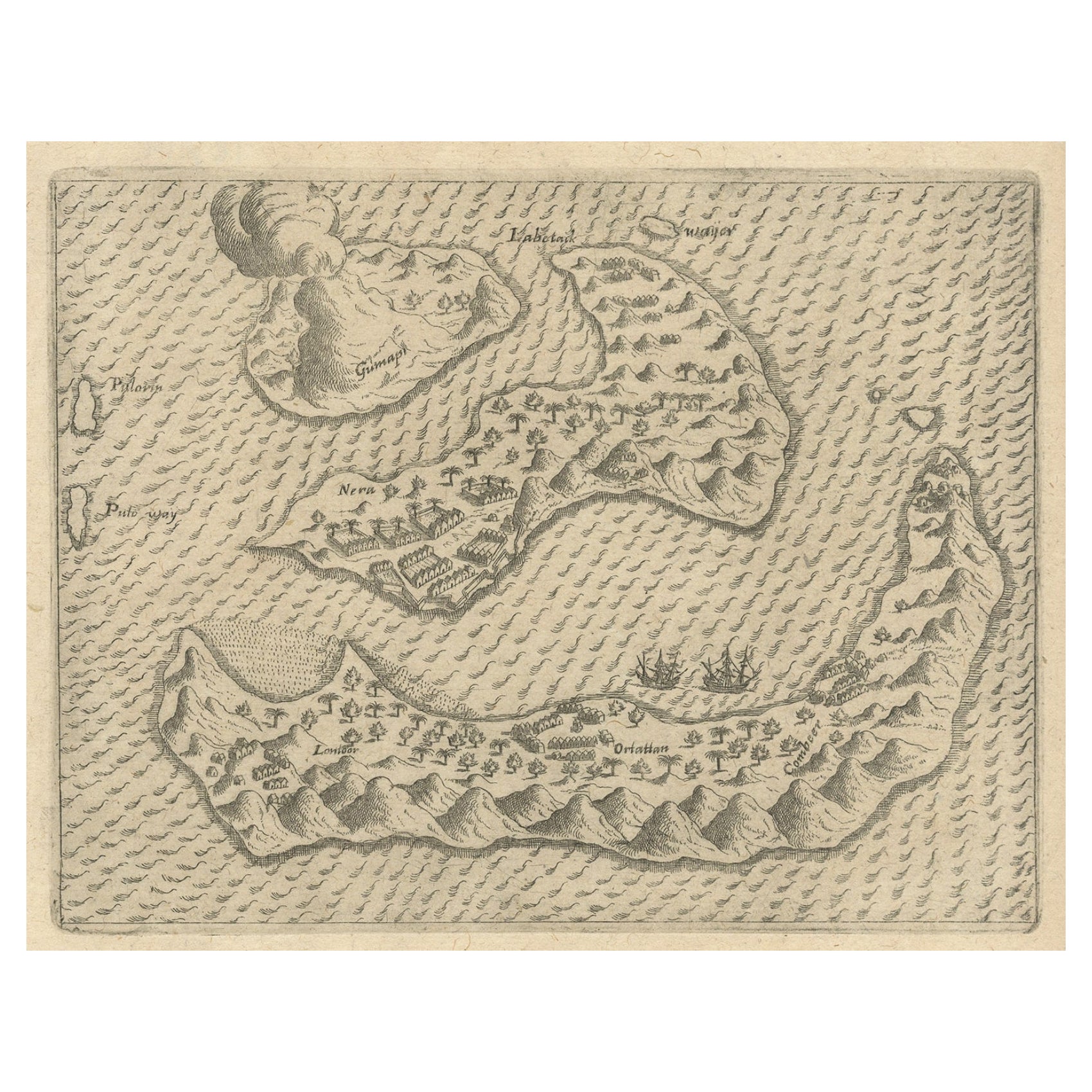
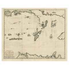
Small Old Map Depicting the Banda Islands or the Spice Islands, Indonesia, 1706
About the Item
Antique map titled 'Isole di Banda Nelle Molucche'.
Small old map depicting the Banda Islands, Indonesia.
Artists and Engravers: Published by V.M. Coronelli in Venice, 1706.
- Dimensions:Height: 7.09 in (18 cm)Width: 8.86 in (22.5 cm)Depth: 0 in (0.02 mm)
- Materials and Techniques:
- Period:1700-1709
- Date of Manufacture:1706
- Condition:Wear consistent with age and use. Condition: Good, few small worm holes outside image border. Please study image carefully.
- Seller Location:Langweer, NL
- Reference Number:
About the Seller
5.0
Platinum Seller
These expertly vetted sellers are 1stDibs' most experienced sellers and are rated highest by our customers.
Established in 2009
1stDibs seller since 2017
1,929 sales on 1stDibs
Typical response time: <1 hour
- ShippingRetrieving quote...Ships From: Langweer, Netherlands
- Return PolicyA return for this item may be initiated within 14 days of delivery.
More From This SellerView All
- Rare Antique Pap Depicting the Banda Islands or Spice Islands, Indonesia, c.1600Located in Langweer, NLAntique map Indonesia titled 'Bandae Insulae designatio'. Antique map depicting the Banda Islands, Indonesia. With Latin text, blank verso. Orig...Category
Antique Early 1600s Maps
MaterialsPaper
- Original Antique Map Southeast of the Banda or Spice Islands, Indonesia, 1726Located in Langweer, NLAntique map titled 'Kaart van de Zuyd-Ooster Eylanden van Banda'. Map of the southeastern part of the Banda islands. This map originates from 'Oud en Nieuw Oost-Indiën' by F. Valen...Category
Antique 1720s Maps
MaterialsPaper
- Antique Chart of the Banda Islands or The Spice Islands, Indonesia, 1726Located in Langweer, NLAntique map titled 'Nieuwe Caart der Eylanden van Banda'. Beautiful chart of the Banda Islands including Banda Api, Banda Neira, Banda Besar, Pulau Hatta (Rosengain), Pulau Ai an...Category
Antique 1720s Maps
MaterialsPaper
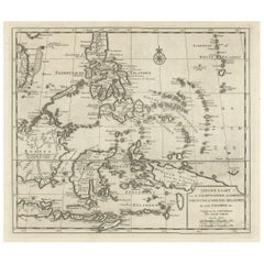
- Old Antique Map of the Banda Islands (Southeast), Indonesia & Northern AustraliaBy F. ValentijnLocated in Langweer, NLOriginal antique map titled 'Kaart van de Zuyd-Ooster Eylanden van Banda'. Important map of the seas and islands surrounding the Banda Islands, Indonesia, extending south to northern Australia, east to Papua New Guinea and north to Ceram. Published 1724-1726 by Joannes van Braam...Category
Antique Early 18th Century Maps
MaterialsPaper
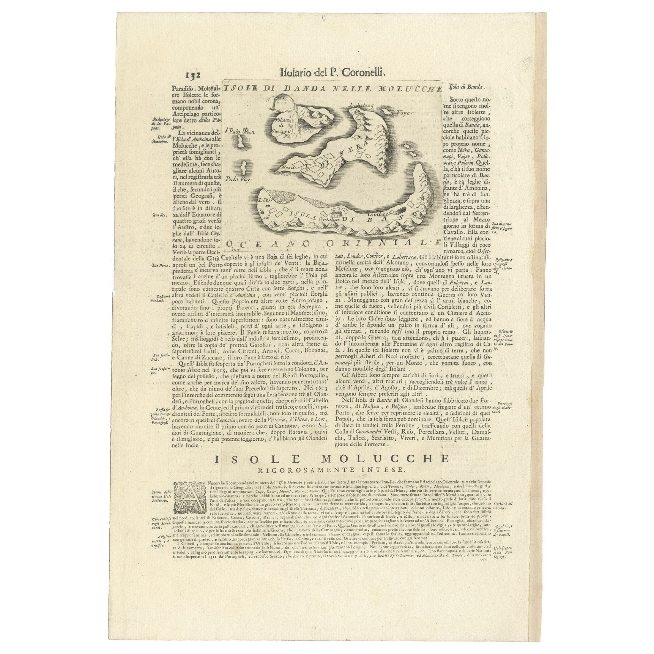
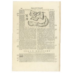
- Antique Map of the Banda Islands or Spice Islands, Moluccas, Indonesia, 1697Located in Langweer, NLAntique map titled 'Isole di Banda Nelle Molucche'. Engraved map of Isola di Banda, Nelle, Molucche. On verso: 'Isola di Solor'. Artists and Engravers: Vincenzo Maria (Padre)...Category
Antique 17th Century Maps
MaterialsPaper
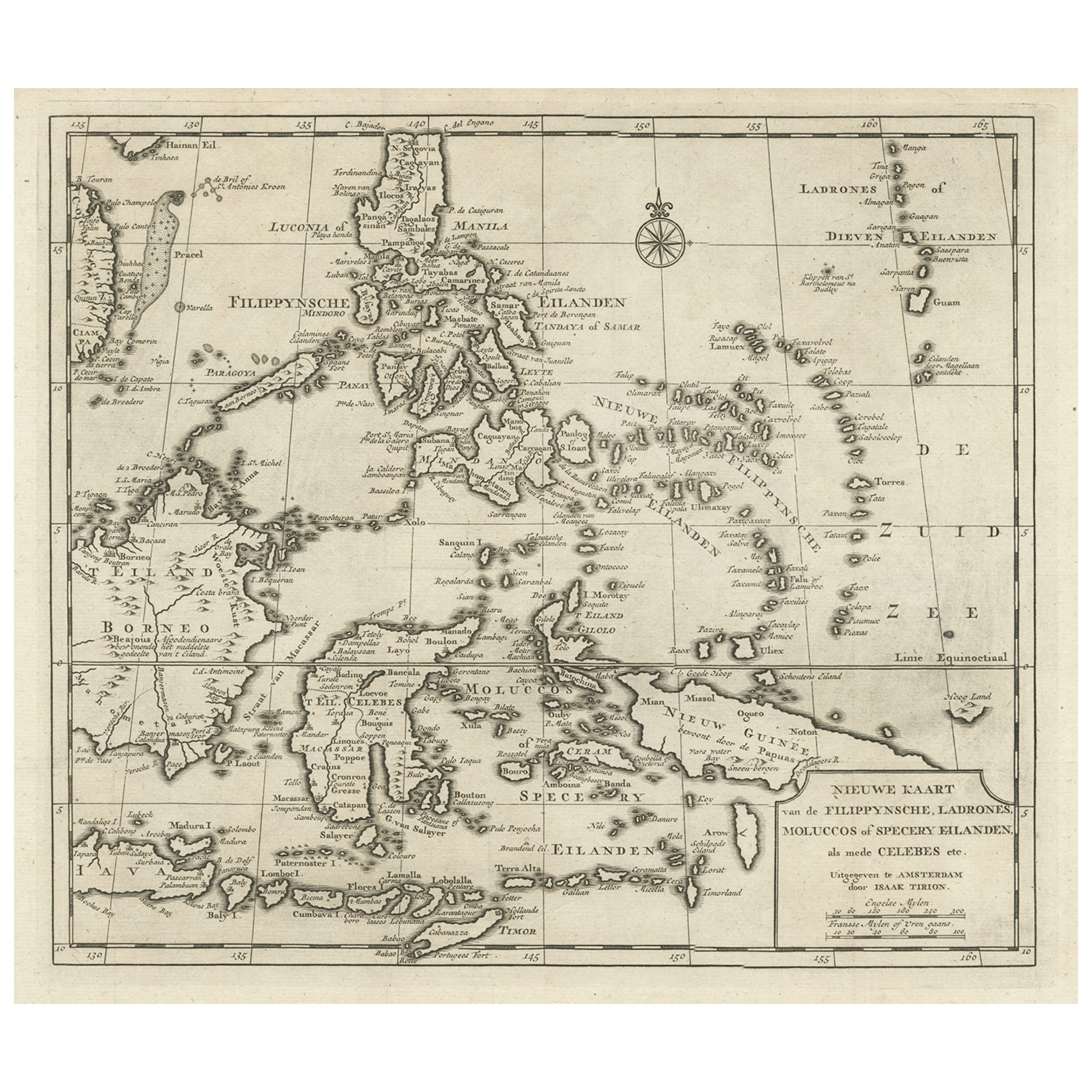
- Old Map of the Philippines and Part of Indonesia 'Spice Islands', 1744Located in Langweer, NLAntique map titled 'Nieuwe Kaart van de Filippynsche, Ladrones, Moluccos of Specery Eilanden, als mede Celebes etc'. Old map of the Philippines and part of Indonesia. Originates ...Category
Antique 1740s Maps
MaterialsPaper


You May Also Like
- Old Nautical Print Depicting the Bombardment of Cadiz by the French Navy 1823Located in Milan, ITPrint by engraving on copper plate of the first half of the 19th century, depicting the bombardment of Cadiz by the French Navy, 23 September 1823. The print is signed peint par Crep...Category
Antique 1830s French Nautical Objects
MaterialsPaper
- Old Nautical Map of CorsicaLocated in Alessandria, PiemonteST/556/1 - Old map of Corsica isle, surveyed by Captain Hell, of the French Royal Navy in 1824, engraved and published on 1874, with additions and corre...Category
Antique Early 19th Century English Other Prints
MaterialsPaper
- Old Horizontal Map of EnglandBy TassoLocated in Alessandria, PiemonteST/520 - Old rare Italian map of England, dated 1826-1827 - by Girolamo Tasso, editor in Venise, for the atlas of M.r Le-Sage.Category
Antique Early 19th Century Italian Other Prints
MaterialsPaper
- Hand-Colored 18th Century Homann Map of Denmark and Islands in the Baltic SeaBy Johann Baptist HomannLocated in Alamo, CAAn 18th century copper plate hand-colored map entitled "Insulae Danicae in Mari Balthico Sitae utpote Zeelandia, Fionia, Langelandia, Lalandia, Falstria, Fembria Mona" created by Joh...Category
Antique Early 18th Century German Maps
MaterialsPaper
- Map of the Republic of GenoaLocated in New York, NYFramed antique hand-coloured map of the Republic of Genoa including the duchies of Mantua, Modena, and Parma. Europe, late 18th century. Dimension: 25...Category
Antique Late 18th Century European Maps
- Map "Estuary- Mouth of the Thames"Located in Alessandria, PiemonteST/426 - Antique French Map of the estuary of the Thames, map dated 1769 - "Mape of the entrance of the Thames. Designed by filing of Navy cards fo...Category
Antique Mid-18th Century French Other Prints
MaterialsPaper


Recently Viewed
View AllMore Ways To Browse
Antique Island Furniture
Antique Spices
Antique Map Indonesia
Antique Maps Indonesia
Old Spice
Antique Maps Venice
Antique Venice Map
Antique Map Venice
Antique Map By Coronelli
Heir Antiques
Marine 18th Century
Antique English Maps
Atlas Metal
Antique Railroad Furniture
Vintage Maps
Dutch Sellers
Ship Wood Carving
Antique Quadrant