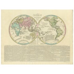
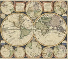
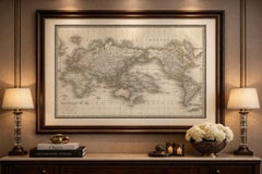
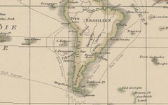
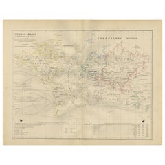
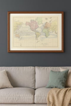
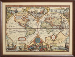
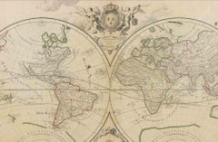
Antique World Map by Lesage, 1823
Located in Langweer, NL
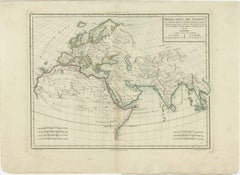
Antique world map titled 'Mappe Monde Historique'. The map depicts both the Eastern and Western
Category
Antique Early 19th Century Maps
Materials
Paper
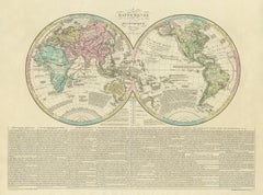
Antique World Map by Lesage, 1823
Located in Langweer, NL
Antique world map titled 'Mappe Monde Historique'. The map depicts both the Eastern and Western
Paper
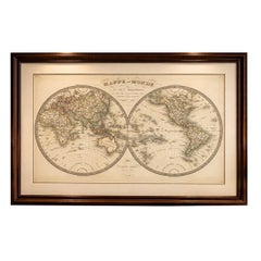
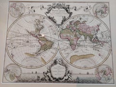
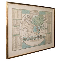
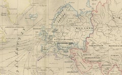
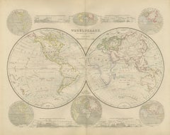
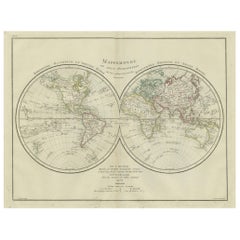
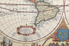
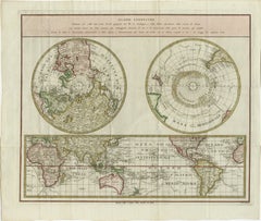
Antique Double Hemisphere World Map – Lapie, Paris, 1838
Located in Langweer, NL
Antique Double Hemisphere World Map – Lapie, Paris, 1838 This elegant and finely engraved double
Paper

$5,172Sale Price|20% Off
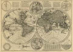
Antique World Map by P. Schenk '1706'
By Peter Schenk
Located in Langweer, NL
Aert-klooten (..)'. One of the earliest Dutch World Maps to focus on a more modern cartographic style
Paper
$37,659Sale Price|20% Off
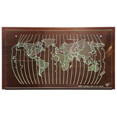
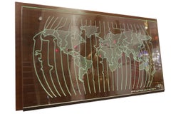
World Map Clock
Located in Paris, FR
Clock world map with natural solid wengue wood back panel on which are placed different time zone
Glass, Wenge
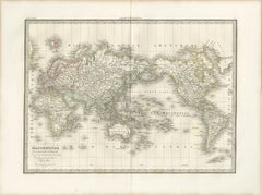
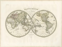
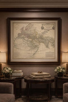
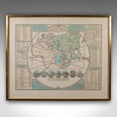
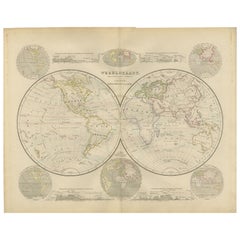
Antique World Map on Mercator Projection – Lapie, Paris, 1838
Located in Langweer, NL
Antique World Map on Mercator Projection – Lapie, Paris, 1838 This elegant and finely engraved
Paper

$4,310Sale Price|20% Off
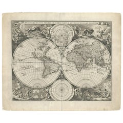
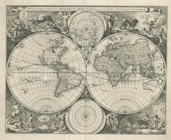
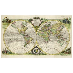
Original Antique Hand-colored World Map with or without Frame, '1696'
Located in Langweer, NL
Antique world map titled 'Mappe-Monde dressee sur les Observations de Mrs. de l'Academie Royale des
Paper
Antique Ancient World Map – Orbis Veteribus Notus, Engraving c.1818
Located in Langweer, NL
Antique Ancient World Map – Orbis Veteribus Notus, Engraving c.1818 Striking antique map depicting
Paper
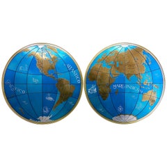
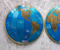
Two Impressive Huge Midcentury World Map Wall Globes, 95" Diameter, 1950s
Located in Vienna, AT
We proudly offer this outstanding pair of very large wall-mounted modernist globes / world maps
Aluminum, Iron
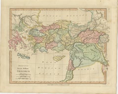
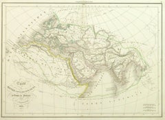
World According to Herodotus – Antique Classical World Map, Wilkinson 1819
Located in Langweer, NL
World According to Herodotus – Antique Classical World Map, Wilkinson 1819 Description: This
Paper
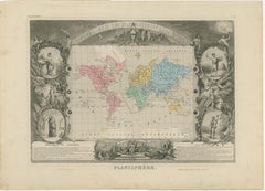
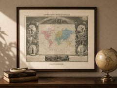
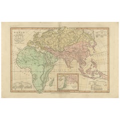
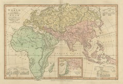
Antique World Map Planisphere, Decorative Original Hand Coloring, c.1845
Located in Langweer, NL
Antique World Map Planisphere, Levasseur, Decorative Atlas, c.1845 This highly decorative world
Paper
$6,321Sale Price|20% Off
Gorgeous Antique World Map by the Dutch Mapmaker Visscher, published circa 1679
Located in Langweer, NL
example of Nicholas Visscher's World map, which appeared in his Atlas Minor after 1679. The map is
Paper

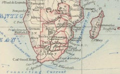
World Map – Mercator Projection with Global Sea Routes, Published in 1857
Located in Langweer, NL
World Map – Mercator Projection with Global Sea Routes 1857 This attractive antique print shows a
Paper


Antique Mercator Projection World Map by Petri, c.1873
Located in Langweer, NL
Antique world map titled 'Wereldkaart naar Mercator's Projectie'. Old map of the world. This map
Paper
Antique Plan de l'Historie Universelle World Map, Framed Cartography, Circa 1730
Located in Hele, Devon, GB
This is an antique Plan de l'Historie Universelle World Map. A Dutch, framed atlas engraving by
Glass, Paper

Mid-18th Century Antique World Map by R. & J. Wetstein, Netherlands
Located in Langweer, NL
Antique world map titled 'De Werelt Caart'. A scarce and richly detailed double hemisphere world
Paper
World Map in Mercator’s Projection – Nieuwe Hand-Atlas, Leiden 1876
Located in Langweer, NL
World Map in Mercator’s Projection – Nieuwe Hand-Atlas, Leiden 1876 This 19th-century Dutch world
Paper
Rare Original Double Hemisphere World Map with Allegorical Figures, 1785
Located in Langweer, NL
hemisphere world map. Four allegorical figures in the corners represent Europe, Asia, Africa and America
Paper
Double Hemisphere World Map from the Nieuwe Hand-Atlas, Leiden 1876
Located in Langweer, NL
Title: Double Hemisphere World Map from the Nieuwe Hand-Atlas, Leiden 1876 Description: This 19th
Paper
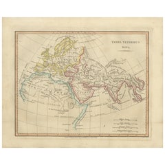
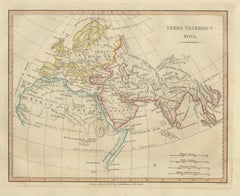
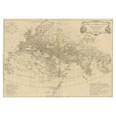
Terra Veteribus Nota — Classical World Map of Antiquity, Wilkinson 1814
Located in Langweer, NL
Terra Veteribus Nota — Classical World Map of Antiquity, Wilkinson 1827 This elegant antique map
Paper
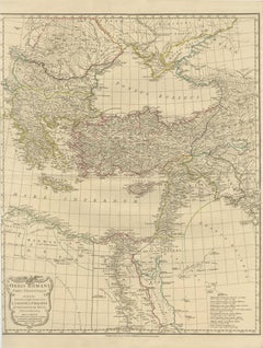
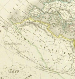
Eastern Roman World Map, Black Sea & Levant, Antique Engraving c.1818
Located in Langweer, NL
Eastern Roman World Map, Black Sea & Levant, Antique Engraving c.1818 Antique engraved map of the
Paper

$229Sale Price|20% Off
Antique World Map before the Voyages of Christopher Columbus, 1880
Located in Langweer, NL
Antique world map titled 'Monde Connu des Anciens'. Antique map of the World and continents before
Paper
$209Sale Price|20% Off
Small Antique World Map in Decorative Old Hand-Colouring, circa 1840
Located in Langweer, NL
Antique map titled 'Wereld Kaart'. Small and very decorative double hemisphere world map. Source
Paper
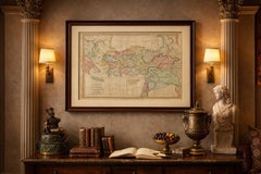
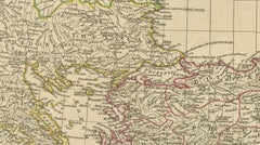
Classical World Map of Greece, Asia Minor & Levant, Wilkinson Atlas 1817
Located in Langweer, NL
Classical World Map Greece Asia Minor & Levant, Wilkinson Atlas 1817 This finely engraved and
Paper
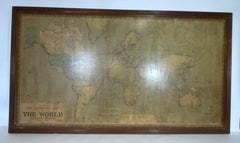
8 Foot Framed World Map by Philips
Located in Norwell, MA
1951 map of the world by George Philip and Son. Large beautiful map as it was in 1951. Nice patina
Paper

$438Sale Price|20% Off
World Map in Two Hemispheres: Eastern & Western - 1802 Tardieu Atlas
Located in Langweer, NL
Revolutionary Calendar) **Geographical Scope:** This antique map illustrates a double-hemisphere world map
Paper

1884 Antique Decorative World Map – Mercator Projection, Victorian Era Print
Located in Langweer, NL
Antique World Map on Mercator’s Projection – Black’s Atlas, 1884 This finely engraved and colored
Paper
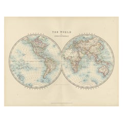
Antique World Map in Hemispheres with Delicate Pastel Coloring, 1903
Located in Langweer, NL
Title: Antique World Map in Hemispheres with Delicate Pastel Coloring, 1903 Description: This
Paper
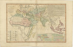
Islamic World Map with Africa, Middle East, India, Indies, Wilkinson 1817
Located in Langweer, NL
Islamic World Map, Africa Middle East India Indies, Wilkinson 1817 This finely engraved and
Paper
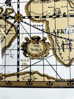
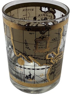
Vintage Cera "Old World Map" Pattern, Companion Serving Tray
Located in Nantucket, MA
Glassware "Old World Map" barware having an image of an antique style world map in tans and gold on a white
Plastic

$875Sale Price|25% Off
Antique World Map with Astronomical Spheres by Pierre Mortier, Amsterdam, c.1700
Located in Langweer, NL
Antique World Map with Astronomical Spheres by Pierre Mortier, Amsterdam, circa 1700 This
Paper
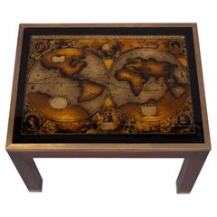
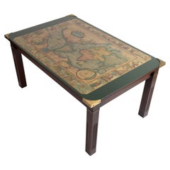
Maison Jansen World Map Coffee Table 1970s France
By Maison Jansen
Located in Den Haag, NL
top a World Map picture and a Glass top. Good condition .
Glass
World Map, Romantic Color Etching by Daniel Derveaux
Located in Long Island City, NY
Daniel Derveaux, French (1914 - 2010) - World Map, Medium: Color Etching, Image Size: 13.5 x 18
Etching
Ancient World Map
Located in Houston, TX
Over 150 year old engraved map of the world as it was known during the antiquities by cartographer
Ink, Watercolor, Handmade Paper
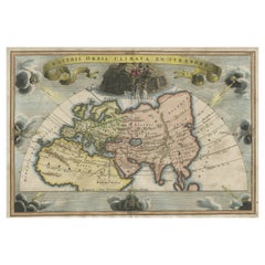
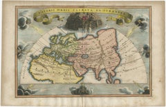
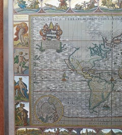
Veteris Orbis Climata – Ancient World Map after Strabo by Cellarius, 1731
Located in Langweer, NL
Veteris Orbis Climata – Ancient World Map after Strabo by Cellarius, 1731 This fascinating hand
Paper
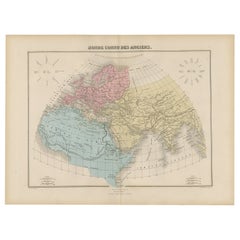
Biblical World Map of the Descendants of Noah — Wilkinson Atlas Classica, 1827
Located in Langweer, NL
Antique Biblical World Map Descendants of Noah Asia Europe Africa Wilkinson 1827 This fascinating
Paper
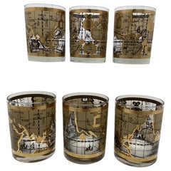
Set of 6 Cera Old World Map Double Rocks Glasses
By Cera
Located in Chapel Hill, NC
Set of 6 Cera Old World Map Double Rocks Glasses. These glasses are larger than rerocks glasses
Glass
Price Upon Request
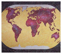
World Map II
Located in New York, NY
Leign Wen’s works reflect her personal and cultural histories. Having grown up on the island of Taiwan, she has a deep affinity for the elemental power of water and the forces of nat...
Oil
Price Upon Request
World Map I
Located in New York, NY
Leign Wen’s works reflect her personal and cultural histories. Having grown up on the island of Taiwan, she has a deep affinity for the elemental power of water and the forces of nat...
Oil
$300Sale Price / set|20% Off
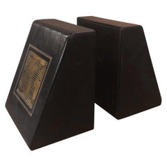
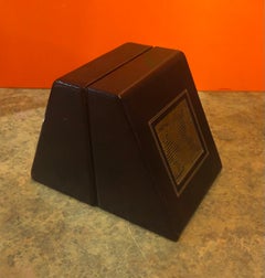
Pair of MCM Leather Wrapped World Map Bookends
Located in San Diego, CA
Classic pair of large leather wrapped bookends with a midcentury brass world map plaque embedded in
Brass
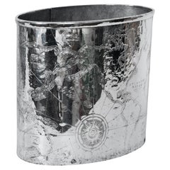

Arthur Amour Hammered Aluminum "Mariners World Map" Wastepaper Basket, 1930s
By Arthur Armour
Located in Bainbridge, NY
Arthur Armour Hammered Aluminum Mariners World Map Trash Can, 1930s. Featuring a smooth hand
Aluminum
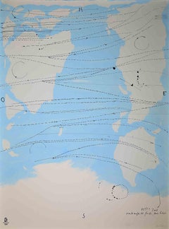
Antique World Map on Mercator's Projection, Ocean Currents and Trade Routes 1903
Located in Langweer, NL
Title: Antique World Map on Mercator's Projection, 1903, Showing Ocean Currents and Trade Routes
Paper

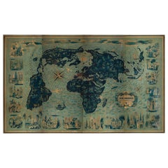
Silver Leaf Foil Wall World Map Engraving Based on the Original Moses Pitt, 1681
Located in West Sussex, Pulborough
We are delighted to offer for sale this lovely antique style pictorial silver leaf foil world map
Silver Leaf

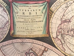
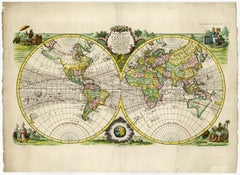
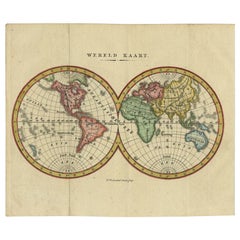
WORLD MAP - Planisphaerium Terrestre Sive Terrarum Orbis... 1696
By Carel Allard
Located in Santa Monica, CA
) Engraving, 20 ½ x 23 ½”, sheet 21 x 24 1/8". A stunning double hemisphere World Map with sphere projections
Engraving
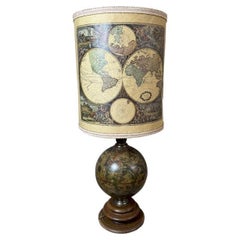
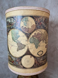
20th century French World map Floor Lamp, 1980s
Located in LEGNY, FR
adventure and history to your décor. The lampshade is adorned with vintage world maps, offering a warm
Wood
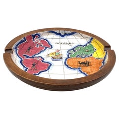
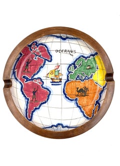
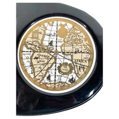
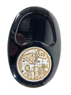
Polychrome Ceramic World Map Catchall / Ashtray, Zaccagnini, Italy, 1940s
By Ugo Zaccagnini
Located in Firenze, IT
Polychrome ceramic world map catchall / ashtray Zaccagnini Italy 1940s Zaccagnini mark under
Ceramic
$421Sale Price|20% Off
Ancient World Map: Europe, Africa & Asia - 1802 Tardieu Atlas
Located in Langweer, NL
Revolutionary Calendar) Geographical Scope: This antique map illustrates the "known world" of the ancients
Paper

$1,811Sale Price|20% Off
Old World Map Featuring Captain Cook's Exploration Routes and Polar Views, 1787
Located in Langweer, NL
1786 World Map with Polar Projections - "Globo Terrestre" by Giovanni Maria Cassini This 1786
Paper
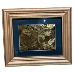
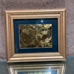
Late 20th Century Gold Foil World Map Double Hemisphere
Located in Chula Vista, CA
Late 20th Century Gold Foil Ancient World Map Double Hemisphere Gold Foil Old World Framed Map
Gold

World Map - Etching by Hubert Nicholas-Jaillot - 1719
Located in Roma, IT
World map is an original modern artwork realized by Hubert Nicholas - Jaillot, printed by Louis
Etching


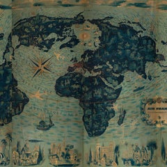
Four Reproduction Vintage Panels of Air France World Map
Located in Los Angeles, CA
Reproduction of beautiful blue and green mid-century Air France world map on four individual panels
Paper, Wood
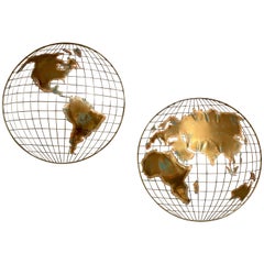
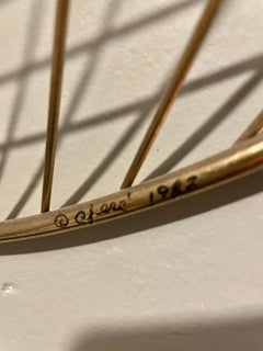
Curtis Jere World Map / Globe Wall Sculpture 'Two Piece'
By Curtis Jeré
Located in North Miami, FL
World Map was designed by American artist duo Curtis Jere. It is signed to base. A finely rendered
Brass
Four Reproduction Vintage Panels of Air France World Map
Located in Los Angeles, CA
Reproduction of a beautiful green and blue mid-century Air France world map on four individual
Wood, Paper
New World Map - Mind
Located in Montreal, Quebec
Lending exhibition, entitled “Maps”. During the 1980’s, Tullio received a Pennsylvania Council on the Arts
Canvas, Glitter, Spray Paint, Acrylic
Sketch for World Map, Conceptual Art Screenprint by Öyvind Fahlström
By Oyvind Fahlstrom
Located in Long Island City, NY
Artist: Oyvind Fahlstrom, Swedish (1928 - 1976) Title: Sketch for World Map from the Peace
Screen
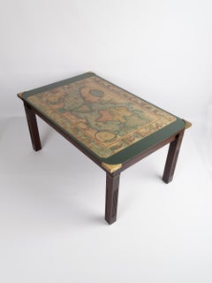
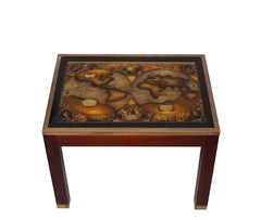
Mid Century 'World Map' Military Campaign Coffee Table, C.1960, France
By Maison Jansen
Located in London, GB
Vintage World Map Military Campaign coffee table France, circa 1960. Verre églomisé map image with
Brass
Vintage Vinyl Clad Cheese Board with Old World Map Ceramic Tile Cutting Surface
Located in Nantucket, MA
mad to compliment the Cera Glassware Old World Map barware pattern, decorated with an antique style
Ceramic, Plastic
Little World Map Rome Peking - Olympic Games Beijing 2008
By Piero Pizzi Cannella
Located in Roma, IT
Little world map Rome Peking, Olympic Games Beijing 2008 is an original litography print realized
Lithograph