Nautical Maps
to
12
50
50
36
29
23
20
16
15
14
13
10
9
7
7
6
5
5
5
4
4
3
3
3
3
2
2
2
2
2
2
2
2
2
1
1
1
1
12
7
6
4
3
Sort By
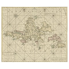
Shetland Islands Sea Chart – Antique Nautical Map by Ottens Brother c.1745
Located in Langweer, NL
Shetland Islands Sea Chart – Antique Nautical Map by Ottens Brothers, c.1740s
This striking
Category
Antique 1740s Dutch Maps
Materials
Paper
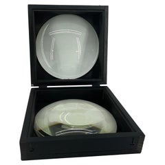
Large European 1930's Nautical Map Reader Magnifying Glass
Located in Haddonfield, NJ
This European set of two nautical magnifying glass map-readers are quite unusual and rarely found
Category
Vintage 1930s German Industrial Nautical Objects
Materials
Metal
$2,000 Sale Price
20% Off
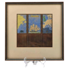
Watercolour Drawing by Kenneth Stevens MacIntire of a Nautical Map
By Kenneth Stevens MacIntire
Located in Norwich, GB
A watercolour drawing of a three-fold screen design, depicting a nautical map of the Atlantic
Category
20th Century American American Classical Paintings
Materials
Paper
$1,210 Sale Price
20% Off
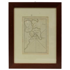
Antique Nautical Portolano of Isle De Poro by Antoine Roux, France, 1844
By Antoine Roux
Located in Milan, IT
Antique portolano, nautical map of Isle De Poro engraved on a copper plate by Antoine Roux
Category
Antique 1840s French Nautical Objects
Materials
Paper
Antique Nautical Portolano of Port St. Antoine by Antoine Roux, France, 1844
By Antoine Roux
Located in Milan, IT
Antique portolano, nautical map of Port St. Antoine engraved on a copper plate by Antoine Roux
Category
Antique 1840s French Nautical Objects
Materials
Paper
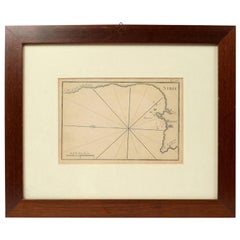
1844 French Antique Nautical print Engraved Portolano of Syrie by Antoine Roux
By Antoine Roux
Located in Milan, IT
Antique portolano, nautical map of Syrie engraved on a copper plate by Antoine Roux, Marseille
Category
Antique 1840s French Nautical Objects
Materials
Paper
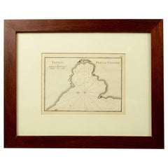
1844 French Nautical Portolano of Port De Chichimé Natolie by Antoine Roux
By Antoine Roux
Located in Milan, IT
Antique portolano, nautical map of Port De Chichimé Natolie engraved on a copper plate by Antoine
Category
Antique 1840s French Nautical Objects
Materials
Paper
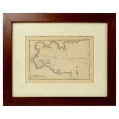
1844 French Antique Nautical Portolano of Golfe De St. Drely by Antoine Roux
By Antoine Roux
Located in Milan, IT
Antique portolano, nautical map of Golfe De St. Drely engraved on a copper plate by Antoine Roux
Category
Antique 1840s French Nautical Objects
Materials
Paper
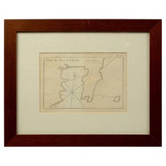
1844 French Antique Nautical Portolan of Plan du Port de Cherfe by Antoine Roux
By Antoine Roux
Located in Milan, IT
Antique portolano, nautical map of Plan du Port de Cherfe engraved on a copper plate by Antoine
Category
Antique 1840s French Nautical Objects
Materials
Paper
Antique Map: Carte du Détroit du Sond with Copenhagen Inset, 1693
Located in Langweer, NL
chart, Zealand and Scania map, 17th-century nautical map, Copenhagen inset map, La Neptune François map
Category
Antique Late 17th Century Maps
Materials
Paper
$2,203 Sale Price
20% Off
Antique 1683 Map of Hispaniola and Puerto Rico in the Caribbean by Mallet
Located in Langweer, NL
- Vintage Caribbean nautical map
- Historical geography of Hispaniola
- Puerto Rico antique map
- Old maps
Category
Antique 1830s Maps
Materials
Paper
$372 Sale Price
20% Off
Nautical Chart of Cape Verde Islands by J.W. Norie, 1824 Coastal Map
Located in Langweer, NL
Nautical Chart of Cape Verde Islands by J.W. Norie, 1824 Coastal Map
This beautifully engraved
Category
Antique Early 19th Century English Maps
Materials
Paper
1901 Nautical Chart Showing Woods Hole, Mass
Located in Norwell, MA
Rare 1901 chart of Woods Hole, Mass., showing Buzzards Bay, Penzance Point, Nonamesset Island, Downtown Woods Hole, Parker Neck, Nobska Head, Vineyard Sound, Woods Hole Golf Club, Ra...
Category
Antique Early 1900s North American Maps
Materials
Paper
Cádiz 1901: Nautical Crossroads of the Atlantic and Mediterranean
Located in Langweer, NL
The map illustrates the province of Cádiz, located in the autonomous community of Andalusia, Spain
Category
Antique Early 1900s Spanish Maps
Materials
Paper
$411 Sale Price
20% Off
Nautical Chart of Skagerrak and Øresund by Johannes van Keulen, 1680
Located in Langweer, NL
, Johannes van Keulen map, 17th-century nautical chart, Skagerrak, Kattegat, Øresund, North Sea to Baltic Sea
Category
Antique Late 17th Century Dutch Maps
Materials
Paper
$940 Sale Price
20% Off
Original Hand-Coloured Nautical Chart of West-Africa, c.1680
Located in Langweer, NL
. Blanco tot C. Verde (...). Amsterdam, Johannus van Keulen, c. 1680.
Large folio coloured map in passe
Category
Antique 17th Century Dutch Maps
Materials
Paper
$1,419 Sale Price
20% Off
Channel Islands Map, Jersey Guernsey Alderney Sark, Bacon London, 1885
Located in Langweer, NL
’ strategic and nautical importance.
Maps from Bacon’s large-scale atlases are increasingly sought after by
Category
Antique Late 19th Century British Maps
Materials
Paper
Hand-colored Nautical Chart: St. George's Channel and the Irish Sea, 1744
Located in Langweer, NL
The map was engraved by Richard William Seale, a notable British engraver. This map is a fine
Category
Antique 1740s Maps
Materials
Paper
$646 Sale Price
20% Off
Original 1882 Map of Arabia, Red Sea & Persian Gulf
Located in Langweer, NL
significant for navigation and commerce. The map includes nautical lines indicating sea depths and shipping
Category
Antique 1880s Maps
Materials
Paper
Map of Avenches Region Switzerland by Mercator, Original 1585 Engraving
Located in Langweer, NL
Mercator projection, a method of mapmaking that became foundational for nautical navigation. His 1585 map
Category
Antique 16th Century Dutch Maps
Materials
Paper
Early French Nautical Chart of the Northern Coast of of Java, Indonesia, C.1850
Located in Langweer, NL
Antique map titled Carte de la côte Nord de Java.
Early French nautical chart of the northern
Category
Antique 1850s Maps
Materials
Paper
$1,126 Sale Price
20% Off
Map of Virgin Islands and Lesser Antilles by Rigobert Bonne, c. 1780
Located in Langweer, NL
. Kitts St. Lucia Tobago Barbados Grenada map, maritime nautical atlas plate
Category
Antique 1780s French Maps
Materials
Paper
1773 Map of Persia, Gujarat & Malabar Coasts – Arabia to India, Hand-Colored
Located in Langweer, NL
atlas, Jacques-Nicolas Bellin map, 18th century nautical chart
Category
Antique 1780s Maps
Materials
Paper
Old Map of the Spice Islands, Moluccas by Bellin, Published in 1771
Located in Langweer, NL
bar in both French and Dutch nautical miles demonstrates the map’s practical use for navigation. The
Category
Antique 1770s French Maps
Materials
Paper
$195 Sale Price
20% Off
1856 U.S. Coast Survey Map of Chesapeake Bay and Delaware Bay
Located in Colorado Springs, CO
Presented is U.S. Coast Survey nautical chart or maritime map of Chesapeake Bay and Delaware Bay
Category
Antique 1850s American Maps
Materials
Paper
Barbados Island at the Height of the Plantation Economy, Circa 1759
Located in Langweer, NL
, as Hydrographer to the King of France, is known for his nautical charts and colonial maps that
Category
Antique 1750s Maps
Materials
Paper
$430 Sale Price
20% Off
Cartographic Elegance: The British Raj's India, 1882 Atlas by Blackie and Son
Located in Langweer, NL
British nautical knowledge.
Both maps display an overlay of longitude and latitude lines, indicative of
Category
Antique 1880s British Maps
Materials
Paper
Map Nautical Glass Flush Mount
Located in Douglas Manor, NY
1428 Nautical glass 3 light flushmount
light red and blue color
Category
Vintage 1970s Flush Mount
Materials
Brass
Metal Nautical Captains Trunk Aluminium & Brass Campaign Style
Located in BUSSUM, NH
. This piece was used to store maps and nautical equipment.
Beautiful patina and brass fittings
Category
Vintage 1950s Coffee and Cocktail Tables
Materials
Aluminum, Brass
Map of the World: An Original 18th Century Hand-colored Map by E. Bowen
Located in Alamo, CA
example of a nautical chart, a type of map that was designed specifically for use by mariners. The map is
Category
Mid-18th Century Old Masters Landscape Prints
Materials
Engraving
A Map Of Western Long Island Sound Showing Yacht Clubs, Aids To Navigation...
Located in Bristol, CT
Classic color map/ nautical chart (by Nolf Klep '39) of the North Shore of Long Island Sound
for
Category
1930s More Prints
Materials
Paper
Mario Ceroli La Rosa dei Venti Table in Pinewood with Inlays by Poltronova 1970s
By Mario Ceroli, Poltronova
Located in Cascina, Pisa
found on a compass, map, nautical chart, or also a monument used to display the orientation of the
Category
Vintage 1970s Italian Mid-Century Modern Tables
Materials
Pine
Kathleen Vance, Newtown Creek Triptych, 2017, Gesso, Ink, Acrylic Paint, Wood
By Kathleen Vance
Located in Darien, CT
, “Newtown Creek” Vance looked to historical maps and nautical charts to find the “prime” of the waterway
Category
2010s Expressionist Landscape Paintings
Materials
Gesso, Ink, Acrylic, Wood Panel
Kathleen Vance, Newtown Creek Waterway, 2017, Found Objects, Acrylic Paint, Wood
By Kathleen Vance
Located in Darien, CT
, “Newtown Creek” Vance looked to historical maps and nautical charts to find the “prime” of the waterway
Category
2010s Conceptual Figurative Sculptures
Materials
Wire
Framed Vintage Nautical Map of Long Island Sound
Located in Houston, TX
Great framed vintage nautical map of Long Island Sound, would look great in a Hamptons Home
Category
20th Century American Maps
Materials
Wood
Framed Vintage Nautical Map of Gardiners Bay Long Island
Located in Houston, TX
Great framed vintage nautical map of Gardiners Bay Long Island, would look great in a Hamptons Home
Category
20th Century American Nautical Objects
RAZZLE DAZZLE, Original, Nautical, War Time, Camflouage, Antique Map, Signed
By Jana Nicole
Located in London, GB
distance. Razzle Dazzle is composed of a vintage nautical map, with hand made wooden boats, painted in a
Category
21st Century and Contemporary Contemporary Mixed Media
Materials
Mixed Media, Handmade Paper
1960s Set of Six Long Island Tidal Current Charts or Maps
Located in Culver City, CA
This set of six charts are aesthetically great and intriguing for their geographic, nautical and
Category
Vintage 1960s American Mid-Century Modern Nautical Objects
Materials
Linen, Paper, Plexiglass, Wood
Carte de la Rade et des Iles d'Hyeres [...].
Located in Zeeland, Noord-Brabant
decorative sea chart / nautical map / maritime map. Map orientation is north.
Engraving on handlaid (verge
Category
Late 18th Century More Prints
Materials
Engraving
No. 28. Carte reduite du Golfe de Gascoigne [...].
Located in Zeeland, Noord-Brabant
Detailed map of the Gulf of Gascoigne / Biscay.) Decorative sea chart / nautical map / maritime map
Category
Late 18th Century More Prints
Materials
Engraving
Carte reduite des Mers du Nord [...].
By Jacques-Nicolas Bellin
Located in Zeeland, Noord-Brabant
sea chart / nautical map / maritime map of the North Atlantic Ocean and other northern seas with the
Category
Mid-18th Century More Prints
Materials
Engraving
Carte reduite des costes d'Espagne et de Portugal [...].
By Jacques-Nicolas Bellin
Located in Zeeland, Noord-Brabant
decorative sea chart / nautical map / maritime map of the region centered on Portugal with parts of N-W Spain
Category
Mid-18th Century More Prints
Materials
Engraving
Carte reduite de Partie de la Mer du Nord comprise entre l'Ecosse, [...].
By Jacques-Nicolas Bellin
Located in Zeeland, Noord-Brabant
decorative sea chart / nautical map / maritime map of the North Sea, also including parts of Ireland, the
Category
Late 18th Century More Prints
Materials
Engraving
No.27. Carte reduite des Passage de l'Iroise du Four et du Raz [...].
By Jacques-Nicolas Bellin
Located in Zeeland, Noord-Brabant
Detailed map of the Iroise, du Four and du Raz Passages. Highly decorative sea chart / nautical map
Category
1760s More Prints
Materials
Engraving
Carte reduite du Golphe de St. Laurent [...].
By Jacques-Nicolas Bellin
Located in Zeeland, Noord-Brabant
...) Highly decorative sea chart / nautical map / maritime map of the Gulf of St. Lawrence including the
Category
Mid-18th Century More Prints
Materials
Engraving
Sea chart of the Southern Atlantic Ocean - Engraving - 18th century
Located in Zeeland, Noord-Brabant
Southern Atlantic Ocean ...) Highly decorative sea chart / nautical map / maritime map of the South
Category
1750s Old Masters More Prints
Materials
Engraving
Highly decorative sea chart of the Pacific Ocean - Engraving - 18th century
By Jacques-Nicolas Bellin
Located in Zeeland, Noord-Brabant
apelees par les Navigateurs Mer du Sud ou Mer Pacifique [...]' - (Detailed map of Oceans between Asia and
Category
1750s Old Masters More Prints
Materials
Engraving
Sea chart of Santa Domingo and its surroundings - Engraving - 18th century
Located in Zeeland, Noord-Brabant
, to serve for the ships of the King.) Highly decorative sea chart / nautical map / maritime map of the
Category
1750s Old Masters More Prints
Materials
Engraving
Sea chart of Gulf of Saint Laurence and Belle Isle - Engraving - 18th century
Located in Zeeland, Noord-Brabant
detailed map of the Gulf of St. Laurence ...) Highly decorative sea chart / nautical map / maritime map of
Category
1750s Old Masters More Prints
Materials
Engraving
Carte generale des costes de l'Europe sur l'ocean [...].
By Alexis Hubert Jaillot
Located in Zeeland, Noord-Brabant
Strait of Gibraltar.) Highly decorative sea chart / nautical map / maritime map of north-western Europe
Category
Late 17th Century More Prints
Materials
Engraving
"Costa Del Sol XII" Multi Colored Target Painting with Luminous Effect
By Michael Hoffman
Located in Baltimore, MD
mixture and carve into before it sets. The geometrical markings bring to mind old nautical maps and
Category
2010s Abstract Abstract Paintings
Materials
Canvas, Oil, Panel
Swedish Nautical Charts of the Stockholm from 1970s
Located in Singapore, SG
Original vintage nautical charts. Aesthetically great and intriguing for their geographic, nautical
Category
Mid-20th Century Swedish Scandinavian Modern Posters
Compass Rose
By Keith Reynolds
Located in Stonington, CT
points on a map, nautical chart, or monument.
Keith L. Reynolds has been actively painting since 1961
Category
21st Century and Contemporary American Realist Landscape Paintings
Materials
Acrylic
Large Nautical Map of New York Entrance, 1870
Located in Haddonfield, NJ
Large rectangular nautical map of the New York Entrance, 1857.
Sandy Hook Bay, Coney Island
Category
Antique 19th Century American Nautical Objects
Nautical Map of the Mediterranean Sea from Le petit Neptune françois, 1763
By G. A. Rizzi-zannoni
Located in Milan, IT
Antique nautical map of the Mediterranean sea from La Spezia to Roussillon, from Le petit Neptune
Category
Antique 1760s French Nautical Objects
Martha's Vineyard to Block Island, Big Tuna - Painting on a Vintage Nautical Map
By Jeff Conroy
Located in Chicago, IL
right corner. This game of cat and mouse is played out on a vintage nautical map of the coast of Rhode
Category
21st Century and Contemporary Contemporary Animal Drawings and Watercolors
Materials
Paper, Watercolor
- 1
Get Updated with New Arrivals
Save "Nautical Maps", and we’ll notify you when there are new listings in this category.
Nautical Maps For Sale on 1stDibs
There is a range of nautical maps for sale on 1stDibs. The range of distinct nautical maps — often made from glass and paper — can elevate any home. There are all kinds of nautical maps available, from those produced as long ago as the 18th Century to those made as recently as the 20th Century. There have been many well-made nautical maps over the years, but those made by G. A. Rizzi-zannoni are often thought to be among the most beautiful.
How Much are Nautical Maps?
The average selling price for at 1stDibs is $1,250, while they’re typically $491 on the low end and $5,669 highest priced.
