Maps
to
4,249
5,434
193
5,632
3
76
35
18
13
6
5
5
4
4
3
1
1
2,929
2,227
476
3
290
34
10
126
9
37
9
2
5
4
3
3
5,545
122
55
34
32
677
326
212
147
132
5,635
5,635
5,635
104
59
28
21
15
Maps For Sale
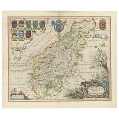
A Gold Highlighted Antique Map of Northamptonshire by Blaeu '1659'
Located in Langweer, NL
Antique map titled 'Comitatus Northantonensis vernacule Northamtonshire'. Original antique map of Northamptonshire, England. This map originates from 'Atlas Universal y Cosmographico...
Category
Mid-17th Century Antique Maps
Materials
Paper
$745 Sale Price
20% Off
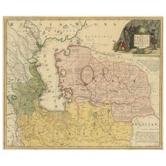
Antique Map of the Caspian Sea, Uzbekistan, Northern Persia Etc, C.1735
Located in Langweer, NL
Antique map titled 'Nova Maris Caspii et Regions Usbeck (..).' Detailed map of Central Asia centered on the Caspian Sea, showing Uzbekistan to the east of ...
Category
18th Century Antique Maps
Materials
Paper
$1,537 Sale Price
20% Off
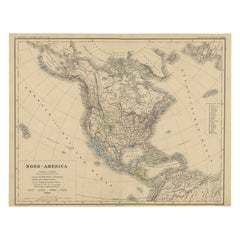
Old Original Antique German Map of North America, ca.1870
Located in Langweer, NL
Antique map titled 'Nord-America'.
Old map of North America. This map originates from 'H. Kiepert's Kleiner Atlas der Neueren Geographie für Schule und Haus'.
Artists and Engrave...
Category
1870s Antique Maps
Materials
Paper
$456 Sale Price
20% Off
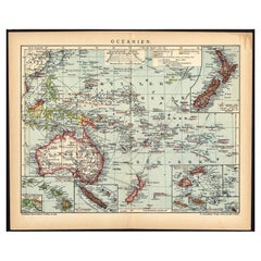
German Antique Map of Oceania, 1895
Located in Langweer, NL
Antique map titled 'Oceanie.' Map of Oceania. This attractive original old antique print / plate / map originates from 1885-1907 editions of a famous German encyclopedia: 'Meyers grosses Konversations-Lexikon.', published in Leipzig and Vienna. Meyers Konversations-Lexikon was a major German encyclopedia that existed in various editions from 1839 until 1984, when it merged with the Brockhaus encyclopedia. Several of the plates were also used in Dutch Encyclopedia's like Winkler Prins...
Category
19th Century Antique Maps
Materials
Paper
$74 Sale Price
20% Off
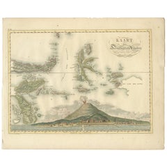
Antique Map of the Ternate Islands by Van den Bosch '1818'
Located in Langweer, NL
Antique map titled 'Kaart der Ternataansche Eilanden'. Rare and attractive map of the Ternate Islands with a large view of Ternate Island. One of 12 maps from 'Atlas van Overzeesche ...
Category
Early 19th Century Antique Maps
Materials
Paper
$1,118 Sale Price
20% Off
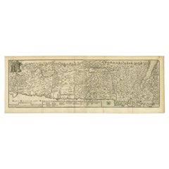
Antique Map of the Holy Land, c.1717
Located in Langweer, NL
Antique map Israel titled 'Tabula Geographica Terrae Sanctae'. Rare edition made after a map of the Holy Land by J. Bonfrerius. The map is oriented ...
Category
18th Century Antique Maps
Materials
Paper
$363 Sale Price
20% Off
Pl. 465 Antique Print of Roof Structures by Bell, c.1810
Located in Langweer, NL
Antique print titled 'Plate CCCCLXIV Roofs'. Old print depicting various roof structures. This print originates from 'Encyclopedia Britannica'. Artists and Engravers: Engraved by A. ...
Category
19th Century Antique Maps
Materials
Paper
$55 Sale Price
20% Off
Rare Detailed Antique Map of Prague and Its North West Environs, ca.1760
Located in Langweer, NL
Description: original antique map of the environs of North West Prague. This map originates from the 'Gentlemans Magazine'. Published circa 1760.
Artists and Engravers: Engraved ...
Category
1760s Antique Maps
Materials
Paper
$419 Sale Price
20% Off
Antique Map of the World by Ferrario '1831'
Located in Langweer, NL
Original antique map of the world. This print originates from 'Costume Antico e Moderno: Palestine, China, India, Oceania' by Ferrario. Publis...
Category
Mid-19th Century Antique Maps
Materials
Paper
$186 Sale Price
20% Off
Roman Balkans: Pannonia, Illyricum, Dacia, Moesia, Thracia, Macedonia and Thyris
Located in Langweer, NL
This original antique map showcases the Roman provinces in the Balkan region and parts of Central and Eastern Europe. The title "PANNONIA, ILLYRICUM DACIA, MOESIA, THRACIA, MACEDONIA...
Category
1880s Antique Maps
Materials
Paper
$344 Sale Price
20% Off
Colorful Detailed Antique Map of The British Islands and `The North Sea, 1882
Located in Langweer, NL
Discover 'The British Islands and The North Sea' Map with Insets of Orkney, Shetland, and Channel Islands! This captivating original antique map offers a detailed view of the British...
Category
1880s Antique Maps
Materials
Paper
$177 Sale Price
20% Off
Antique Map of the Northern Part of Scotland by Black '1854'
Located in Langweer, NL
Antique map titled 'Scotland'. Original map of the northern part of Scotland. With an inset map of the Orkney Isles. This map originates from 'General Atlas Of The World: Containing ...
Category
Mid-19th Century Antique Maps
Materials
Paper
$186 Sale Price
20% Off
Antique Engraved Map of the Friendly Islands or Tonga, ca.1785
Located in Langweer, NL
Antique map titled 'Carte des Isles des Amis'.
Map of the Friendly Islands / Tonga. The Tongan people first encountered Europeans in 1616 when the Dutch vessel Eendracht, captain...
Category
1780s Antique Maps
Materials
Paper
$298 Sale Price
20% Off
Antique Print of the Rialto Bridge in Venice in Italy, 1835
Located in Langweer, NL
Antique print titled 'The Rialto at Venice'. Old print of the Rialto Bridge (or Ponte di Rialto) in Venice, Italy. This print originates from 'One Hundred and Fifty Wood Cuts selecte...
Category
19th Century Antique Maps
Materials
Paper
$111 Sale Price
20% Off
Architectural French Print of Villa a Fontainebleau, Chabat, c.1900
Located in Langweer, NL
Antique print titled 'Villa a Fontainebleau Mr. Brunnarius Architecte'. This print depicts the design of a building in France. Originates from 'La Brique et La Terre Cuite' by P. Cha...
Category
20th Century Maps
Materials
Paper
Large Original Antique Map of The World, Fullarton, C.1870
Located in St Annes, Lancashire
Great map of the World. Showing both hemispheres
From the celebrated Royal Illustrated Atlas
Lithograph. Original color.
Published by Fullarton, Edinburgh, C.1870
Unframed.
Rep...
Category
1870s Scottish Antique Maps
Materials
Paper
Old Prints of Costumes of Hungary, Tyrol, Sweden, Romania, Holland, Etc., Ca1875
Located in Langweer, NL
Antique costume print including many different costumes including costumes of Hungary, Tyrol, Sweden and others.
This print originates from 'Blätter für Kostümkunde. Historische ...
Category
1870s Antique Maps
Materials
Paper
$204 Sale Price
20% Off
Print of a Dutch VOC Fort on the Peninsula Trincomalee, Ceylon (Sri Lanka), 1726
Located in Langweer, NL
Dutch print with the title: Platte Grond van t'Fort Tricoen male met de daar aangelegen Pagoods-Berg (Trincomalee, Sri Lanka)
The map is taken from: 'Oud en Nieuw Oost-Indiën' van...
Category
1720s Antique Maps
Materials
Paper
$251 Sale Price
20% Off
Small Detailed Antique Map of France, with Decorative Title Cartouche, 1754
Located in Langweer, NL
Antique map France titled 'An Accurate Map of France drawn from the best authorities'.
Small, detailed map of France. With decorative title cartouche.
...
Category
1750s Antique Maps
Materials
Paper
$223 Sale Price
20% Off
Map of Sevilla Province, 1901: A Depiction of The Spanish Cultural Heartland
Located in Langweer, NL
The print for sale here depicts a historical map of the province of Sevilla (Seville) from the year 1901. Sevilla is located in the southern part of Spain and is part of the autonomo...
Category
Early 1900s Antique Maps
Materials
Paper
$260 Sale Price
30% Off
Antique Map of South Australia, Victoria, Queensland and New South Wales, c.1860
Located in Langweer, NL
Antique map Australia titled 'South Australia, New South Wales, Victoria & Queensland'. Old map depicting South Australia including New South Wal...
Category
19th Century Antique Maps
Materials
Paper
$316 Sale Price
20% Off
Antique Print of Garden Buildings from Garden Architecture by Van Laar, 1802
Located in Langweer, NL
Untitled print of garden architecture. It shows garden buildings. This print originates from 'Magazijn van tuin-sieraden'. The book is compiled by Gijs...
Category
19th Century Antique Maps
Materials
Paper
Antique Map of Germany by T. Kitchin, circa 1770
Located in Langweer, NL
Antique map titled 'An Accurate Map of Germany (..) '. Drawn from the best Authorities by T.Kitchin Geogr." Rare edition, drawn and etched by Thomas Kitchin, published, circa 1770.
Category
Mid-18th Century Antique Maps
Materials
Paper
$223 Sale Price
20% Off
Antique Map of Denmark with the Danish Royal Crest, c.1730
By Homann Heirs
Located in Langweer, NL
Antique map titled 'Regni Daniae in quo sunt Ducatus Holsatia and Slesuicum Insulae Danicae Jutia, Scania Blekingia (..).' Map of Denmark and islands, part of Sweden and Germany, dra...
Category
18th Century Antique Maps
Materials
Paper
$419 Sale Price
20% Off
Topographical and Infrastructure Map of the Province of Valencia, 1901
Located in Langweer, NL
A historical map of the province of Valencia, dated 1901. The map includes intricate details such as topographical features, with mountain ranges and river systems prominently marked...
Category
Early 1900s Antique Maps
Materials
Paper
$484 Sale Price
20% Off
Antique Map of the Kanton Luzerne 'Switzerland' by Homann Heirs, 1763
Located in Langweer, NL
Antique map titled 'Canton Lucern (..)'. Fine decorative copper plate engraved antique map of the Canton of Lucerne in Central Switzerland with pictorial cartouche in top right corne...
Category
Mid-18th Century Antique Maps
Materials
Paper
$456 Sale Price
20% Off
Antique Map of Denmark with An Inset of Iceland, 1852
Located in Langweer, NL
Antique map titled 'Denemarken'. Map of Denmark, with a small inset map of Iceland. This map originates from 'School-Atlas van alle deelen der Aarde' by Otto Petri...
Category
19th Century Antique Maps
Materials
Paper
$130 Sale Price
20% Off
Antique Map of the Malay Archipelago with Images of Indigenous People, 1851
Located in Langweer, NL
John Tallis & Company, often simply known as Tallis, was renowned for the production of maps and illustrated geographical publications in the mid-19th century. Tallis maps, such as t...
Category
1850s Antique Maps
Materials
Paper
$316 Sale Price
20% Off
Antique Old Map of Africa with Insets of Mauritius, Reunion and Natal, 1882
Located in Langweer, NL
The uploaded image is a historical map of Africa from the 1882 atlas by Blackie & Son. The map includes the entire African continent, with various countries, regions, and topographic...
Category
1880s Antique Maps
Materials
Paper
The Principality of Dombes: A 17th-Century Cartographic Jewel by Jan Jansson
Located in Langweer, NL
The text on the map "La principaute de Dombes; J. van den Eynde sculpit.; La Principavte de Dombes" indicates that it is a map of the principality of Dombes, engraved by J. van den E...
Category
1630s Antique Maps
Materials
Paper
$521 Sale Price
20% Off
Antique Map of the Islands in the Atlantic Ocean including Bermuda & Cape Verde
Located in Langweer, NL
Antique map titled 'Islands in the Atlantic'. Steel engraved map of the islands in the Atlantic Ocean. It shows 16 individual maps on one sheet. Covers the Azores or Western Isles, Faeroe Isles, Madeira Isles, Princes Island, Canary Islands, Fernando Po, Anno Bon, St. Thomas, Bermuda Isles, Trinidade Isles, Fernando Noronha, Cape Verde Isles, Ascension Island, St. Helena, Tristan d'Acunha Isles and the Falkland Isles.
Engraved by J. & C. Walker. Published by George Cox...
Category
Mid-19th Century Antique Maps
Materials
Paper
$270 Sale Price
20% Off
Antique Map of the Rhine centered on Cologne, Germany
Located in Langweer, NL
Antique map titled 'Archiepsiscopatus et Electoratus Coloniensis (..)'. Original antique map of the Rhine river, centered on Cologne, Germany. The Rhine River cuts across this map fr...
Category
Early 18th Century Antique Maps
Materials
Paper
$512 Sale Price
20% Off
Antique Map Featuring Turkey, Persia, India, Egypt & Arabia by James Wyld, 1839
Located in Langweer, NL
The map titled "Map of the countries lying between Turkey & Birmah, comprising Asia Minor, Persia, India, Egypt & Arabia and including the Black, Caspian & Red Seas" is an antique ma...
Category
1830s Antique Maps
Materials
Paper
$354 Sale Price
20% Off
Huelva 1901: A Cartographic Presentation of Andalusia's Atlantic Frontier
Located in Langweer, NL
The map displays the province of Huelva, located in the southwestern part of the autonomous community of Andalusia in Spain, as of the year 1901. It outlines various geographic and m...
Category
Early 1900s Antique Maps
Materials
Paper
$335 Sale Price
20% Off
Antique Map of The United States of North America, 1882
Located in Langweer, NL
This is a historical map titled "The United States of North America, Central Part" from the 1882 Blackie Atlas. It depicts the continental United States with a high level of detail, ...
Category
1880s Antique Maps
Materials
Paper
$232 Sale Price
20% Off
Echoes of Empire: Spanish Territories in West Africa, 1903
Located in Langweer, NL
This is a historical map showing Spanish possessions in West Africa from the year 1903. The map includes the islands of Fernando Póo (now known as Bioko), part of the modern-day country of Equatorial Guinea, Annobón Island, and the Elobey Islands, along with the Spanish-controlled areas on the continental region near Rio Muni.
These territories were part of Spain's colonial empire and are situated in the Gulf of Guinea, off the coast of Central Africa. Fernando Póo (Bioko) is particularly notable for its volcanic origins and as a center of cocoa production during the colonial period. Annobón, lying further southwest of Bioko, is a small volcanic island. The Elobey Islands are very small and located near the coast of Gabon.
Here's a brief overview of their significance:
1. **Bioko Island (Fernando Póo)**: The island has a rich biodiversity and is known for its unique flora and fauna, including several endemic species. Malabo, the capital city of Equatorial Guinea, is located here.
2. **Annobón Island**: This remote island has a small population and is known for its isolation and distinctive Creole culture, which has developed independently from the mainland.
3. **Elobey Islands**: These consist of Elobey Grande and Elobey Chico and are situated near the mouths of the Muni and Campo rivers. They were historically important as transit points in river trade...
Category
Early 1900s Antique Maps
Materials
Paper
$372 Sale Price
20% Off
Antique Map of the Northern Hemisphere, 1782
Located in Langweer, NL
Antique map titled 'Hémisphère Septentrional pour voir plus distinctement les Terres Arctiques (..)'.
Map of the Northern Hemisphere, originall...
Category
1780s Antique Maps
Materials
Paper
$1,397 Sale Price
20% Off
Antique Map of the Area Around Venice in Italy by H. Hondius, circa 1606
By Gerard Mercator, Jodocus Hondius
Located in Langweer, NL
Attractive and early map of the area around Venice, Italy. With South-Tirol in the North, areas of Krain (Slovenia), Croatia, Ferrara, Modena and Piacenza. In the east with areas aro...
Category
Early 17th Century Dutch Antique Maps
Materials
Paper
Antique Map of Asia by Dufour, circa 1834
Located in Langweer, NL
Antique map titled 'Asie par A.H. Dufour'. Uncommon map of Asia. Published by or after A.H. Dufour, circa 1834. Source unknown, to be determined.
Category
Mid-19th Century Antique Maps
Materials
Paper
$186 Sale Price
20% Off
Antique Map of Cities of the Jiangsu Region in China, c.1760
Located in Langweer, NL
Antique map titled 'Plan de l' Enceinte de la Ville de Nan-King ou Kyang-Ning-Fou et plan de la ville de Su-Tcheou-Fou.' A map of the city of Nanking or Nanjing and a second map show...
Category
18th Century Antique Maps
Materials
Paper
$186 Sale Price
20% Off
Mediterranean Encounters: From the Punic Wars to the Hannibalic War, 1880
Located in Langweer, NL
The map, with the title "MARE INTERNUM cum populis adiacentibus a bello Hannibalico usque ad Vespasiani M. princip," depicts the Mediterranean Sea and its surrounding territories, ex...
Category
1880s Antique Maps
Materials
Paper
$344 Sale Price
20% Off
Antique Map of the County of Bentheim by Hondius, c.1630
Located in Langweer, NL
Antique map titled 'Comitatus Bentheimensis nova descriptio'. Engraved map of the County of Bentheim, showing Linge, Enschede, Bad Bentheim, Coevorden, Ne...
Category
17th Century Antique Maps
Materials
Paper
$382 Sale Price
20% Off
Imperium Romanum: A Detailed Map of the Roman Empire in its Zenith, 1880
Located in Langweer, NL
This original antique map, titled "IMPERIVM ROMANVM", is a detailed depiction of the Roman Empire at the height of its power. The main map encompasses the vast expanse of the Roman territories, stretching from the British Isles in the northwest to the deserts of Arabia and the northern fringes of Africa in the southeast.
**Key Features of the Map:**
1. **Territorial Colors**: The map uses different colors to distinguish the various provinces of the Roman Empire. These color-coded areas are to represent the administrative divisions within the Empire.
2. **Topography**: It shows a considerable amount of topographical detail, with mountain ranges, rivers, and bodies of water such as the Mediterranean Sea, prominently displayed.
3. **Cities and Settlements**: Cities are marked, with symbols indicative of their size or importance. Major cities such as Rome, Constantinople, Alexandria, and Carthage are highlighted.
4. **Road Networks**: There appear to be lines connecting various cities and towns, which could represent the famous Roman road network that facilitated trade and military movements.
5. **Latin Text...
Category
1880s Antique Maps
Materials
Paper
$344 Sale Price
20% Off
Antique Plan of the City of Damietta Egypt by C. Niebuhr, 1774
Located in Langweer, NL
Antique print titled 'Grundris der Stadt Damiât'. This print originates from 'Reisebeschreibung nach Arabien und andern umliegenden Ländern' by C. Niebuhr, 1774.
Category
Late 18th Century Antique Maps
Materials
Paper
$167 Sale Price
20% Off
Antique Map of Africa Made after Hondius, circa 1655
Located in Langweer, NL
Antique map titled 'Africa Nova Tabula Auct Jud. Hondio'. Beautiful and rare paneled map of Africa, Based Upon Hondius' map. The first derivative of the map was issued separately by ...
Category
Mid-17th Century Antique Maps
Materials
Paper
$2,795 Sale Price
20% Off
Extremely Rare Map of The land of Eso or Hokkaido in Japan, 1725
Located in Langweer, NL
Plate 46: 'Le Pais d' Eso.' (The land of Eso / Hokkaido in Japan.) Extremely rare in this edition.
This plate originates from the very scarse: 'La Galerie Agreable du Monde (..). T...
Category
18th Century Antique Maps
Materials
Paper
$675 Sale Price
20% Off
Antique Map of Harrison County 'Ohio' by Titus, 1871
Located in Langweer, NL
Antique map titled 'Harrison'. Original antique map of Harrison, Ohio. This map originates from 'Atlas of Preble County Ohio' by C.O. Titus. Published, 1871.
Category
Late 19th Century Antique Maps
Materials
Paper
$232 Sale Price
20% Off
1859 Classic Map of France: Blackie's Imperial Geographic Masterpiece
Located in Langweer, NL
The "Antique Map of France" from 'The Imperial Atlas of Modern Geography', published in 1859 by W. G. Blackie, is a historically valuable cartographic work that offers a comprehensiv...
Category
Mid-19th Century Antique Maps
Materials
Paper
$218 Sale Price
25% Off
Benedictus Goes’ Route – Antique Map of Tartary to China by Van der Aa, 1714
Located in Langweer, NL
Benedictus Goes’ Route – Antique Map of Tartary to China by Van der Aa, 1714
This fascinating antique map titled De Land-Reyse door Benedictus Goes, van Lahor gedaan, door Tartaryen...
Category
Early 18th Century Dutch Antique Maps
Materials
Paper
$503 Sale Price
20% Off
Antique Map of the Gambia River by J. Van Schley, circa 1750
Located in Langweer, NL
"Carte de la Riviere de Gambra ou Gambie. Depuis son Embouchure Jusqu a Eropina". Orig. copper-engraving after Capt. J. Leach's map of the region from 1732. With ornamental title cartouche and Dutch...
Category
Mid-18th Century Antique Maps
Materials
Paper
$340 Sale Price
20% Off
Huesca 1901: A Geographic Overview of Aragon's Northern Frontier in Spain
Located in Langweer, NL
The map provided is of the province of Huesca, located in the northeastern part of Spain, within the autonomous community of Aragon, as of the year 1901. Here are some of the key fea...
Category
Early 1900s Antique Maps
Materials
Paper
$298 Sale Price
20% Off
Antique Plan of the Castle & City of Batavia 'Jakarta' on Java, Indonesia, c1669
Located in Langweer, NL
Antique map Batavia titled 'Ware Affbeeldinge wegens het Casteel ende Stadt Batavia'.
Antique print of the castle and city of Batavia on the Island of Java'. Rare edition with En...
Category
1660s Antique Maps
Materials
Paper
$1,164 Sale Price
20% Off
Antique East Yorkshire Map, English, Framed Lithograph, Cartography, Victorian
Located in Hele, Devon, GB
This is an antique lithography map of East Yorkshire. An English, framed atlas engraving of cartographic interest, dating to the mid 19th century and later.
Superb lithography of t...
Category
Mid-19th Century British Victorian Antique Maps
Materials
Paper
Antique Map of Côte d'Or ‘France’ by V. Levasseur, 1854
Located in Langweer, NL
Antique map titled 'Dépt. de la Côte d'Or'. Map of the French department of Cote D’Or, France. Part of France's Burgundy or Bourgogne wine region, a premier wine-growing region of Fr...
Category
Mid-19th Century Antique Maps
Materials
Paper
$139 Sale Price
20% Off
Original Antique Coloured Map of Western Africa, Published in 1882
Located in Langweer, NL
This is a map of Western Africa from the 1882 Blackie & Son atlas. The map details the West African coast from the Sahara Desert in the north down to the Gulf of Guinea, including a ...
Category
1880s Antique Maps
Materials
Paper
$232 Sale Price
20% Off
Original Antique Map of the American State of Oregon, 1889
Located in St Annes, Lancashire
Great map of Oregon
Drawn and Engraved by W. & A.K. Johnston
Published By A & C Black, Edinburgh.
Original colour
Unframed.
Category
1880s Scottish Victorian Antique Maps
Materials
Paper
Cuenca 1901: A Historical Cartographic Detailing of High Plains and Mountains
Located in Langweer, NL
The original antique map displays the province of Cuenca, located in the autonomous community of Castilla-La Mancha in central Spain, as of 1901. Here are some of its features:
It i...
Category
Early 1900s Antique Maps
Materials
Paper
$270 Sale Price
20% Off
Antique Map of Japan, the Kurile Islands and Liu Kiu Islands, 1886
Located in Langweer, NL
The map is an exquisite piece, showcasing Japan's vibrant geography. Engraved by J. Bartholomew and published by George Philip & Son in London & Liverpool, it presents a detailed and...
Category
Late 19th Century Antique Maps
Materials
Paper
$111 Sale Price
20% Off
Original Antique Map of Palencia Province, in Northern Spain, 1901
Located in Langweer, NL
This historical map is of Palencia, a province in the northern part of Spain.
Palencia is situated within the autonomous community of Castilla y León. It is bordered by the provinc...
Category
Early 1900s Antique Maps
Materials
Paper
$363 Sale Price
20% Off
Antique Ptolemaic Map of Ceylon or nowadays Sri Lanka
Located in Langweer, NL
Antique map titled 'Tab XII. Asiae Taprobanam'. Ptolemaic map of Sri Lanka. Ptolemy drew on the accounts of travelers and sailors and though the information was secondhand and often ...
Category
Mid-18th Century Antique Maps
Materials
Paper
$642 Sale Price
20% Off
Recently Viewed
View AllMore Ways To Browse
Antique Wellington Chests
Antonio Cassi Ramelli
Archimede Seguso Birds
Art Deco Coasters
Art Deco Footballer
Art Deco Music Cabinet
Art Deco Waterfall Bedroom Furniture
Art Deco Waterfall Bedroom
Art Deco Whisky
Art Foulard
Art Nouveau Sunflower
Arts And Crafts Silver Coffee Pot
Asian Pink Bowl
Avesn Vase
Baccarat Carafe
Bakelite Bird
Bakelite Cocktail Picks
Bamboo Ikebana Vase
