18th Century and Earlier Maps
to
2,336
2,867
64
2,934
26
12
1
1
2,934
2,261
475
3
290
34
10
126
10
37
9
2
5
4
3
3
2,920
30
20
3
3
304
110
79
53
50
2,934
2,934
2,934
59
21
13
12
12
Period: 18th Century and Earlier
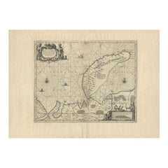
Antique Map of Nova Zembla by Janssonius, c.1650
Located in Langweer, NL
Antique map titled 'Nova Zemla, waygats fretum Nassovi cum et terra Samoiedum singula omnium emendatissime descripta'. This map depicts Nova Zembla and the northern continental coast...
Category
Antique 18th Century and Earlier Maps
Materials
Paper
$377 Sale Price
20% Off
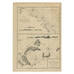
Antique Map of Quinam and the Côn ?ao Islands by Sayer, 1778
Located in Langweer, NL
Antique map titled 'A Chart of a part of the Coast of Cochinchina' and 'Plan of Pulo Condor'. Two maps on one sheet. The upper map shows part of the coast of Cochinchina from Cham Co...
Category
Antique 18th Century and Earlier Maps
Materials
Paper
$313 Sale Price
20% Off
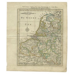
Antique Map of the Netherlands and Belgium by Keizer & De Lat, 1788
Located in Langweer, NL
Antique map titled 'Nouvelle Carte des XVII Provinces du Païs Bas (..)'. Uncommon antique map of Holland and Belgium. This map originates from ...
Category
Antique 18th Century and Earlier Maps
Materials
Paper
$311 Sale Price
20% Off
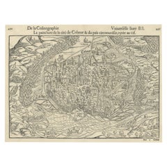
Original Antique Bird's-Eye View of Colmar, Alsace, France, 1552
Located in Langweer, NL
Antique map titled 'La Paincture de la cité de Colmar & du pais circonuoisin'.
Original antique bird's-eye view of Colmar, Alsace, France. This map originates from 'La Cosmograph...
Category
Antique 18th Century and Earlier Maps
Materials
Paper
$627 Sale Price
20% Off
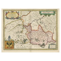
Decorative Antique Map of the Region of Cambrai, France, ca.1630
Located in Langweer, NL
Antique map titled 'l'Archevesche de Cambray'. Decorative map of the region of Cambrai, France. Includes the cities of Cambrai, Valencienes, Douai, and Bouchain.
Artists and Engravers: Henricus...
Category
Antique 18th Century and Earlier Maps
Materials
Paper
$704 Sale Price
20% Off
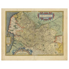
Antique Map of the Artois Region of France by Ortelius, 'circa 1590'
Located in Langweer, NL
Antique map titled 'Artesia'. Original antique map of the Artois region, France. Published by A. Ortelius, circa 1590.
Category
Antique 18th Century and Earlier Maps
Materials
Paper
$570 Sale Price
20% Off
Antique Architectural Print of Cobham Hall in Kent, England, 1717
Located in Langweer, NL
Antique print titled 'The Elevation of Cobham Hall in Kent (..)'.
Elevation of the entrance facade of Cobham Hall, Kent. This print originates from 'Vitruvius Britannicus' by Colen...
Category
Antique 18th Century and Earlier Maps
Materials
Paper
Antique Map of the Region of Oldenburg, Germany
By Willem Blaeu
Located in Langweer, NL
Antique map titled 'Oldenburg Comitatus'. Detailed old map of Oldenburg, Germany. The map also shows Bremen and the Jade Bight. Published by W. Blaeu, circa 1640. Willem Jansz. Blaeu...
Category
Antique 18th Century and Earlier Maps
Materials
Paper
$418 Sale Price
20% Off
Old Map of the East Indonesian Islands Borneo, Celebes, New Guinea, Bali, 1792
Located in Langweer, NL
Antique map titled 'Partie de la Nouvelle Grande Carte des Indes Orientales, contenant les Isles de Borneo, Iava, Celebes, Mindanao (..)'.
Detailed map of the Indonesian islands ...
Category
Antique 18th Century and Earlier Maps
Materials
Paper
$1,189 Sale Price
20% Off
Antique Maps of Manipa, Nusa-Laut, Saparua and Haruku in Maluku, Indonesia 1726
Located in Langweer, NL
Antique map titled 'Caart van het Eyland Manipa, Noessa-Laoet, Honimoa, Oma. Der Manipesen dracht, een Orangkaya van Manipa.' Four maps of islands and two figures in native dress. Th...
Category
Antique 18th Century and Earlier Maps
Materials
Paper
$333 Sale Price
20% Off
Old Antique Print of the City of Groningen, The Netherlands, by Münster, c.1600
Located in Langweer, NL
Antique print titled 'Groeninga'. View of the city of Groningen, the Netherlands. This map originates from 'Cosmographia' published by Münster.
Artists and Engravers: Sebastian Münster...
Category
Antique 18th Century and Earlier Maps
Materials
Paper
$323 Sale Price
20% Off
Old Map of Awatska Bay on the Coast of Kamchatka Peninsula, Russia by Cook, 1784
Located in Langweer, NL
Antique map Awatska titled 'Plan of the Bay of Awatska (..)'. Antique map of Awatska Bay on the east coast of the Russian peninsula of Kamtschatka. Inset plan of St. Peter’s and St. ...
Category
Antique 18th Century and Earlier Maps
Materials
Paper
$171 Sale Price
20% Off
Antique Bible Map of the Middle East by A. Schut, 1743
Located in Langweer, NL
Antique map titled 'De Gelegentheyt van 't Paradys en 't Landt Canaan'. Dutch Bible map covering the region between the Mediterranean and the Persian Gulf, ...
Category
Antique 18th Century and Earlier Maps
Materials
Paper
$523 Sale Price
20% Off
Antique Map of Ambon Island in the Moluccas, Indonesia, c.1760
Located in Langweer, NL
Antique map Ambon titled 'Carte Particuliere de l 'Isle Amboine'. Old map showing Ambon, in the Moluccas Islands, better known as the Spice Islands. Ambon was the headquarters of the...
Category
Antique 18th Century and Earlier Maps
Materials
Paper
$228 Sale Price
20% Off
Decorative Map of the Empire of China, Korea, Japan, Taiwan, Lucon, Macau, 1780
Located in Langweer, NL
Antique map titled 'Carte de L'Empire de la Chine.'
Decorative map of the Empire of China, depicting China, Corea ( Korea ), Japan, Tonquin and the Philippine island Lucon. Source unknown, to be determined.
Artists and Engravers: Rigobert Bonne (1727-1795 ) was one of the most important cartographers of the late 18th century. In 1773 he succeeded Jacques Bellin as Royal Cartographer to France in the office of the Hydrographer at the Depôt de la Marine. Working in his official capacity Bonne compiled some of the most detailed and accurate maps of the period. Bonne's work represents an important step in the evolution of the cartographic ideology away from the decorative work of the 17th and early 18th century towards a more detail oriented and practical aesthetic. With regard to the rendering of terrain Bonne maps...
Category
Antique 18th Century and Earlier Maps
Materials
Paper
$618 Sale Price
20% Off
French Antique Map of France and Western Europe, 1765
Located in Langweer, NL
Antique map titled 'Carte de tous les Lieux, célébres dans l'Histoire (..)'. Beautiful old map of France and western Europe. This map originates from 'Atlas Historique de la France A...
Category
Antique 18th Century and Earlier Maps
Materials
Paper
$159 Sale Price
20% Off
Antique Map of the British Isles and Part of Europe by Chatelain, c.1720
Located in Langweer, NL
Antique map titled 'Carte pour l'Intelligence de l'Histoire d'Angleterre (..)'. Decorative map showing the British Isles and the various regions conquered in Europe. Includese two elaborate family trees for the House of York...
Category
Antique 18th Century and Earlier Maps
Materials
Paper
Antique Map of the Duchy of Saxony by De Wit, c.1680
Located in Langweer, NL
Antique map titled 'Circuli Saxoniae Superior Pars Meridionalis in qua sunt Ducatus Saxoniae, Comitatus Mansfeldiae, et Voitlandiae, Landgraviat Thuringiae, Marchionatus Misniae Prin...
Category
Antique 18th Century and Earlier Maps
Materials
Paper
$685 Sale Price
20% Off
Large German Chart of the Islands of the Philippines with Hand-Colored Borders
Located in Langweer, NL
Original antique map titled 'Karte von dem Canal in den Philippinischen Inseln (..)'. Large detailed chart of the islands of the Philippines. One of the most detailed charts of the Philippines of the era. Shows Islands, bays, reefs, soundings tracks of the Manila Galleon route, etc. Includes a large compass rose and rhumb lines. Originates from a German edition of "Voyage around the World...
Category
Antique 18th Century and Earlier Maps
Materials
Paper
$941 Sale Price
20% Off
Rare Handcolored Map of Isle de Juan Fernandes 'Robinson Crusoe Island', Chili
Located in Langweer, NL
Antique map titled 'Die Insel Iuan Fernandes in der Sudsee (..)'. This map depicts Robinson Crusoe, one of the Juan Fernández Islands.
Robinson Crusoe Island, formerly known as Más a Tierra, is the second largest of the Juan Fernández Islands. From 1704 to 1709, the island was home to the marooned sailor Alexander Selkirk, who at least partially inspired novelist Daniel Defoe's fictional Robinson Crusoe in his 1719 novel, although the novel is explicitly set in the Caribbean.
This was just one of several survival stories from the period of which Defoe would have been aware. To reflect the literary lore associated with the island and attract tourists, the Chilean government renamed the place Robinson Crusoe Island in 1966. This map originates from a German edition of 'Voyage around the World...
Category
Antique 18th Century and Earlier Maps
Materials
Paper
$399 Sale Price
20% Off
Antique Map of Tibet, The Gobi Desert and China by Bellin, circa 1764
Located in Langweer, NL
Antique map titled 'Carte de l'Empire de Hya et Partie de Tangut'. Old map of Tibet, Gobi desert and China depicting the Great Wall of China and caravan routes. Originates from Prevo...
Category
Antique 18th Century and Earlier Maps
Materials
Paper
$228 Sale Price
20% Off
Antique Map of the Duchy of Westphalia, Germany
Located in Langweer, NL
Original antique map titled 'Westphalia Ducatus'. Fine map of the Duchy of Westphalia, Germany. The map is centered on Meschede and includes Arensberg, Beelick, and Brilon. Published...
Category
Antique 18th Century and Earlier Maps
Materials
Paper
$704 Sale Price
20% Off
Charting Eastern Tartary: An 18th-Century Jesuit and English Collaboration, 1757
Located in Langweer, NL
The antique map titled 'Carte de la Tartarie Orientale pour Servir a l'Histoire Generale des Voyages Tiree des Cartes Levees par les P.P. Jesuites' is an original old map that covers...
Category
Antique 18th Century and Earlier Maps
Materials
Paper
$361 Sale Price
20% Off
Rare Antique Engraving of Mount Fuji During an Earthquake in Tokyo, Japan, 1669
Located in Langweer, NL
Antique print, titled: 'Aertbeevinge tot Jedo.' - ('Earthquake in Edo').
A temple falls to ruins because of an earthquake in Yedo (or Edo, Jeddo; now Tokyo). Men and women lament...
Category
Antique 18th Century and Earlier Maps
Materials
Paper
$608 Sale Price
20% Off
Antique Map of the Northeast of England by Mercator 'circa 1620'
Located in Langweer, NL
Antique map titled 'Eboracum Lincolnia, Derbia, Staffordia, Notinghamia, Lecestria, Rutlandia, et Norfolcia'. Decorative early map of the northeast of England, comprising the countie...
Category
Antique 18th Century and Earlier Maps
Materials
Paper
$523 Sale Price
20% Off
Large Antique Lithography Map, Northamptonshire, Framed Cartography, John Speed
Located in Hele, Devon, GB
This is a large antique lithography map of Northamptonshire. An English, framed atlas engraving of cartographic interest by John Speed, dating to the early 17th century and later.
Superb lithography reproduction of Northamtonshire - place names are written in 17th century English
Displays a desirable aged patina and in very good order
Fascinating Jacobean period cartography, set within a quality, later frame
Reproduced here from its appearance in the 'Theatre of Great Britain' of 1627 published by George Humble
Marked for John Speed as cartographer and George Humbell (sic) as seller
Exceptional detail, as expected from a John Speed map...
Category
British Other Antique 18th Century and Earlier Maps
Materials
Glass, Wood, Paper
Original Antique Map of the Road from Marlborough to Huntspil
Located in Langweer, NL
Antique map titled 'The Continuation of the Road from London to Bristol (..)'. A strip map of the continuation of the road from London to Bristol, this particular sheet showing the r...
Category
Antique 18th Century and Earlier Maps
Materials
Paper
$513 Sale Price
20% Off
Antique Map of the Southern Lorraine Region by Mercator, c.1625
Located in Langweer, NL
Antique map titled 'Lotharingiae Ducatus'. Old map of the southern portion of the Lorraine region, France. Lorraine is a cultural and historical region in north-eastern France, now l...
Category
Antique 18th Century and Earlier Maps
Materials
Paper
$275 Sale Price
20% Off
Original Antique Bird's Eye View of Banten or Bantam in Java, Indonesia, 1725
Located in Langweer, NL
Antique print titled 'La Ville de Bantam capitale du Roiaume de meme nom'.
A bird's eye view of the city Banten or Bantam near the western end of Java in Indonesia. Several tall ...
Category
Antique 18th Century and Earlier Maps
Materials
Paper
$685 Sale Price
20% Off
Antique Copper Engraved Map of Germany in the Early 18th Century, c.1740
Located in Langweer, NL
Antique map Germany titled 'Allemagne'.
Rare miniature map of Germany and surroundings. Also depicting the Baltic Sea and the Gulf of Venice. S...
Category
Antique 18th Century and Earlier Maps
Materials
Paper
Fine Engraving of the 2nd Corps de Garde in the Low Countries 'Holland', 1760
Located in Langweer, NL
Title on page (Dutch and French): TWEEDE CORPS DE GARDE van Hollandsche Officiers / Second Corps de Garde d'Officiers Hollandois". Amst., P. Fouquet, 1760.
An interior with several Dutch officers. On the right a man is sitting at a writing table, on the left a man is working on fire from the fireplace, in the middle three gentlemen are looking at a map. Above the chimney a coat of arms and above it a portrait of a man in profile, surrounded by a laurel wreath.
Fine engraved print depicting an officer's mess by J. Houbraken after a painting by C. Troost, with coat of arms engraved in lower margin and dedication to D. Muilman.
Cornelis Troost...
Category
Antique 18th Century and Earlier Maps
Materials
Paper
$428 Sale Price
20% Off
Two Engravings of an Florida King of the Indians in America, 1722
Located in Langweer, NL
Antique print titled 'Ceremonie, observée par un des Rois de la Floride (..)'.
Two images on one sheet.
1. A ceremony that takes place before they set...
Category
Antique 18th Century and Earlier Maps
Materials
Paper
$323 Sale Price
20% Off
Antique Town Plan Map, Poole, English, Framed Cartography, Georgian, Circa 1780
Located in Hele, Devon, GB
This is an antique town plan map of Poole in Dorset. An English, framed atlas engraving, dating to the 18th century and later.
Fascinating cartography with annotated streets and pl...
Category
British George III Antique 18th Century and Earlier Maps
Materials
Glass, Wood, Paper
The Principality of Dombes: A 17th-Century Cartographic Jewel by Jan Jansson
Located in Langweer, NL
The text on the map "La principaute de Dombes; J. van den Eynde sculpit.; La Principavte de Dombes" indicates that it is a map of the principality of Dombes, engraved by J. van den E...
Category
Antique 18th Century and Earlier Maps
Materials
Paper
$532 Sale Price
20% Off
Antique Map of Guyenne, Gascony and Béarn, France
Located in Langweer, NL
Antique map titled 'Guyenne et Gascogne et Bearn'. Original old map of Guyenne (or Guienne), Gascony and Béarn, France. This map originates from 'Le Petit Atlas Maritime Recueil De C...
Category
Antique 18th Century and Earlier Maps
Materials
Paper
$247 Sale Price
20% Off
Antique Plan of the Overground Area of Baths of Emperor Titus, Rome, Italy, 1786
Located in Langweer, NL
Antique print titled 'Plan des Thermes de Titus Partie Superieure'.
Plan of the overground area of the Baths of Titus. The Baths of Titus or Thermae Titi were public baths (Thermae) built in 81 AD at Rome, by Roman emperor Titus...
Category
Antique 18th Century and Earlier Maps
Materials
Paper
$266 Sale Price
20% Off
Print of a Dutch VOC Fort on the Peninsula Trincomalee, Ceylon (Sri Lanka), 1726
Located in Langweer, NL
Dutch print with the title: Platte Grond van t'Fort Tricoen male met de daar aangelegen Pagoods-Berg (Trincomalee, Sri Lanka)
The map is taken from: 'Oud en Nieuw Oost-Indiën' van...
Category
Antique 18th Century and Earlier Maps
Materials
Paper
$256 Sale Price
20% Off
Friesland, Groningen and Overijssel – Rare Woodcut Map by Münster, c. 1550
Located in Langweer, NL
Frisia, Groningen and Overijssel – Rare Woodcut Map by Münster, c. 1550, Germany
This highly decorative 16th-century woodcut map titled “Von dem Teutschen Land: Seelentfrie” was pub...
Category
Antique 18th Century and Earlier Maps
Materials
Paper
Antique French Engraving of Mexico with Lots of Details, c.1780
Located in Langweer, NL
Antique map titled 'Partie Meridionale, de L'Ancien Mexique ou de la Nouvelle Espagne.'
Detailed map of Mexico, the Yucatan and Central America, prepared under the direction of Rigobert Bonne. Shows towns, rivers, mountains, lakes, etc. Detailed map of the region. Source unknown, to be determined.
Artists and Engravers: Rigobert Bonne (1727-1795 ) was one of the most important cartographers of the late 18th century. In 1773 he succeeded Jacques Bellin as Royal Cartographer to France in the office of the Hydrographer at the Depôt de la Marine. Working in his official capacity Bonne compiled some of the most detailed and accurate maps of the period. Bonne's work represents an important step in the evolution of the cartographic ideology away from the decorative work of the 17th and early 18th century towards a more detail oriented and practical aesthetic. With regard to the rendering of terrain Bonne maps...
Category
Antique 18th Century and Earlier Maps
Materials
Paper
$333 Sale Price
20% Off
Antique Map of Kent with Inset Plans of Rochester & Canterbury, England, 1676
Located in Langweer, NL
Antique map titled 'Kent with her Cities and Earles described and observed'.
Map of Kent, England. Includes inset town plans of Rochester and Canterbury....
Category
Antique 18th Century and Earlier Maps
Materials
Paper
$666 Sale Price
20% Off
Antique Print of various Churches on Ceylon or Nowadays Sri Lanka, 1704
Located in Langweer, NL
Antique print titled 'Paneteripou, Manipay, Changane, Vanarpone'. Antique print with four views of the churches of Paneteripoum, Manipay, Changane and Vanarpone (Ceylon/Sri Lanka). This print originates from 'A Collection of Voyages and Travels, some now first printed from original manuscripts'.
Artists and Engravers: Published by Awnsham and John Churchill...
Category
Antique 18th Century and Earlier Maps
Materials
Paper
$209 Sale Price
20% Off
Three Views of Fort James, Van der Schley, c.1760
Located in Langweer, NL
Three views of Fort James. The Dutch subtitles read: a) Grondtekening van ?t eiland St. James, op de Gambra Ao 1732. B) Noord-Oostlyk gezigt van ?t Fort St. James. C) Noord-Noord-Wes...
Category
Antique 18th Century and Earlier Maps
Materials
Paper
$76 Sale Price
20% Off
Antique Map of Ancient Persia, Assyria and surroundings, c.1760
Located in Langweer, NL
Antique map titled 'De XII de Landkaart vertoonende de Landen der Assyrische, Babylonische, Persische, Grieksche en daarna Romeinsche Heerschappy.' Map of ancient Persia...
Category
Antique 18th Century and Earlier Maps
Materials
Paper
$323 Sale Price
20% Off
Print of Makassar 'Ujung Pandang' in the Dutch East Indies 'Indonesia', c.1725
Located in Langweer, NL
Antique print titled 'Macasar, Capitale du Roiaume de même nom'. This rare print shows Makassar, the present capital of South Sulawesi, Indonesia. In the foreground several VOC ships...
Category
Antique 18th Century and Earlier Maps
Materials
Paper
$418 Sale Price
20% Off
Antique Print of Designs for Ebberston Lodge, Yorkshire, United Kingdom, 1725
Located in Langweer, NL
Antique print titled 'The Elevation of Ebberston Lodge (..)'. Designs for Ebberston Lodge, near Scarborough, Yorkshire, England.
This print originates from 'Vitruvius Britannicus' ...
Category
Antique 18th Century and Earlier Maps
Materials
Paper
Original Antique Map of North and South America in Attractive Old Coloring
By Isaak Tirion
Located in Langweer, NL
Antique map titled 'Nieuwe Kaart van America'. Beautiful map of America. The fabled Quivira is used to name a large mountain range placed just north of M...
Category
Antique 18th Century and Earlier Maps
Materials
Paper
$941 Sale Price
20% Off
Pl. 6 Antique Print of Château De Neuilly by Le Rouge, c.1785
Located in Langweer, NL
Antique print titled 'Grande Facade de Neuilly'. Copper engraving showing part of Château de Neuilly. This print originates from 'Jardins Anglo-Chinois à la Mode' by Georg Louis le R...
Category
Antique 18th Century and Earlier Maps
Materials
Paper
Antique Map of the Holy Land by Schut, 1710
Located in Langweer, NL
Antique map of the Holy Land titled 'Het Beloofde Landt Canaan.' Very detailed and decorative map of the Holy Land embellished with sailing ships and com...
Category
Antique 18th Century and Earlier Maps
Materials
Paper
$399 Sale Price
20% Off
Pl. 2 Antique Print of Pavilion Decorations by Le Rouge, c.1785
Located in Langweer, NL
Antique print titled 'Différentes Décorations de Romainville de l'Ordonnance (..)'. Copper engraving showing various pavilion decorations. This print originates from 'Jardins Anglo-C...
Category
Antique 18th Century and Earlier Maps
Materials
Paper
Antique Print of Batavia or nowadays Jakarta, Indonesia, c.1755
Located in Langweer, NL
Antique print titled 'Vue de l'Isle et de la ville de Batavia appartenant aux Hollandois'. Beautiful view of the island and the city of Batavia belonging to the Dutch, for the India ...
Category
Antique 18th Century and Earlier Maps
Materials
Paper
$694 Sale Price
20% Off
Antique Map of Southeast Asia by H. Chatelain, circa 1720
Located in Langweer, NL
Antique map titled 'Le Royaume de Siam aves les Royaumes qui luy sont Tributaires et les Isles de Sumatra Andemaon'. Influential map of Southeast Asia, including modern day Thailand, southern Vietnam, Cambodia, Malaysia, Singapore, Borneo, Sumatra and Java. Chatelain incorporated information provided by the French Jesuits and charts the route of the French Embassy to and from Siam in 1685-1686 through the Straits of Banca and the Gulf of Siam.
With good detail of the Andaman Islands, the Gulf of Thailand (Golfe de Siam) and coastal Vietnam. In the Kingdom of Siam, this map shows the fortress of Bangkok, the ancient Siamese capital of Ayutthaya, royal palace, and the Dutch trading colony. In Cambodia, it details the village of Ponompingn (Phnom Penh...
Category
Antique 18th Century and Earlier Maps
Materials
Paper
$1,379 Sale Price
20% Off
Antique Map of Buckinghamshire in England, 1743
Located in Langweer, NL
Antique map titled 'Buckingham both shyre and shire towne describ'. Map of Buckinghamshire, England. With town plans of Buckingham and Redding. This map originates from Overton's atl...
Category
Antique 18th Century and Earlier Maps
Materials
Paper
$456 Sale Price
20% Off
Print of Garden Pavilions of the Earl of Tilney and Knight Stevenson, c.1785
Located in Langweer, NL
Antique print titled 'Pavillon pour les jardins (..)'. Copper engraving showing the pavilions of the Earl of Tilney and Knight Stevenson.
Earl Tylney, of Castlemaine in the Count...
Category
Antique 18th Century and Earlier Maps
Materials
Paper
$275 Sale Price
20% Off
Copperplate Engraving Showing Forts on the West African Gold Coast, Ghana, 1744
Located in Langweer, NL
Antique print, titled: 'The Fort Fredricksburg formerly to ye Danes and now Fort Royal (…).' - A three panel copperplate engraving showing three forts on the West African Gold Coast, Ghana; a) The Fort Fredricksburgh formerly to ye Danes and now Fort Royal. English at Manfroe, b) The Fort Amsterdam at Cormentyn belonging to ye Hollanders, c) The Fort James, English at Accra. From: "A Collection of Voyages and Travels" published by John and Awnsham Churchill in London in 1744.
Artists and Engravers: Made by 'Johannes Kip' after 'A. Churchill'. Johannes Kip (b Amsterdam, 1653; d London, 1722). Dutch draughtsman, engraver and dealer, active in England. He was a pupil of Bastiaen Stopendaal (1636–1707) from 1668 to 1670. His earliest dated engravings are of 1672 (e.g. the Siege of Groningen , Hollstein, no. 4), and he supplied numerous plates for books published from that date onwards. His work brought him into contact with the court of William of Orange and in 1686 he produced six plates depicting William of Orange, his Wife and Attendants near The Hague (Hollstein, no. 5). Shortly after the Glorious Revolution of 1688 Kip followed the court to England. After settling in Westminster, he worked extensively for London publishers, engraving works after Francis Barlow, Caius Gabriel Cibber (e.g. Interior of the Danish Church in London , 1697; Hollstein, no. 6) and other London-based artists. His engravings were principally destined for book illustrations. The work for which Kip is best remembered is his large corpus...
Category
Antique 18th Century and Earlier Maps
Materials
Paper
$342 Sale Price
20% Off
Antique Map of Borneo (Largely Kalimantan), the Largest Island of Asia, 1726
Located in Langweer, NL
Antique map Indonesia titled 'Kaart van het Eyland Borneo'. Early map of the Island of Borneo. This map originates from 'Oud en Nieuw Oost-Indië...
Category
Antique 18th Century and Earlier Maps
Materials
Paper
$4,043 Sale Price
20% Off
Original Antique Map the Imperial States of the Habsburg Netherlands, 1609
Located in Langweer, NL
Antique map titled 'Belgii inferioris descriptio (..)'.
Old map of the Seventeen Provinces, the Imperial states of the Habsburg Netherlands in the 16th century. They roughly cove...
Category
Antique 18th Century and Earlier Maps
Materials
Paper
$1,189 Sale Price
20% Off
Antique Map of Part of Flanders 'Belgium' by F. de Wit 'circa 1680'
Located in Langweer, NL
Antique map titled 'Marchionatus Sacri Imperii et Dominii Mechelini Tabula'. Large folio size map of the region around Mechelen, Leuven, Brussels, Dendermonde and Antwerp. Published ...
Category
Antique 18th Century and Earlier Maps
Materials
Paper
$547 Sale Price
20% Off
Antique Plan of Underground Area of Baths of Emperor Titus, Rome, Italy, 1786
Located in Langweer, NL
Antique print titled 'Plan des Thermes de Titus Partie Superieure'.
Plan of the underground areas of the Baths of Titus. The Baths of Titus or Thermae Titi were public baths (Thermae) built in 81 AD at Rome, by Roman emperor Titus...
Category
Antique 18th Century and Earlier Maps
Materials
Paper
$228 Sale Price
20% Off
Original Antique Engraving of Sakai in the Osaka Prefecture, Japan, 1669
Located in Langweer, NL
Antique print, titled: 'De Stadt Saccai. La Ville de Saccai.' - ('The City Saccai').
This plate shows a view of Sakai in the Osaka Prefecture, Japan. Sakai has been one of the la...
Category
Antique 18th Century and Earlier Maps
Materials
Paper
$618 Sale Price
20% Off
Nice Antique Map of Asia Minor, Turkey, circa 1718
Located in Langweer, NL
Antique map titled 'Antiquae Asiae Minoris & C. Tabula' by Philippo Talbor. This rare antique map is published by Edward Wells, circa 1718.
Category
Antique 18th Century and Earlier Maps
Materials
Paper
