18th Century Maps
to
1,514
1,846
36
1,884
26
1
1
2,976
2,230
474
3
289
34
9
126
9
36
9
2
5
4
3
2
1,871
19
11
3
1
172
46
44
41
27
1,884
1,884
1,884
24
16
13
12
12
Period: 18th Century
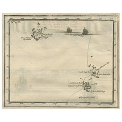
Antique Map of the Banda Islands and the Route of Abel Tasman, Indonesia, 1726
Located in Langweer, NL
Antique print Indonesia with an image on each side. The first image depicts Ontong Java, one of the largest atolls on earth. On verso: antique map of the Banda Islands. With the rout...
Category
Antique 18th Century Maps
Materials
Paper
$398 Sale Price
24% Off
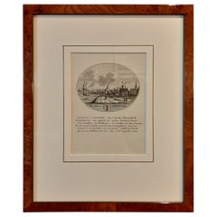
Nicely Framed View on the 'Spaarndammerdijk' in Amsterdam, the Netherlands, 1795
Located in Langweer, NL
Antique print titled 'De Stad Amsteldam'.
View on the 'Spaarndammerdijk' in the city of Amsterdam, the Netherlands. This print originates from 'De...
Category
Antique 18th Century Maps
Materials
Paper
$358 Sale Price
20% Off
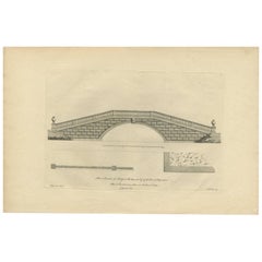
Old Print of a Bridge of Kimpton Hoo in Kimpton, Hertfordshire, England, c.1770
Located in Langweer, NL
Antique print titled 'Plan & Elevation of a Bridge at Thomas Brand's Esqr. of the Hoo in Hertfordshire'.
This is a scheduled Monument in Kimpton, Hertfordshire
PLan and elevat...
Category
Antique 18th Century Maps
Materials
Paper
$433 Sale Price
20% Off
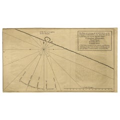
Navigational Chart of Mexico's Coast, with Acapulco and Port Marquis, 1748
Located in Langweer, NL
Antique map titled 'The Form of cruising off Acapulca on the Coast of Mexico in the South Seas in the Year 1742. by His Majesty's Ships, Centurion, Gloucester, Tryall Prize, Carmila ...
Category
Antique 18th Century Maps
Materials
Paper
$132 Sale Price
20% Off
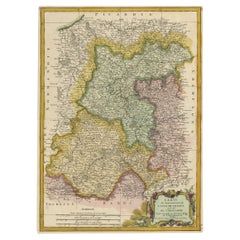
Decorative Rare Map of the French Regions of Isle De France and Orleans, ca.1780
Located in Langweer, NL
Antique map titled 'Carte du Gouvernment de L'Isle de France et de edlui de L'Orleanois (..).'
A fine example of Rigobert Bonne's c. 1780 decorative map of the French regions of ...
Category
Antique 18th Century Maps
Materials
Paper
$650 Sale Price
20% Off
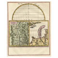
Remarkable Map of the Alsace Region and Nova Zembla, Russia, ca.1700
Located in Langweer, NL
Antique map titled 'Chorographia Alsatiae.'
Map of the Alsace region and Nova Zembla, printed for Scherer's 'Atlas Novus' (1702-1710). Scherer's 'Atlas Novus' forms an important ...
Category
Antique 18th Century Maps
Materials
Paper
$376 Sale Price
34% Off
Curious Map of the Laptev Sea 'Arctic Ocean' and the Mediterranean, ca.1700
Located in Langweer, NL
Antique map, untitled.
Map of the Laptev Sea (Arctic Ocean) and the Mediterranean, printed for Scherer's 'Atlas Novus' (1702-1710). Scherer's 'Atlas Novus' forms an important mil...
Category
Antique 18th Century Maps
Materials
Paper
$443 Sale Price
20% Off
Uncommon and Rare Map of the Caspian Sea by Order of the Czar, 1742
Located in Langweer, NL
Antique map, titled: 'Kaert van de Kaspische Zee volgens bevel van den Czaer (…).'
Uncommon map of Caspian Sea. Source unknown, to be determined.
Ar...
Category
Antique 18th Century Maps
Materials
Paper
$688 Sale Price
20% Off
Interesting Old Map of the Nw Coast of America and the Ne Coast of Asia, ca.1772
Located in Langweer, NL
Antique map titled 'Carte Generale des Decouvertes de l'Amiral de Fonte (..)'.
Original antique map of the discoveries of Admiral de Fonte, showing the possibility of a north-west passage. Interesting map of the NW Coast...
Category
Antique 18th Century Maps
Materials
Paper
$559 Sale Price
35% Off
Small Early 18th Century Map of Banten Bay on the Island Java, Indonesia, c.1725
Located in Langweer, NL
A small early 18th century map of Banten Bay showing the islands of Pulo Dua and Pulo Batto together with soundings within the Bay and profiles of hills on the islands published by C...
Category
Antique 18th Century Maps
Materials
Paper
$207 Sale Price
20% Off
Decorative Hand-Colored Antique Map of Groningen in the Netherlands, ca.1730
Located in Langweer, NL
Antique print, titled: 'Groningae et Omlandiae Dominium vulgo de Provincie van Stadt en Lande (…) ' - This map shows Groningen, the Netherlands. Lower left scale sticks in the decora...
Category
Antique 18th Century Maps
Materials
Paper
$1,179 Sale Price
20% Off
Old Dutch Map of the City of Oran 'Warran', Algeria, 1773
Located in Langweer, NL
Antique print titled 'Ligging der Stad en Haven van Warran of Oran'.
Old map of the city of Oran (Warran), Algeria. Originates from the first Dutch ed...
Category
Antique 18th Century Maps
Materials
Paper
$273 Sale Price
20% Off
Beautiful Original Print of The Creation of the World According to Moses, 1725
Located in Langweer, NL
Antique map, titled: 'De Schepping der Wereldt volgens de Beschryving van Mozes.'
Two separate maps on one sheet showing the creation of the world according to Moses. The upper dep...
Category
Antique 18th Century Maps
Materials
Paper
$924 Sale Price
20% Off
Beautiful Antique Map of the Province of Noord-Holland, the Netherlands, Ca.1730
Located in Langweer, NL
Antique map titled 'Kennemaria et Westfrisia vulgo et vernaculé Noord-Holland'.
Beautiful original antique map of the province of Noord-Holland, the Netherlands. Two large elaborat...
Category
Antique 18th Century Maps
Materials
Paper
$1,368 Sale Price
20% Off
Map of the Circle of Franconia, Germany Bamberg, Wurtzburg and Nuremberg, 1757
Located in Langweer, NL
Antique map titled 'Cercle de Franconie (..)'.
Map of the Circle of Franconia, Germany. Centered on Bamberg, Wurtzburg and Nuremberg. This map originates from 'Atlas Universel (..)'.
Artists and Engravers: Gilles Robert de Vaugondy (1688 - 1766), also known as Le Sieur or Monsieur Robert, and his son, Didier Robert de Vaugondy (c.1723 - 1786), were leading mapmakers in France during the 18th century. In 1757, they published The Atlas Universel, one of the most important atlases of the 18th century. To produce the atlas, the Vaugondys integrated older sources with more modern surveyed maps...
Category
Antique 18th Century Maps
Materials
Paper
$518 Sale Price
20% Off
Antique Plan of Fort Dauphin on Madagascar of the East Coast of Africa, 1756
Located in Langweer, NL
Antique map titled 'Plan du Fort Dauphin (..) -
Grondtekening van 't Fort Dauphin'. Plan of Fort Dauphin on the island of Madagascar of the east coast of Africa. This print origi...
Category
Antique 18th Century Maps
Materials
Paper
$226 Sale Price
20% Off
Old Town View of the Fula Tribe and Its Cotton Plantations, Gambia, Africa, 1748
Located in Langweer, NL
Antique print titled 'Vue d'une Ville des Foulis et de ses Plantations - Gezigt van eene Stad der Fuli, en derzelver Planteryen'. View of a town of the Fula people and its cotton pla...
Category
Antique 18th Century Maps
Materials
Paper
$132 Sale Price
20% Off
Map of Tapi or Tapti River in Central India and Along the Arabian Sea, 1726
Located in Langweer, NL
Description: Antique map titled 'De Rivier van Suratta'.
This chart shows the Tapti or Tapi River in Central India and the Indian coast along the Arabian Sea, into which the rive...
Category
Antique 18th Century Maps
Materials
Paper
$358 Sale Price
20% Off
Antique Map of France under the Reign of Charles VII by Zannoni, 1765
Located in Langweer, NL
Antique map France titled 'La France sous le Règne de Charles VII (..)'.
Beautiful old map of France. This map originates from 'Atlas Historique de la ...
Category
Antique 18th Century Maps
Materials
Paper
$150 Sale Price
20% Off
Shetland Islands Sea Chart – Antique Nautical Map by Ottens Brother c.1745
Located in Langweer, NL
Shetland Islands Sea Chart – Antique Nautical Map by Ottens Brothers, c.1740s
This striking antique nautical chart titled Nieuwe Paskaard van Hitland… presents the Shetland Islands ...
Category
Dutch Antique 18th Century Maps
Materials
Paper
$1,179 Sale Price
20% Off
Antique Map of France in the 5th Century by Zannoni, 1765
Located in Langweer, NL
Antique map France titled 'Etat de la Gaule (..)'.
Beautiful old map of France. This map originates from 'Atlas Historique de la France Ancienne et Moderne' by M. Rizzi Zannoni. ...
Category
Antique 18th Century Maps
Materials
Paper
$150 Sale Price
20% Off
Antique Map of France under the Reign of Philip II by Zannoni, 1765
Located in Langweer, NL
Antique map France titled 'La France sous les Regne de Philippe Auguste (..)'.
Beautiful old map of France. This map originates from 'Atlas Historique de la France Ancienne et Mo...
Category
Antique 18th Century Maps
Materials
Paper
$148 Sale Price
20% Off
Rare Engraved Antique Map of India with Elephants in the Cartouche, c.1725
Located in Langweer, NL
Antique map titled 'L'Inde de ca le Gange suivant les nouvelles observations (..)'.
Detailed map of India, with part of Sri Lanka. Compass rose and decorative cartouche lower rig...
Category
Antique 18th Century Maps
Materials
Paper
$1,273 Sale Price
20% Off
Antique Map of Hungary Incl Surroundings like Croatia, Bosnia, Servia, 1730
Located in Langweer, NL
Antique map titled 'Nieuwe Kaart van t Koninkryk Hongaryen en Zevenbergen na de laatste ontdekkingen'.
This map depicts Hungary including surroundings like Croatia, Bosnia, Servia,...
Category
Antique 18th Century Maps
Materials
Paper
$518 Sale Price
20% Off
Attractive Antique Map of Asia with Borders Hand-Coloured, c.1780
Located in Langweer, NL
Antique map titled 'L'Asie.'
This map shows the Asia continent. Originates from 'Atlas de toutes les parties du Globe Terrestre (..)', published by M. Bonne in Paris, c. 1780.
...
Category
Antique 18th Century Maps
Materials
Paper
$424 Sale Price
20% Off
Rare Map of St. Louis on the Island of Hispaniola 'Santa Domingo', 1748
Located in Langweer, NL
Description: Antique map titled 'A New & Exact Planof the Harbour of Port Louis (..)'.
Scarce early plan of the Harbor of St. Louis on the Island of Hispaniola (Santa Domingo), showing the the harbor at the time it was taken by Admiral Knowles in March 1748. Charles Knowles (1704 – 1777) was an officer of the Royal Navy, who saw service during the War of Jenkins' Ear, the War of the Austrian Succession, and the Seven Years War. He also briefly served with the Imperial Russian Navy...
Category
Antique 18th Century Maps
Materials
Paper
$330 Sale Price
20% Off
Antique Map of France in the 7th Century by Zannoni, 1765
Located in Langweer, NL
Antique map France titled 'La France sous le VIIe Siècle (..)'. Beautiful old map of France. This map originates from 'Atlas Historique de la France Ancienne et Moderne' by M. Rizzi ...
Category
Antique 18th Century Maps
Materials
Paper
$150 Sale Price
20% Off
Antique Frontispiece of a Book about Europe by Tirion, 1734
Located in Langweer, NL
Antique frontispiece of the 6th volume of 'Hedendaagsche historie of tegenwoordige staat van allen volkeren (..)' by Thomas Salmon. This volume describes par...
Category
Antique 18th Century Maps
Materials
Paper
$113 Sale Price
20% Off
Antique Map of South America Depicting Guayana, c.1780
Located in Langweer, NL
Antique map titled 'La Guyane Francopise avec partie de la Guyane Hollandoise: suivant les Operations et les Cartes recentes des Ingenieurs-Geographes Francois'. Antique map of South...
Category
Antique 18th Century Maps
Materials
Paper
$330 Sale Price
20% Off
Rare Authentic Engraved Map of Large Part of Indonesia by Stavorinus, 1779
Located in Langweer, NL
Antique map titled 'Carte de la Navigation de Batavia a Amboina'. Rare chart of Indonesia including Borneo, Java, Celebes, Ceram and more. This map originates from 'Voyage par le Cap...
Category
Antique 18th Century Maps
Materials
Paper
$697 Sale Price
20% Off
Antique Engraving of a Map or Plan of Jerusalem and Surrounding Mountains, 1773
Located in Langweer, NL
Antique map titled 'Platte grond van Jerusalem, en de omliggende Bergen'. Plan of the city of Jerusalem, with surrounding mountains. Originates from the first Dutch editon of an inte...
Category
Antique 18th Century Maps
Materials
Paper
$254 Sale Price
20% Off
Antique Map of Mozambique Channel with Madagascar and Inset of Cape Region, 1780
Located in Langweer, NL
Antique map titled 'Carte du canal de Mosambique, contenant l'Isle de Madagascar avec les Cotes d'Afrique.' Map of Mozambique Channel, containing the Island of Madagascar with the coasts of Africa from Cape of Good Hope to Melinde. The inset map shows the Cape region in South Africa with False Bay, Robben Island etc. Source unknown, to be determined. Artists and Engravers: Rigobert Bonne (1727-1795 ) was one of the most important cartographers of the late 18th century. In 1773 he succeeded Jacques Bellin as Royal Cartographer to France in the office of the Hydrographer at the Depôt de la Marine. Working in his official capacity Bonne compiled some of the most detailed and accurate maps of the period. Bonne's work represents an important step in the evolution of the cartographic ideology away from the decorative work of the 17th and early 18th century towards a more detail oriented and practical aesthetic. With regard to the rendering of terrain Bonne maps...
Category
Antique 18th Century Maps
Materials
Paper
$415 Sale Price
20% Off
Antique Map of Mozambique Bay and a Map Fort de Mozambique, c.1759
Located in Langweer, NL
Two antique maps on one sheet. The upper antique map is titled 'Plan du Fort de Mozambique tiré de Faria' and depicts the island of Mozambique with its fort, settlement, harbor and i...
Category
Antique 18th Century Maps
Materials
Paper
$103 Sale Price
20% Off
Rare Antique Map of Noord-Holland, Province in The Netherlands, c.1750
Located in Langweer, NL
Antique map titled 'Kaart van Noord-Holland'. Map of the province of Noord-Holland, the Netherlands. Published circa 1750. Artists and Engravers: Published by 'de Erven van J. Ratelb...
Category
Antique 18th Century Maps
Materials
Paper
Antique Map of Guadeloupe with Les Saintes, Grand Bourg and La Désirade, c.1780
Located in Langweer, NL
Antique map titled 'Les Isles de la Guadeloupe (..).'
Map of the Caribbean Island of Guadeloupe with the surrounding islands Les Saintes, Grand Bourg and La Désirade. Source unknow...
Category
Antique 18th Century Maps
Materials
Paper
$264 Sale Price
20% Off
Antique Map of Lapland Covering all of Sweden around the Gulf of Bothnia, 1714
Located in Langweer, NL
Antique map titled 'Carte de la Laponie Suedoise (..)'. Includes an inset map of Lapland covering all of Sweden around the Gulf of Bothnia. A series of ...
Category
Antique 18th Century Maps
Materials
Paper
$641 Sale Price
20% Off
French Antique Miniature Map of Germany and Surrounding Countries, 1721
Located in Langweer, NL
Antique map Germany titled 'Allemagne Par N. Sanson le Fils Geographe du Roy'. Minitaure map of Germany and surroundings. Originates from 'Introduc...
Category
Antique 18th Century Maps
Materials
Paper
$84 Sale Price
20% Off
Antique Map of France under the Reign of Charles IX by Zannoni, 1765
Located in Langweer, NL
Antique map France titled 'Tableau du Domaine sous Charles IX (..)'. Beautiful old map of France. This map originates from 'Atlas Historique de la France An...
Category
Antique 18th Century Maps
Materials
Paper
$117 Sale Price
20% Off
French Edition of an Antique Map of Friesland in the Netherlands, 1709
Located in Langweer, NL
Antique map titled 'La Seigneurie d'Ouest-Frise ou Frise Occidentale (..)'. Original antique map of Friesland, published 1709. Artists and Engravers: Alexis-Hubert Jaillot (1632 ? 2 ...
Category
Antique 18th Century Maps
Materials
Paper
$613 Sale Price
20% Off
Antique Map of France under the Reign of Philip VI by Zannoni, 1765
Located in Langweer, NL
Antique map France titled 'Le Dauphine et la Champagne (..)'. Beautiful old map of France. This map originates from 'Atlas Historique de la France Ancienne...
Category
Antique 18th Century Maps
Materials
Paper
$141 Sale Price
20% Off
Antique Map of France under the Reign of St. Louis by Zannoni, 1765
Located in Langweer, NL
Antique map France titled 'Le Domaine de la Couronne (..)'. Beautiful old map of France. This map originates from 'Atlas Historique de la France Ancienne et Moderne' by M. Rizzi Zann...
Category
Antique 18th Century Maps
Materials
Paper
$141 Sale Price
20% Off
Antique Map of France up-to the Peace of Ryswick by Zannoni, 1765
Located in Langweer, NL
Antique map France titled 'Carte pour servir à l'intelligence de l'Histoire de France (..)'. Beautiful old map of France. This map originates from 'Atlas Historique de la France Anci...
Category
Antique 18th Century Maps
Materials
Paper
$141 Sale Price
20% Off
Antique Map of Friesland by Bussemacher in Frame, c.1592
Located in Langweer, NL
Original antique map titled 'Frisiae Antiquissimae (..)'. Original antique map of Friesland. Published by J. Bussemacher, circa 1592. Artists and Engravers: Bussemacher was active as...
Category
Antique 18th Century Maps
Materials
Paper
$707 Sale Price
20% Off
Antique Map of Friesland after the Floods of the 13th Century, 1718
Located in Langweer, NL
Antique map Friesland titled 'Pars II et III Frisiae Libera(..)'. Old map of Friesland, the Netherlands, after the floods of the 13th century. Originates from 'Uitbeelding van de Hee...
Category
Antique 18th Century Maps
Materials
Paper
$330 Sale Price
20% Off
Antique Map of Friesland by Von Reilly, 1791
Located in Langweer, NL
Antique map titled 'Friesland'. Map of the province of Friesland, the Netherlands. This map orginates from 'Schauplatz der fünf Theile der Welt'. Artists and Engravers: Franz Joseph ...
Category
Antique 18th Century Maps
Materials
Paper
$183 Sale Price
20% Off
Antique Map of Friesland in the Time of the Franks, 1718
Located in Langweer, NL
Antique map Friesland titled 'Descriptio Frisiae sub Francorum reditum (..)'. Old map of Friesland, the Netherlands, in the time of the Franks. Originates from 'Uitbeelding van de He...
Category
Antique 18th Century Maps
Materials
Paper
$240 Sale Price
20% Off
Antique Map of Asia with Misshaped Coastlines and Distorted Islands c.1760
Located in Langweer, NL
Antique map titled 'L’Asie la feuille exc'. Old map of Asia. The map contains several misshaped coastlines and distorted islands with a small cartouche held by an elephant in the top...
Category
Antique 18th Century Maps
Materials
Paper
$131 Sale Price
20% Off
Antique Map of Anjouan or Ndzuani, Island of The Comoros, 1748
Located in Langweer, NL
Antique map titled ‘Carte de L’Isle D’Anjouan’. Original antique map of Anjouan, also known as Ndzuwani or Nzwani, or, historically, as Johanna, an autonomous island in the Indian Oc...
Category
Antique 18th Century Maps
Materials
Paper
$216 Sale Price
20% Off
Antique Map of Asia Showing all of Indonesia and the Marianas, 1790
Located in Langweer, NL
Antique map titled 'L'Asie dressee pour l'etude de la Geographie (..)'. Attractive map of Asia with an ornate cartouche and ships surrounding the coast. Extends to an incomplete New ...
Category
Antique 18th Century Maps
Materials
Paper
$204 Sale Price
20% Off
Antique Map of Ambon with Inset of the Victoria Castle, Moluku, Indonesia, 1726
Located in Langweer, NL
Antique map titled 'Caart van het Eyland Ambonia in het bijsonder. ' This is a print of an antique map of the Islands Ambon and Timor, one of the Moluccan Islands, Indonesia, with an...
Category
Antique 18th Century Maps
Materials
Paper
$248 Sale Price
20% Off
Antique Map of a Bay Nearby Makassar, Celebes 'Sulawesi)' by Hawkesworth, 1774
Located in Langweer, NL
Antique map titled 'Vue de la Baye de Bonthain (..)'. Map of the island Sulawesi (Celebes), Indonesia that Philip Carteret rested his crew and made repairs to his ship the Swallow fo...
Category
Antique 18th Century Maps
Materials
Paper
$108 Sale Price
20% Off
Antique Frontispiece of Book about The Turkish Empire in Asia and Africa, 1733
Located in Langweer, NL
Antique frontispiece of the 5th volume of 'Hedendaagsche historie of tegenwoordige staat van allen volkeren (..)' by Thomas Salmon. This volume describes the...
Category
Antique 18th Century Maps
Materials
Paper
$127 Sale Price
20% Off
Antique Map of Asia by Guthrie, 1787
Located in Langweer, NL
Antique map titled 'Asia from the best Authorities'. Old map of the Asian continent. This map originates from 'A New Geographical, Historical and Commercial Grammar; and Present State of the several Kingdoms of the World' 10th ed. by W. Guthrie.
Artists and Engravers: Published by Ch.Dilly; GGJ...
Category
Antique 18th Century Maps
Materials
Paper
$136 Sale Price
20% Off
Antique Map of Asia with Northern Portion of Australia “Hollandia Nova", 1727
Located in Langweer, NL
Antique map titled 'Exactissima Asiae Delineatio in praecipuas regiones Caeterasq Partes.' Original antique map of the continent of Asia with a northern portion of Australia “Holland...
Category
Antique 18th Century Maps
Materials
Paper
$1,556 Sale Price
20% Off
Antique Map of France After the Peace of Ryswick by Zannoni, 1765
Located in Langweer, NL
Antique map France titled 'Etat du Domaine apès le Traité de Ryswick (..)'. Beautiful old map of France. This map originates from 'Atlas Historique de la France Ancienne et Moderne' ...
Category
Antique 18th Century Maps
Materials
Paper
$139 Sale Price
20% Off
Large Antique Map of Denmark by Bowles, c.1780
By Thomas
Located in Langweer, NL
Antique map titled 'Bowles's new pocket map of the Kingdom of Denmark (..)' Large map of Denmark. Source unknown, to be determined.
Artists and Engravers: Made by 'Thomas & Carington Bowles' after 'J. Palairet'. Thomas Bowles, born around 1712, was map publisher and seller in London...
Category
Antique 18th Century Maps
Materials
Paper
$281 Sale Price
20% Off
Antique Map of Eastern Tartary and the Gobi Desert by Van Schley, 1758
Located in Langweer, NL
Antique map titled 'Carte de la Tartarie occidentale.' Original antique map of Eastern Tartary and the Gobi desert showing the silk road and the Great Wall of China. While these maps...
Category
Antique 18th Century Maps
Materials
Paper
$330 Sale Price
20% Off
Antique Map of Eastern Siberia Extending to Kamtchatka, Russia, 1764
Located in Langweer, NL
Antique map titled 'Suite De La Carte De La Siberie Et le Pays de Kamtchatka'. Detailed map the Eastern portion of Siberia, extending to Kamtchatka. Shows the Russian voyage of 1648 in the NE Passage region. Includes a decorative title cartouche. Originates from Prevost d'Exiles influential travel book, 'L'Histoire Generale des Voyages'.
Artists and Engravers: Jacques-Nicolas Bellin (1703-1772) was among the most important mapmakers of the eighteenth century. In 1721, at age 18, he was appointed hydrographer (chief cartographer) to the French Navy. In August 1741, he became the first Ingénieur de la Marine of the Depot des cartes...
Category
Antique 18th Century Maps
Materials
Paper
$207 Sale Price
20% Off
Antique Map Showing Estates of 1669 in Amsterdam, Published in c.1767
Located in Langweer, NL
Antique map titled 'Kaart der landeryen, gelegen aan of onder de honderd gaarden, zo in de Buitenvelder- als Stads-polder; van welken de gestreepten, voor 't geregt van Nieuwer-Amste...
Category
Antique 18th Century Maps
Materials
Paper
$424 Sale Price
20% Off
Antique Map of Gallia and Germania on one Sheet, c.1703
Located in Langweer, NL
Antique map depicting France (Gallia) and Germany (Germania). Printed for Scherer's 'Atlas Novus' (1702-1710).
Artists and Engravers: Heinrich Scherer (1628-1704) was a Professor o...
Category
German Antique 18th Century Maps
Materials
Paper
$226 Sale Price
20% Off
