19th Century Maps
to
1,669
2,188
70
2,261
72
9
5
4
2
2
1
1
2,934
2,261
475
3
290
34
10
126
10
37
9
2
5
4
3
3
2,223
66
28
12
10
335
174
106
101
97
2,261
2,261
2,261
104
23
9
8
7
Period: 19th Century
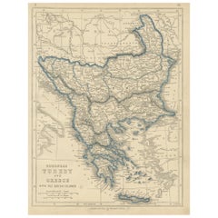
Antique Map of European Turkey and Greece by Lowry '1852'
Located in Langweer, NL
Antique map titled 'European Turkey and Greece with the Ionian Islands'. Original map of European Turkey and Greece. This map originates from 'Lowry's table Atlas constructed and eng...
Category
Antique 19th Century Maps
Materials
Paper
$95 Sale Price
20% Off
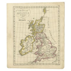
Antique Map of the United Kingdom and Ireland, circa 1825
Located in Langweer, NL
Antique map titled 'Insula Britannicae'. Old map of the United Kingdom and Ireland originating from 'Atlas der Oude Wereld'.
Artists and Engravers: Published by C. Ph. Funke and W. v...
Category
Antique 19th Century Maps
Materials
Paper
$133 Sale Price
20% Off
The Hudson, by Wallace Bruce, 1st Ed
Located in valatie, NY
The Hudson by Wallace Bruce. New York: Bryant Literary Union, 1894. 1st Ed hardcover. Illustrated by Alfred Fredericks. Alfred Frederick's photo-engravings ...
Category
American Antique 19th Century Maps
Materials
Paper
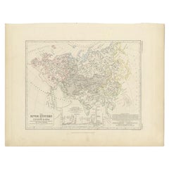
Antique Map of the River Systems of Europe and Asia by Johnston, c.1850
Located in Langweer, NL
Antique map titled 'The River Systems of Europe & Asia'. Old map depicting the river systems of Europe and Asia showing the boundaries & comparative extent of the river basins, and t...
Category
Antique 19th Century Maps
Materials
Paper
$103 Sale Price
20% Off
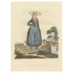
Old Costume Print of a Peasant of Upper Carniola, Slovenia, Eastern Europe, 1804
Located in Langweer, NL
Old print of a peasant of upper Carniola, Slovenia.
This print originates from 'The Costume of the Hereditary States of the House of Austria' by William Miller.
Artists and Engravers: Engraved by William Ellis.
Category
Antique 19th Century Maps
Materials
Paper
$266 Sale Price
20% Off
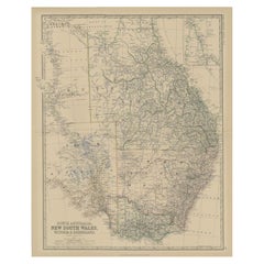
Antique Map of South Australia by Johnston, 1882
Located in Langweer, NL
Antique map titled 'South Australia, New South Wales, Victoria & Queensland'. Old map of Southern Australia, with an inset map of Cape York Peninsula. This map originates from 'The R...
Category
Antique 19th Century Maps
Materials
Paper
$114 Sale Price
20% Off
Antique Map of Venezuela, New Granada, Ecuador and Peru by a & C. Black, 1870
Located in Langweer, NL
Antique map titled 'Venezuela, New Granada, Ecuador and Peru & c'. Original antique map of Venezuela, New Granada, Ecuador and Peru & c. This map originates from ‘Black's General Atl...
Category
Antique 19th Century Maps
Materials
Paper
$166 Sale Price
20% Off
Antique Map of South America by Walker, 1816
Located in Langweer, NL
Antique map titled 'South America'. Old map of South America. This map originates from 'Walker's Universal Atlas'. Artists and Engravers: Printed by Barnard and Farley.
Artist: Pr...
Category
Antique 19th Century Maps
Materials
Paper
$104 Sale Price
20% Off
Antique Copper Engraving of Folding Plan of London, Published in 1804
Located in Langweer, NL
This rare map comes originally from the publication: Modern London: Being the History and Present State of the British Metropolis.
It was published in London and Printed for Richard...
Category
Antique 19th Century Maps
Materials
Paper
$713 Sale Price
20% Off
Antique Map of the Asian Continent by Levasseur, '1875'
Located in Langweer, NL
Antique map titled 'Carte générale de l'Asie'. Large map of the Asian Continent. This map originates from 'Atlas de Géographie Moderne Physique et Politique' by A. Levasseur. Publish...
Category
Antique 19th Century Maps
Materials
Paper
$416 Sale Price
30% Off
Ancient Iberia: Hispania Map from Spruner-Menke Atlas Antiquus, 1880
Located in Langweer, NL
This map is titled "HISPANIA," indicating it is a historical map of ancient Spain.
It is an original antique map from the "Spruner-Menke Atlas Antiquus," a 19th-century historical a...
Category
Antique 19th Century Maps
Materials
Paper
$352 Sale Price
20% Off
Antique Chart of the US Predominating Sex, 1874
Located in Langweer, NL
Antique chart titled 'Map of predominating sex showing the local excess of males or of females in the distribution of population over the territory of th...
Category
Antique 19th Century Maps
Materials
Paper
$475 Sale Price
20% Off
Antique County Map, Oxfordshire, English, Framed Cartography Interest, Victorian
Located in Hele, Devon, GB
This is an antique lithography map of Oxfordshire. An English, framed atlas engraving of cartographic interest, dating to the mid 19th century and later.
Superb lithography of Oxfo...
Category
British Mid-Century Modern Antique 19th Century Maps
Materials
Wood
Detailed Antique Map of Jamaica - Published in Weimar, 1825
Located in Langweer, NL
This map of Jamaica is an interesting historical document.
This map is part of an atlas that was issued in six editions in English, French, and German ...
Category
Antique 19th Century Maps
Materials
Paper
$513 Sale Price
20% Off
Antique Map of Asia Minor by Malte-Brun, 1847
Located in Langweer, NL
Antique map titled 'Asie Mineure Ancienne'. This is an original antique map of Asia Minor from Malte Brun's "" Atlas de Géographie Universelle"", revised by...
Category
Antique 19th Century Maps
Materials
Paper
$76 Sale Price
20% Off
Rare Fish Print of the Norway Redfish 'Sebastes Viviparus' and the Sculpin, 1842
Located in Langweer, NL
Antique print, titled: 'Poissons Plate 9 - La Sebaste du Nord (Sebastes septentrionalis) - Le Cotte Scorpion (Cottus scorpius).' - This rare plate shows the Norway redfish (Sebastes ...
Category
Antique 19th Century Maps
Materials
Paper
$723 Sale Price
20% Off
Antique Map of the Swabia Region of Germany by Cary, '1811'
By John Cary
Located in Langweer, NL
Antique map titled 'A New Map of the Circle of Swabia'. Antique map of Swabia in Southwestern Germany. Covers from the Upper Rhine region south as far as Switzerland, Lake Constance ...
Category
Antique 19th Century Maps
Materials
Paper
$237 Sale Price
20% Off
Antique Map of Finistère ‘France’ by V. Levasseur, 1854
Located in Langweer, NL
Antique map titled 'Dépt. du Finistère'. Map of the French department of Finistère, Brittany, France. This area of France is known for its cider production and excellent boar hunting...
Category
Antique 19th Century Maps
Materials
Paper
$171 Sale Price
20% Off
Large Original Antique Map of The World, Fullarton, C.1870
Located in St Annes, Lancashire
Great map of the World. Showing both hemispheres
From the celebrated Royal Illustrated Atlas
Lithograph. Original color.
Published by Fullarton, Edinburgh, C.1870
Unframed.
Rep...
Category
Scottish Antique 19th Century Maps
Materials
Paper
Antique Map of Sweden and Norway by Lowry, '1852'
Located in Langweer, NL
Antique map titled 'Sweden and Norway'. Two individual sheets of Sweden and Norway. This map originates from 'Lowry's Table Atlas constructed and engraved from the most recent Author...
Category
Antique 19th Century Maps
Materials
Paper
$190 Sale Price / set
20% Off
Antique Map of Eaton 'Ohio' by Titus, 1871
Located in Langweer, NL
Antique map titled 'Eaton'. Original antique map of Eaton, Ohio. This map originates from 'Atlas of Preble County Ohio' by C.O. Titus. Published 1871.
Category
Antique 19th Century Maps
Materials
Paper
$380 Sale Price
20% Off
Roman Italy and Provinces: A Cartographic Snapshot, 1880
Located in Langweer, NL
The map titled "ITALIA, Gallia Cisalpina, Sicilia, Sardinia, Corsica" focuses on Italy and its surrounding regions during Roman times. It offers a detailed depiction of the Italian peninsula, the Po Valley (Gallia Cisalpina), and the islands of Sicily, Sardinia, and Corsica.
Produced as part of the "Spruner-Menke Atlas Antiquus" by Karl Spruner von Merz and edited by Theodorus Menke, this map reflects the 19th-century European scholarship on ancient geography and history.
The period represented is likely during the Roman Republic or early Roman Empire, suggested by the level of detail in regions like Latium and Campania, which were central to Roman culture and power. This era was marked by Roman expansion and consolidation of the Italian peninsula, as well as the Punic Wars, which led to Roman dominance over the Mediterranean.
What makes this map interesting is its:
1. **Rich Detail**: The map delineates the intricate network of Roman roads, cities, and colonies, showing the infrastructure that facilitated Roman administration and control.
2. **Strategic Locations**: It identifies strategic locations like harbors and passes, crucial for trade and military campaigns.
3. **Geographic Accuracy**: It reflects the geographical knowledge of the time, with an accurate representation of the topography that shaped the development of these regions.
4. **Cultural and Historical Sites**: Insets of important sites like Syracuse offer a closer look at places of historical significance.
5. **Educational Purpose**: The map was designed to aid in the study of Roman history, providing a visual tool for understanding the ancient world...
Category
Antique 19th Century Maps
Materials
Paper
$352 Sale Price
20% Off
Antique Map of Sweden and Norway by Johnston, 1882
Located in Langweer, NL
Antique map titled 'Sweden & Norway (Scandinavia)'. Old map of Sweden and Norway, with inset map of Stockholm. This map originates from 'The Royal Atlas ...
Category
Antique 19th Century Maps
Materials
Paper
$128 Sale Price
20% Off
Antique Engraving of the Islands Wanooa, Wateeoo, Mangeea, Toobouai, Cook, 1803
Located in Langweer, NL
Antique map South Pacific Islands, Polynesia. Originates from 'Reizen Rondom de Waereld door James Cook (..)'.
Artists and Engravers: Translated by J.D. Pasteur. Published by Hon...
Category
Antique 19th Century Maps
Materials
Paper
$266 Sale Price
20% Off
Antique Map of Germany with the Empire of Austria by Wyld '1845'
Located in Langweer, NL
Antique map titled 'The Confederated States of Germany with the Empire of Austria, and The Kingdoms of Prussia and Poland'. Original antique map of ...
Category
Antique 19th Century Maps
Materials
Paper
$285 Sale Price
20% Off
Original Hand-Colored Antique County Map of Durham, England, 1804
Located in Langweer, NL
Antique county map of Durham first published c.1800. Villages, towns, and cities illustrated include Gateshead, South Shields, and Darlington.
C...
Category
Antique 19th Century Maps
Materials
Paper
$309 Sale Price
20% Off
1849 Map of "Europaische Russland", 'Meyer Map of European Russia', Ric. R017
Located in Norton, MA
1849 Map of
"Europaische Russland"
( Meyer Map of European Russia)
Ric.r017
A lovely map of European Russia dating to 1849 by Joseph Meyer. It covers the European portions of...
Category
Unknown Antique 19th Century Maps
Materials
Paper
Decorative Dutch Antique Map of North and South America, 1841
Located in Langweer, NL
Description: Antique map titled 'Amerika'. Small map of North and South America.
This map originates from the Dutch publication 'De Aarde, beschouwd in haren Natuurlijken Toestan...
Category
Antique 19th Century Maps
Materials
Paper
$333 Sale Price
20% Off
Antique Map of Noord-Holland and the Island Texel in The Netherlands, c.1870
Located in Langweer, NL
Antique map titled 'De Provincie Noord-Holland'. Map of the province of Noord-Holland, the Netherlands. This map originates from 'F. C. Brugsma's Atlas van het Koninkrijk der Nederla...
Category
Antique 19th Century Maps
Materials
Paper
$133 Sale Price
20% Off
Set of 4 Antique Maps of part of the United States of America
Located in Langweer, NL
Set of four individual antique maps of part of the United States. Published as part of a set of six individual maps.
These maps originate from Stielers Handatlas, published circa 1...
Category
Antique 19th Century Maps
Materials
Paper
$711 Sale Price / set
35% Off
Original Antique Map of Switzerland, 1882
Located in Langweer, NL
Embark on a historical journey with an original Antique Map of Switzerland from the renowned 'Comprehensive Atlas and Geography of the World...
Category
Antique 19th Century Maps
Materials
Paper
$218 Sale Price
20% Off
Original Antique Map of the American State of Oregon, 1889
Located in St Annes, Lancashire
Great map of Oregon
Drawn and Engraved by W. & A.K. Johnston
Published By A & C Black, Edinburgh.
Original colour
Unframed.
Category
Scottish Victorian Antique 19th Century Maps
Materials
Paper
Antique West Yorkshire Map, English, Framed Lithography, Cartography, Victorian
Located in Hele, Devon, GB
This is an antique lithography map of West Yorkshire. An English, framed atlas engraving of cartographic interest, dating to the mid 19th century and later.
Superb lithography of t...
Category
British Victorian Antique 19th Century Maps
Materials
Paper
Map of Northern European Russia: Early 19th Century - 1802 Tardieu Atlas
Located in Langweer, NL
Title: Russie Européenne: Partie Septentrionale. Deuxieme Carte.
**Publication Details:**
- **Atlas Title:** Nouvel Atlas Universel de Géographie Ancienne et Moderne
- **Purpose:**...
Category
Antique 19th Century Maps
Materials
Paper
$456 Sale Price
20% Off
Antique Map of Spain and Portugal, with Frame Style Border
Located in Langweer, NL
Antique map titled 'Espagne et Portugal'. Attractive map of Spain and Portugal. The map covers all of Spain and Portugal from France to the Mediterranean Sea and includes the Baleari...
Category
Antique 19th Century Maps
Materials
Paper
$114 Sale Price
20% Off
Antique Map of Vienne 'France' by V. Levasseur, 1854
Located in Langweer, NL
Antique map titled 'Dépt. de la Vienne'. Decorative antique map of the French Department of Vienne, with its capital of Poitiers and small engraved vignette of the battle of Poitiers...
Category
Antique 19th Century Maps
Materials
Paper
$171 Sale Price
20% Off
Antique Map of Germany by Lapie, 1842
Located in Langweer, NL
Antique map titled 'Carte de la Germanie Ancienne'. Map of Germany. This map originates from 'Atlas universel de géographie ancienne et moderne (..)' by...
Category
Antique 19th Century Maps
Materials
Paper
$475 Sale Price
20% Off
Antique Map of Turkey and Greece, 1842
Located in Langweer, NL
Antique map titled 'Carte de la Turquie d'Europe et de la Grèce Moderne'. Map of Turkey and Greece. This map originates from 'Atlas universel de géographie ancienne et moderne (..)' ...
Category
Antique 19th Century Maps
Materials
Paper
$333 Sale Price
20% Off
Antique Map of Wisconsin with Inset Geological Map of Wisconsin
Located in Langweer, NL
Antique map titled 'Wisconsin'. Original antique map of Wisconsin, United States. With inset geological map of Wisconsin. This print originates from '...
Category
Antique 19th Century Maps
Materials
Paper
$275 Sale Price
20% Off
Black Sea & Eastern Mediterranean Map: Eastern Roman Empire, Tardieu Atlas, 1802
Located in Langweer, NL
Antique Map with Title: "Partie Orientale de l'Empire Romain ou du Monde connu des Anciens"
Publication Details:
- **Atlas Title:** Nouvel Atlas Universel de Géographie Ancienne e...
Category
Antique 19th Century Maps
Materials
Paper
$494 Sale Price
20% Off
Antique Map of the Sinai Peninsula, '1895'
Located in Langweer, NL
Antique map titled 'Peninsula of Sinaï'. Lithographed map of the Sinai Peninsula, a peninsula in Egypt, and the only part of the country located in Asia. It is situated between the M...
Category
Antique 19th Century Maps
Materials
Paper
$95 Sale Price
20% Off
Antique Map Showing the Religions Around the World by Johnston '1854'
Located in Langweer, NL
Antique map titled 'Moral & Statistical Chart showing the Geographical Distribution of Man According to Religious Belief'. Rare large-size thematic map on the distribution of religio...
Category
Antique 19th Century Maps
Materials
Paper
$927 Sale Price
35% Off
Miniature Antique Map of England and Wales
Located in Langweer, NL
Miniature map titled 'England & Wales'. Original antique map of England & Wales. This map originates from 'Darton's New Miniature Atlas' publis...
Category
Antique 19th Century Maps
Materials
Paper
$247 Sale Price
20% Off
Antique Map of Saxon England according to the Anglo-Saxon Chronicle
Located in Langweer, NL
Antique map titled 'Saxon England According to the Saxon Chronicle'. Map of Saxon England based upon descriptions in the Anglo-Saxon Chronicle, a collection of annals in Old English ...
Category
Antique 19th Century Maps
Materials
Paper
$428 Sale Price
20% Off
Original Antique Map of Hungary, Arrowsmith, 1820
Located in St Annes, Lancashire
Great map of Hungary
Drawn under the direction of Arrowsmith.
Copper-plate engraving.
Published by Longman, Hurst, Rees, Orme and Brown, 1820
Unframed.
Category
English Antique 19th Century Maps
Materials
Paper
Antique Map of Italy from an Old French Atlas, 1842
Located in Langweer, NL
Antique map titled 'Carte de l'Italie'. Map of Italy.
This map originates from 'Atlas universel de géographie ancienne et moderne (..)' by Pierre M. Lapie and Alexandre E. Lapie. A...
Category
Antique 19th Century Maps
Materials
Paper
$313 Sale Price
20% Off
Antique Map Colton's United States of America
Located in Langweer, NL
Antique map titled 'Colton's United States of America'. Show railroads, canals, state capitals, major cities and towns, military posts, historic trails, Pony Express and U.S. mail routes; Dakota [Territory] extending deep into Nebraska, and Idaho [Territory] encompassing [modern day] Montana and Wyoming; Indian Territory...
Category
Antique 19th Century Maps
Materials
Paper
$846 Sale Price
20% Off
Original Antique Map of South Africa, Arrowsmith, 1820
Located in St Annes, Lancashire
Great map of South Africa.
Drawn under the direction of Arrowsmith.
Copper-plate engraving.
Published by Longman, Hurst, Rees, Orme and Br...
Category
English Antique 19th Century Maps
Materials
Paper
Copper Engraved Grenada Map by John Thompson Published in 1810
Located in Langweer, NL
John Thomson's original antique map of Grenada, dating back to 1810 and hailing from Edinburgh, stands as a testament to meticulous cartography. This historical piece, adorned with o...
Category
Antique 19th Century Maps
Materials
Paper
$228 Sale Price
20% Off
Original Antique Map of the American State of Nevada, 1889
Located in St Annes, Lancashire
Great map of Nevada
Drawn and Engraved by W. & A.K. Johnston
Published By A & C Black, Edinburgh.
Original colour
Unframed.
Category
Scottish Victorian Antique 19th Century Maps
Materials
Paper
Antique Map of the British Islands to the White Sea by J. Imray
Located in Langweer, NL
Antique large nautical chart of the British Islands to the White Sea. With insets of Veshnyak Channel, Sosnovets and the Bay of Arkhangel. Published by James Irmay and Son, circa 1875.
Category
Antique 19th Century Maps
Materials
Paper
Roman Balkans: Pannonia, Illyricum, Dacia, Moesia, Thracia, Macedonia and Thyris
Located in Langweer, NL
This original antique map showcases the Roman provinces in the Balkan region and parts of Central and Eastern Europe. The title "PANNONIA, ILLYRICUM DACIA, MOESIA, THRACIA, MACEDONIA...
Category
Antique 19th Century Maps
Materials
Paper
$352 Sale Price
20% Off
Antique Map of the Malay Archipelago with Images of Indigenous People, 1851
Located in Langweer, NL
John Tallis & Company, often simply known as Tallis, was renowned for the production of maps and illustrated geographical publications in the mid-19th century. Tallis maps, such as t...
Category
Antique 19th Century Maps
Materials
Paper
$323 Sale Price
20% Off
Antique Map of Japan by W. G. Blackie, 1859
Located in Langweer, NL
Antique map titled 'Japan'. Original antique map of Japan. This map originates from ‘The Imperial Atlas of Modern Geography’. Published by W. G. B...
Category
Antique 19th Century Maps
Materials
Paper
$178 Sale Price
25% Off
Antique Map of the United States by Lowry, '1852'
Located in Langweer, NL
Antique map titled 'United States'. Four individual sheets of the United States. This map originates from 'Lowry's Table Atlas constructed and engraved from the most recent Authoriti...
Category
Antique 19th Century Maps
Materials
Paper
$285 Sale Price / set
20% Off
Antique Map Featuring Turkey, Persia, India, Egypt & Arabia by James Wyld, 1839
Located in Langweer, NL
The map titled "Map of the countries lying between Turkey & Birmah, comprising Asia Minor, Persia, India, Egypt & Arabia and including the Black, Caspian & Red Seas" is an antique ma...
Category
Antique 19th Century Maps
Materials
Paper
$361 Sale Price
20% Off
Antique Map of Russia and the Caucasus by Sharpe, 1849
Located in Langweer, NL
Antique map titled 'Russia at the Caucasus'. Old map of Russia and the Caucasus, also shows part of the Black Sea and Caspian Sea. This map originates from 'Sharpe's Corresponding Atlas (..)' by J. Sharpe. Artists and Engravers: Published by Chapman and Hall...
Category
Antique 19th Century Maps
Materials
Paper
$90 Sale Price
20% Off
Antique Map of France by Balbi '1847'
Located in Langweer, NL
Antique map titled 'France'. Original antique map of France. This map originates from 'Abrégé de Géographie (..)' by Adrien Balbi. Published 1847.
Category
Antique 19th Century Maps
Materials
Paper
$118 Sale Price
20% Off
Antique East Yorkshire Map, English, Framed Lithograph, Cartography, Victorian
Located in Hele, Devon, GB
This is an antique lithography map of East Yorkshire. An English, framed atlas engraving of cartographic interest, dating to the mid 19th century and later.
Superb lithography of t...
Category
British Victorian Antique 19th Century Maps
Materials
Paper
Antique Map of South America by Johnston, 1882
Located in Langweer, NL
Antique map titled 'South America'. Old map of South America, with an inset map of the Galapagos Isles. This map originates from 'The Royal Atlas of Modern Geography, Exhibiting, in ...
Category
Antique 19th Century Maps
Materials
Paper
$136 Sale Price
20% Off
